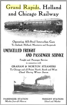
Grand Rapids - Holland interurban line

Left click on the images below for larger versions.
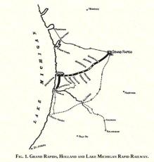
March 15, 1902
|
2013
|
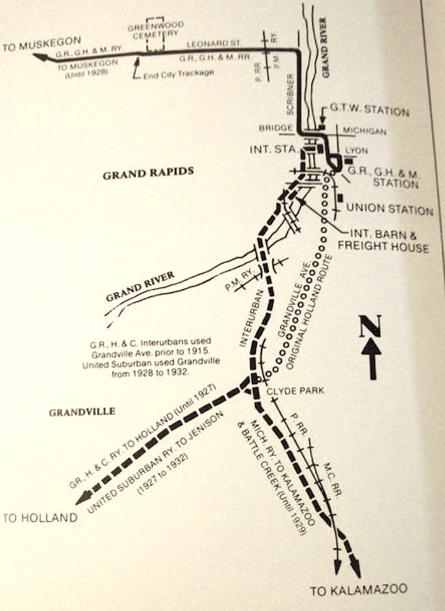
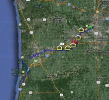
The map above, right, is a current attempt to reconstruct the route of the Grand Rapids to Holland line.
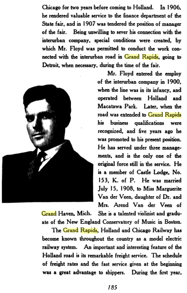
The Grand Rapids, Holland, and Chicago interurban operated between about
1898 and 1924. The item below, from about 1918, talks about the system manager, Charles A. Floyd.
Left click on the images below for larger versions.
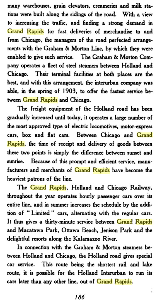
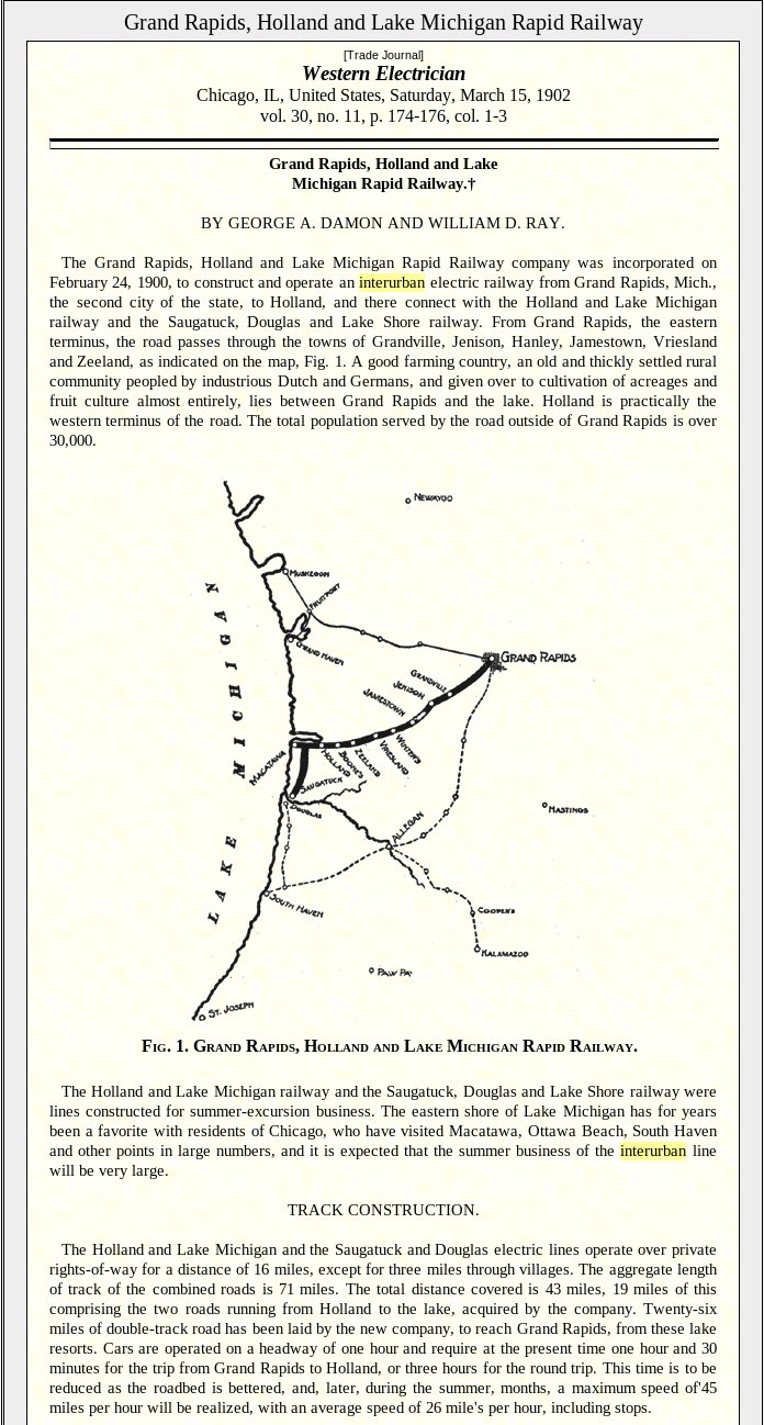
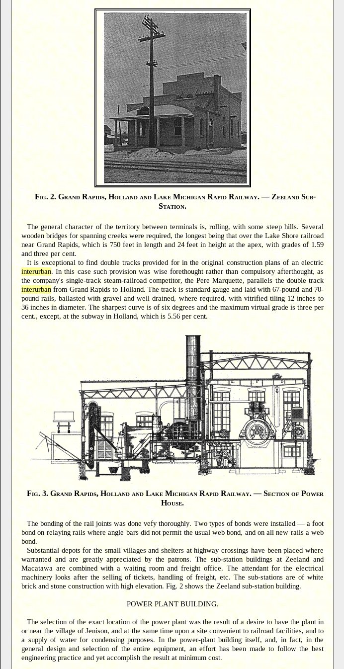
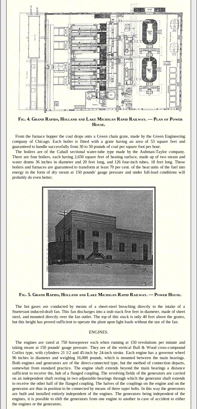
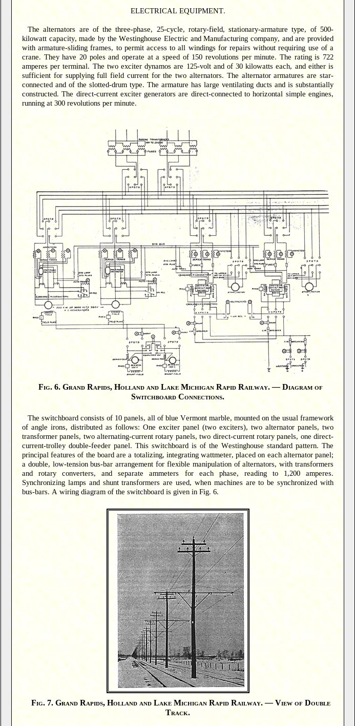
The item below is from the March 15, 1902, issue of Western Electrician, and describes the
technical aspects of the Grand Rapids, Holland, and Lake Michigan interurban system.
Left click on the images below for larger versions.
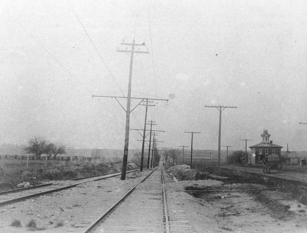
The line was double tracked much of the way, as can be seen below. After 1927, the
right of way was apparently taken over by Chicago Drive, a.k.a. MI 121, although the piece of track
from Grand Rapids to Grandville was still used until 1932, after which it too failed.
Grand Rapids
Left click on the image below for a larger version.
The map above shows that the original intent was to have the GR, H & C route stay on the east side of theGrand River. This might have been the case for a while. After the two Grand River bridges were built,
the line apparently shared track with the GR - Kalamazoo line until about Clyde Park - stop 62 on the
Grand Rapids - Kalamzoo line. The details of this are unclear at this time, and no vestiges of the old
route exist, even in sateillite views.
Note the entry "Ivanrest" on the plaque
below. Until the 1960s, at least, the Ivanrest stop station, on 28th Street,
still stood.
Left click on the images below for larger versions.
Material provided by Lewis Lull, class of 1940, scanned and sent by Craig Lull, class of 1970.
Wyoming Park.
Left click on the images below for larger versions.
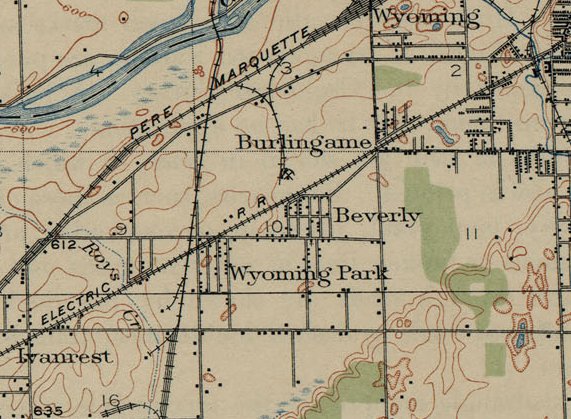
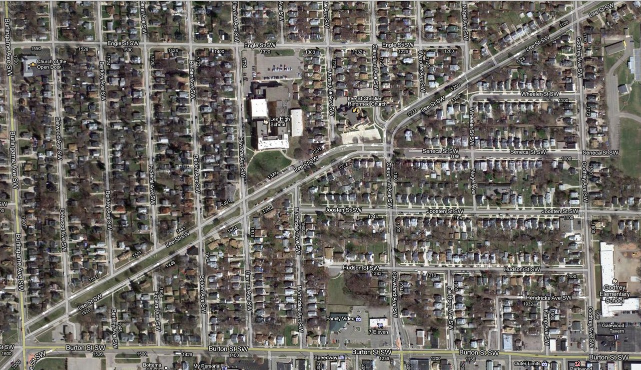
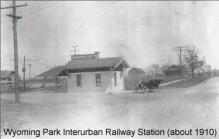
The map snippet at the left, above, is from a 1914 Grand Rapids topological map.
Near the lower left corner one can see where the track crossed 28th Street, which was
the location of the Wyoming Park stop. Still there in the early 1960s, one could
look on the south side of the street and see an overgrown track bed. Note also
on the make that just before the Wyoming Park stop one sees that the interurban
track crossed the LS & MS railroad track, and in the upper right corner one can
see where it crossed the GR & I track. There would have been a trestle there too.
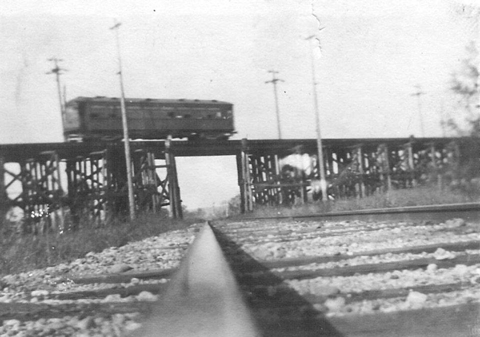
The photograph in the middle, above, shows a Grand Rapids and Holland interurban
coach using a trestle to cross a Lake Shore and Michigan Southern track, perhaps
some time between 1915 and 1920. Railroads would typically not allow interurbans
to cross their tracks at grade level, leading to a number large, and probably
expensive, trestles. It appears the interurban coach was heading west, in which
case it's next stop would be Wyoming Park, as it was called in 1914.
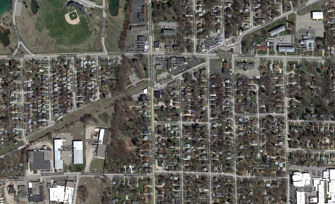
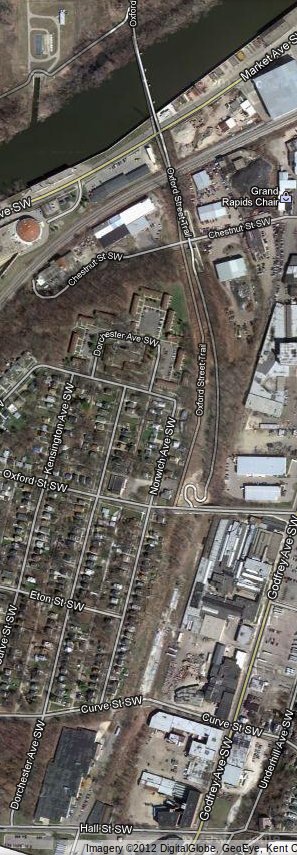
The location of the crossing is shown in the right hand image, top row. The trestle as
just southwest of the intersection of Byron Center Road and Porter Street.
The interurban track went along what is today Lee Street. The track bed of
the LS & MS track is delineated by the foliage now covering the old track bed,
and to some extent by the location of street relative to the old track. This
is a phenomena known to archaeologists, who use satellites to discern features
in the ground to suggest old structures and roads. After 85 years one can
still see the track beds of all the interurbans that were in the area in satellite
images.
Left click on the images below for larger versions.
|

Circa 1915.
|
Circa 1920.
|
Circa 1921. Photo courtesy of the GR Museum.
|
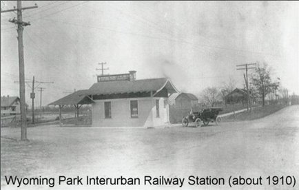
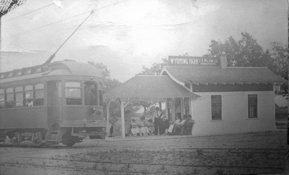
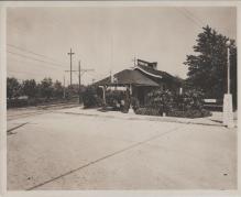
The photos above show the depot at Wyoming Park. The same design
was apparently used for all, or most, of the depots on this line.
The photo on the left is a bit earlier, based on the lack of foliage. It could
even be quite new. The license plate on the car in the photo at the right is
consistent with the design used in 1921, according to the Michigan Department of
Natural Resources in year 2012.
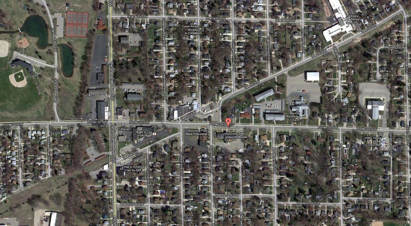
The depot was located on the north side of 28th Street, a block or so east of
Ivanrest, and was still there in the 1960s. In year 2012 the site is occupied by
Walgreen's.
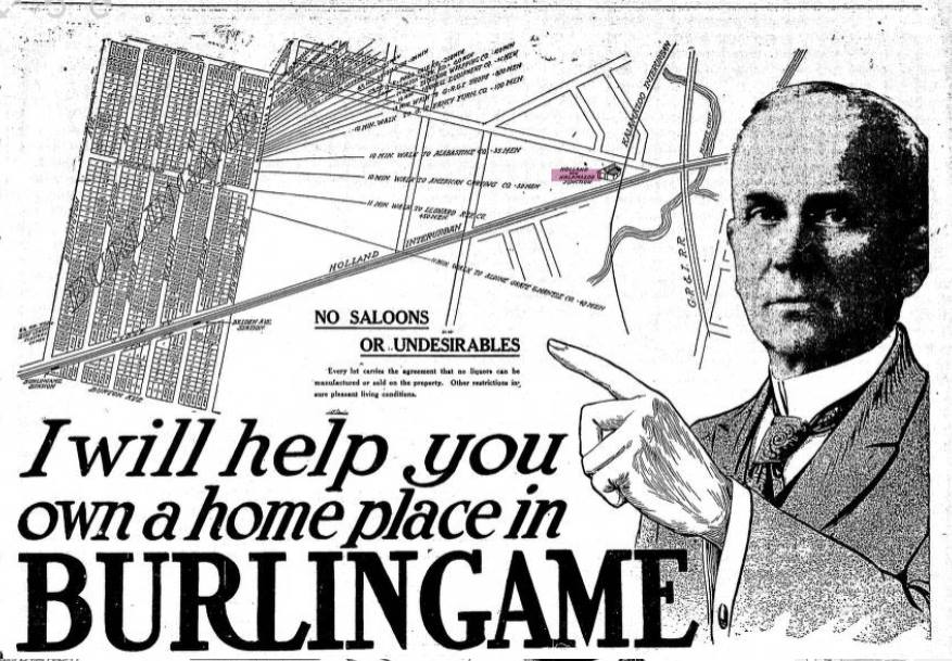
Note the name S. H. Wilson on the sign. Apparently the depot was in part an office.
So who was S. H. Wilson?
S. H. Wilson
Left click on the image below for a larger version.
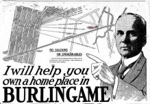
A possible likeness of S. H. Wilson, from a 1920's ad.
Left click on the images below for larger versions.
Grandville
Left click on the images below for larger versions.
1925
|
The photo above shows the intersection of Grandville and Wilson, in 1925. The view is to the east. The PM tracks are to the left.
The 2012 satellite views above illustrate that even after close to 85 years
some parts of the Grand Rapids to Holland interurban track bed can seen. As is
often the case, the tracks paralleled existing railroad tracks, as did later
roads and interstates. So in many cases the interurban track beds have been
obliterated. In some cases the right of ways were taken over by power companies
for their transmission lines, an example being the Grand Rapids to Kalamazoo
line. Often as not the transmission lines and the interurbans coexisted for a
while. For those cases it's still easy to discern the locations of the right of
ways yet.
Left click on the images below for larger versions.
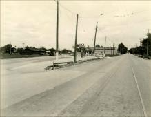
Left, above, the interurban tracks near Grandville, in an undated photograph.
The photograph suggests this was at a place called Meengs Crossing. The tracks would
have paralleled the Pere Market railroad tracks west of Jenison, and are now obscured
by Chicago Drive - Route 121. The area has seen explosive development in the years
leading to year 2012, and little of the interurban track remains to be seen.
Right, above, the location is not exactly known. The small waiting area is more
typical of the "depot" along the line than the few more elaborate depots. Mainly
a way for people to get out of the wind and rain.
Both systems are now long gone. The GR & Holland interurban since about 1928,
and the LS & MS since a little after WWII. It was easy to see the LS & MS track
bed in the early 1960s as one drove west on 36th, just before Grandville. Like
the interurban track bed that ran through Frank Rackett's property, and
was familiar to most of us in the 1950s, the LS & MS track bed was just as
prominent in the early 1960s. Nothing can be seen in year 2012.
In the bottom row, left, above, one can see that part of the Grand Rapids to
Holland route is a walking path today. The bride that crossed the Grand River
still exists, as does the bridge further east, which once ran into the side of
the Civic Theater, and is now a foot bridge.
Jenison
Left click on the image below for a larger version.
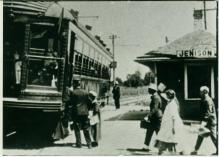
The undated photograph above shows the interurban depot at Jenison.
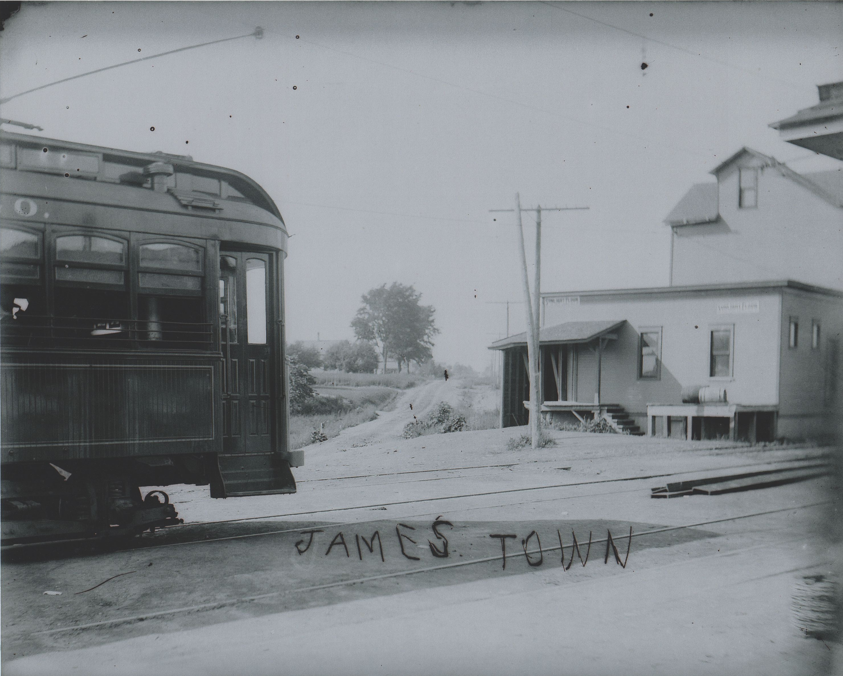
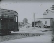
Jamestown
Left click on the image below for a larger version.

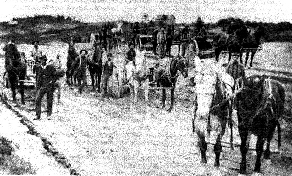
The photograph above shows some grading work being down near Shackhuddle, MI, a town which does not exists in year 2013.
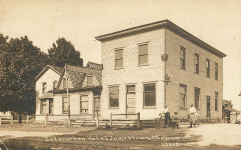
Left click on the images below for a larger version.
Arriving or leaving Jamestown.
|
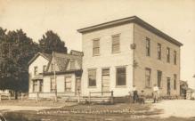
Jamestown interurban hotel - 1915.
|
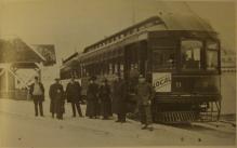
Left click on the images below for larger versions.
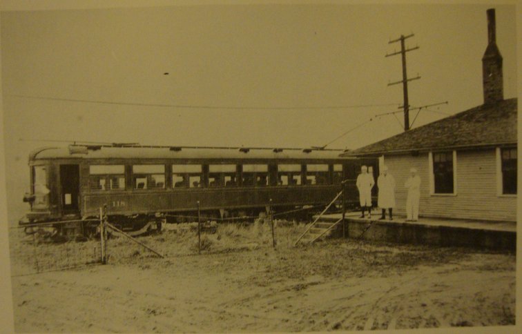
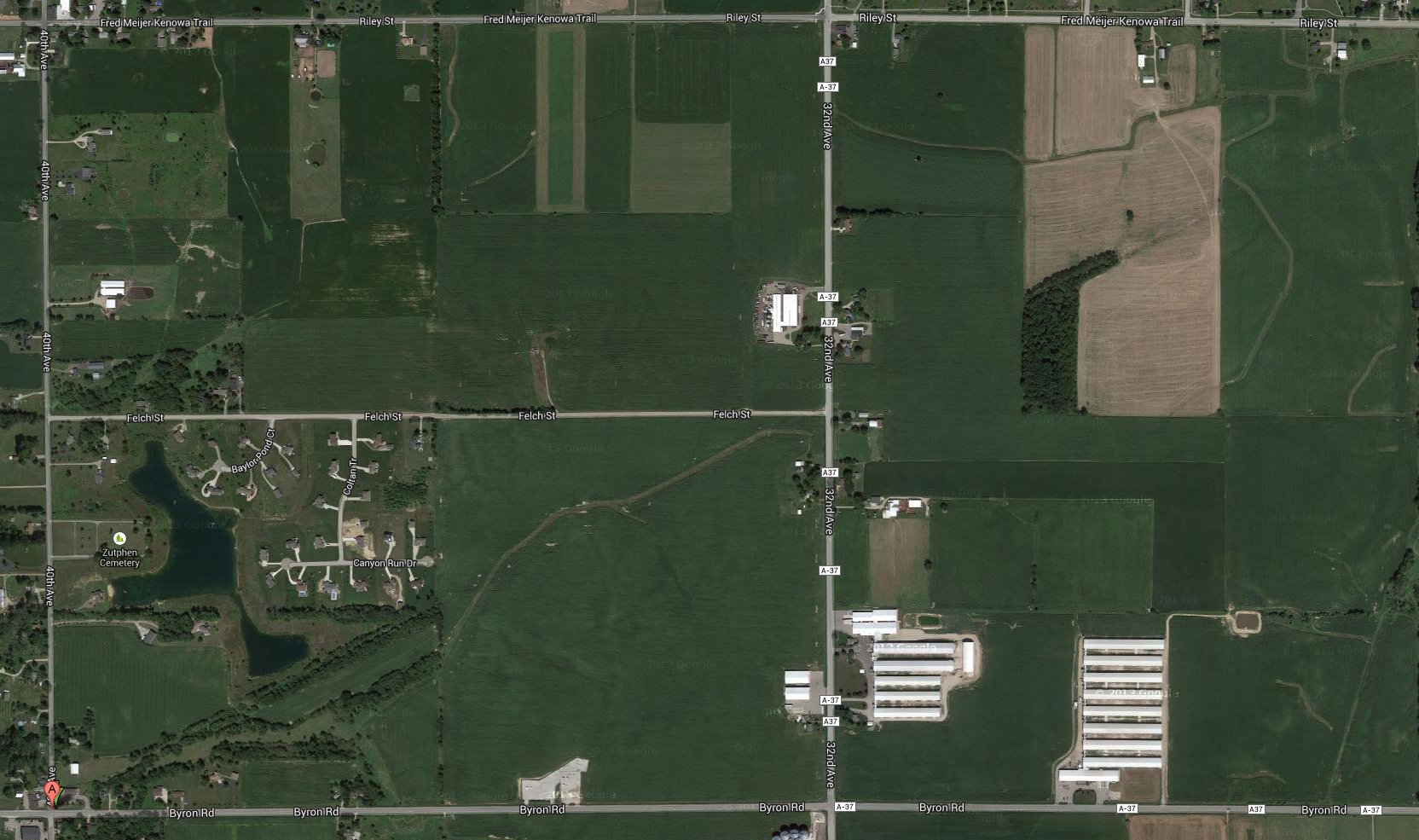
Car 118 on its last run, November 15, 1926. The location is by a creamery in Forest Grove.
Forest Grove has GPS coordinates 42.811196, -85.881412. In the photo at the right, above,
one can still see the interurban track, as outlined in trees, after something like 85 years, going
from lower left to upper right in the image at the right, above.
Zeeland
Left click on the image below for a larger version.
Holland
Left click on the image below for a larger version.
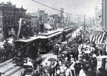
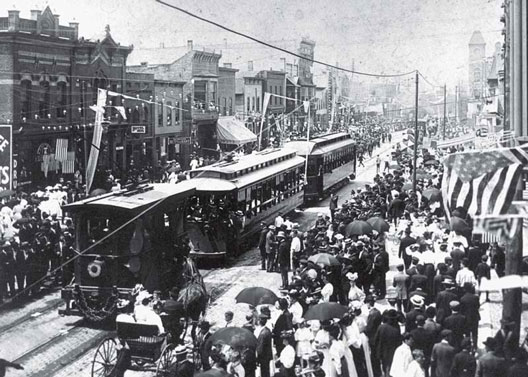
The photograph above shows the inauguration of service to Holland, MI, on July 4, 1898.
Left click on the image below for a larger version.
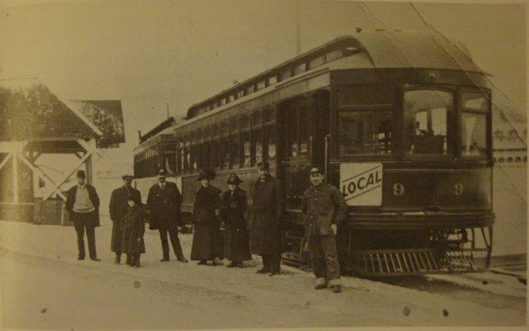
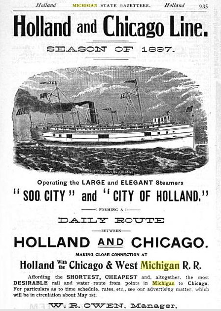
Car 9 at the dock in Holland. For some, the next step would be to board a boat like those on
the Holland and Chicago line shown below. Freight would also be transfered to and from a
boat. In the beginning, around 1902, the boats were not big enough or strong enough to
travel Lake Michigan in the winter. By the end, which is all of 1926 or so, they were, but
the shipping companies often failed with the interurbans, victims of competition from
railroad ships.
Left click on the images below for larger versions.
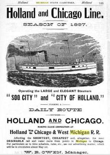
1897 - pre interurban link
|
June, 1915
|
Left click on the image below for a larger version.
Saugatuck
Left click on the images below for larger versions.
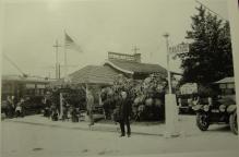
Saugatuck, MI, depot, in an undated photograph. Saugatuck has long been a summer resort town.
The building that houses the depot was probably also some kind of amusement attraction, a popular
way for interurban lines to generate revenues on weekends.