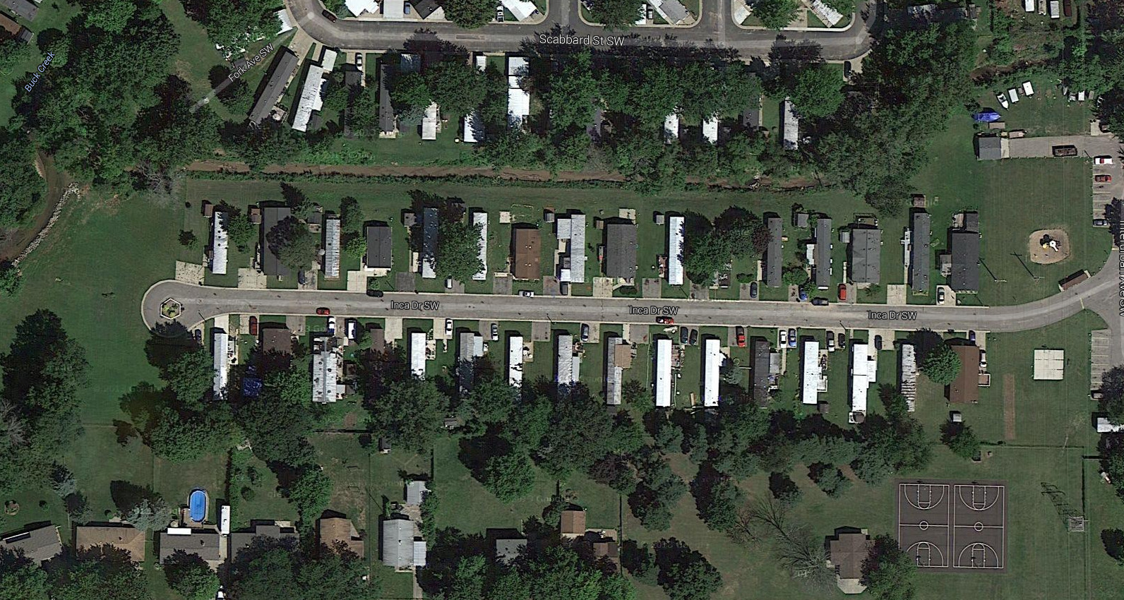
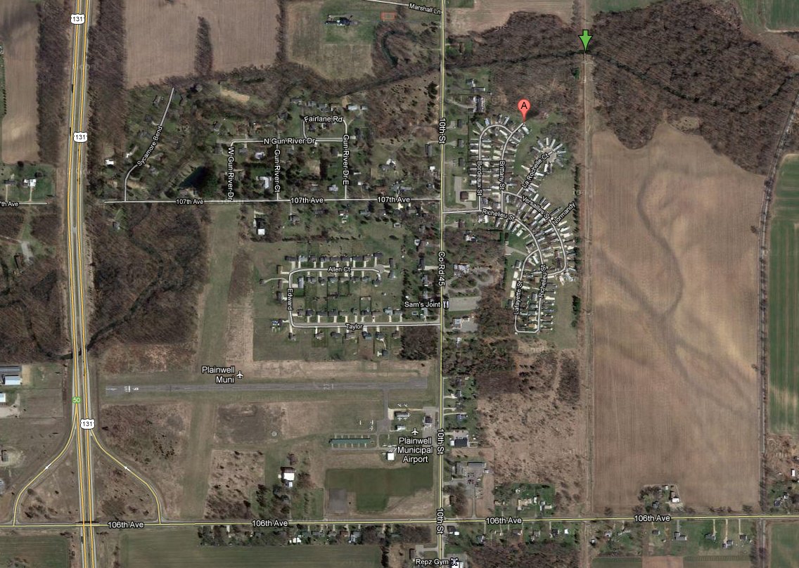
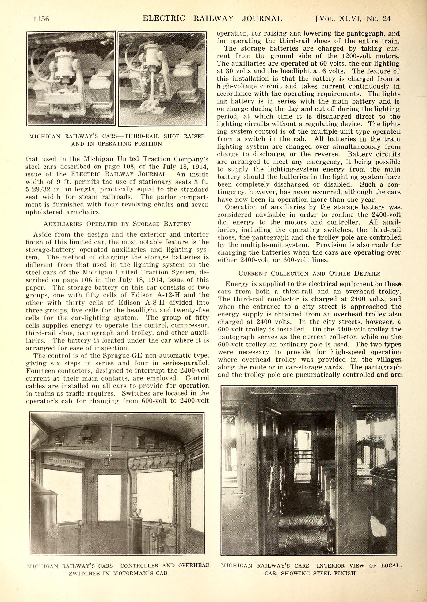
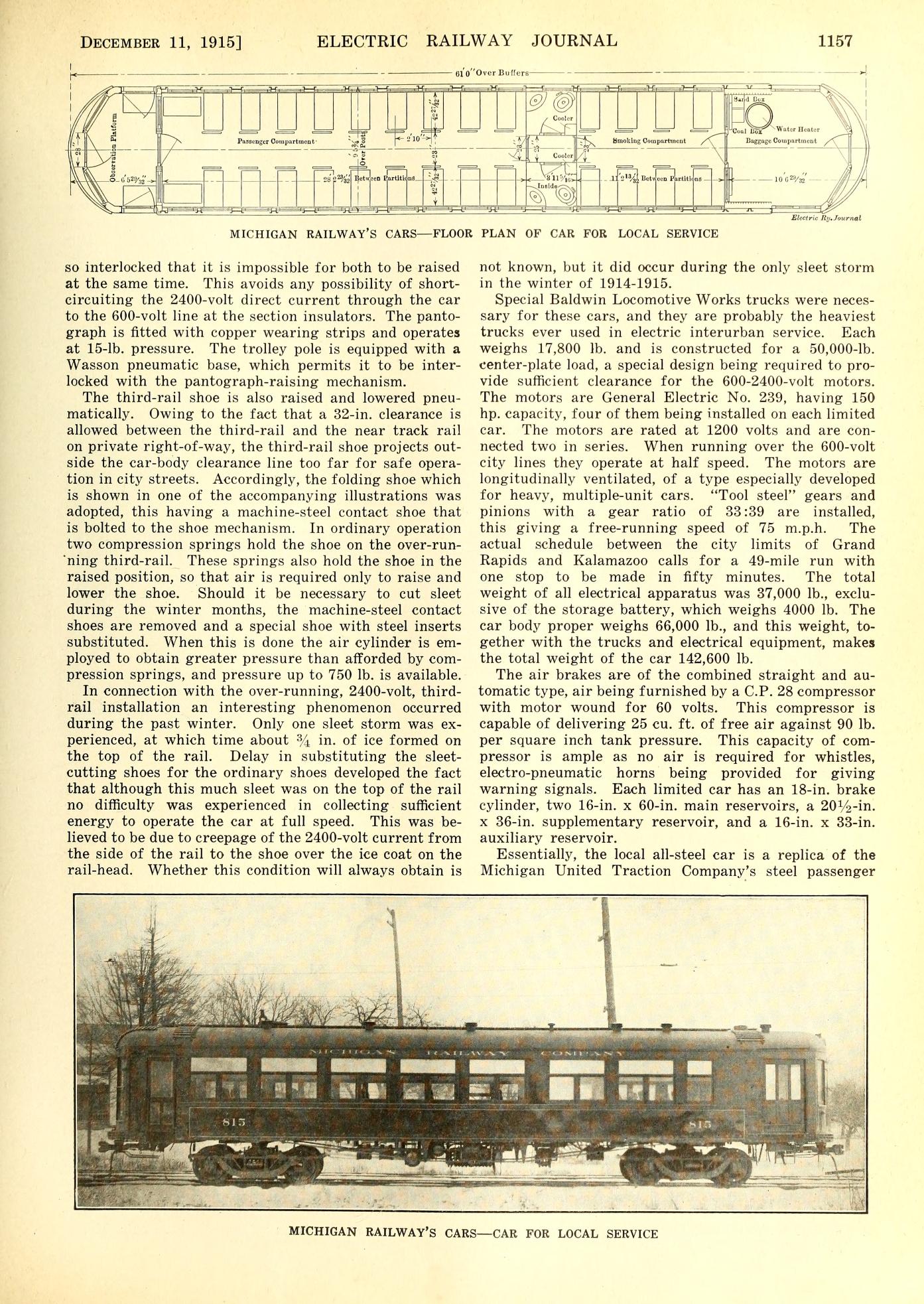
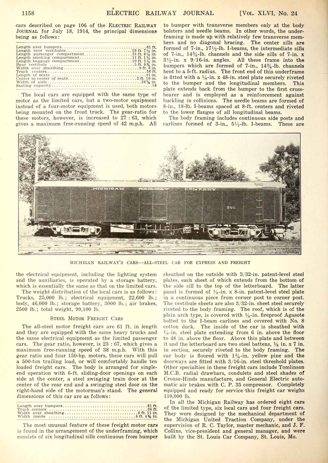
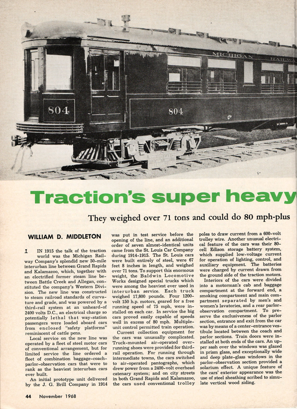
Grand Rapids - Kalamazoo interurban line.

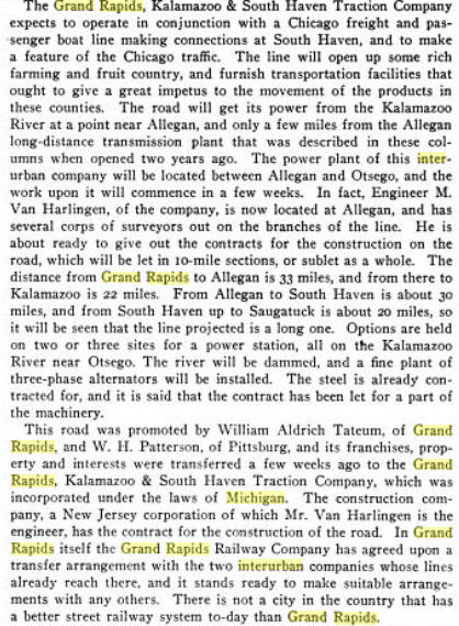
While the two items below, from the November 16, 1901, issue of Electrical World & Engineer show, there
was already planning for an interurban line from Grand Rapids to Kalamazoo, in a time frame similar to the lines
from Grand Rapids to Holland, and Grand Rapids to Muskegon and Grand Haven, it would be 14 more years before
anything was actually built.
Left click on the images below for larger versions.
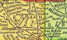
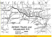
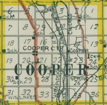
It's difficult to see, but one can discern that the plan was to build a 33 mile line from Grand Rapids to Allegan.
From there, a 22 mile line would go to Kalamazoo, and a 30 mile line would head west, to Hawkhead, North Haven,
and other places. It would have been a larger system than was actually built.
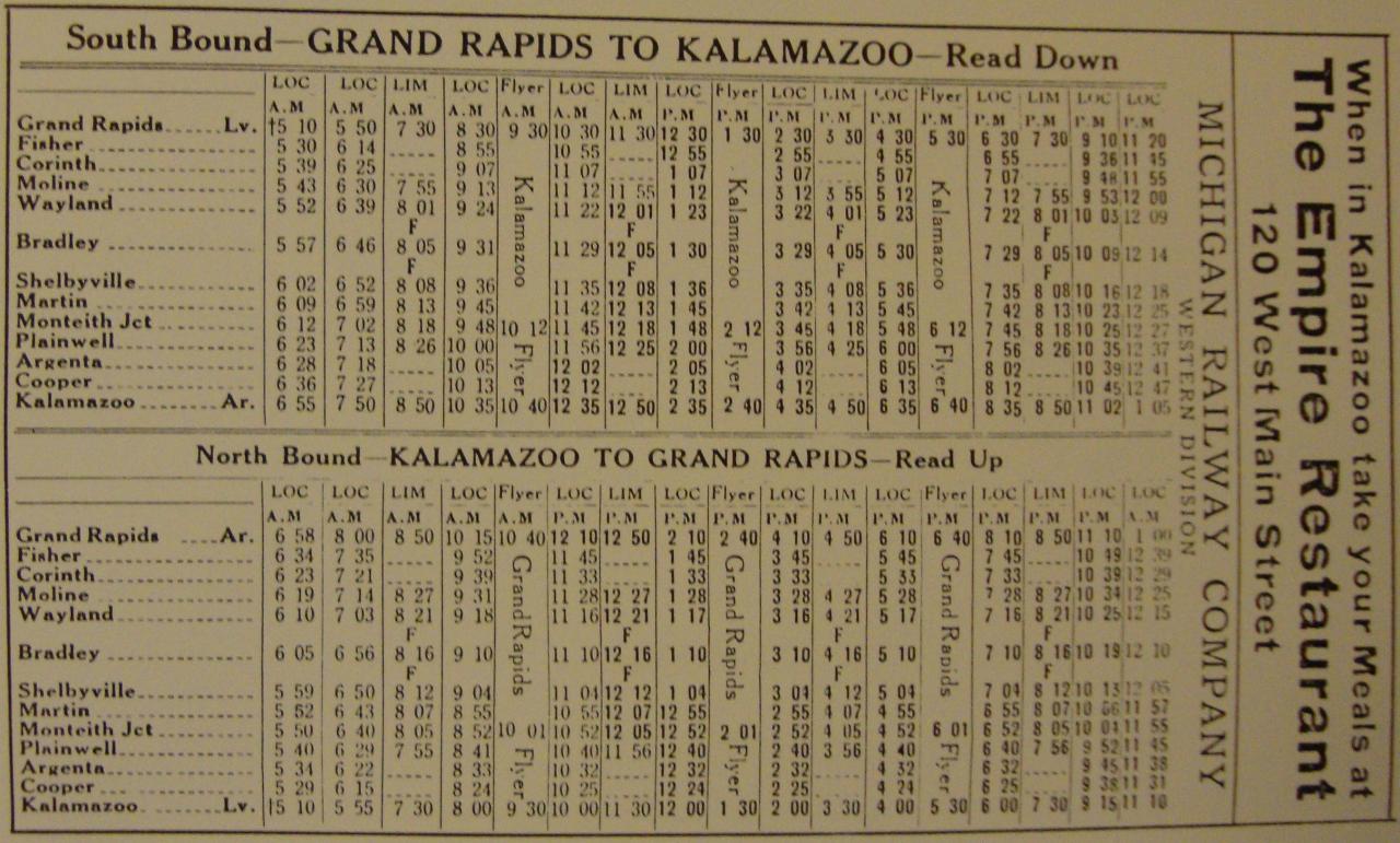
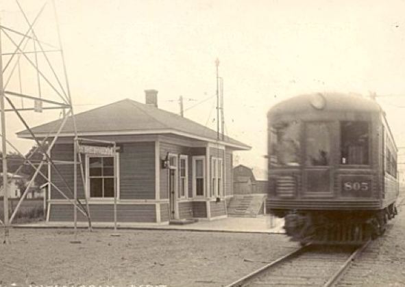
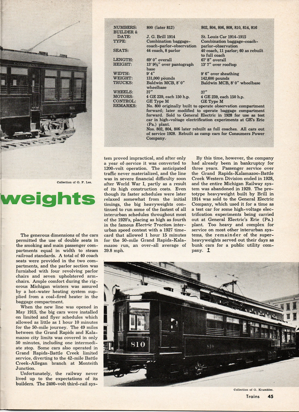
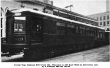
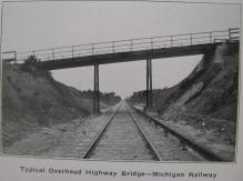
The interurban line that was eventually built from Grand Rapids to Kalamazoo operated from 1916 to 1928. It was
built to very high standards, including the use of standard gauge railroad track, and
very heavy coaches. Starting at Kalamazoo, the numbered stops are shown below.
STATION LIST FROM TARIFF BOOK - NOV. 1, 1917 WESTERN DIVISION - MAIN LINE
|
* AGENT
KALAMAZOO * +
STOP NO. 2 - MAIN STREET
STOP NO. 3 - NORTH STREET +
STOP NO. 4 - CEMETERY
STOP NO. 5 - KNIGHT FARM
STOP NO. 6 - GALLUP ROAD
STOP NO. 7 - TOWN LINE ROAD
STOP NO. 8 - WHITE - STARK FARM
STOP NO. 9 - COOPER +
STOP NO. 10 - VANE FARM
STOP NO. 11 - TRAVIS ROAD
STOP NO. 12 - CRANE FARM
STOP NO. 13 - ARGENTA +
STOP NO. 14 - RIVER ROAD +
STOP NO. 15 - +
STOP NO. 16 - BRIDGE STREET +
PLAINWELL * +
STOP NO. 18 - CEMETARY ROAD
STOP NO. 19 - OTSEGO ROAD
STOP NO. 20 - SMITH ROAD
STOP NO. 21 -
STOP NO. 22 - TOWN LINE ROAD
STOP NO. 23 -
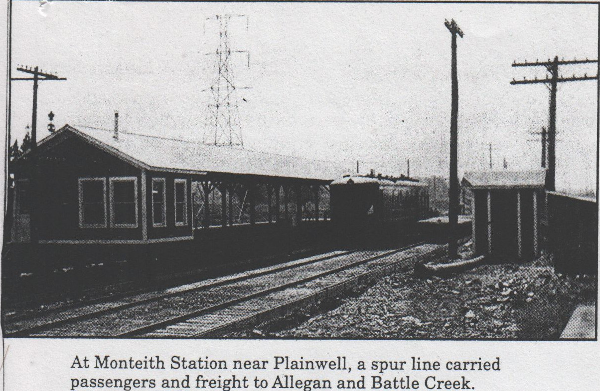
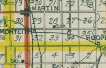
MONTEITH JUNCTION +
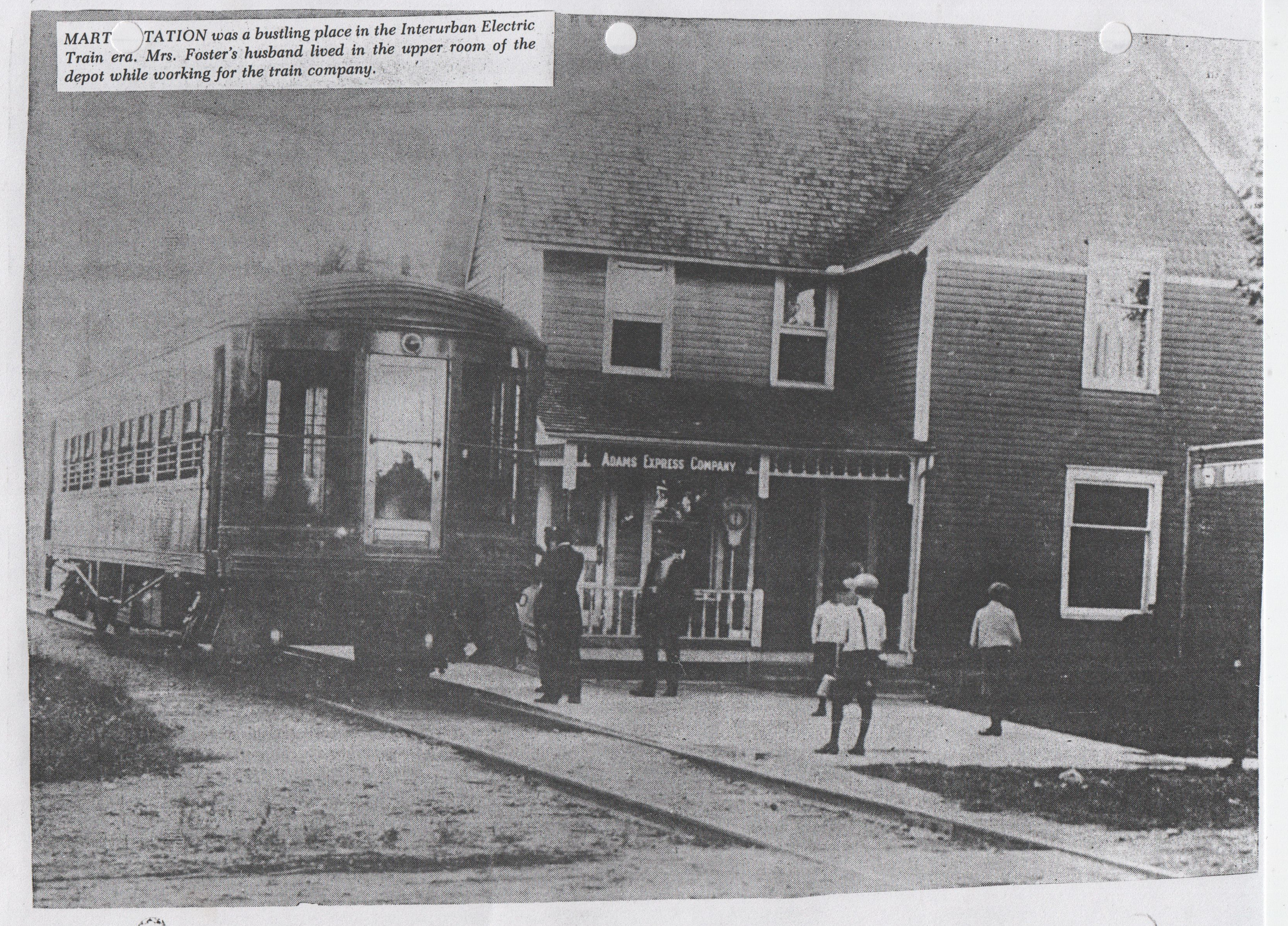
MARTIN * +
STOP NO. 26 - +
STOP NO. 27 - CARPENTER FARM +
STOP NO. 28 - STEERS ROAD +
STOP NO. 29 - +
SHELBYVILLE * +
STOP NO. 31 - SNELL ROAD
STOP NO. 32 -
|
STOP NO. 33 - HOPKINSBURG ROAD
BRADLEY * +
STOP NO. 35 - DOAN LAKE
STOP NO. 36 - DAMOTH ROAD
STOP NO. 37 -
WAYLAND * +
STOP NO. 39 - BARNES ROAD
STOP NO. 40 - CALKINS ROAD
STOP NO. 41 - BRUSH ROAD
STOP NO. 42 -
STOP NO. 43 - DE HAAN ROAD
MOLINE * +
STOP NO. 45 - WEAVER ROAD
STOP NO. 46 - COUNTY LINE ROAD
STOP NO. 47 - CORINTH ROAD +
STOP NO. 48 - VOISIN ROAD
STOP NO. 49 - BYRON CENTER ROAD ( 84th Street ) +
STOP NO. 50 - GRAVEL PIT ROAD
STOP NO. 51 - CARLISLE ROAD
STOP NO. 52 - CUTLERVILLE + ( 68th Street ) +
STOP NO. 53 - WELDER ROAD
STOP NO. 54 - FISHER ROAD +
STOP NO. 55 - BARENDSEN ROAD
STOP NO. 56 - DENNIS CORNERS ROAD
STOP NO. 57 - BRICK SCHOOL HOUSE ROAD (36th Street - Godwin ) +
STOP NO. 58 - Northeast corner, Buchanan & 32nd +
STOP NO. 59 - BEALS ROAD ( 28th Street ) +
STOP NO. 60 - MORTON STREET
STOP NO. 61 - BURTON STREET +
STOP NO. 62 - CLYDE PARK STREET +
STOP NO. 63 - GRANDVILLE AVENUE +
GRAND RAPIDS * +
|
+ above means that the location and other information about the stop has been obtained.
The list above is comprehensive, and shows that stops are only about
10 blocks apart, a short walk for people in 1917. One would never be more than
5 blocks from a stop. "Flag stops," where anyone could wave an approaching coach and be picked up,
were allowed between these stops.
This would have been done primarily by farmers, who were given free passes on the lines, in partial
payment for the land they provided. Alas, many of the stops appear to be named after farms. e.g.,
stop 10 is "Vane Farm." Just where that was will take work to discover. An old street map, if they
existed in 1917, would do wonders.
Note that the street names in the list above might well have changed after 1943,
when many of the names in Kent county were changed. For example, stop 59, was Beals Road,
named after a landowner along the road. Today it is 28th Street.
The list is from 1917, and a lot situations might have changed over the next 10 or so years.
Given the number, there would have been a potential stop every 0.8 mile or so, and a
station with an agent about every 10 miles.
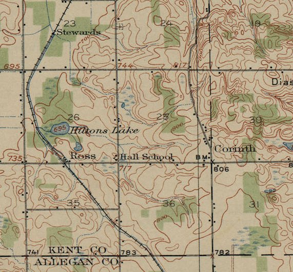
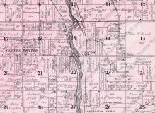
Left click on the image below for a larger version.
1916 map of GR & I stops.
|
The map segment above is simply meant to show the parallel between the GR & I stops and the interurban stops.
The major difference was the flag stops on the interurban line. Thirteen stops for the GR & I between GR and
Kalamazoo, and 64 for the interurban line. In both cases the stops are but memories in year 2015.
Left click on the image below for a larger version.
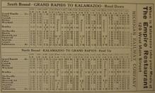
The schedule above does not represent all the stops along the line - perhaps it
indicated major stops at the time it was printed. E.g., the Fisher Station stop was
active in and around 1916 to 1918 because large numbers of workers at the Picric Acid
plant were dropped off and picked up at that stop each workday. When WWI ended in
1918, it's likely that ridership to that location dropped precipitously. Fisher
Station was a town of no more than perhaps a dozen houses and a store even at
its peak. There was mining activity in the area. But probably not enough of any
of these things to consider Fisher Station a primary stop, and it's likely that
other schedules would reflect this.
Note the "flyer" runs - GR to Kalamazoo in 70 minutes, including one stop at Monteith Junction. One couldn't
do any better in year 2014.
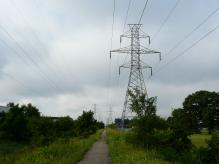
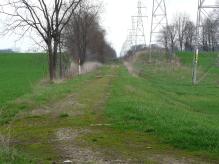
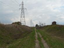
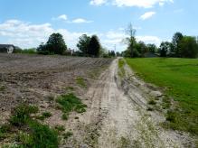
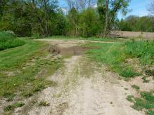
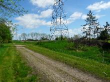
Below is a summary of information currently on hand, on a stop by stop basis,
progressing from Grand Rapids to Kalamazoo. In some cases the areas are still,
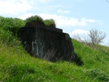
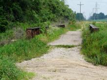
after 84 years ( as of year 2012 ), sufficiently undeveloped that many details
of the road bed can still be seen. Incredibly, depot foundations in Bradley
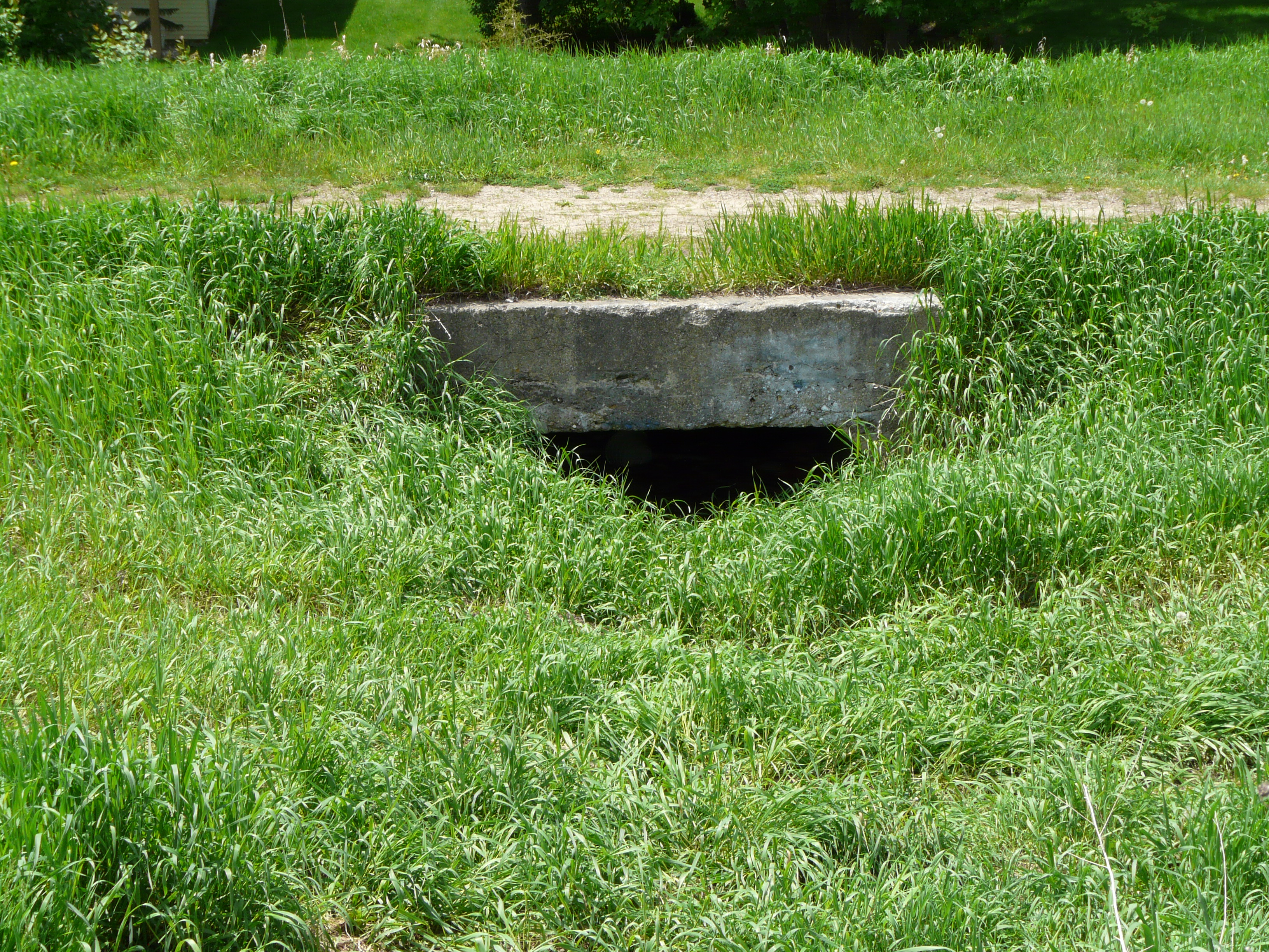
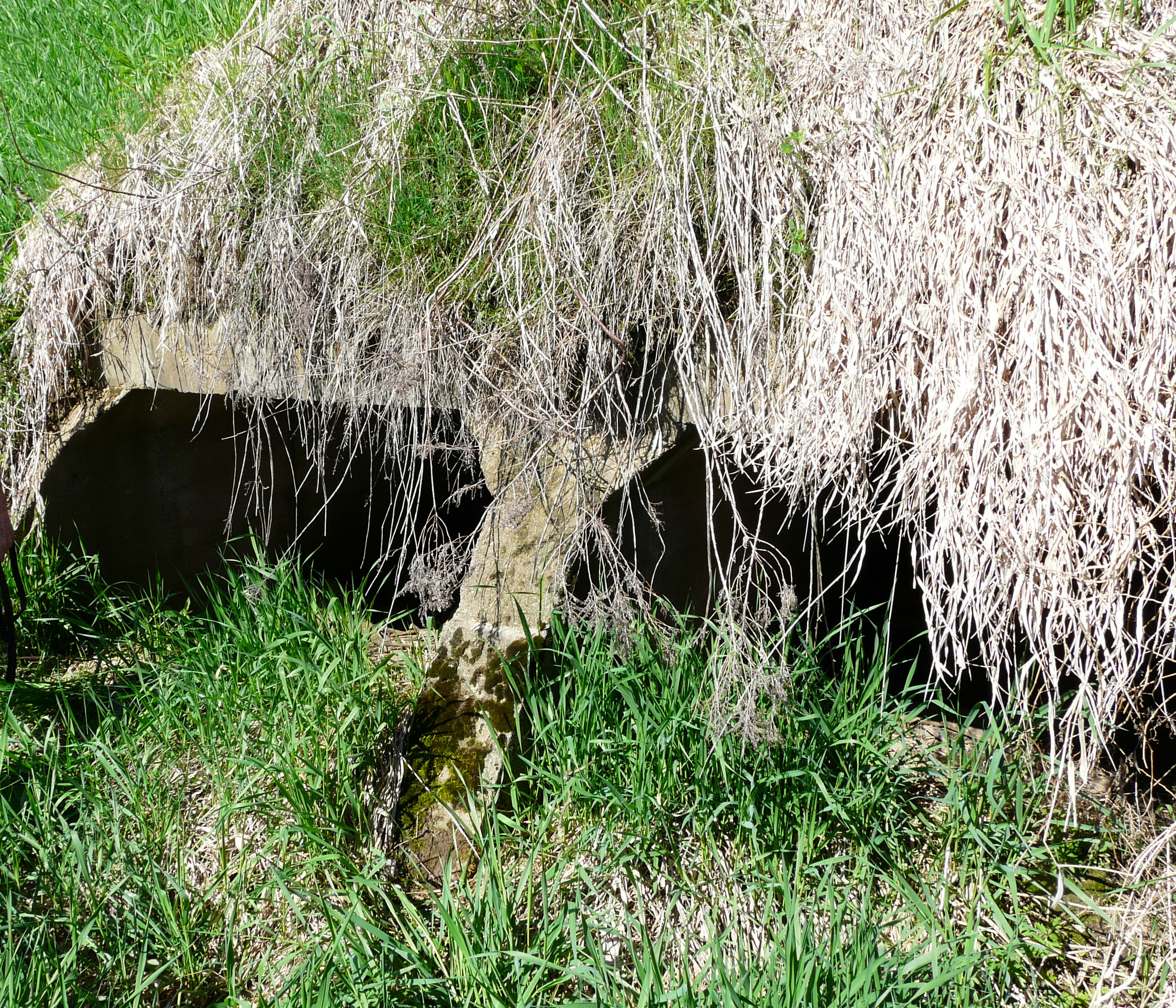
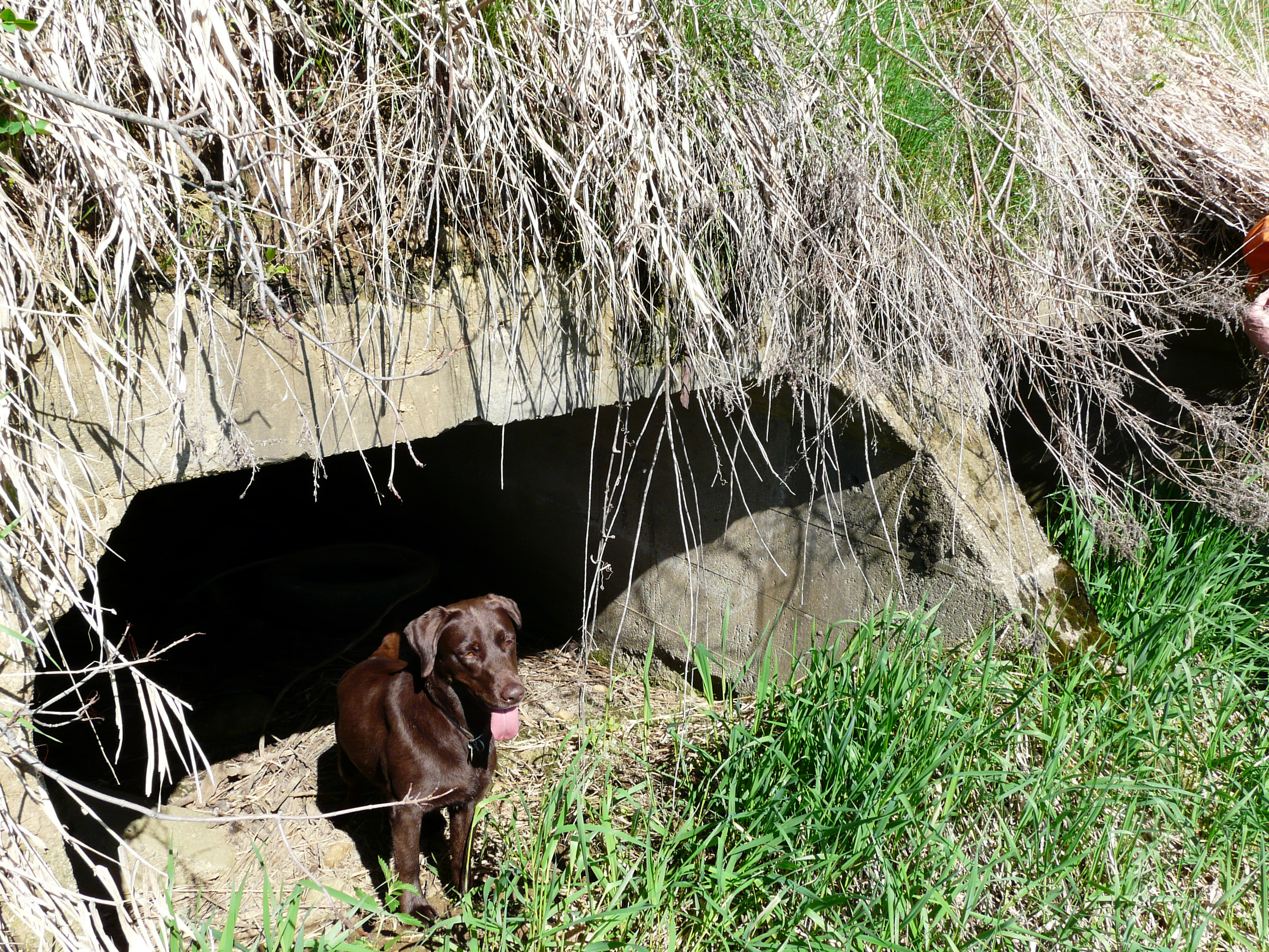
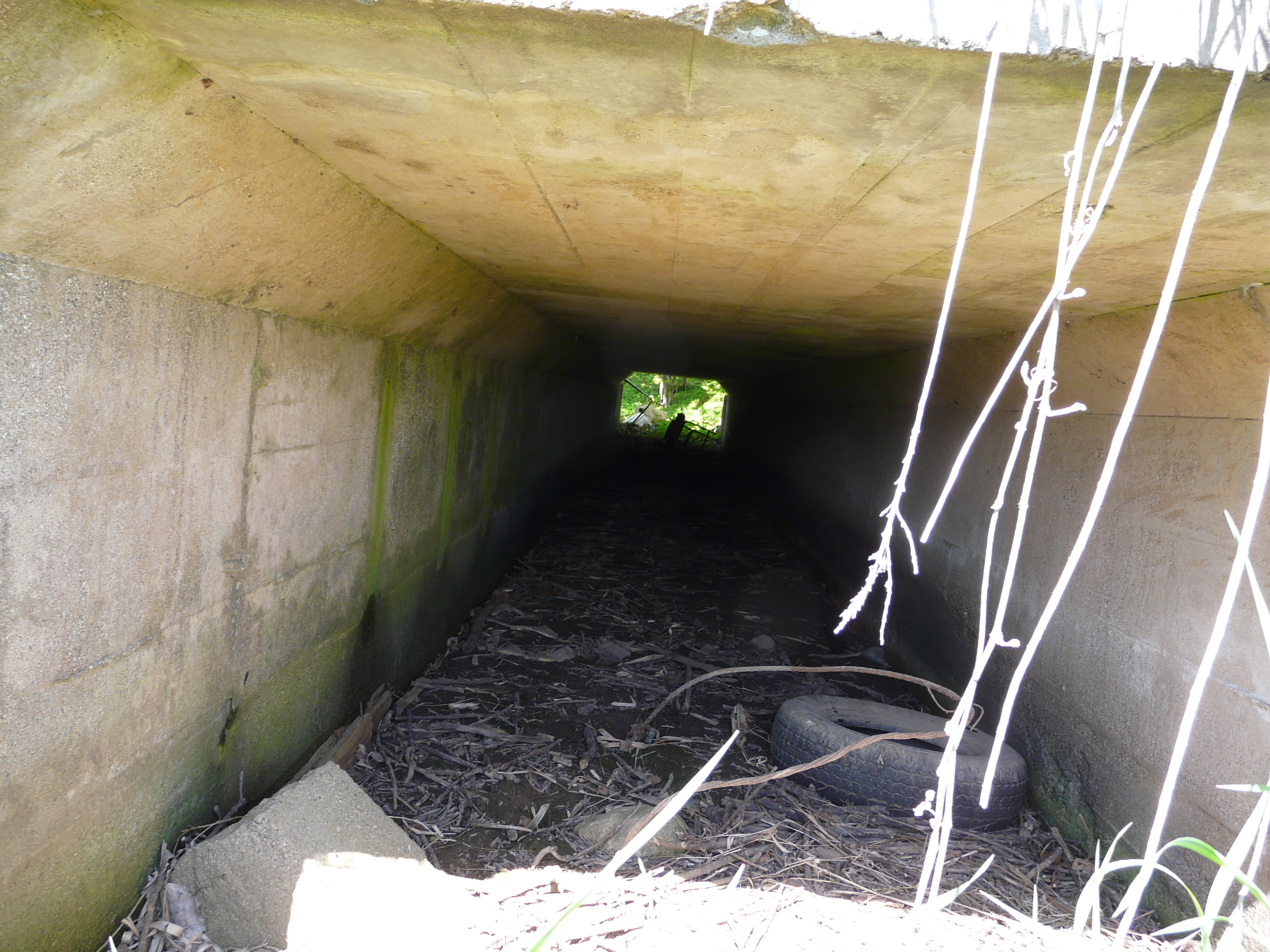
and Shelbyville are still extant. Bridges survive here and there, if only because
no one has bothered to remove them. Concrete tunnels under the roadbed for drainage
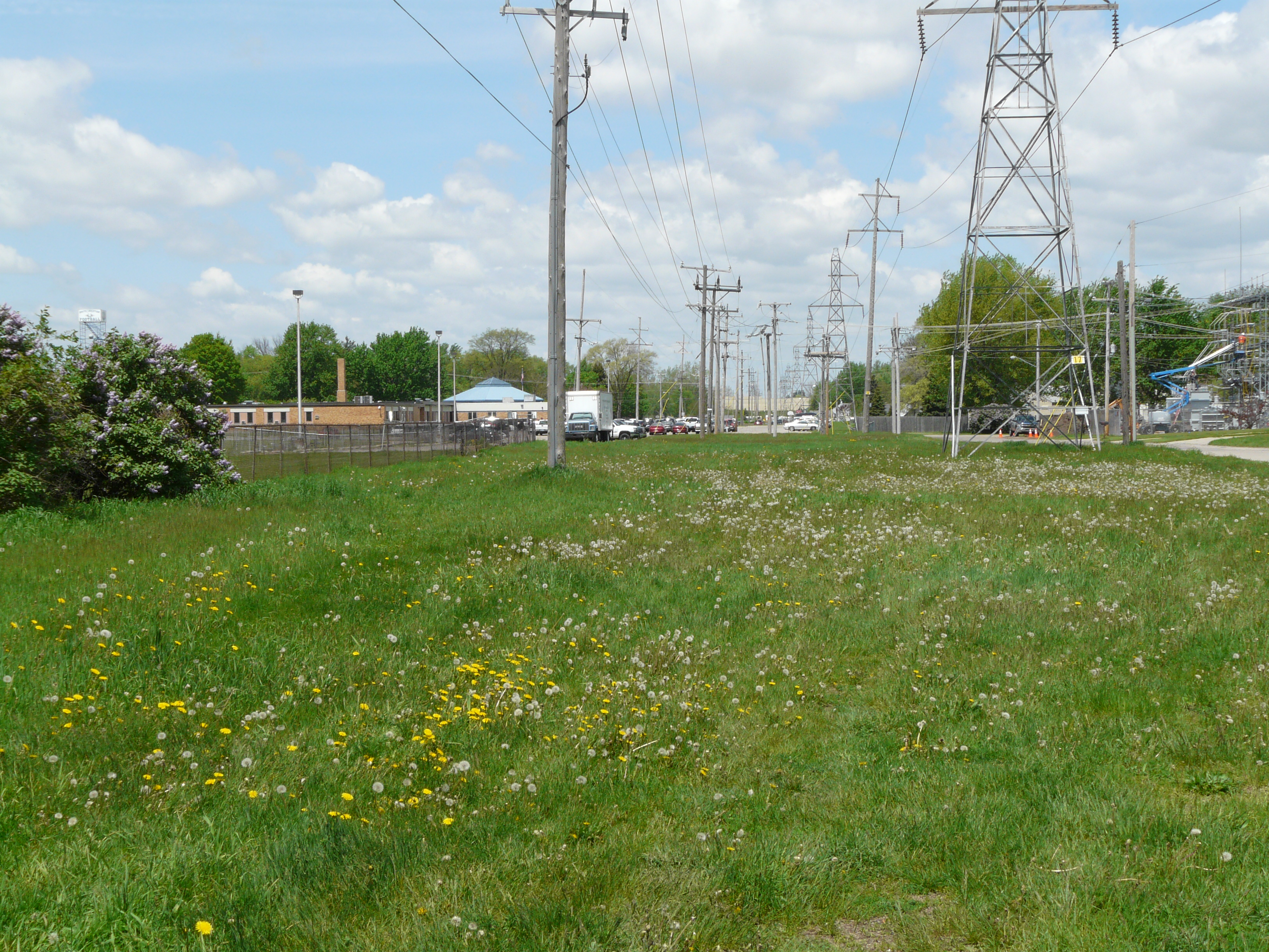
purposes largely still exist. In other cases, development has obliterated
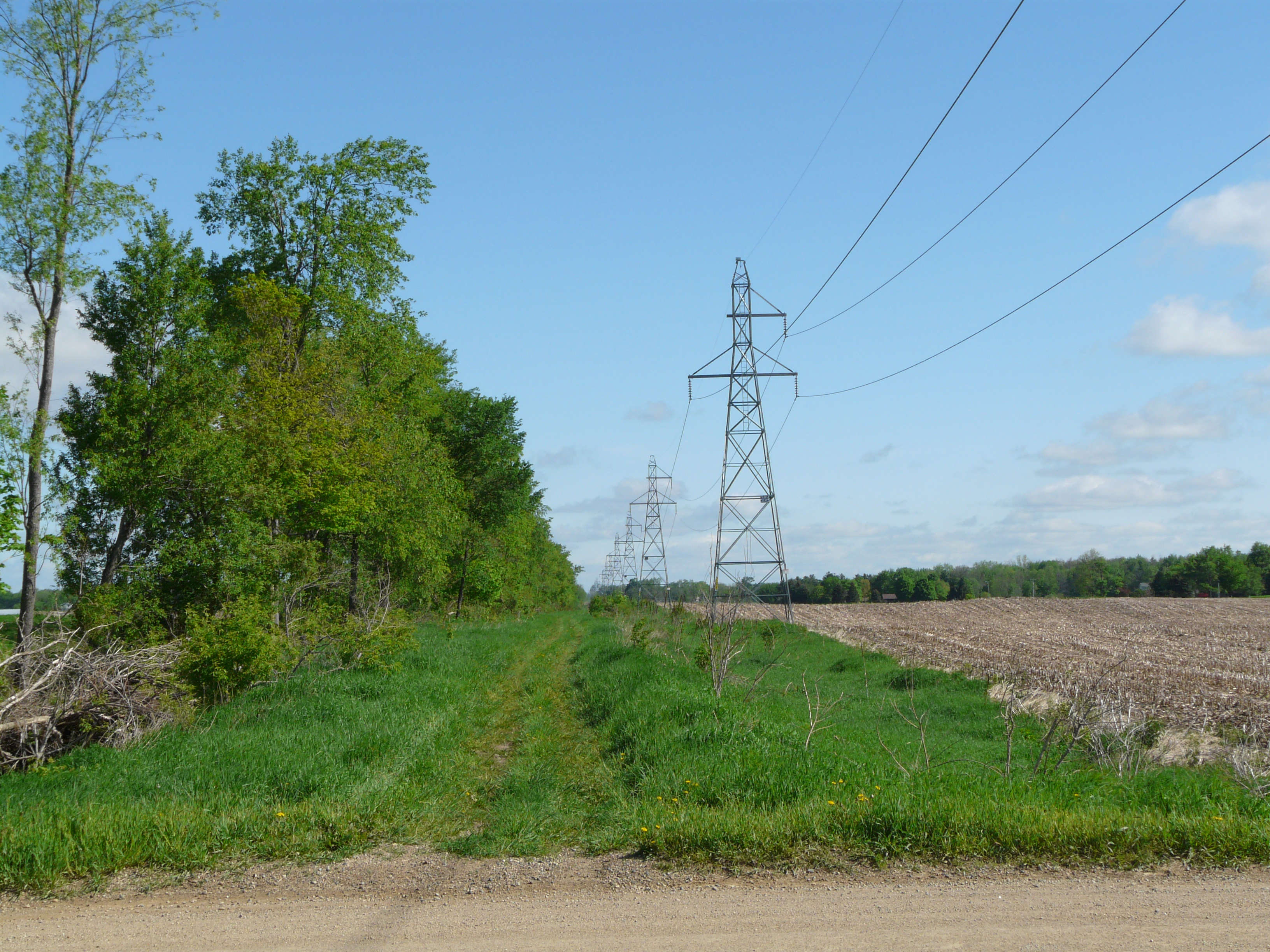
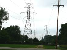
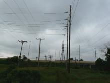
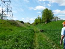
almost everything, and the only way one can follow the track at all is by keeping
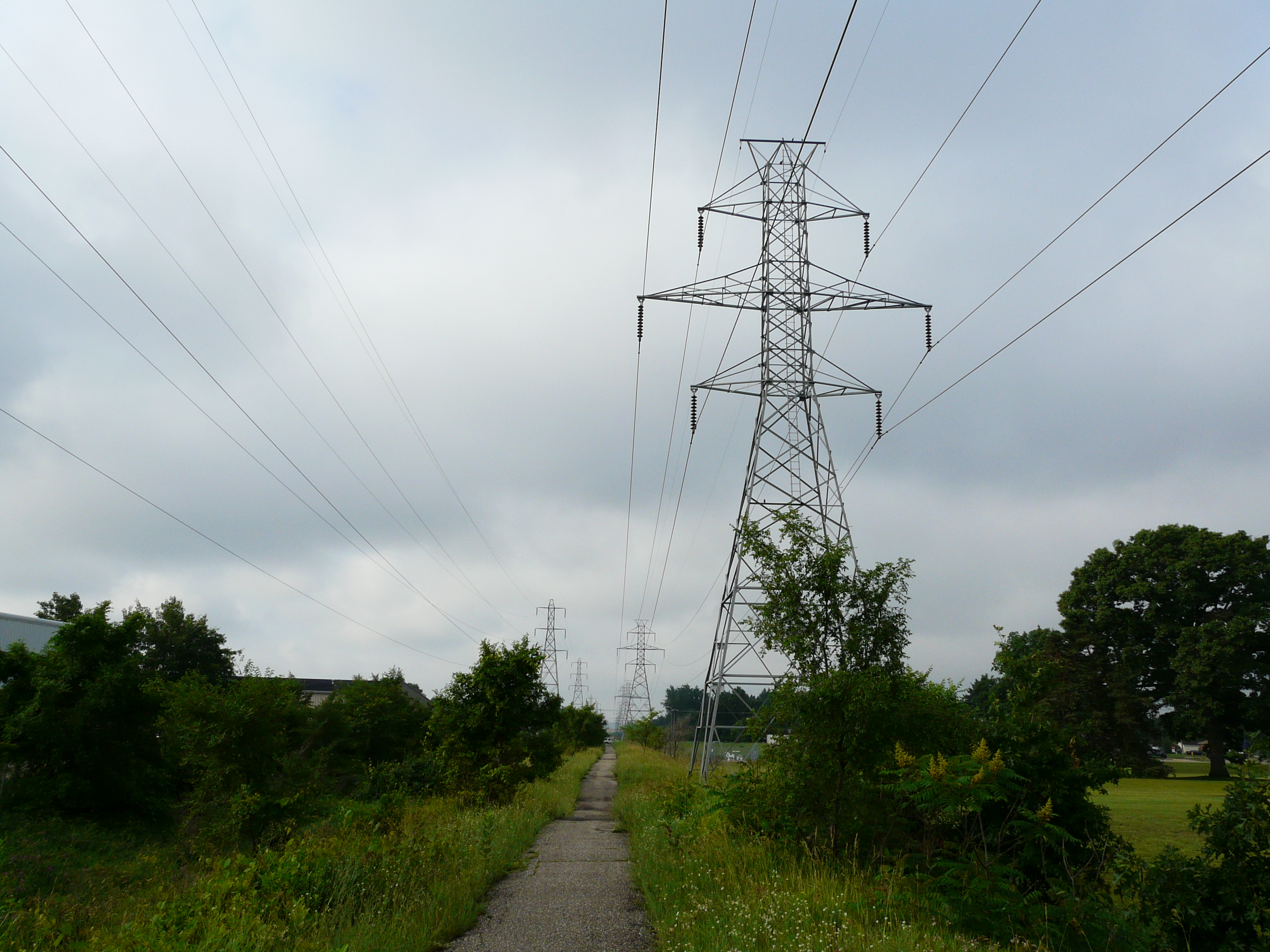
the electric transmission lines in view. The best view of the past remains
photographs, schedules, and magazine and newspaper pieces. The roadbed is in
the best condition north of Kalamazoo, probably simply reflecting the patterns
of development as the line progresses south of Grand Rapids. The Fisher Station
and Wayland areas are now sufficiently developed that nothing remains except the
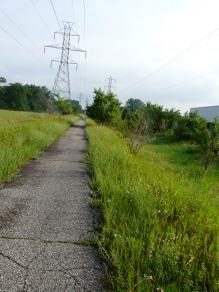
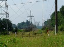
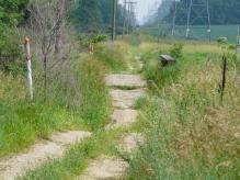
power line right of ways. In some areas the power company has allowed walking
and bike riding paths on the old roadbeds.
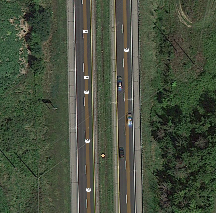
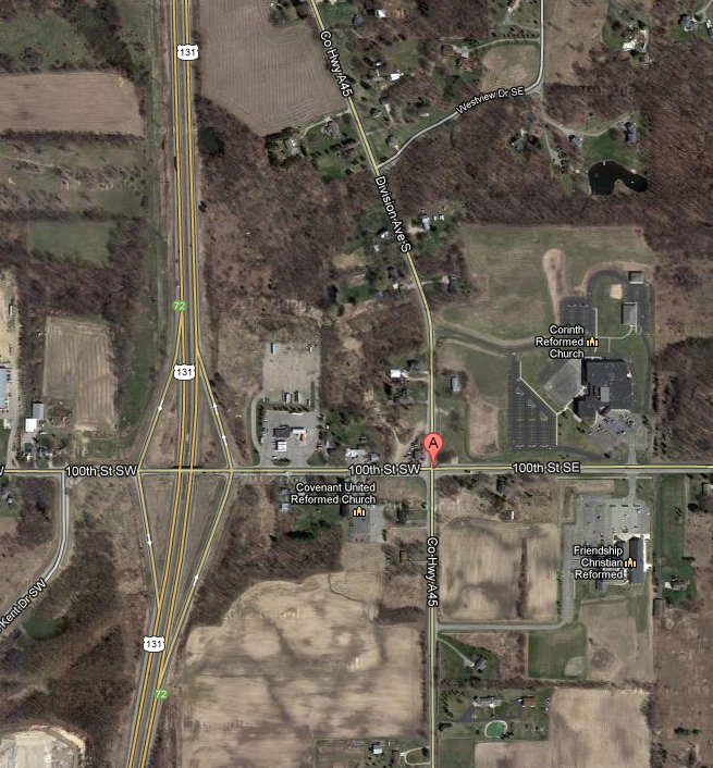
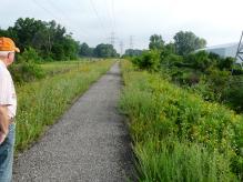
Some of the stops are difficult to find in year 2012. The interurban track
crossed 100th Street at what is US-131 today, which of course obliterates the
track bed at that point. The only sign of Corinth in year 2012 seems to be
the Corinth Reformed Church, which is in the northeast corner of the intersection
of Division Avenue South and 100th Street SE. If there was a foundation there,
is it surely gone now.
Similarly, the town of Cooper seems to be represented by Cooper Congregational Church
and Cooper Cemetery, both on Douglas Avenue and the intersection with West D Avenue.
However, there's little sign of the interurban track bed, and Consumer's Power lines
no longer follow the track at this point. What would have justified the interurban
car stooping at this location is difficult to tell today.
The town of Argenta is a mystery for now. It is/was in Allegan County, in the
Silver Creek area, in Gun Plain Township. The reasons for the interurban stopping
there, for example a dairy farm or factory, might be gone in year 2012.
It's hoped that more photographs of depots and other structures will still become
available. Old maps might help illuminate where some of the old, now obscure, towns
were located.
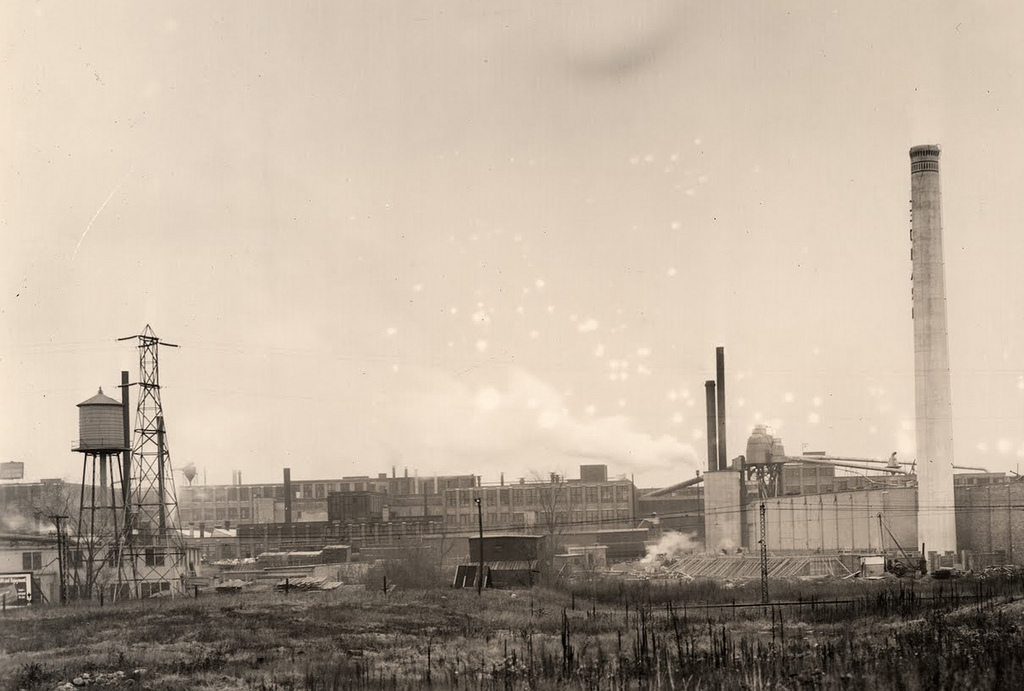
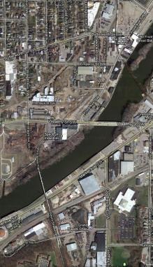
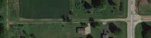
Grand Rapids - stop 64.
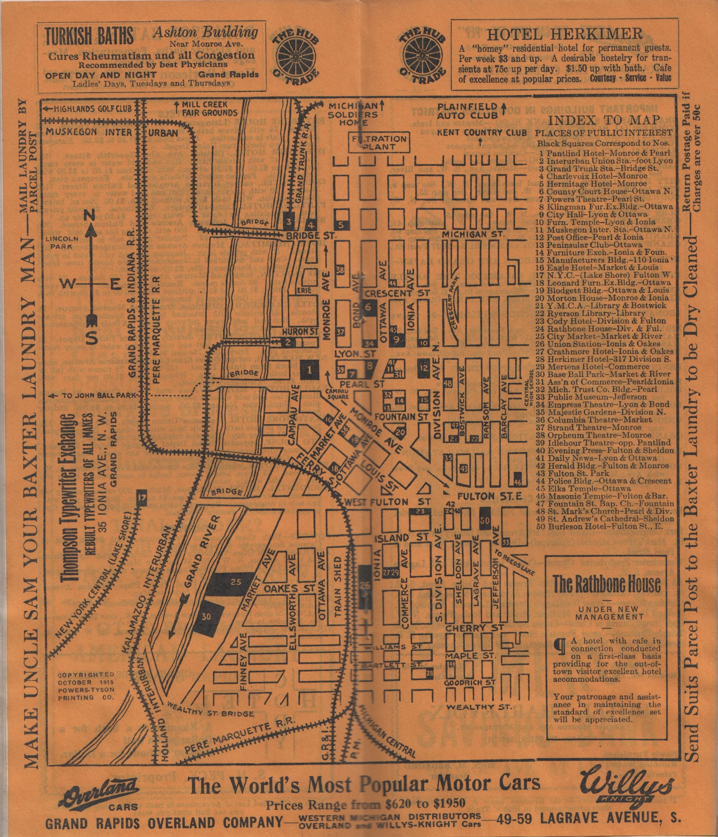
Left click on the image below for a larger version.
The street and track map above is dated October, 1915.
It appears to show the Grand Rapids - Kalamazoo line about the time it opened for service.
Notice that the map does not indicate any connection with the GR-GH-M line. Perhaps that
was done either by foot or streetcar.
A number of streets, tracks, and buildings, are indicated that do not exist in yar 2014.
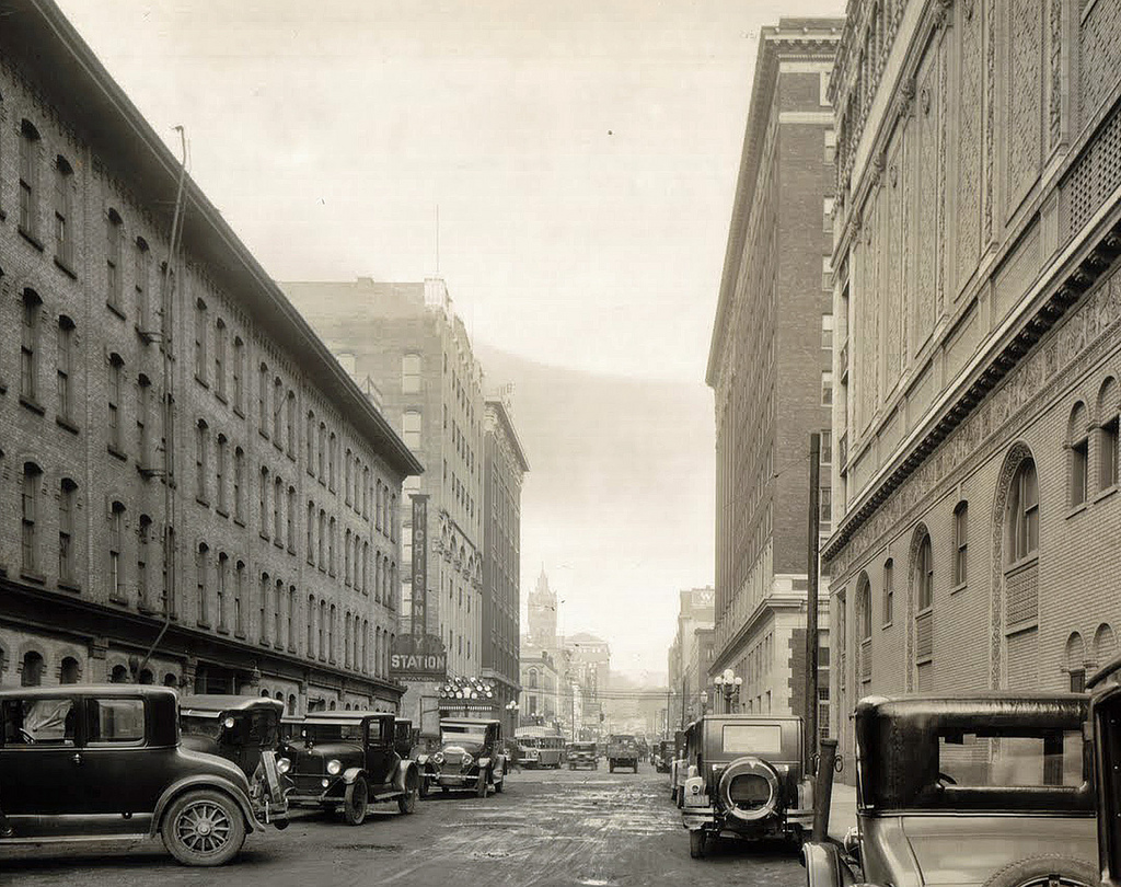
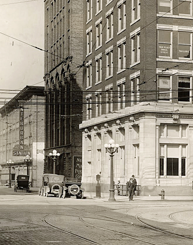
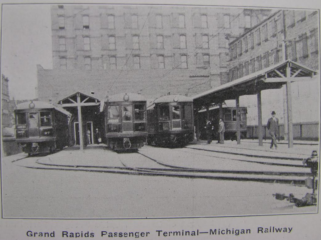
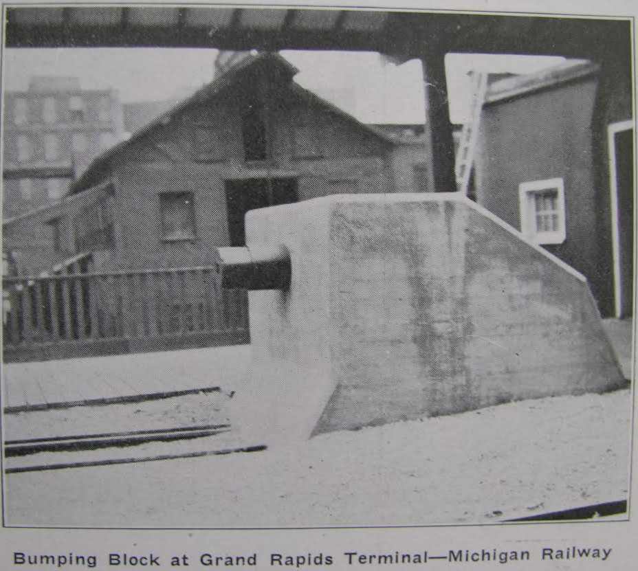
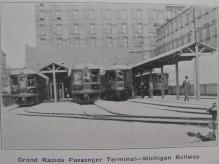
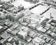
Connecting Grand Rapids and
Kalamazoo, the interurbans started out in Grand Rapids from a terminal that
was located on the site where the Civic Auditorium was later built. It is shown
in the photograph below, on the left. The terminal was probably entered from the
street on the left, in the left hand photo, top row. The street was Campau. Huron ran along
the tracks, and is apparently gone in year 2012.
Left click on the images below for larger versions.

Station sign Lyon & Campau
|
Opposite side of station sign.
|
Station entrance on Huron Street.
|
|
|
1915
|
|
Huron Street to the left.
|

|
1915
|
c1919 - car 810 on the north
side of the Pantlind Hotel.
|
Circa 1935.
|
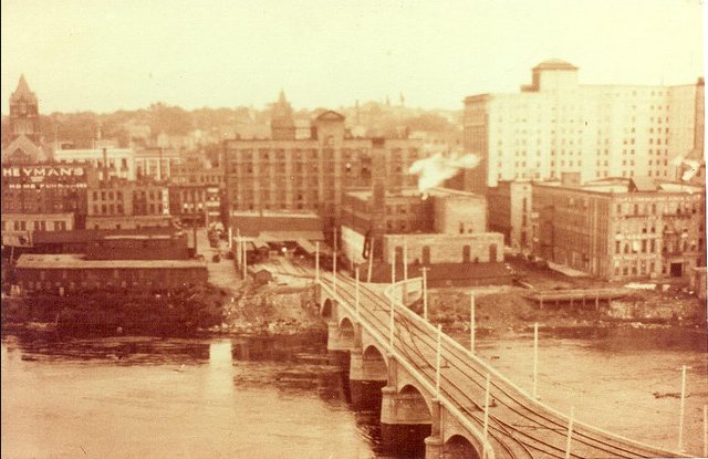
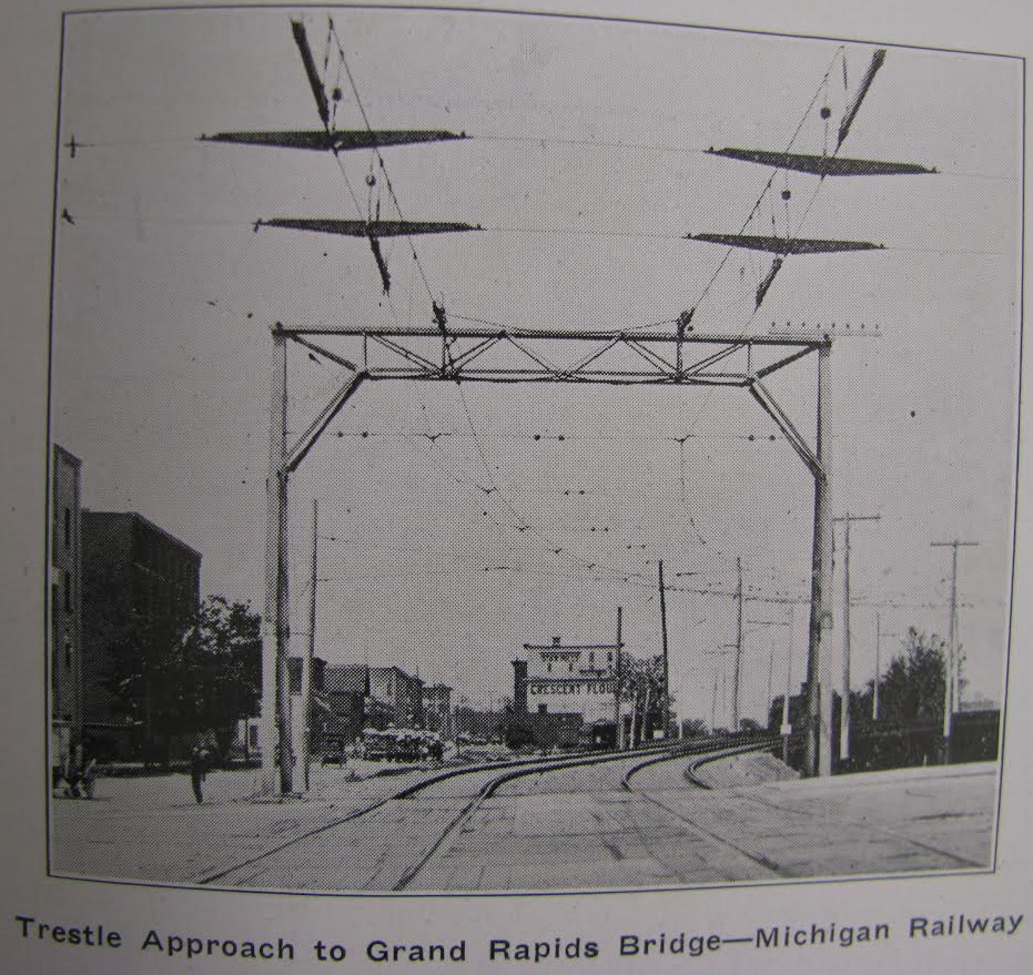
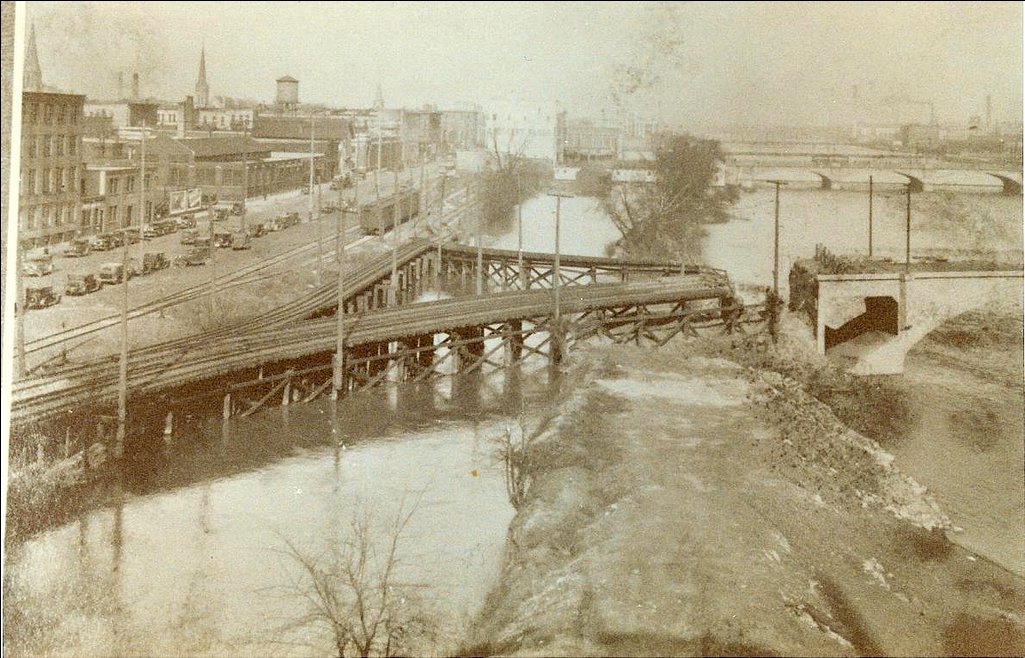
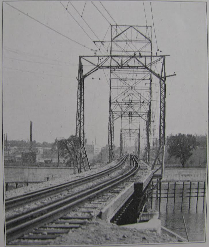
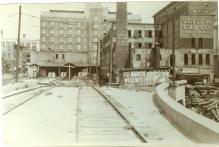
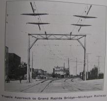
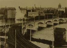
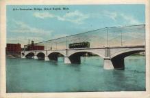
The coaches headed west over the river, as shown in the left photo, middle row, above, top row.
The left hand track headed left for Kalamazoo.
The middle track headed towards Grandville, and eventually to Holland.
The track curving to the right went to Muskegon, with many stops along the way.
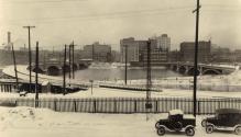
The photograph on the left, bottom row, probably shows the bridge and station
after operations ceased. Perhaps because of the Great Depression, and the cost of razing the bridge,
it still stands in year 2010, and is a footbridge.
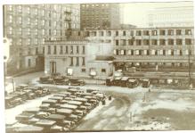
The photo on the right side, bottom row, above, is thought to be circa 1935. The Civic Auditorium
exists, making it at least 1933. The interurban bridge still has trestles on the west on, because
no one got around to tearing them out. And there might be streetcar on Monroe, just north of the
Pantlind Hotel, suggesting no later than 1935.
Left click on the images below for larger versions.
June, 1915 - approaching GR
|
Circa 1915 - Camera Shop photo.
|
Note west side canal
below the tracks.
|
Track on west side of
bridge heading north.
|
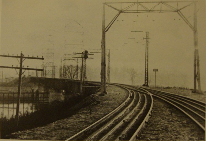
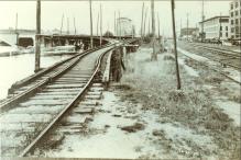
The west end of the interuban bridge shows the track curving towards the south end bridge, as it winds its way
along the west side of the river. The photo at the right shows a section of track heading north. The situation
here is not clear at present, but it appears there was an effort to connect the GR-GH-M line with the
GR - Kalamazoo line. It's hard to tell from the photo whether there is a live wire hanging over the track
at the time the photo was taken. Just when the photo was taken is unknown. The cars to the right suggest
1925 to 1930, in which case the system might well have shut down. Also unknown at present is when the
connecting track was laid. The 1915 map above does not indicate a connecting track.
Left click on the images below for larger versions.
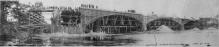
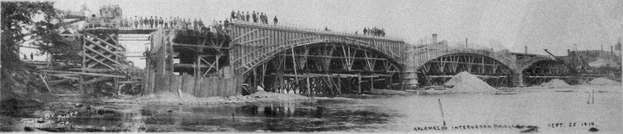
September 25, 1914
|
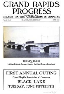
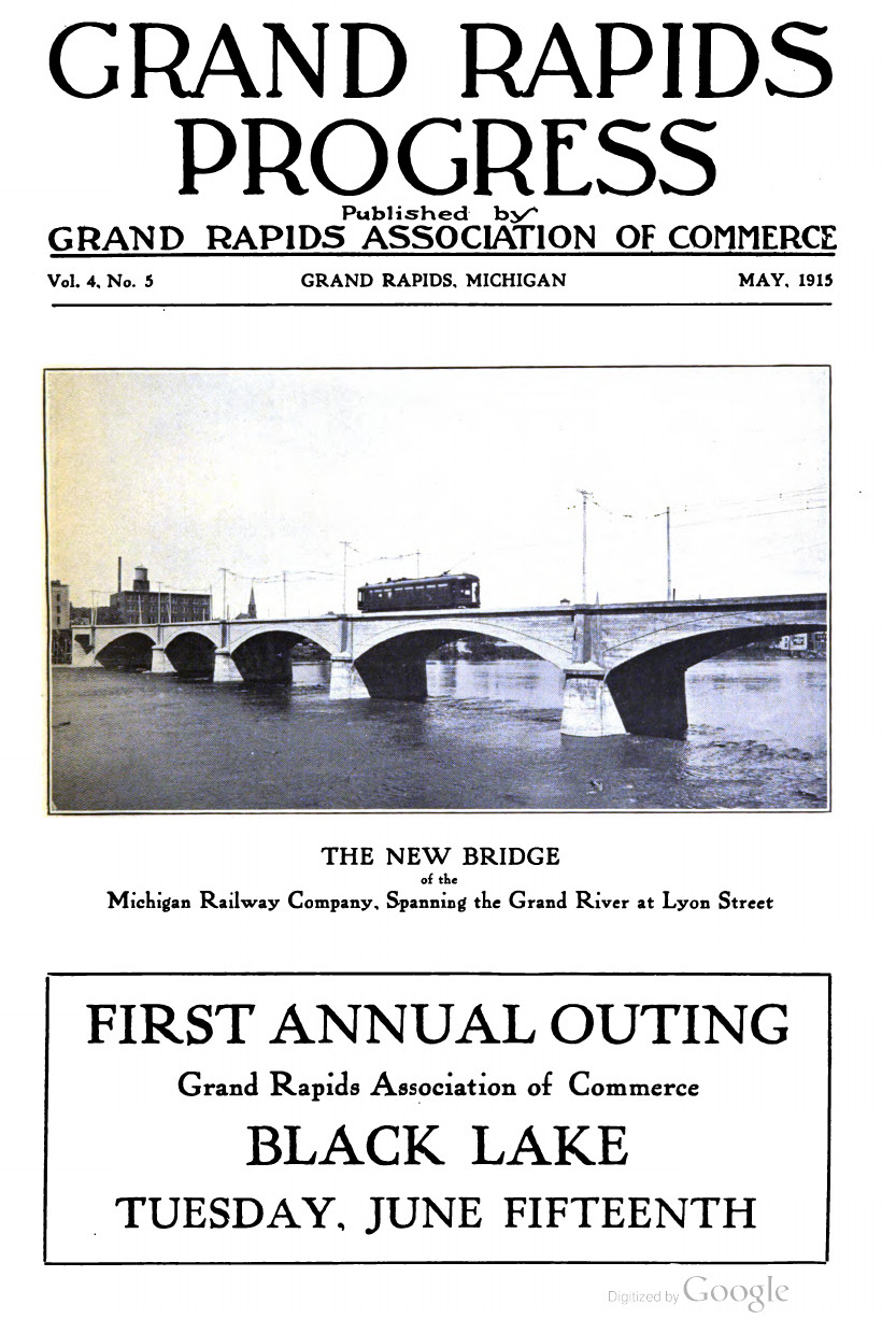
New bridge - May, 1915
|
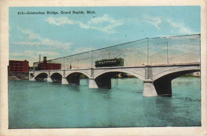
Postcard based on photo.
|
Postcard based on photo.
|
c1935
|
1936
|
Circa 1940
|
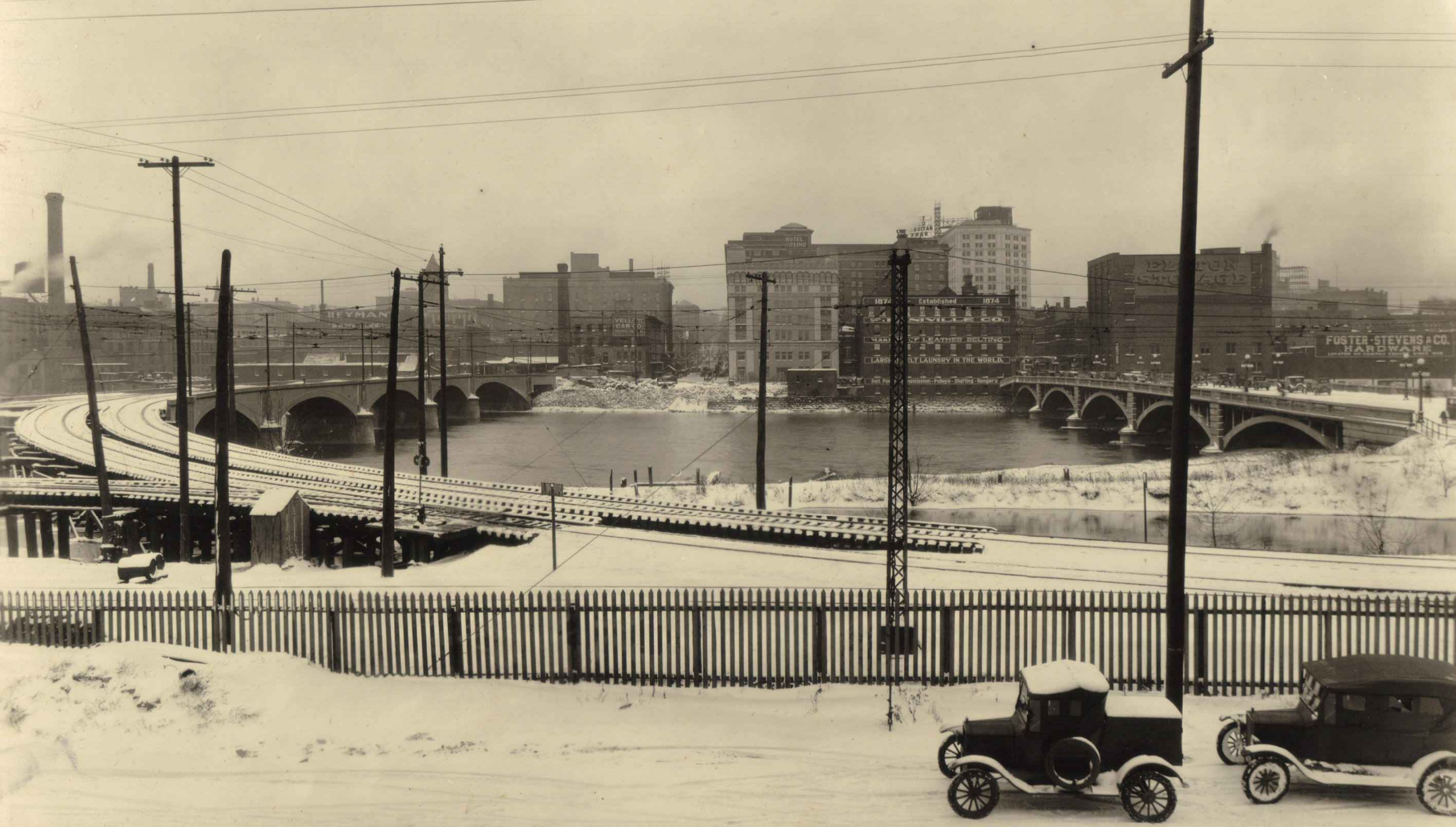
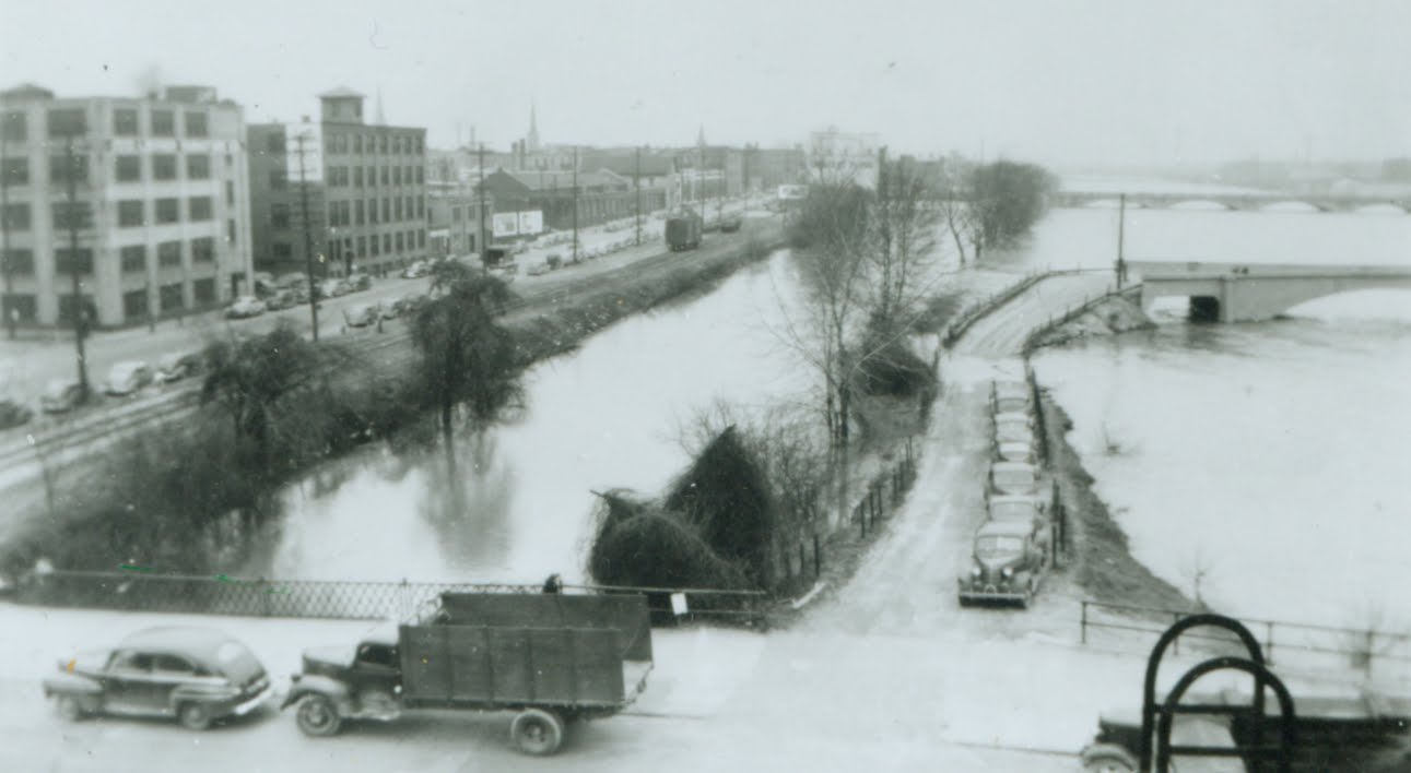
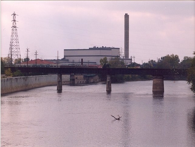
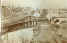
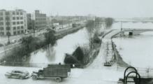
The interurban bridge still stands in year 2010, as a footbridge.
The photos, above, dated 1935 and 1936, shows the interurban bridge after it was
disconnected from the tracks on the west side. The views are northwest. Also seen
is the bridge over the west side canal. The canal was just a stagnant water channel
in the early 1950s, collecting garbage, and whatever else people threw in.
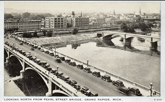
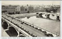
The large number of cars along the Pearl Street bridge helps explain why the
interurban lines failed. Cheaper cars, personal transportation, and taxpayer
financed roads. The interuban systems were doomed economically.
In the background is the Rexall Train, which is parked on interurban track.
Moved by a NY Central engine, the train toured the country, educating Rexall
employees at each stop.
Left click on the image below for a larger version.
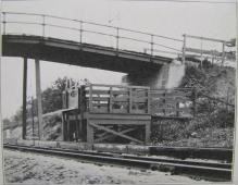
The photograph above shows car 814 coming in to the Grand Rapids terminal on the
"upper bridge." The one by the old Civic Auditorium.
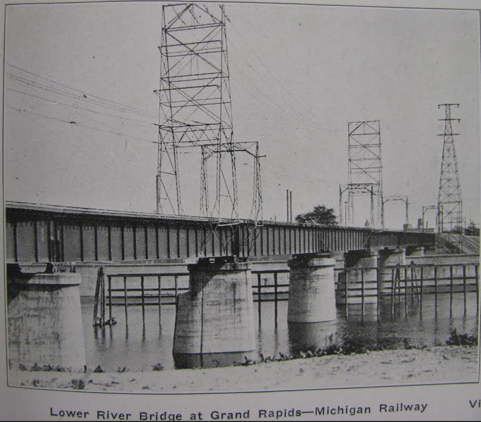
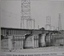
The track to Kalamazoo crossed the river a second time on a second bridge,
further south, shown below.
Left click on the images below for larger versions.
June, 1915
|
June, 1915
|
June, 1915 - 2400 volts
is still being used.
|
South bridge, orginally a
swing bridge. Apparently looking
north, two tracks merge into one.
|
A group of coaches apparently
approaching the swing bridge
south of Grand Rapids.
|

Undated view of swing bridge.
|
|
2012
|
2012
|
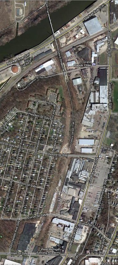
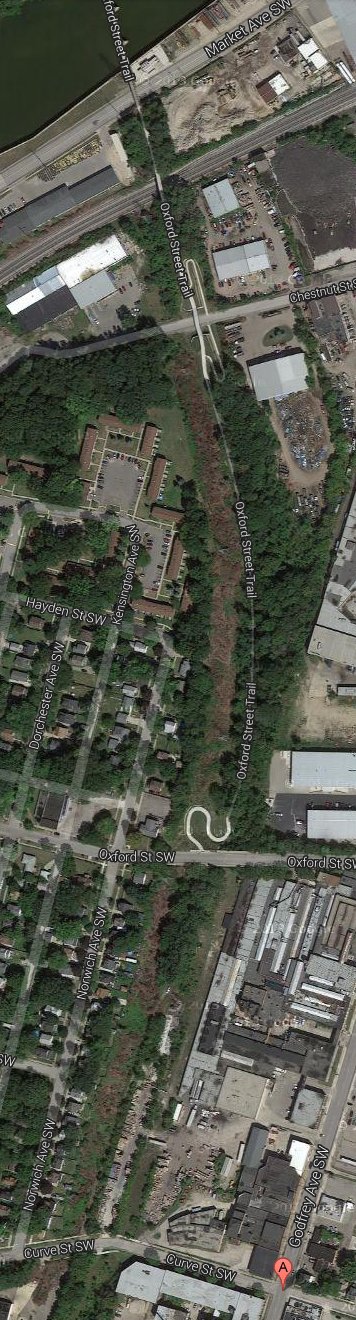
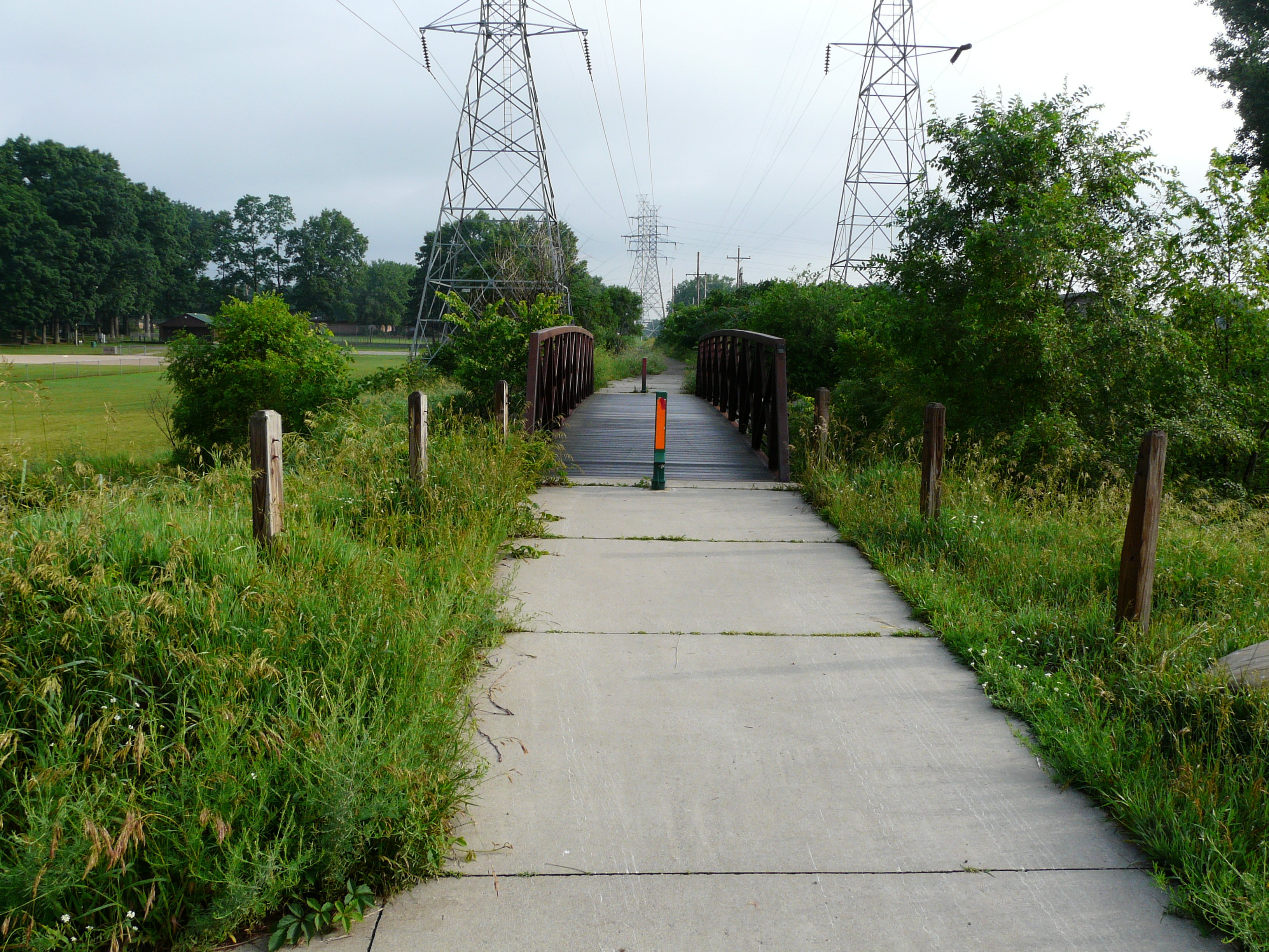
The swing bridge which was used for the second crossing of the interurban coaches
on their way to-from Kalamazoo. At some point it was made a fixed bridge, which
is a foot bridge in year 2012. Even in year 2012 one can see outlines of the course
of the track on both sides of the rive, and possibly the course of the canal on
the west side of the river, which still existed in the early 1950s. The bridge, and
part of the track roadbed, is today part of the Oxford Street Trail. Some group
is attempting to establish a walking path along the route of the line. Another
segment goes south from Godwin. Perhaps it is enabled by Consumers Power, which
owns the land in year 2012.
Left click on the images below for larger versions.
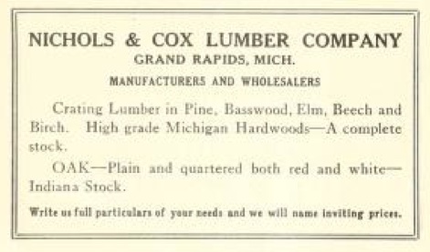
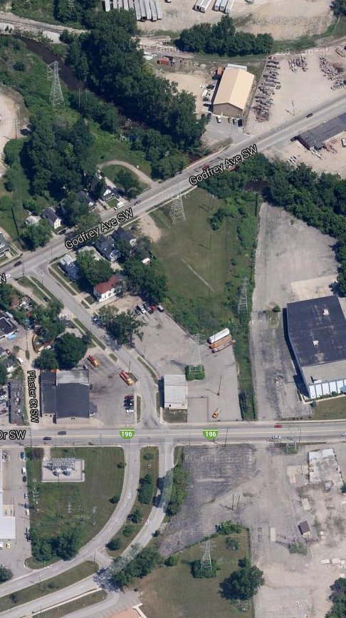
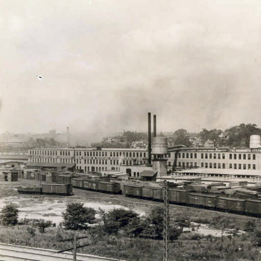
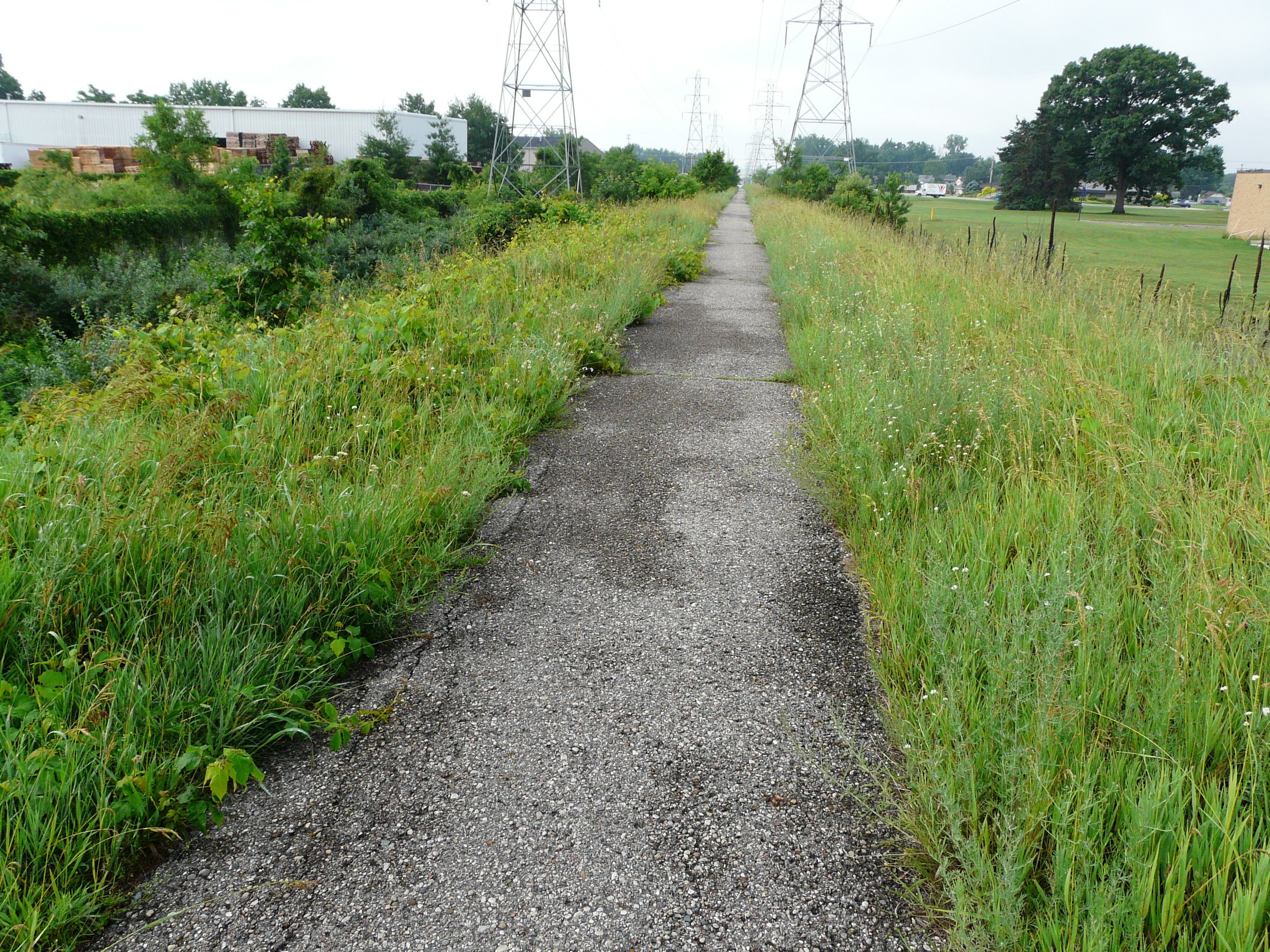
The Nichols & Cox Lumber Company building was located at 1035 Godfrey Avenue SW and Curve Street SW, in
the northwest corner. Apparently the plant was big enough to butt up against the GR - Kalamazoo
interurban line, which is shown at the left. The location is about half way between the south
interurban bridge on the Grand River and stop 63, Grandville Avenue. The company wholesaled hardwoods
from Michigan and Indiana.
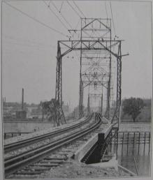
One can see that the line is double tracked at this location. One can see in the south
bridge photos above that the same line hangers are used there. Just why double tracks were used
in this location is unknown at present. In the view of the south bridge above, apparently looking
north, one can see the two tracks merge into one just before the bridge.
Left click on the images below for larger versions.
c1920
|
c1920
|
About June, 2013
|
GPS coordinates: 42.937629 -85.690121
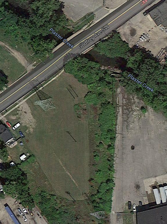
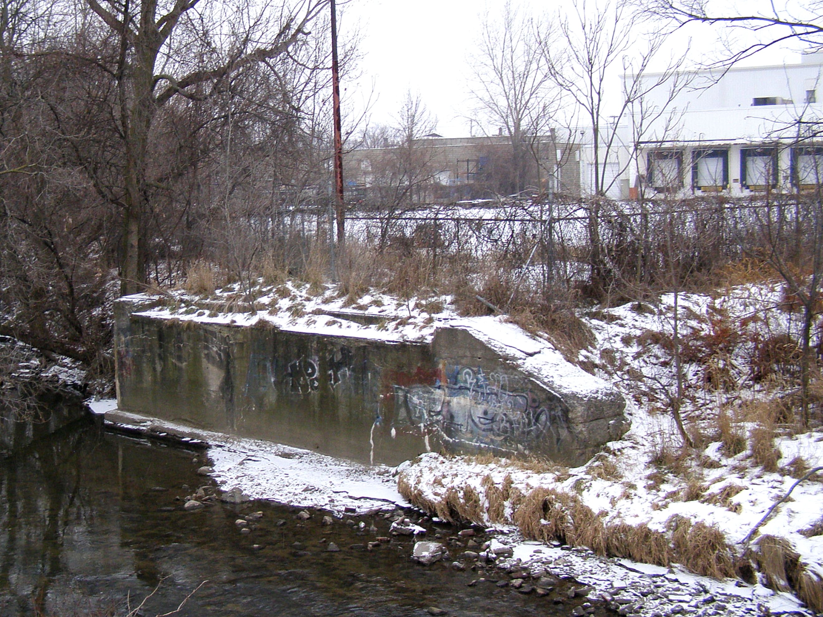
The location above is where the interurban crossed Plaster Creek. The photos above, center and left, are c1920,
and show the track crossing Godfrey at this location. The abutments confirm that there is dual track
at this location, which is shown in the wire hangers in the photograph. The photograph at the right
shows one of the abutments in year 2013.
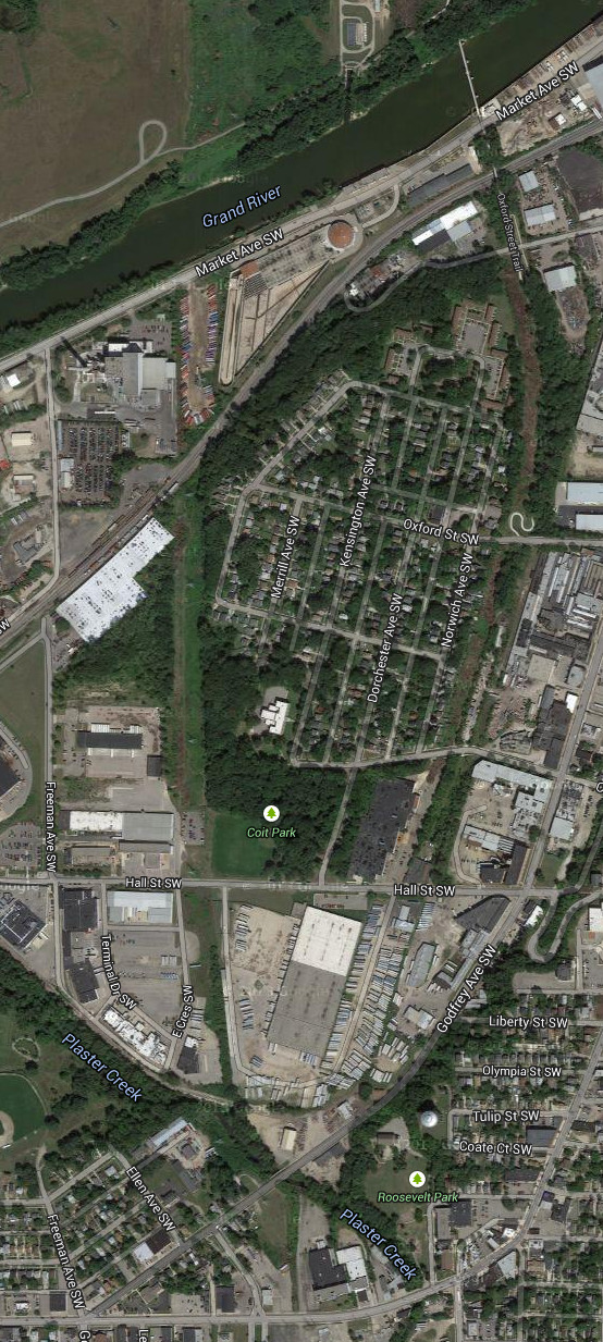
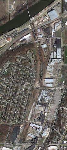
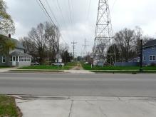
Grandville Avenue - stop 63.
Left click on the images below for larger versions.
The image above shows the approximate location of the Grandville stop in year 2013. Grandville
Avenue changes to Chicago Drive in this area, so it's not clear for now whether Grandville refers to
the town or the road. Many stops are named after a road, but further south they can be named for a
farm, or something else, making the exact, or even approximate, location of the stop hard to
discern in year 2013.
In any case, one can follow the transmission towers in the image above to see about where the
track would have crossed Grandville Avenue. It's likely this location looked nothing like this in
1916 or so.
GPS coordinates: 42.937419 -85.689803
Left click on the images below for larger versions.
Track crosses Grand River,
upper right, eventually heads
for Godfery Avenue SE.
|
Bridge abutment just SW of
Godfrey Ave.
|
South abutment. Photo
by Pete Walsh.
|
Clyde Park - stop 62.
The information below might pertain to stop 62, or a special stop at the Leonard, later Kelvinator,
plant at 1575 Clyde Park, in which case stop 62 would have literally been at Clyde Park where the track
crosses.
The photos and image below show the line as it passed the Leonard, later Kevinator, plant.
The exact dates of
the photos are unknow, but they had to be between about 1916 and 1928. One can see the faint
impression of the interurban track going along Plaster Creek. Satellite images show that the track
did indeed pass to the west of the plant. Like the Parchement stop, just north of Kalamazoo, which
served local paper mills, the stop by Kelvinator might have been a special stop, bringing people from
north and south of the plant to work.
Left click on the images below for larger versions.
|
Interurban track and
overhanging cable.
|
1928 or before. Leonard
plant in background. Bridge
over Plaster Creek is at the
right location.
|
Swing bridge at top.
Path the Kalvinator plant.
|
ROW near bottom of photo.
|
Bridge over Plaster Creek.
To interurban stop?
GPS coords: 42.933082 -85.689316
|
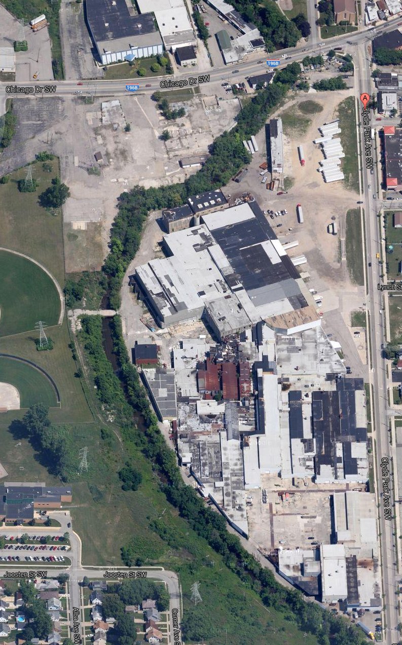
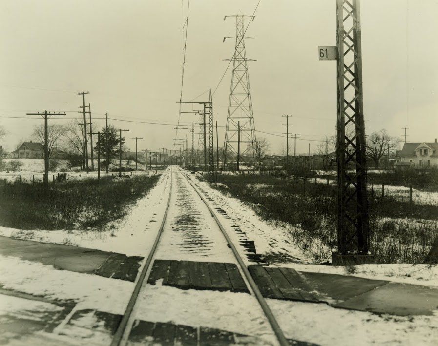
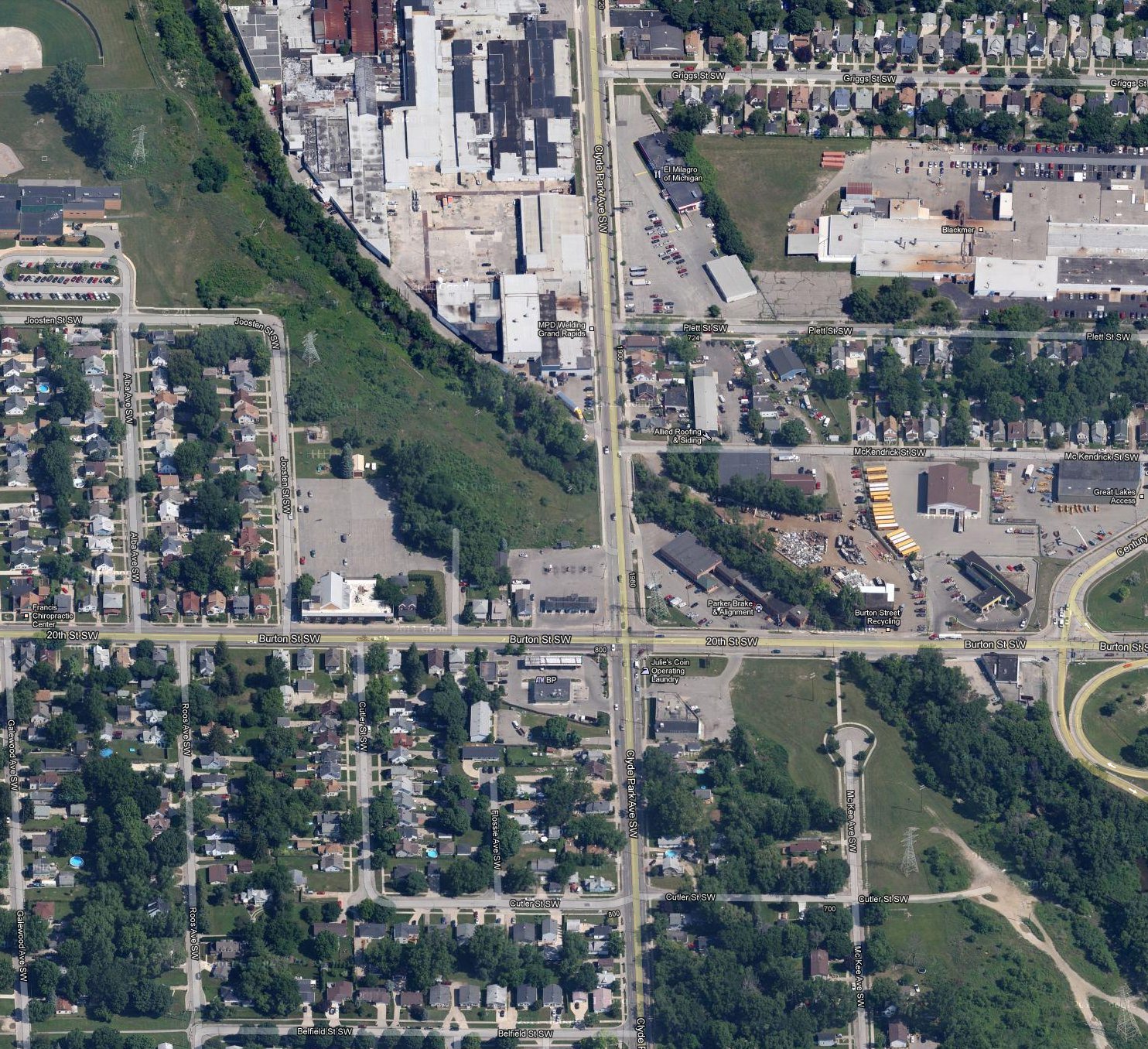
Burton Street at Clyde Park - stop 61
The next stop, 61, would be Burton Street at Clyde Park Avenue, shown below. Note the "61" on the steel "pole," in the old photogrpah below - top row, left. Clyde Park is the road at the base of the
hill, in the upper left.
Left click on the images below for larger versions.
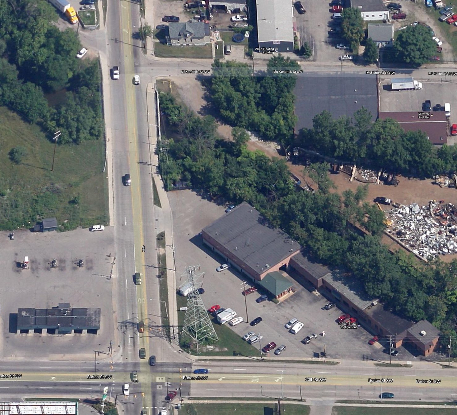
The house shown on the right side of the old photograph, top row, left, can be seen in the
2013 image shown to the right, on the corner of Clyde Park and McKendrick Street SW. So the old
photograph is looking northwest, from the north side of Burton Street.
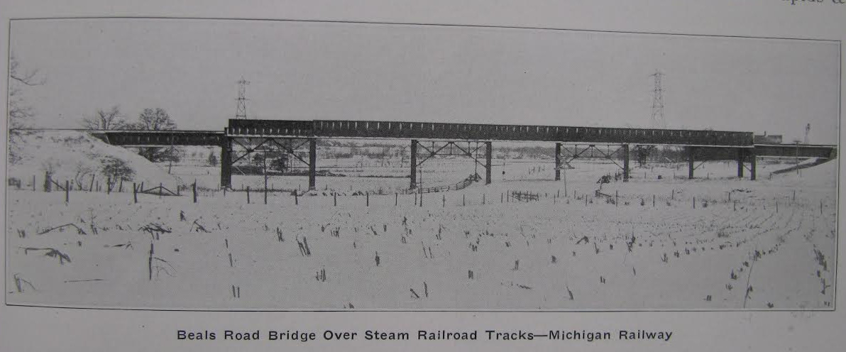
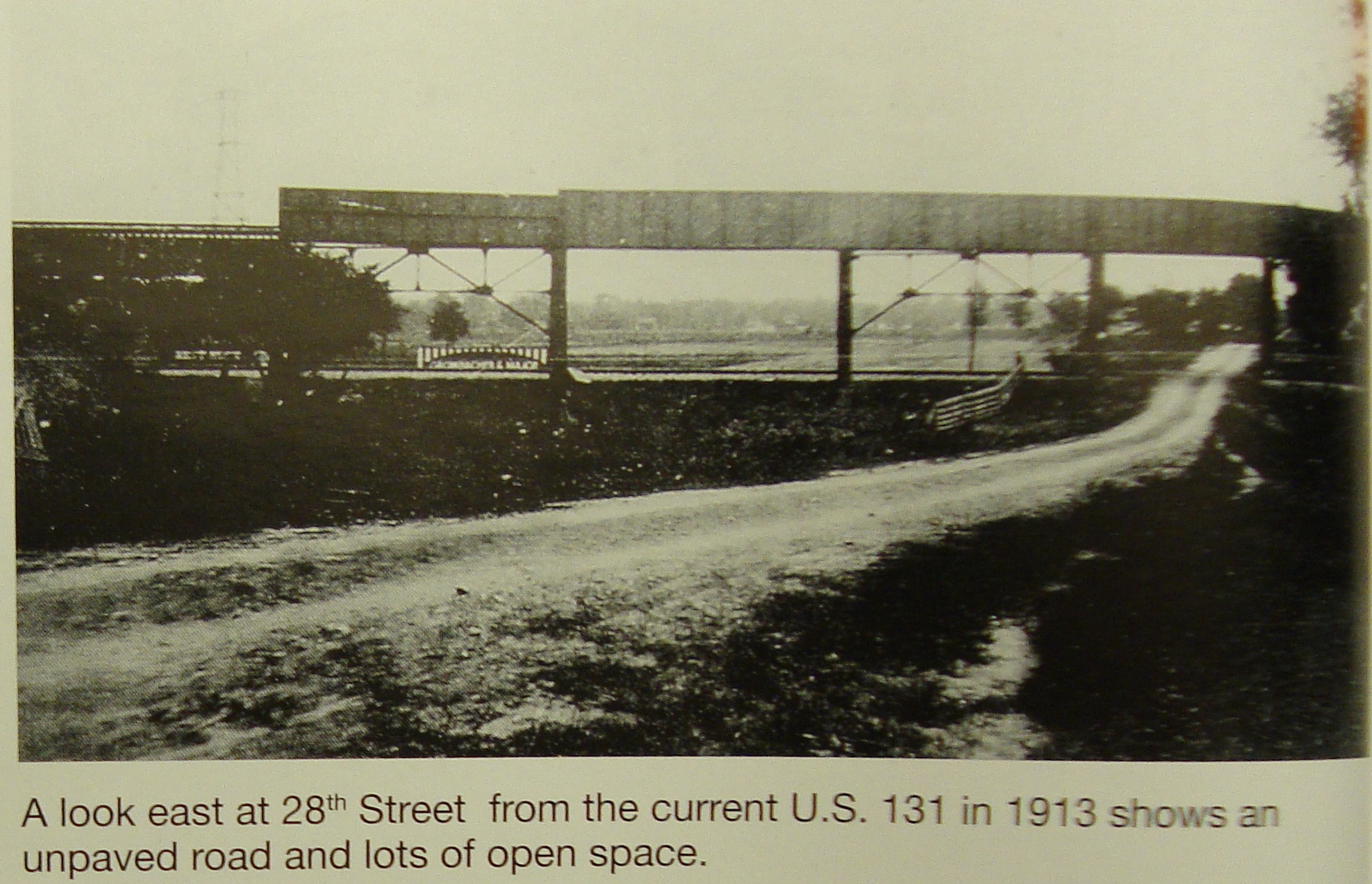
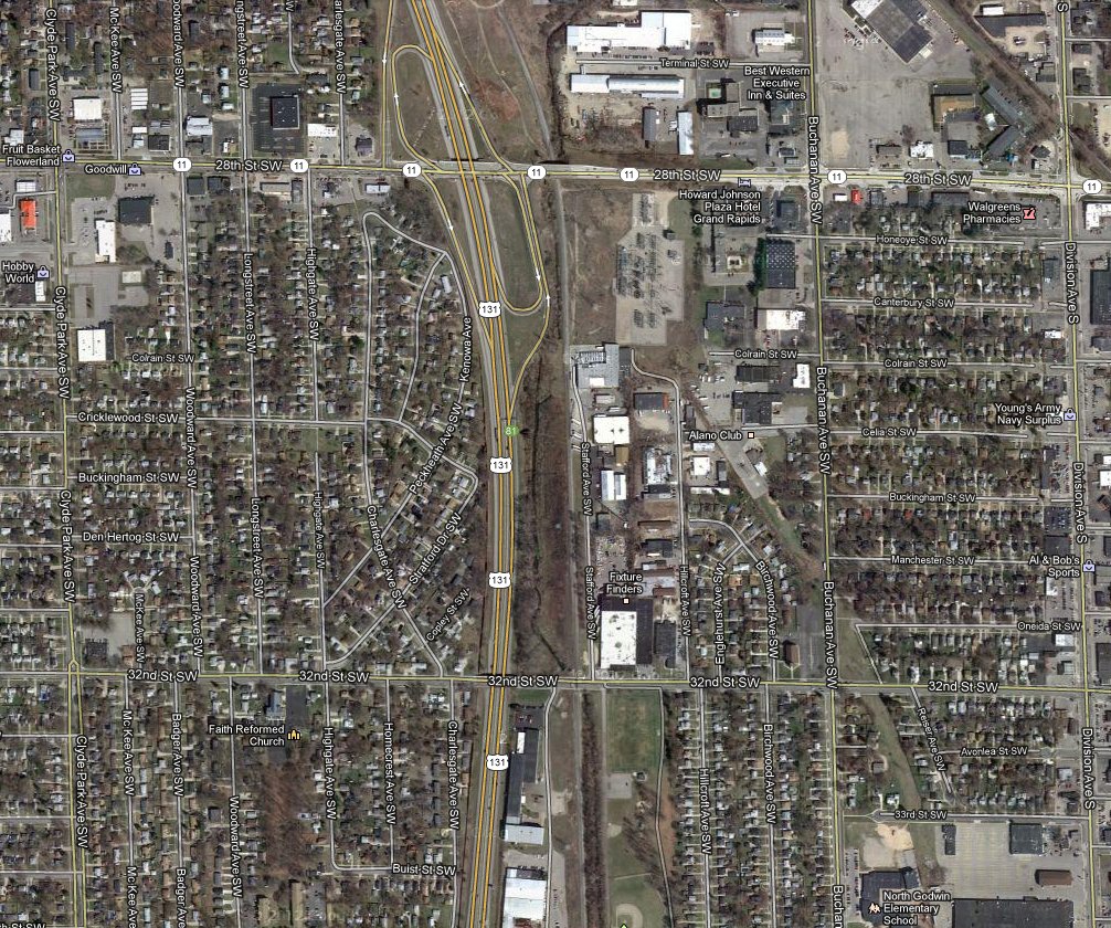
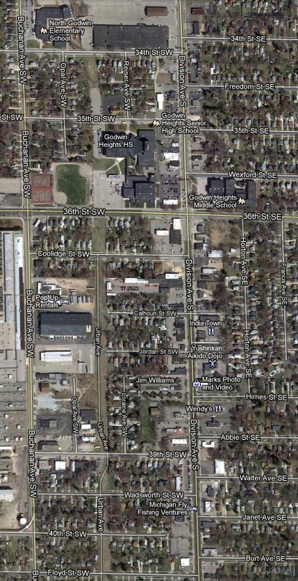
Beals Road ( 28th Street) - stop 59
The track eventually crossed 28th Street not far from the old Consumers Power
sub station located on the SW corner of 28th and Buchanan. A steel trestle
at 28th Street that moved the interurban coaches over both
the road and the Grand Rapids and Indiana Railroad tracks that run north
and south, and cut across 28th Street, in the same area. The tracks
later crossed Buchanan just before 32nd Street, then crossed 32nd Street, and
headed due south until at least 92nd Street.
Left click on the images below for larger versions.
The photograph above, left, shows where the Grand Rapids to Kalamazoo interurban
crossed the Grand Rapids and Indiana Track - later the PRR - and 28th Street at
the same point. The photograph is from 1913, although the date might be off a
couple of years. Clearly all the land shown is still farmland.
This is also the location of stop 59, Beals Road - 28th Street in year 2013.
Just where people boarded the coach is not clear.
The middle and right hand photographs, above, show satellite images of the
same area. After almost 100 years one can still see much of the old route of
the interurban, as it approaches Buchanan, just south of 32nd Street, the triangle
of land in the northeast corner of 32nd Street and Buchanan, how the track bed defines
Riser, and then heads due south once south of 36th Street. In year 2012 Urban Avenue
apparently shares the right of way with the power lines south of 36th Street for a ways,
and is a walking path south of about 44th Street.
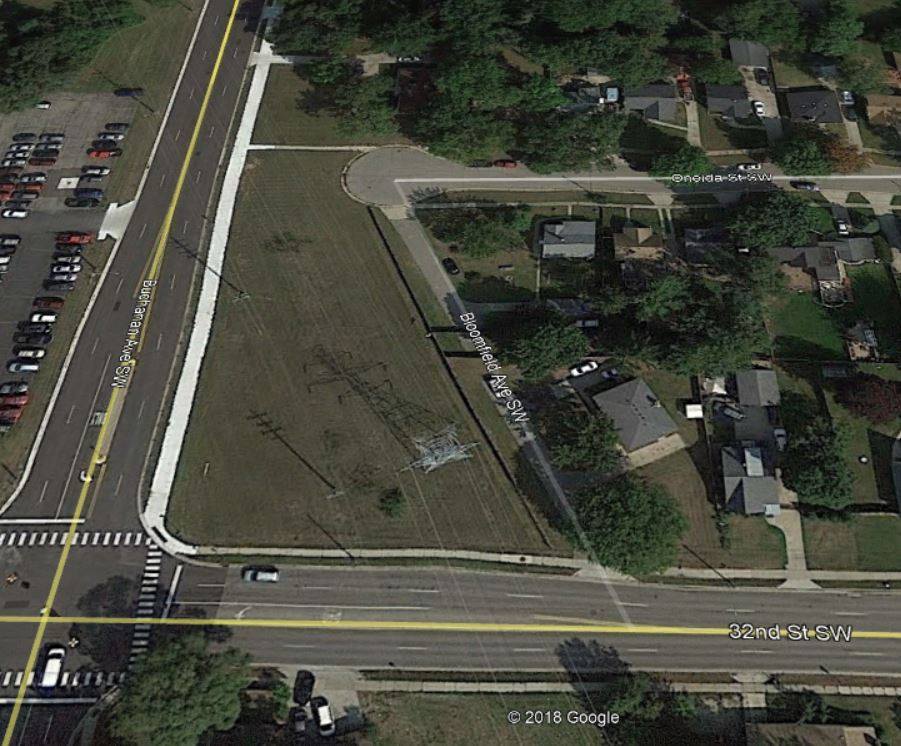
32nd Street - stop 58
Stop 58, at Buchanan and 32nd Street, would have been located in the triangle defined by Buchanan, 32nd Street, and
Bloomfield Avenue SW. Just where the station was, or perhaps this was a flag stop, is not known here. Being an odd
shaped piece, and having the Consumers Power lines overhead, there was really no way for this wedge of land to
develop beyond the placement of the interurban track and the stop. Today the situation is no different.
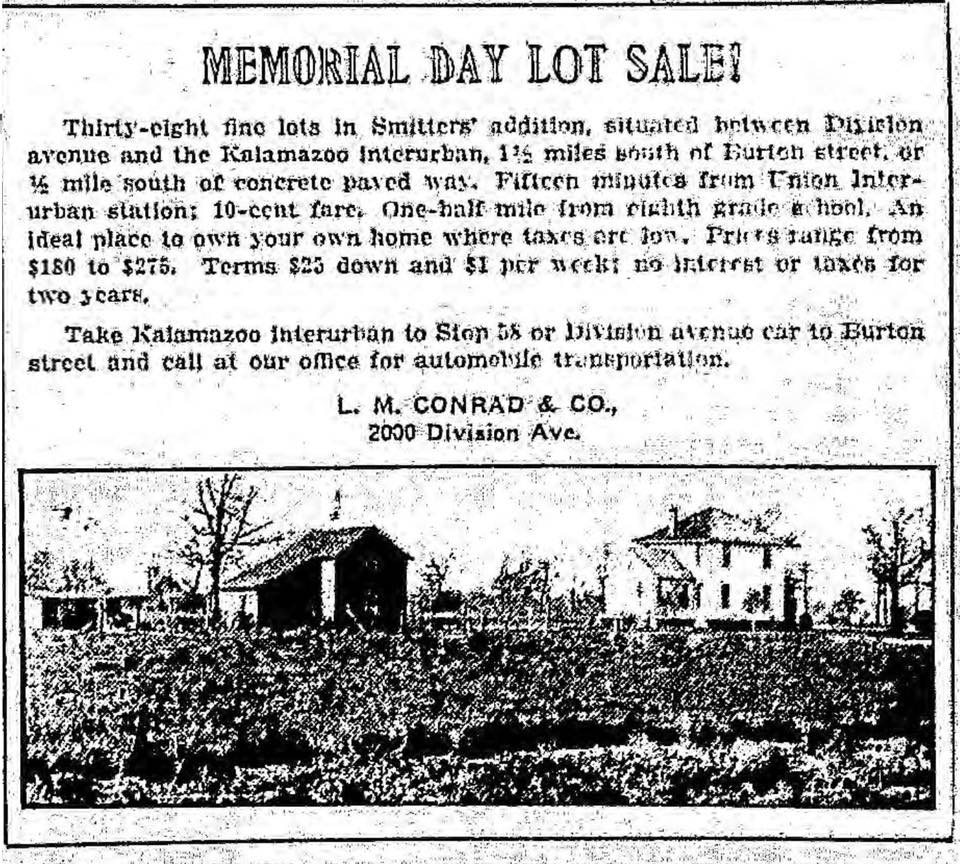
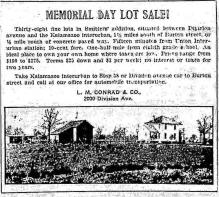
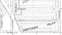
The 1916 advertisement below shows yet another farm going down. Smitter's Plat was apparently the name of
the development. A 1922 plat map shows that it was a 10 acre farm,
and also that Buchanan did not extend below maybe Alger at this time.
Left click on the images below for larger versions.
1916
|
Smitter's Plat
|
Stop 58 area in 2018
|
Brick School House Road - stop 57
This would be 36th Street. Godwin was a one room brick school in 1917. It was only replaced
in 1924, just 4 years before the GR - Kalamazoo line ceased operation.
The land in that area was significantly altered in 1937, when the 10 acres of land belonging
to Frank Rackett was converted to a sports and playground complex.
Curiously, the interurban track to 50th street was still in place as late as 1945, as
shown in the segment of a 1945 map below.
Left click on the images below for larger versions.
According to Bill De Bruyn, Godwin class of 1945, the track was taken up during WWII for the steel.
There apparently was a plan as far back as 1929 to bridge the NYC track to Jackson and the GR & I track
at a location in or around 28th Street. The details are murky, and the plan was never executed. Just
how the interurban track was going to be used is also unclear. They all seem to have about the same
level at 36th Street, that was not the case at 28th. Godwin graduates remember the track in the early
1940s yet. And it is possibly why track ties still existed, as did rail under the pavement on streets
like 34th.
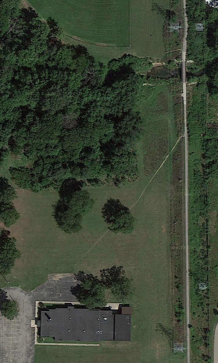
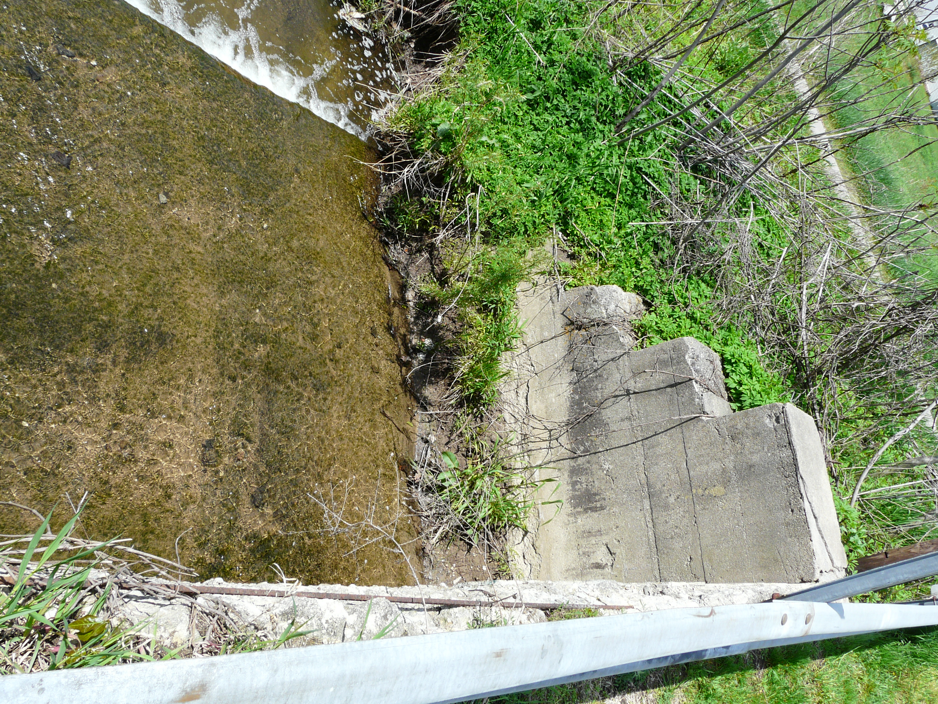
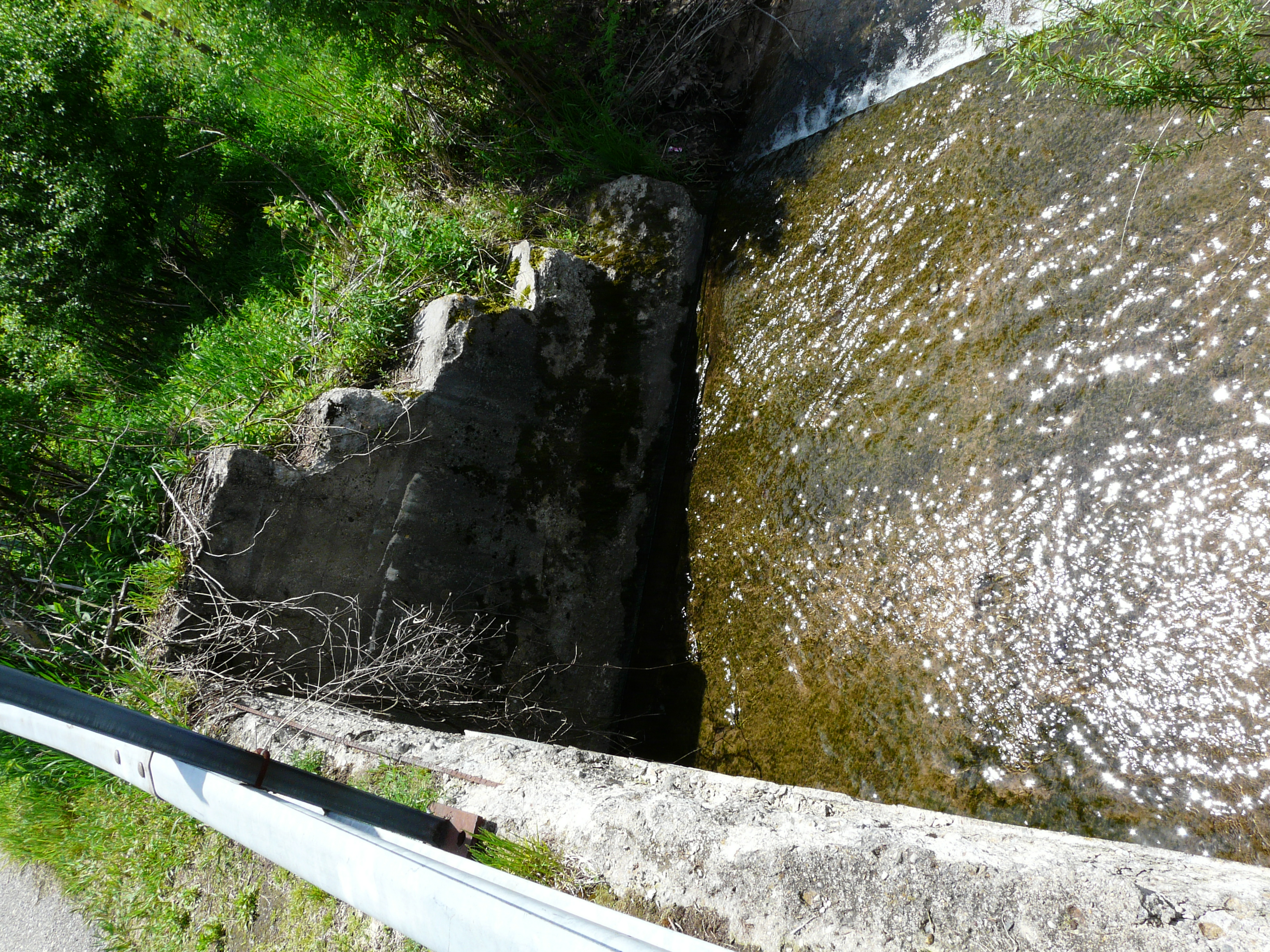
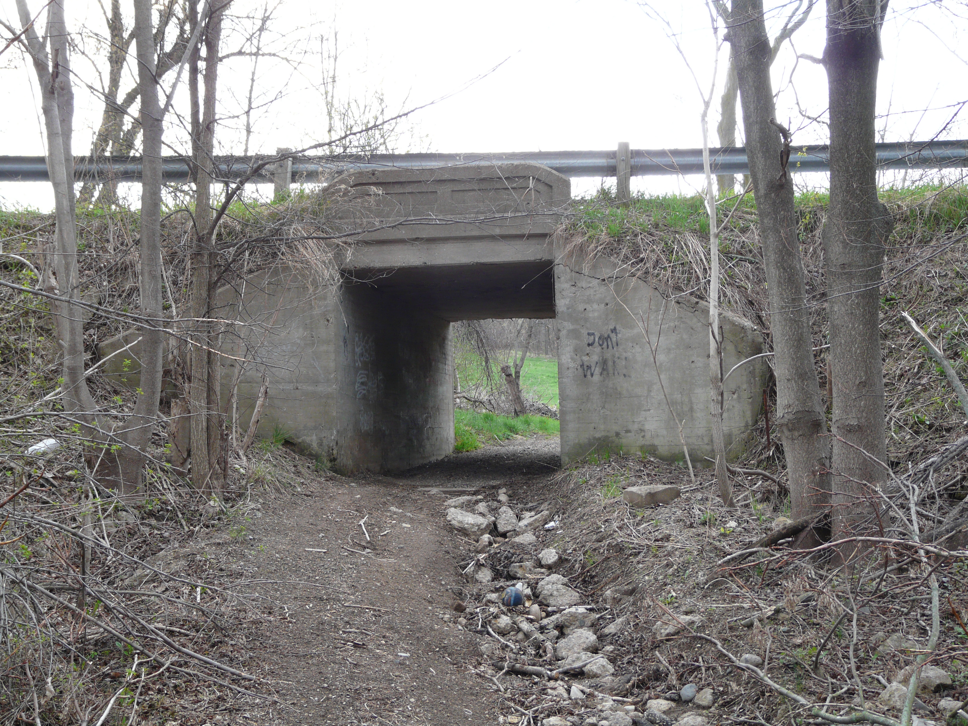
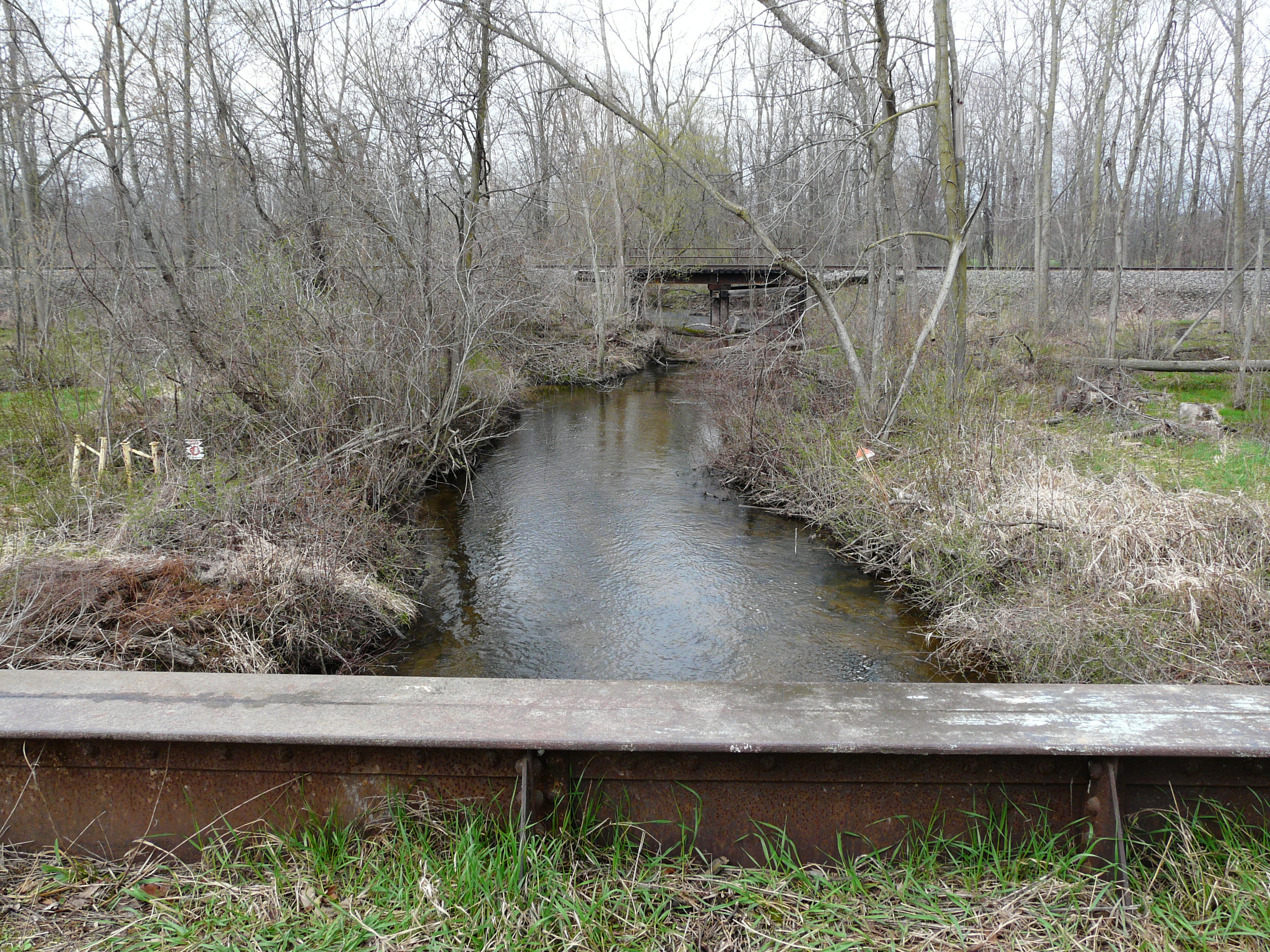
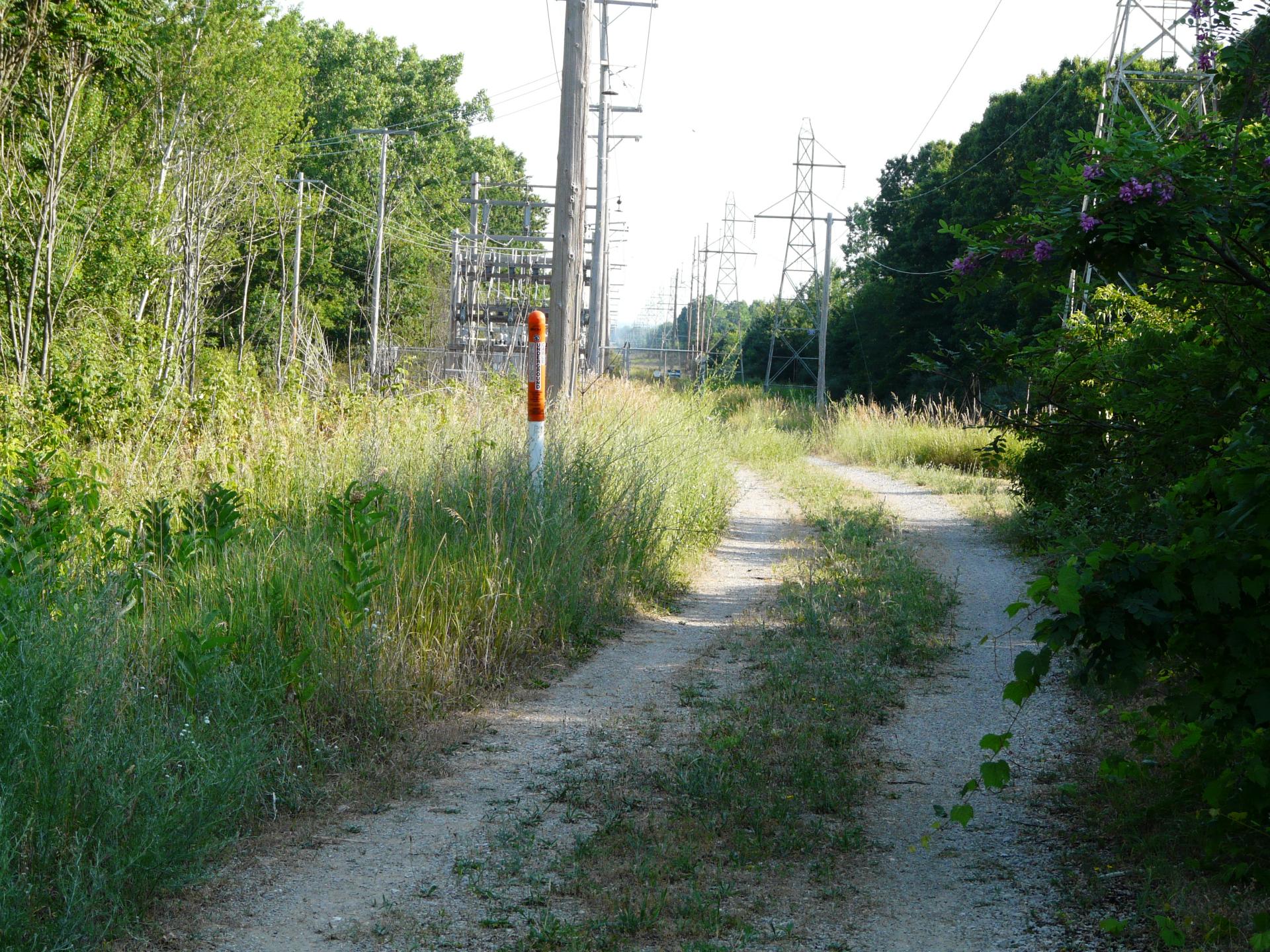
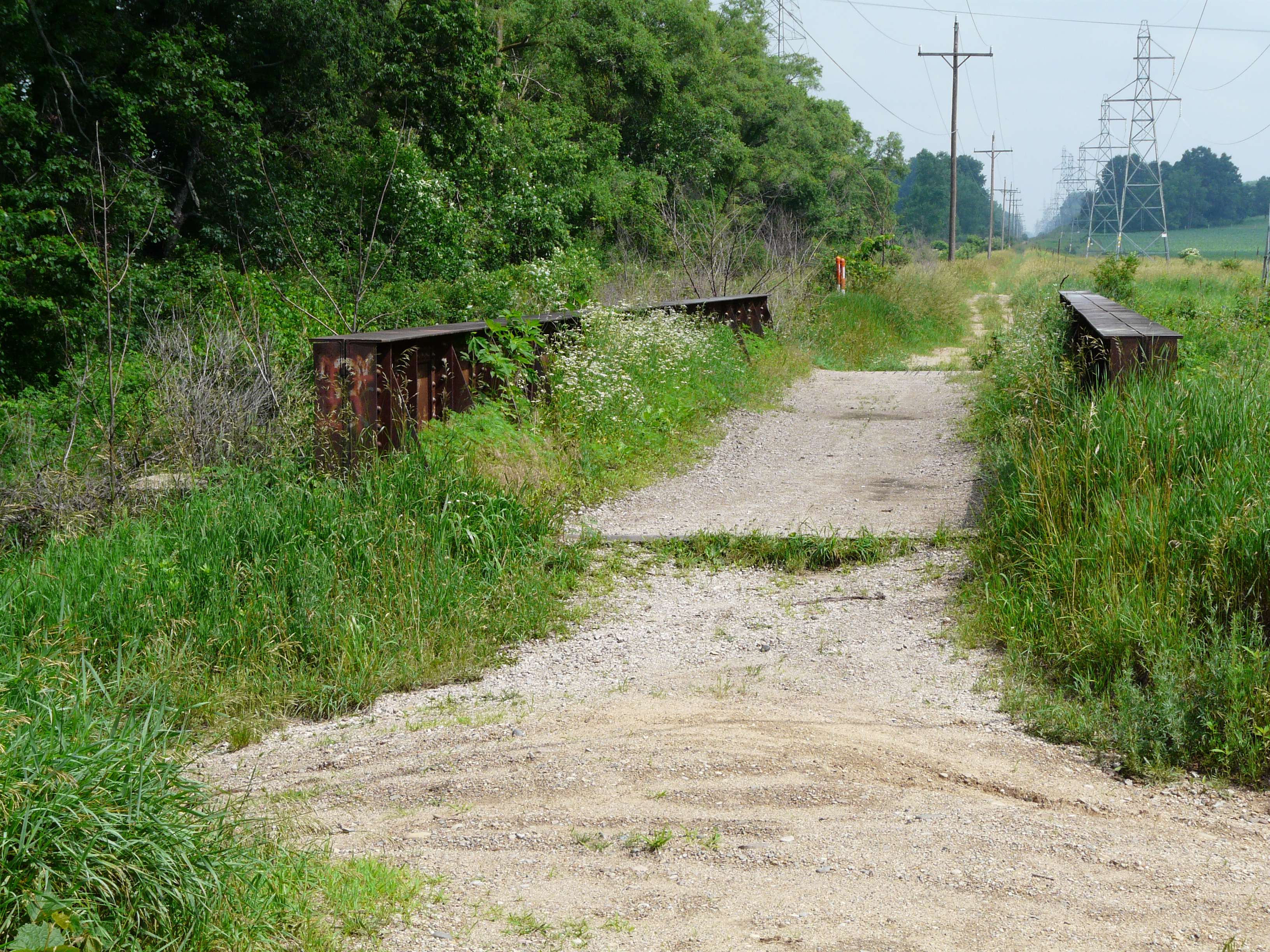
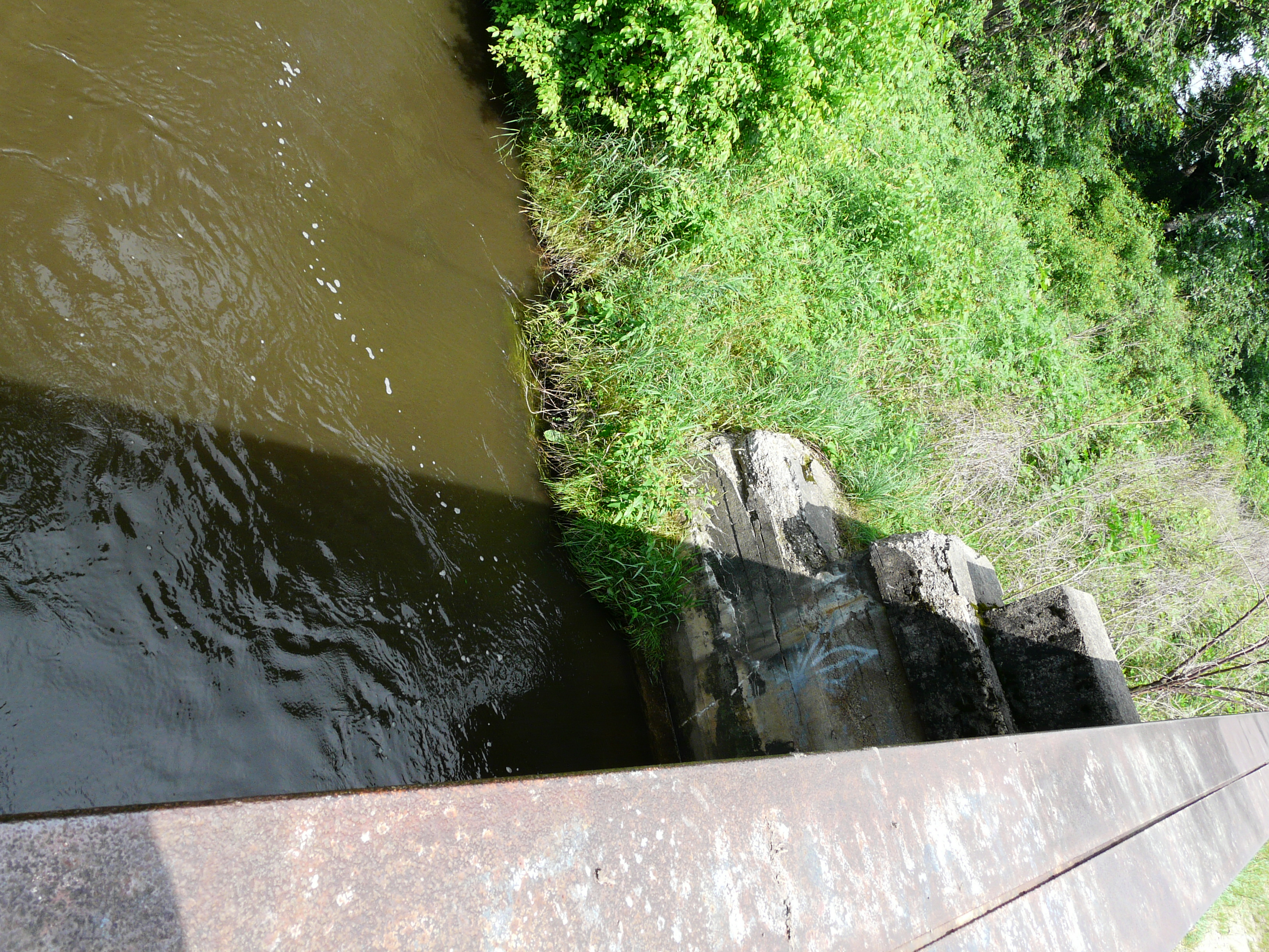
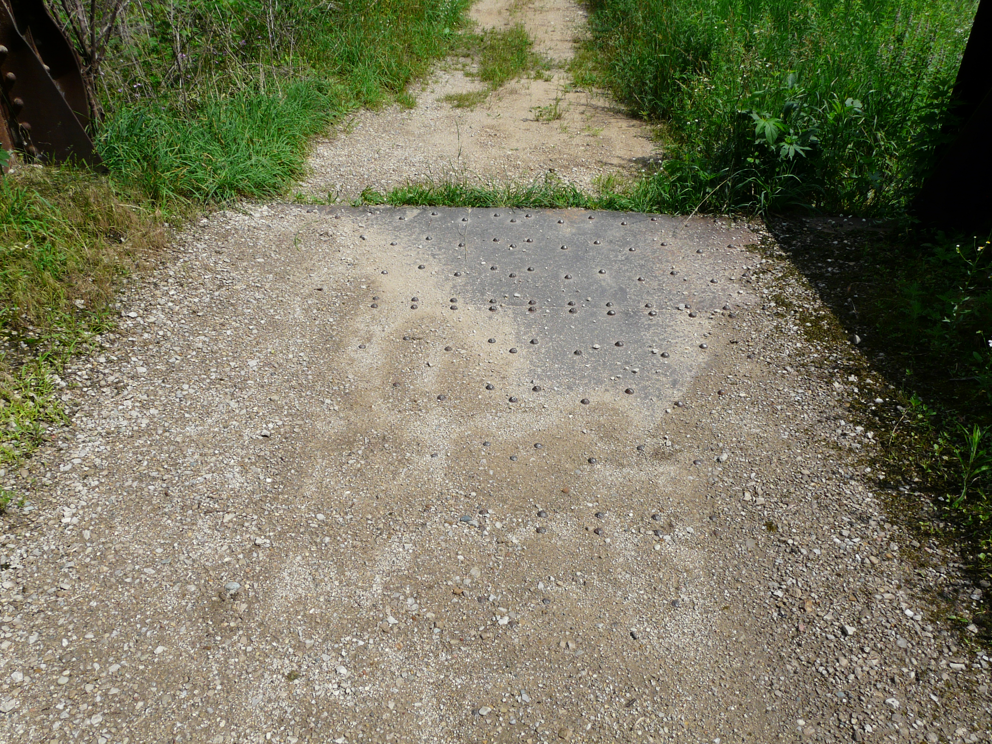
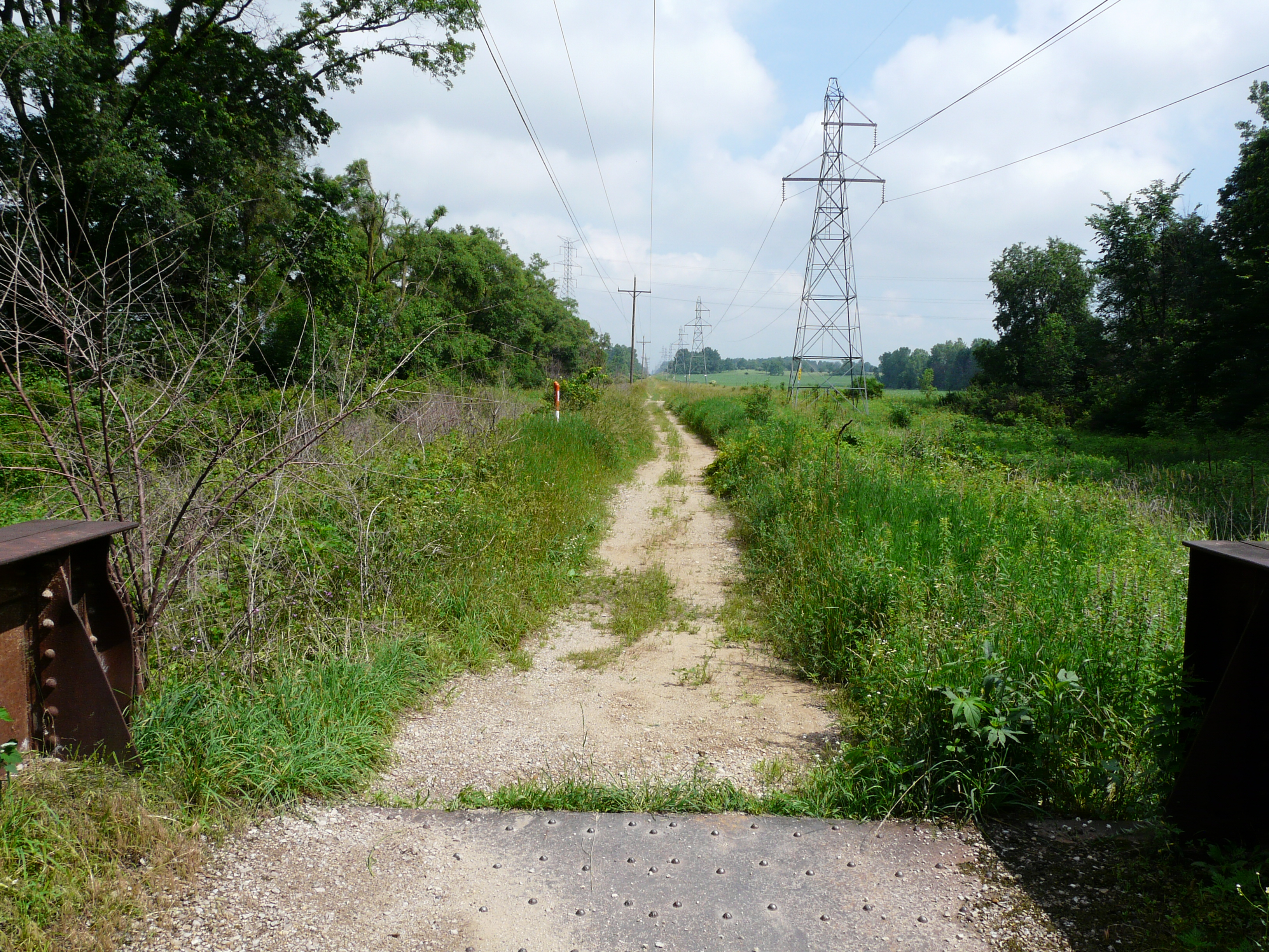
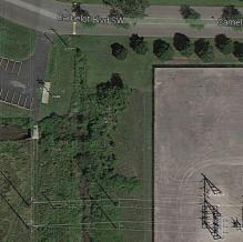
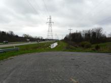
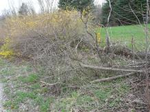
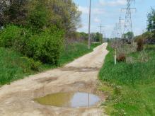
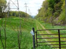
Just before stop 54 is a bridge over Buck Creek. Now part of a walking path, the bridge has been significantly
modified, and the original construction is almost invibisle today - 2014. The photos below were taken on
June 26, 2014. The transmission towers on the west side of the track were added long after the system was
abandoned. Perhaps in the 1970's or later.
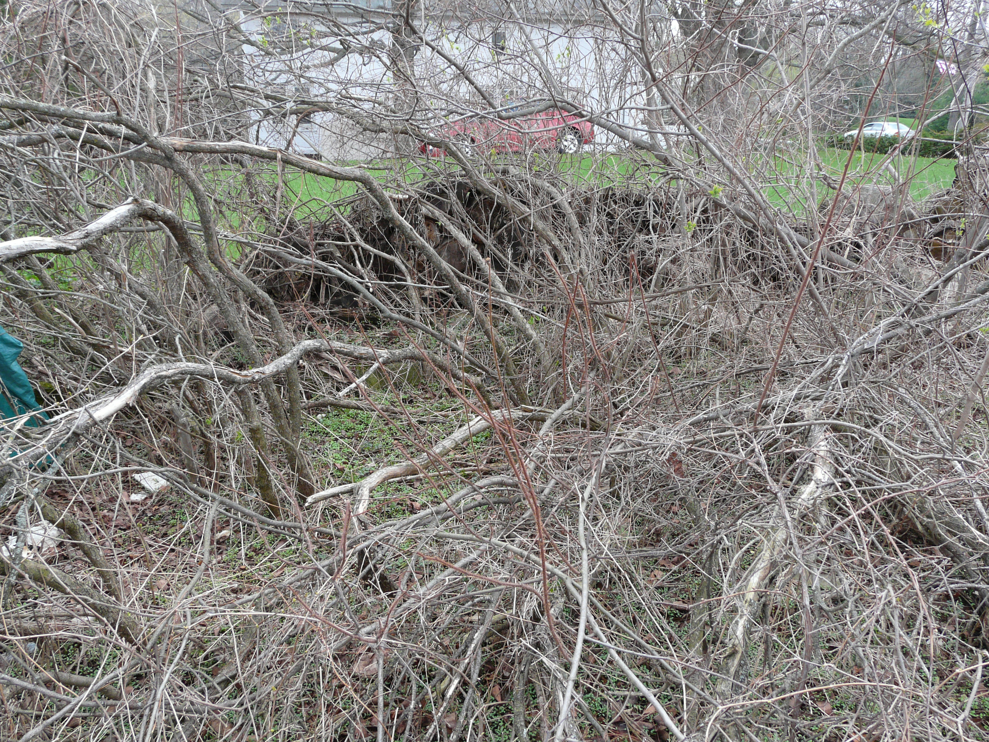
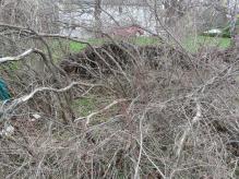
While the undergrowth prohibits easily seeing the contour of the land by the ROW, it is in fact significantly
built up along this stretch. As could be seen north of 36th Street - stop 57 - in the 1950's yet, the method
of construction was to use a power shovel to scoop earth from both sides of the ROW and piled on the ROW. The track
bed is at least 10 feet higher than the surrounding area in this stretch.
GPS coordinates: 42.869875 -85.667536
Left click on the images below for larger versions.
2014
|
2014
|
Looking north. There's a deep
depression by the tower at left.
Perhaps to keep motorbikes from
speeding?
|
Bridge is right of next tower
on the left.
|
Approaching the bridge
from the south end.
|
Looking south from the bridge.
|
Looking south, one see a vehicle
at 54th Street. The purpose of the
dip in the trail is unknown.
|
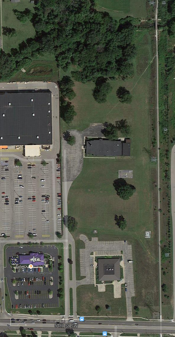
Fisher Road - stop 54
Coincidentally, stop 54 is on 54th Street. At one time there was the small town of
Fisher Station at this location.
Left click on the images below for larger versions.
1952
|
It was a stop on the GR & I - PRR after 1920. A general
store and a few other businesses were located at there. There were some local resources that
were exploited. During WWI, both the GR & I and the interurban would drop workers off at
Fisher Station to go work at the Picric Acid plant on Clyde Park and 44th, one of three
such facilities being built around the country.
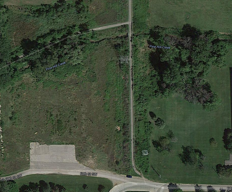
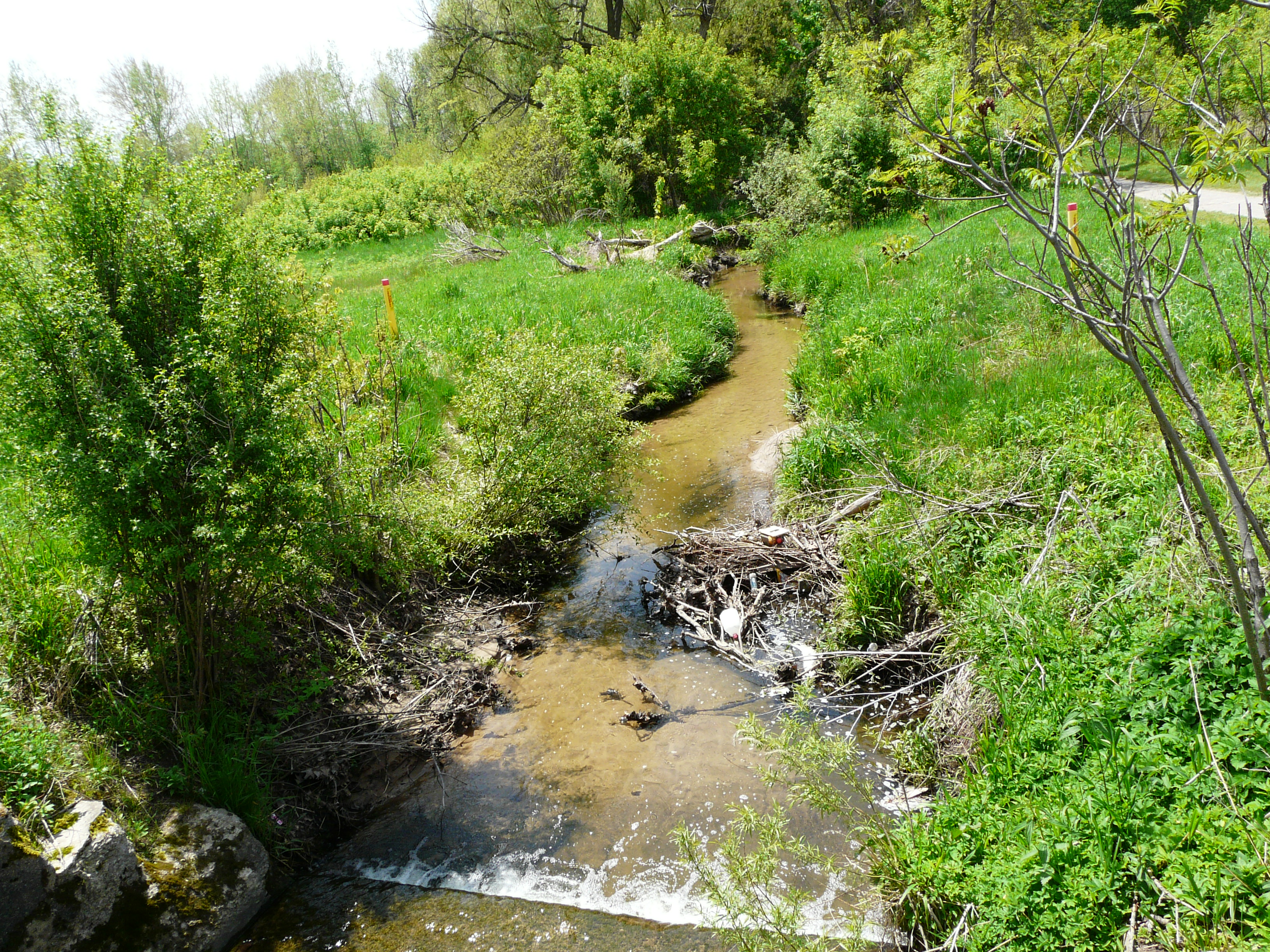
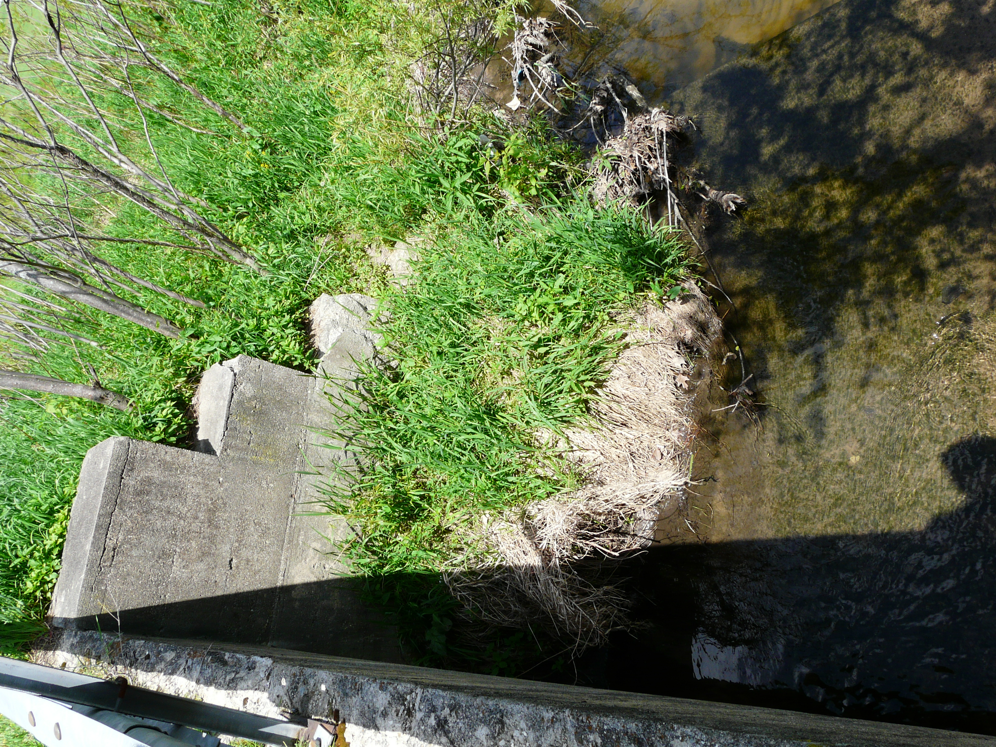
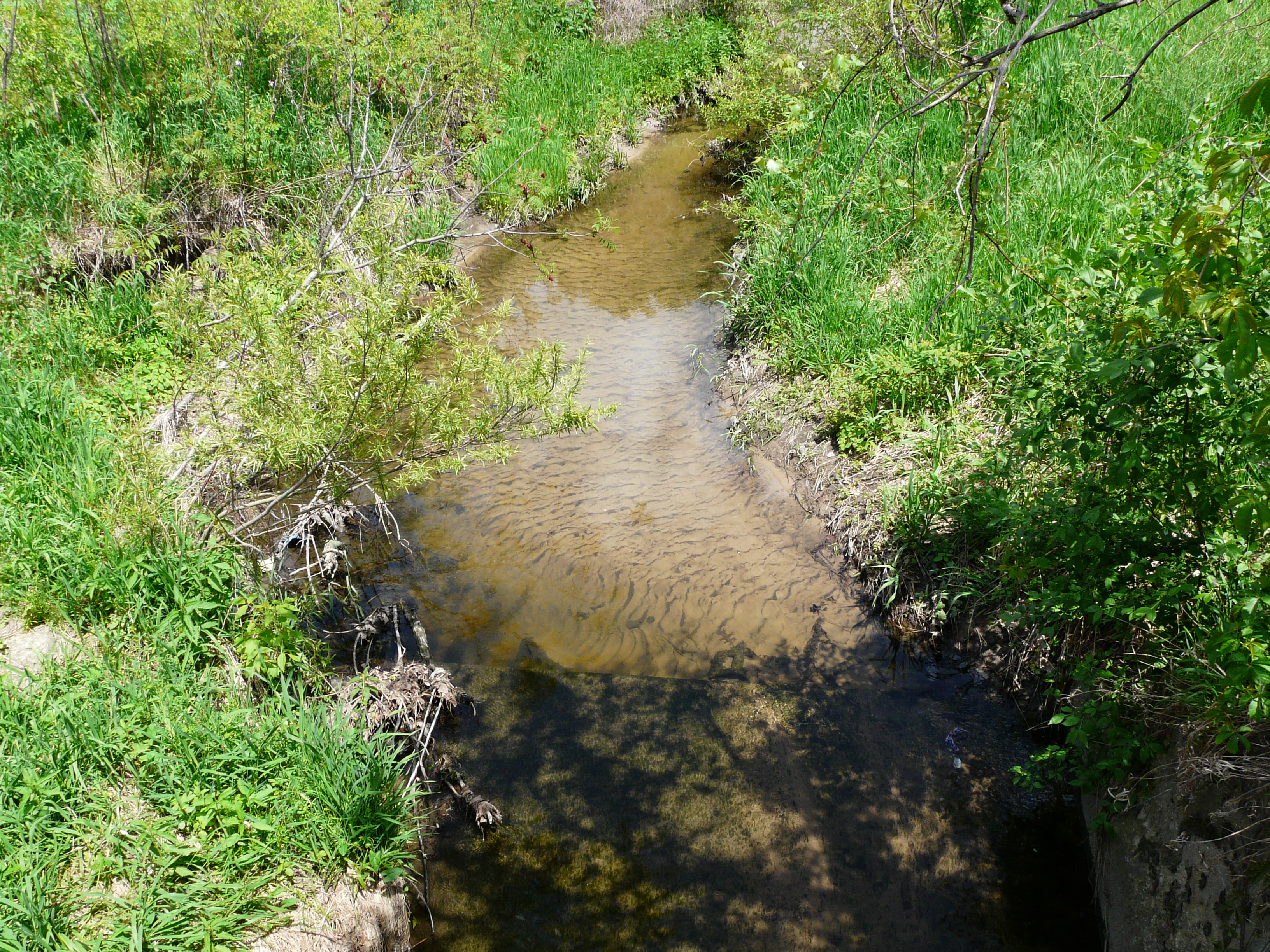
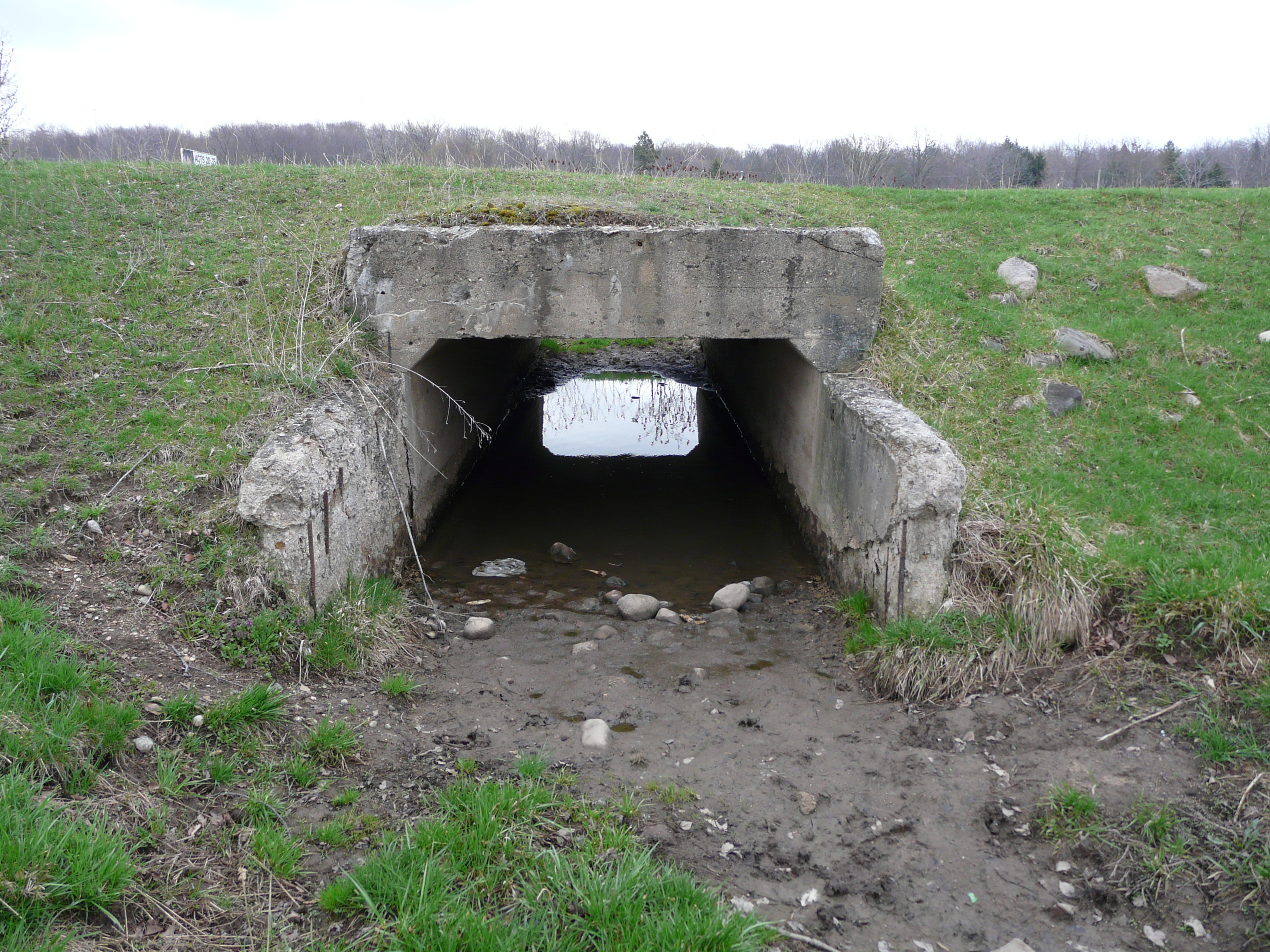
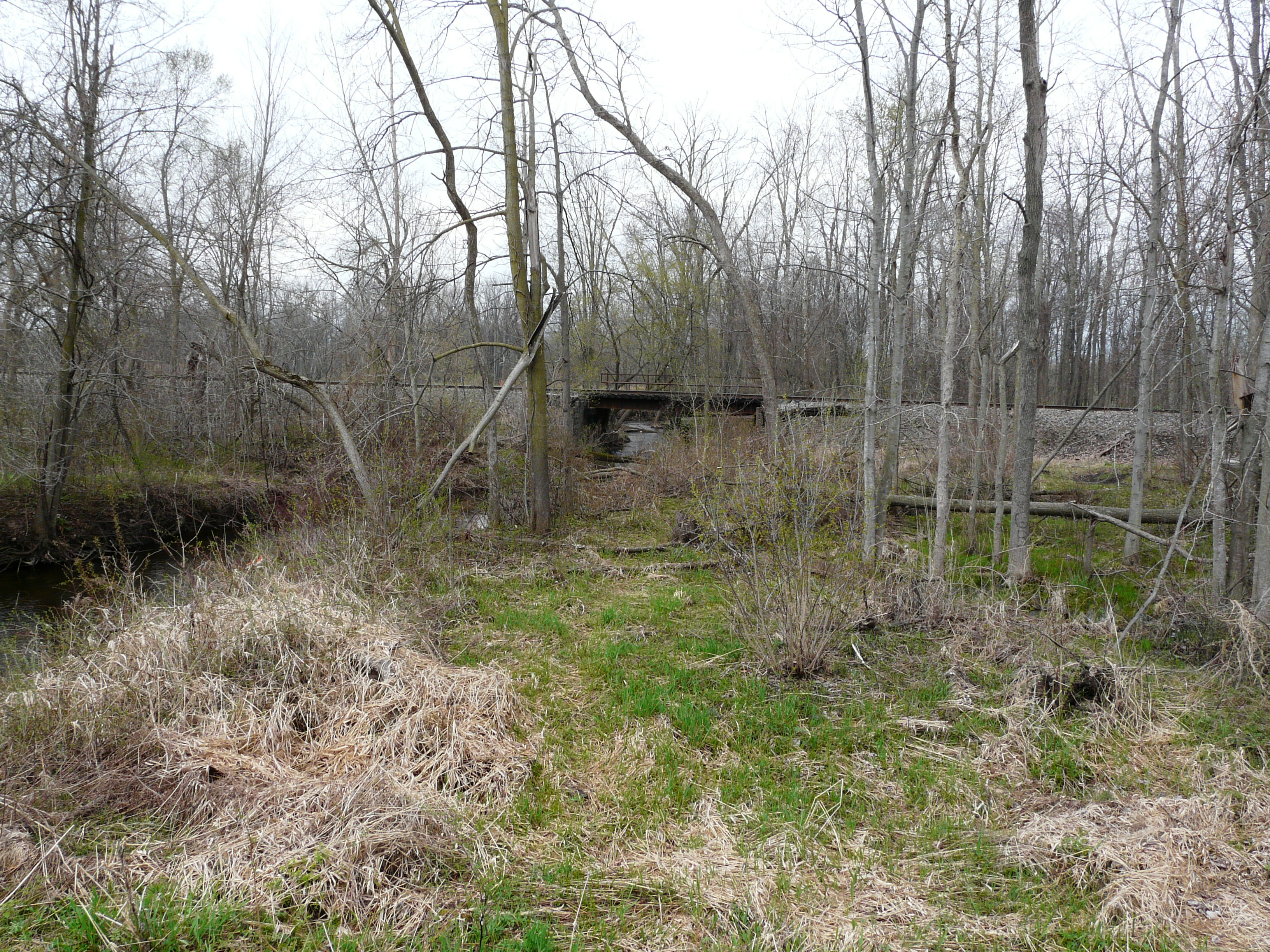
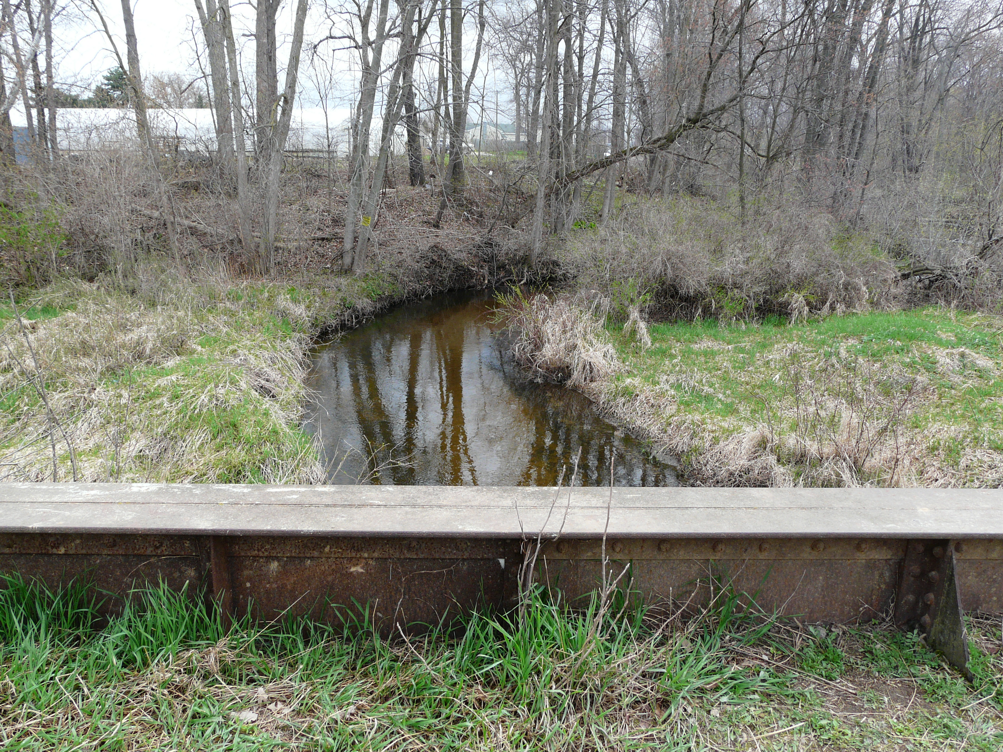
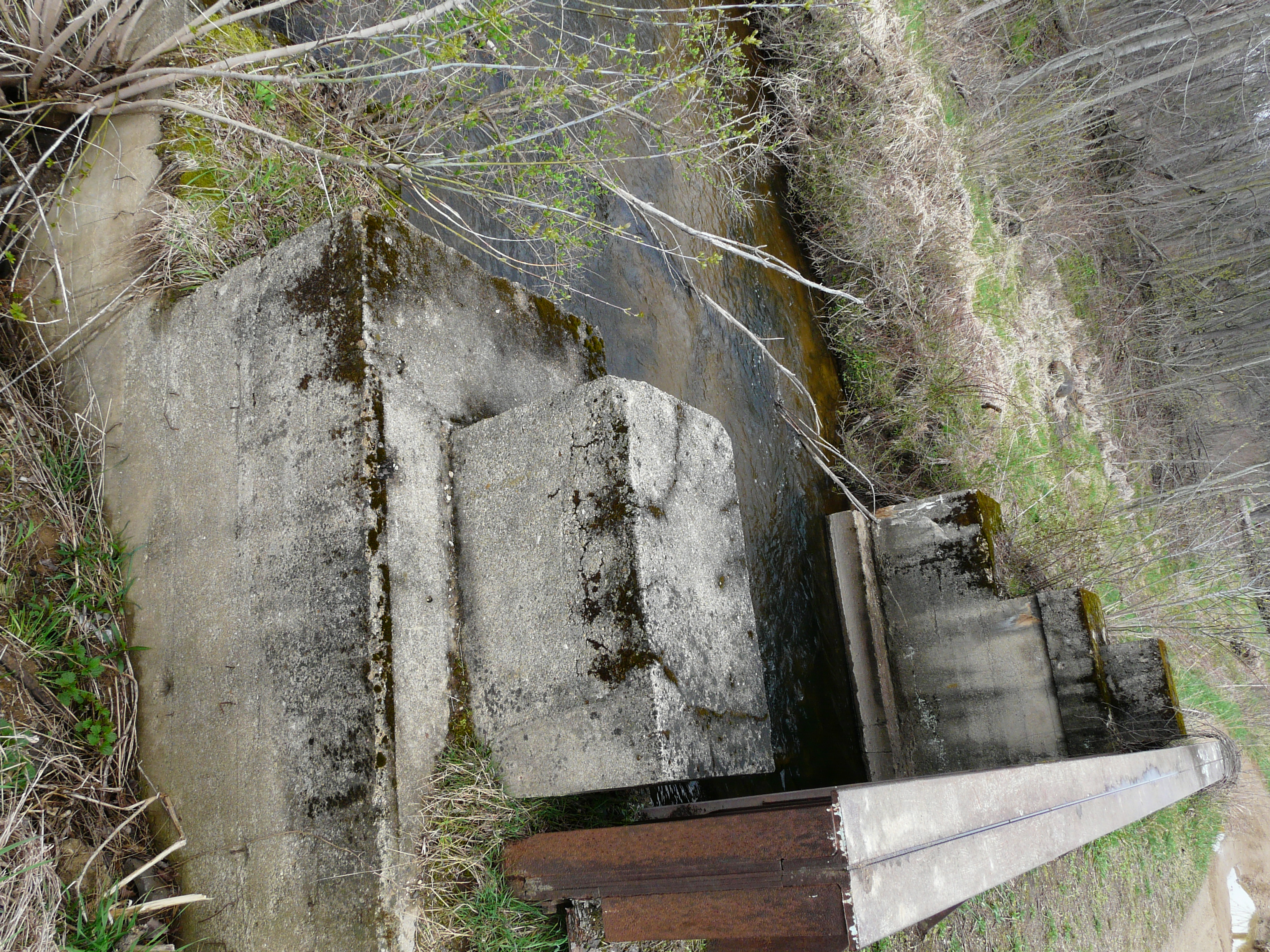
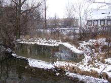
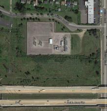
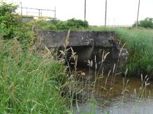
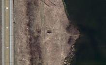
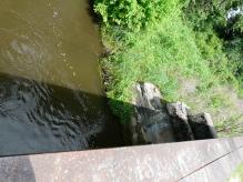
Bridge on Pine Hill Creek, just north of 60th Street.
GPS coordinates: 42.856154 -85.667286
Left click on the images below for larger versions.
Welder Road - stop 53
At this time, it's not known just which road was Welder Road in 1917, or whether it even exists in year 2014.
A county wide renaming of streets occurred in 1943. So the locations of structures below are just assumed to be
somewhere near stop 53 for now, and this will be corrected if-when more information becomes available.
The bridge below is just north of M-6. It is still in good condition, considering that as of year 2014 it is
just short of 100 years old. It is not part of a walking path, and so it has not been modified. The interurban
ROW is erased near M-6. The power lines go up and over M-6, and the ROW picks up again south of M-6.
GPS coordinates: 42.850579 -85.667199
The photos below were taken on June 26, 2014.
Left click on the images below for larger versions.
Context of the bridge.
|
Context of the bridge.
|
|
|
|
|
|
|
|
Looking north from bridge.
|
Looking south from bridge.
|
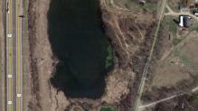
Below, unless the stream did not exist at the time, there would have been a bridge over the stream shown feeding into
Buck Creek, in the upper right corner. Looking at the location, no sign of a bridge was apparent.
Left click on the images below for larger versions.
Taken June 26, 2014.
|
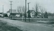
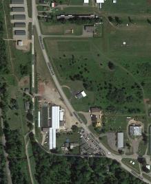
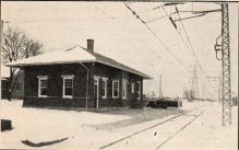
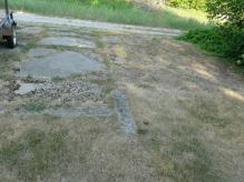
Cutlerville - stop 52
Left click on the image below for a larger version.
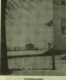
The image above shows the interurban depot at Cutlerville. Exactly where it
was located is not known at present. The area is highly developed in year 2012,
so the exact location might be lost.
Cutlerville was stop 52 on the 1917 list of stops on the GR - Kalamazoo line, stop 1
being Kalamazoo.
The location below is just north of 71st Street. One can see M-6 to the north.
GPS coordinates: 42.837125 -85.666948
Left click on the images below for larger versions.
Byron Center Road - stop 49
I'm assuming for now that Byron Center Road is the old name for 84th Street. Like many other streets, it's not
clear at this time what kind of facilities were available at the stop. A small building, with one side open,
just big enough to keep people out of the weather as they wait. For whatever reason, almost all depots were
razed, presumbaly by salvagers. Only the large depots in Kalamazoo still survive.
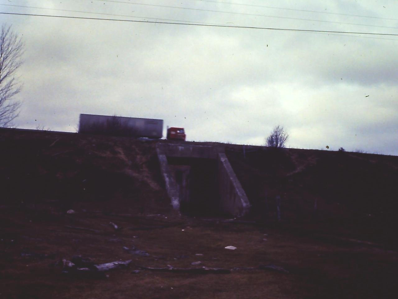
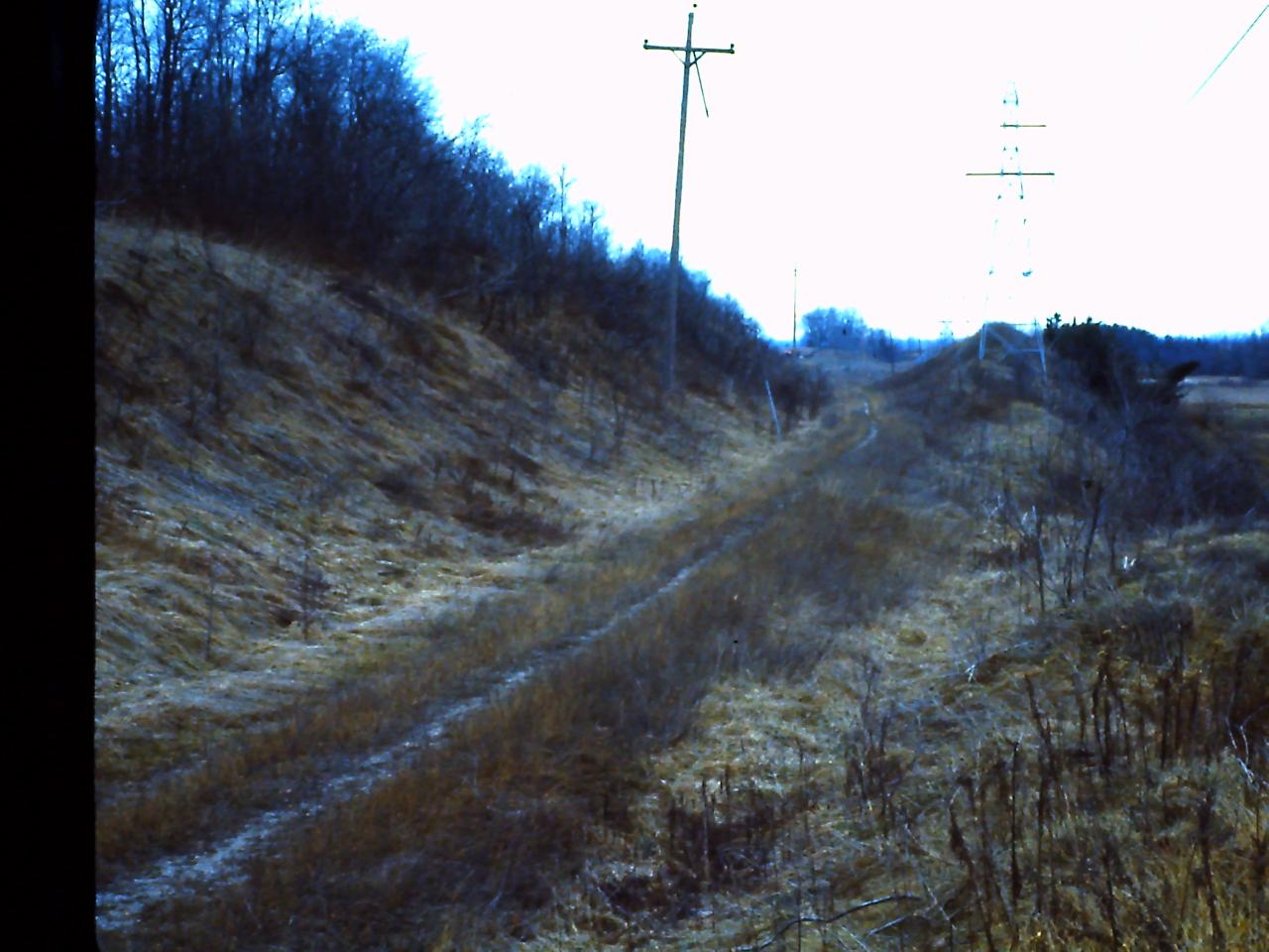
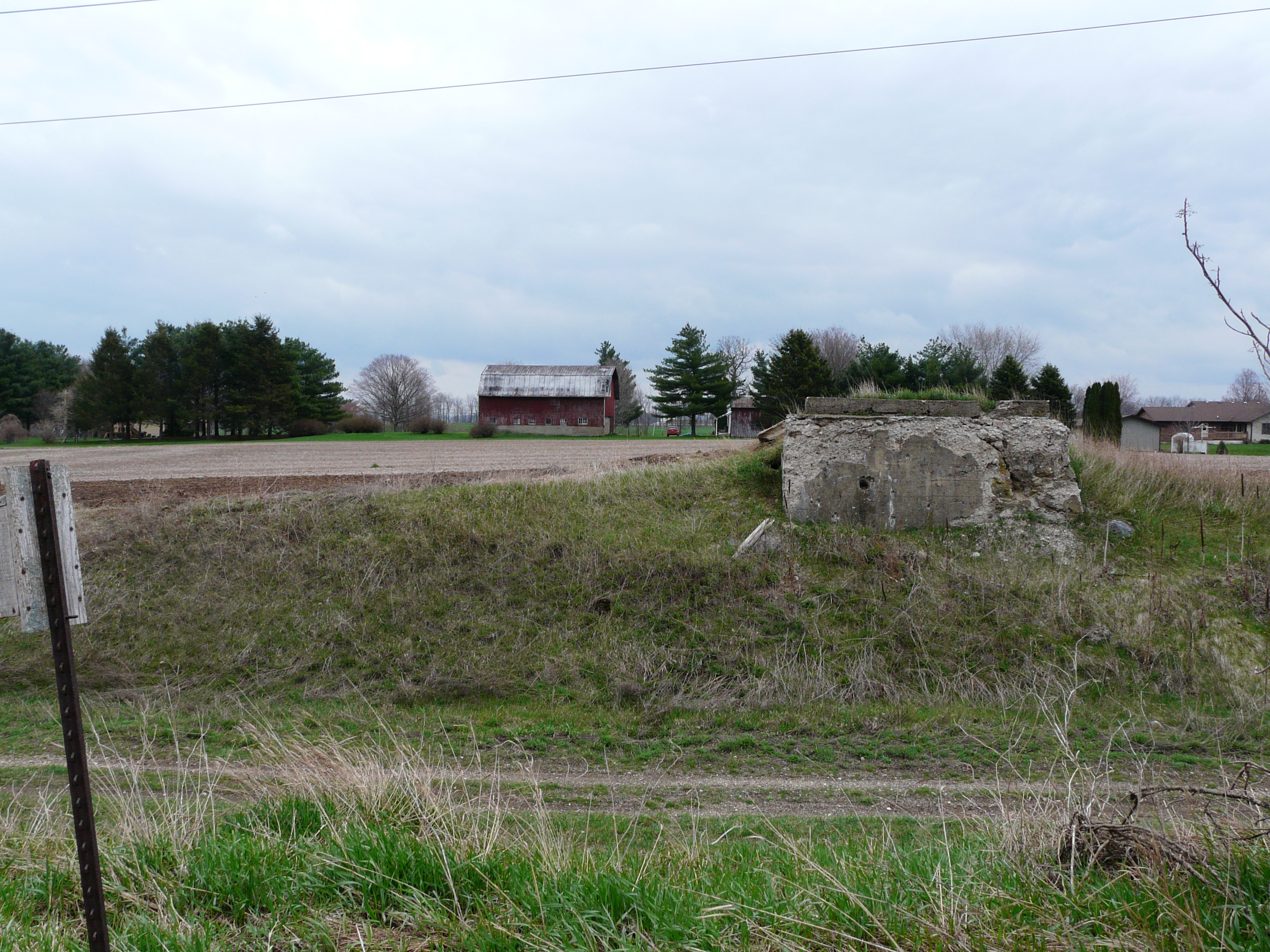
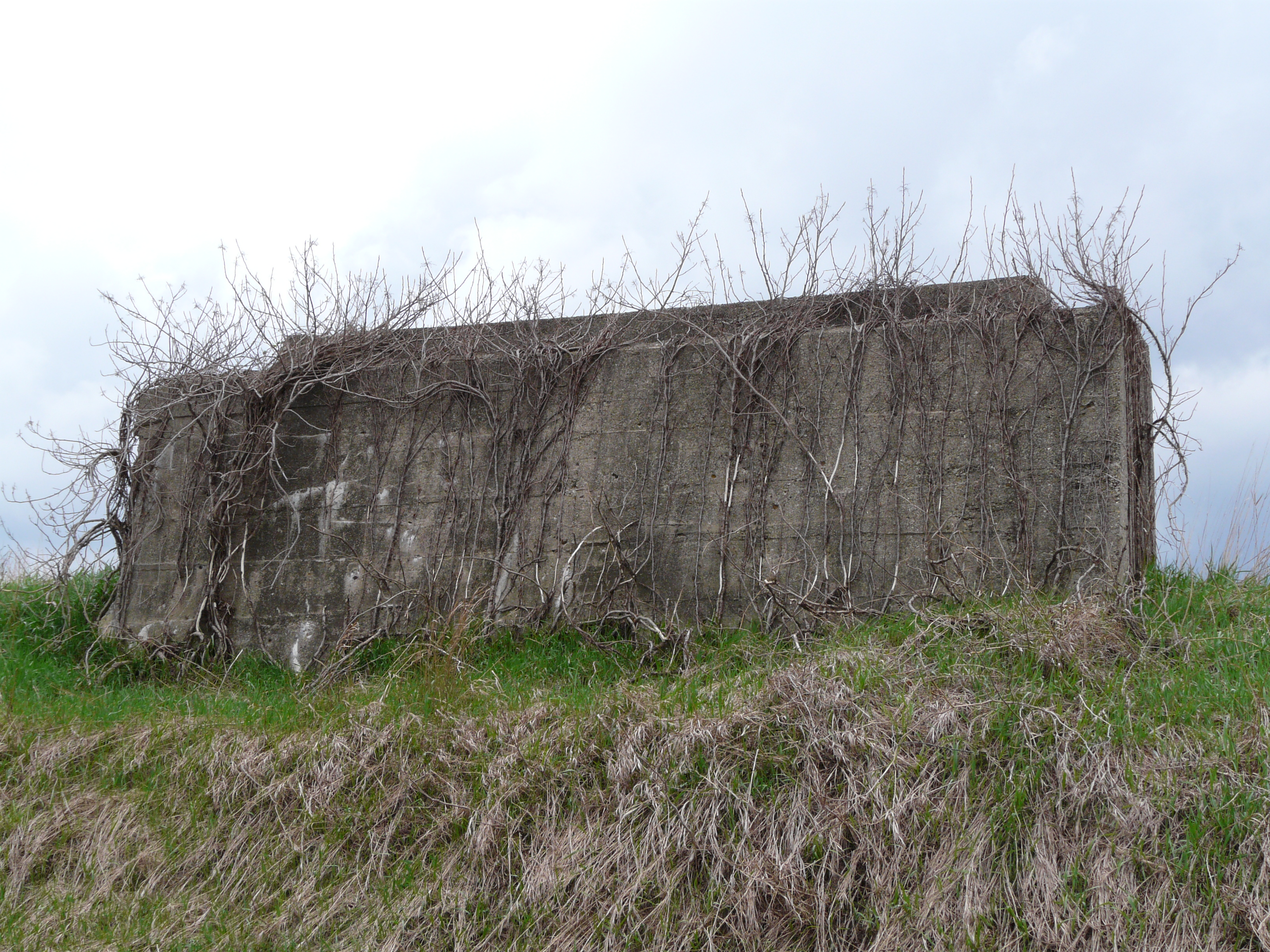
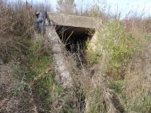
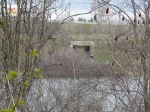
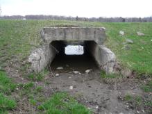
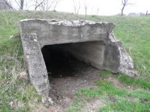
December 15, 1967, on a walk along the right of way, between 84th and 92nd Streets, I
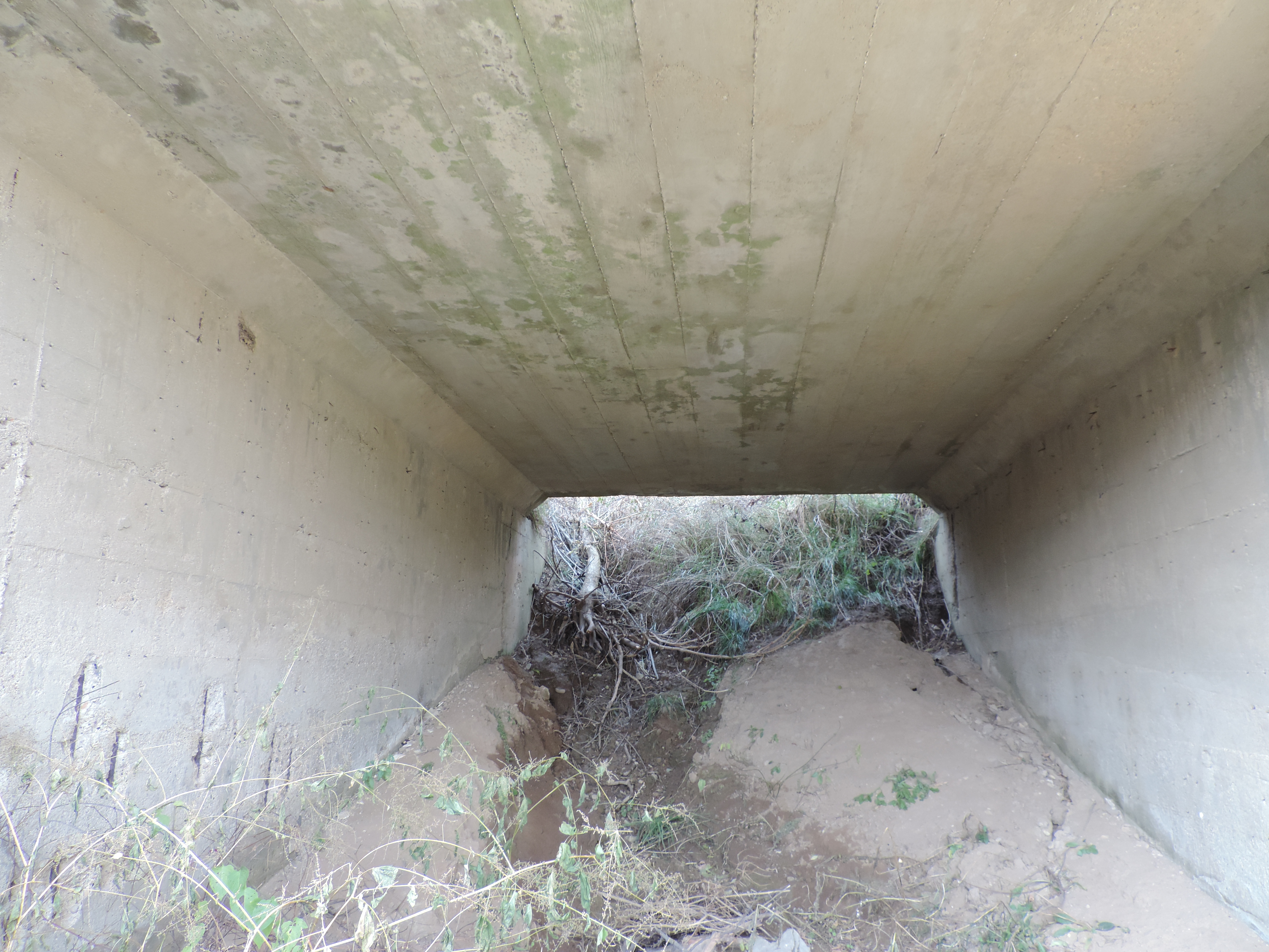
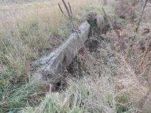
walked down below a bridge used by the interurban.
It was not a culvert, but what was called a farm crossing. Anything from cattle
to farm wagons could cross under the bridge. Many railroad right of ways had
such crossings in farm areas. This one seems especially elaborate and substantial.
Left click on the images below for larger versions.

Photograph taken about January, 1967.
|
|
|
|
The photograph at the left, above, top row, was taken about January, 1967. While it
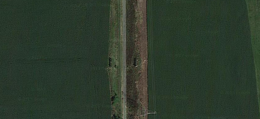
appears the truck above the bridge is going over the bridge, in fact, as the
satellite image on the right, top row, shows, the truck is on US 131, to the west of the
interurban track. On the right abutment is scratched the notice referred to
below.
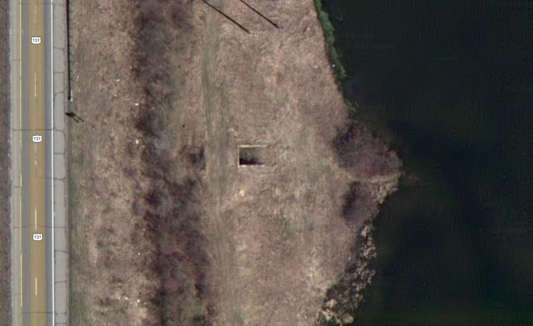
The satellite images above, show the bridge in year 2012. The body of
water to the right did not exist in 1967, although the ground clearly would
have been spongy in the summer. The satellite image on the right shows the
wider context of the bridge. In year 2012 it is simply a ruin, with no suggestion
whatsoever what it was ever for. The best guess is that it was a cattle or farm
equipment crossing. This was a common feature of railroad right of ways 100
years ago. It exists because Consumers Power never saw fit to get rid of it.
And in fact it is a substantial structure, built of reinforced concrete.
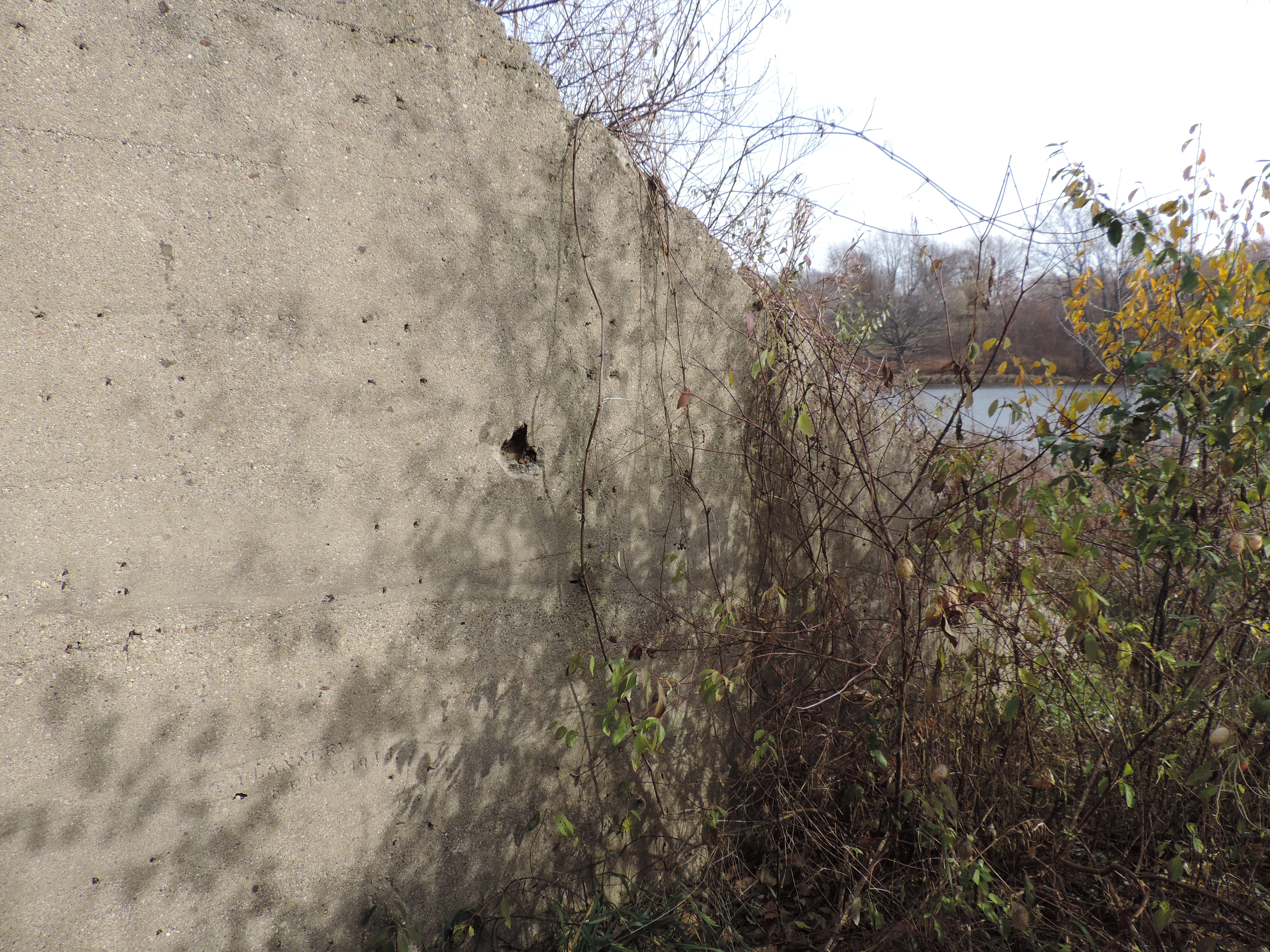
The ground was frozen, so
what would have been swampy ground in the summer was quite firm. On the cement
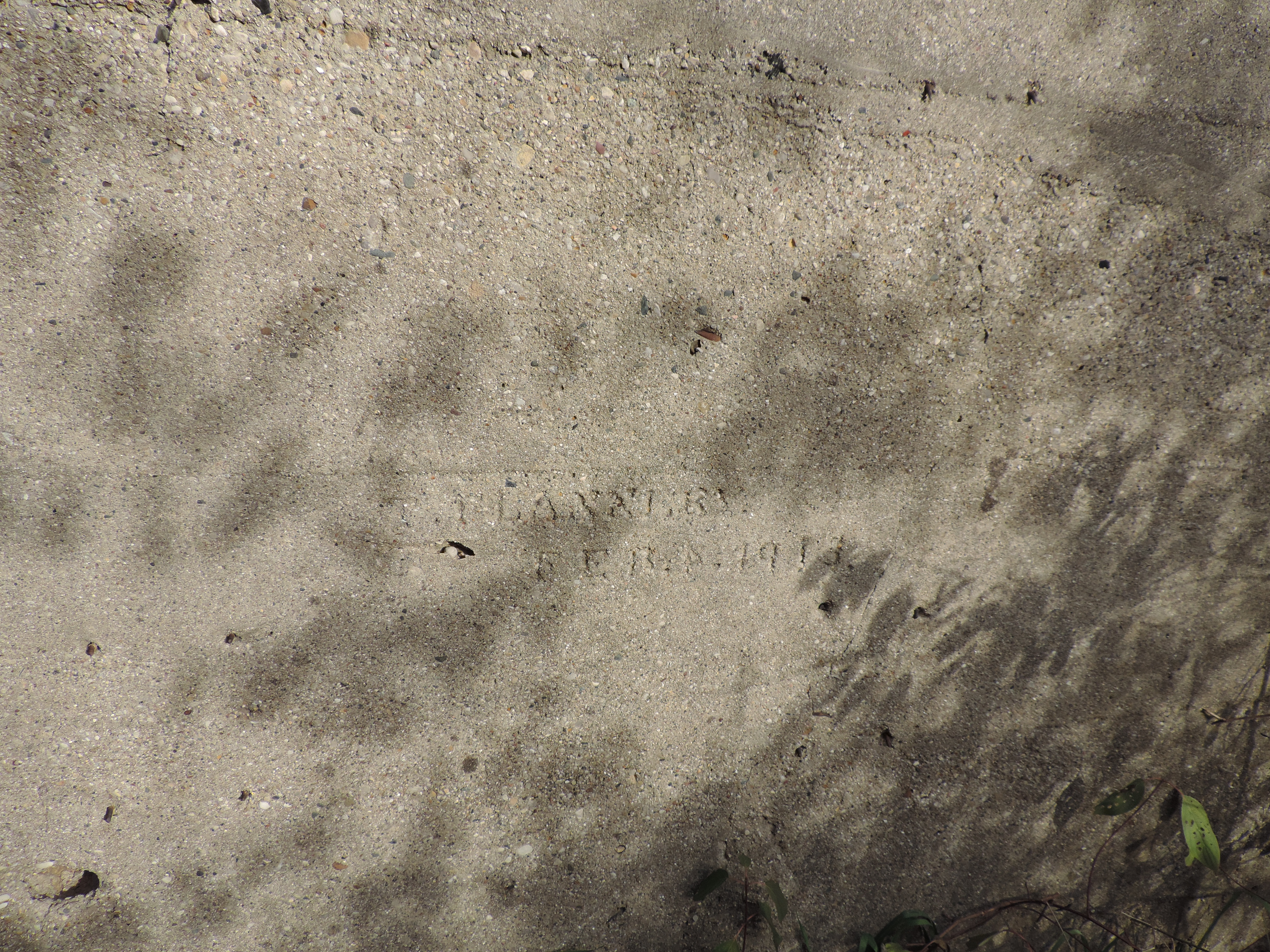
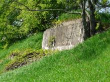
wall is inscribed "T. FLANNNRY, Feb 4, 1913." It appears to be a contractor label,
and "FLANNNRY" is a mistake. It should read FLANNARY.
This is probably about the time the route between Grand Rapids and Kalamazoo was being built.
According to Robert Morris, father of Phyllis Morris, class of 1962, there were
a number of members of the Flannary family - with this spelling - in the area,
but whether they had anything to do with the construction of the bridge is unknown.
in to fresh concrete.
The Google satellite coordinates of the bridge are 42.806012, -85.668195.
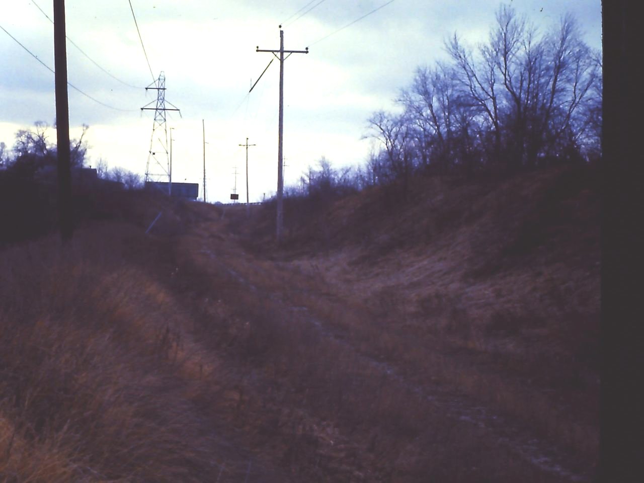
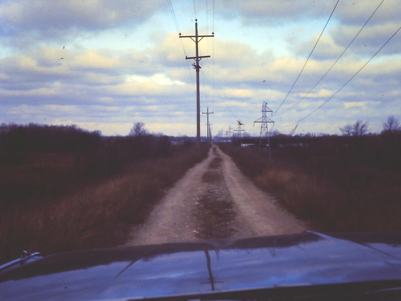
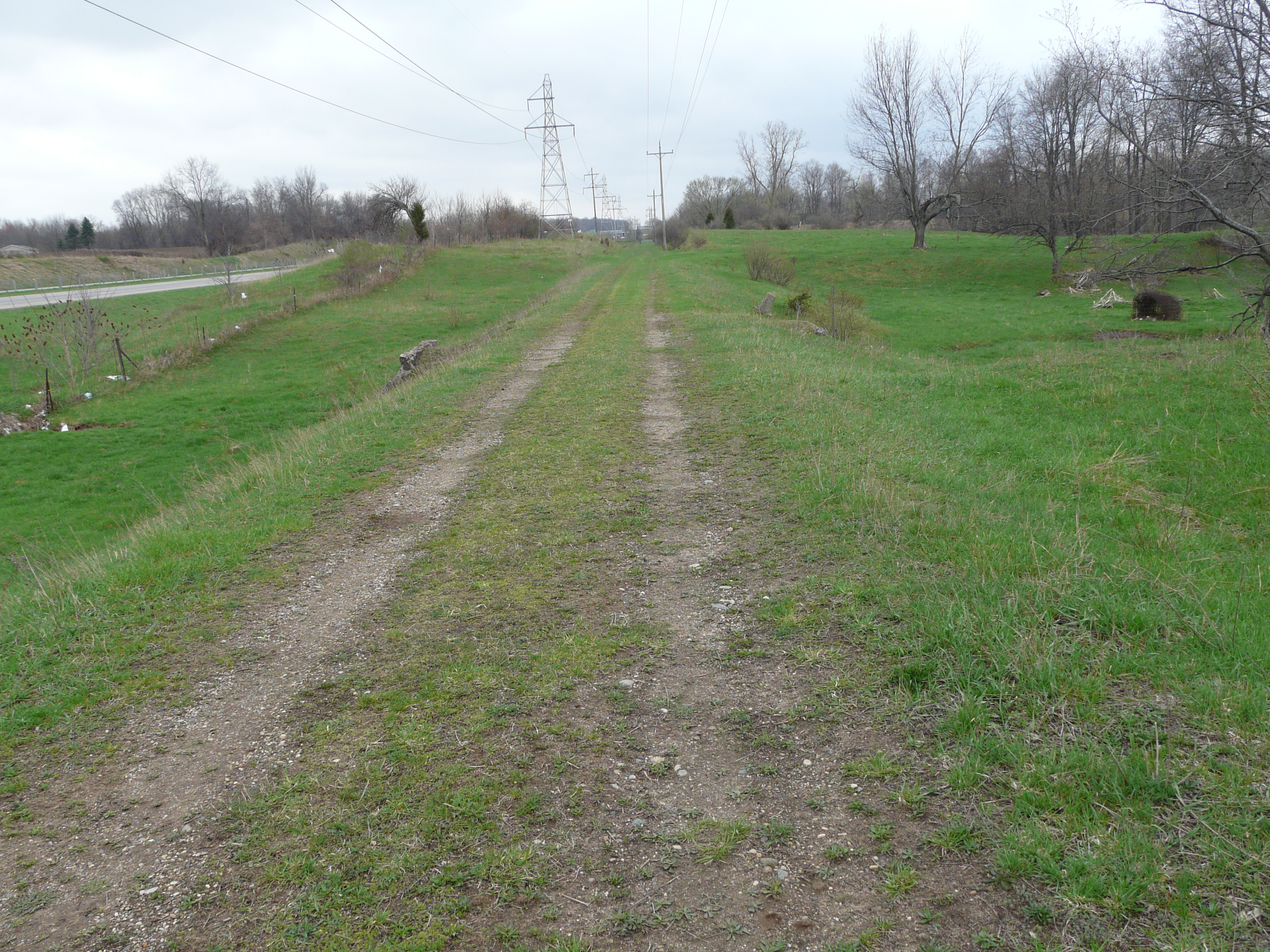
On the same walk, I took a few photographs of the rail bed of the interurban.
Left click on the images below for larger versions.
The track bed was still fairly well defined after almost 40 years. Using satellite
images one can still see the outline of the right of way from Grand Rapids to
Kalamazoo. The right of way extended 50 feet either side of the track, leaving
plenty of room for the transmission towers and an access road that one can see
in the photographs above.
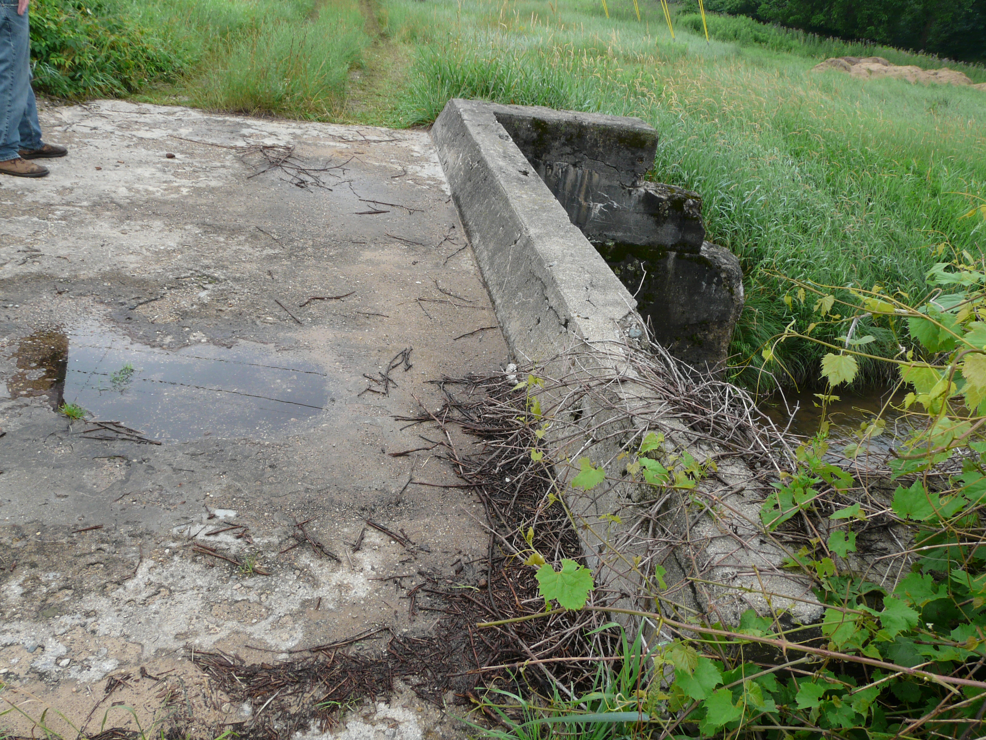
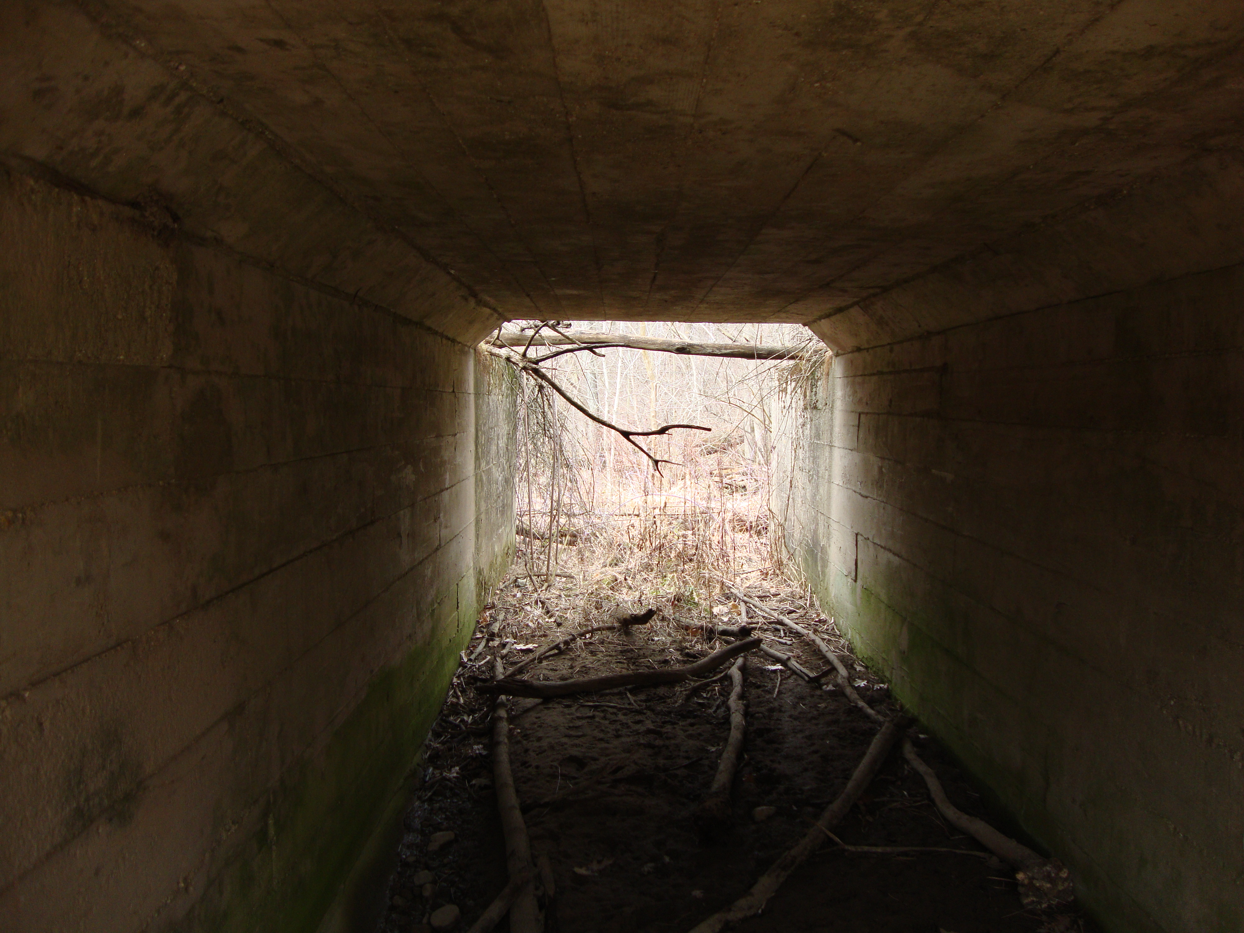
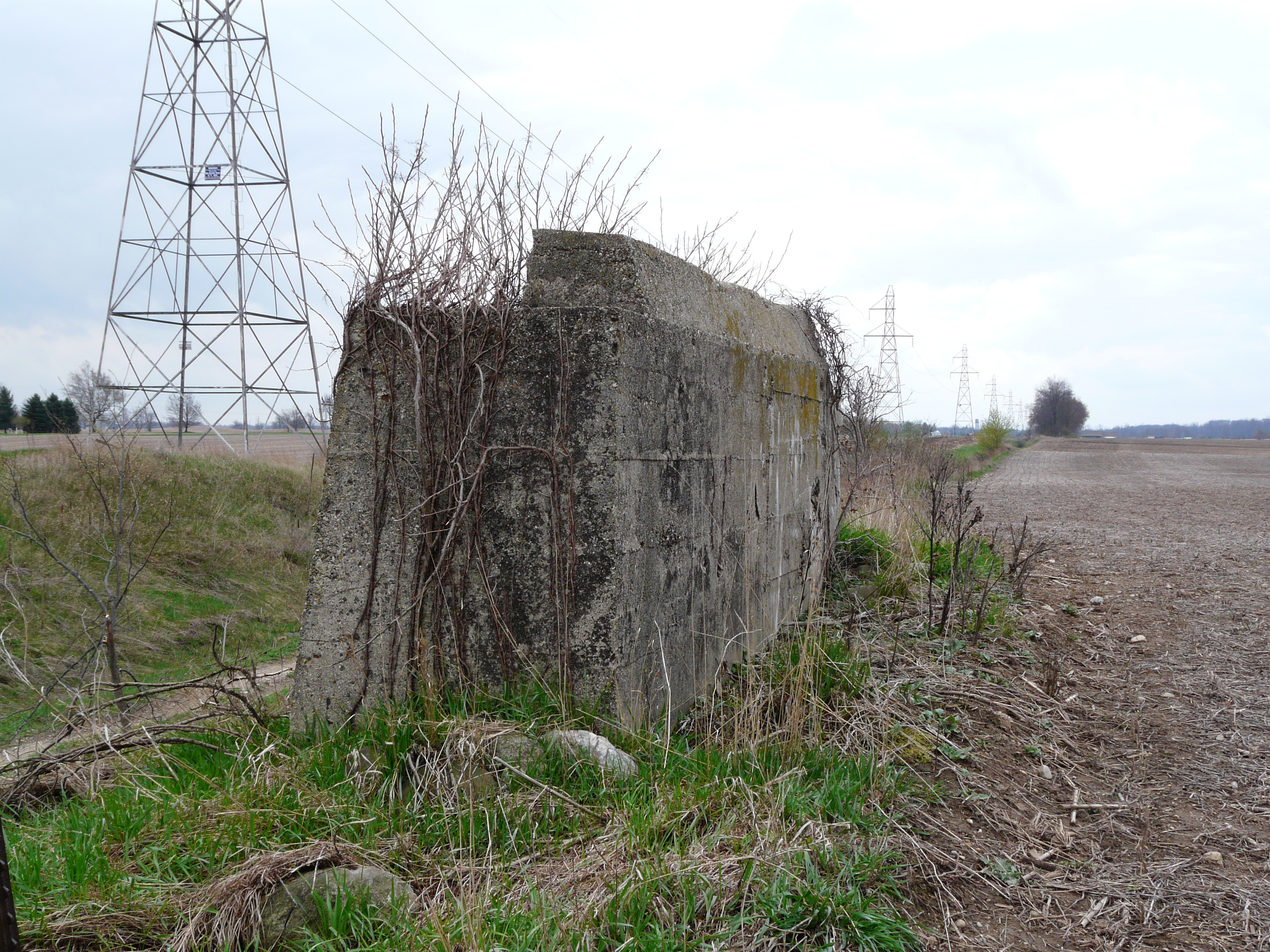
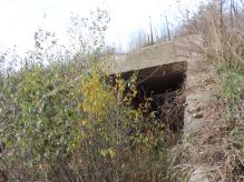
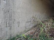
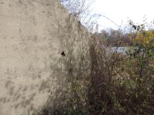
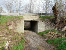
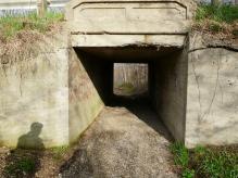
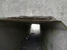
Update - Interurban crossing - November 20, 2013.
A visit to the same bridge for some new photos. The 46 years or since my last visit have of course
shown some changes. The bridge is now something over 100 years old, having been constructed in about
February, 1913. For various reason the concrete near the road bed is showing wear and tear - perhas a
combination of weather and abuse. In other places it's as if the concrete was poured recently.
Left click on an image for a full size version.
|
- 1 -
|
- 2 -
|

- 3 -
|
- 4 -
|

- 5 -
|
- 6 -
|
- 7 -
|
- 8 -
|
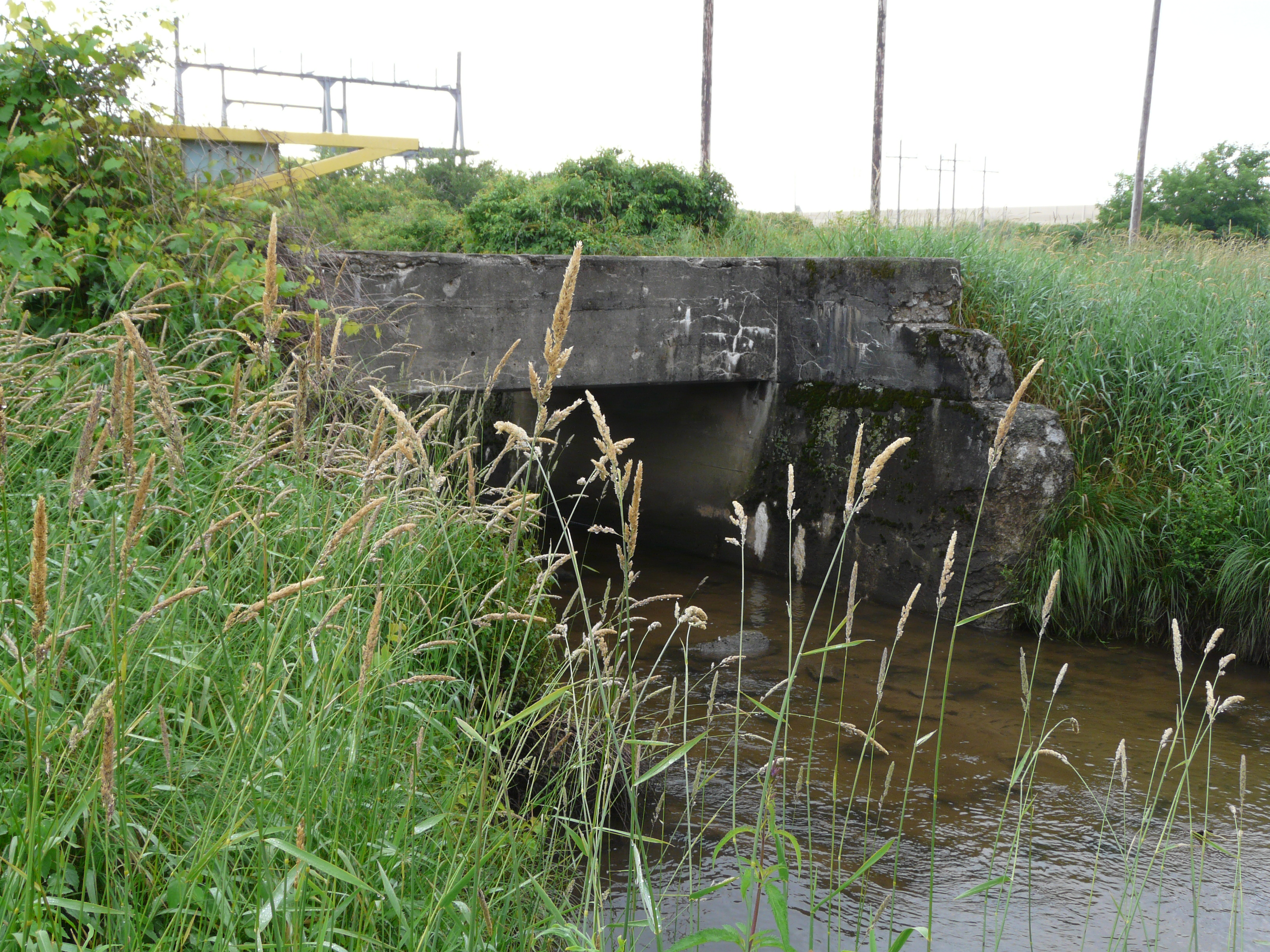
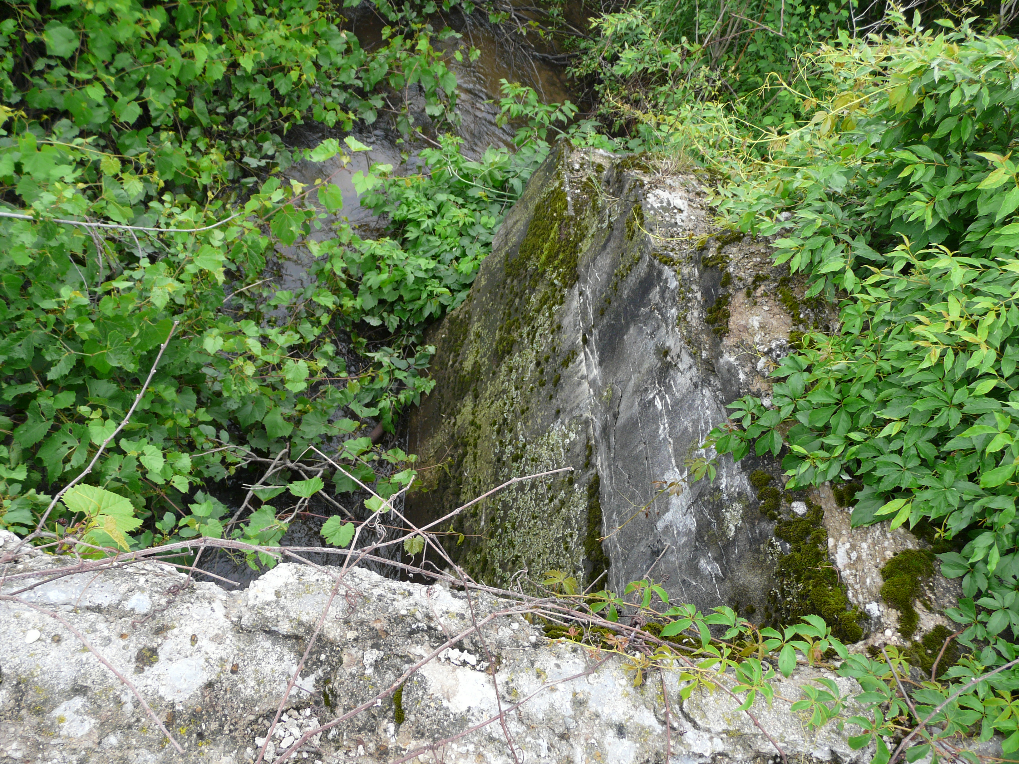
Using the numbers under the photos above, here are a few comments.
1 - the bridge on the west side of the track. The terrain has been altered here because of the
contrutction of the 131 expressway. Debries, dirt, and vegetation have almost filled up the opening
on this side. The edge of the bridge roadway on both sides is showing signs of erosion and
perhaps abuse.
2 - View of the east side of the brdge from slightly north.
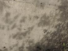
3 & 4 - Views of the north wall. With effort, one can still see what appears to be a contractor's
stamp. It appears to say "T. FLANNNRY (sic)" on the first line, and "Feb 4, 1913 on the second line.
The "4" is faint today, but I could see it without difficulty in 1967. The concrete is in great
condition yet overall.
5 - Inside the tunnel, the concrete looks like it was poured recently. One can see how dirt and
debris have piled up on the west side.
6 - On the south wall of the tunnel the concrete is basically in good shape. Why the concrete
over the rebar has pulled away is unclear. Differential expansion rates?
7 - Another view of the north wall, on the east side of the bridge.
8 - The east side of the bridge. The bridge appears to have been built in and astonishingly
strong fashion. Essentially to standard railroad standards. Overbuilt? Better than
underbuilt.
Overall, the vegetation in the area has grown a lot in the last couple of years, as has the
lake to the east of the track. This was a marshy area 46 years ago.
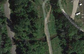
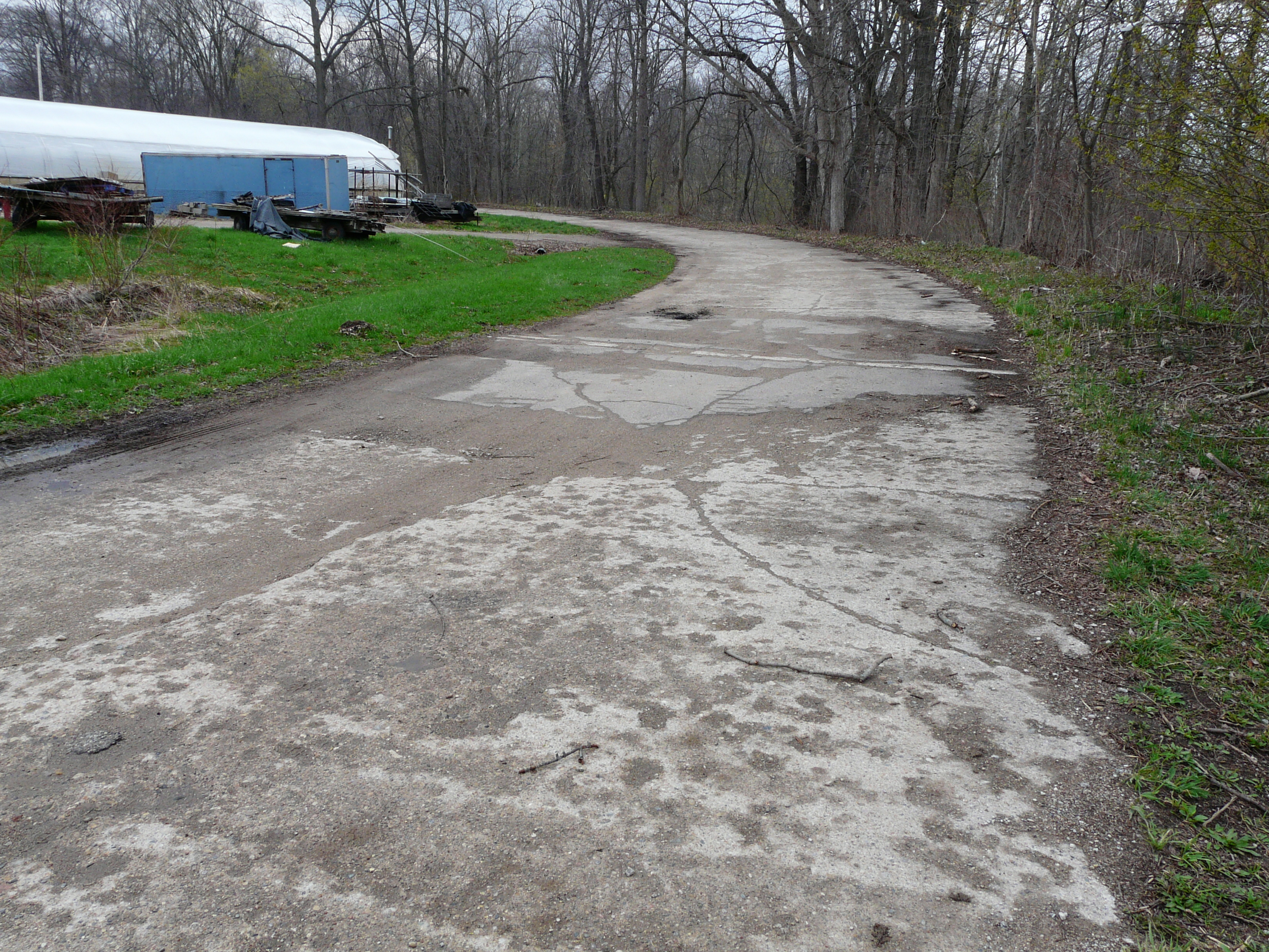
A 1960 county map show that another cattle crossing exists in the same area, at about 8665 Division
Avenue.
Left click on the images below for larger versions.
1960
|
Undated. About 8665 Division.
|
April 30, 2014
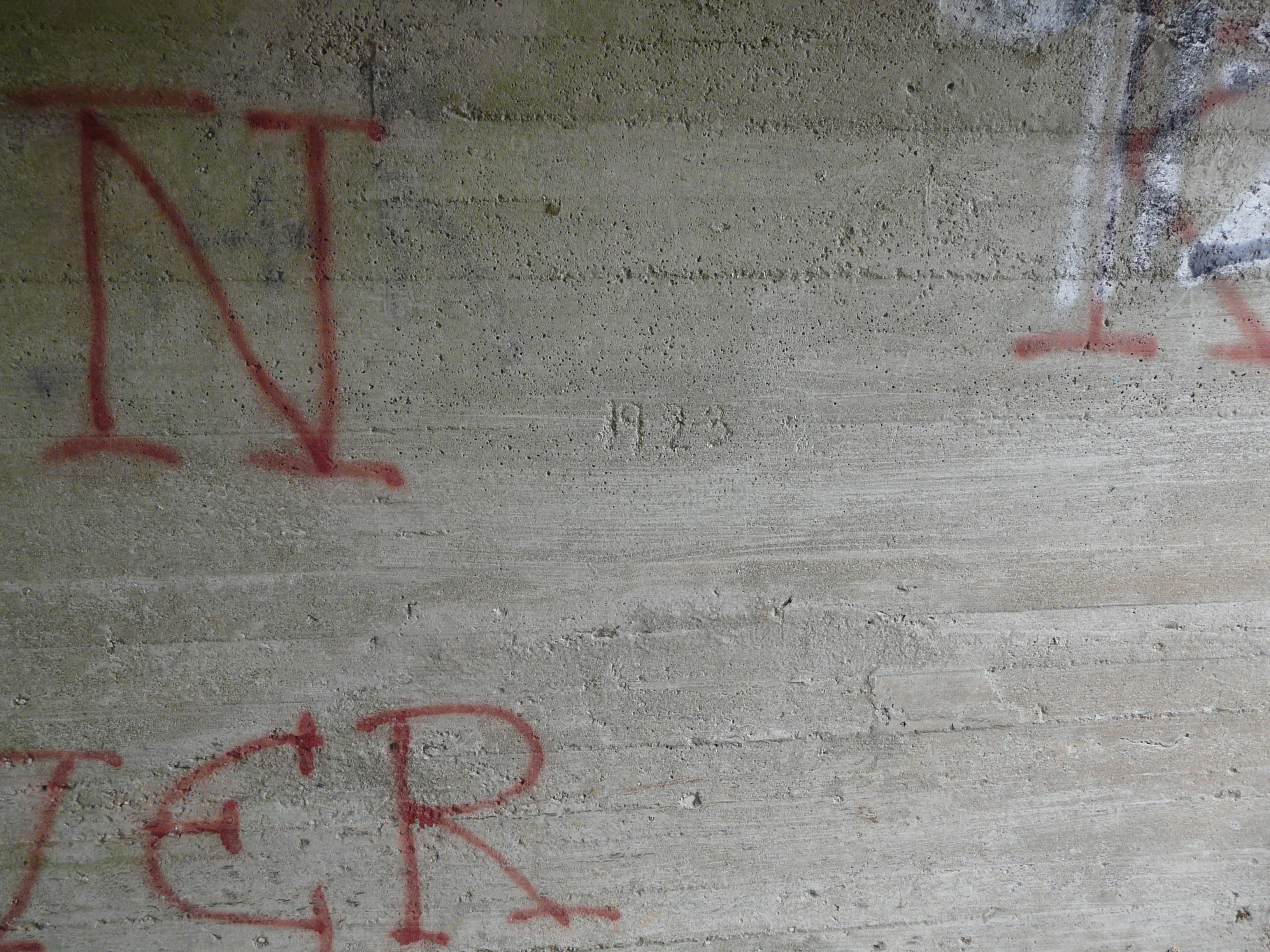
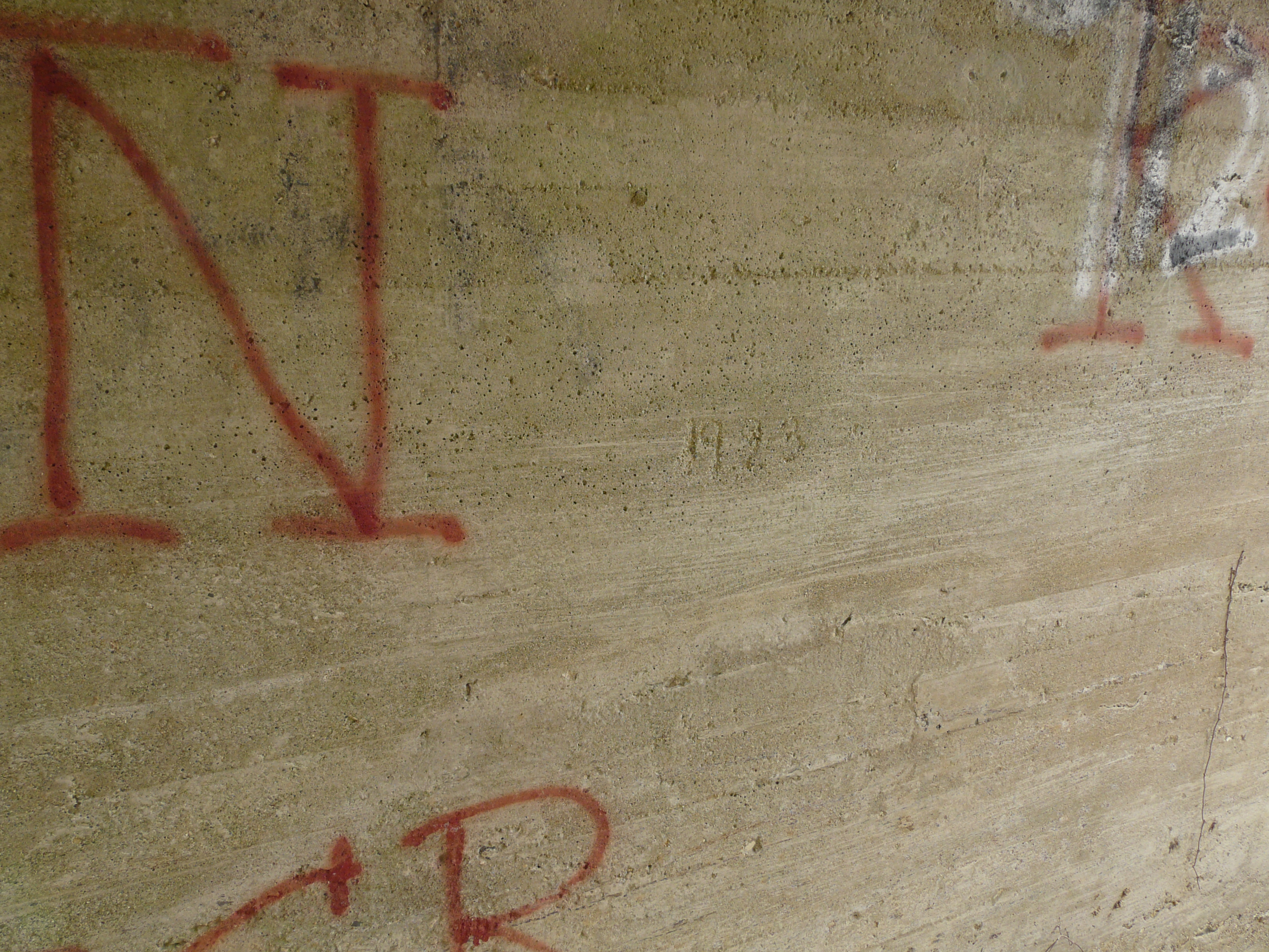
|

Shows 1923 date
|
Shows 1923 date
|
April 30, 2014
|
April 30, 2014
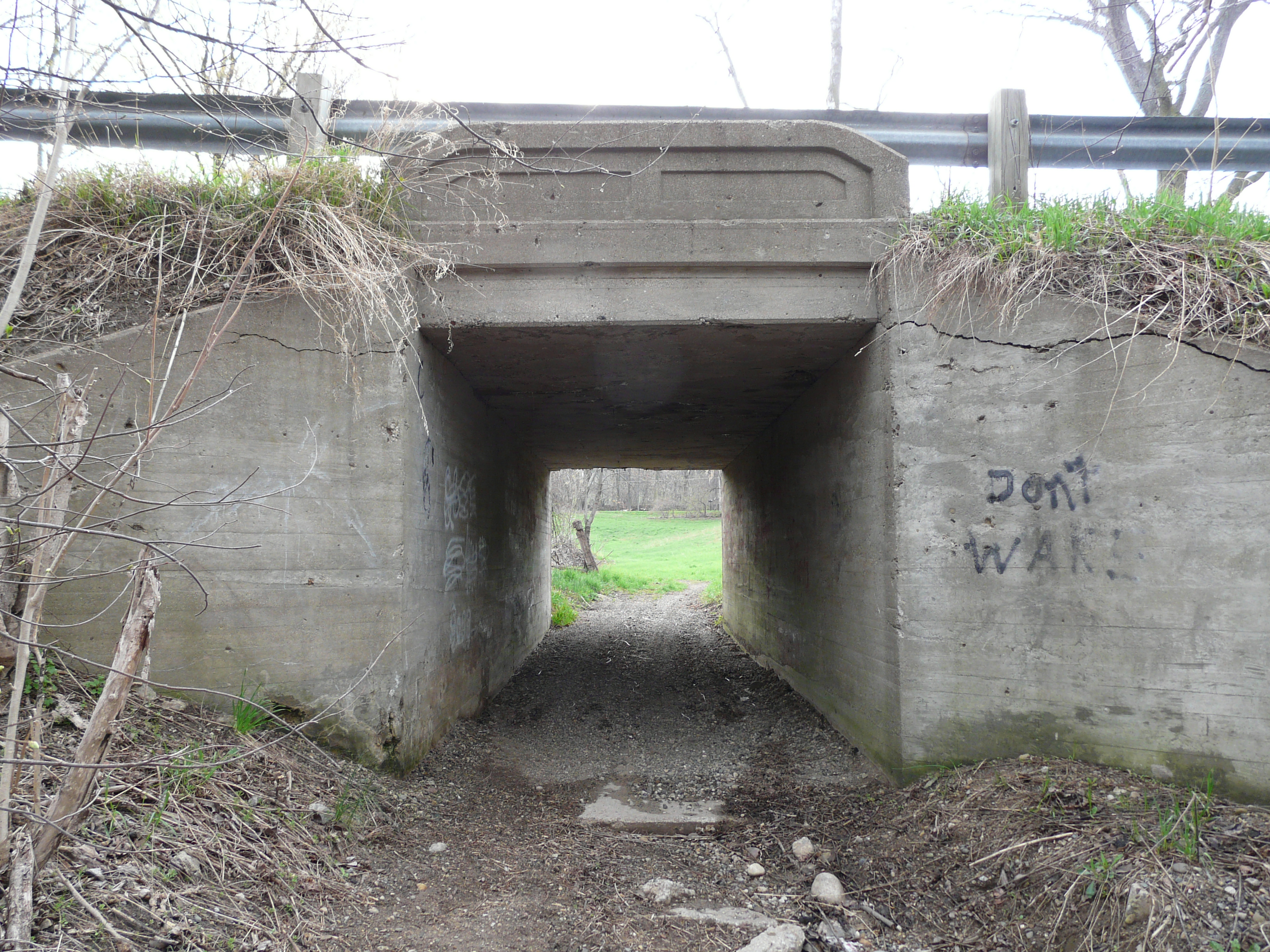
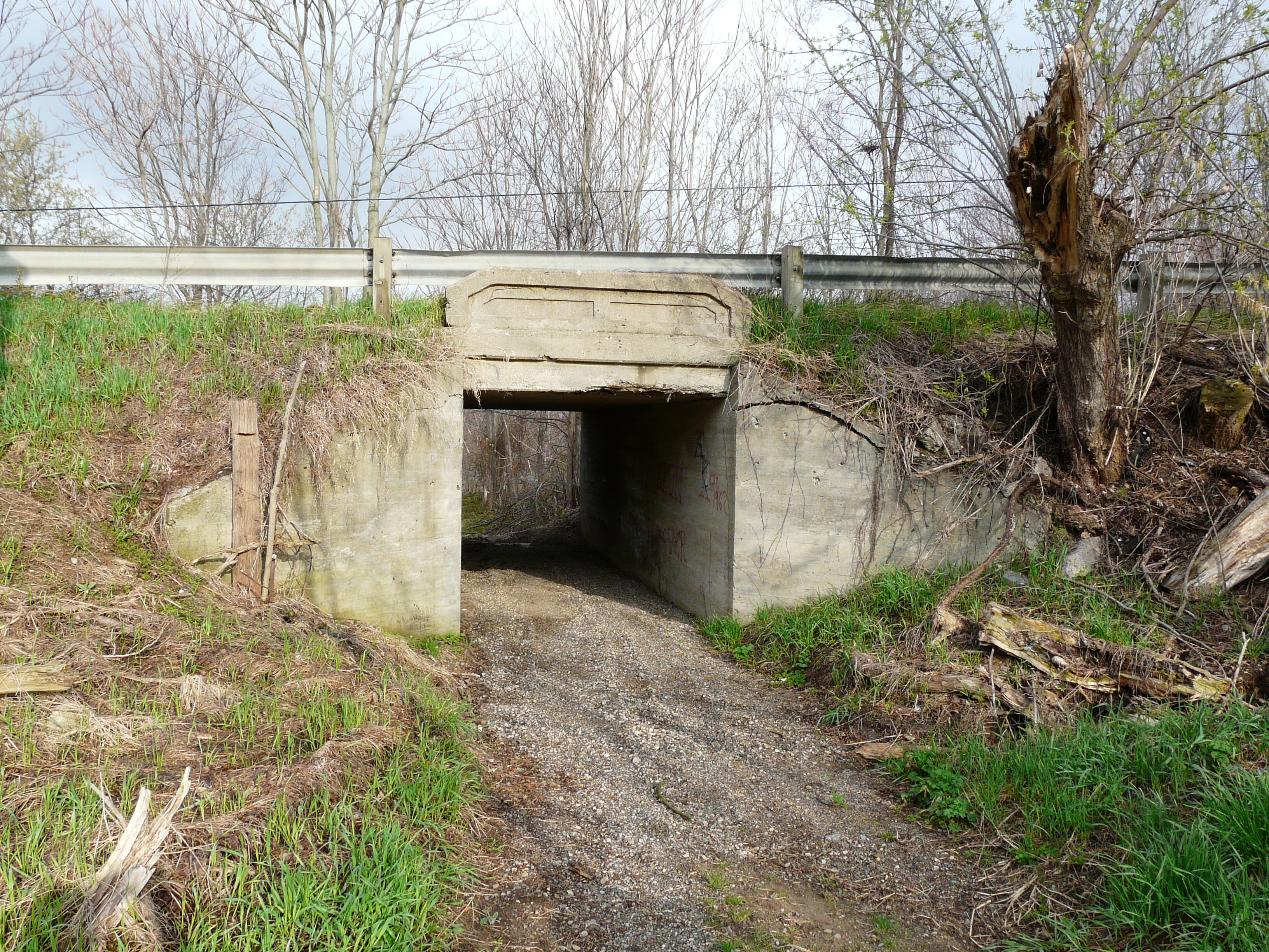
|
Flannery farm.
|
Tunnel from Flannery
farm side.
|
Tunnel from Flannery
farm side.
|
Interurban tunnel from the
Division Ave tunnel
|
Prefab cattle crossing ad - 2014
|
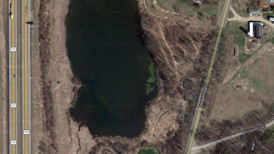
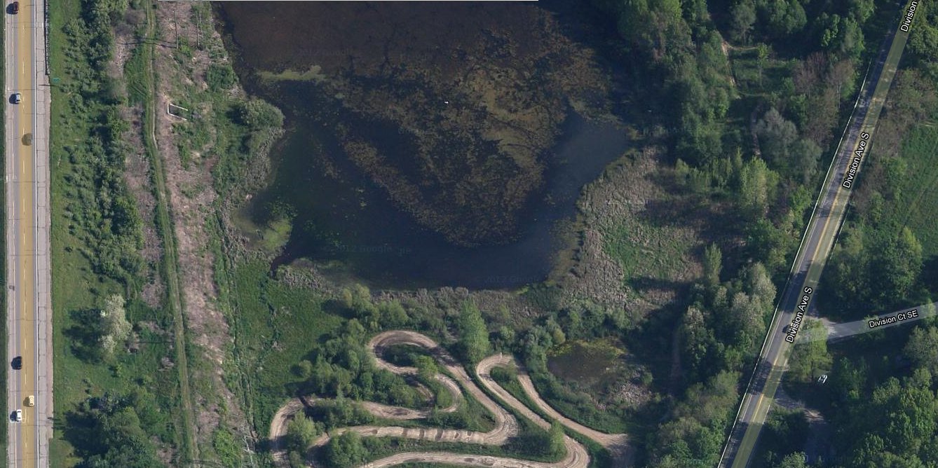
In year 2014 the area between the interurban track and Division Avenue is a shallow lake. West of the
interurban track is US 131, and debris has obscurred the west side of the tunnel. Pretty clearly the
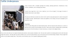
cattle crossing under Division Avenue hasn't been used for any farming purposes for a long time now.
Cattle crossing was a generic name for a farm access tunnel. While cattle might have used them too,
another function was to moved farm machinery to different locations. The Flannery family was well known
in the area in 1913 or so, when the interurban track was built, and might have been able to extract
the construction of the tunnel as a condition for use of the land. The tunnel under Division is
another matter. Apparently the route Division Avenue takes was modified at some point, and Division
Ct. today might be the old Division Avenue. When all this was done is not known at this time.
The following photos show the stretch of track from 92nd Street going south towards 100th Street. The
track veered to the west to avoid the steep hill by 92nd Street. The US 131 expressway has exaggerated the
manner in which the track moved west in order to make the power lines go pretty much east and west across the
road. The track very likely moved west in a more gradual way, and has been lost to 131 now. The track is lost
by 92nd Street, and again near 100th Street, where it makes an abrupt switch back to the east side of US 131, which
of course had nothing to do with the original route of the track.
Left click on the images below for larger versions.
Heading east on 92nd Street
|
Looking south from 92nd Street
|

Looking north from 92nd Street.
Note land for sale sign.....
|
Original track route to
92nd Street?
|
Transmission wires crossing
131 near 92nd Street.
|

Signal base near 92nd Street.
|

Approaching cattle crossing
|
Cattle crossing - west side
|
Cattle crossing - east side
|

Signal base by cattle crossing
|
A cut - not everything can
be seen from the roads.
|
Cattle gate & land for sale.
|

Just before cattle gate.
West side.
|
East side - much more fill.
|
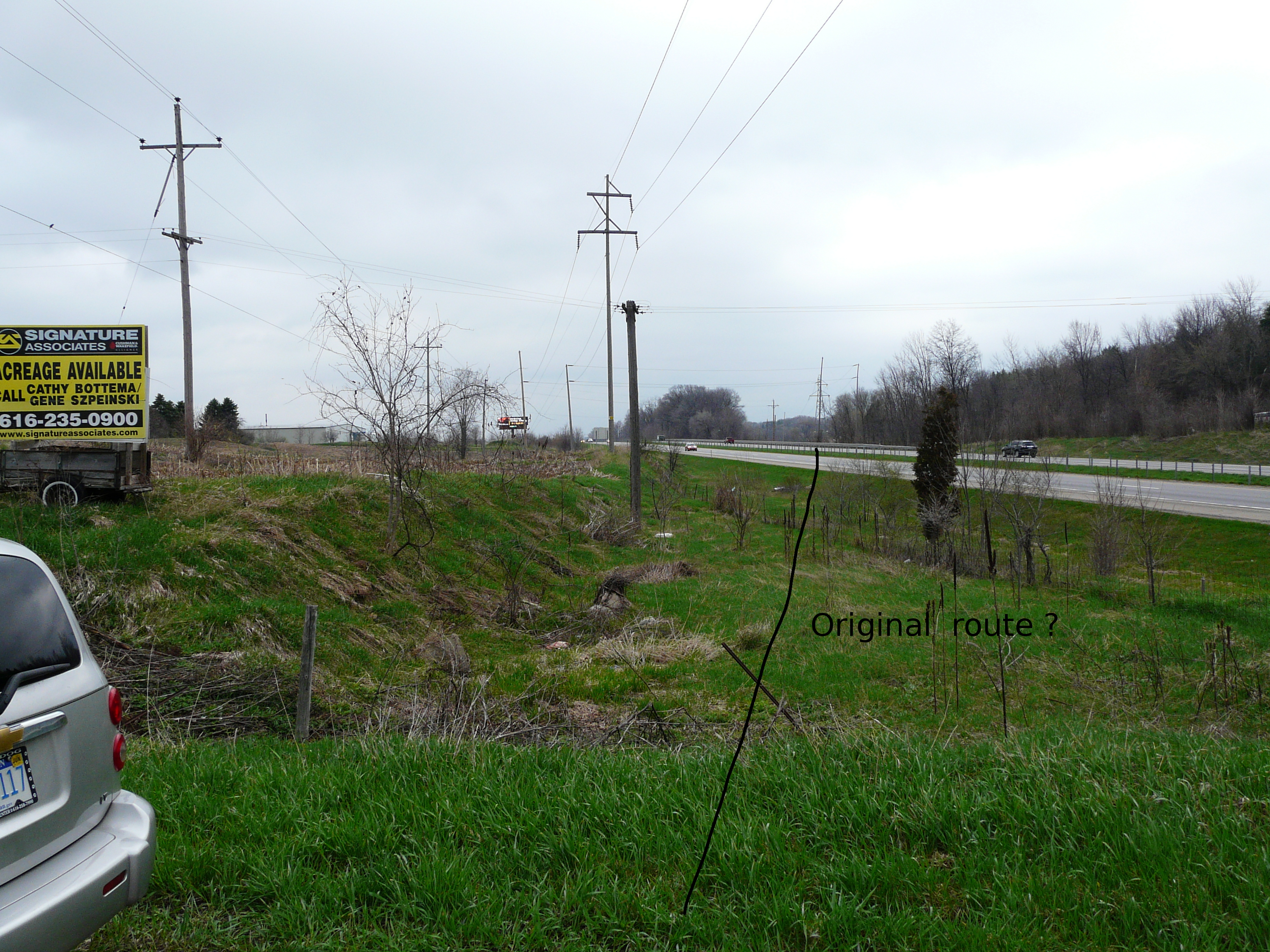
Not much further south the original route of the track was changed by the new 131. The gental curve of the track
originally intended to take the track around the steep elevations around 92nd, and the reason for the track
seemingly going west of the new 131 for a while, have been erased now by 131. The long stretches taking the
track west and back east, as the track goes south, are now gone. Like the GR & I track, and the old 131, the
interurban track largely paralleled the GR & I track, and so then did the new 131. So things have been lost now.
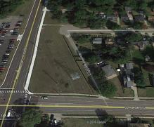
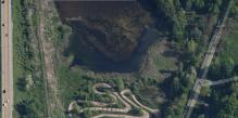
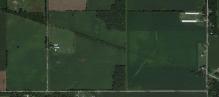
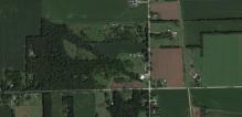
Corinth - stop 47
Left click on the images below for larger versions.
The October, 1914, topographical map above shows the location of Corinth as being at
the intersection of 100th Street and Division Avenue. Even Division Avenue had to
make a jog in this area to avoid the steep 92nd Street hill. Corinth is located at the
point where Division Avenue begins to head due south, and where the land is again flat
enough to farm. Why there was an Interurban stop here is unclear, save that a coach
would stop just about anywhere someone was waiting to be picked up.
Perhaps Corinth was a stage coach stop at one time - Division Avenue, once called
Gull Road, was at one time a toll road - a plank road consisting of almost 50 miles
of lumber, each plank being 16 feet long, a foot wide, and 3 inches thick.
An 1897 Michgian State Gazetteer describes Corinth as have a population of 100, and was on the
line between Byron and Gains Townships. It had two blacksmiths, a general store, and a church.
In year 2012 there's little to indicate that Corinth existed. It is still shown
on maps, but little defines the location as a town. The interurban crossed 100th
Street where the US 131 interchange now exists. As shown in the middle and right
images above, one can see where the interurban approaches that area, and again further
south, where the track bed can be seen again. A depot would have been where
131 intersects with 100th Street SW, and for that reason, all traces of it have
now been erases.
All the way through the area the
Consumers Power towers and lines can be seen. In the right hand image one can
see the GR & IN track moving in a NW to SE direction, eventually to head due south
again. It too had to make a long detour around the hills around 92nd Street - in
short, standard trains don't climb hills. Otherwise, a church and a cemetery are
about all that carry the Corinth name today.
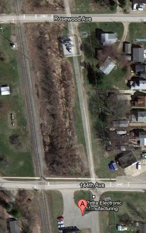
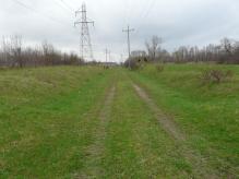
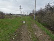
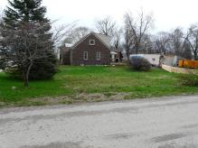
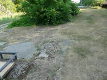
Moline - stop 44
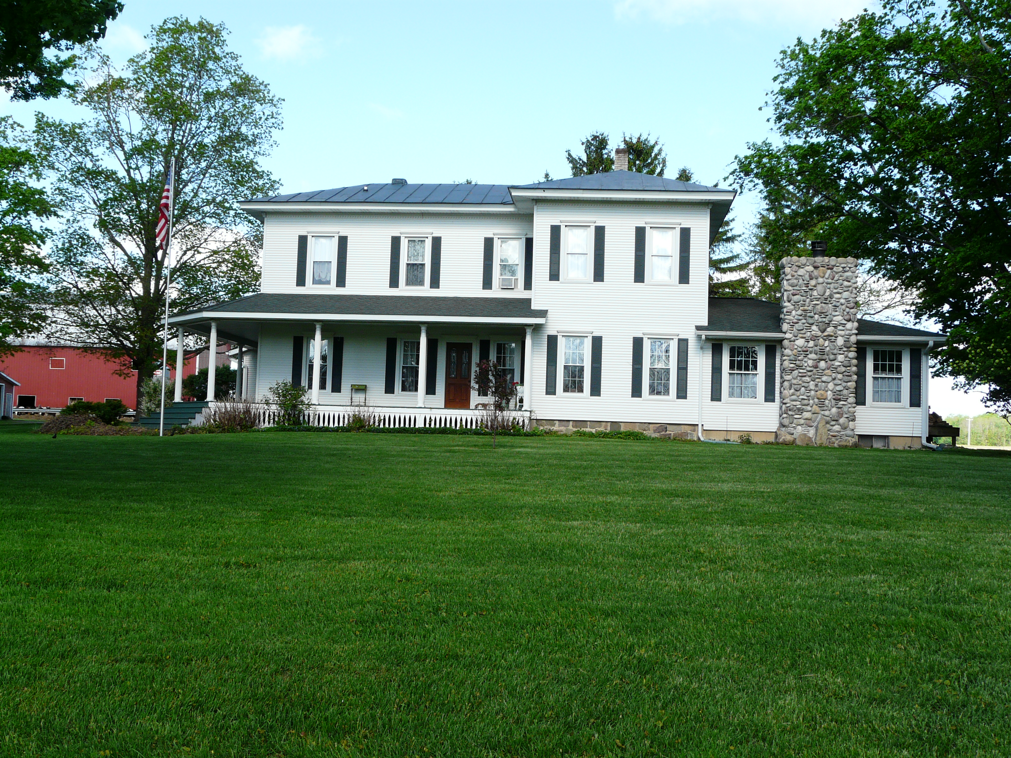
Like Martin, and Plainwell, the depot in Moline was a converted house.
The most likely site for the Moline depot is at the location below:
GPS coordinates: 42.739172, -85.663517
Left click on the image below for a larger version.
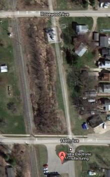
The most likely location for the depot would seem to be around where the track intersects
144th Avenue. The house that contained the depot is known to be gone as of year 2012.
So far, no photograph has become available, and the location above appears to contain
no evidence for a foundation, although this has not been confirmed at ground level yet.
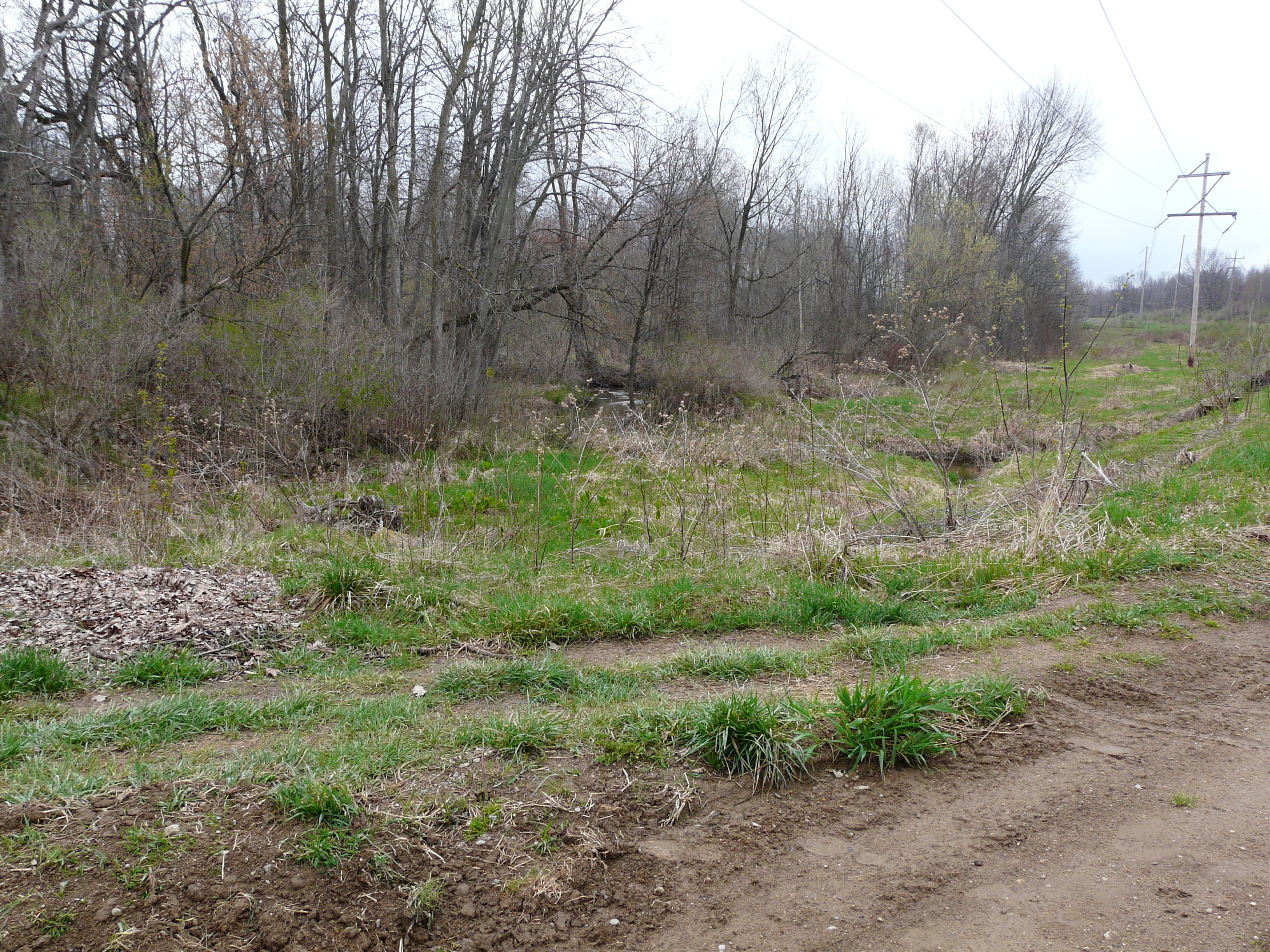
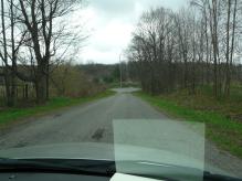
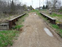
Wayland - stop 38
135th Street in year 2014
Approaching Wayland from the north, there is a split in Division Avenue. The piece going straight ahead, as
show below, is the old division. The cement was probably laid in the early 1920s. Unmaintained, the road is
nevertheless serviceable. Taking that branch, one finds a dirt road off to the right, and that is where an
interurban bridge still sits, on the Rabbit River. It's in surprisingly good condition after over 85 years of
little to no maintenance.
Left click on the images below for larger versions.
Bridge in lower left area.
|
Detail of area of interest.
|
Old Division, looking north.
|
Old Division, looking south.
|
|
|

|
|
|

|

|
|
|
|
Left click on the images below for larger versions.
1915
|
|
Postcard photo
|
|
c1915
|
c1915
|
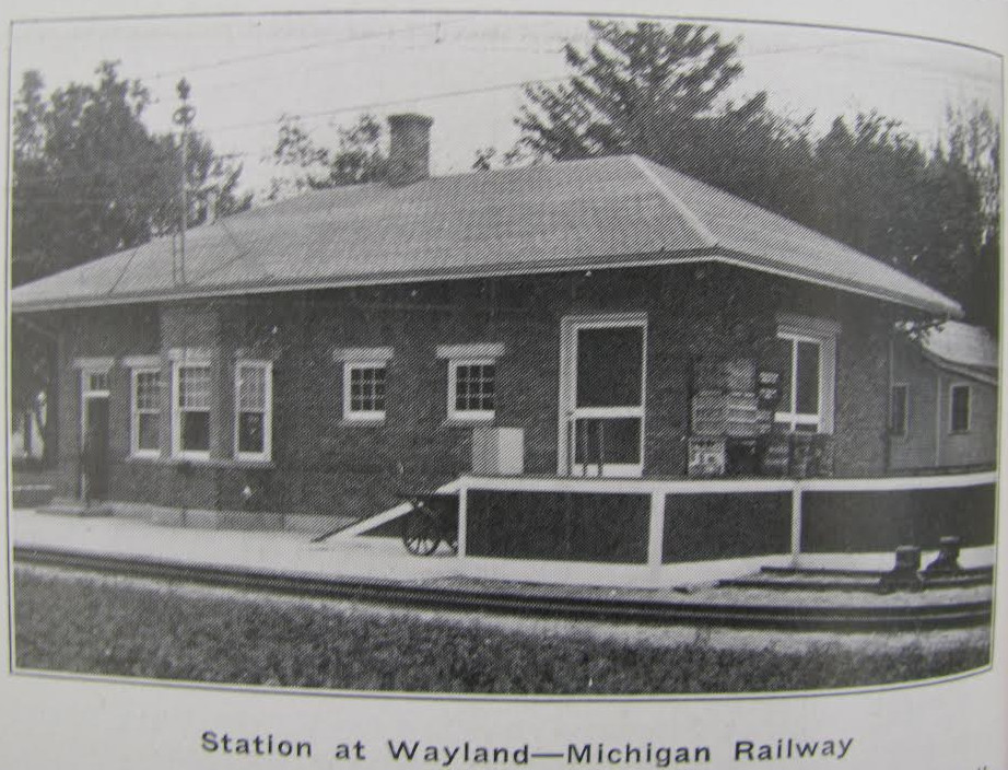
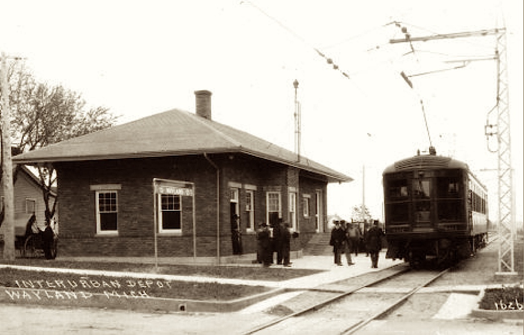
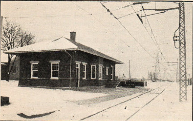
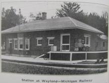
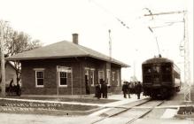
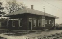
The interurban depot at Wayland, MI. The third rail was not used at depots
for safety reasons. One can see the overhead wire and pulley used by the depot in
the photograph at the left, above.
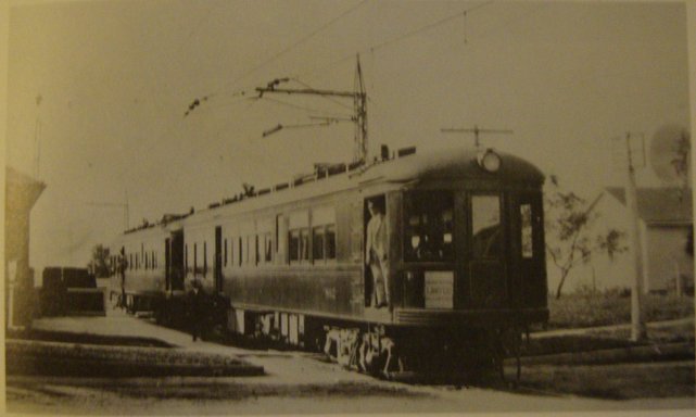
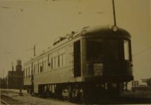
In the photograph at the right, above, coaches 802 and 808 are likely headed for Grand
Rapids. The power pole cannot be seen, and is probably at the back of unit. The power pole can
be clearly seen in the photograph at the left, above, suggesting that if the depot was on the east
side of the tracks, and south of West Superior Street, it was heading south, towards Kalamazoo.
Left click on the images below for larger versions.
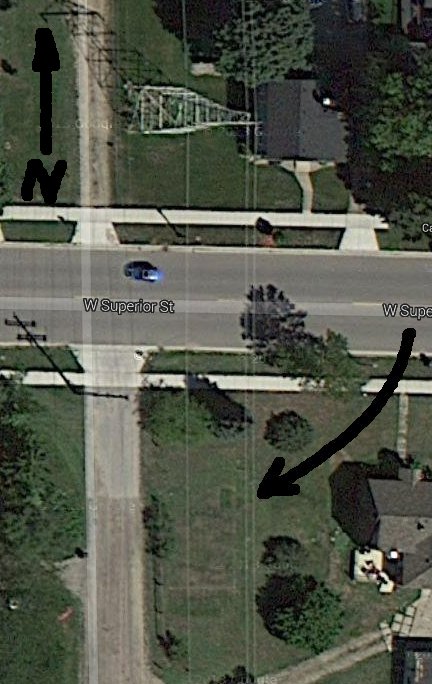
There is a suggestion of the outline of a foundation at the location pointed to above. The satellite image is
from about June, 2013.
GPS coordinates: 42.673643 -85.647305
The Wayland interurban depot was indeed on the southeast corner of
West Superior Street and the intersection with the track bed. The house on the right of the location
fits that of an early photograph in that the roof line is correctly oriented.
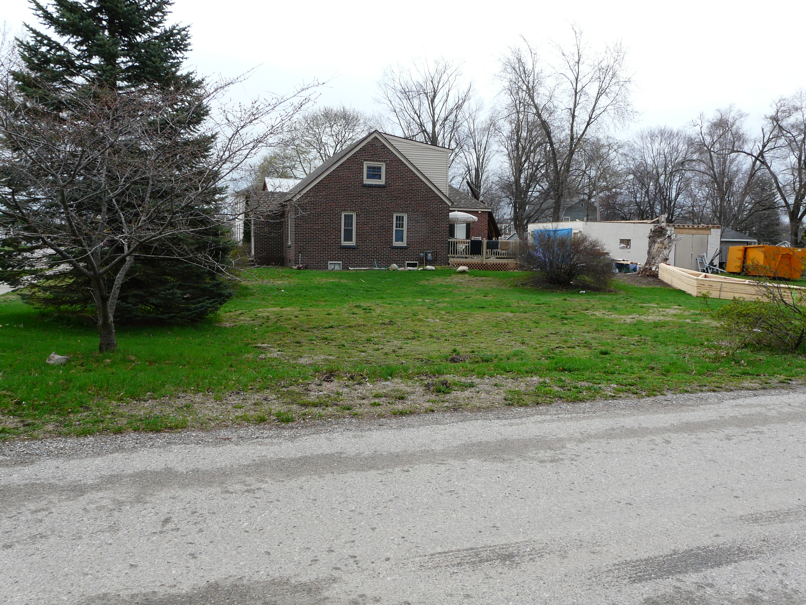
But as the photos below show, a lot of effort has been made recently - about April, 2014 - to remove the
remaining elements of the foundation from the location. Pieces are still seen. And it's reasonably clear from
the construction materials that some kind of structure is about to be erected at that location.
Left click on the images below for larger versions.
|
Looking north from depot location.
|
Looking south from depot location.
|
Piece of foundation.
|
Vague traces of foundation.
|
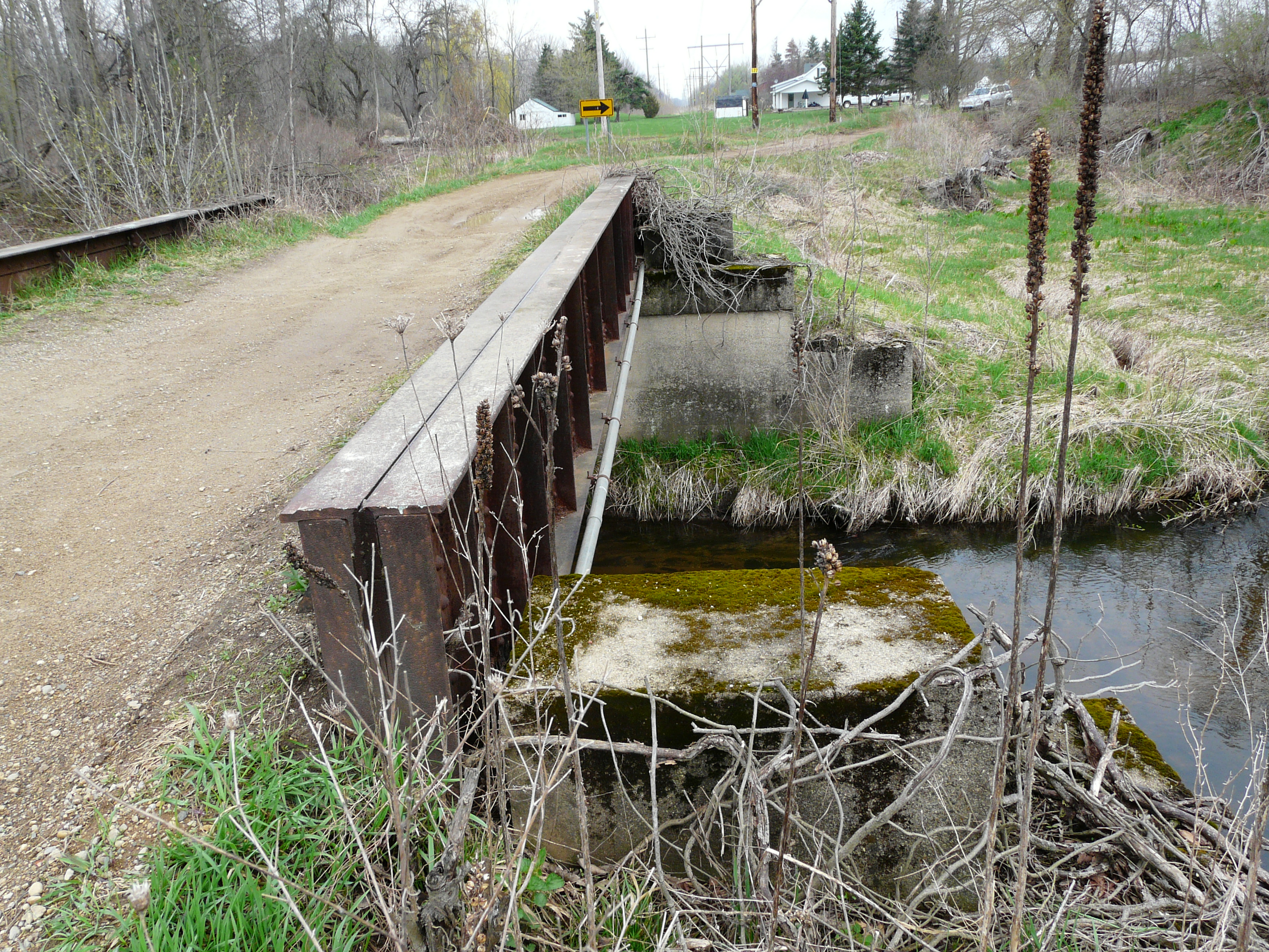
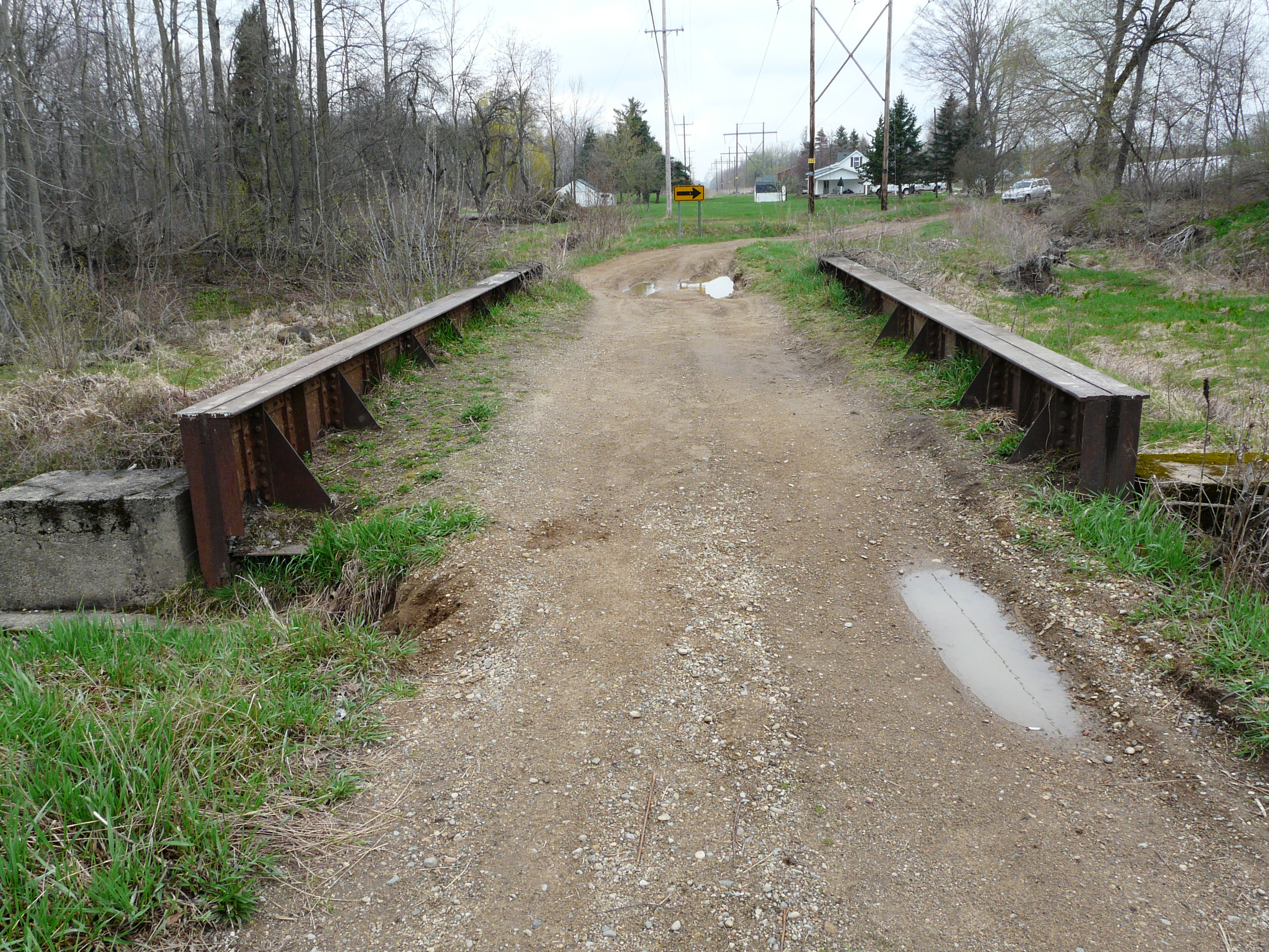
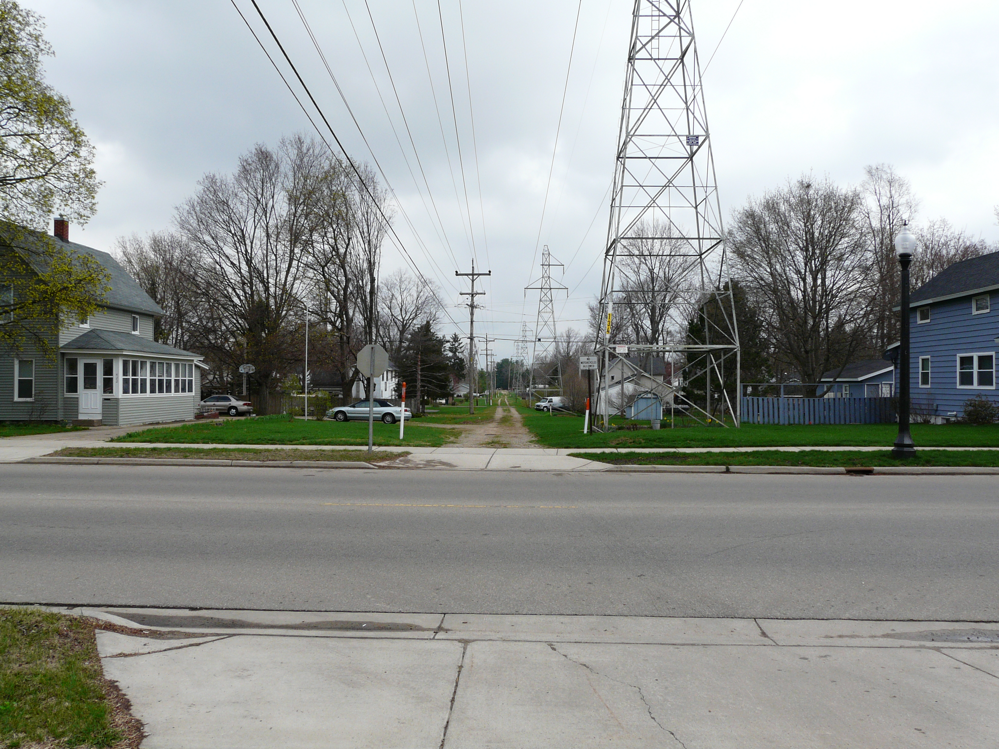
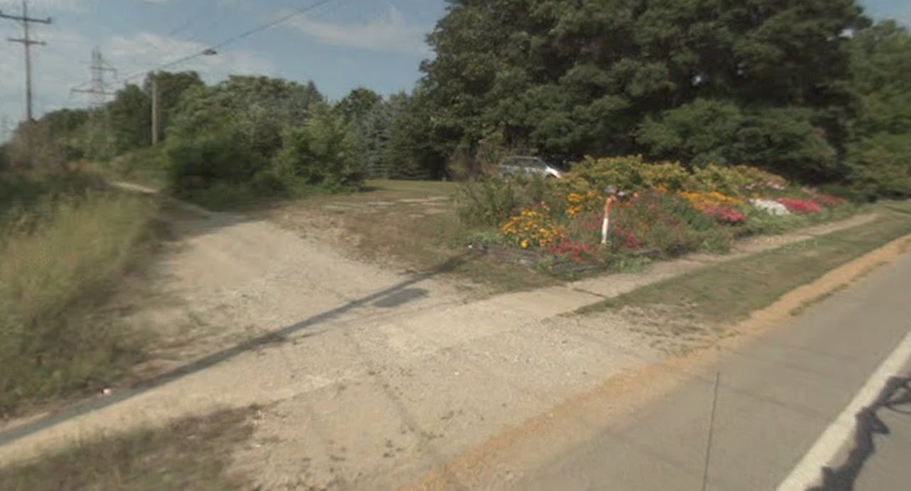
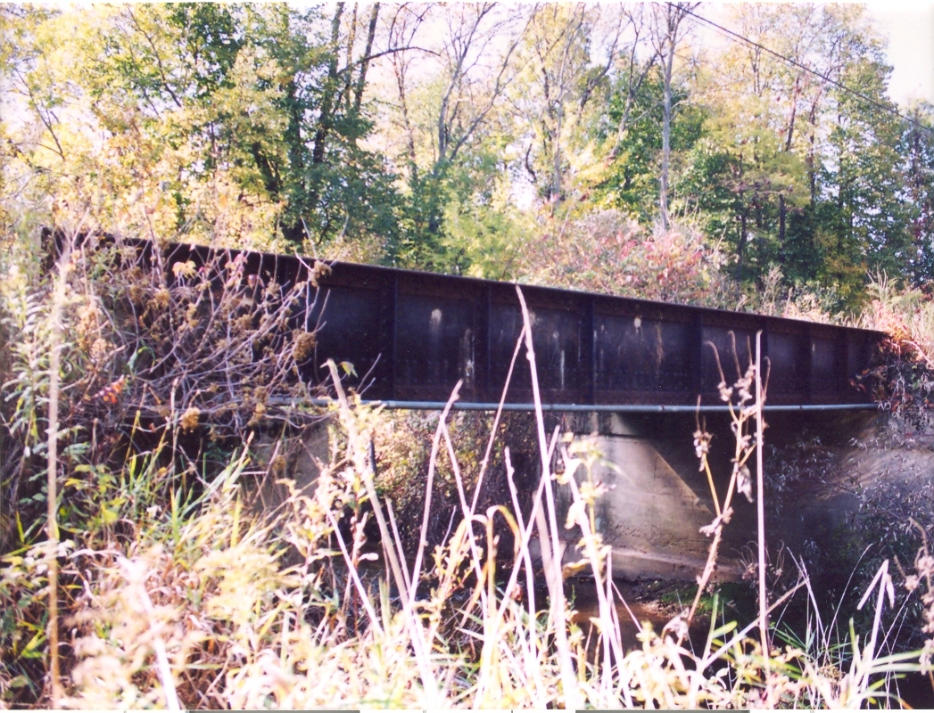
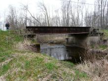
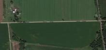
About two miles south of Wayland the GR & I and the interurban line cross. There was an interurban bridge over the
GR & I track, and the abutments still exist.
GPS coordinates: 42.611261 -85.644175
Left click on the images below for larger versions.
2015
|
|
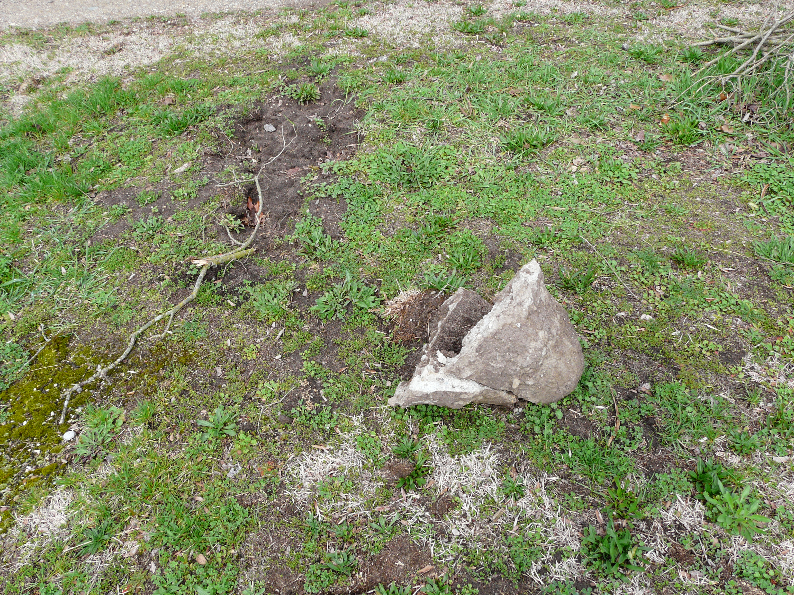
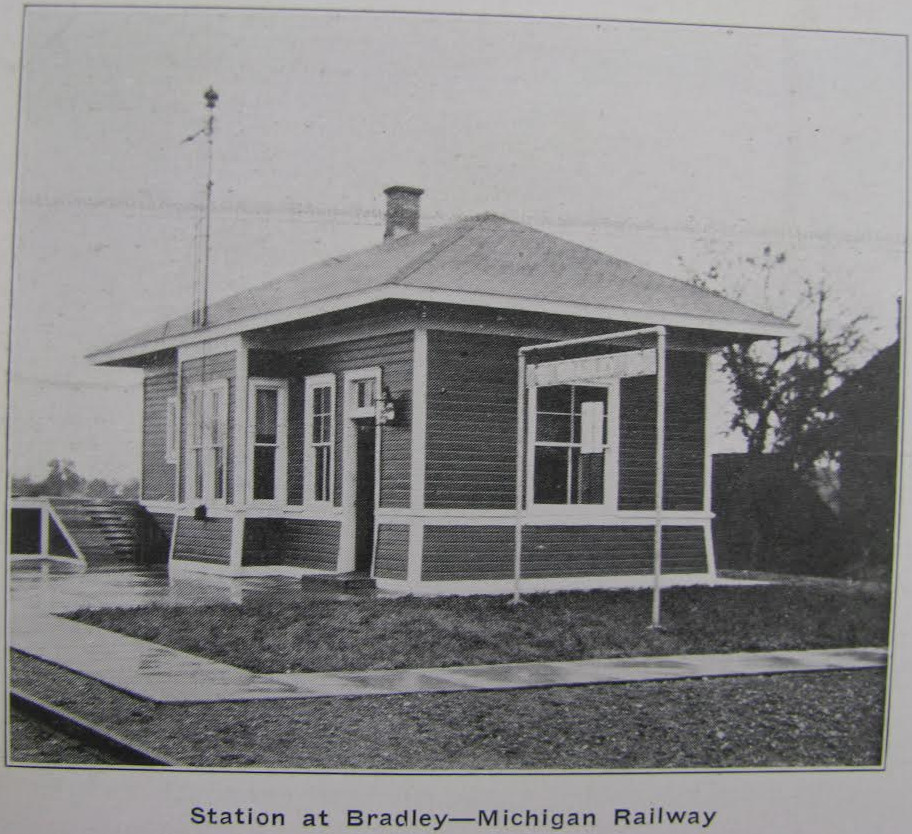
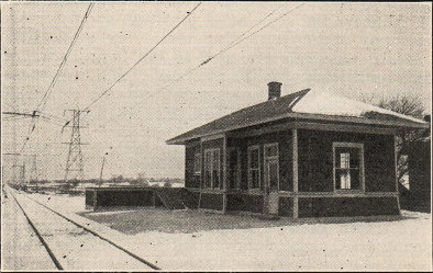
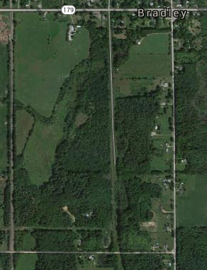
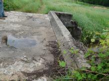
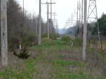
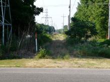
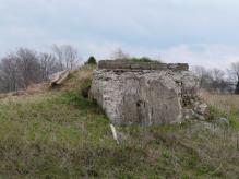
Bradley - stop 34
Left click on the images below for larger versions.
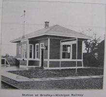
c1915
|
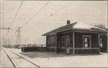
c1915
|
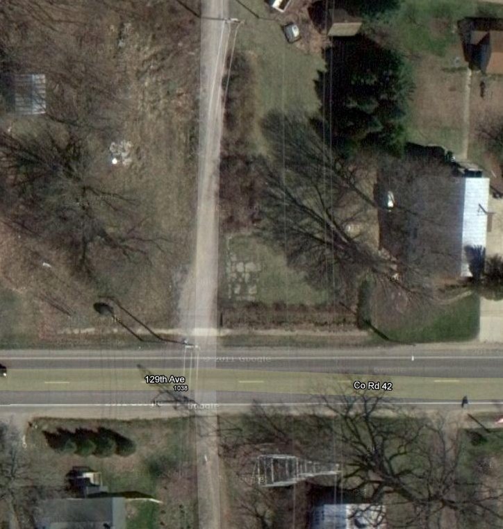
In year 2014, the station location is the NE corner of the intersection of 129th Street and the track bed.
Left click on the images below for larger versions.
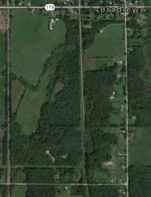
The satellite images above were obtained in year 2012. The middle one shows the
location of the Bradley interurban terminal. Akin to the view below of the
Shelbyville terminal foundation, one can see an area in the center of the
photograph that appears to be the remnants of a foundation. Hopefully a photograph
of the station will emerge.
The GPS location for the apparent foundation is 42.630581, -85.646216.
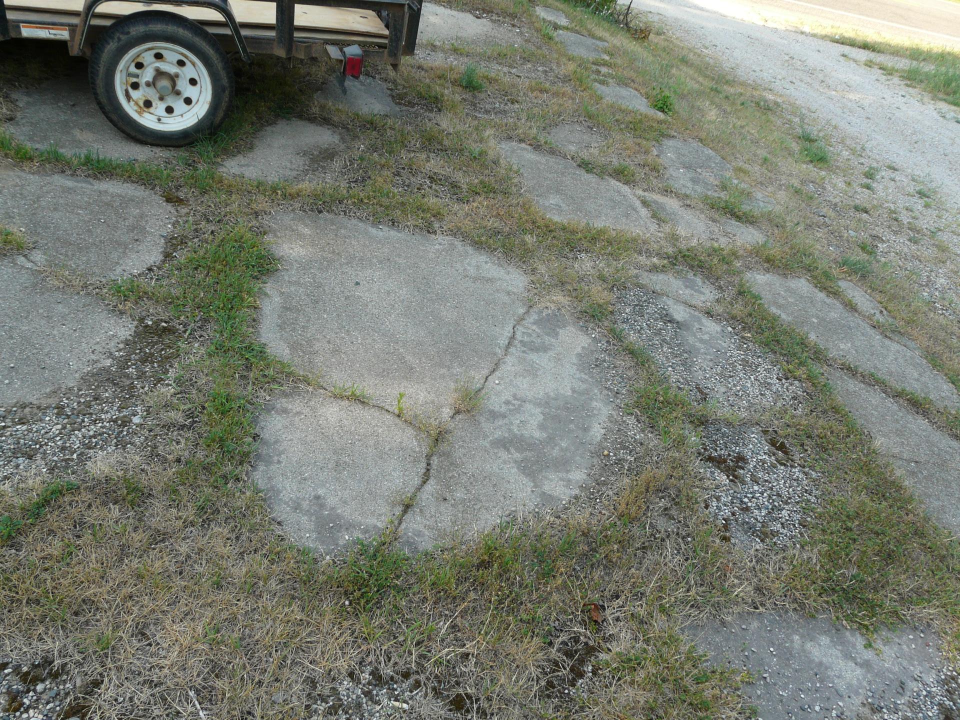
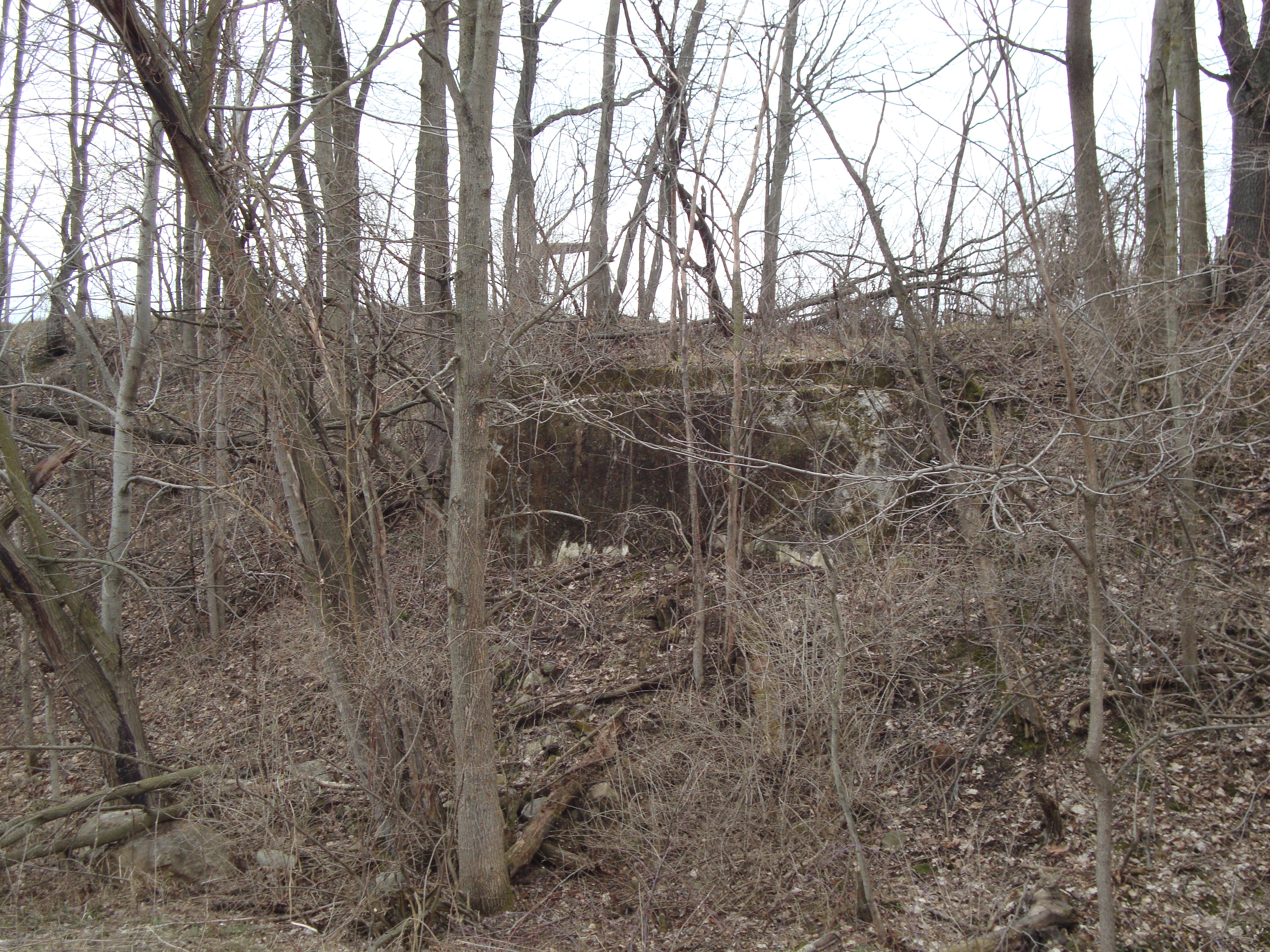
The photographs below, taken on June 28, 2012, show the foundation and platform
of the Bradley, MI, depot. The adjoining house has apparently been using the
land, belonging to Consumer's Power, as an extended yard, and is keeping it mowed.
For good or for bad, this has kept the foundation and platform visible where it
might otherwise be overgrown and impossible to spot. At present it appears that
about half of the primary stops between Grand Rapids and Kalamazoo have been
obliterated by construction of some kind, so the Bradley depot location might well be
the last one to be found where any significant remnants still exist.
Left click on the images below for larger versions.
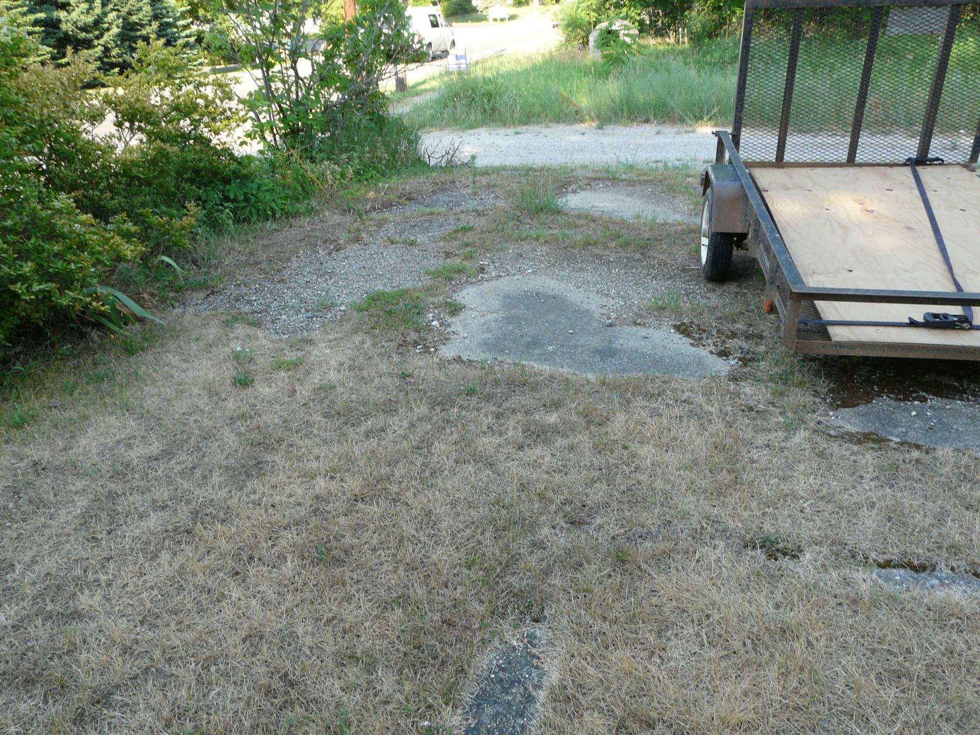
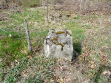
Above one can see the general location of the platform and depot. The inadvertently
placed trailer gives some idea of the scale. The track was located towards the bottom
and left of the foundation. A short wall goes north of the foundation for about 40
feet. Perhaps part of a platform.
Left click on the images below for larger versions.
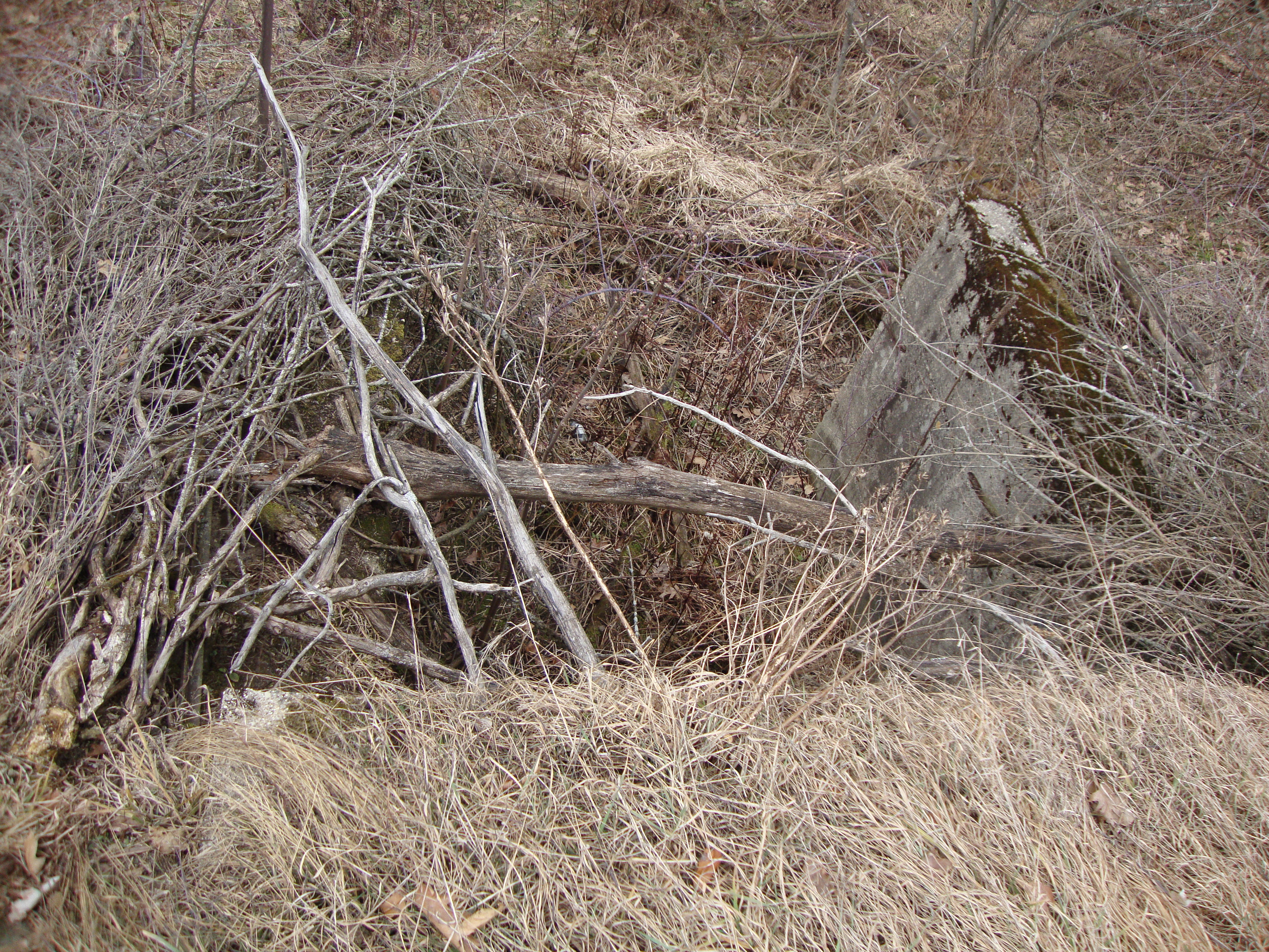
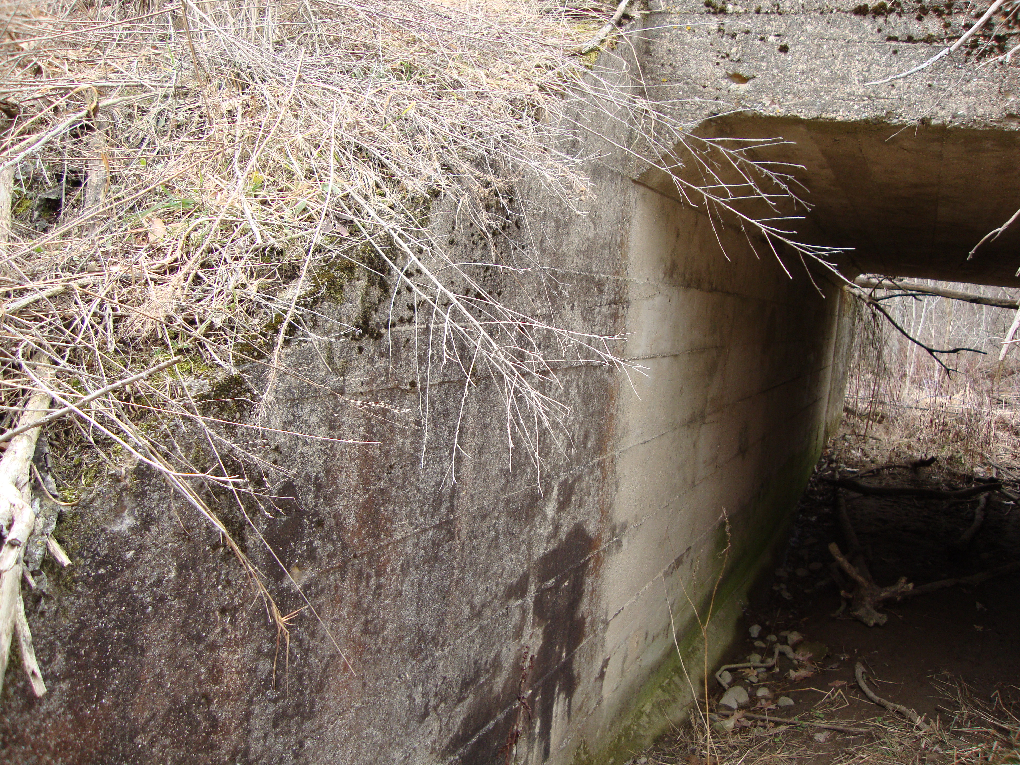
Southern part of foundation.
|
Southwest part of foundation.
|
Western part of foundation.
|
Eastern part of foundation.
|
Western part of foundation.
Wall in bushes.
|
Wall where bushes are.
|
Wall where bushes are.
|
Wall where bushes are.
|
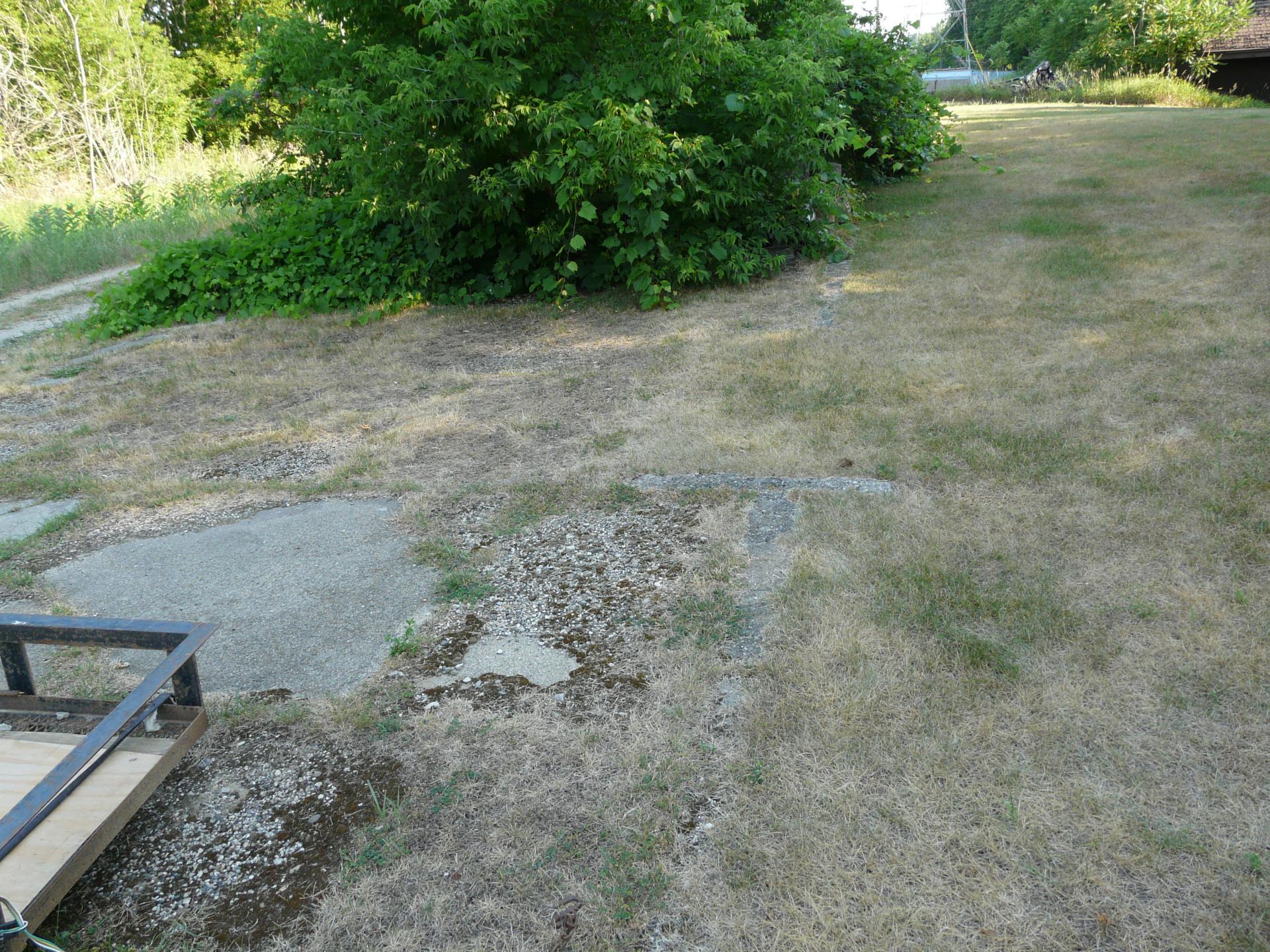
The top row, above, shows the south and southwest parts of the depot foundation.
The middle row, above, shows the western parts of the depot foundation.
The bottom row, above, shows the eastern part of the depot foundation.
The dirt road area is where the tracks were. One can see again that but for the
efforts of the neighboring house to keep the area clear, the foundation would
probably be obscure in year 2012.
Left click on the images below for larger versions.

Looking north.
|
Looking north.
|
Looking north.
|
Looking north - telephoto.
|
Looking south.
|

Looking south. Signal base at
left. Depot at blue trailer.
|
Signal base - just north of depot.
|
Above, looking at the track bed, north and south. In this stretch of track, location
of the right of way is mostly defined by the power towers, without which the track bed
would likely be totally overgrown by year 2012.
Lee Tanner, Godwin class of 1941, recalls that her grandparents had a farm on the east side of US 131,
and the interurban tracks were behind the barn. She says her cousins used to hang around the depot,
helping the agent do various things. Her father started his working life on the interurban line.
He graduated from Dorr HS in 1912 or 1913, and his first job with the was in 1914 or 1915, which
would then have had to be when the line just opened, or slightly before.
Left click on the images below for larger versions.
|
East abutment, April, 2015
|
West abutment, April, 2015
|
Abutments exist just south of 128th, shown on the map above, lower left corner.
Left click on the images below for larger versions.
The cattle crossing above is a ways north of 128th. The interior walls look like they were recently poured.
It's amusing to see a line between the interior concrete and the outside, which is more weathered. The photos were taken in April, 2015.
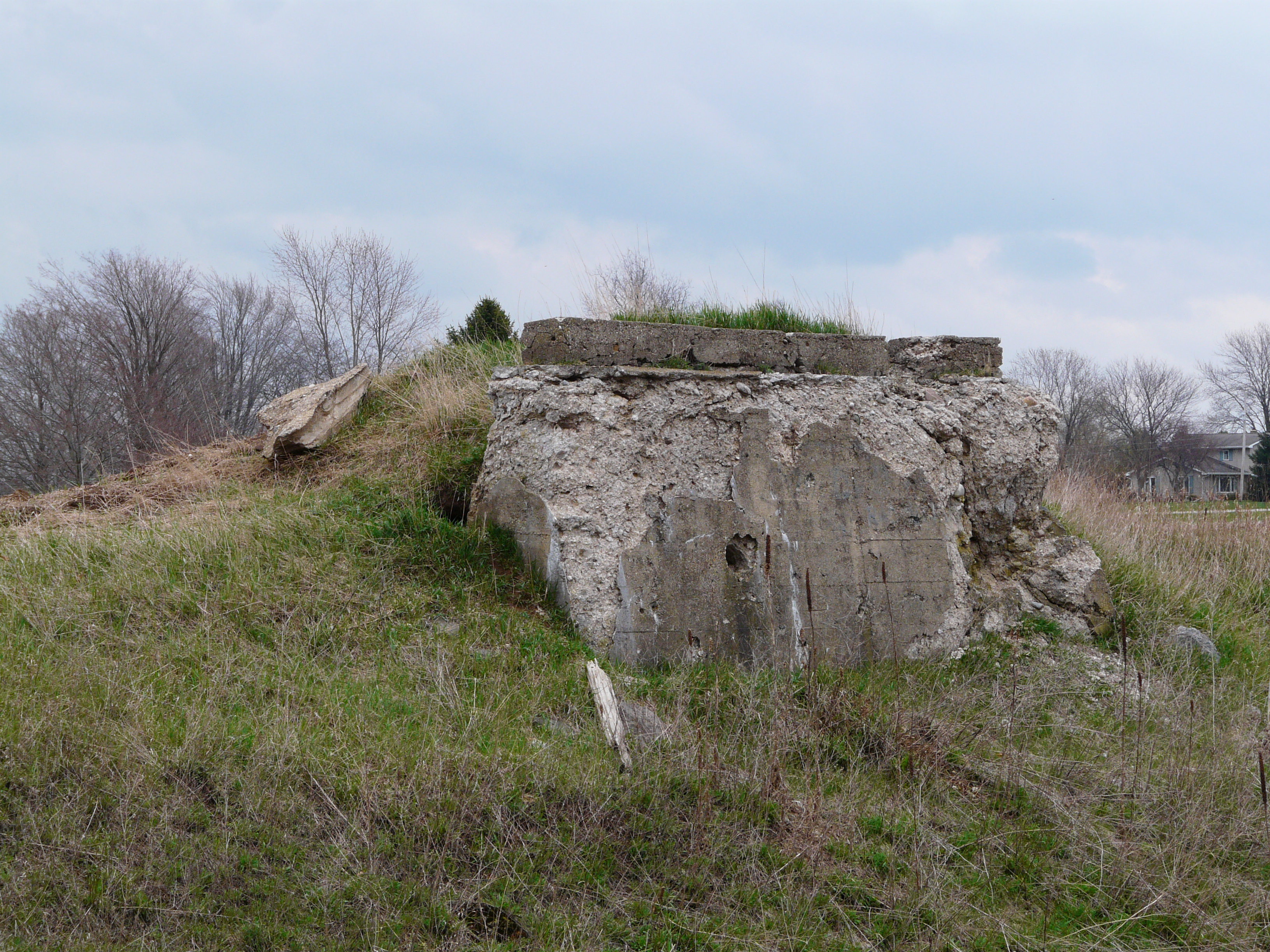
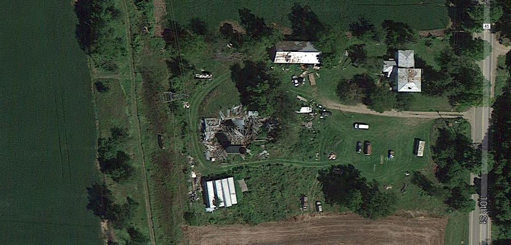
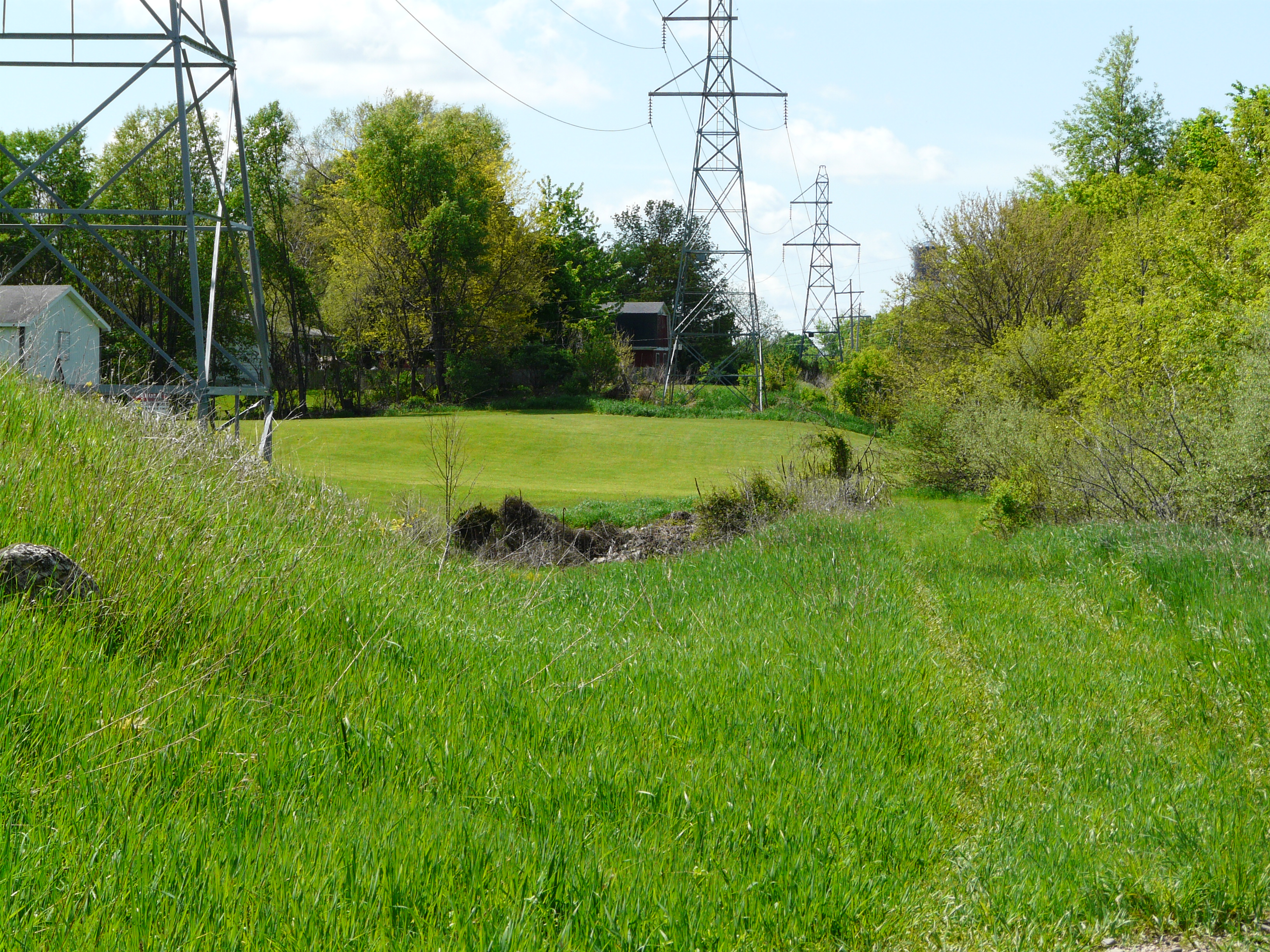
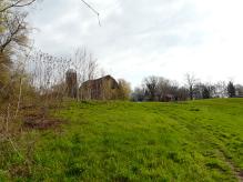
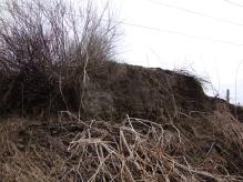
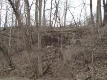
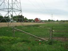
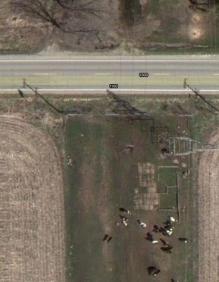
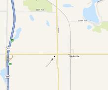
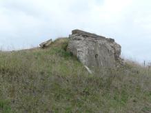
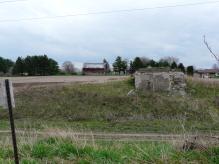
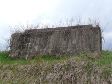
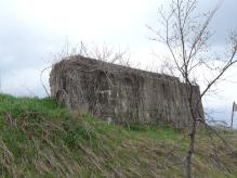
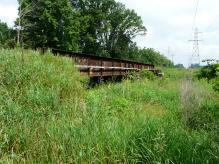
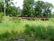
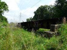
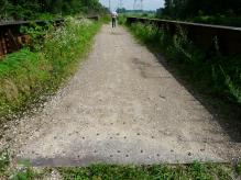
Shelbyville - stop 30
South of 84th Street, and along the old 131, the interurban track bed is well
defined yet in year 2010, some 82 years after operations ceased. In some areas
the culverts and roadbed appear to be in very good condition, having the appearance
that track could be laid again. For much of this stretch, the owners of the land,
Consumers Power, has not graded the property. Just south of 124th Street and east
the old 131, there is the foundation of a terminal. See below.
Left click on the images below for larger versions.
View in about 1920.
|
View in about 1920.
|
View in 2010.
|
Satellite view of foundation
|
Depot when in use.
|
As shown on the map, the stop is near a spot on the map called Shelbyville.
Shelbyville was also served by the Grand Rapids and Indiana Railroad at one time.
The reason was mostly the tourist trade at Gunn Lake. At both the railroad and interurban
stops, local transportation would have taken people the remaining 5 to 7 miles to the lake.
The satellite view at the left, above, bottom row, shows the outline of the terminal, at
GPS coordinates 42.59405, -85.643988 .
Projecting the path of the track, at the top of the image, shows that the track
would have passed to the left of what appears to be a platform.
Why the foundation was never removed, since it is now in pasture land is unclear.
But fortunately, it was not. One reason might be that the land is actually owned by a power
company. As one can see at the left, in the photo at the right, bottom row, there are
transmission line towers in place even when the interurban line was running, because those lines supplied
power to the line, and were there for that purpose. When the line folded, the ROW and the power lines
stayed in place.
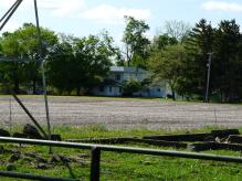
The top two views show a house at the left, and a barn at the right. These two structures still exist
in year 2014. Below is a view of the house from the Divison Avenue side, looking west. Note the large
granite foundation blocks, suggesting the house was built before 1900, and maybe much before.
Left click on the images below for larger versions.

View from Divsion Ave.
|
View from the depot foundation,
looking southeast.
|
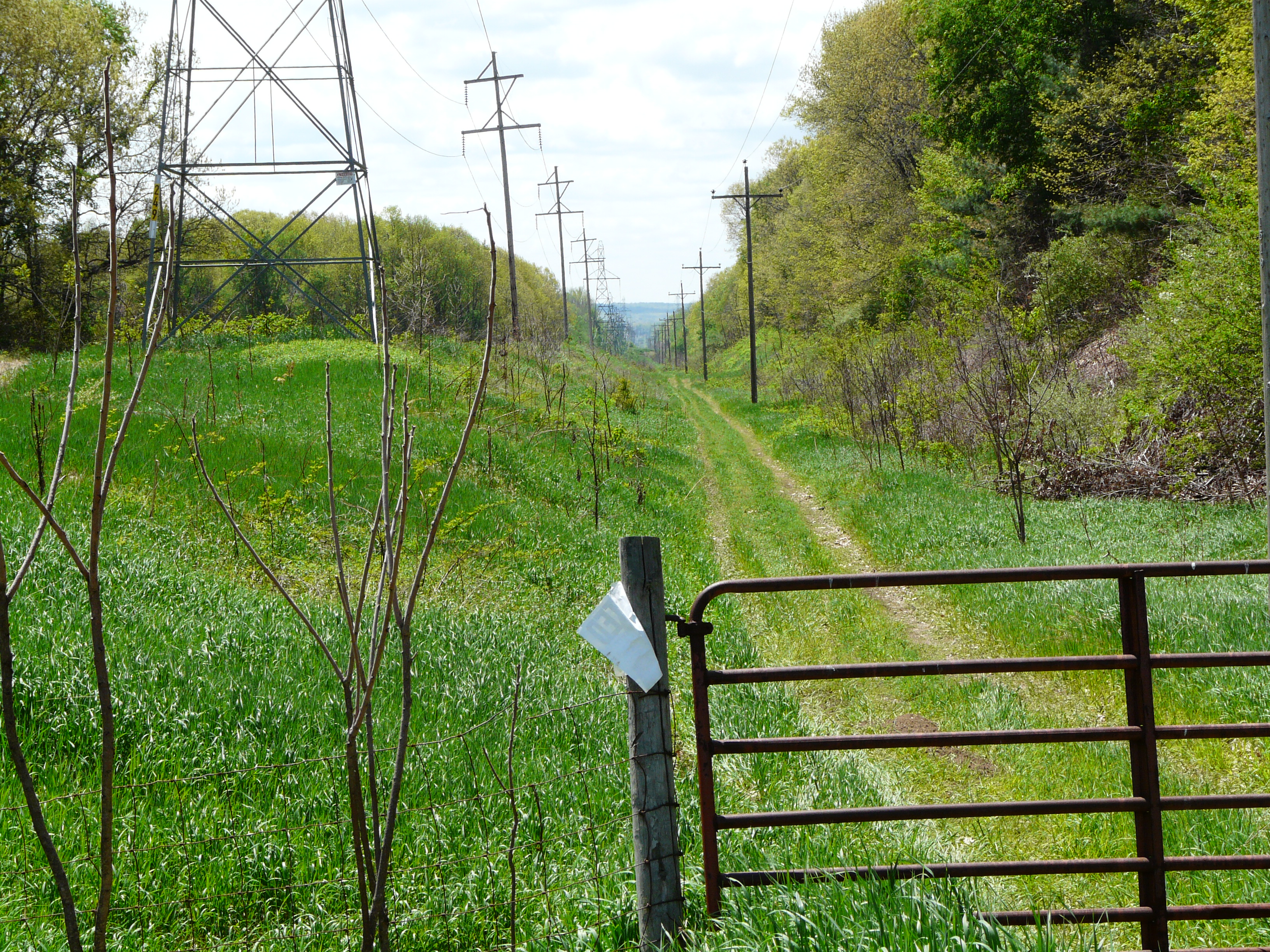
The house shown in the depot photo. Taken May 22, 2014. The house is in perfect condition.
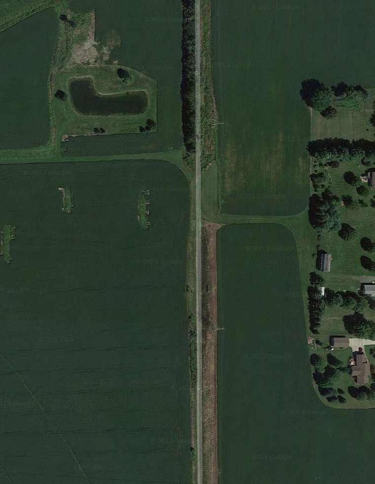
Unnamed - stop 29
Stop 29 is unnamed. It is likely at 122nd, or whatever the road was called, if anything, in 1917,
and was likely a flag stop.
Stop 28 probably corresponds to Steers Road, which is 120th in year 2014, and stop 27
to Carpenter Farm, which is 118th in year 2014. Both were probably flag stops as well. Even in year 2014
there are no houses or businesses around the stops.
The habit of naming stops after farm owners and other local
landmarks likely reflected the causual naming of roads in and around 1920. A road might have many different names,
being called by whatever farm it was passing at the time. In the early 1940's, or thereabouts, street names
were changed in many Michigan counties. Whether at the behest of the post office, map makers, businesses, etc.,
is unclear at this time. Apparently what is 120th Street in year 2014 had no name at all in 1917, when the
official list of stops for the GR - Kzoo line was published.
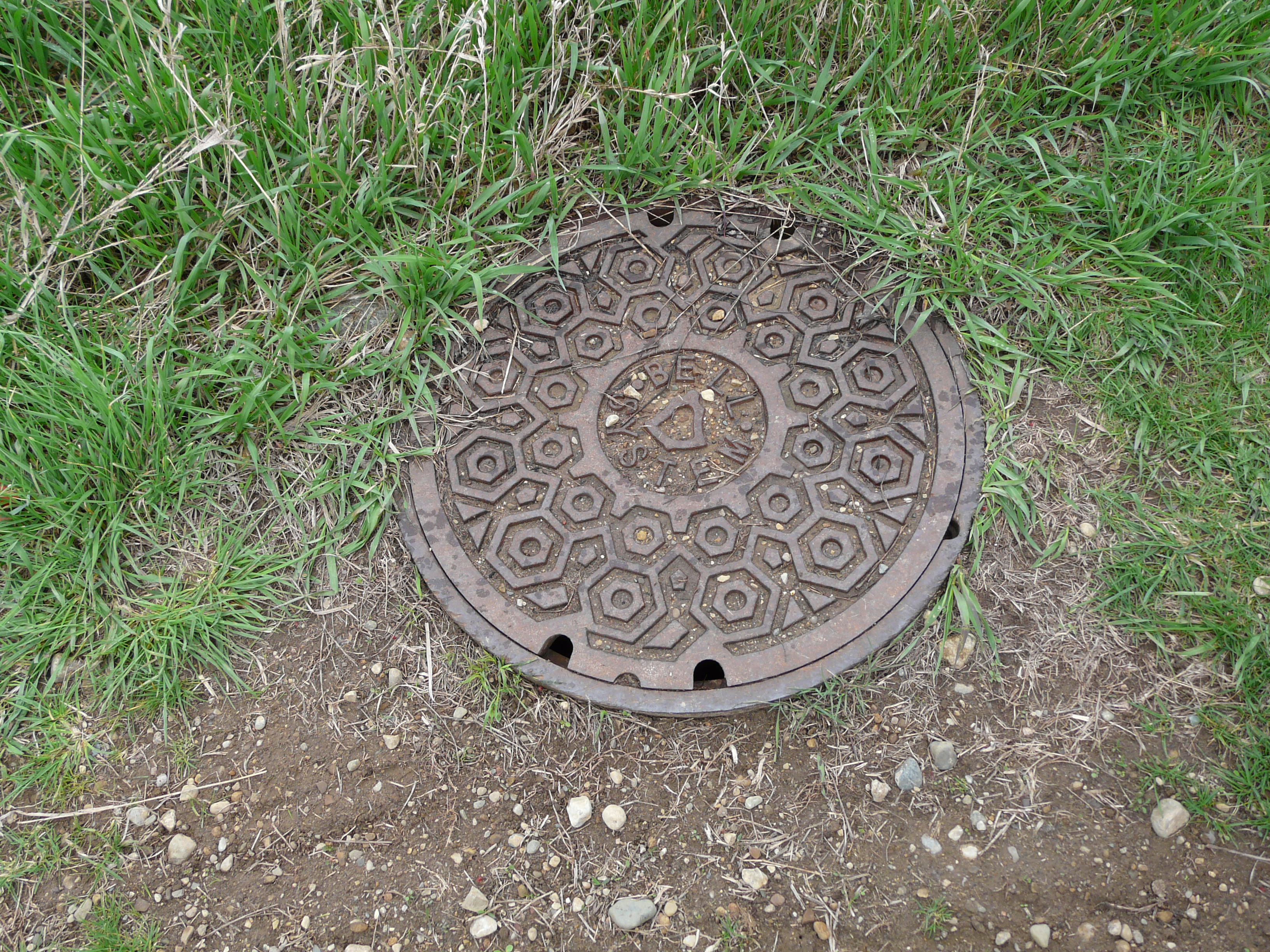
Left click on the images below for larger versions.
A manhole cover in the ROW, with "Bell System" on it. AT&T has not been the Bell System since 1983 when the
company was broken up by the idiotic CO senator Tim Wirth. How long the cover, and what's underneath it, has
been there is unknown for now.
The photos below show the area just south of stop 29, which was at what is today 120th Street.
Left click on the images below for larger versions.
Looking north
|
Looking south
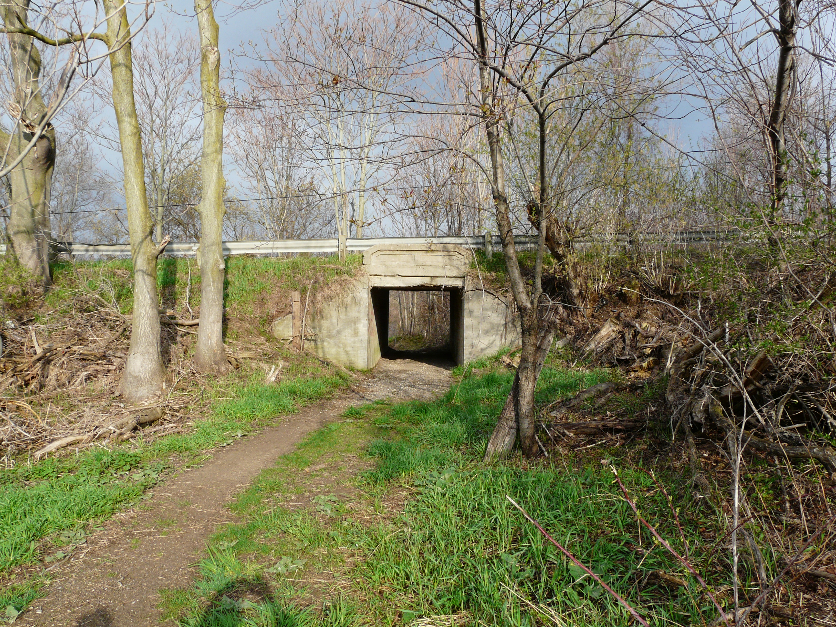
|
|
Third rail insulator
|
Looking south towards
bridge abutments.
|
Deer skeleton
|
Cattle crossing
|
Cattle crossing.
Killed coyote.
|
Cattle crossing.
Killed coyote.
|
Signal base and post.
|
Located about a thousand feet south of 122nd Street, north of Kalamazoo, and about a mile south of
Shelbyville, are the structures shown below.
GPS coordinates: 42.576049 -85.64394
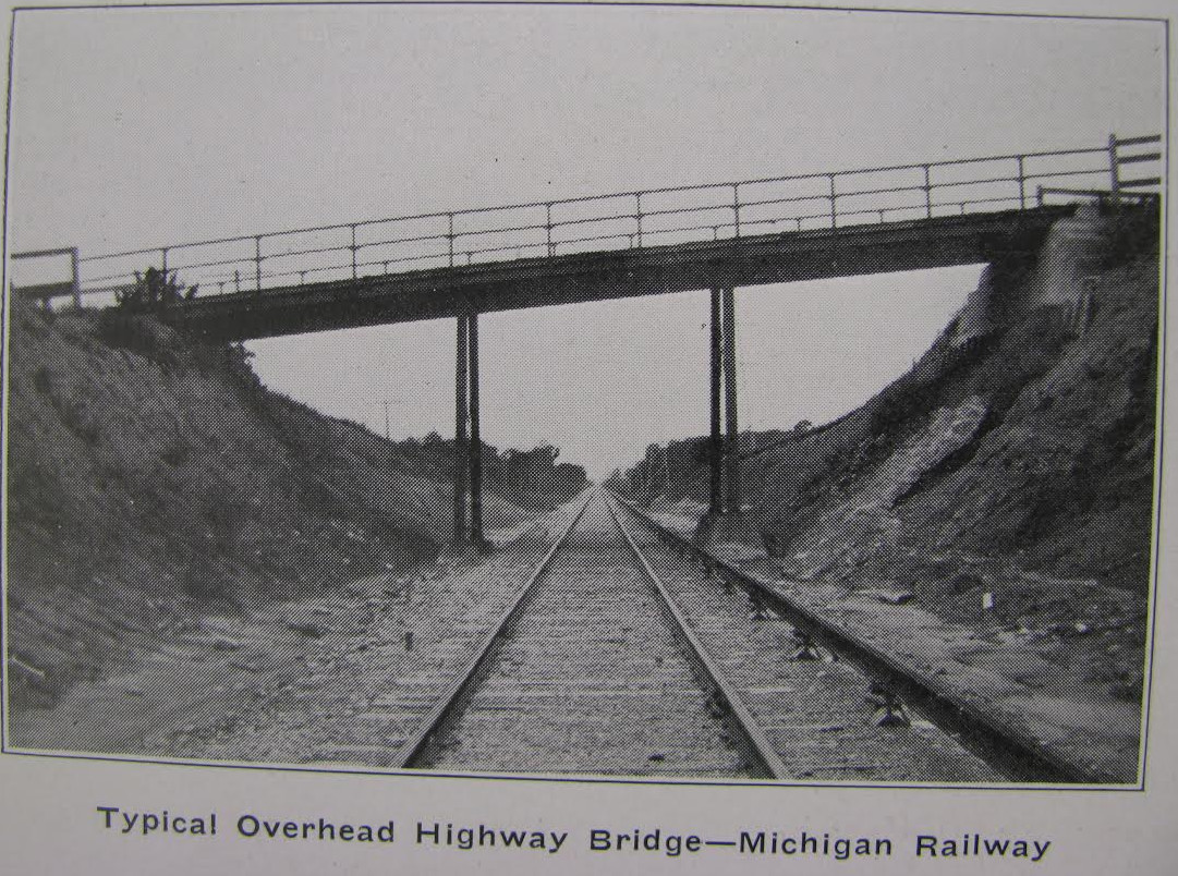
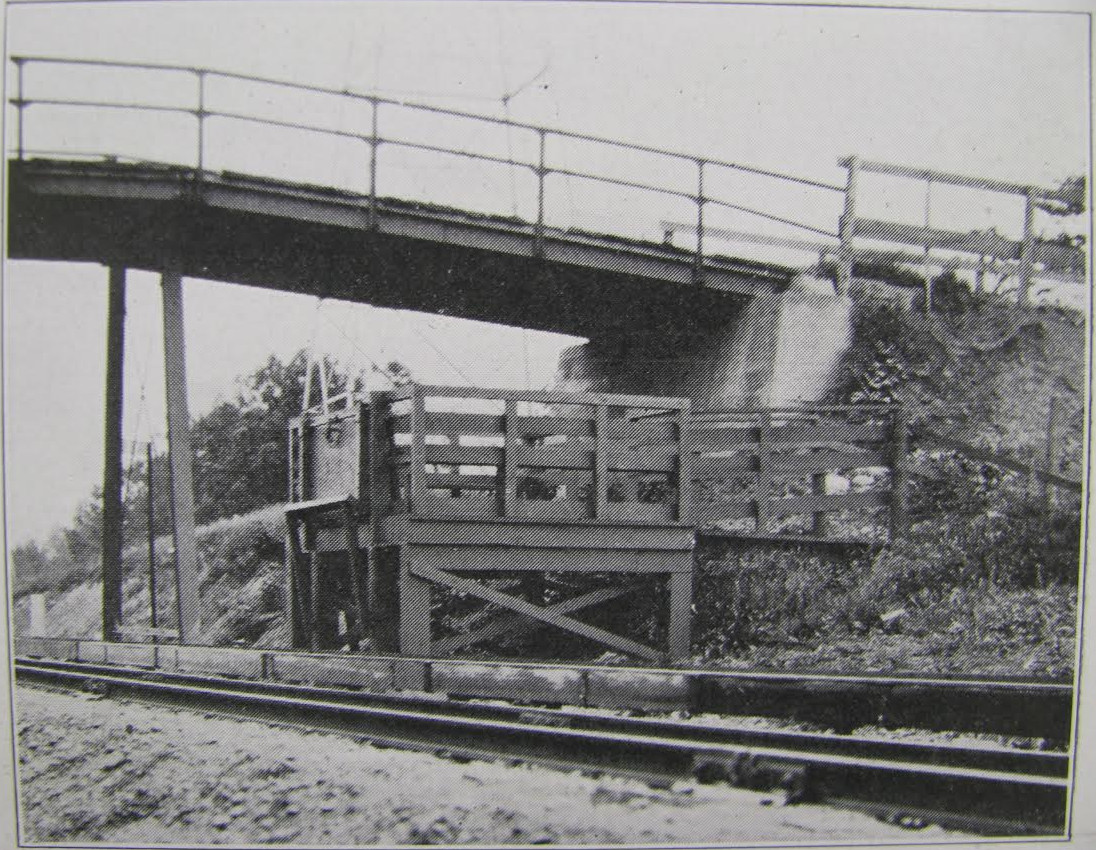
The track runs through a cut at this location. For now, one speculates that the structures are abutments for a
bridge, that would have been an overhead version of the "cattle crossings" commonly seen under roads, railroad
tracks, and interurban tracks. Today, there is no sign of an access road to the abutments, either from the
ground, or, as shown below, in satellite views from year 2013. No dates were found on the west side abutment.
The east side abutment is too damaged to make it worth even looking.
Left click on the images below for larger versions.
Approaching the abutments
from the north.
|
East side
|
East side
|
East side
|
West side
|
West side
|

West side
|
West side - bolts showing.
|
2013 satellite view
|
2013 satellite view
|
Typical highway bridge.
|
Typical bridge - perhaps a
farm bridge..
|
Several pairs of abutments have already been found along the line, but nothing to indicate there was ever a
road where the abutments exist. Perhaps they were for farm access across the cuts.
It's fairly clear the someone has tried to remove the east side abutment. There is too much damage relative
to the west side for this to be due to weather. Someone started to demolish the abutment,
and apparently found it was a massive job, and, for now, decided to just let it stand.
Fortunately, the west side abutment has escaped the same fate for now.
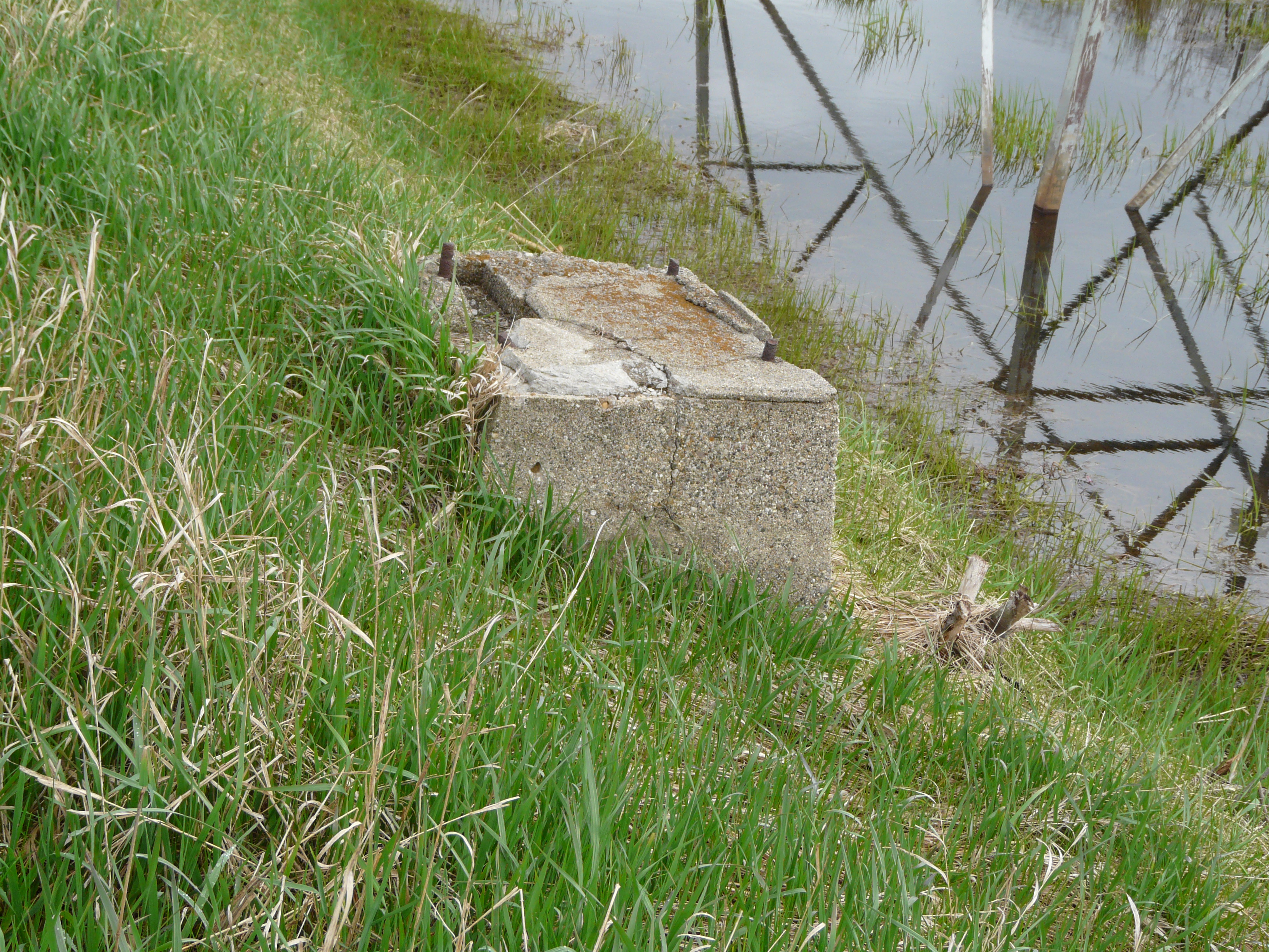
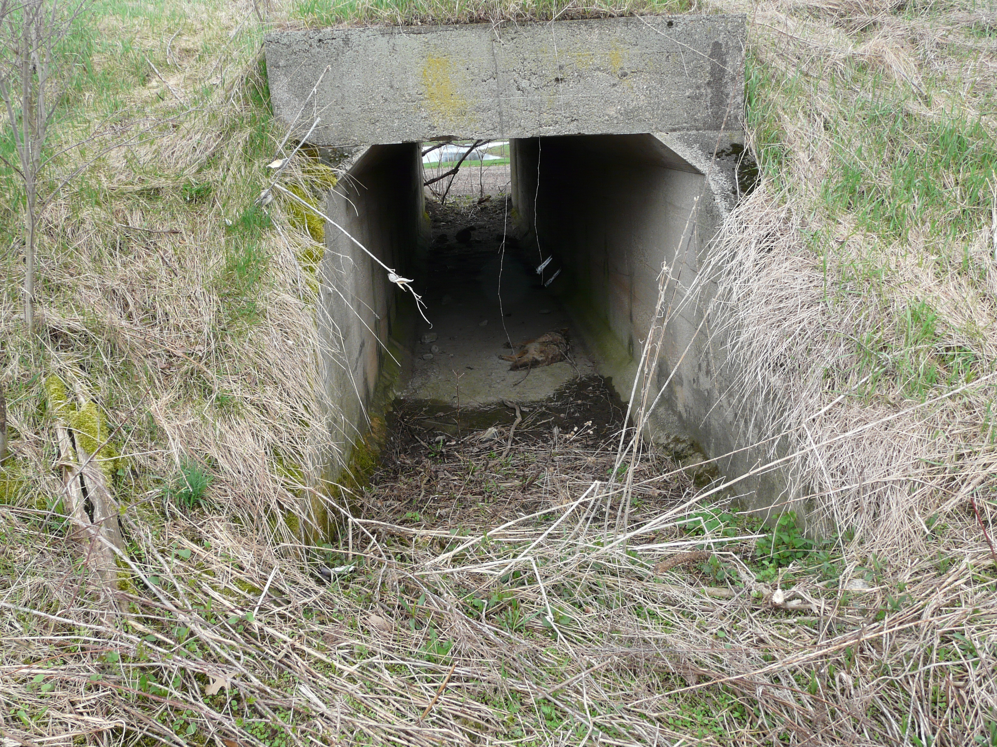
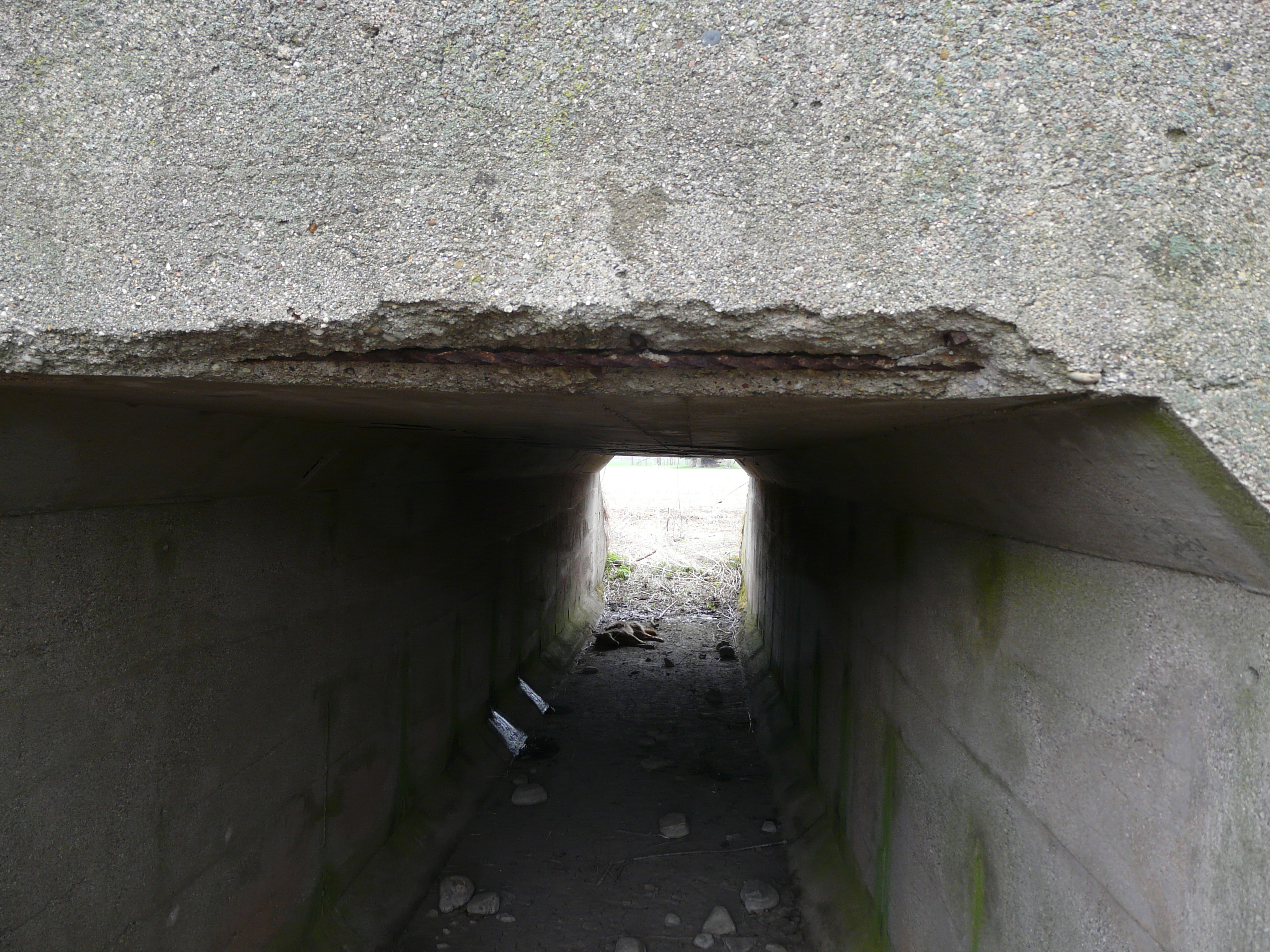
Steers Road - stop 28
Left click on the images below for larger versions.
About June, 2014
|
May 22, 2014
Steers farmhouse?
|
The image above, left, shows the location of what is likely Steers Road, called 120th Avenue in year 2014.
The farmhouse in the upper right hand corner likely belonged to the Steers farm. The brackets under the roofline
suggest it was built in about the 1860's. Abandoned as of year 2014, and earlier, it has now been thoroughly
vandalized, and if probably well beyond restoration. There is no indication of a structure by the interurban
track, so if there was one, it was likely nothing more than a way to get out of the weather.
Steers Road in 1917. 120th Street in year 2014. The photos below were taken on May 22, 2014. Alas, by this time
the grass and other vegetation had made it all but impossible to see any objects on the side of the ROW.
Left click on the images below for larger versions.

Looking north from 120th Street.
|
Looking south from 120th Street.
|
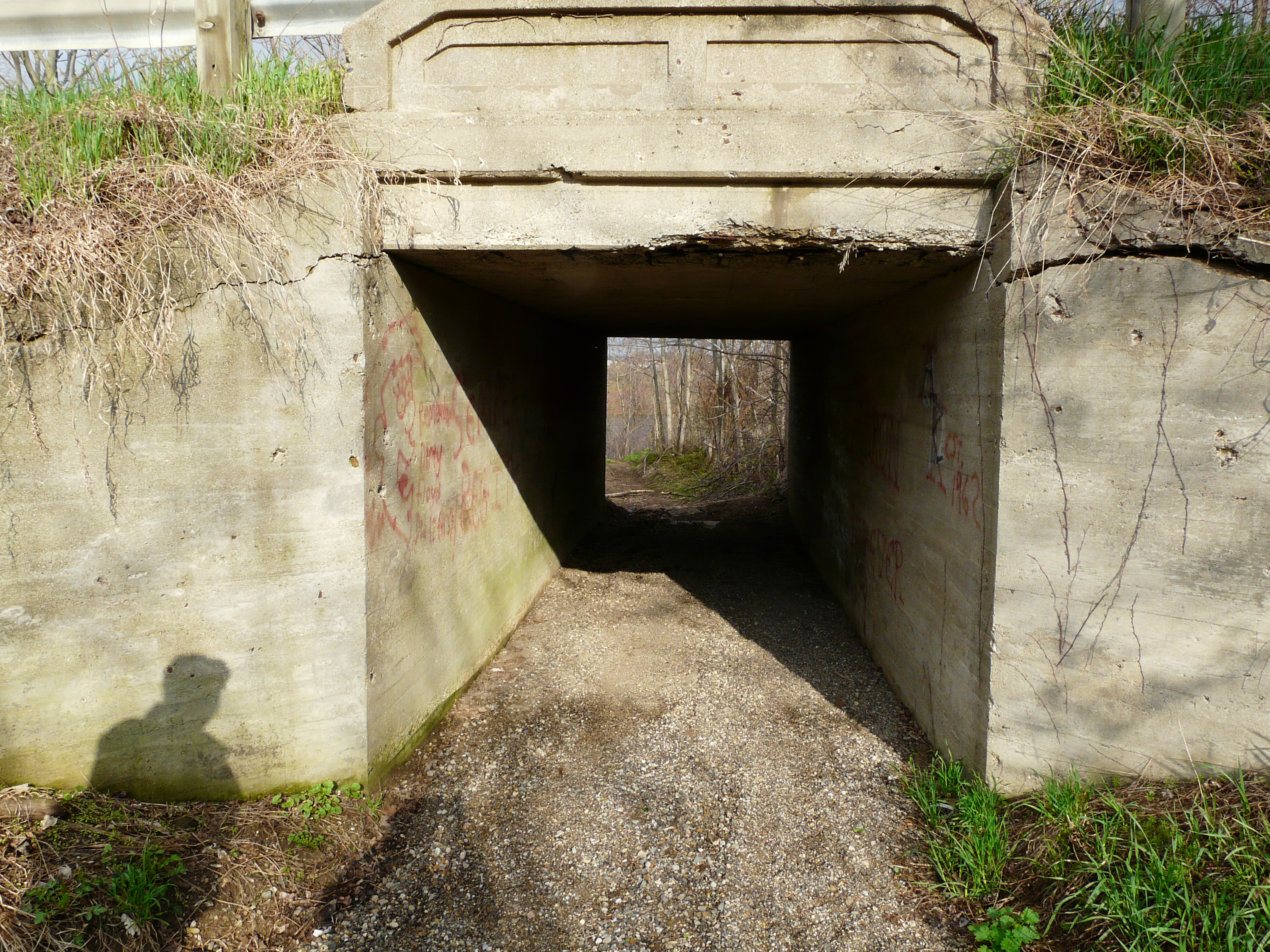
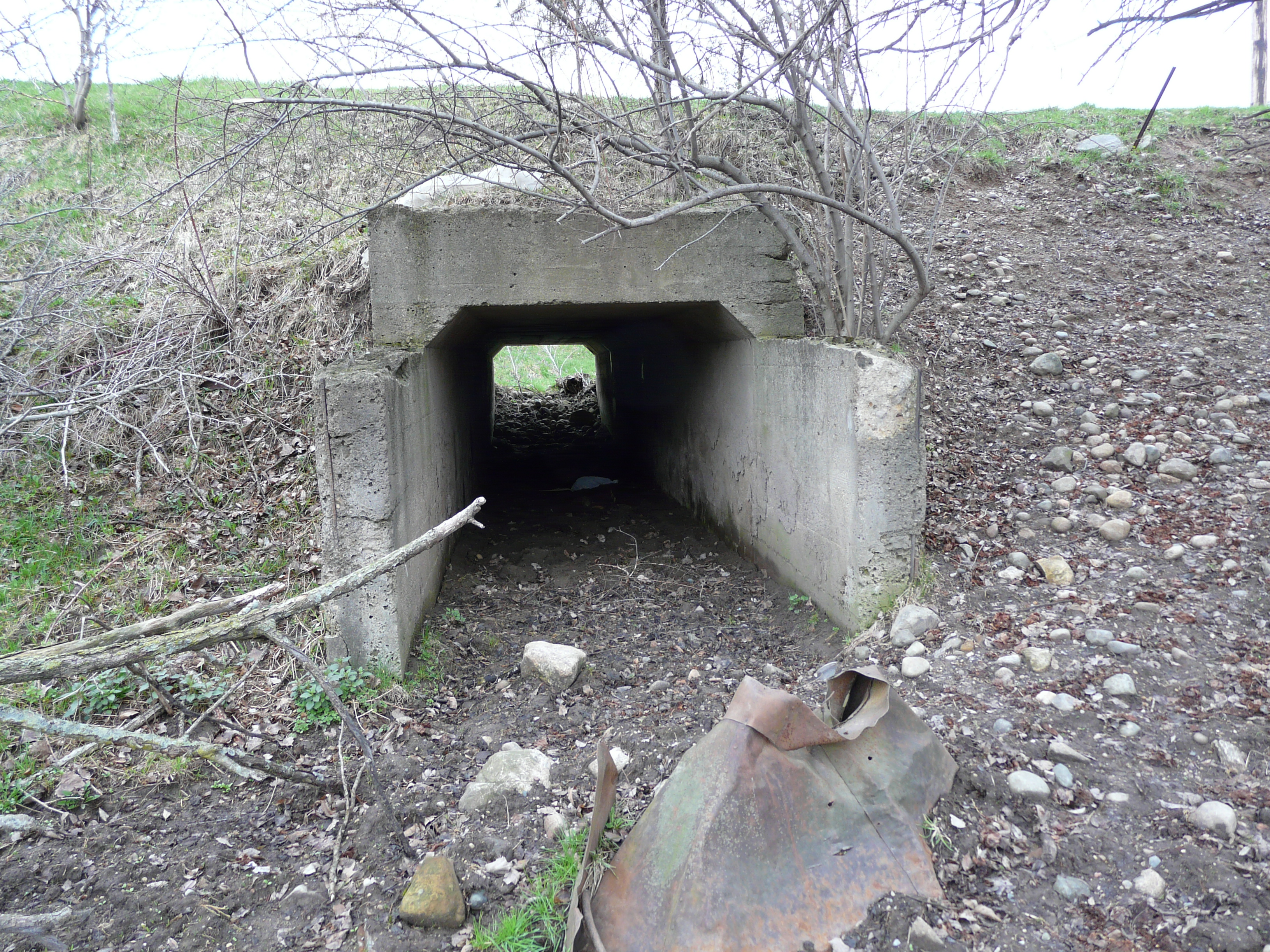
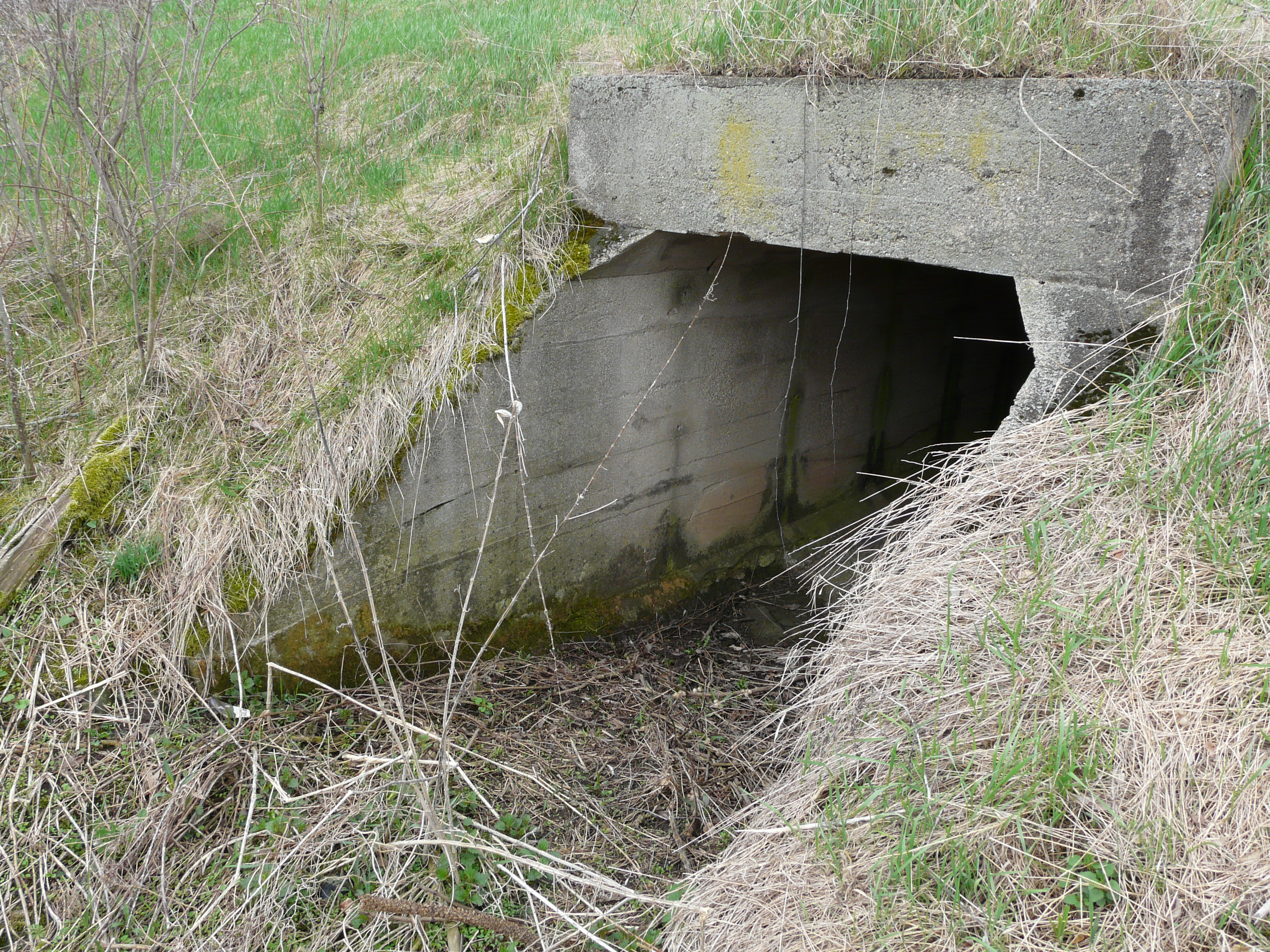
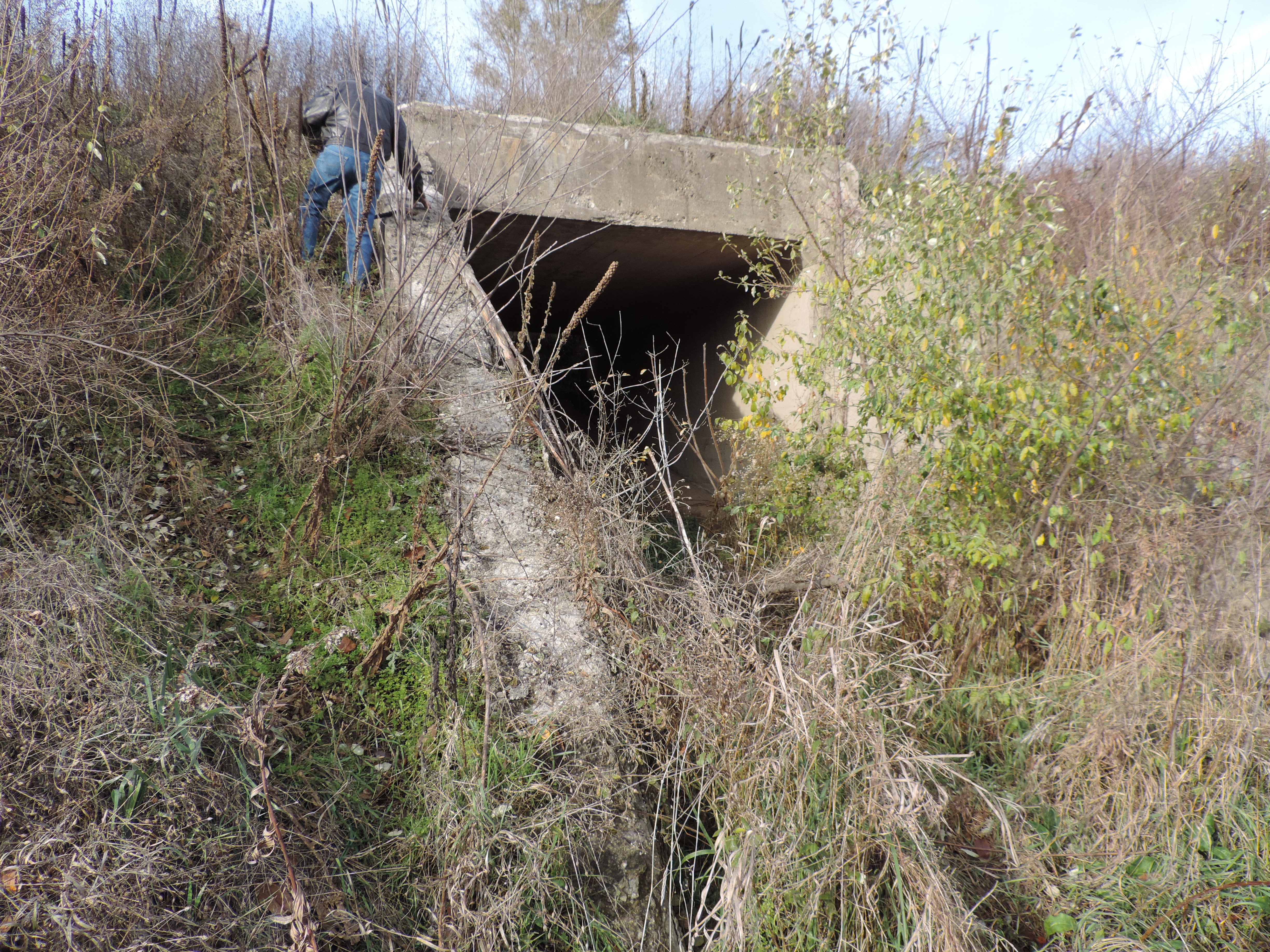
A dual culvert found south of 120th Street. This can be seen in year 2014 from Division Avenue. While the bottom
of each side has filled with trash and dirt in the intervening 98 years or so since construction, the sides and top
look like they could have been poured recently. No dates were found. Just why it was decided to use a dual tunnel
culvert is not known. There's nothing obvious today to support that much capacity, but of course many things were
during the construction period of 1915 or so. The photos below were taken on May 22, 2014.
GPS coordinates: 42.565163 -85.643845
Above are the approximate coordinates of the culvert. Going straight east to Division Avenue one can see the
culvert, when the field is clear.
Left click on the images below for larger versions.
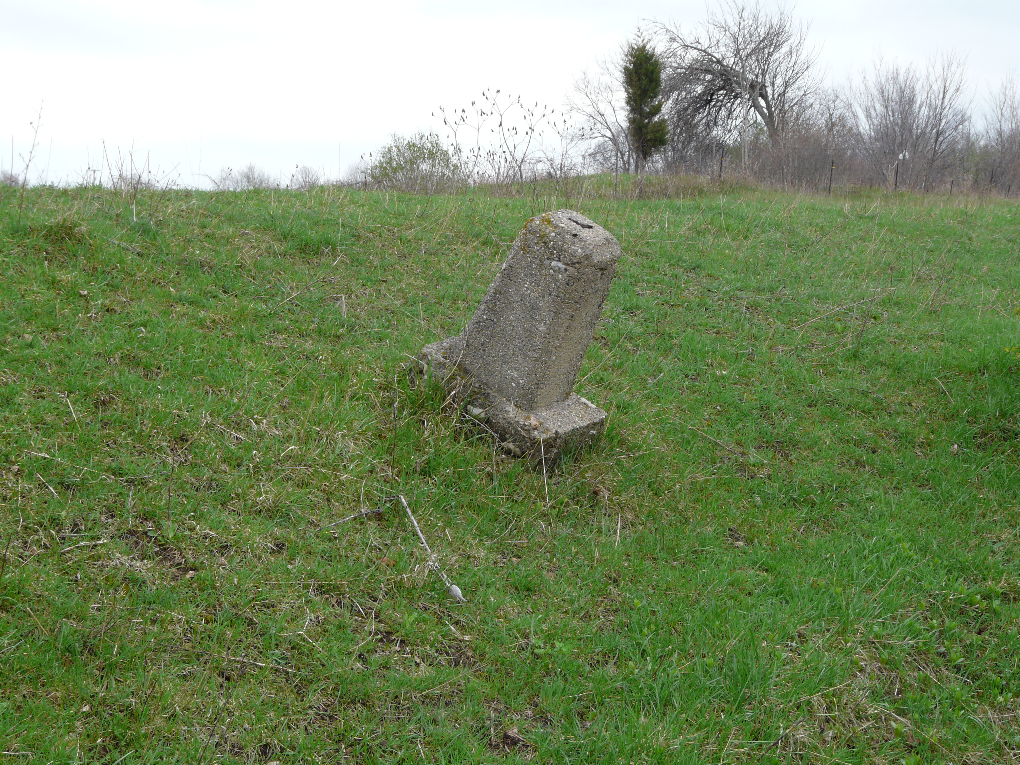
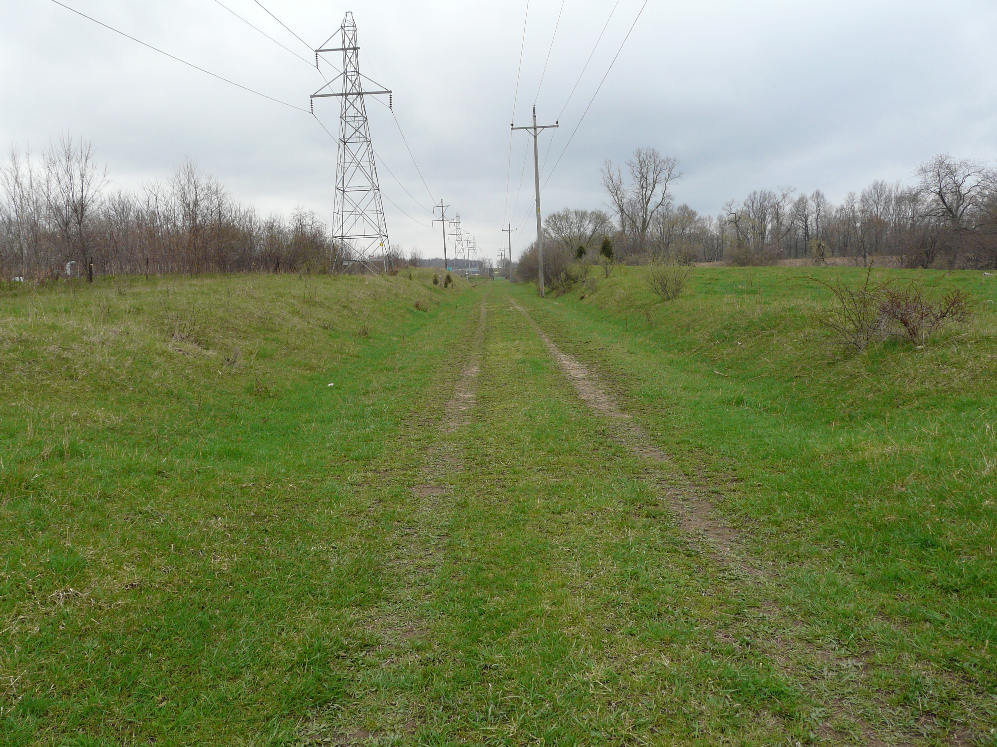
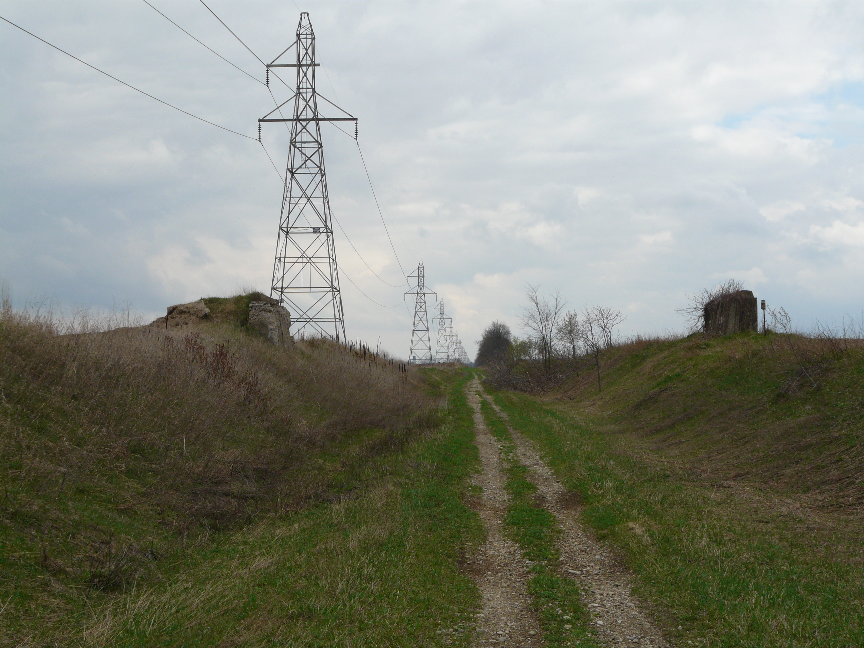
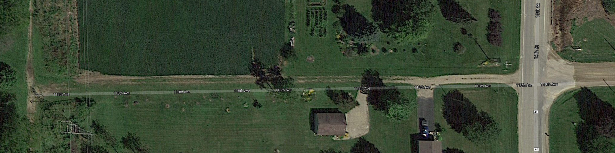
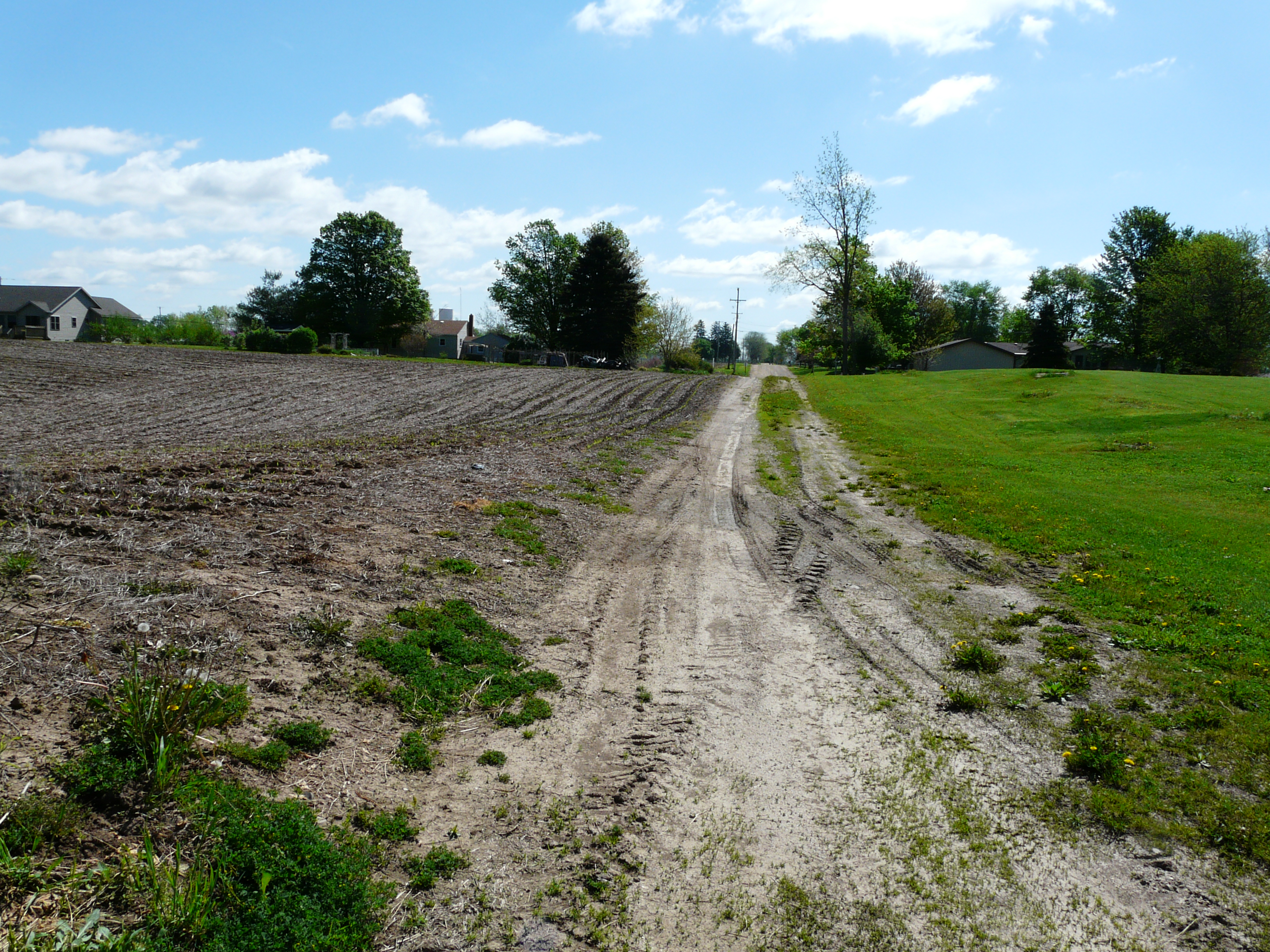
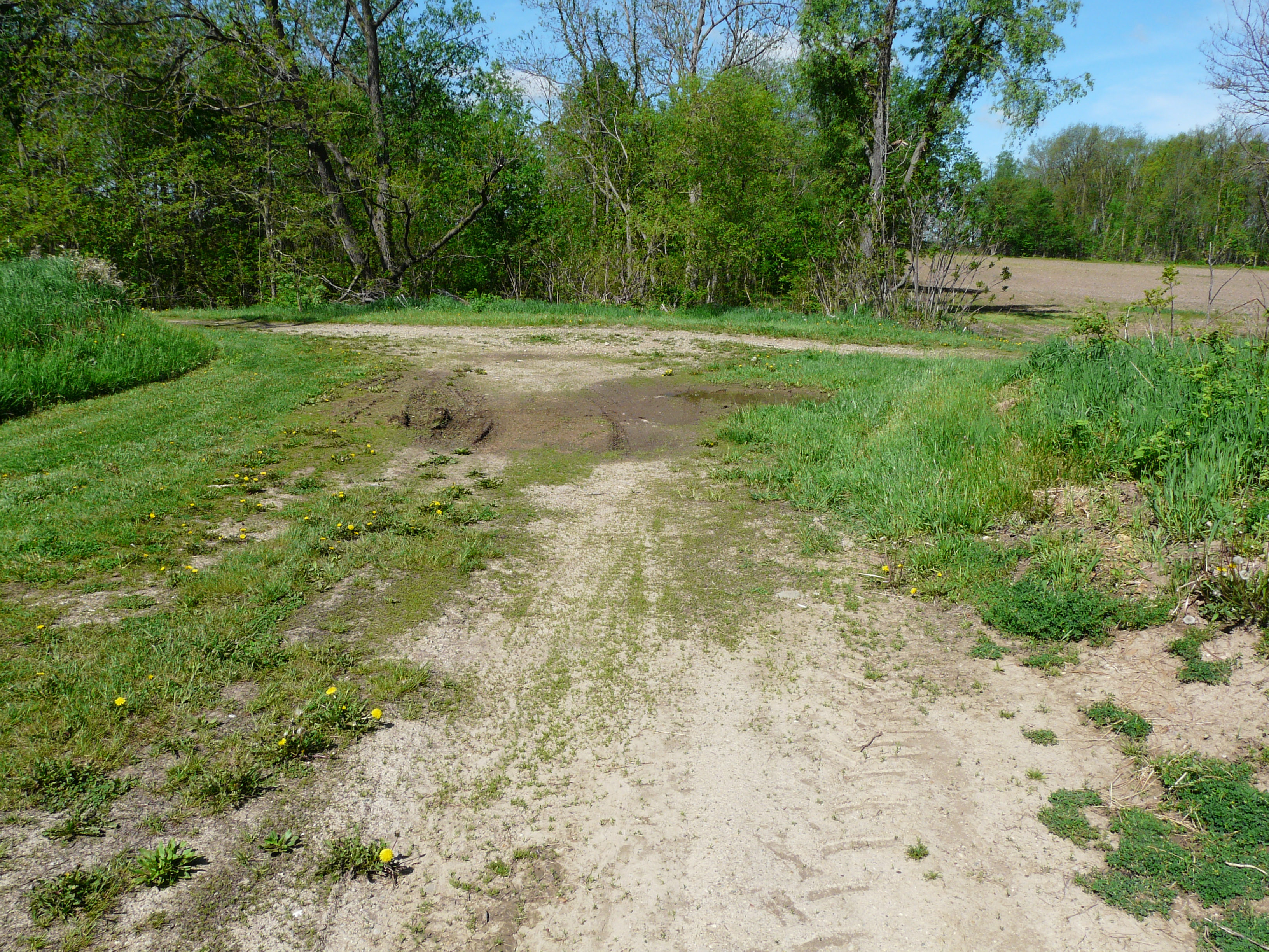
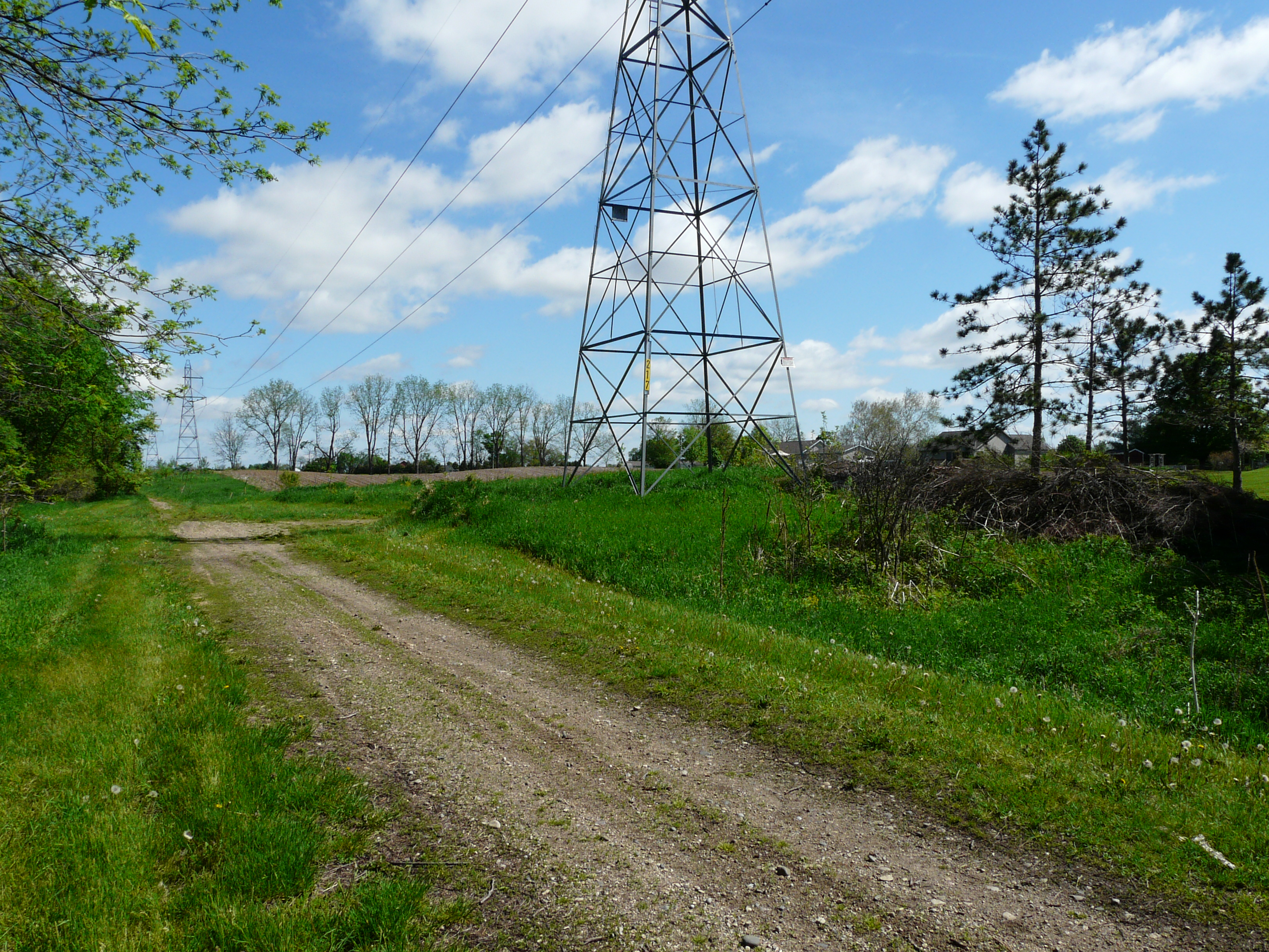
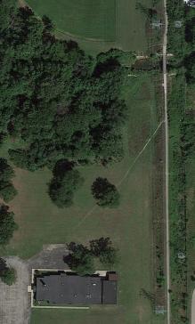
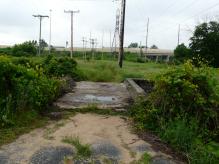
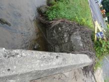
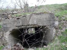
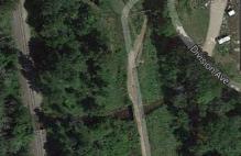
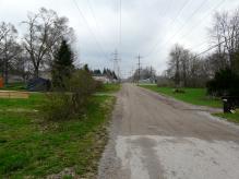
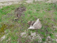
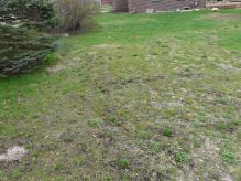
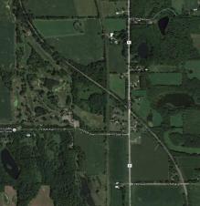
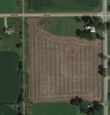
Carpenter Farm - stop 27
Carpenter farm in 1917. 118th Street in year 2014. The road was apparently not maintained after the interuban
line failed in 1928. It seems to be just a farm road in year 2014, providing access to the interurban track bed,
which many farmers now use as road. See the satellite view below. 118th Street is clearly maintained east of
Division Avenue. There is some evidence that there was a structure in the northeast corner of the intersection of
the track and 118th Street. The vegetation is thick, but one lone block was found. It was not a stop with an agent, but might have have been some other kind of structure.
Left click on the images below for larger versions.
Satellite view - 2014
|
Looking east from just east
of the interurban track.
|
Looking west from just east
of the interurban track.
|
View of 118th Street from
south of the intersection.
|
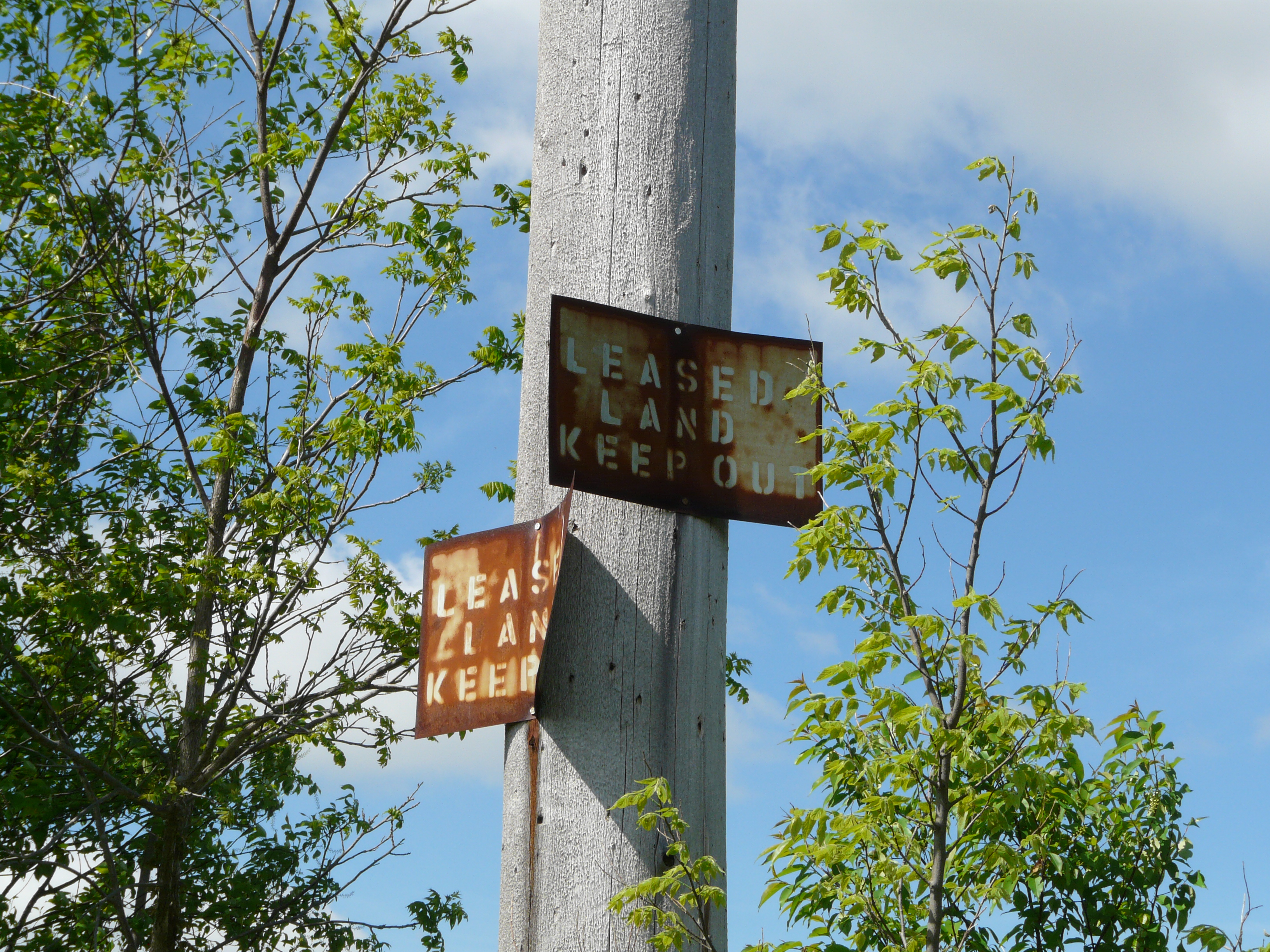
South of stop 27 there are leased land signs, and threats to keep out. The signs are clearly quite old, and it's
not clear they are still in effect.
Left click on the images below for larger versions.
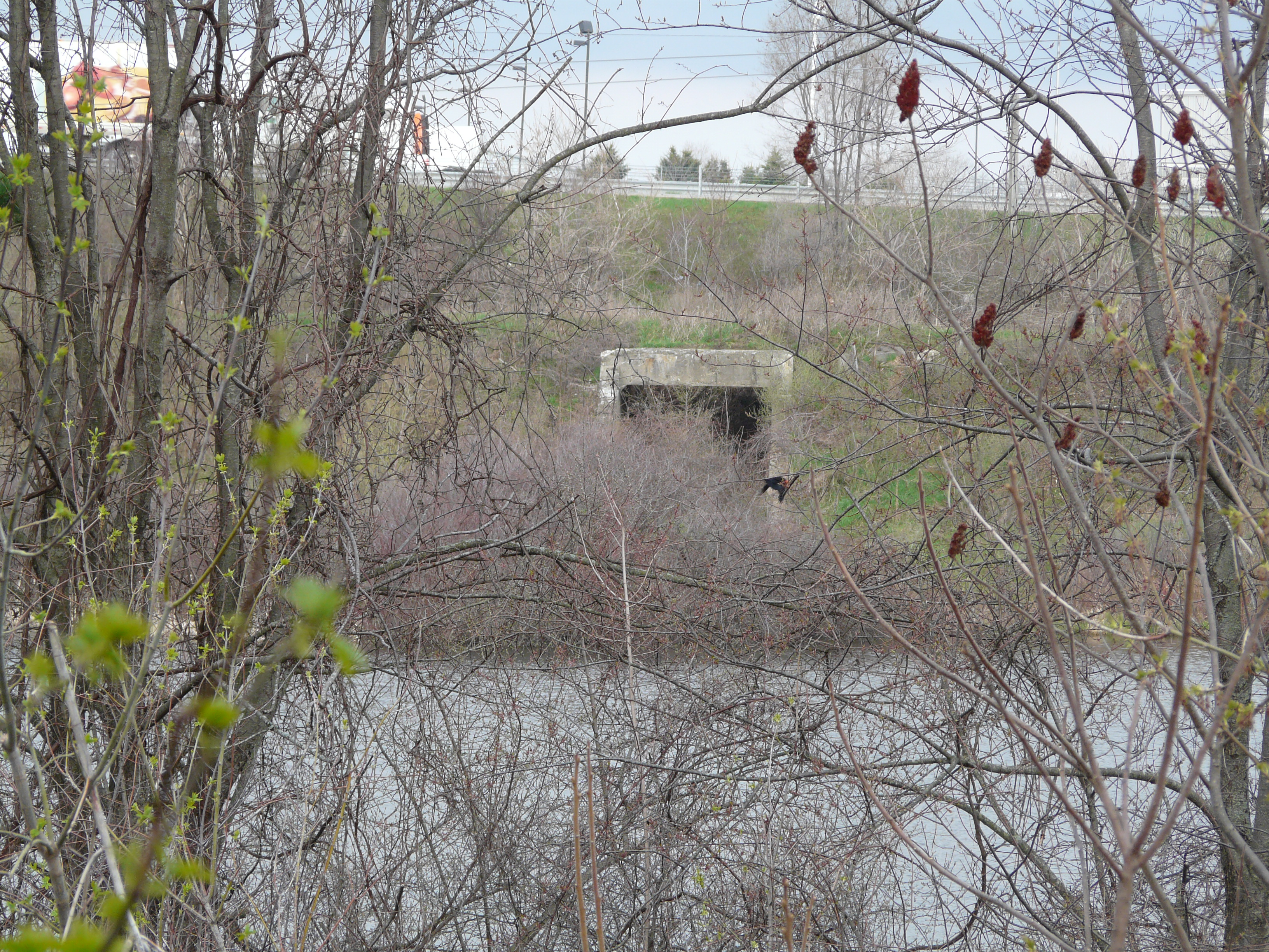
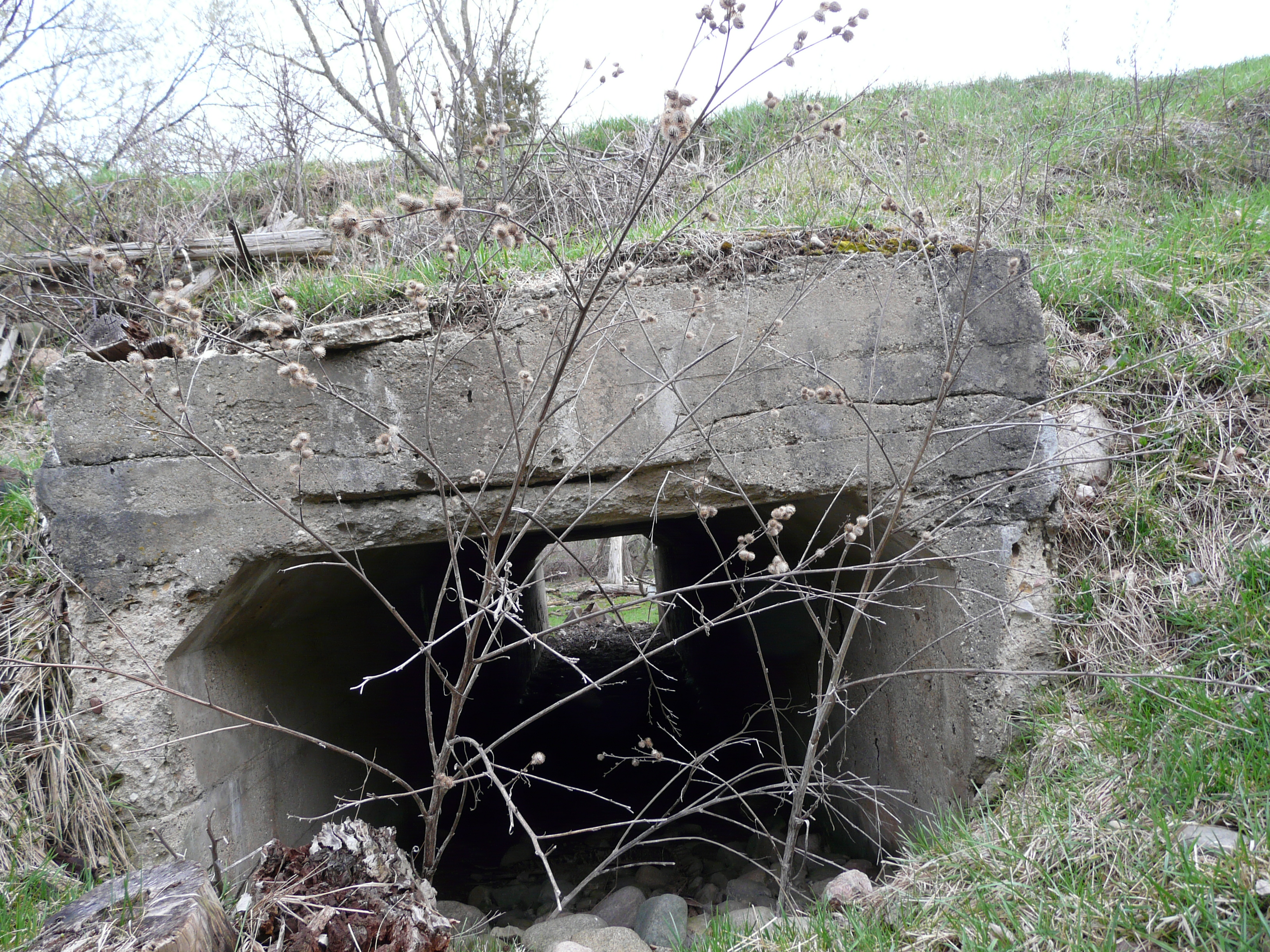
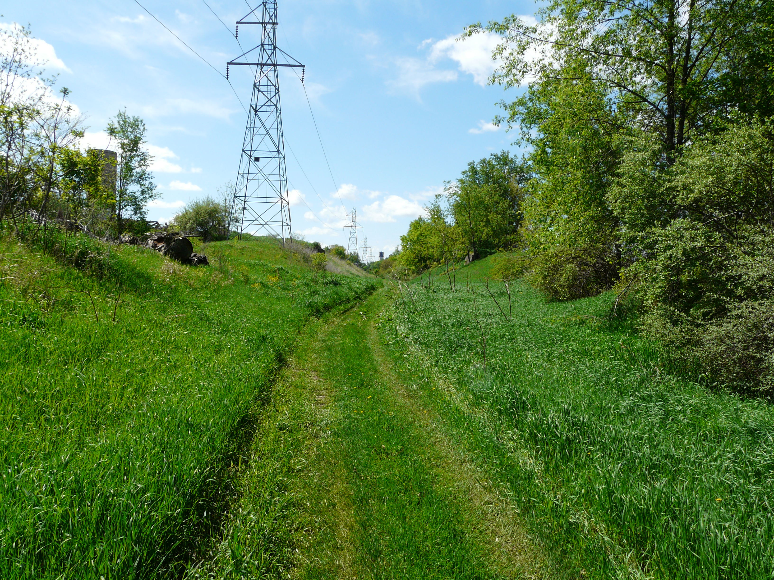
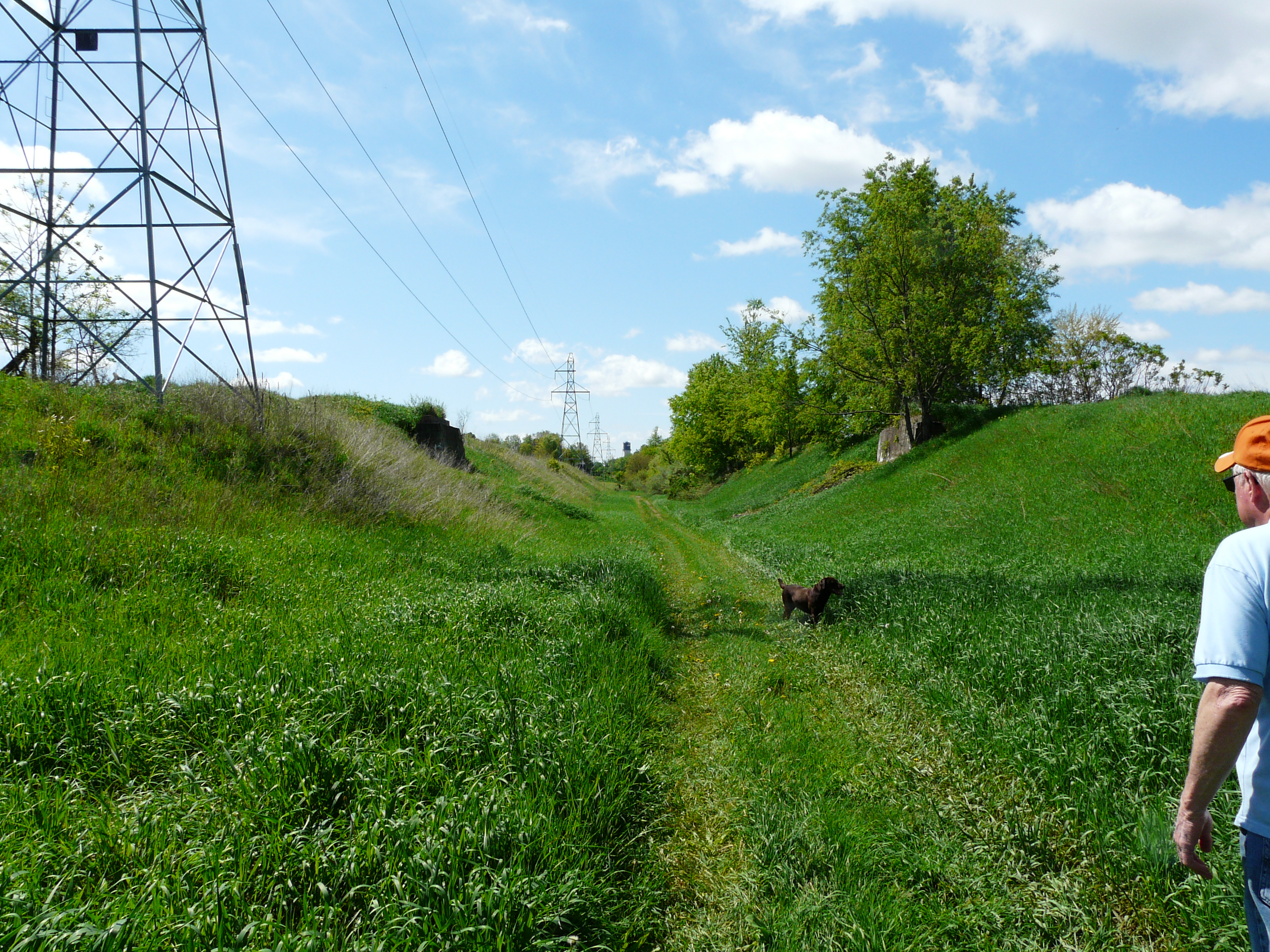
One proceeds through a long cut, and eventually encounters a derelict farm. Such a situation is ripe for a
bridge, and sure enough one can see abutments ahead, just slightly beyond the next tower.
GPS coordinates: 42.548295 -85.643389
Left click on the images below for larger versions.

Bridge abutments in the distance.
|
Approaching bridge abutments.
|
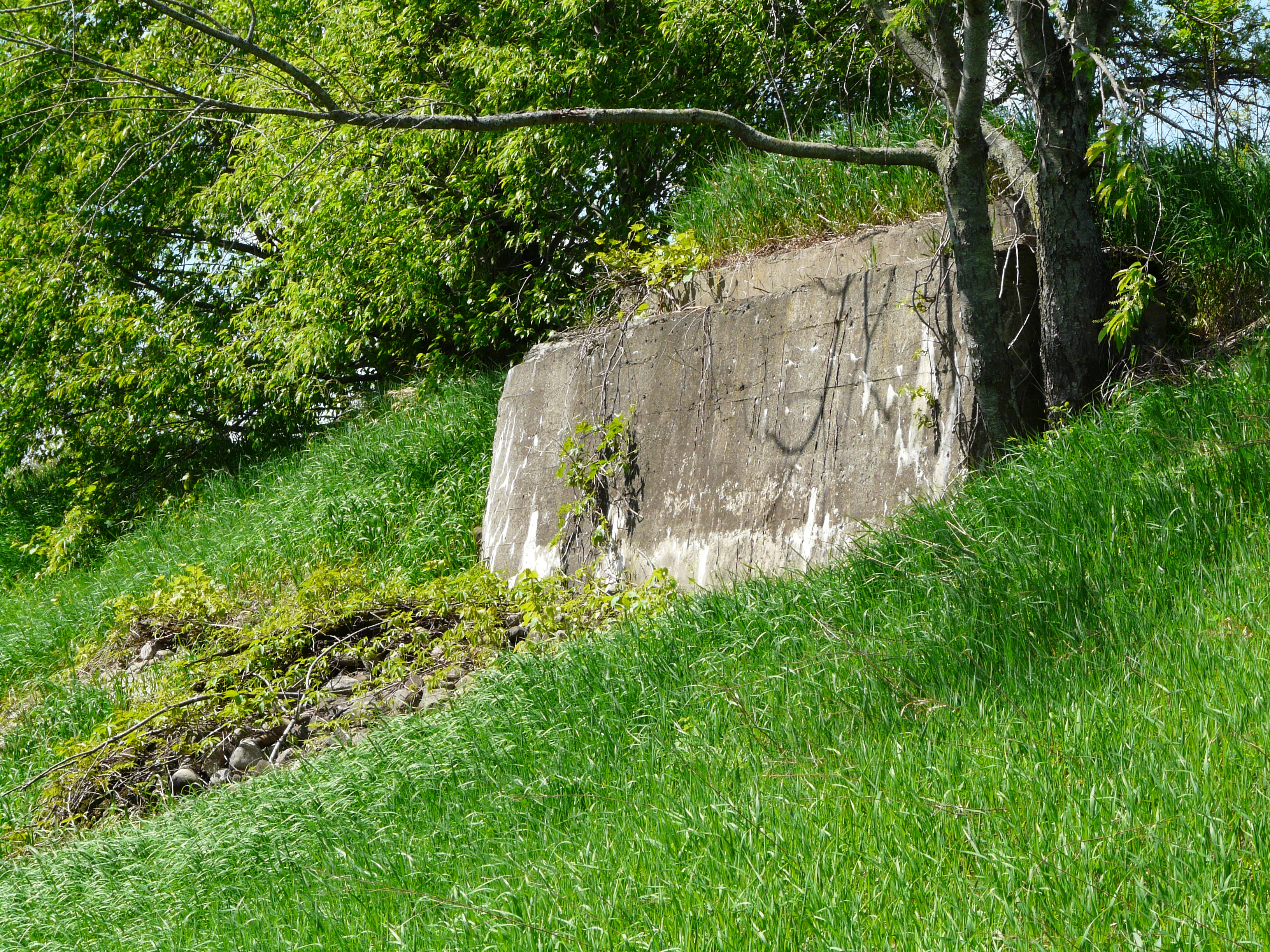
East side bridge abutment.
|
West side bridge abutment.
|
Conext of abutments.
|
The image showing the context of the abutments provides no hint as to how any bridge might have been used,
assuming one was ever put into place. There's no hint of a former road to and from a bridge on either side
of the ROW. A now derelict and partially razed barn on the east side appears to stand in the way of any road.
Slightly south of the bridge abutments the track bed is obscured by people having taken the track bed for their
personal backyard. Whether this is with the permission of the power company is unknown. It's likely the
power company has no frequent need for access to the towers, so perhaps this has just happen. The view is as
below.
Left click on the images below for larger versions.
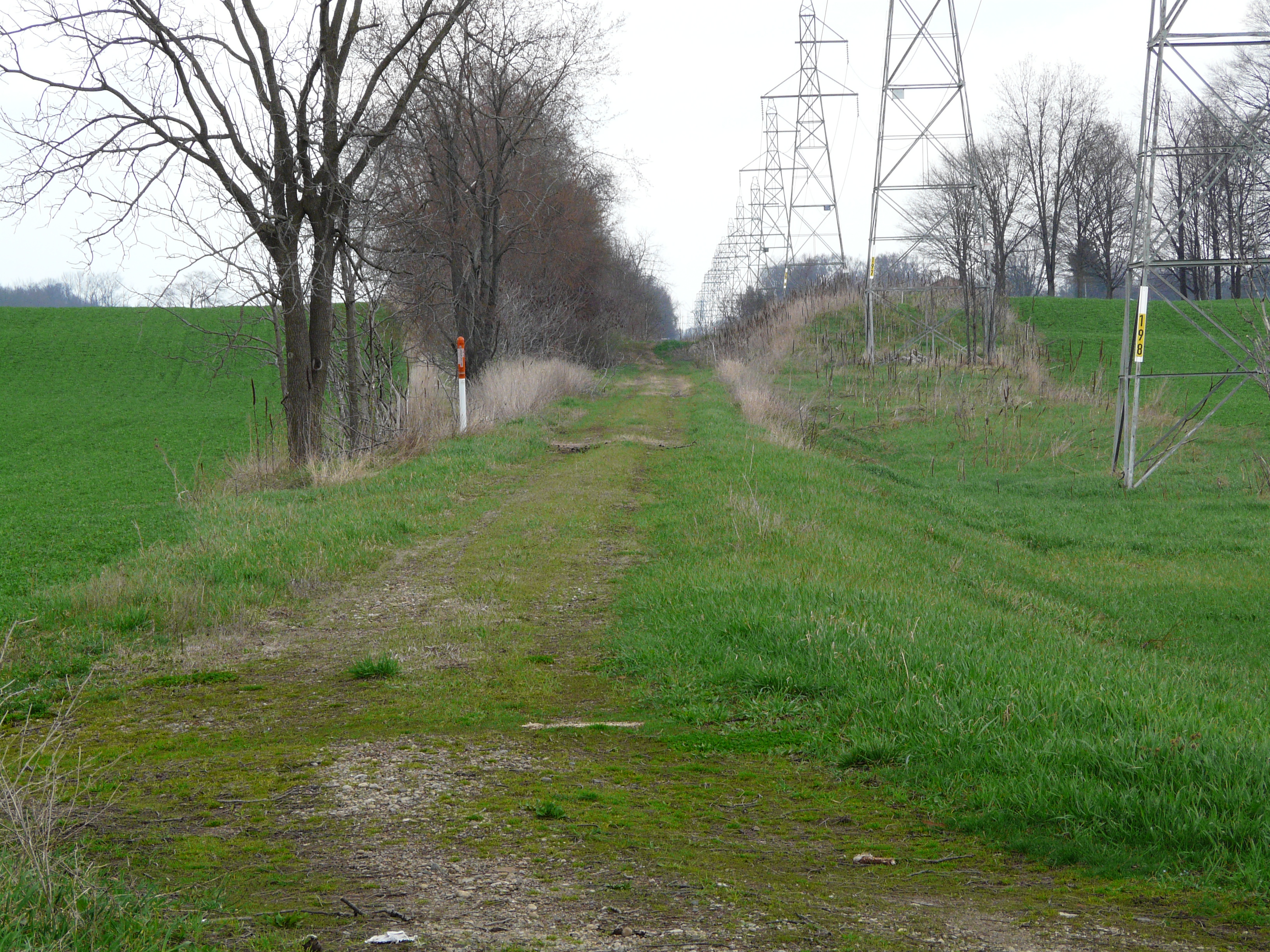
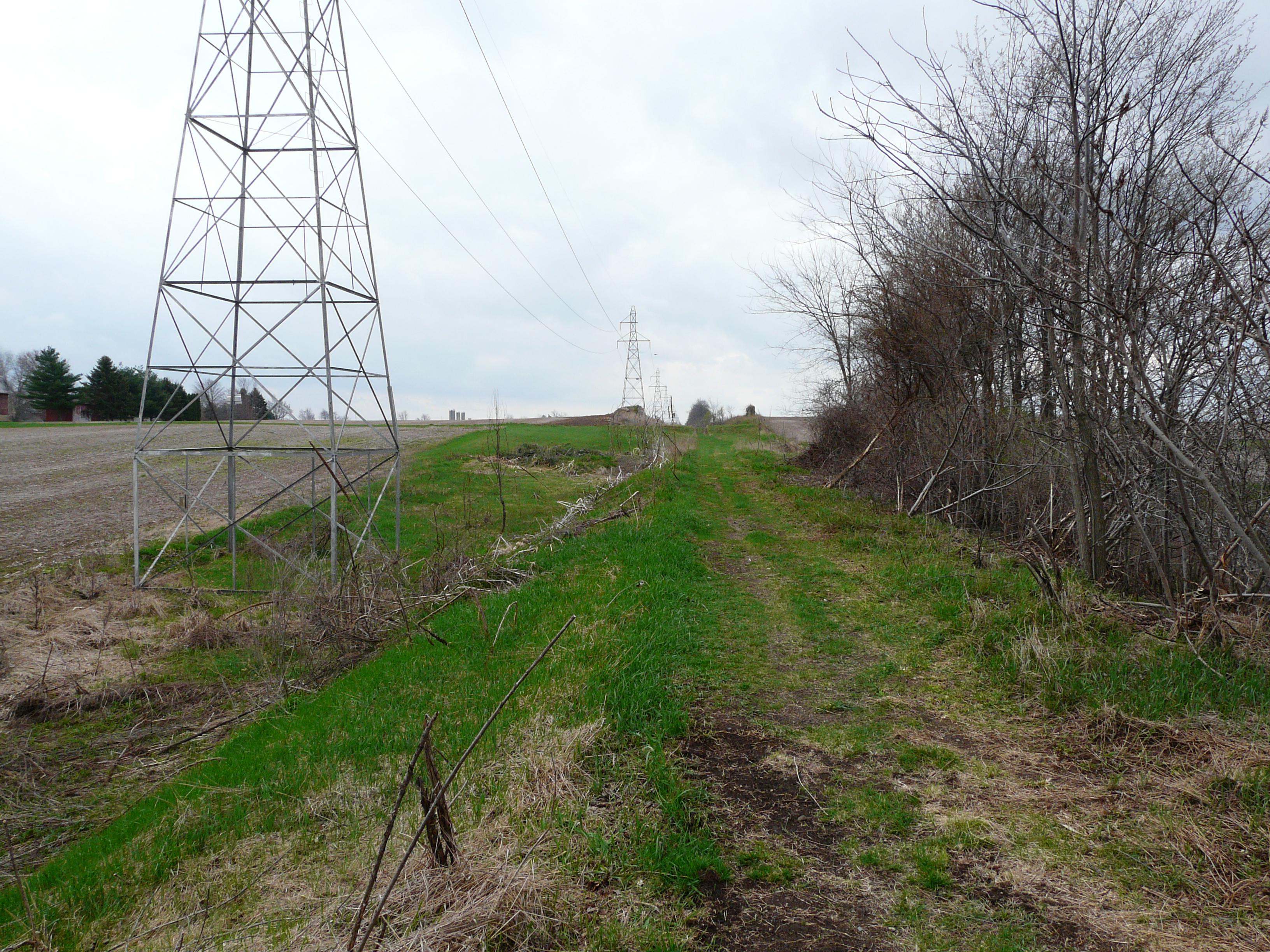
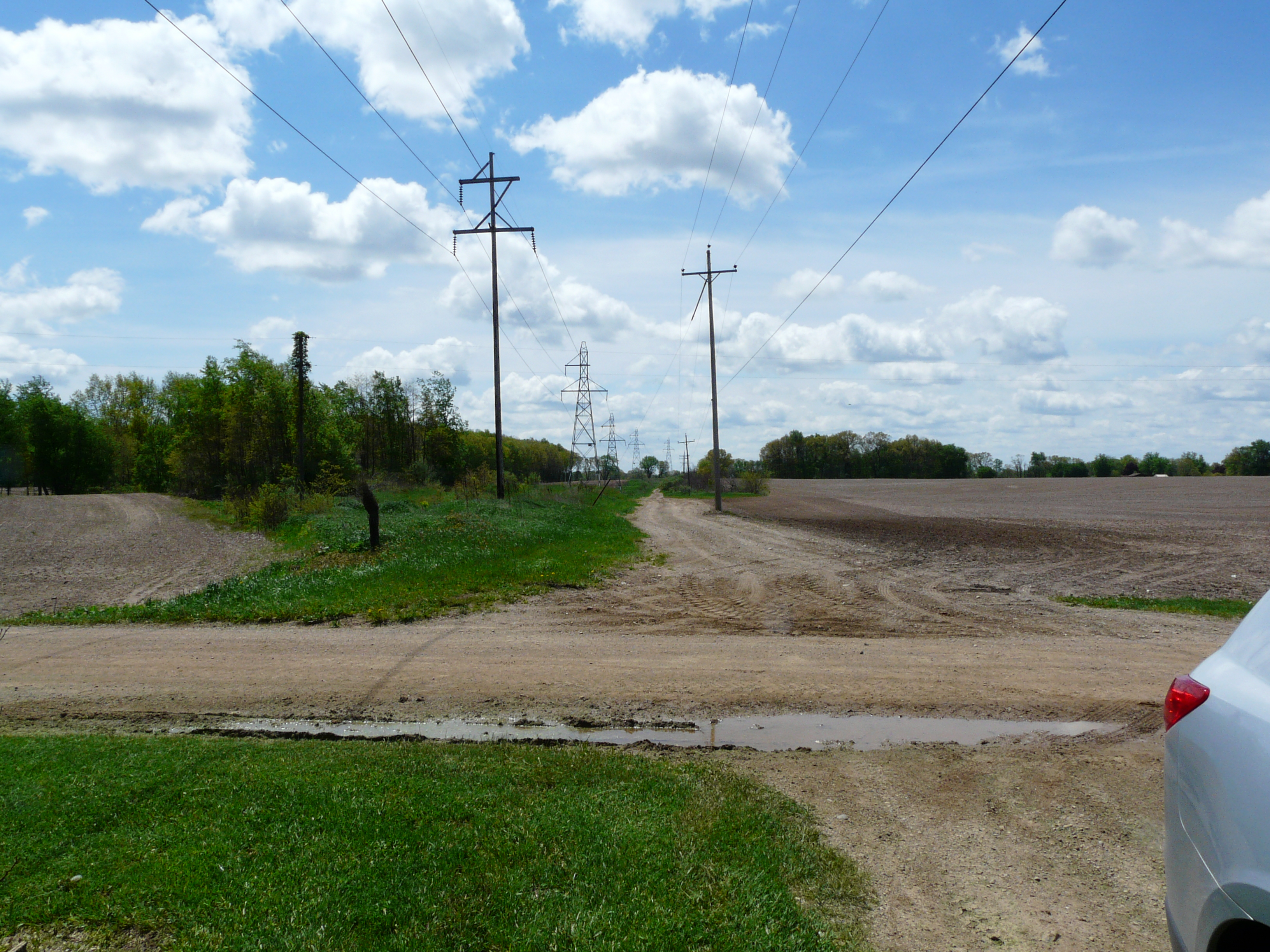
Unnamed - stop 26
It's unclear where this stop was. By a farm or farms? Perhaps a 1920 or so plat map can suggest
where the stop was. Or perhaps it was a flag stop.
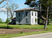
Martin - stop 25
116th Street in year 2014
Left click on the images below for larger versions.
|

Foundation of the original
location of the house/depot.
|
The house, in year 2012, that
served as the Martin depot.
|
2012 satellite view.
|
The photograph at the left, above, clearly shows where the house that served as a depot,
shown in the middle above, was located. One can still easily see the outline of the
foundation, as well as a sidewalk, that for some reason has survived as well.
GPS coordinates of the foundation and sidewalk: 42.537218, -85.64021
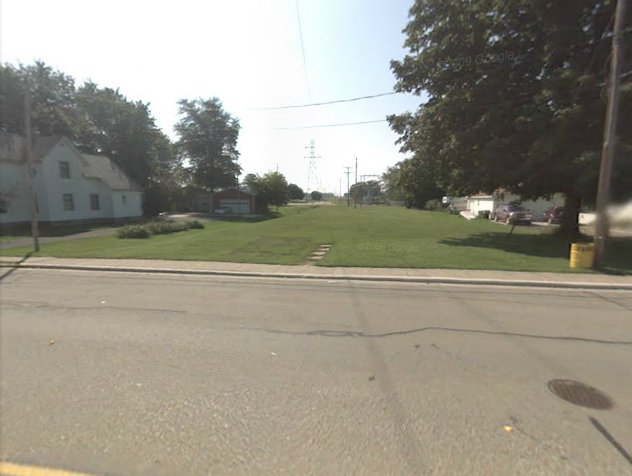
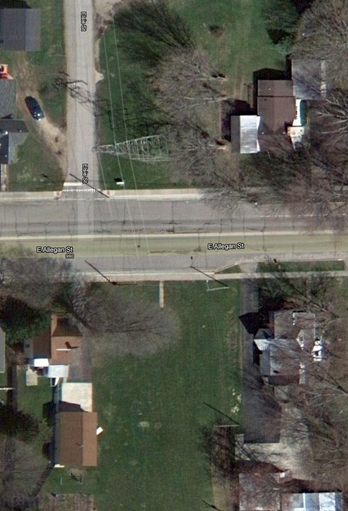
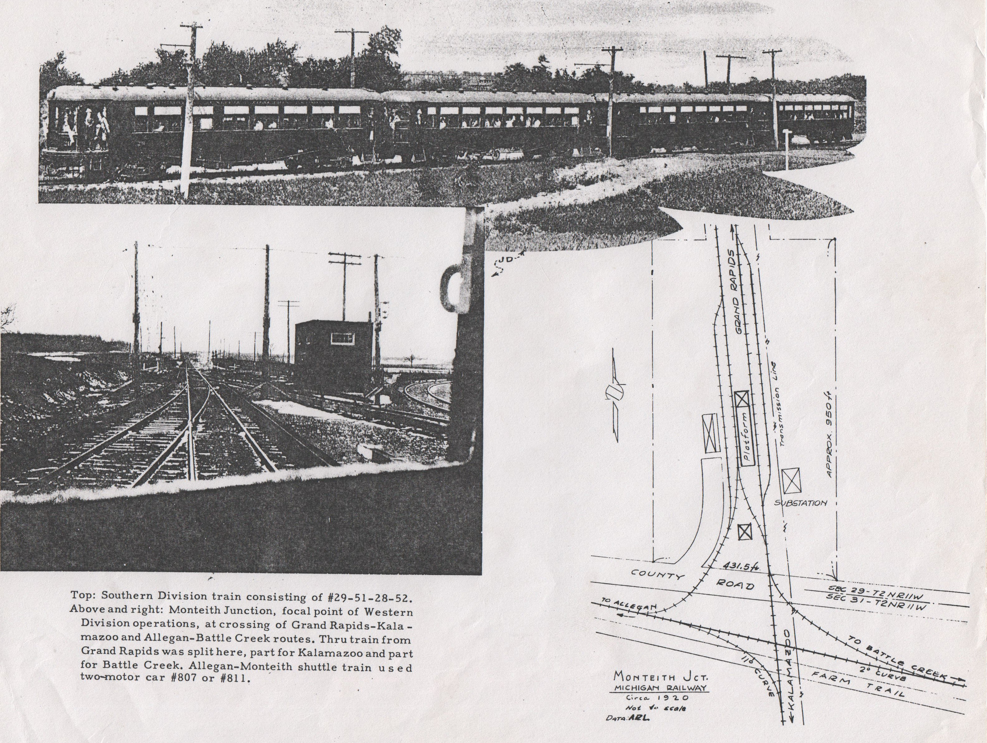
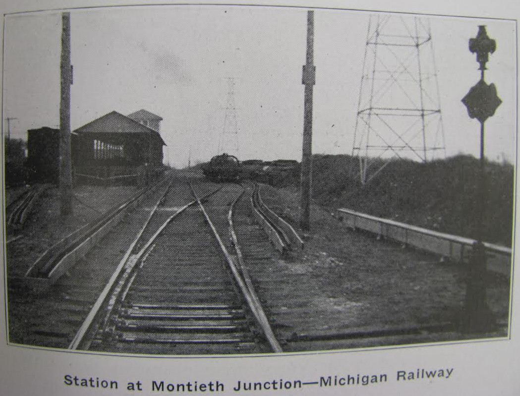
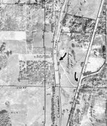
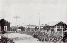
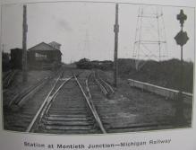
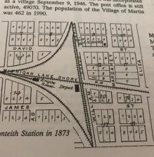
Monteith Junction - stop 24
Left click on the image below for a larger version.
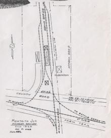
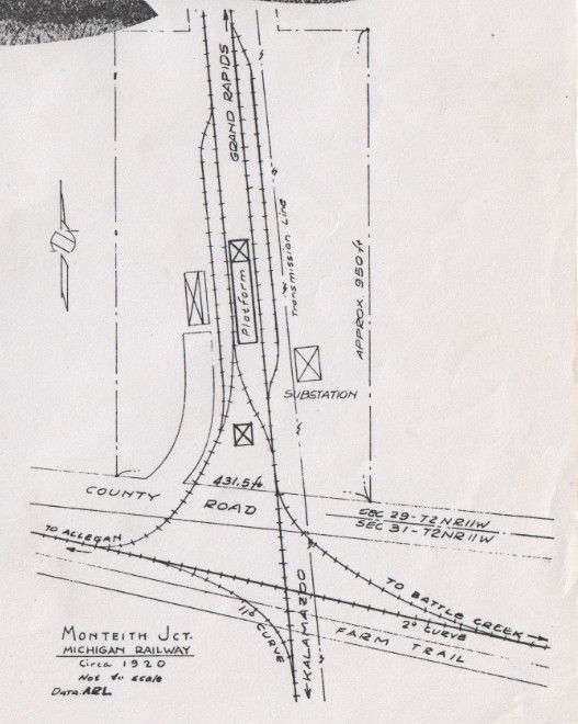
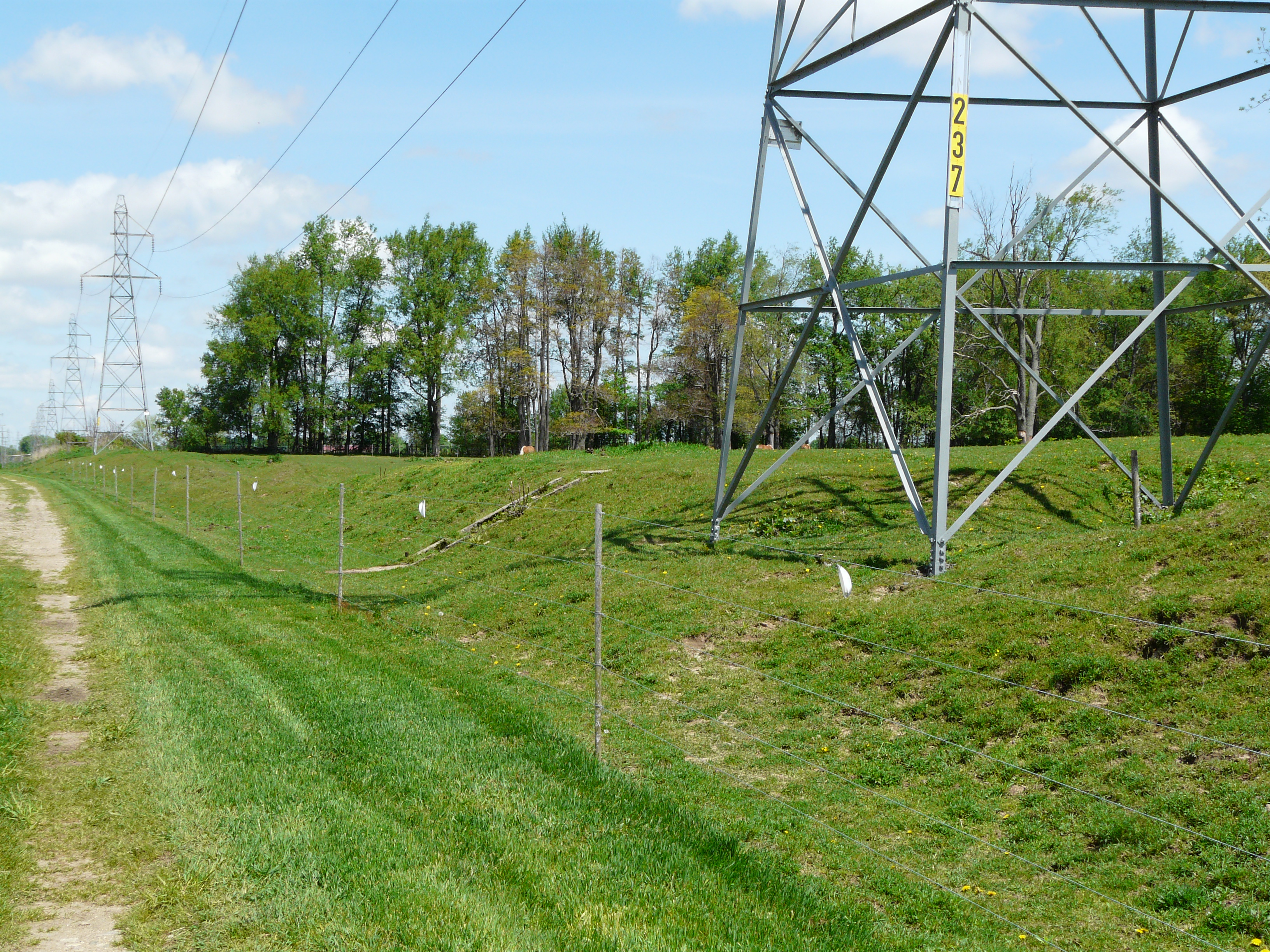
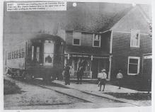
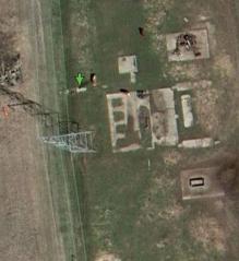
c1920, the map above shows part of the interurban complex at Monteith Junciton. In year 2016 there is nothing left.
Even the concrete foundations have now been removed.
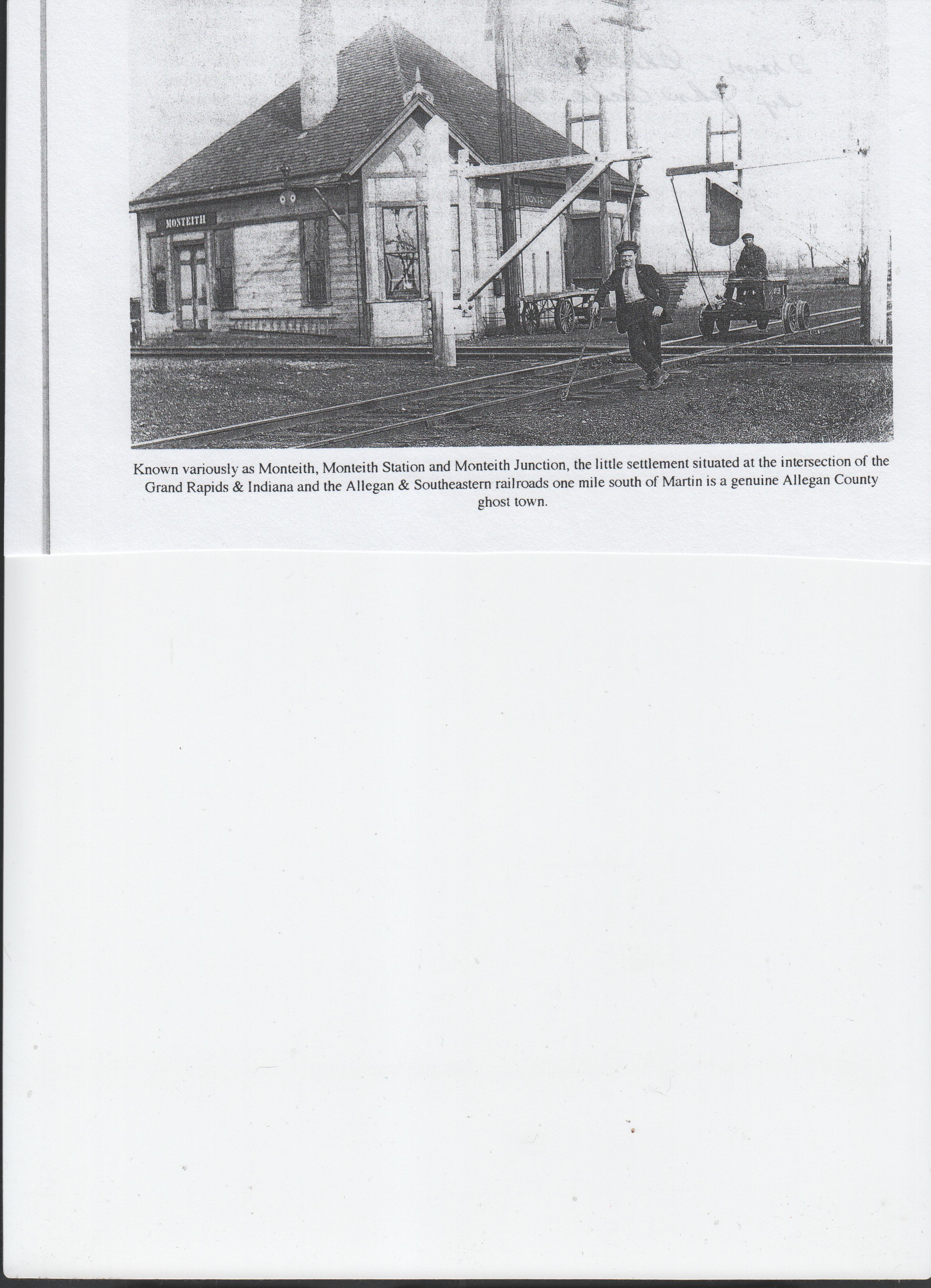
Historically, Monteith Junction was called Monteith, Monteith Station, and Monteith Junction. The Monteith family
loomed large in the area at one time. There was a settlement at one time, but as of year 2016 essentially nothing
remains. One can see outlines of the various tracks in satellite views. But today even the concrete foundations of the ddepots and other structure have been taken out by the owner of a horse farm. Below, one can see the piles of concrete from the foundations. Once removed, only the power lines, which pre-date the interurban, will indicated where the interurban ROW ever was.
Left click on the images below for larger versions.
Part of an 1895 Rand-McNally
railroad map, showing Monteith
and two railroad tracks.
|
Part of a 1916 Allegan County
map, showing Monteith & two
interurban tracks.
|
Map - c1920
|
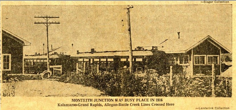
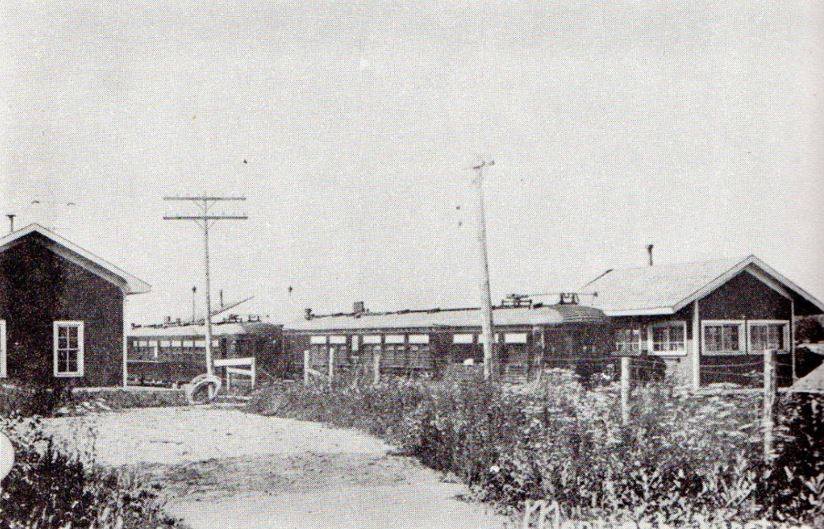
Monteith Junction - 1916
|
Monteith Junction - 1916
|
Monteith Junction - c1916
Tall structure at the left, back
of lower building, is likely the
depot.
|
Monteith Junction - depot
|
Kalamazoo Gazette - Dec 28, 1969
|
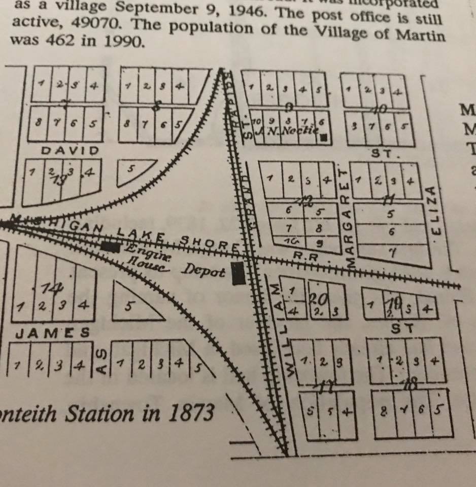
1873 - GR&I and LS&MS tracks
cross, and land plaatted.
|
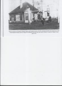
Monteith Junction depot at
cross of tracks. Undated.
|
Below is shown some of the foundations for the various structures in Monteith Junction, both in satellite and ground
views. With without permission, the foundations under the power lines, once owned by Consumers Power, have been removed.
Monteith Junction - 2014
Same tower as in photo at
left. Steps just beyond.
|
Steps to other depots.
|
Satellite view of steps.
2X resolution.
|
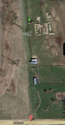
Satellite view of steps. Green
arrow. 114th Ave at bottom
|
May 22, 2014 - foundations gone.
|
Depot complex foundations removed
as of May 22, 2014. West side
foundation seen at left edge of
pile of rubble.
|
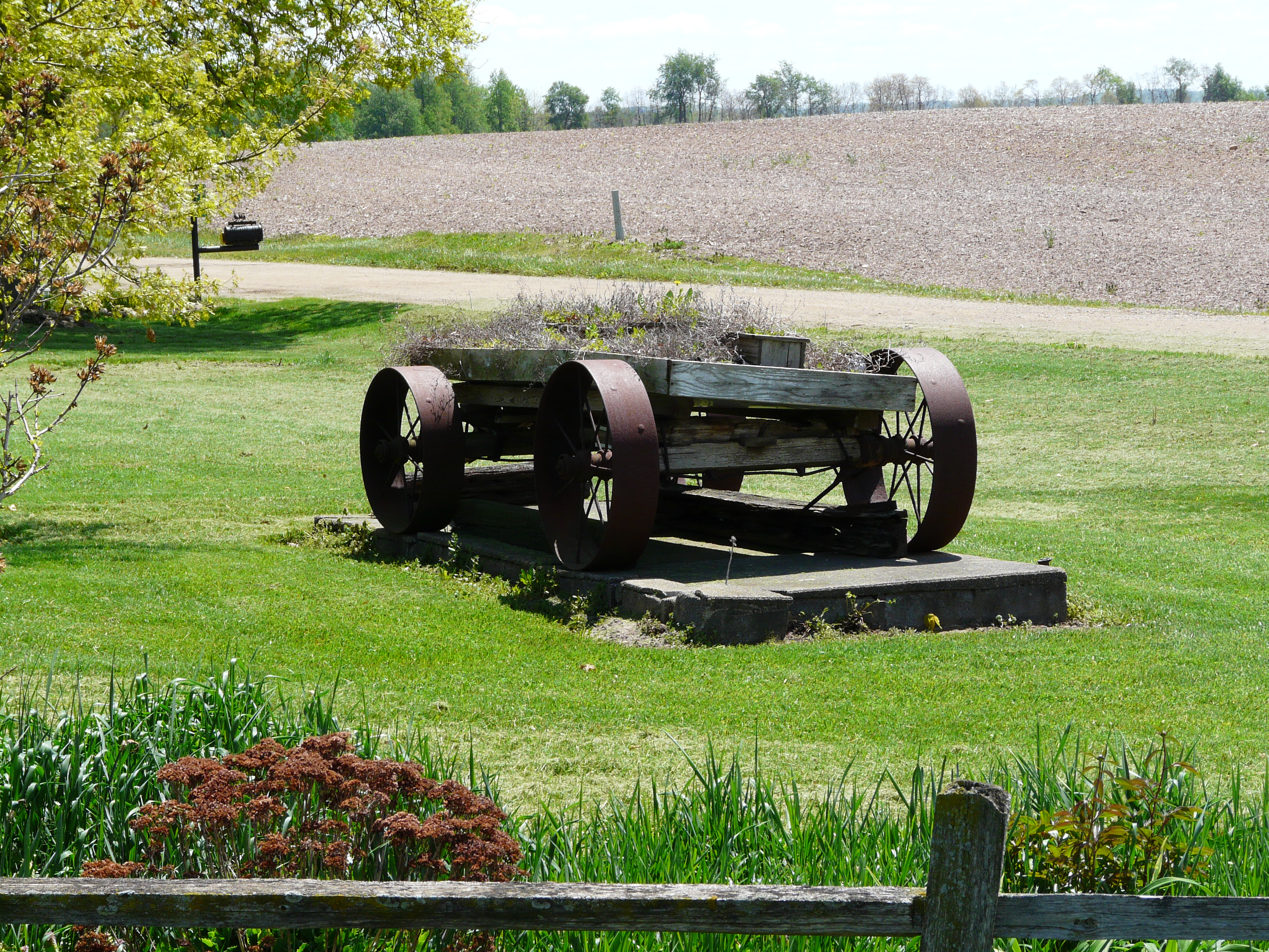
Wagon on a foundation.
Probably a RR structure.
|
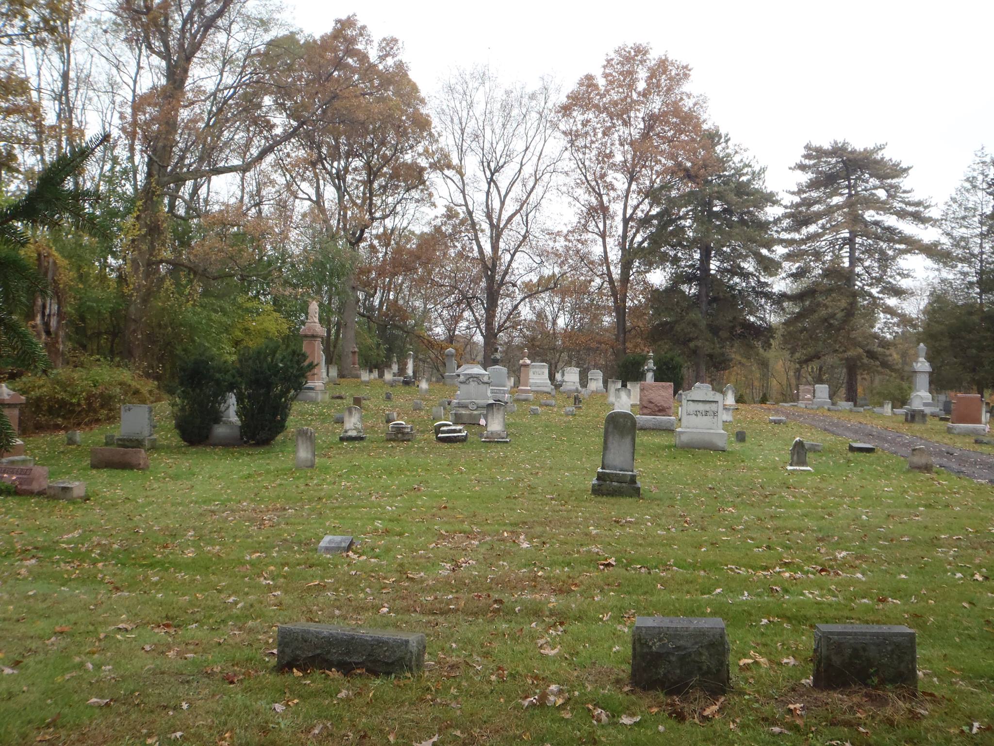
Monteith cemetery.
|
GPS coordinates of the steps: 42.523915, -85.638039
At the base of the steps there appears to be part of a railing.
One also sees a rather formidable fence at the base of the steps, probably because the
land to the east is used for horse rearing. The land on which the steps sit is still owned
by the power company, and is accessible.
Regarding the cement foundation, it's difficult to know what all the two satellite views show.
The steps once led to some kind of substation, but whether any of the foundations shown were part of that is
unknown at this time. Substations were often elaborate structures at the time, required
to convert A/C to D/C for use on the line. In this case, transformers would have been needed
to lower the high voltage A/C on the power company's lines to something useable by an
A/C to D/C motor-generator set. Less elaborate than the complete power generating stations
needed in some areas, they were nevertheless expensive facilities. Usually the
substations also served as depots. Monteith Junction is listed as a primary stop,
so perhaps that was the case here too.
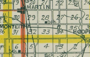
The portion of an 1895 Rand-McNally map shows Monteith, which perhaps should have been
labeled Monteith Junction. At that time it was an at-grade intersection of the Grand Rapids
and Indiana - later PRR - track and a Michigan Central track out of Allegan. There is little
left in year 2012 of either the MCRR track bed or the facilities at the junction needed
to ensure safe operation. The GR & I track is still nominally active.
Left click on the images below for larger versions.

2014
|
2013
|
Satellite view of Allegan -
Battle Creek track.
|
GPS coordinates: 42.521585 -85.637805
Viewed with less resolution, right, above, one indeed sees the MCRR track that once intersected with the
GR & I track at Monteith Junction. Appareantly the track from Battle Creek to Allegan was sold for use as an
interurban line, which the operated from 1916 to 1929, just about exactly the same time period the GR - Kzoo
operated.
It is the track at the left in the bottom left of the left hand image above. After 1929 the ROW from
Battle Creek to Allegan was sold back to the railroad - NYC?
It's likely that the GR & I track connected with the MCRR track. Perhaps later it
was used for the GR & I to access the Monteith Junction interurban depot. Whether the GR & I ever had its
own depot at Monteith Junction is similarly unknown at present.
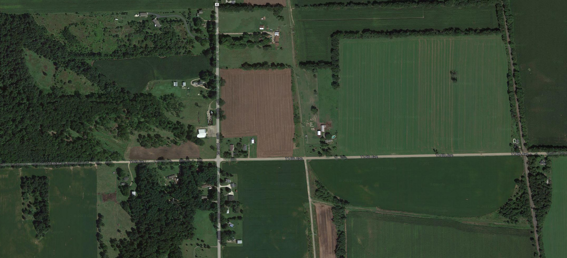
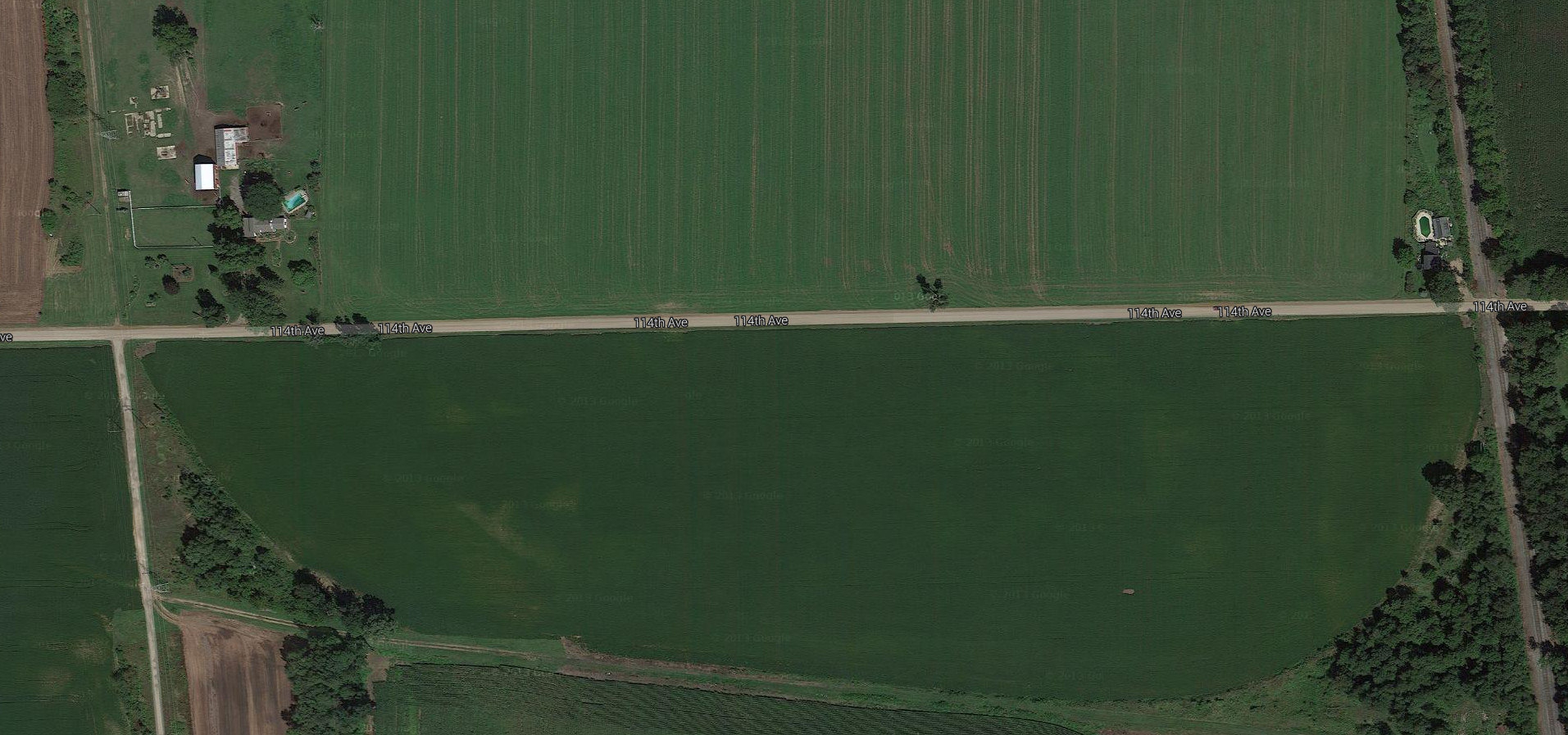
If one looks at the boundary of the field below 114th Avenue, shown above, left, it appears
that a track once went from where the
GR & I intersects 114th Avenue and at the other end where the GR - Kzoo interurban intersected the same road.
This was a complicated track area 90 and more years ago, with a GR & I track and a MCRR track intersecting at
Monteith Junction, and later the GR - Kzoo track.
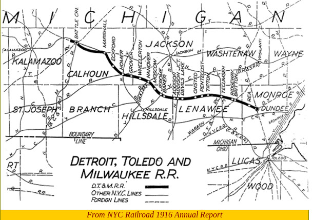
It's now clear the east-west track belonged to the Detroit, Toledo, and Milwaukee railroad. Never very
successful, the only large town the track pass through was Battle Creek. But of course this invokes a
chicken and egg discussion. Often the railroads were a signficant contributing factor for a city's or
town's growth. So did one build a track and hope the towns along the route prospered, or wait until the
towns propered first. In most cases were a town didn't have alternative transportation, usually a river,
they never did grow, and even half or more of those along a railroad track disappeared, rarely little more
than mining or lumber towns that eventually lost their reason for existence.
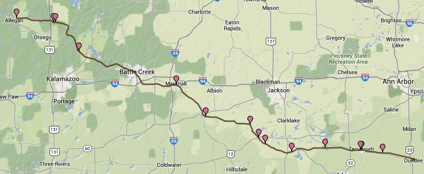
The DT&M railroad was not successful. At one point the ROW west of Battle Creek was sold to an interurban
company, which ran a line between 1916 and 1929, almost indentical to the time period the Grand Rapids -
Kalamazoo line ran. After that line failed, the ROW was sold back to the railroad, but apparently nothing
much came of the purchase, and little remains in year 2014 to show the track ever existed.
One can see in the view at the left, below, in a 1916 map, that the ROW west of Battle Creek is indeed no
longer part of the DT&M line.
Left click on the images below for larger versions.
1916 - west of Battle Creek
sold to an interuban line.
|
|
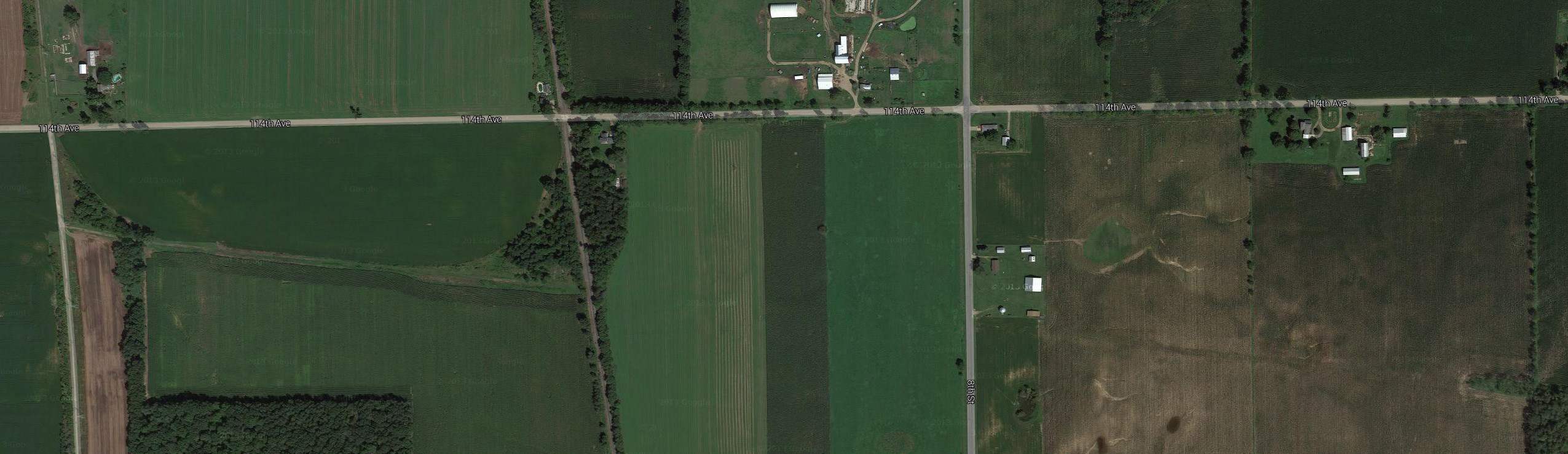
Shown below are some details of the track that intersected the interurban track. Apparently there was once
a track man's building at the intersection.
Left click on the images below for larger versions.
East of interurban track
|
East of interurban track
|
East of interurban track
|
West of interurban track
|
Below is a view of the track from 112th Avenue, south of Monteith Junction. Note that both views are distorted
by the use of a telephoto lens, making the view appear to be compressed.
GPS coordinates: 42.508353 -85.637484
Left click on the images below for larger versions.
North
|
South
|
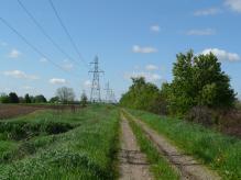
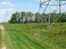
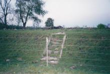
The fence shown in the view looking south was common after the demise of the line, as the ROW was somewhat
taken back by the farmers who supplied it. Notice that wood poles are used in three places for the
transmission wires, rather than the steel towers. Why? fairly substantial cut was needed in the southern
direction.
Looking north, the ROW is been turned into a road by local farmers, and today connects 112th and 114th Avenues.
114th Avenue, to the north, is Monteith Junction.
Left click on the images below for larger versions.

Looking south from 114th Avenue.
May 22, 2014
|
Left click on the images below for larger versions.
Both photographs above are copyrighted year 2010 by Tim Shanahan, Interurban
Junkie, Kalamazoo, MI.
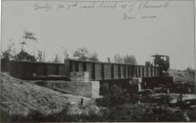
GPS coordinates: 42.475027 -85.637524
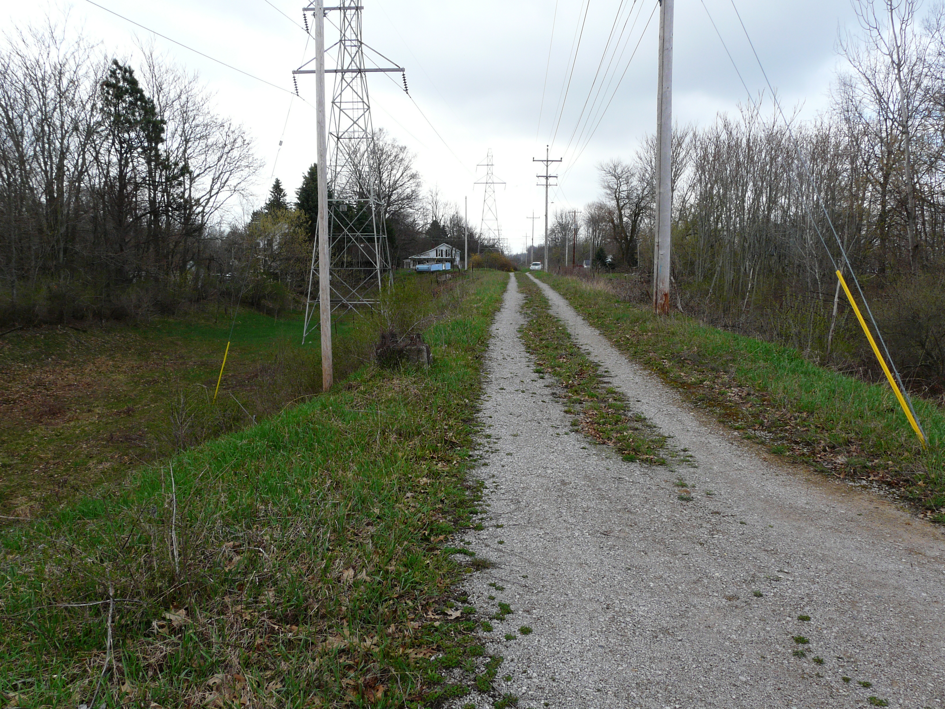
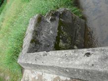
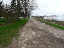
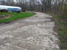
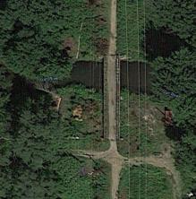
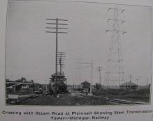
The images above show a bridge north of Plainwell, MI, about 0.7 mile north of 106th Avenue.
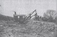
The first photograph shows the construction of the bridge, with the aid of a steam powered tractor.
Hopefully more constructions photos like this one will appear at some point.
Note that to the left of the steam power tractor is what appears to be a cattle crossing.
The middle satellite image shows the context
of the Plainwell bridge in a 2011 view. Gun River, which the bridge crosses, seems largely dried up in year
2014, flowing only after a heavy rain or snow melt. It was flowing the day the photos below were taken - June 26,
2014.
Left click on the images below for larger versions.
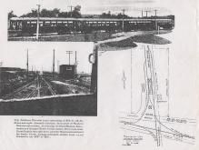
c1915
|
|
|
|
|
|
|
|
|
|

|
2014. Water under half of bridge.
|
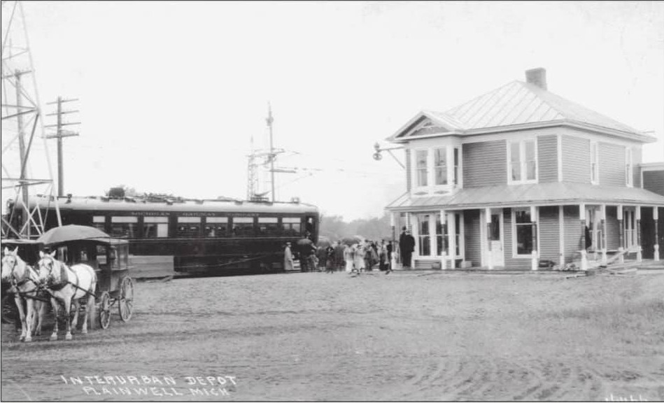
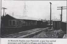
Plainwell - stop 17
Left click on the images below for larger versions.
|
|
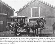
Typical transportation from
depots to hotels, etc.
|
The Plainwell, MI, interurban depot, on a rainy day. The depot is said to have been "behind" the GR & I depot, but
for now it's not known where that stood either.
The photograph at the right, above, appears to show the interurban depot in the center. The GR & I depot might
be the building at the right. The interurban station being "behind" the GR & I depot would mean someone
was standing way to the right.
Like the Martin and Moline depots, the Plainwell depot was a converted house, now gone.
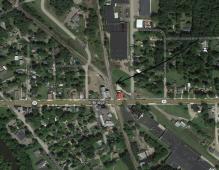
The image below, left, shows a location where the GR & I
tracks and the interurban tracks come near together. And there is possibly a
footbridge over the river, where people could walk from town to catch the
train or the interurban. But there is no evidence of a depot at this location.
Left click on the images below for larger versions.

|
Arrow indicates the approximate
location of the depot.
|
GPS coordinates for image at right, above: 42.444425, -85.632312
Above, left, one can see a bridge over the river. The origins of it are not
clear at this time. The image at the right, above, offers another suggestion for the
location of the depot. See the green arrow. Here again, there is no foundation or
other evidence to suggest that this was the location, but it would have also been
convenient to the town.
Bridge Street - stop 16
Stop 16 was at East Bridge Street. In year 2014 there is no sign of any structures pertaining to a stop.
Left click on the images below for larger versions.
No name - stop 15
Stop 15 is unnamed on the 1917 station list at the top of the page. For now it's assumed that it
was a flag stop, intended only to save riders a little walking. Just where it was might never be known now.
River Road - stop 14
River Road appears to be called River Drive today. Nothing from an aerial view suggests there was a stop
at the location indicated. Perhaps any structures have been removed. Perhaps it was a flag stop.
Left click on the images below for larger versions.
2014
|
2014
|
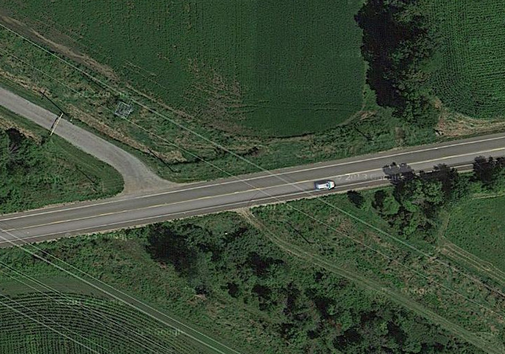
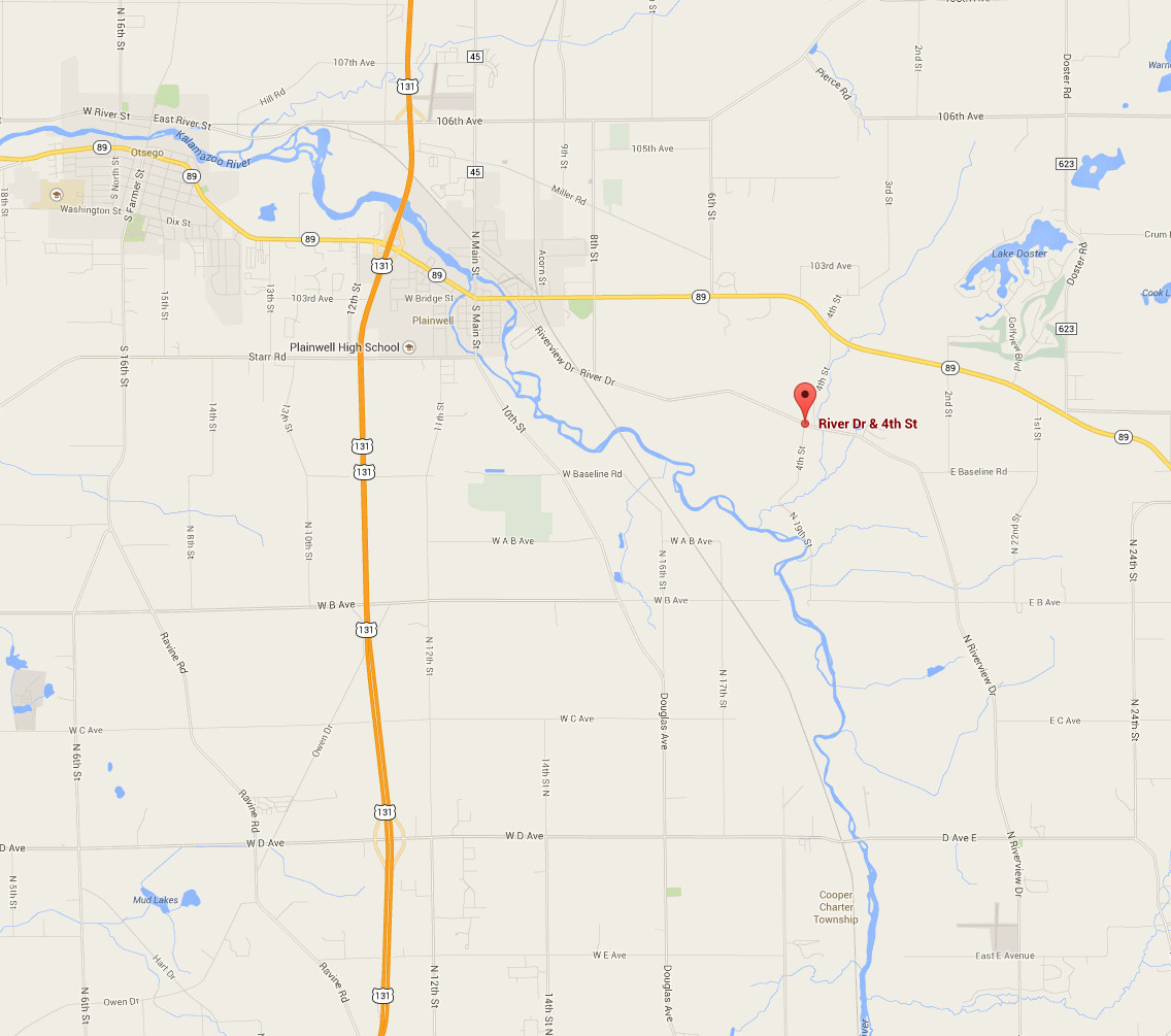
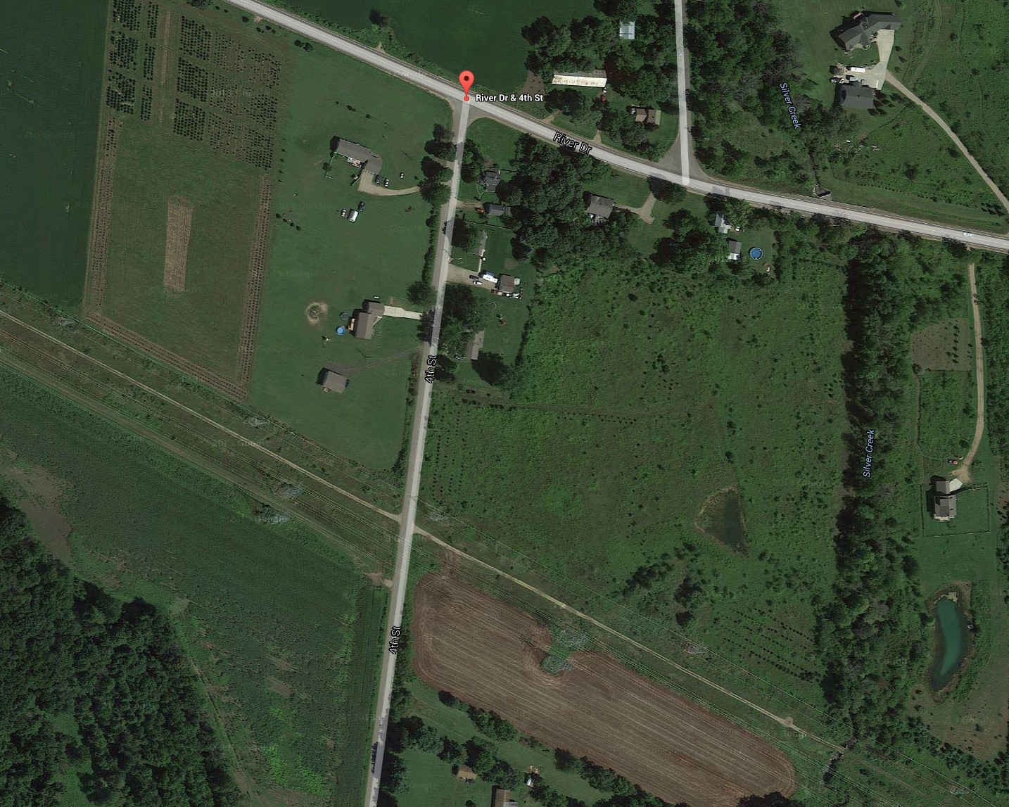
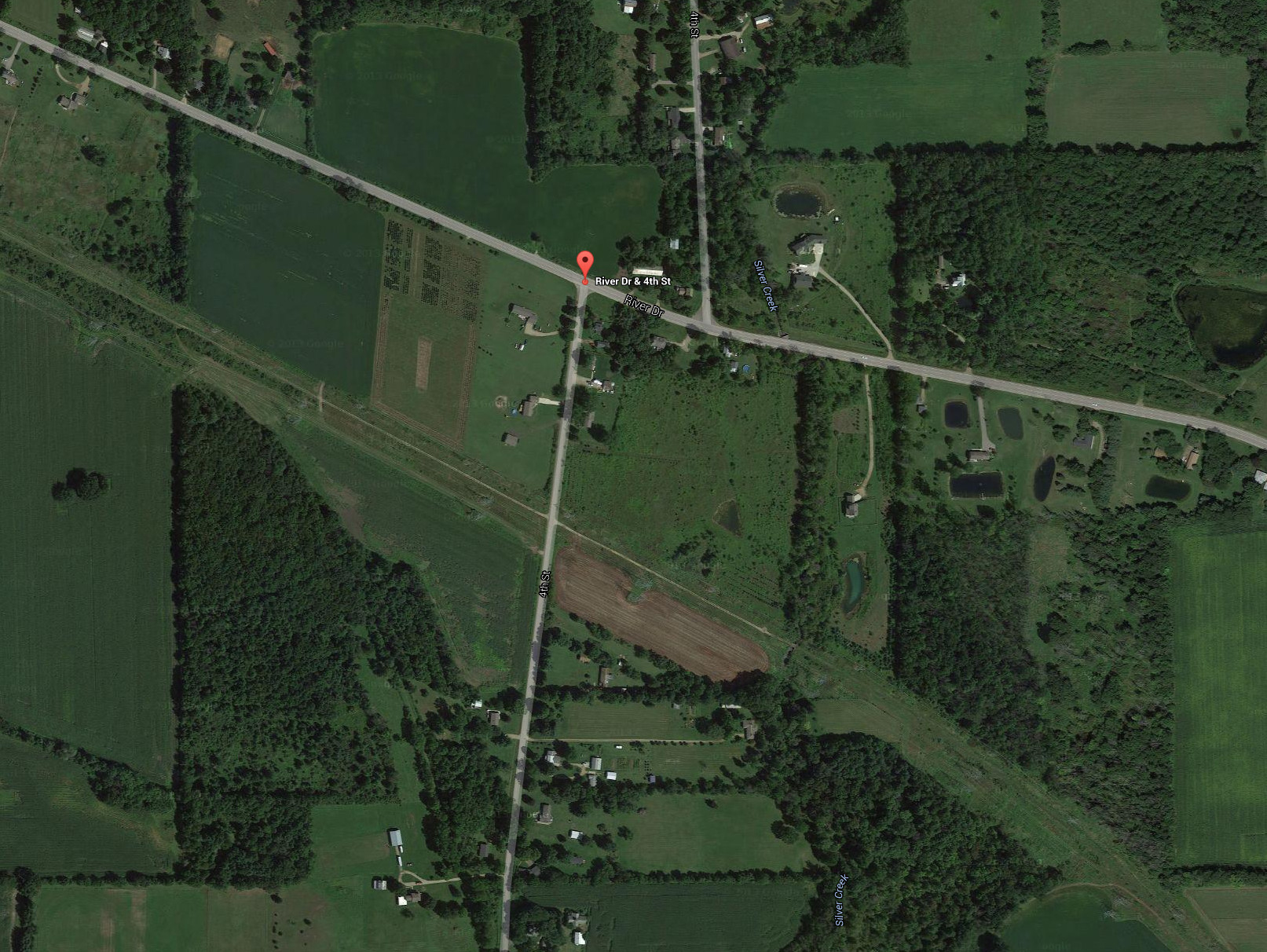
Argenta - stop 13
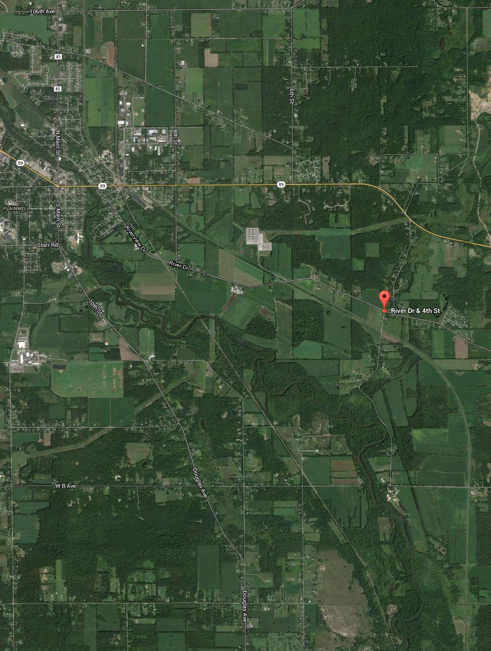
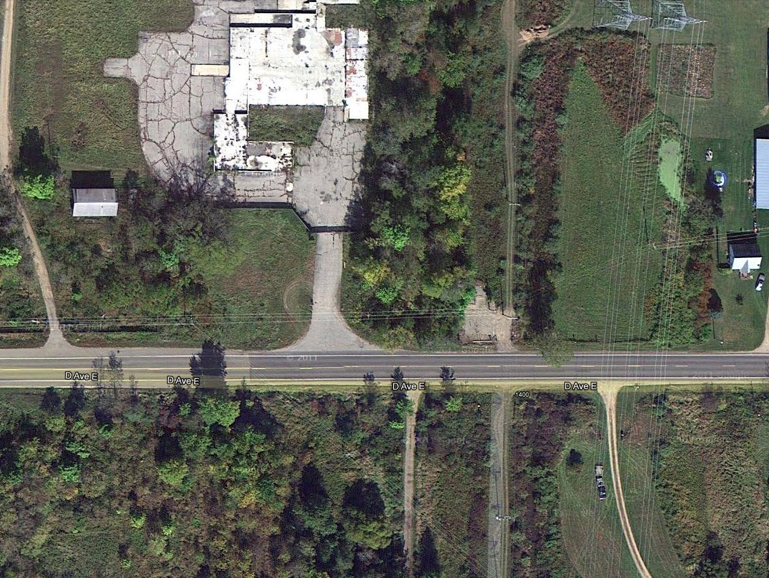
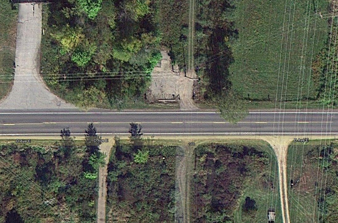
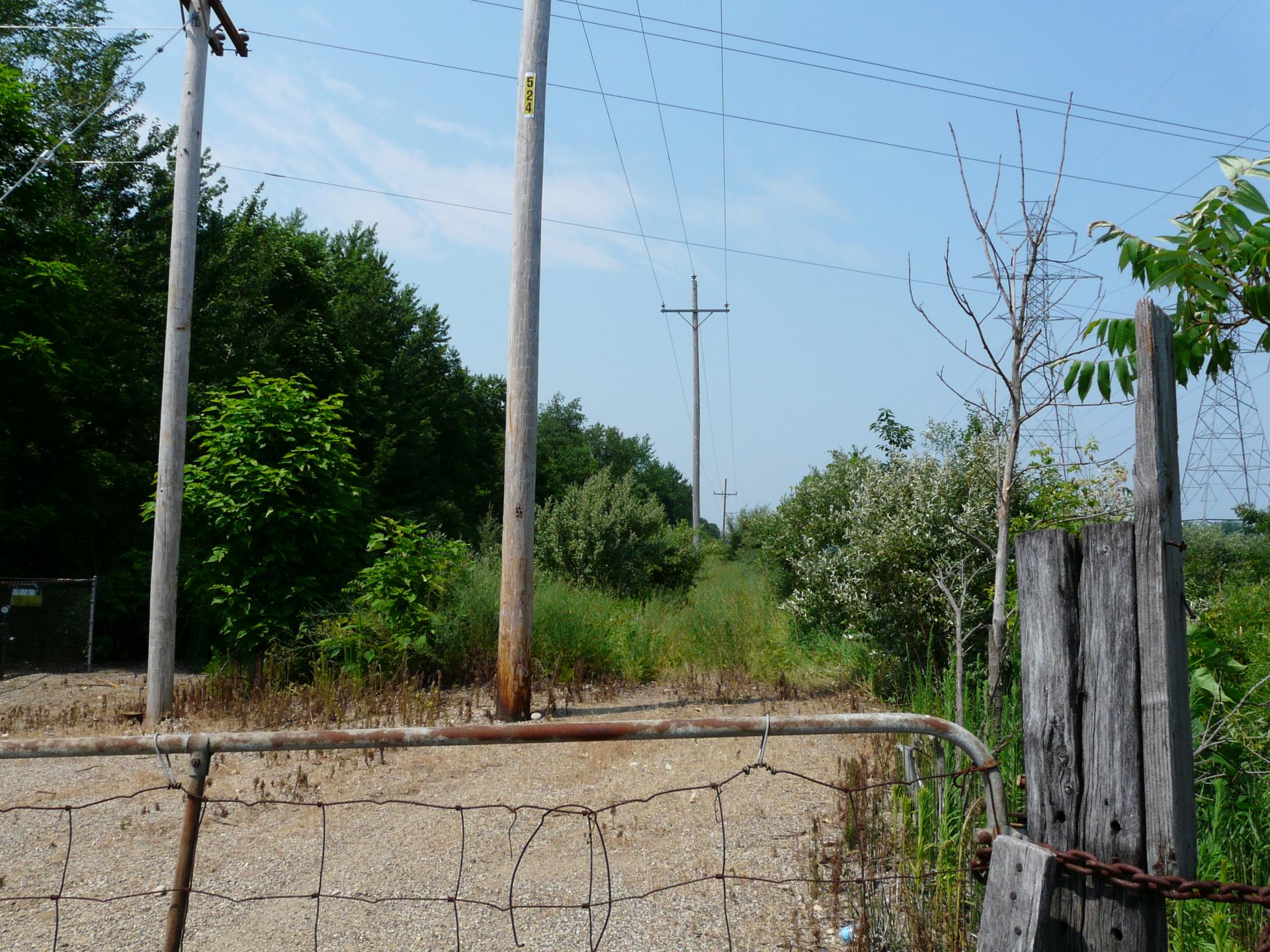
Argenta is located at the corner of River Drive and 4th Street, Plainwell, MI. Just why the interurban would
have stopped here is unknown.
GPS coordinates: 42.427409 -85.587024
Left click on the images below for larger versions.
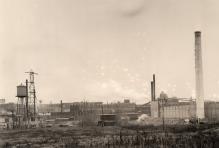
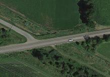
Cooper - stop 9
Left click on the images below for larger versions.
1910
|
Undated.
|
The images above show that the Cooper area was quite active in the 1910 time frame.
Both the Grand Rapids and Indiana and the Lake Shore and Michigan Southern railroads
passed through the area, perhaps in part because it was natural for railroads to
follow the relatively even contours of the rivers. Later, the Grand Rapids - Kalamazoo
interurban would pretty much follow the route of the GR & I RR the entire way.
Left click on the images below for larger versions.
The satellite images above, all of the area where the interurban crossed D Avenue at
about address 1350, are dated 2012. While the bare patch shown in the middle of the
image at the right suggests the depot foundation might have been located there, the
maps above suggest either the depot, or what passed for a town, was on the right
side of the track. The land is owned
by the power company, so it's possible that remnants of the foundation still exist.
A visit to the location on June 28, 2012, shows that the bare patch houses natural
gas equipment. Many right of ways are multi purpose now, carrying perhaps a track,
a fiber optic cable, natural gas lines, power lines, etc. The best guess right now
is that this is the location of the interurban depot, which is now underneath the
sand, if it's still there at all. On the other side of the track bed is a wet
area. What it looked like 100 years ago is another matter of course. Hopefully
more information about this stop will appear.
Left click on the images below for larger versions.
The photographs above show the track bed on June 28, 2012, looking north in the
photograph on the left, and south in the other.
In 1920 or so there would have been three depots in the same area. Perhaps photos of
some or all of them still exist.
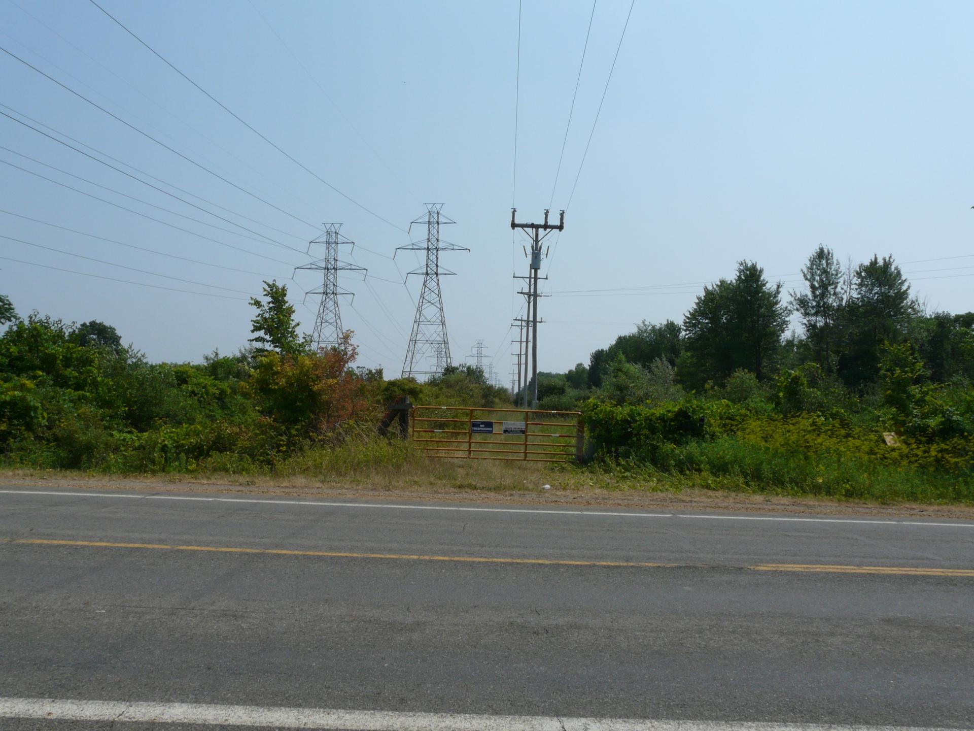
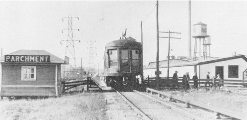
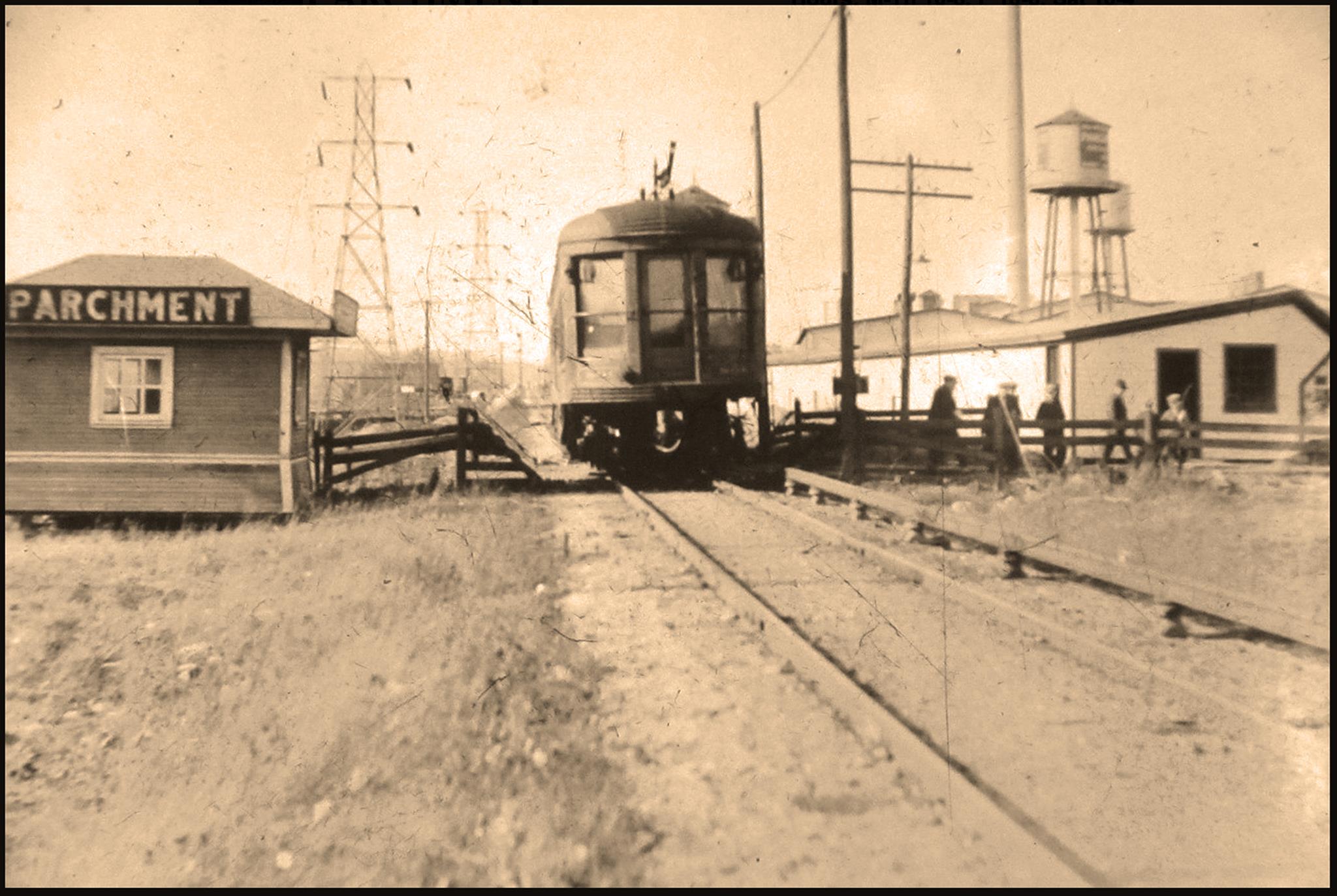
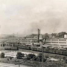
Parchment
Parchment might have been a special stop for factory workers only, and did not
necessarily show up on regular schedules. During WWI, a similar situation existed
with Fisher Station being, in part, a stop for construction workers at the Picric
Acid plant. Note that the third rail continues right in to the depot area, which
again suggests this was not an ordinary stop. In that case overhead wired would
have been used around the depot.
Left click on the images below for larger versions.
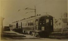
Car 801 discharging workers at the paper mills in Parchment. It's not clear whether the car is heading north
or south. Both photographs above are the same, save that sepia has been added to
the one on the right. This can highlight details.
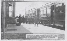
The interurban track in the newspaper piece is the one on the left that goes stright up. One can see the third rail.
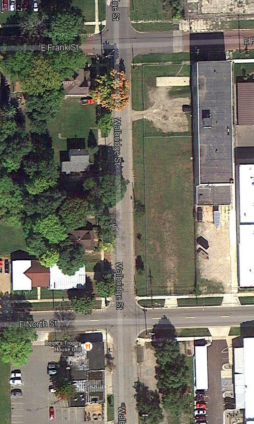
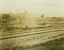
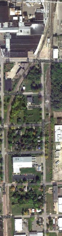
North Street - stop 3
The path of the interurban track is getting vague around North Street in year 2014.
The ROW paralleled Walbridge Street in the area of North Street. Where it crosses North Street today there is
no hint of any structure. This might have been a flag stop.
Left click on the images below for larger versions.
2014
|

2014
|
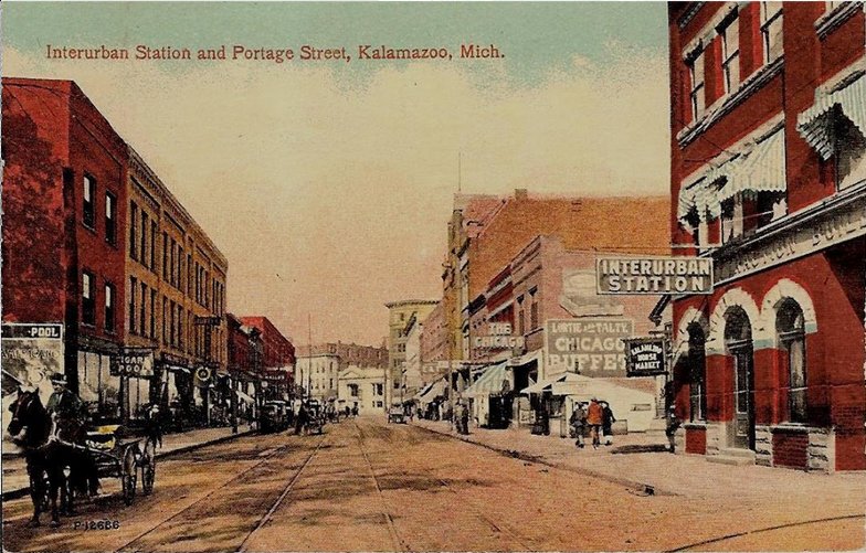
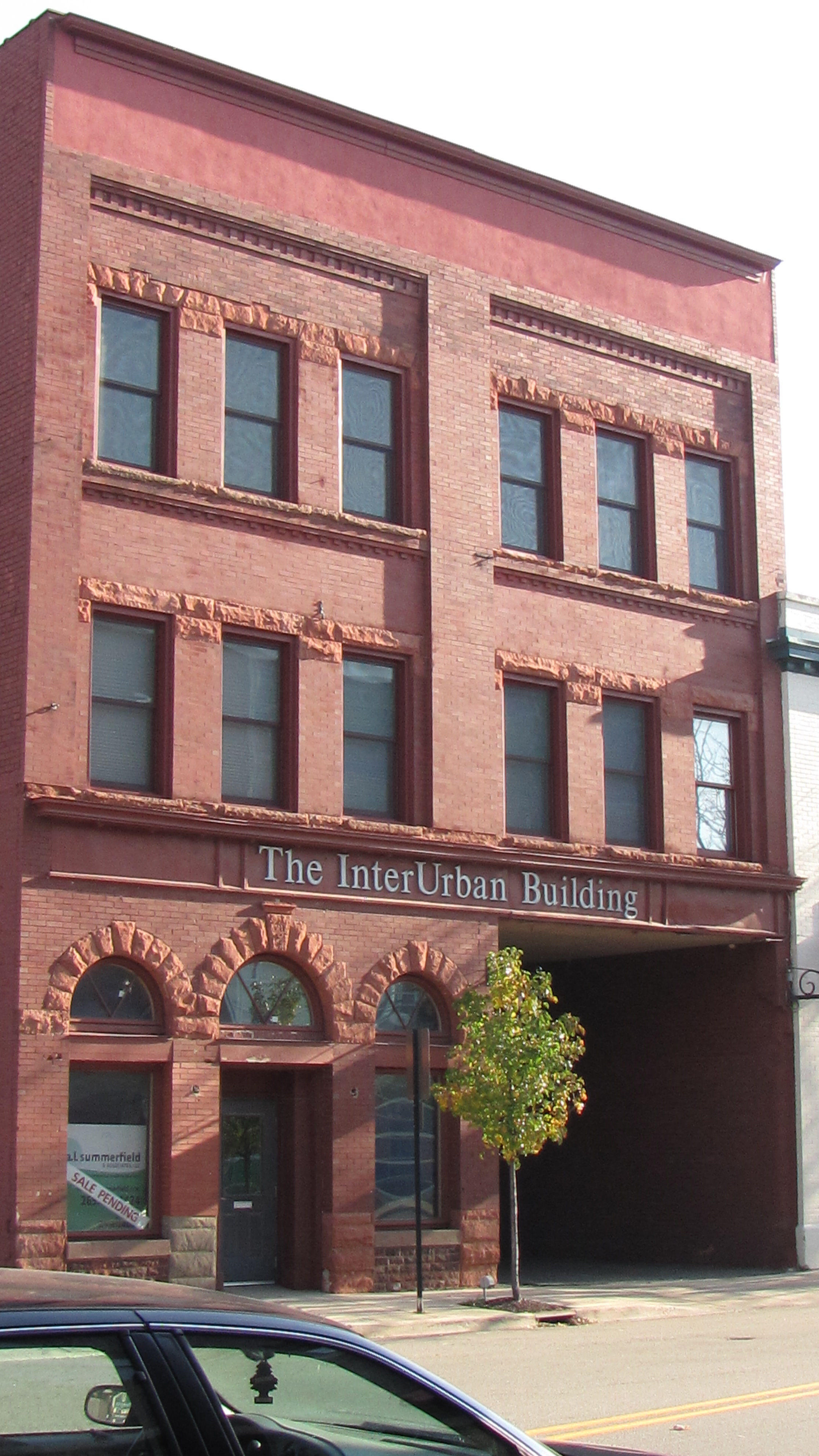
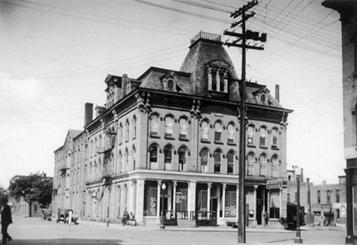
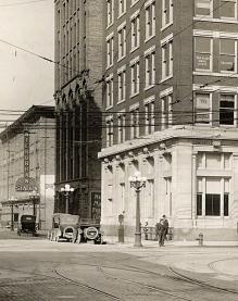
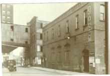
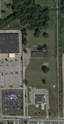
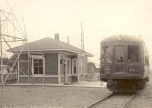
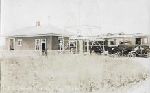
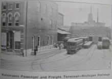
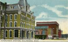
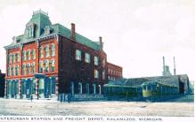
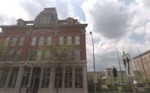
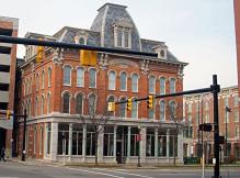
Kalamazoo - stop 1
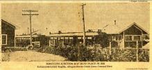
The tracks end at the Kalamazoo
terminal, which still existed as of 1988.
Left click on the images below for larger versions.
The image above shows the first interurban station in Kalamazoo. When the second
terminal, below, was established is not known for now.
Left click on the images below for larger versions.
1915
|
Circa 1917
|
Circa 1917
|

Circa 1920
|
Circa 1994
|
2009
|
Circa 2009
|
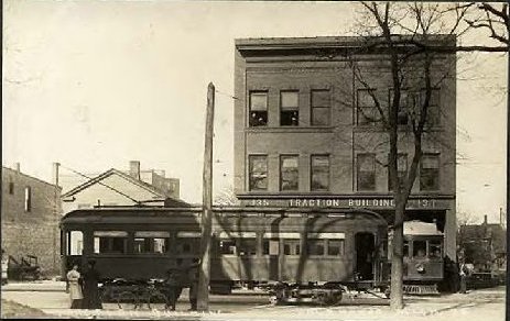
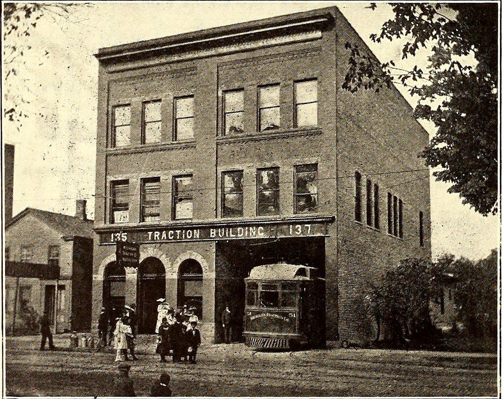
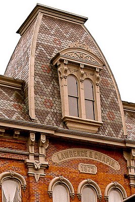
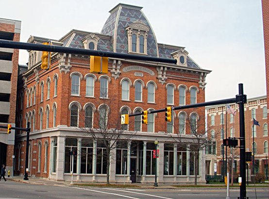
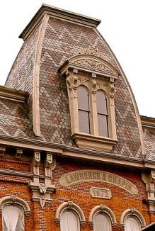
The images above show the second Kalamazoo interurban station. The building is called
the Lawrence & Chapin building, and was built in 1872, as one can see on a marker at the
top of the building. The building originally housed an iron manufacturing facility of some
sort. Later it housed a skating rink, then an interurban station, and, later, a bank. As
of year 2009 or so it is empty. Some time around 1994 a large amount of money was spent
cleaning up the exterior, and the building is something of a local landmark today, if
unused for now.
As of year 2009, and probably before, nothing remains of the track area, which was
to the right of the building as one faced the front.
Many rail tracks and stations
converged in this area in the 1920s. One could have taken the interurban from
Grand Rapids and caught a train in Kalamazoo, or been right in the middle of
town for business or shopping.
On the Grand Rapids end the terminal
occupied the site later occupied by the Civic Auditorium.
Miscellaneous
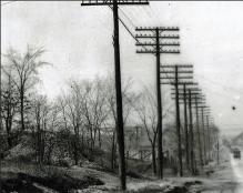
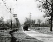
Left click on the images below for larger versions.
|
Car 807
|
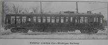
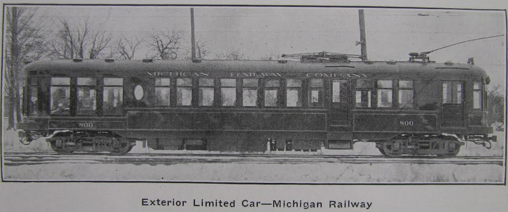
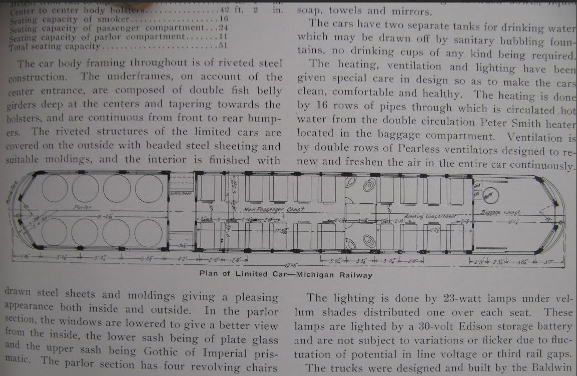
Car 800 - Limited - 1915
|
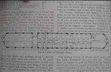
Interior of limited - 1915
|
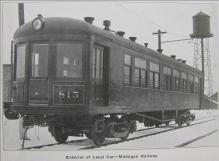
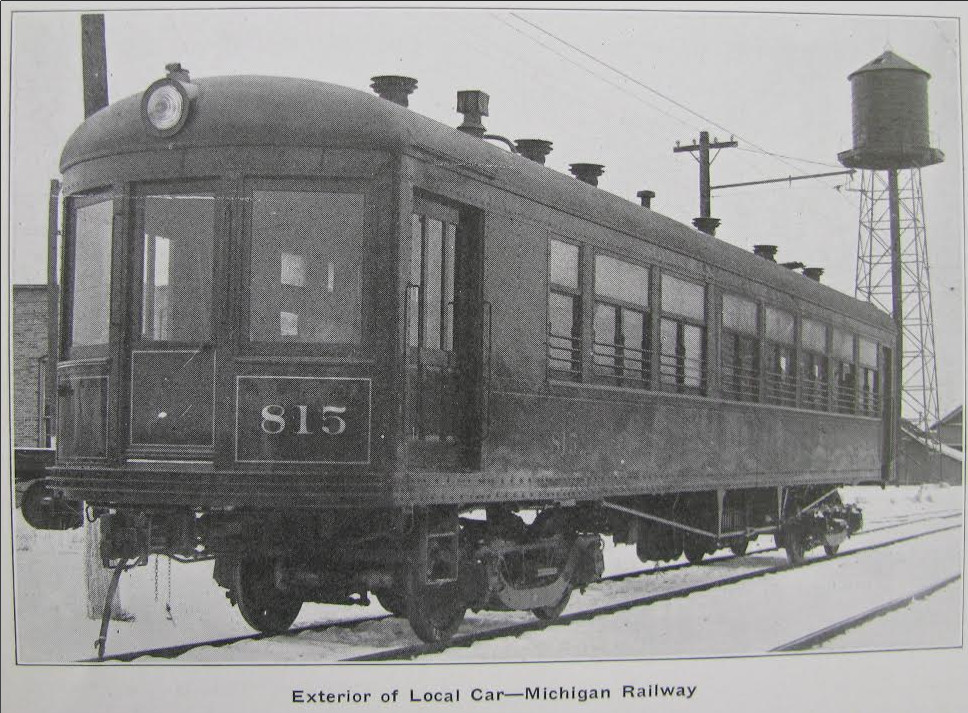
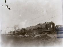
Car 815 - Local - 1915
|
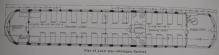
Interior of local - 1915
|
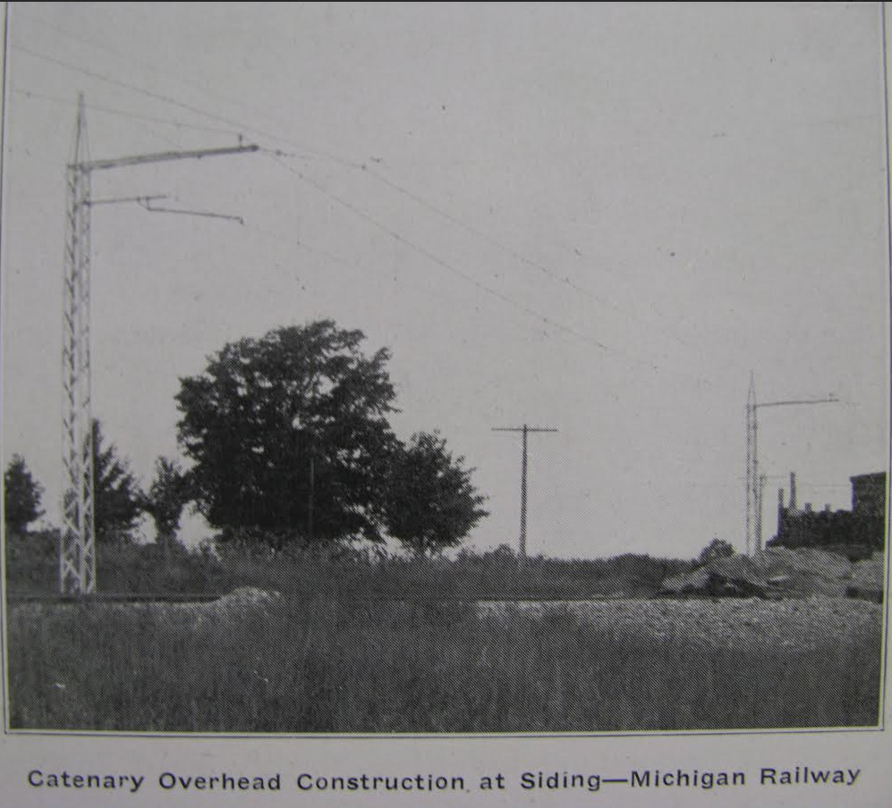
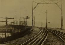
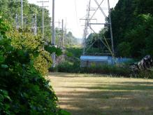
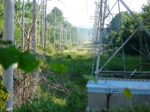
ROW - unknown location.
For high speed runs of up
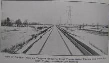
to 80 mph. Note the boards
around third rail, for safety.
|
1915
|
1915
|
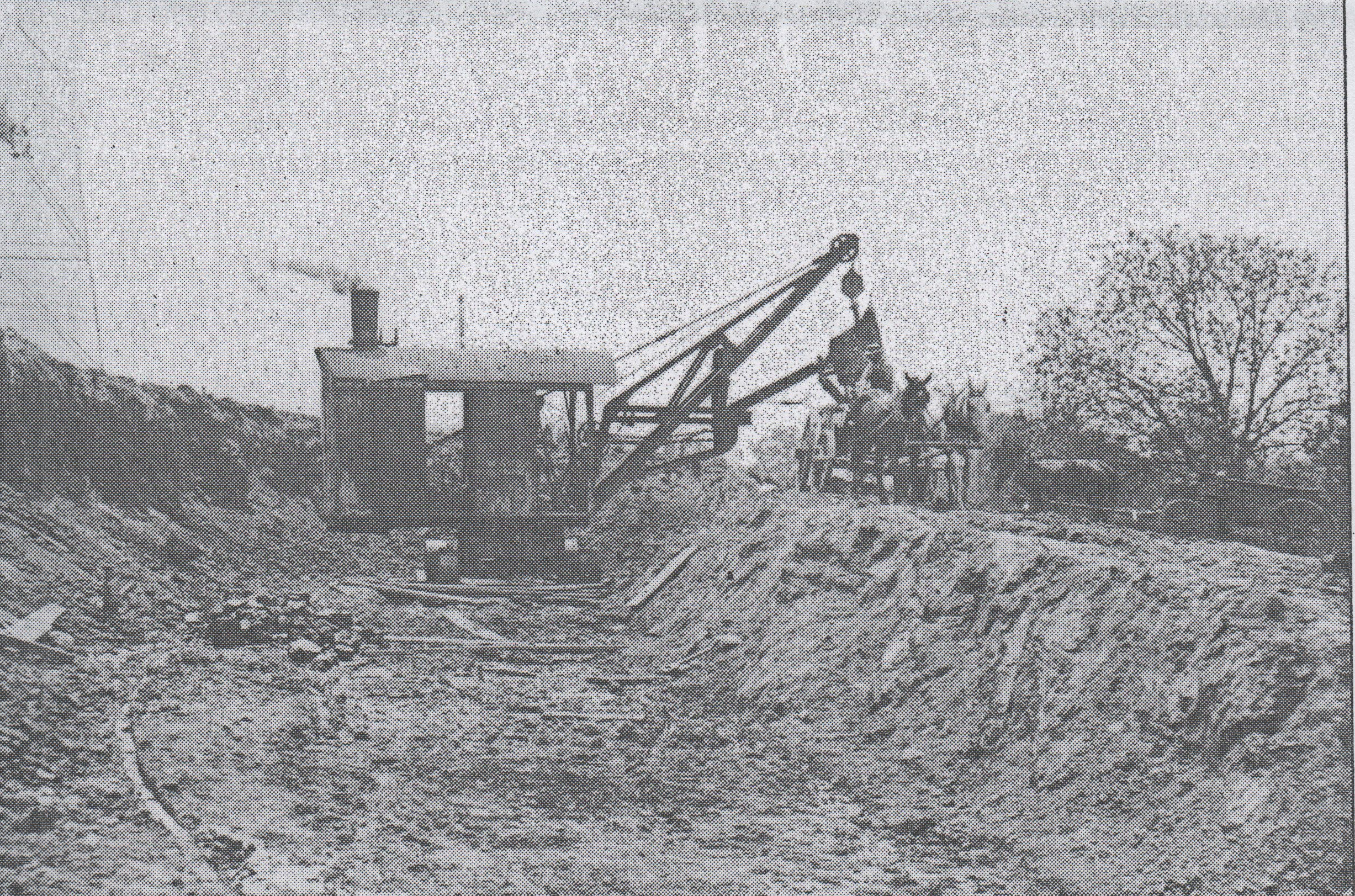
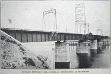
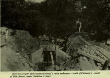
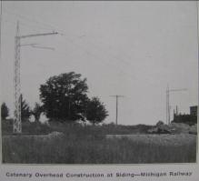
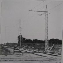
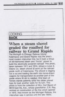
Construction - north of Kzoo.
|
Construction - north of Kzoo.
|
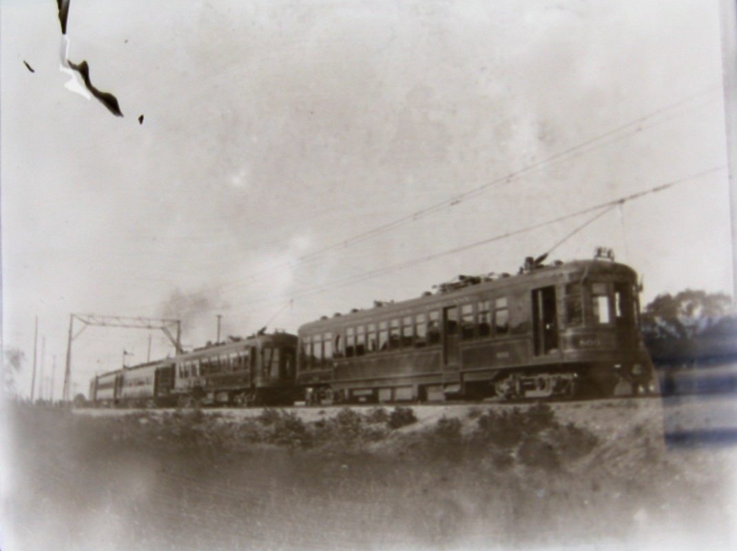
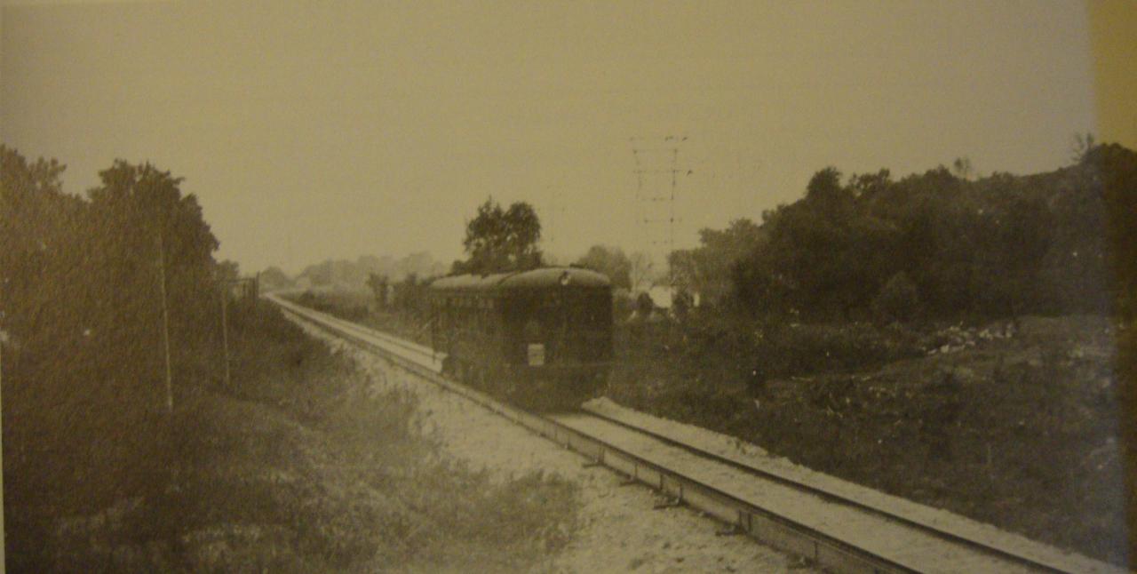
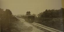
The photograph above, top row, left, shows an interurban car heading south, just north of Kalamazoo.
This photo and others here seem ill focused because they are copies of copies. No
doubt the originals look much better.
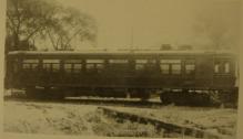
The photograph above, top row, center, shows interurban car 807 "at work." Just where,
or even which way it is headed, are all unclear, as is the photograph itself.
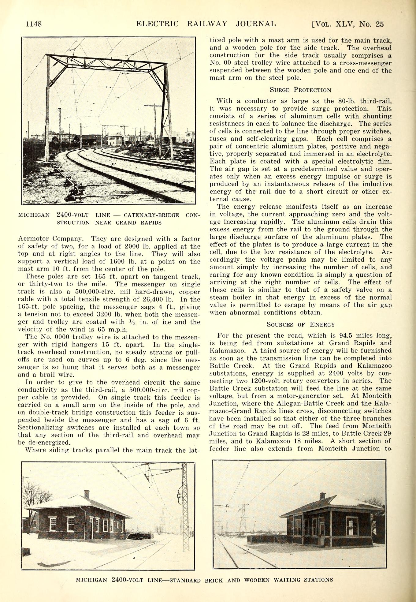
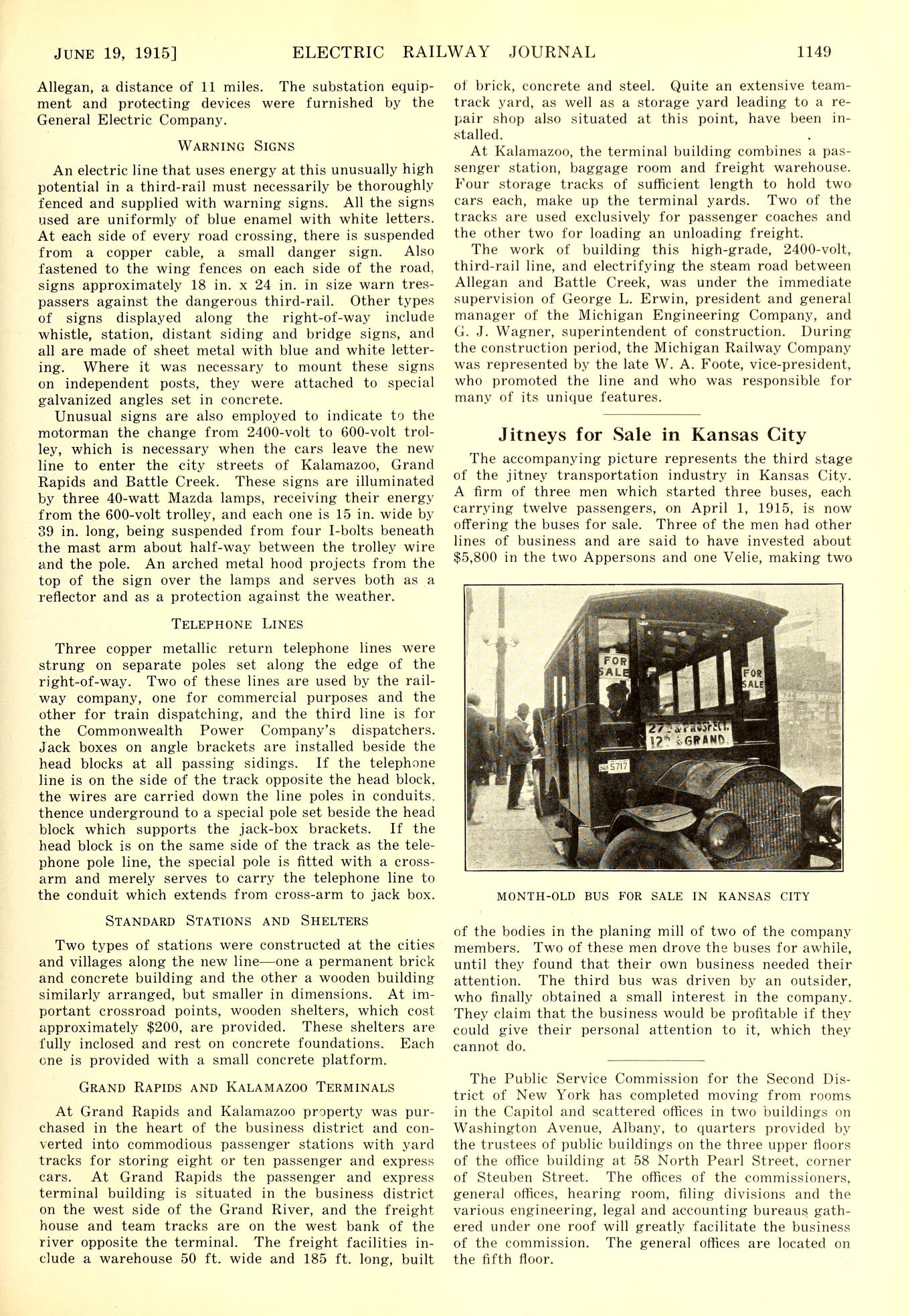
June 19, 1915
Left click on the images below for larger versions.
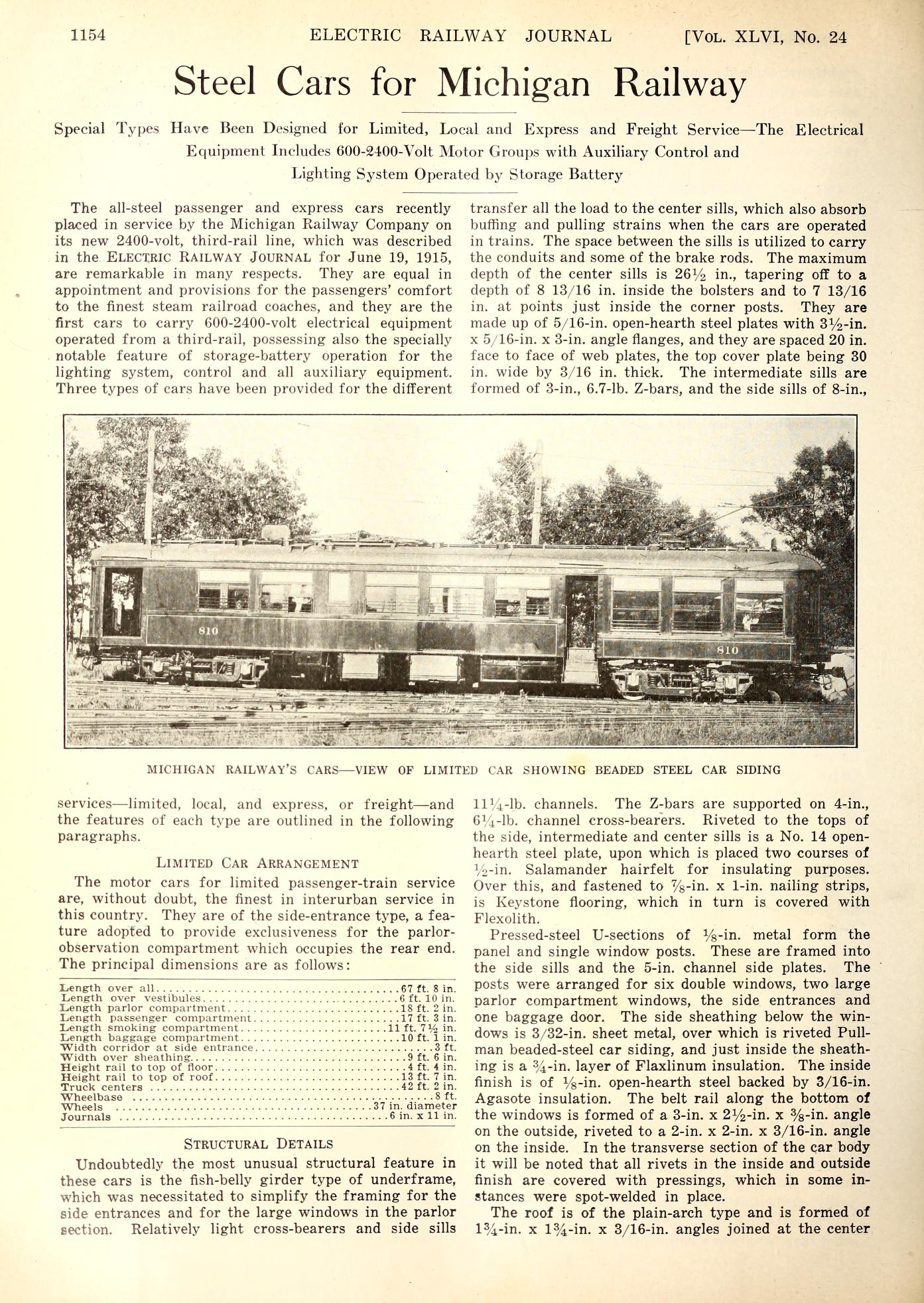
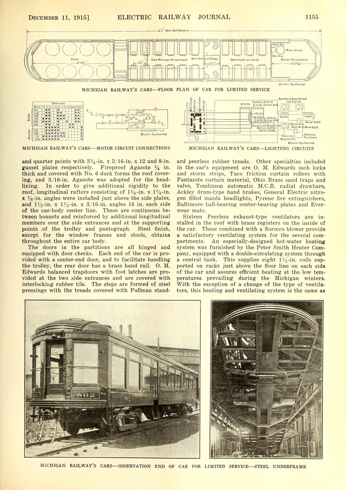
December 11, 1915
Left click on the images below for larger versions.
November, 1968
Left click on the images below for larger versions.