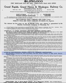
Grand Rapids, Grand Haven, and Muskegon interurban line

Left click on the images below for larger versions.
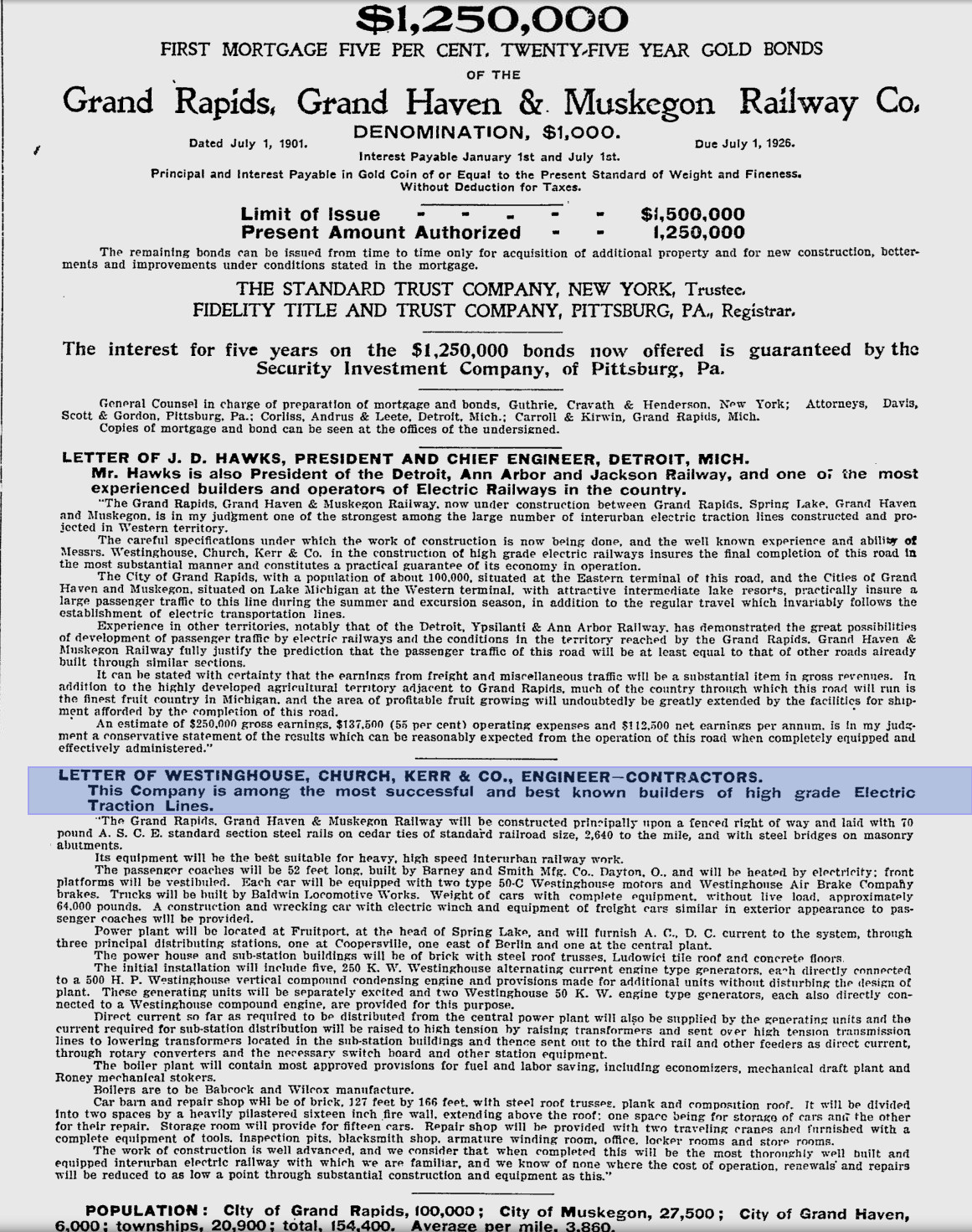
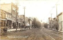
June 9, 1901 - Pittburgh Press
|
As the item above explains, the Grand Rapids, Grand Haven, and Muskegon interurban line, a.k.a. the Lake Line, was
a turnkey system designed and built under the management of Westinghouse in 1901. Nikola Tesla once worked for
Westinghouse, until Edison and his cronies managed to sue the company out of all of its A/C patents. Having lost
a silly battle to use DC for the nation's electrical system, Edison turned his attentions to cheating everyone
who used A/C out of what they had. Anyway, Had Tesla turned his attensions to the use of A/C motors on
interurban coaches, the cost of operation per mile would probably have been so low at the time that the lines
would have been even more successful. Substations and small powerplants were very expensive, whereas using
A/C throughout the system would have allowed the use of large, central power plants, one of which could have
powered the entire line. Alas, even Westinghouse had to use a mixed A/C - D/C system.
Left click on the images below for larger versions.
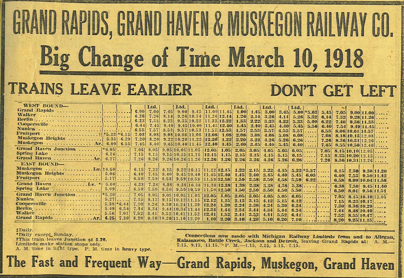
The Grand Rapids, Grand Haven, and Muskegon Railway Company operated from
1902 to 1928, although much of the line was closed by 1926.
Like most interurban companies, growth was rapid in the
first couple of decades, after which the mode of transportation collided with the
growth of the automobile, and taxpayer funded roads.
Left click on the images below for larger versions.
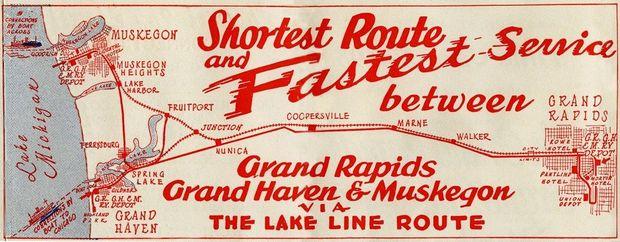
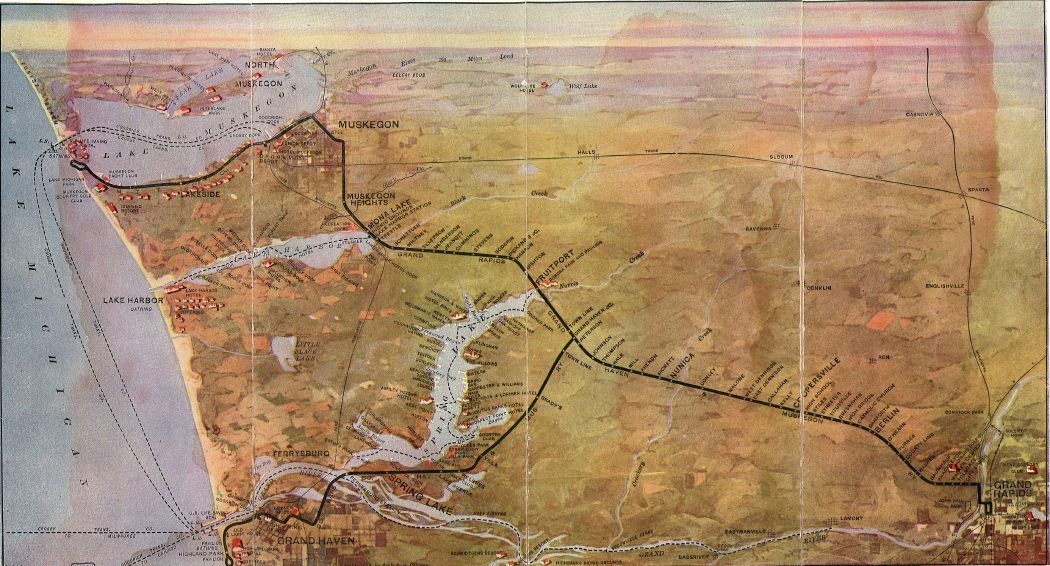
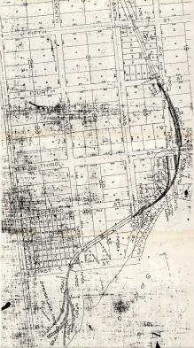
The map and schedule above show the extent of the system. At one time, connections
could be made in Grand Rapids with Michigan Railway stops in Kalamazoo, and then
Battle Creek, Jackson, and Detroit, and on up to Flint.
One eventually was able to connect with the Indiana and Ohio interurban systems,
which were quite extensive, via a line between Detroit and Toledo.
Note that Berlin, between
Walker and Coopersville, was renamed Marne in 1919 because of anti-German
sentiment during WWI, and to honor US soldiers who fought in the Battle of
the Marne.
Left click on the images below for larger versions.
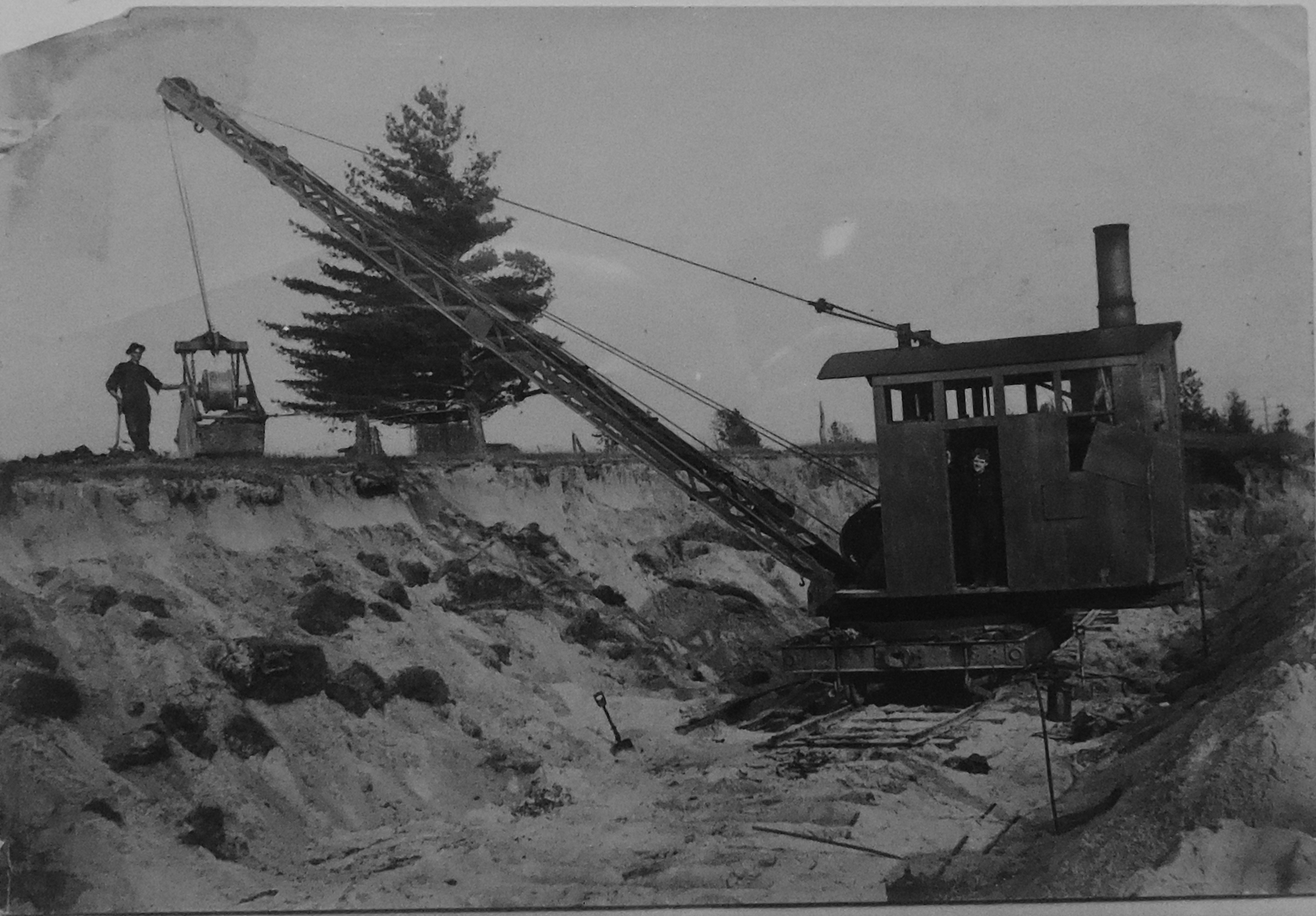
The photographs above are construction photos - just where is not known.
The photograph at the left shows that in conditions of sandy soil a two man crew
and a steam powered shovel could be used to make the necessary cuts and fills.
One can see that the steam shovel is at the very end of the tracks. After a cut or
fill was prepared within the reach of the shovel, another length of track would be
laid.
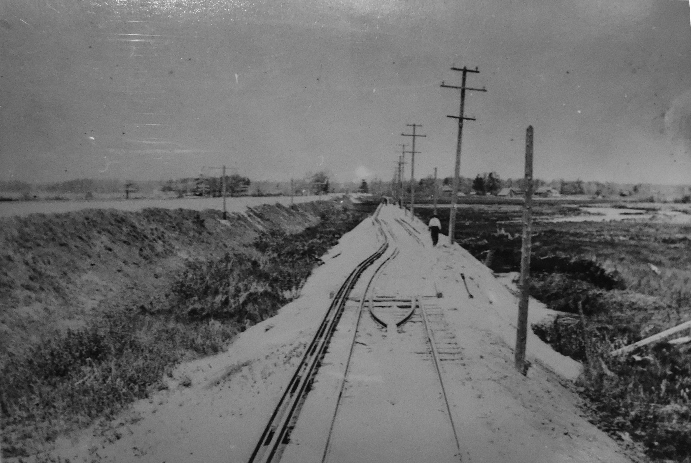
Steam powered pile drivers were used in the same way to get through wet areas.
At times the fills could be quite high. Between 32nd and 36th Streets earth
along the Grand Rapids and Kalamazoo interurban line, which follows Riser Street,
and then cuts through Frank Rackett's property before crossing 36th Street,
was piled quite high to give the track a uniform grade. Up though the 1950s yet
one saw trenches on both sides of the track where a steam shovel likely picked up
the dirt and piled it in the middle. Houses along Riser Street used those trenches
as private dumps up to the time Consumers Power topped the berms and filled in
the trenches.
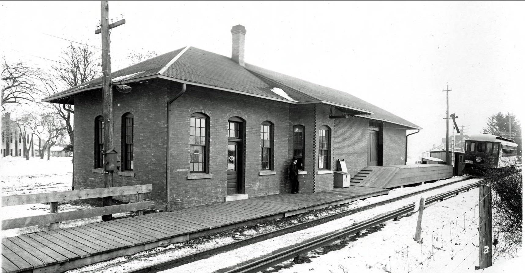
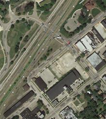
Grand Rapids.
The description of the Grand Rapids terminal is the same as that above for
the Grand Rapids to-from Kalamazoo line. The GR, GH, and Muskegon line used the
track curving to the right, as one looks west while stand in the interurban bridge.
It appears that an older terminal, and bridge, served this line originally, since
it was built in 1902, whereas the GR, Holland, and Chicago, and GR - Kalamazoo lines
were built later.
Left click on the images below for larger versions.
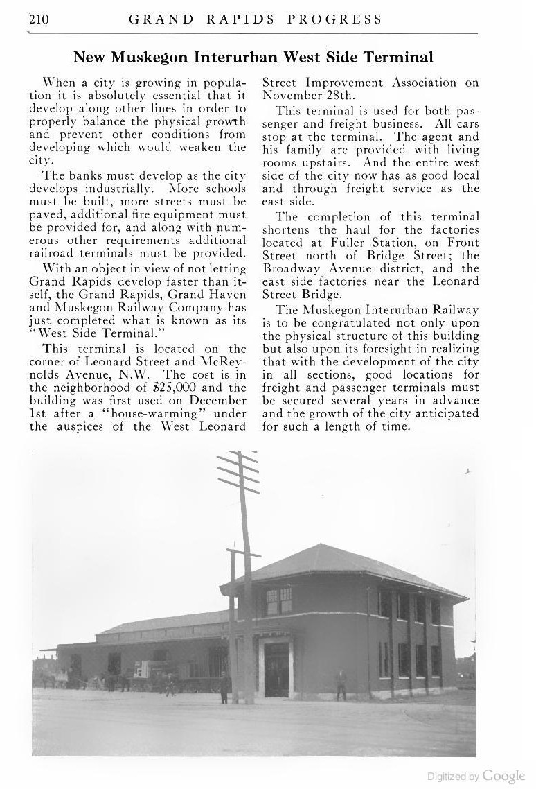
Opened December, 1913
|
Google street view - 2014
|

Google aerial view - 2014
|
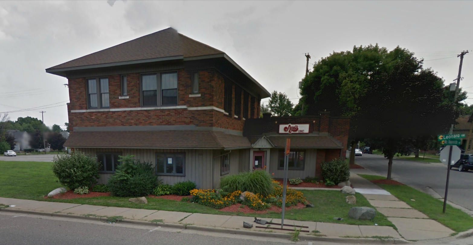
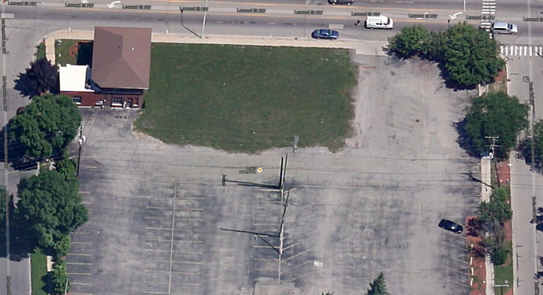
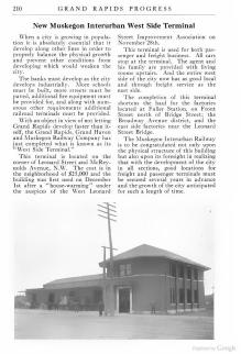
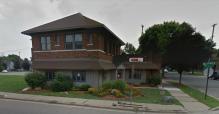
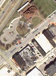
The west side terminal building still exists in year 2014 at about 721 Leonard Street NW, in the SE corner of the
intersection with McReynolds Avenue.
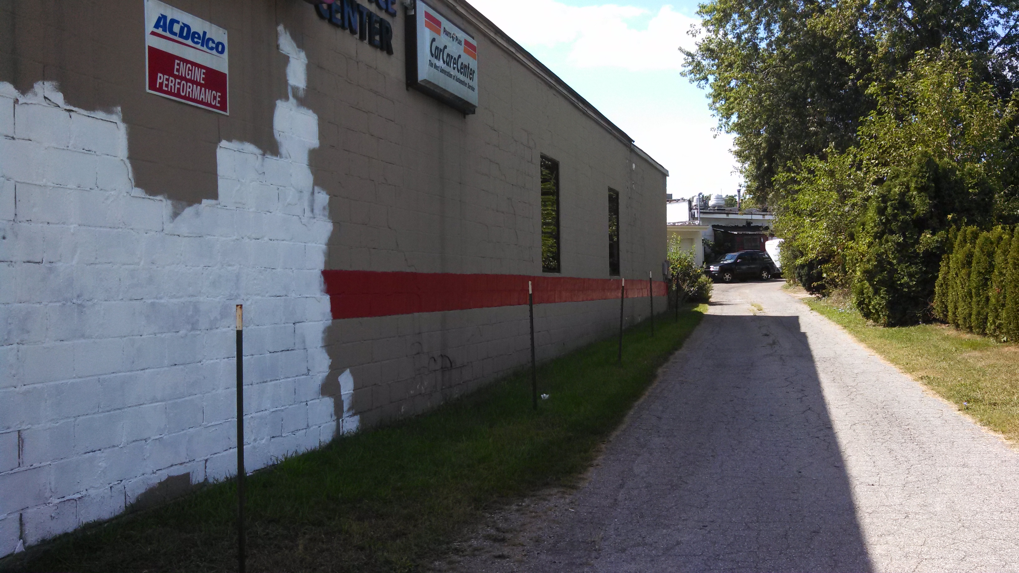
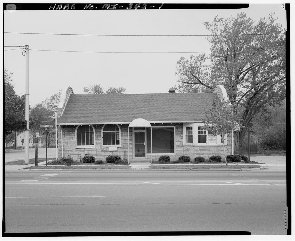
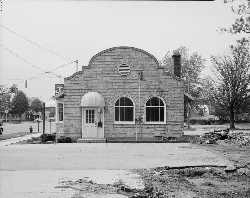
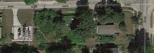
Toll Gate
Walker Center
Left click on the images below for larger versions.
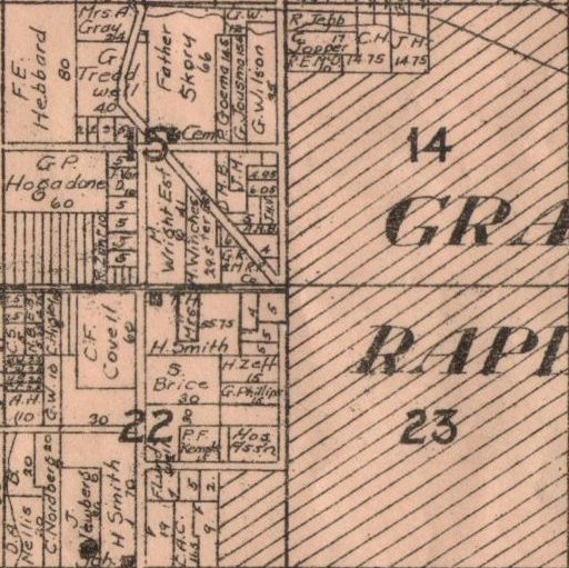
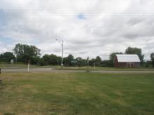
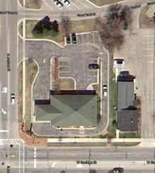
The maps above show the same area around Leonard Street and Walker Avenue in 1907, 1922, and 2013.
In the 1907 one sees a small interurban track off the main line at this corner. It's purpose is unclear
at this time. It is not indicated on a 1922 plat map. In year 2013 there is a structure at about where
one might imagine a car barn might have been, or some other structure, but it appears to be a fire
station, with the bays pointing to Walker Avenue. If so, it is odd that cars would be parked in front
of the doors. This is be looked into further to see whether the
structure is in any way old enough to have existed when the Interurban line was running.
Left click on the images below for larger versions.
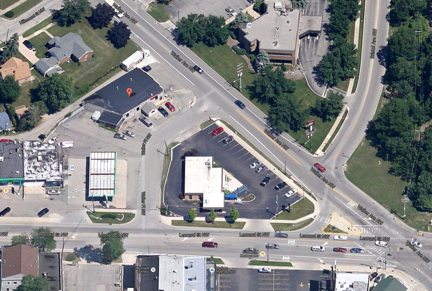
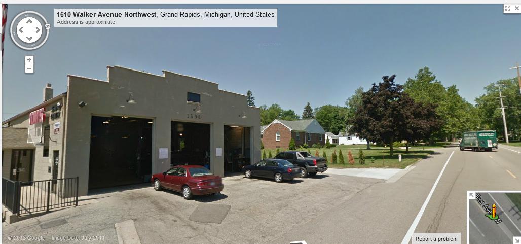
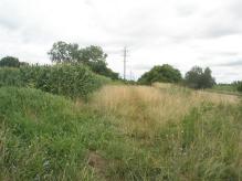
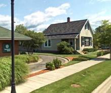
Whether the structure above existed at the endof the spur track shown above, or it's location is just a
coincidence, is not known at present. Today it is a fire station. Whether it was, for example, a car
barn 100 years ago is not known.
Shaokleton
Left click on the images below for larger versions.
Apparent site of the Shaokleton stop and track bed.
Baumhauf
Left click on the images below for larger versions.
Above is the suspected location of the Baumhauf stop. Whether the structure called the depot has
anything structural in common with the depot, or maybe just shares the location, is not known at
present.
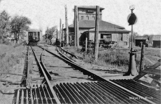
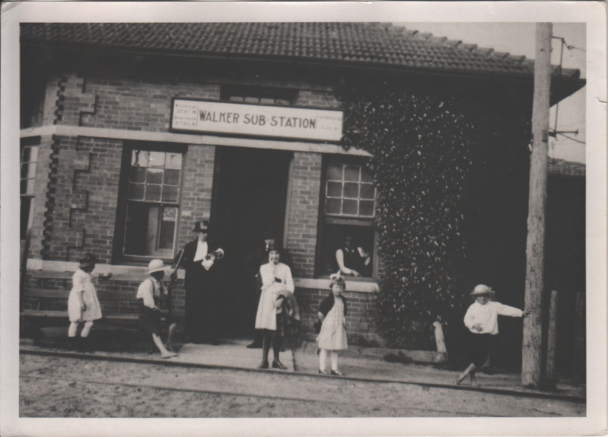
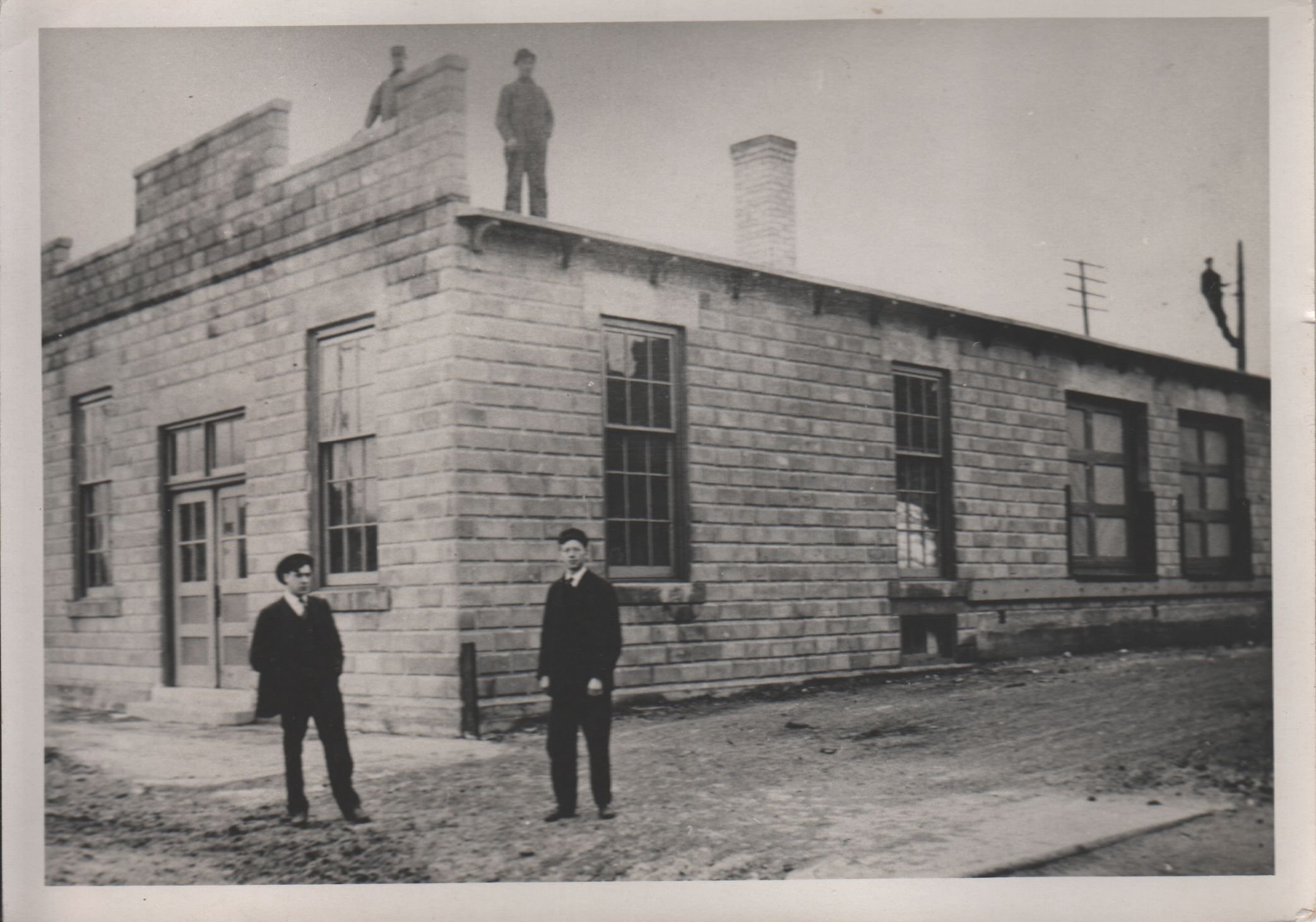
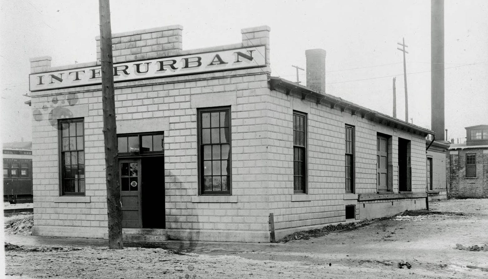
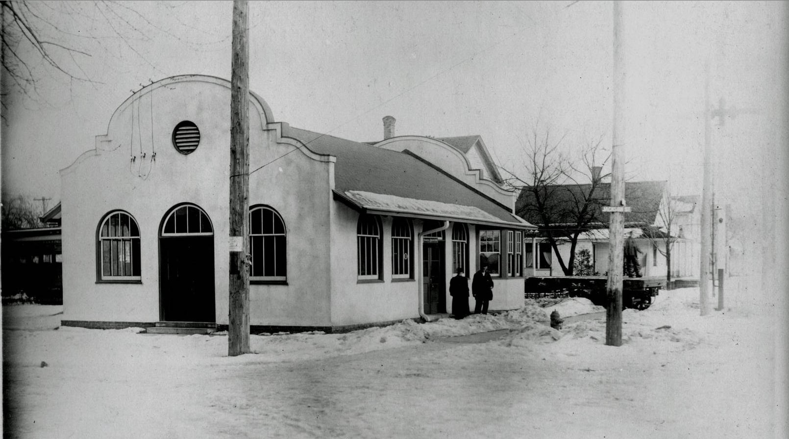
Walker
Left click on the images below for larger versions.

|

c1916
|
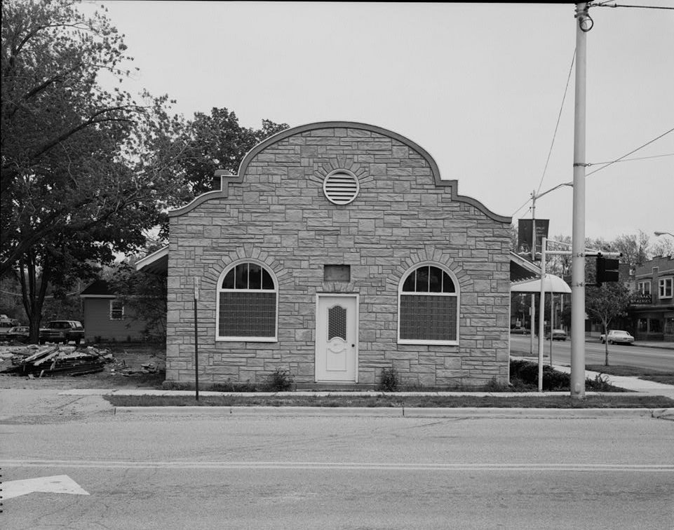
The structure shown above probably served as both a substation for converting A/C to D/C and a station.
It is similar to the one in Coopersville, and was about as close to a standard design as ever emerged
during the short life of the interurban lines.
County Line
Turner
O'Hearn
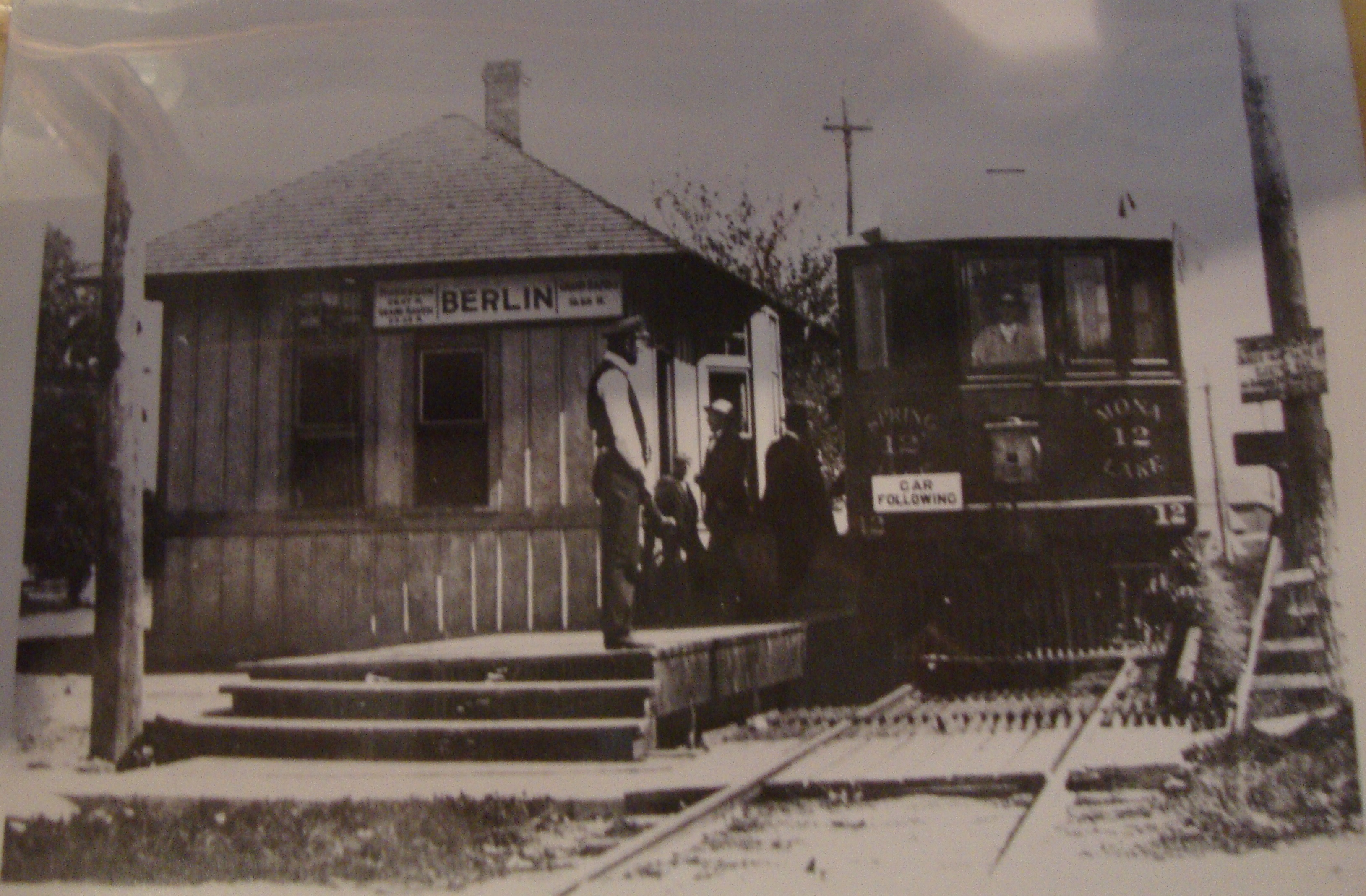
Berlin - Marne
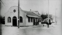
Left click on the images below for larger versions.
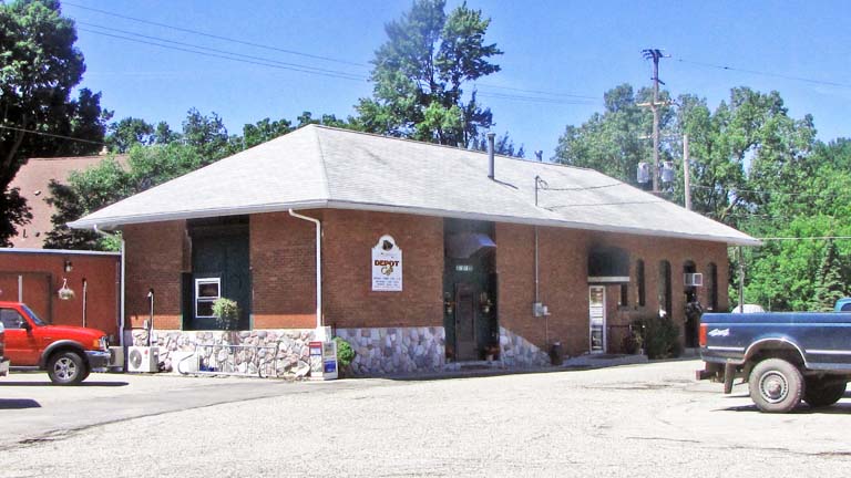
The image above, left, shows the depot at Berlin, MI, as the town was called
before WWI. The depot burned in 1912, and was replaced by a red brick structure,
shown at the right, above, which houses a restaurant in year 2012.
Danforth
Catholic Church
High Bridge
Bresnahan
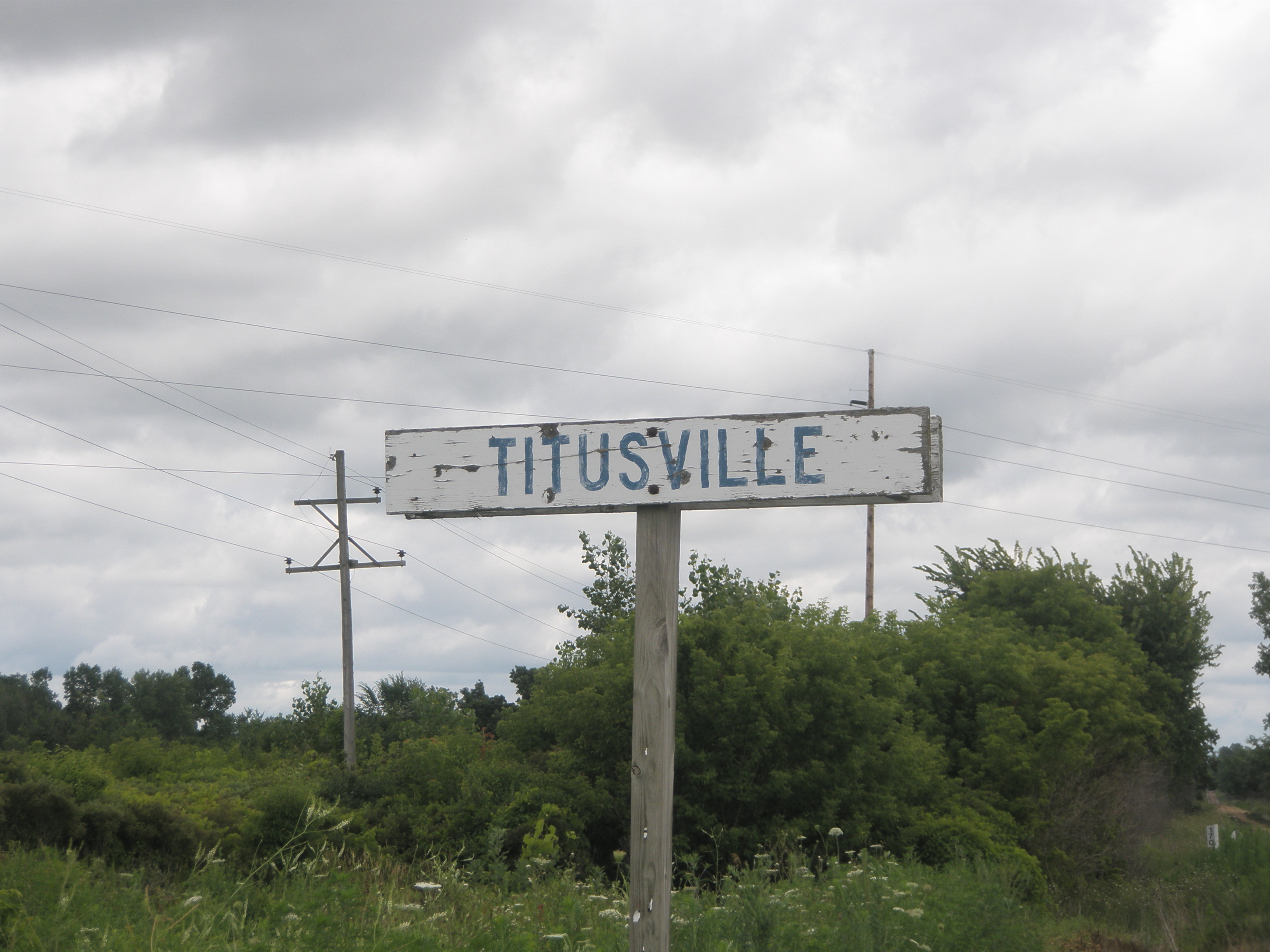
Titusville
GPS coordinates: 43.053163, -85.887233
Never much more than a small collection of houses, for what purpose is unknown, Titusville was probably
a flag stop.
Left click on the images below for larger versions.
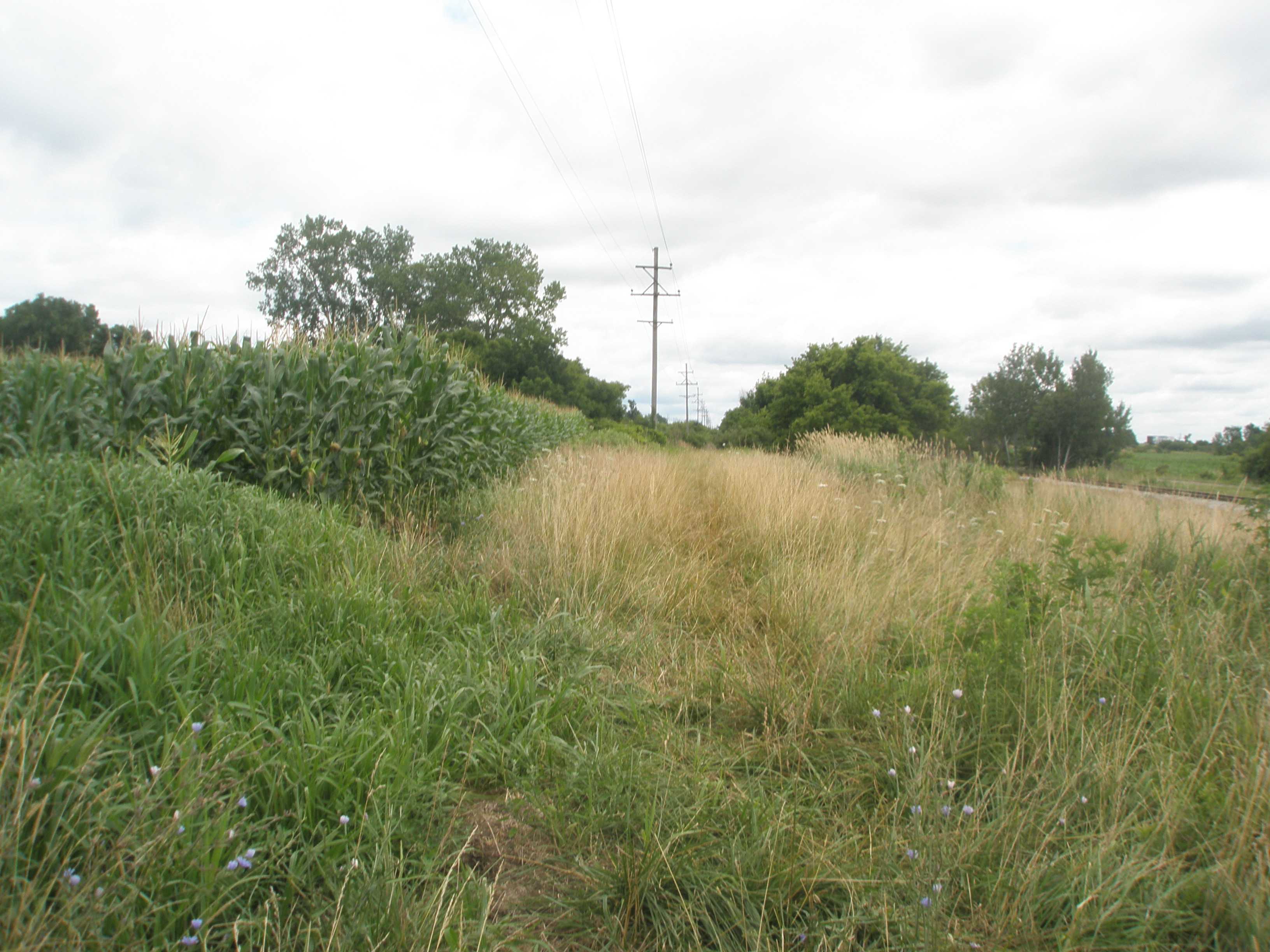
Streeter
GPS coordinates: 43.057632, -85.906951
A small collection of houses for some unspecified reason, Steeter might have been a flag stop.
Left click on the images below for larger versions.
|
Track bed - 2013
|
Satellite - 2013
|
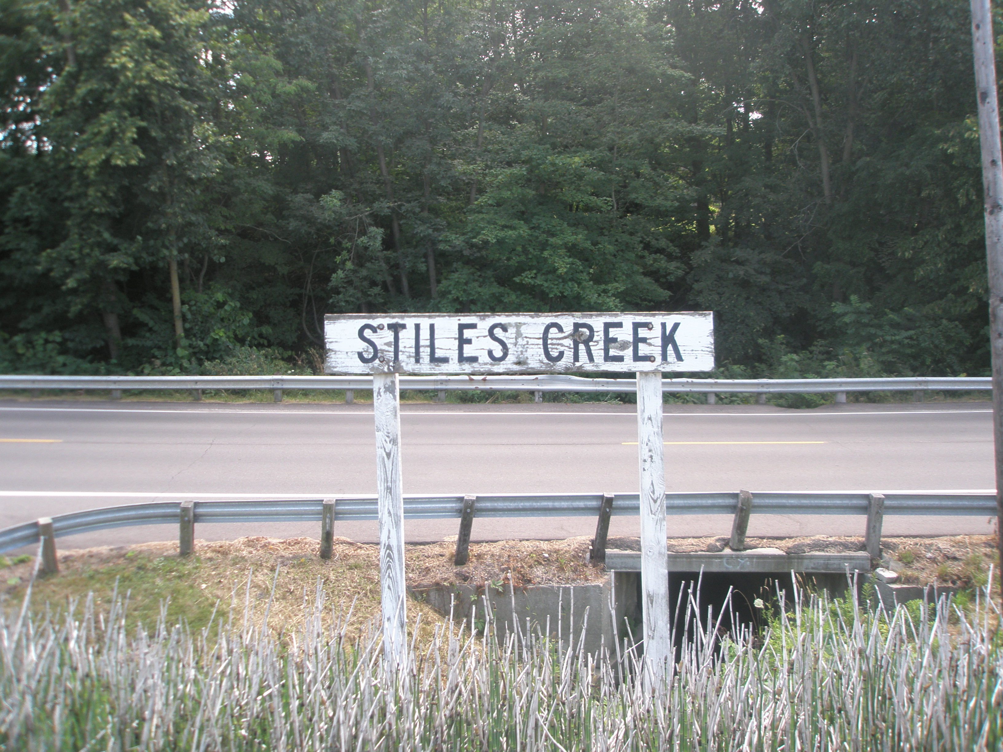
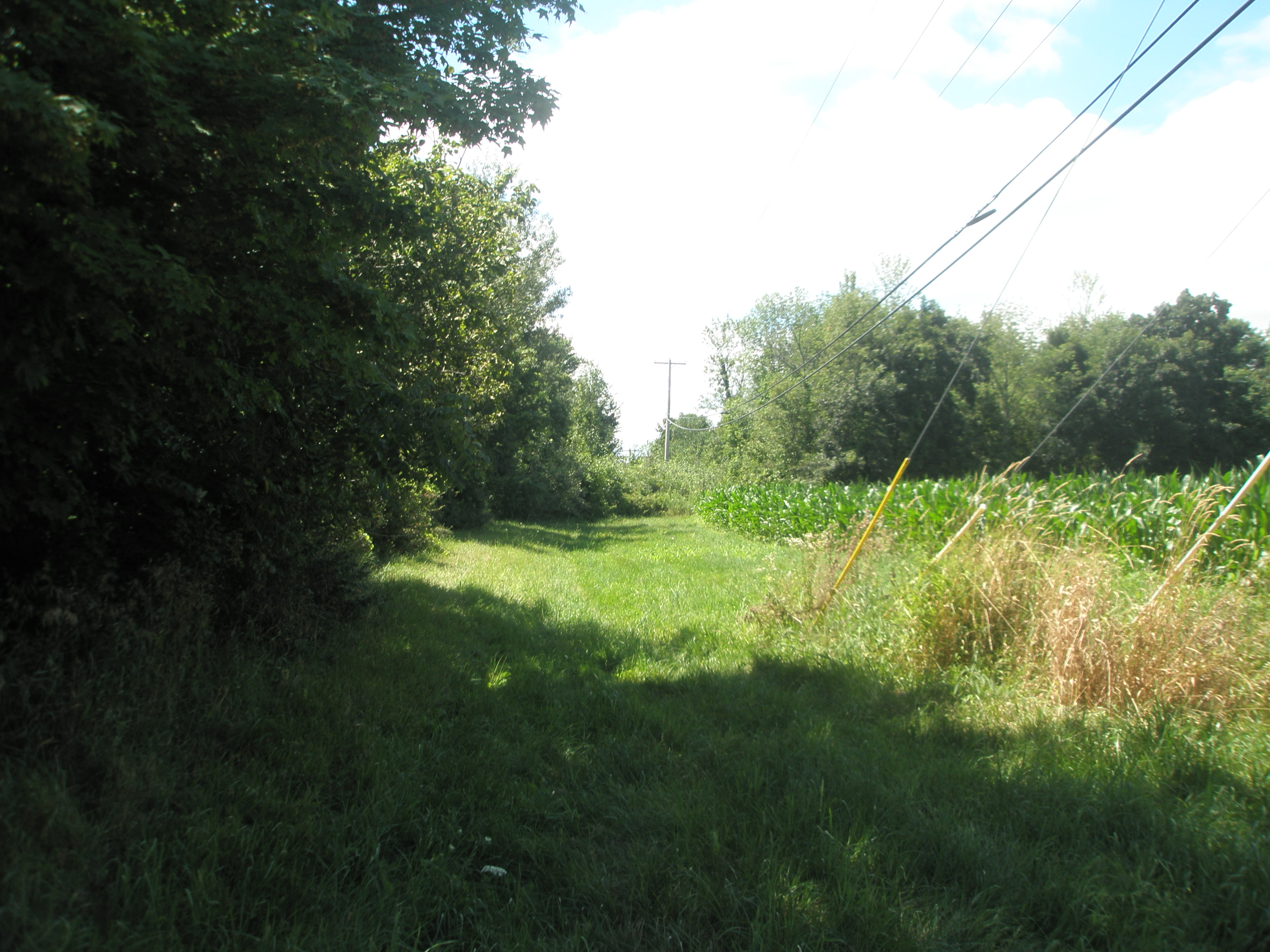
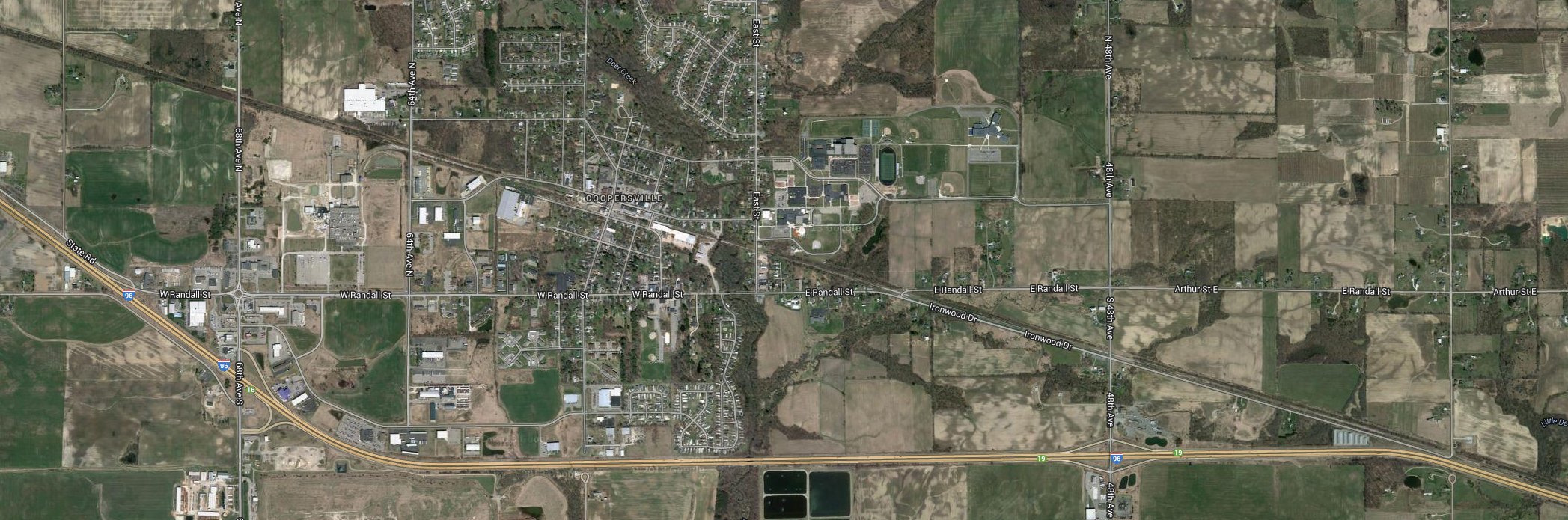
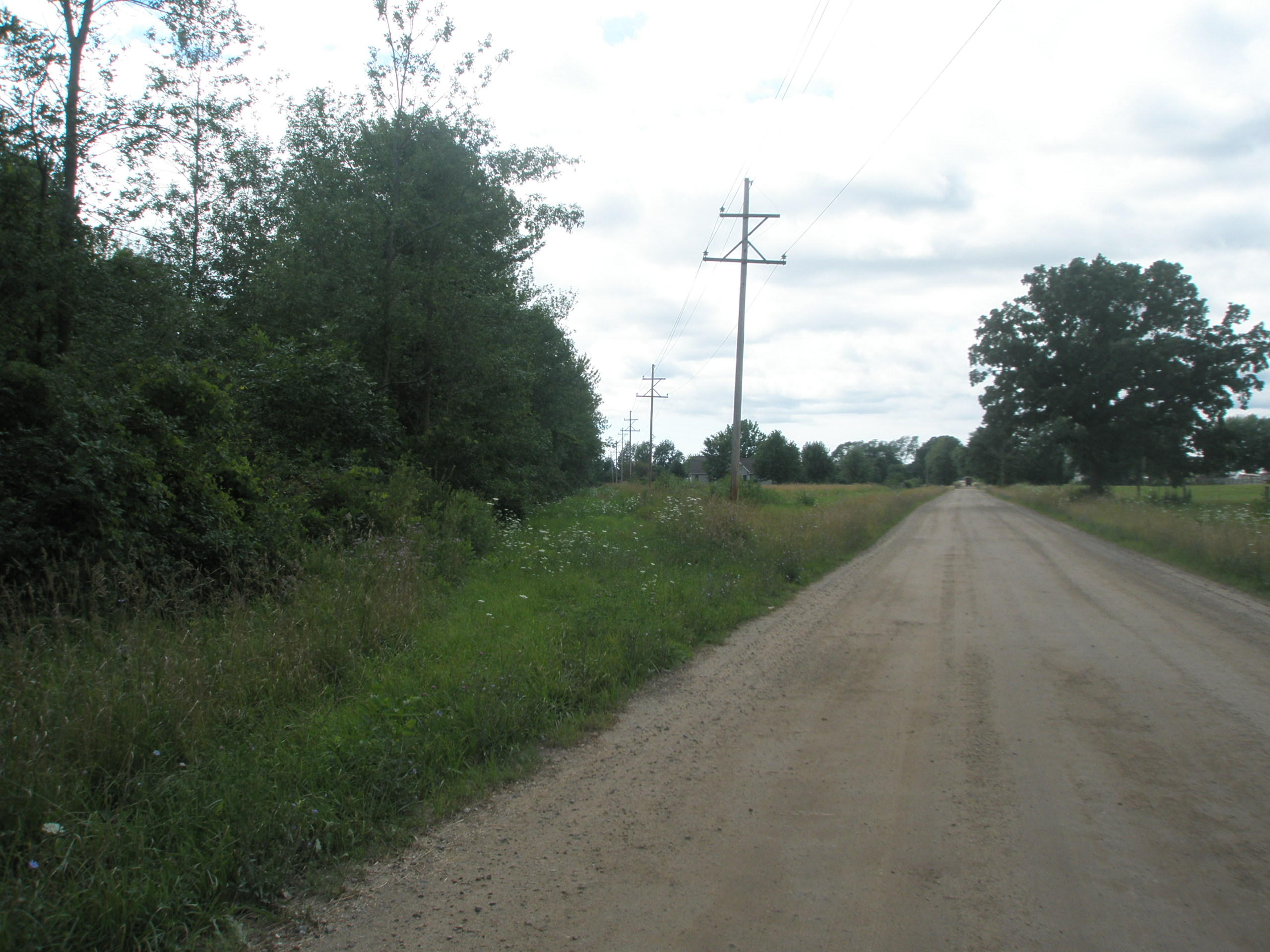
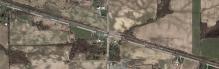
Stiles
GPS coordinates: 43.060046, -85.918629
How much of a town Stiles ever was is unknown at present. Stiles might have been a flag stop.
Left click on the images below for larger versions.
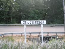
Creek on GTW track
|
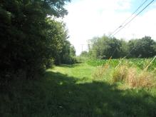
Track bed - 2013
|
Satellite - 2013
|
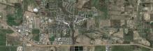
High School
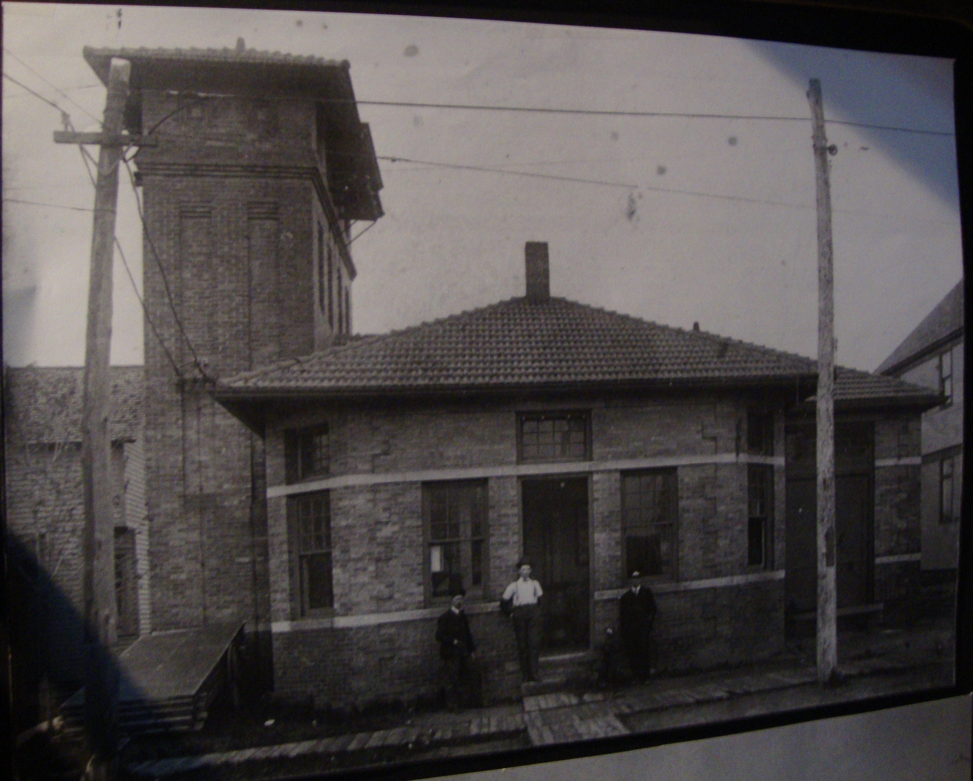
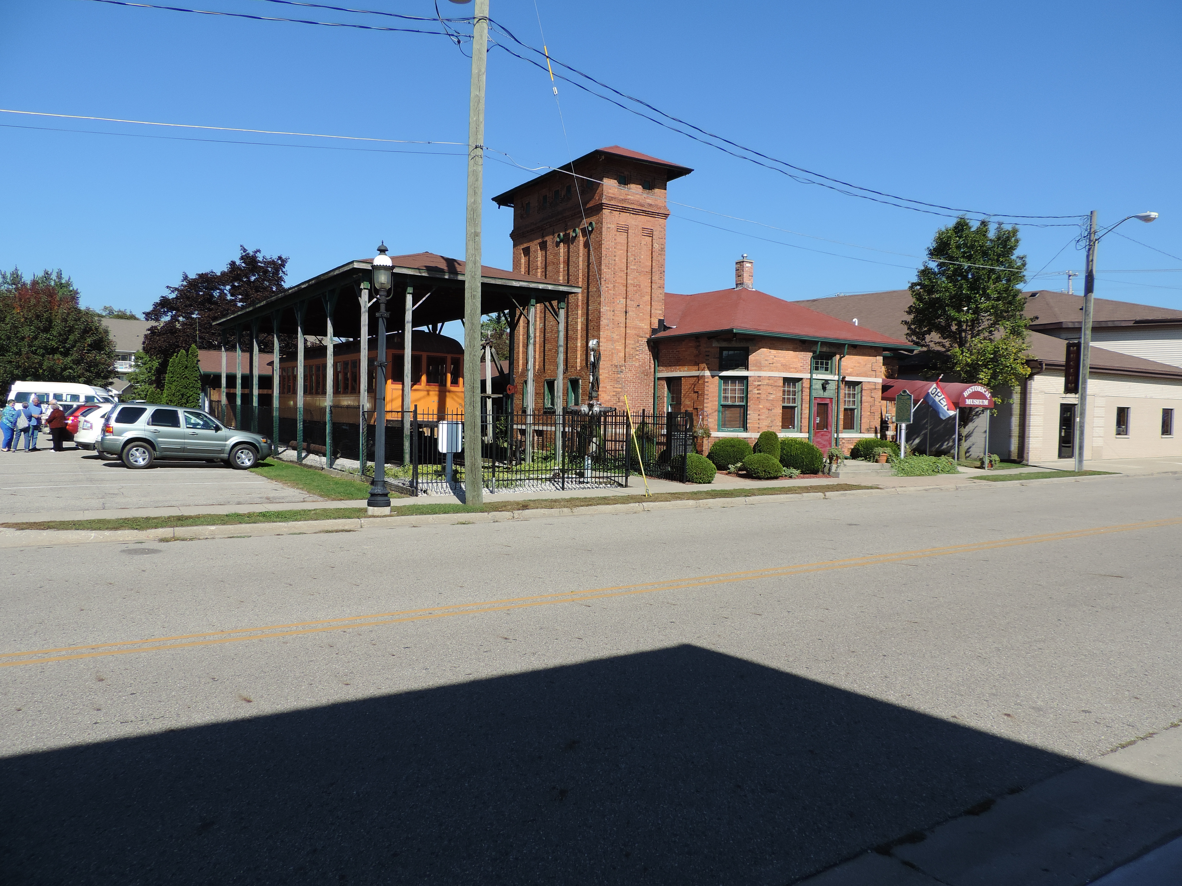
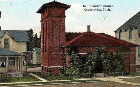
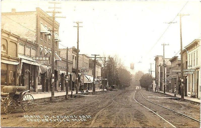
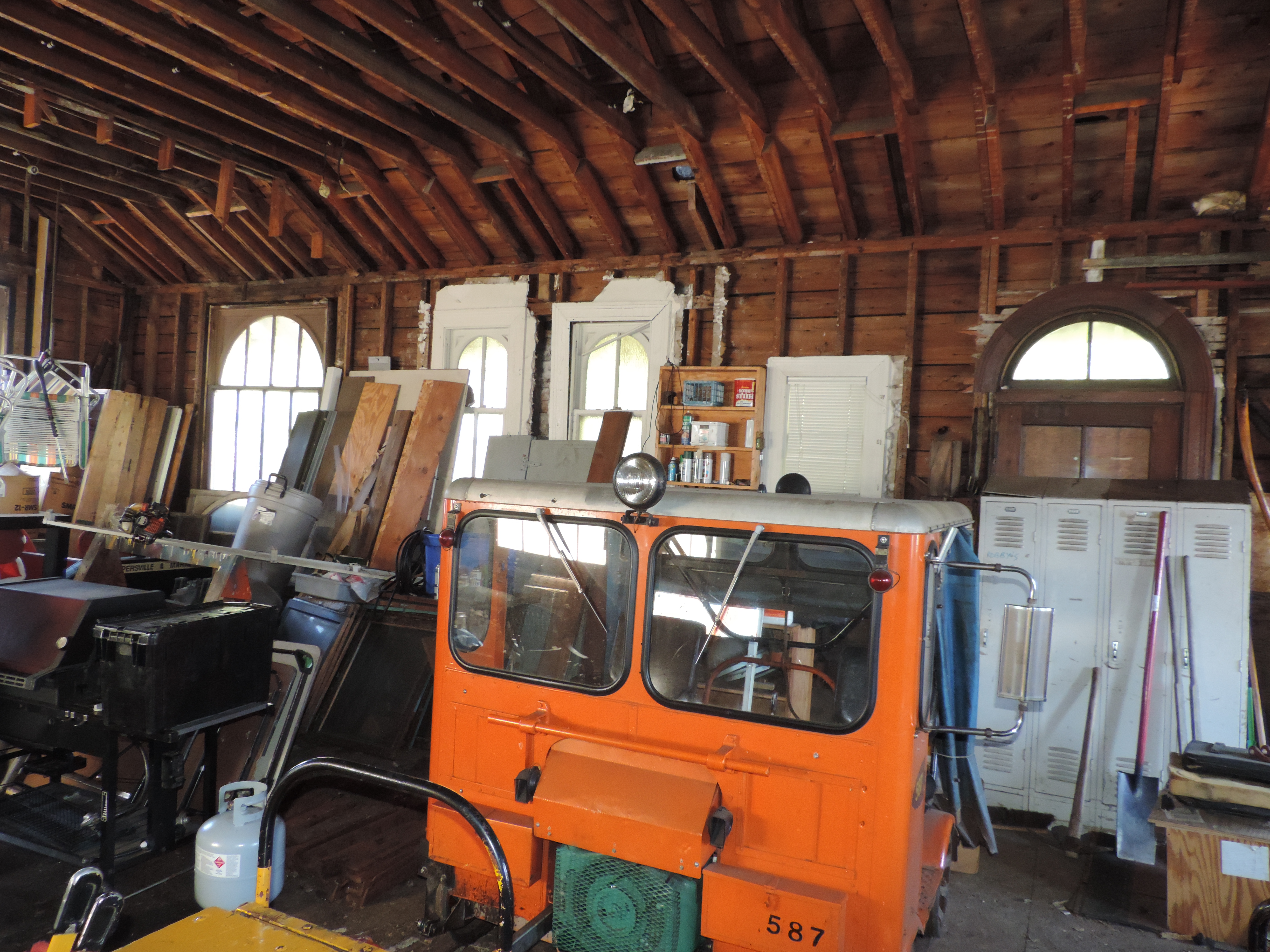
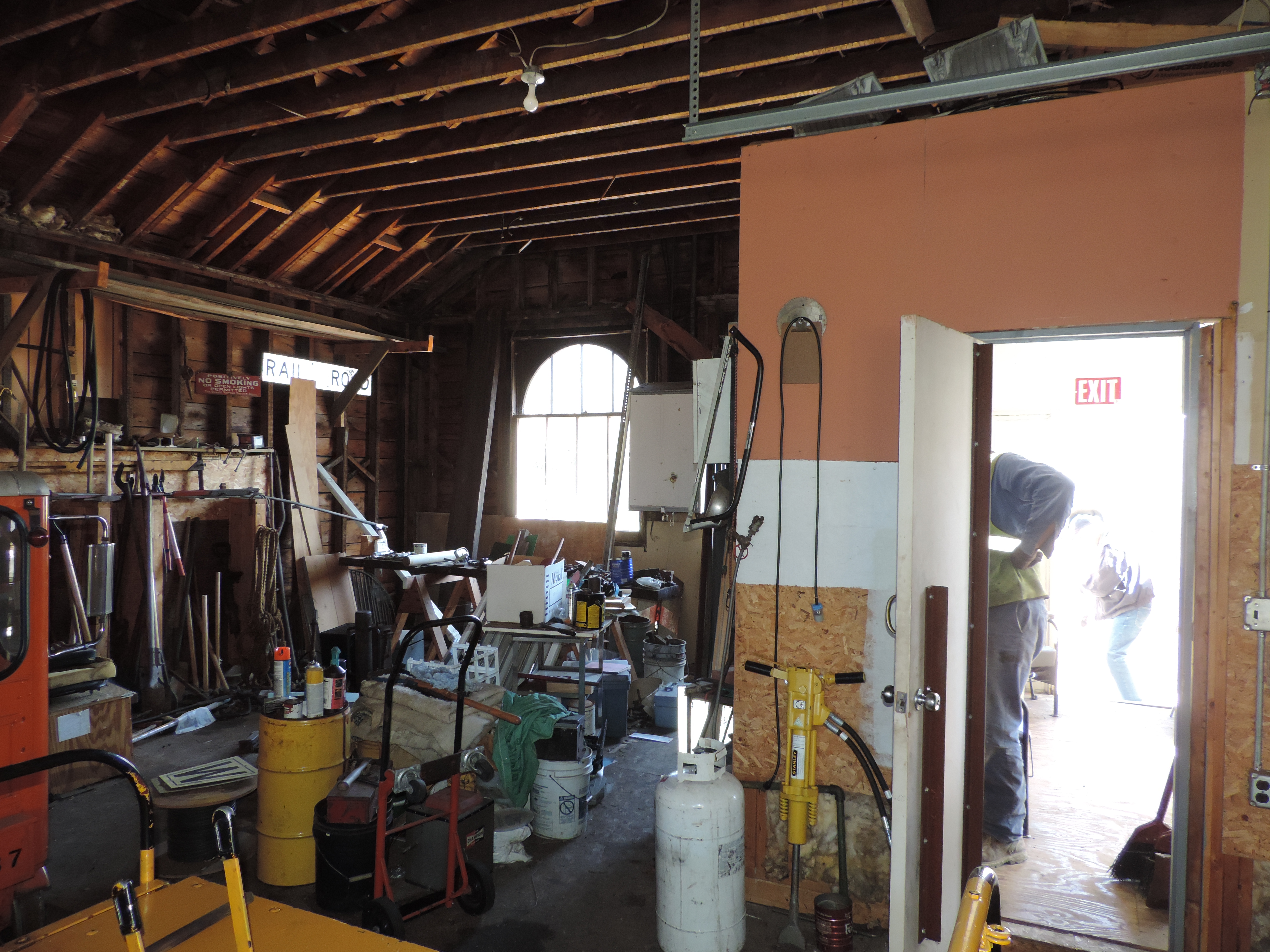
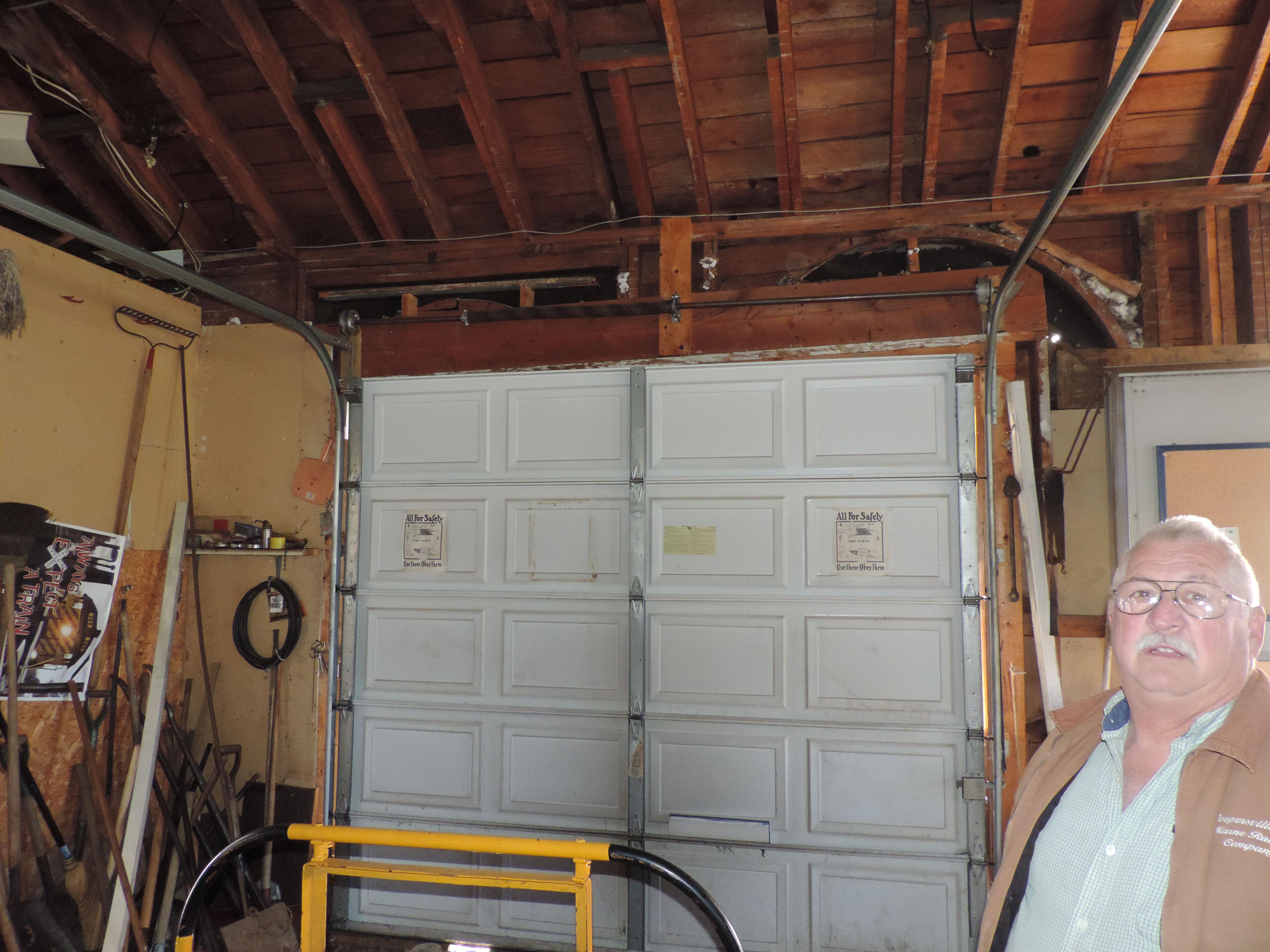
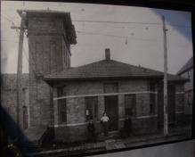
Coopersville
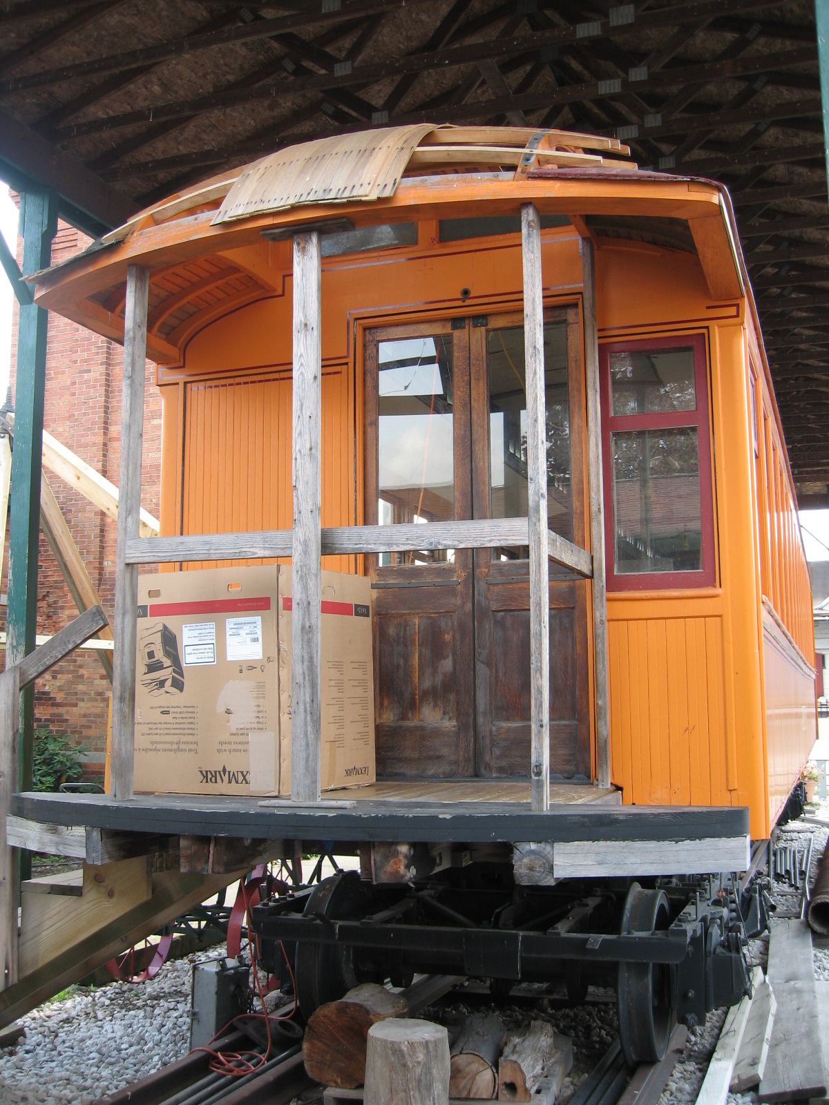
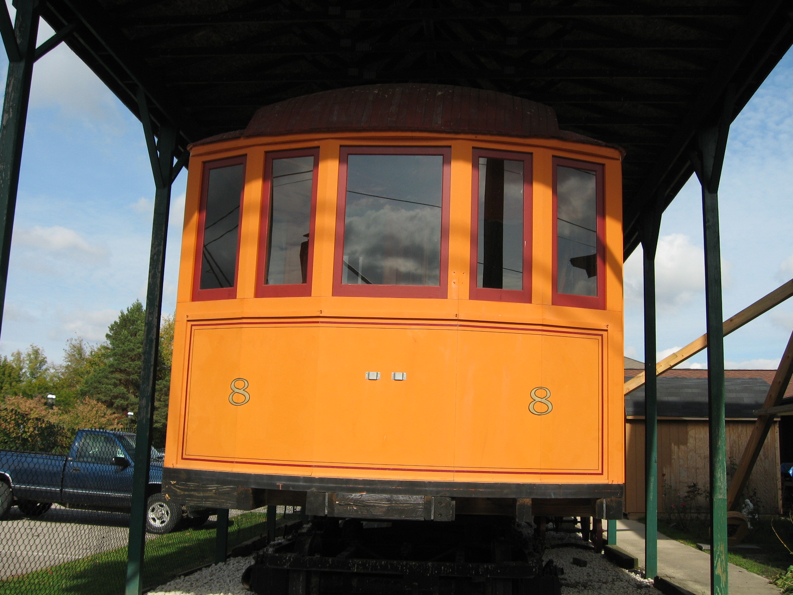
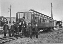
At one time the GR, GH, and Muskegon system had 16 interurban cars.
Car number 8 still exists, and is in the process of slowly being restored,
at the Coopersville, MI, railroad museum. The car was likely in horrible
condition when the project started. It now depends on donations to help the
work along.
The trucks - the wheels and motors - on an abandoned trolley or interurban car
were still valuable for other uses, and were usually removed before a car was
sold, or burned for the meter they contained. The history of car 8 is not known
at this time, but it's a fair bet that those reconstructing it have had to use a lot
of imagination and skill to recreate something even as close as it appears to be.
A monumental job that once would have been routine for the line's maintenance shops,
which no doubt repaired damaged cars on a regular basis, with workers, facilities,
and documentation, that allowed them to work on any facet of a coach.
Left click on the images below for larger versions.
Some of the other cars are shown below. Other than car number 8, it's not
clear that any exist as of year 2012.
Left click on the images below for larger versions.
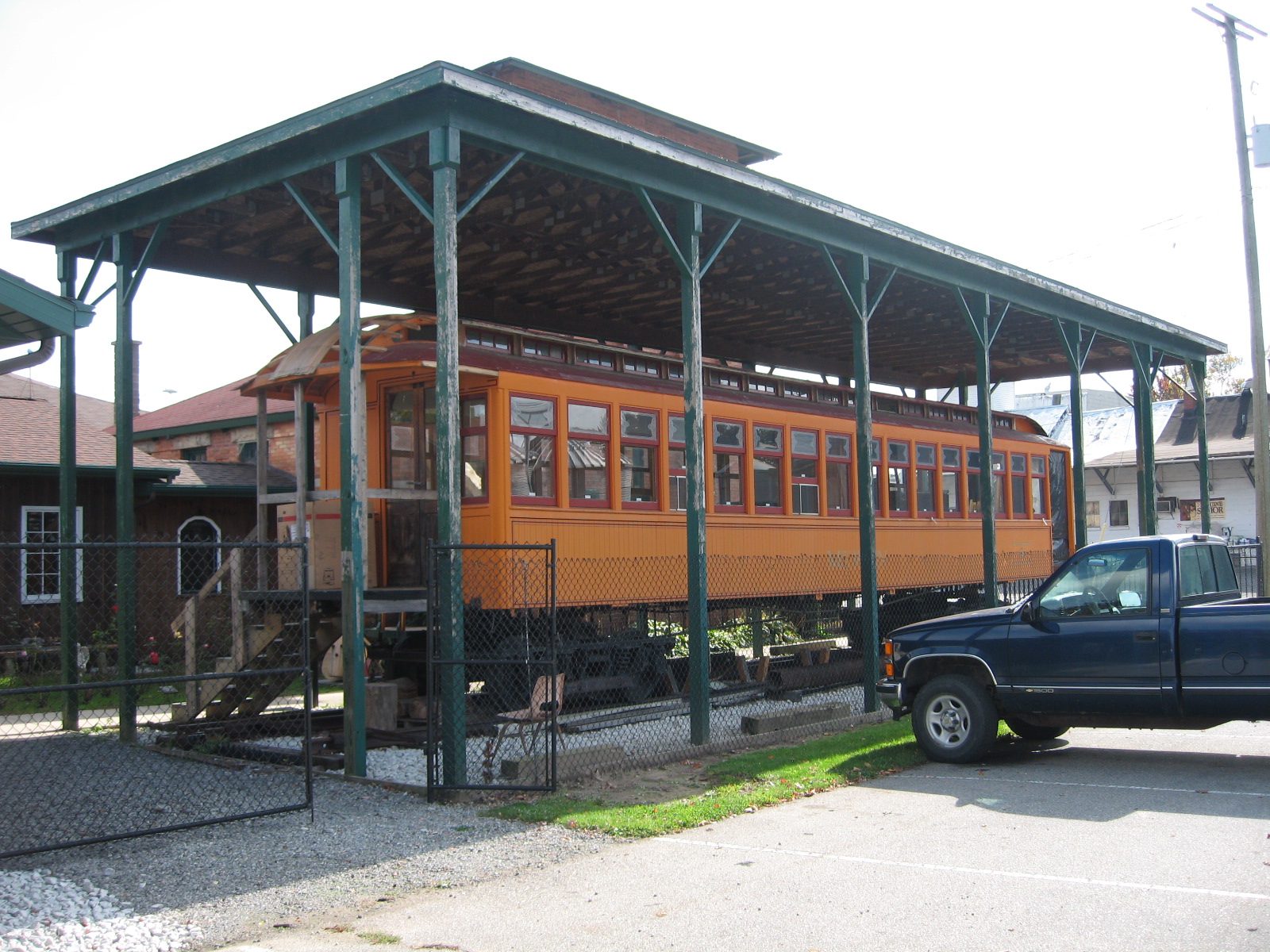
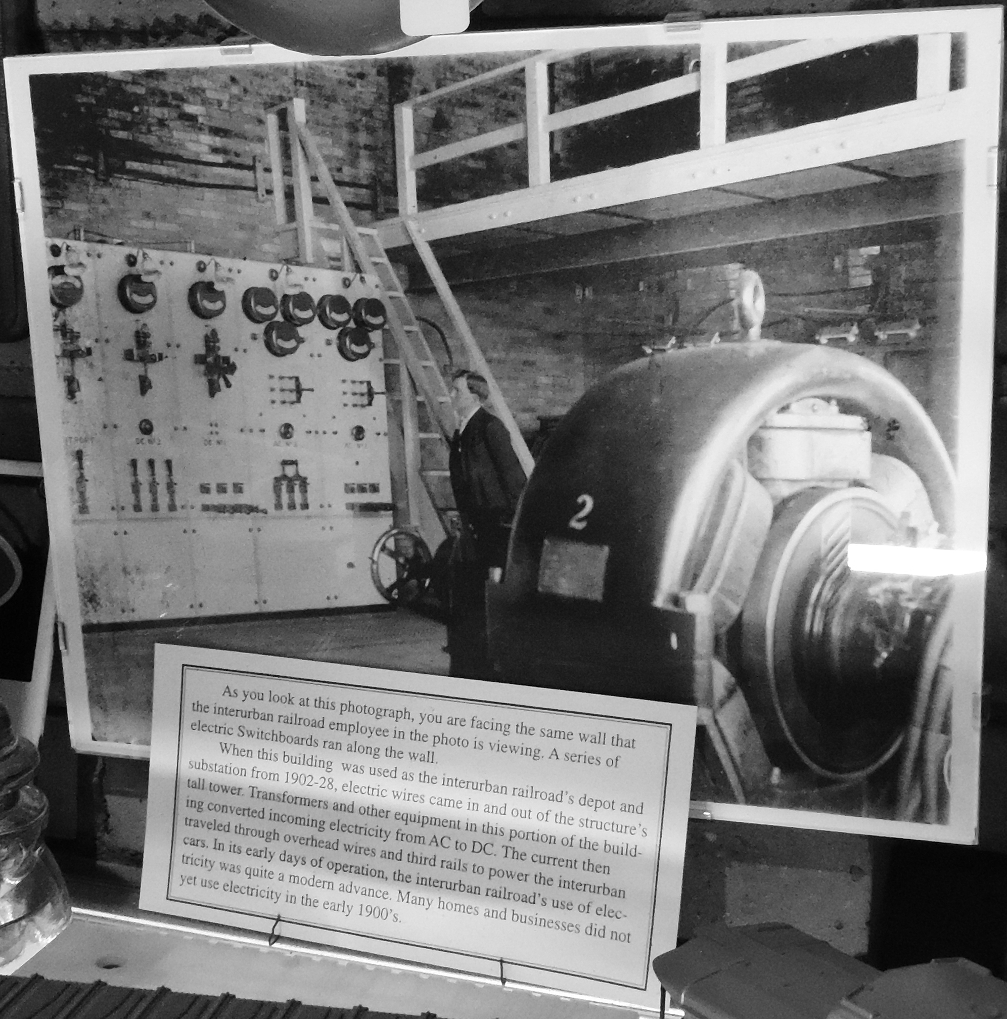
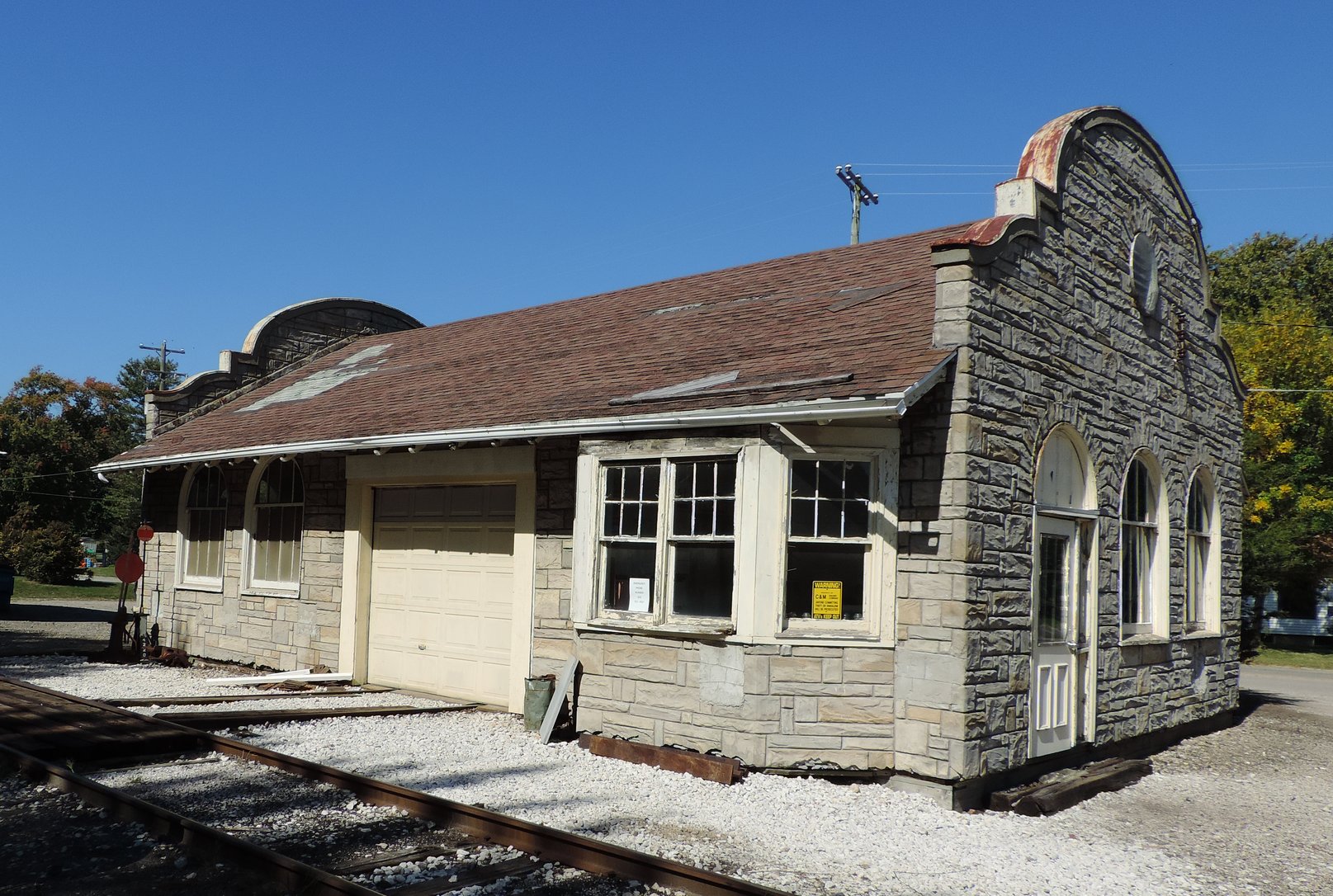
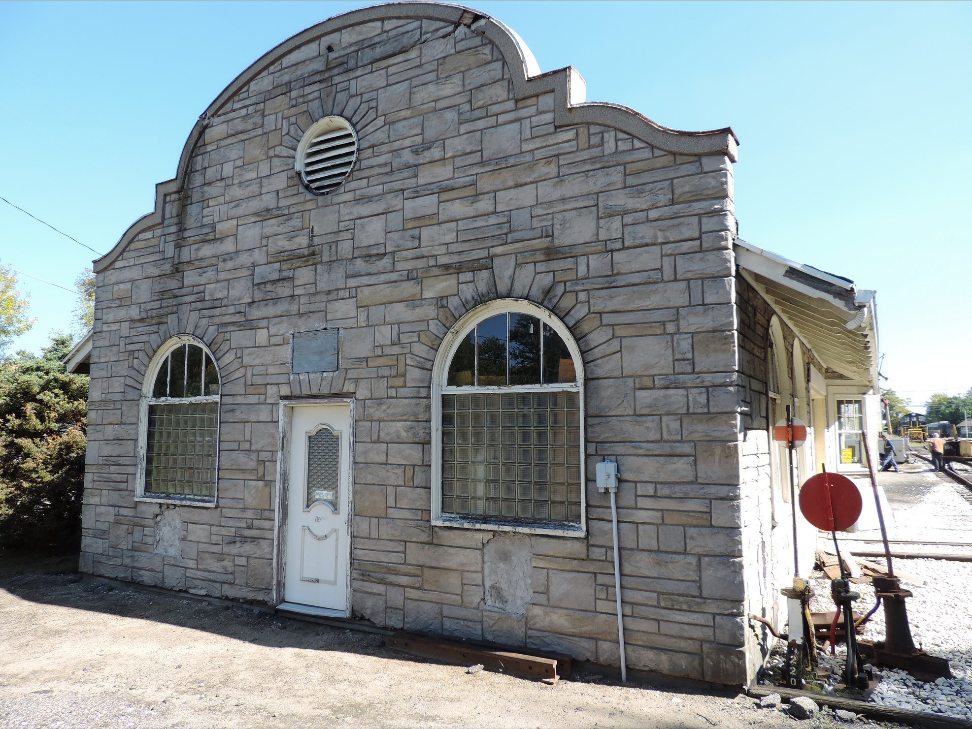
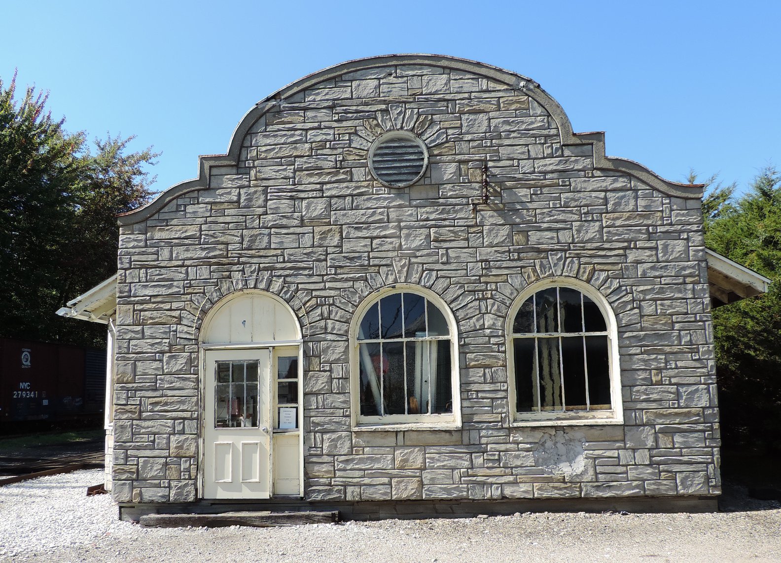
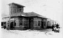
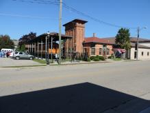
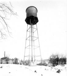
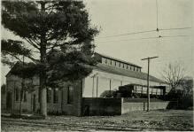
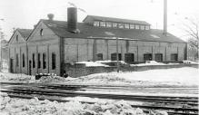
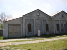
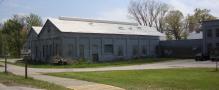
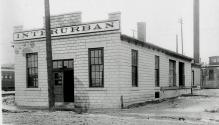
The building which houses the museum is called a generating station. It, and
another facility in Fruitport, MI, converted A/C electricity into the D/C electricity
used by the interurban cars. The Coopersville station is shown below.
Notice that the tracks are essentially right in front of the generating station.
Left click on the images below for larger versions.
|
|
|

Genset
|
September 24, 2013
|

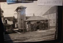
1915 postcard.
|
The genset at Cooperville, show above, occupied the area by the tower, where the high voltage
A/C entered the station. These gensets no doubt represented a huge cost for the interurban systems,
as they required a full time opeator - maybe 16 to 18 hours a day. Had the coaches been able to use
A/C/ motors, only a transformer would have been needed occasionally along the line, no operator,
and the build would have been needed only for freight and passengers. Alas, A/C technology for use
on trolley cars came along too late, and there would have been a massive retrofitting cost to
use A/D motors at a later time.
Left click on the images below for larger versions.
c1908
|
Kelly
Callahan
East Dennison
West Dennison
Left click on the images below for larger versions.

Trackbed - 2013
|
Malone
Conley
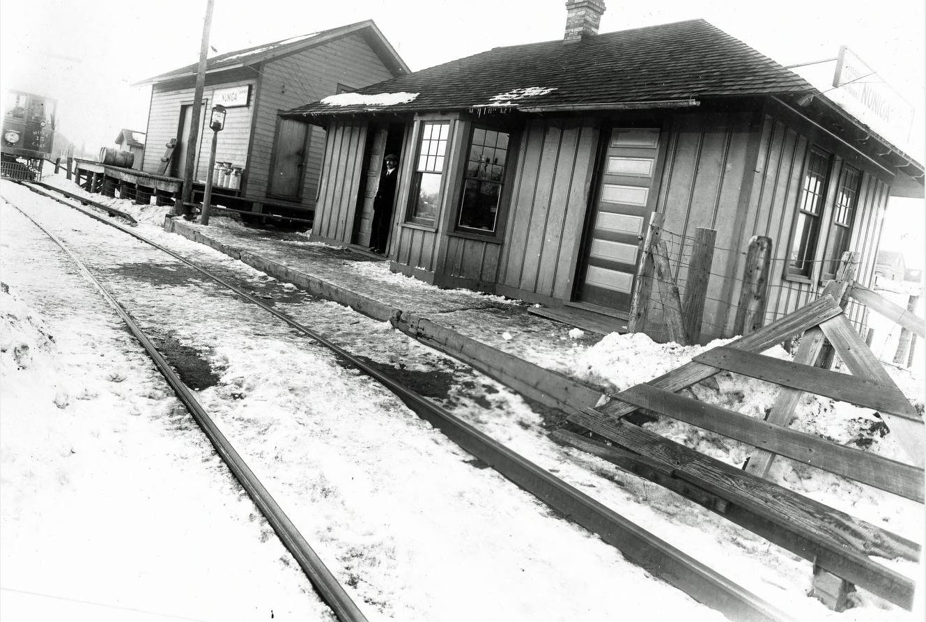
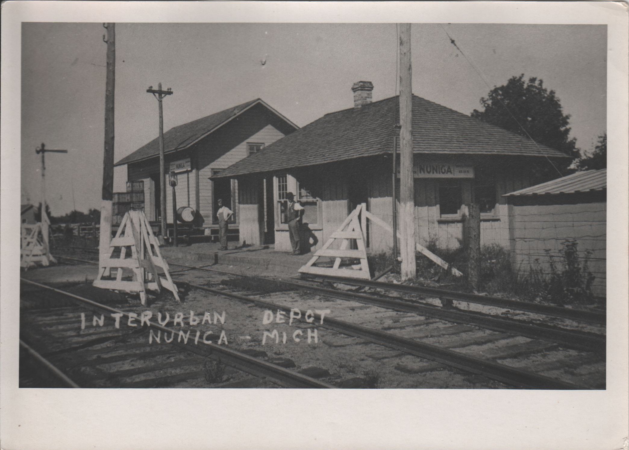
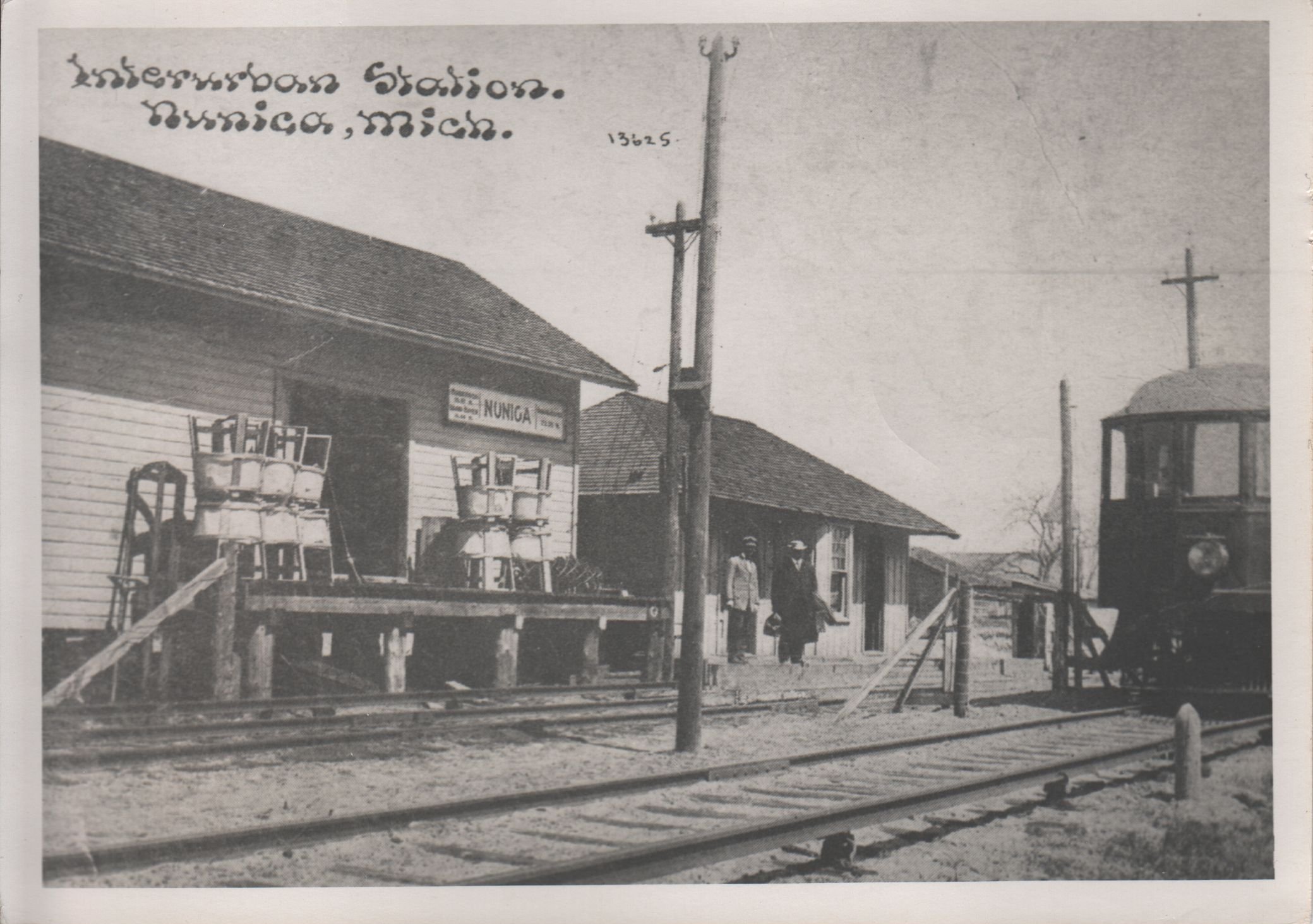
Nunica
Left click on the images below for larger versions.
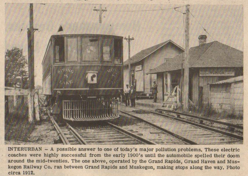
Some material supplied for scanning by Lillian Annis, class of 1941.
Above, top row, right, a 1912 photograph of interurban car number 8 on the
Grand Rapids to Muskegon
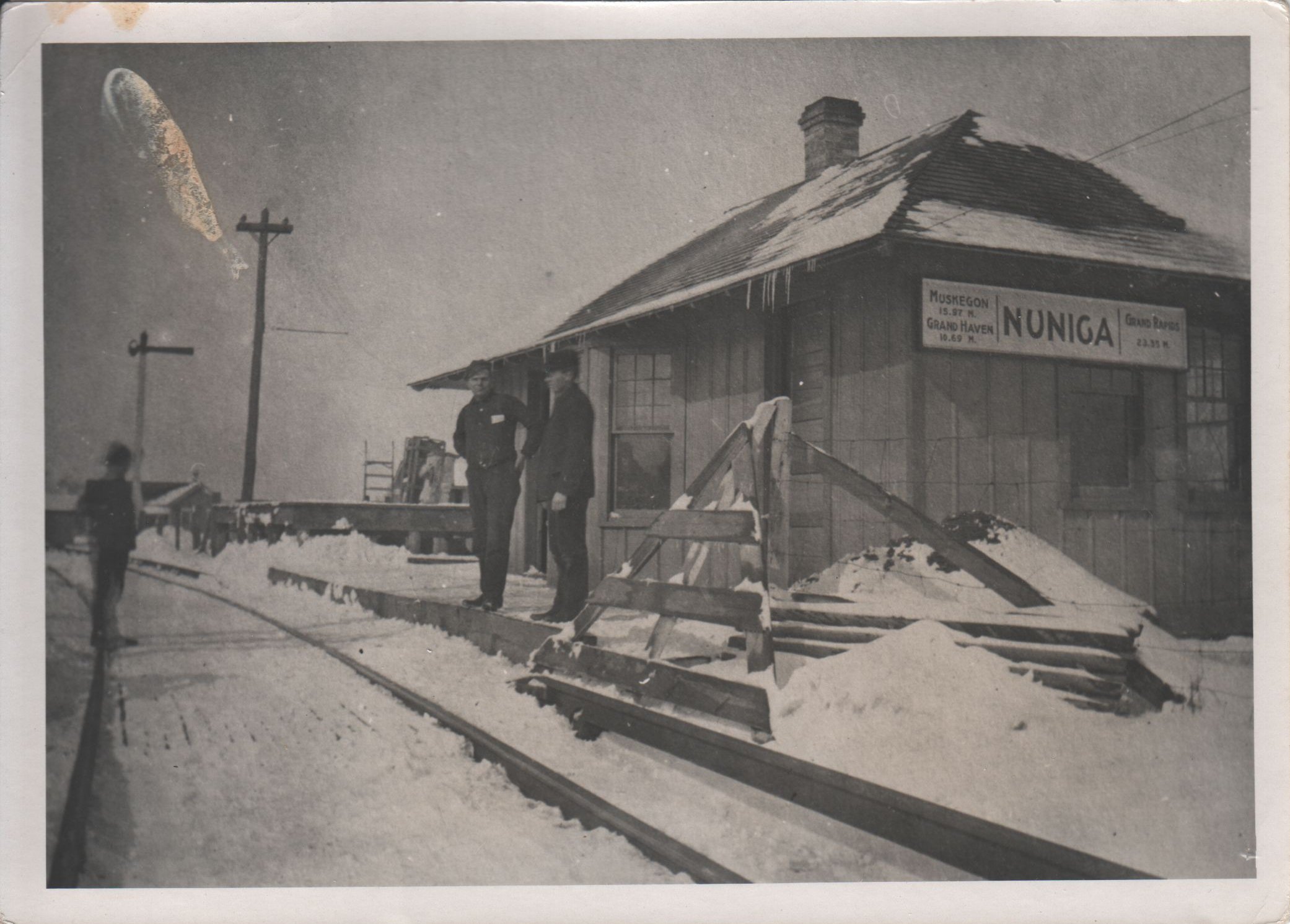
line stopping at Nunica, MI. Middle, above, is an undated photograph of the
Nunica depot. One notices a building behind the depot either does not exist yet,
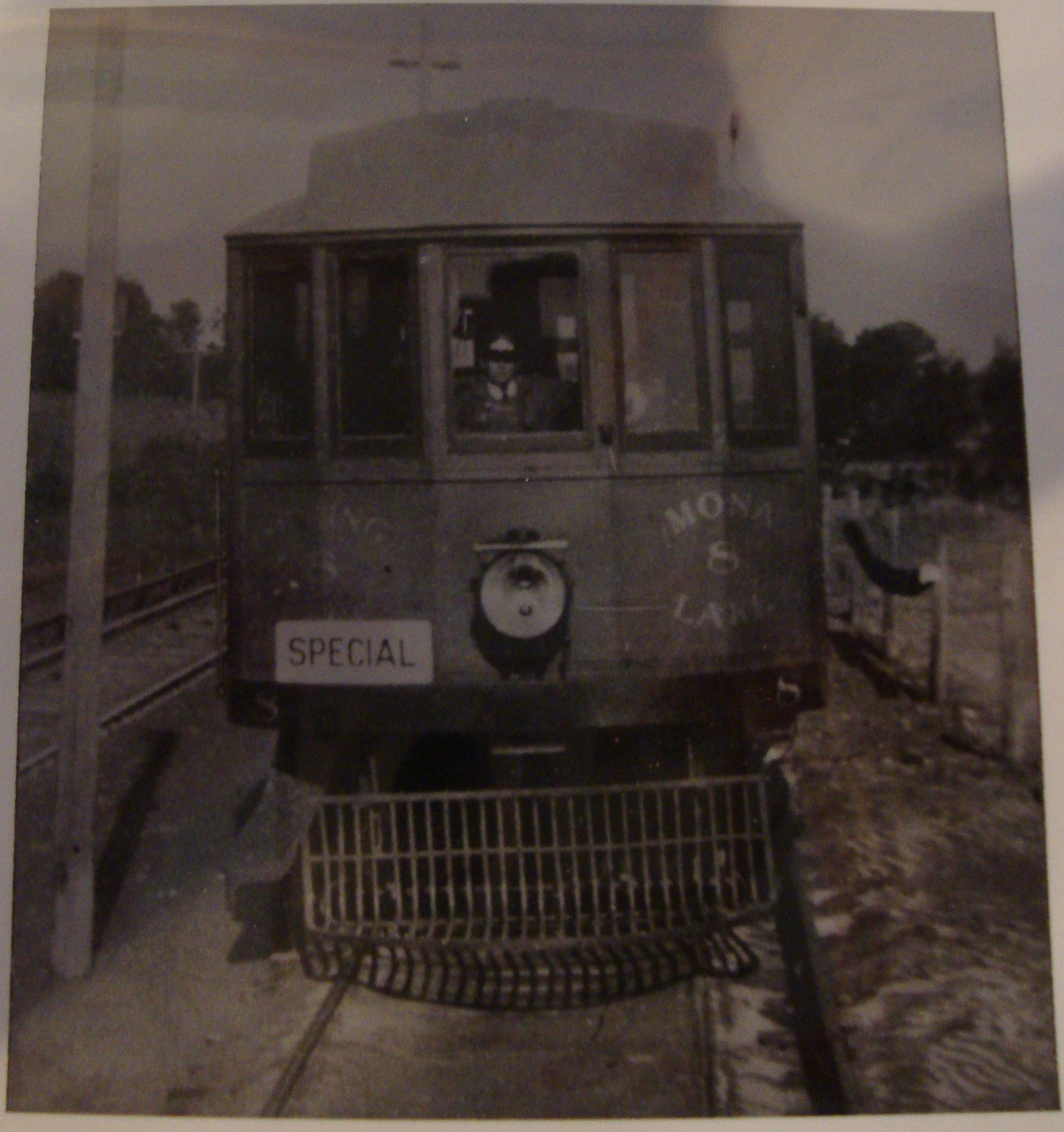
or is gone for some reason. At right, above, second row, is another look at car 8. It's not
clear what "special" means. Possibly a coach on a run with no stops other than the
destination. Possibly a coach reserved for bigshots.
Left click on the image below for a larger version.
The Nunica depot once sat about where the substation in the view above now sits.
GPS coordinates: 43.079594 -86.06841
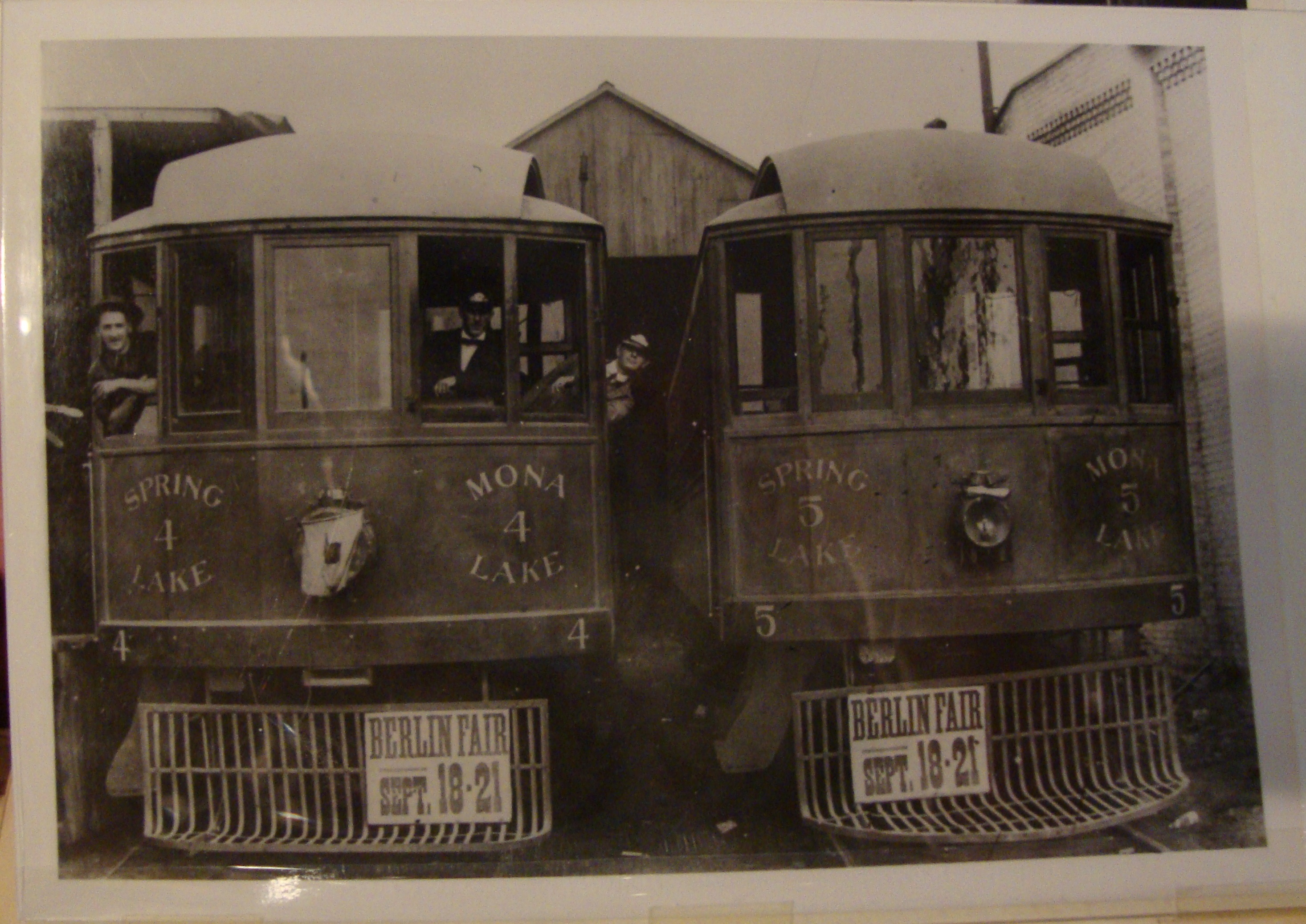
A number of photographs of depots contain coach 15. It's possible that the photographer
got out at each depot, ran ahead and took the photograph of the depot with coach 15
in it, and then moved on.
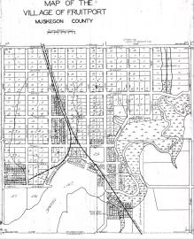
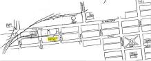
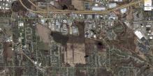
Fruitport
Left click on the images below for larger versions.
The photograph above, left, shows a station at Fruitport. In front of the coach is the
track that heads off to Grand Haven. The coach is apparently coming from Muskeegon.
Locals could wait at the station for coaches headed either to Grand Haven, Grand Rapids,
or Muskeegon. The photograph at the right, above, is described as a company junction
shelter. Perhaps the coach at the right, used as a building. It has no trucks.
Left click on the images below for larger versions.
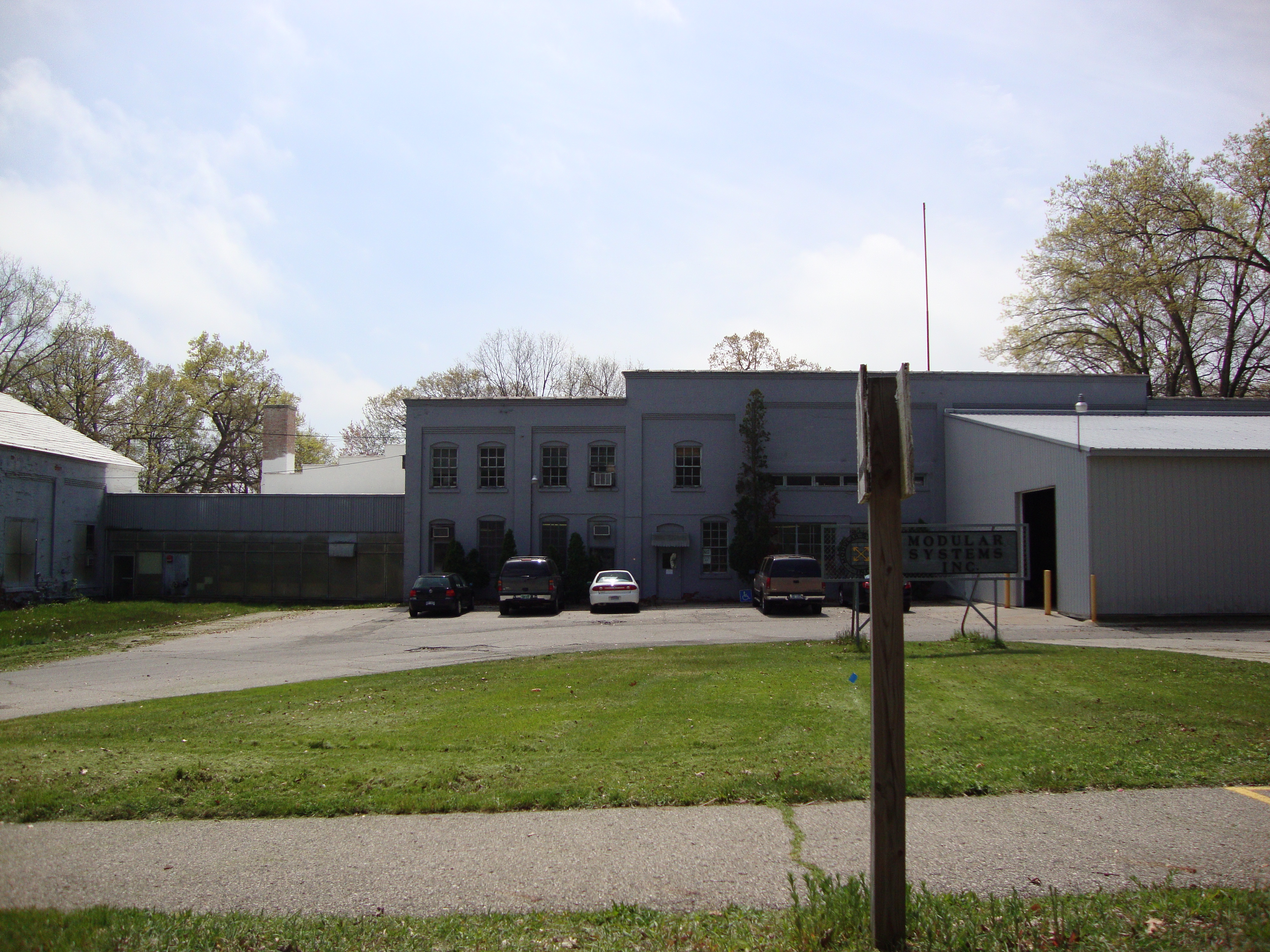
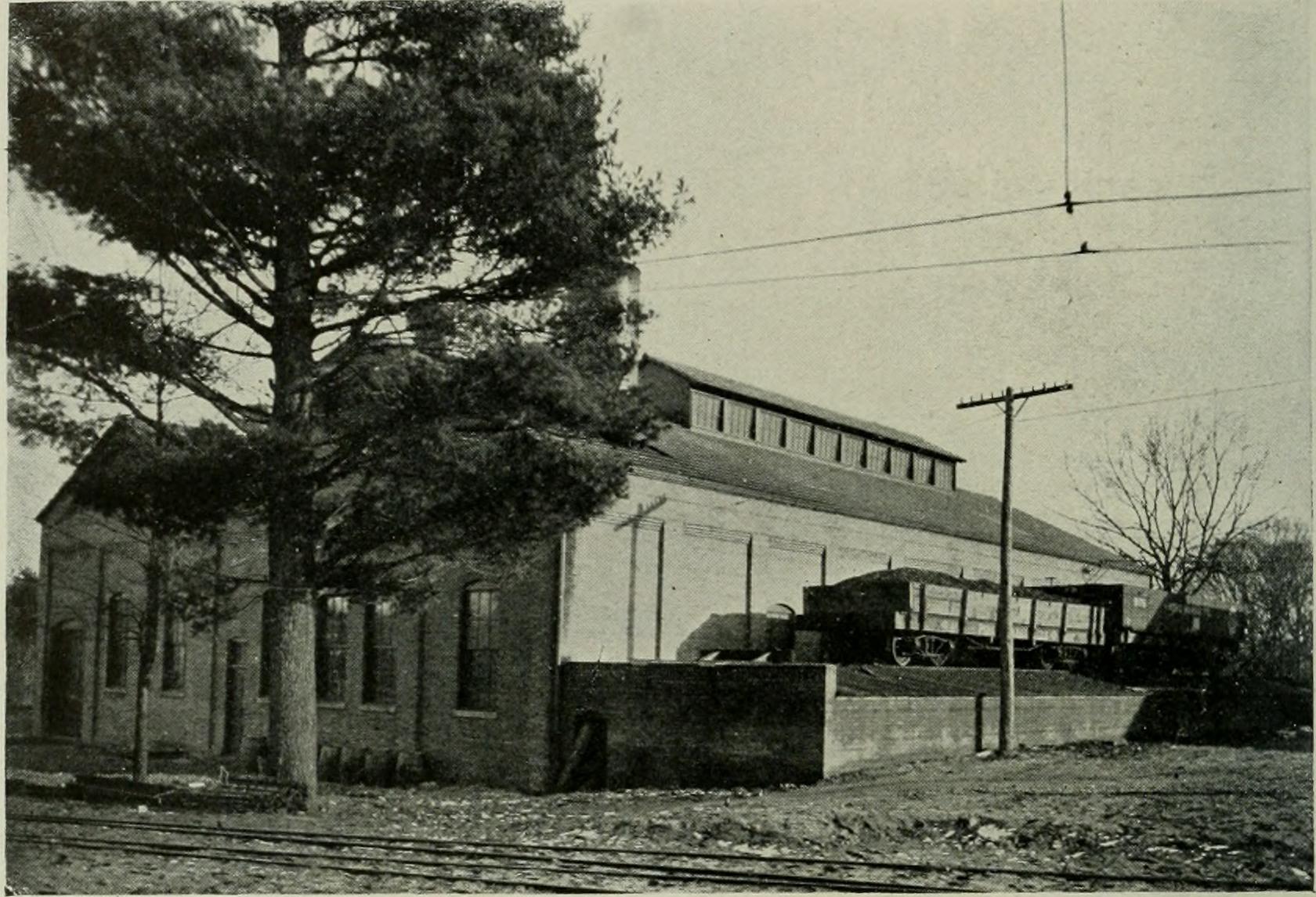
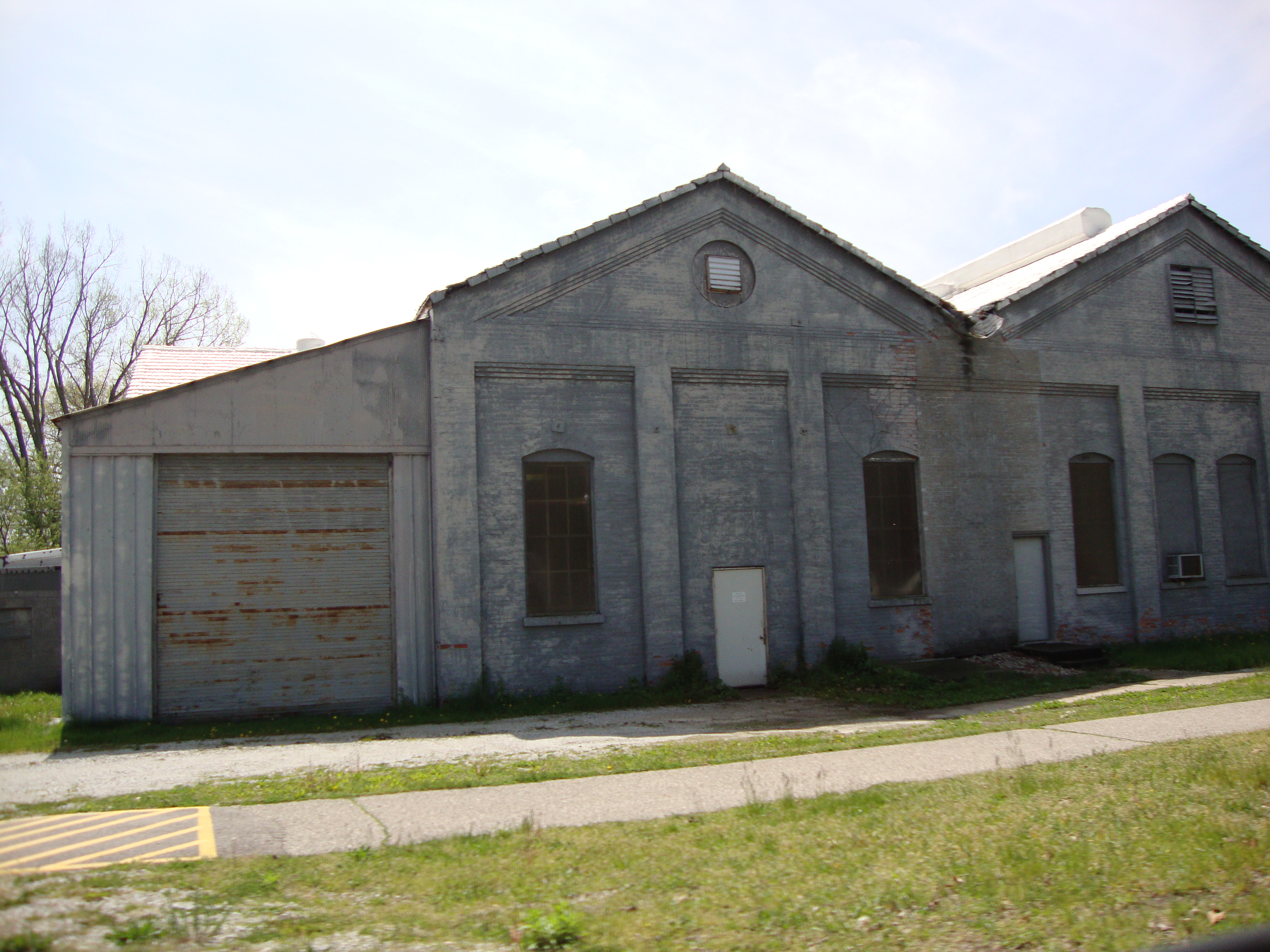
The power station at Fruitport is shown below. Pere Marquette tracks once went on both sides of the
building. On the west side, coal was delivered for the power station. On the right side, the track continued
on and went north, paralelling for a distance the GR-GH-M interurban track.
Left click on the images below for larger versions.
Water tower. PM track at right.
|
Coal dump.
|
Power station.
|
Power station building - 2012
|
Power station building - 2012
|

Power station building - 2012
|
PM track by power station.
c1918
|
PM and interurban tracks.
c1918
|
The Pere Marquette tracks once went to the south of the interurban power station, and then eventually
paralleled the interurban tracks for a ways. "Development" has
compeletely overtaken them today, and even by satellite one cannot discern that
they ever existed.
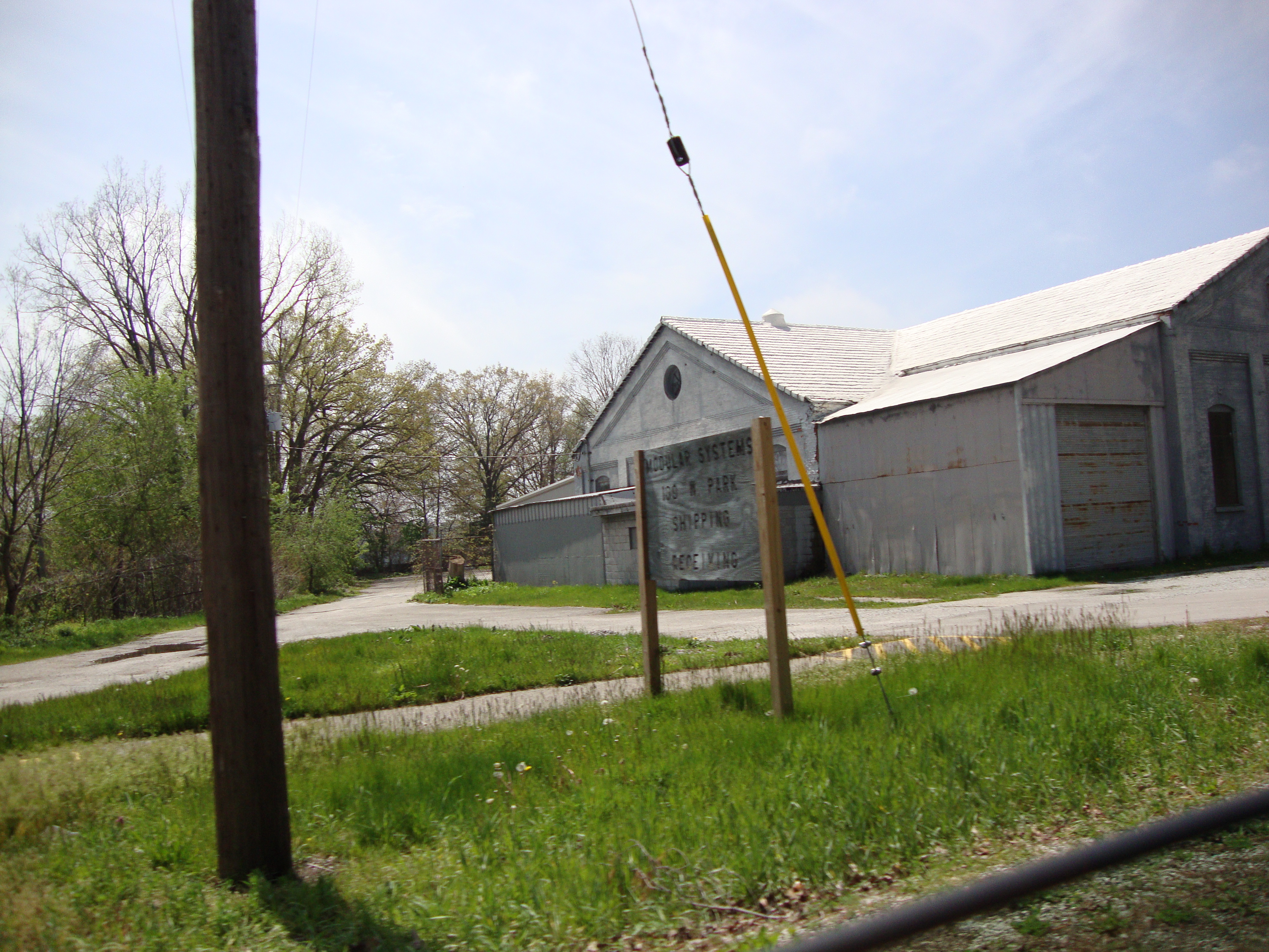
In year 2012 the buildings above house a company named Modular Systems.
Looking at the photograph in the first row,
above, at the right, the main tracks were located to the left, about one quarter mile.
The main track bed can still be seen in aerial photos.
The photograph above labeled "water tower" contains a view of the track and a railroad
car that brought coal and other supplies to the generating station. Alas, a facility like
this was a full fledged power station, and likely expensive to run. In most cases, power
from a local power company was used instead to run a motor-generator pair to create the
D/C needed for the lines.
Left click on the image below for a larger version.
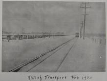
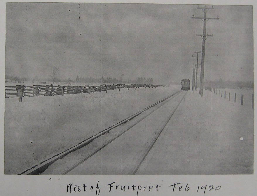
The photograph above shows an interurban car somewhere west of Fruitport, Michigan,
in February, 1920. The interurban cars were heavy, and could deal well with the
February conditions. Special pneumatic shoes on the electric rails helped make
contract during icy conditions.
Left click on the image below for a larger version.
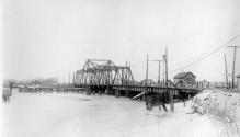
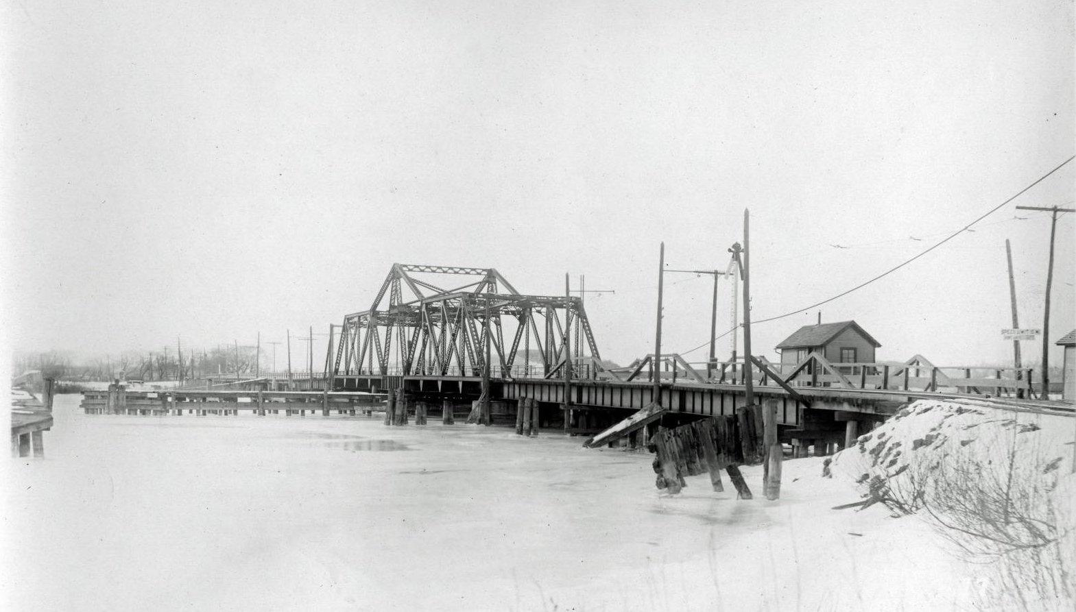
The bridge above, shown in about 1902, connected Grand Haven to Spring Lake, across
the Grand River.
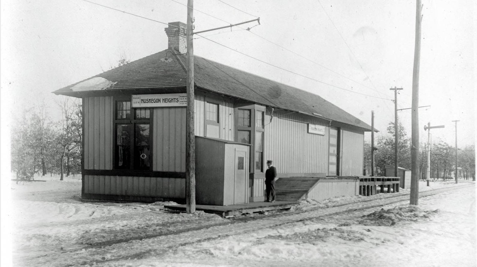
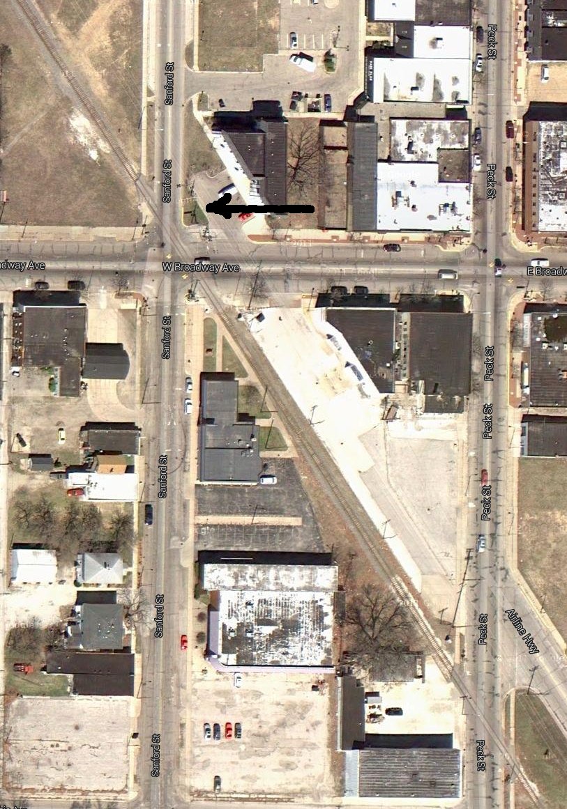
Muskegon Heights
GPS coordinates: 43.201183 -86.245785
Apparently the depot was located between the interurban track and a standard railroad track,
which often paralleled each other.
Left click on the images below for larger versions.
Above, left, the depot in Muskegon Heights. Right, the street location of the depot, as indicated
by a black arrow. Apparently the depot sat between the active track shown and Airline Highway, which
probably occupies the interurban right of way. It was often the case that an abandoned
interurban right of way was used for a road, or for power lines. The area looked reasonably rural
when the depot existed.
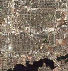
Muskegon
Left click on the images below for larger versions.
|
2013
|
|
Depot, possibly under construction.
|
|
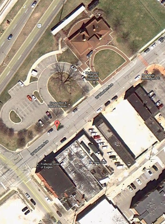
Left, above, the Muskegon depot. It was located on the northwest corner of Western Avenue and 7th Street,
just a few blocks northwest of the Grand Truck depot. The location is an empty lot in year 2013.
Right, above, an interurban coach at 8th Street and Western Avenue.
Left click on the image below for a larger version.
The interurban depot was about where the "A" is in the image above. The building might
well exist yet in year 2012, but the exterior would look nothing like the photograph above.
The GPS coordinates for the likely location of the depot are ( 43.232318, -86.258217 ).
Muskegon Dock
The last stop on the Muskegon leg of the GR-GH-M line was the dock Muskegon Lake. As can
be seen in the 2012 satellite view of the dock area, much of the construction appears to be
relatively recent. Exactly how the line got to the dock area, and just where the terminal
and depot were, are unknown here for now.
Left click on the images below for larger versions.
The Muskegon interurban station at the docks for departure to Chicago is seen at the right,
middle image above.
Grand Haven Junction
Just two stops before Fruitport, Grand Haven Junction is where a separate line split off
for the trip to Spring Lake and Grand Have. In about 1900, when the line was built, it
appears Grand Haven, in part a resort area, was at least as large as the city of
Muskegon. Muskegon apparently saw a great deal of industrial expansion later on,
perhaps because of Lake Muskegon and the ability to move large ships near to the
city, as well as railroad service. A lot of growth occurred during WWII as well.
In year 2012, the city has a lot of the same issues as Detroit, and much of it has
been demolished as the auto and steel related industries declined. But in 1900 it too
must have been an attractive resort area, and easy access to both it, and Grand Haven,
from Grand Rapids would have very desirable at the time.
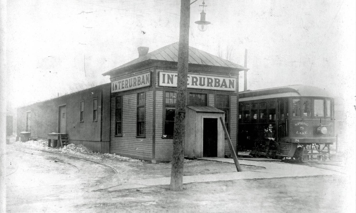
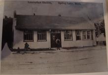
Spring Lake
GPS coordinates: 43.07692 -86.1985
Left click on the images below for larger versions.

Original location - undated.
|
|
|
A Huntington Bank occupies the northeast corner of North Jackson Street and West Savidge Street
in year 2013. The small building to the right, shown above, still exists in year 2013,
and is a lawyer's office.
Left click on the images below for larger versions.
The small building at right
still exists in year 2013.
|
|
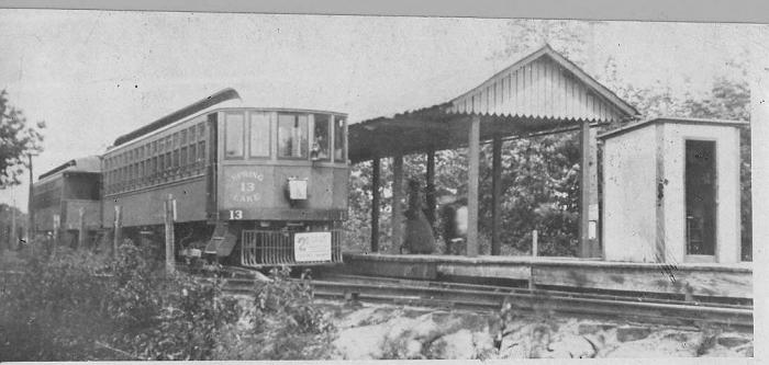
The photographs above shows the interurban station at Spring Lake, MI, built in 1913.
Prior to the building of the structure, people waited in a nearby drugstore.
Often very modest wood affairs, with a loading platform, this station is more elaborate, if not
as much so as a typical railroad station. One can see a coach on the left side of
the photograph on the left. Looking at the bay window, it's possible the coach
pulled in by the side of the station, but otherwise the tracks went down the street,
to the right of where two people stand, as suggested by the tracks in front of the
station in the photograph at the right.
Left click on the images below for larger versions.
The photographs above are undated.
The inside has been gutted, and the outside altered.
Historically, the depot mostly no longer exists.
Left click on the images below for larger versions.
All of the photos above are labeled September 24, 2013. The Spring Lake depot is now located in
Coopersville, roughly across the street from the interurban museum.
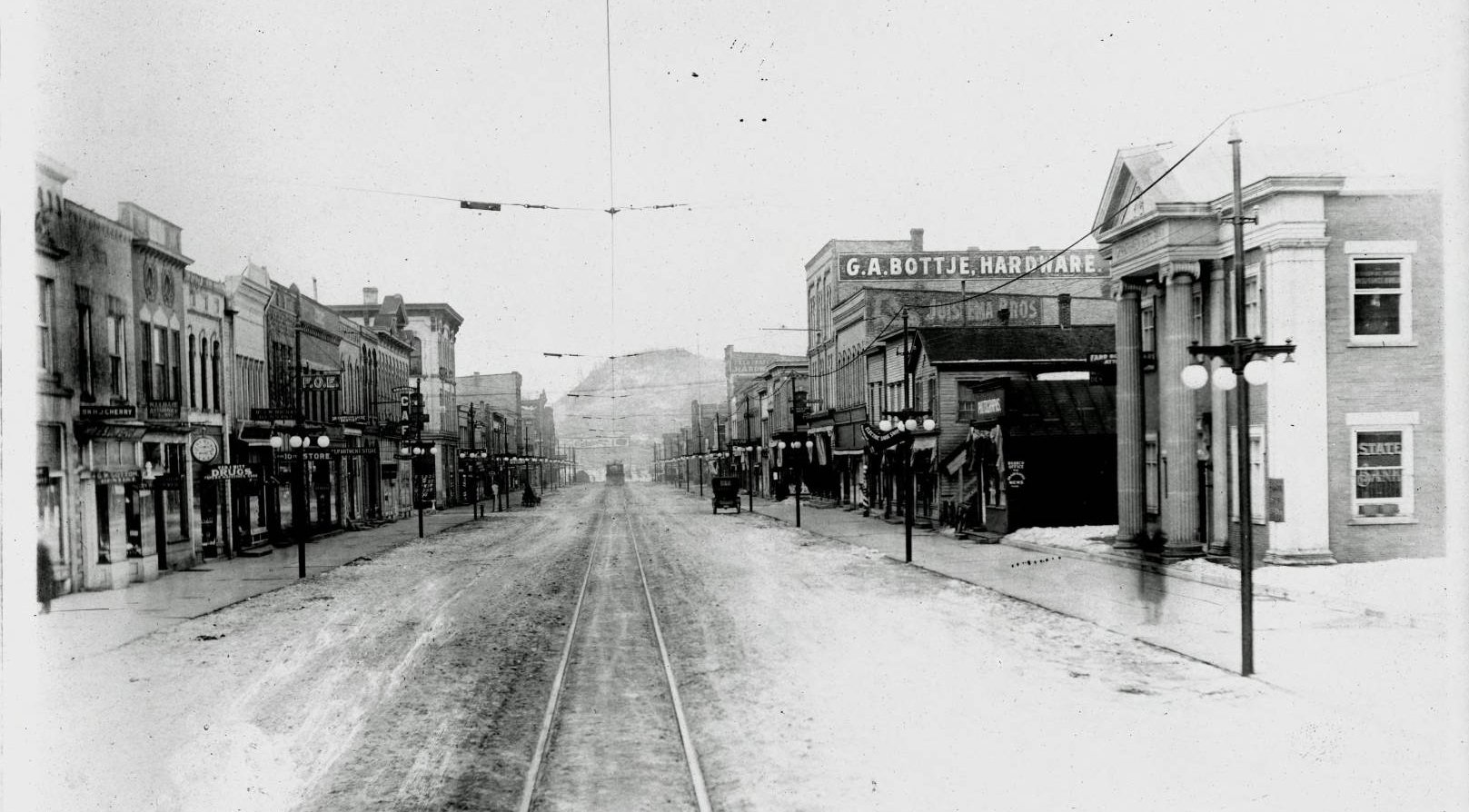
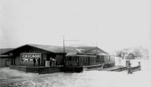
Grand Haven
Left click on the images below for larger versions.
Above, left, Washington Street, looking east.
The interurban is probably heading to the docks,
a block or two west, shown below, to let people heading for Chicago board a boat.
Both photos are undated. The car in the one to the left suggests 1915 to 1920.
Left click on the images below for larger versions.
The Grand Haven depot and freight office is shown above. It was located on the east side Water Street,
between Washington and Franklin, using the street names of the day.
Coach 8 appears in many photographs of depots, so it's possible that a photographer rode along one
day and got off to take photos at each stop.
Left click on the image below for a larger version.
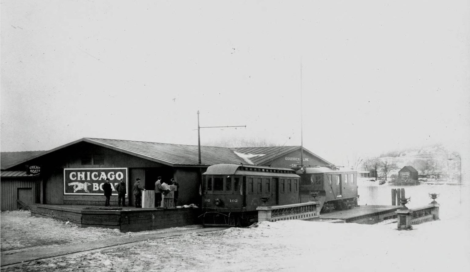
The dock in Grand Haven. Here freight and people would be transferred to and from boats
coming from and going to Chicago.
Left click on the image below for a larger version.
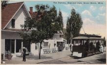
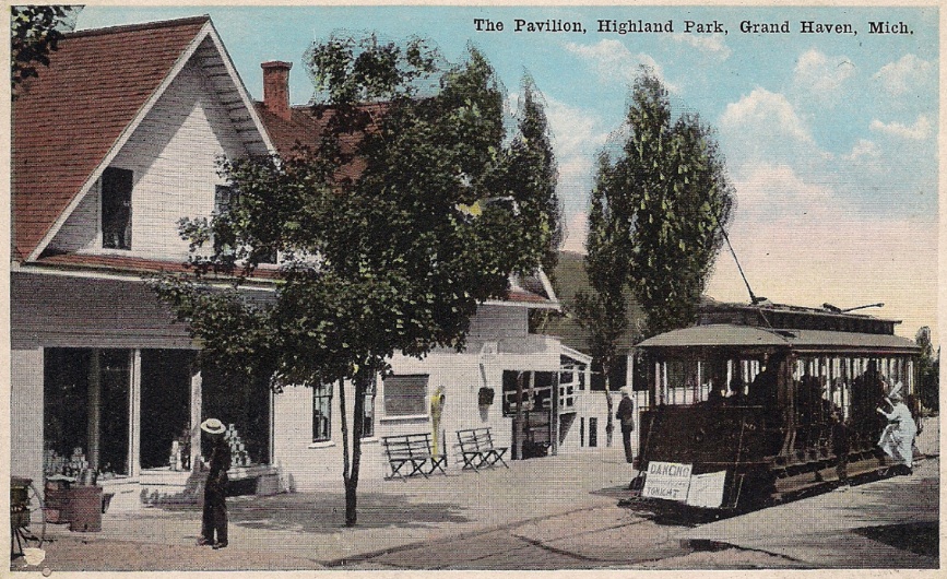
The pavilion at Highland Park, Grand Haven, MI. An undated postcard from perhaps 1925.
The line was removed not long after that, since the cost of removing sand and keeping the
line clear began to exceed revenues.
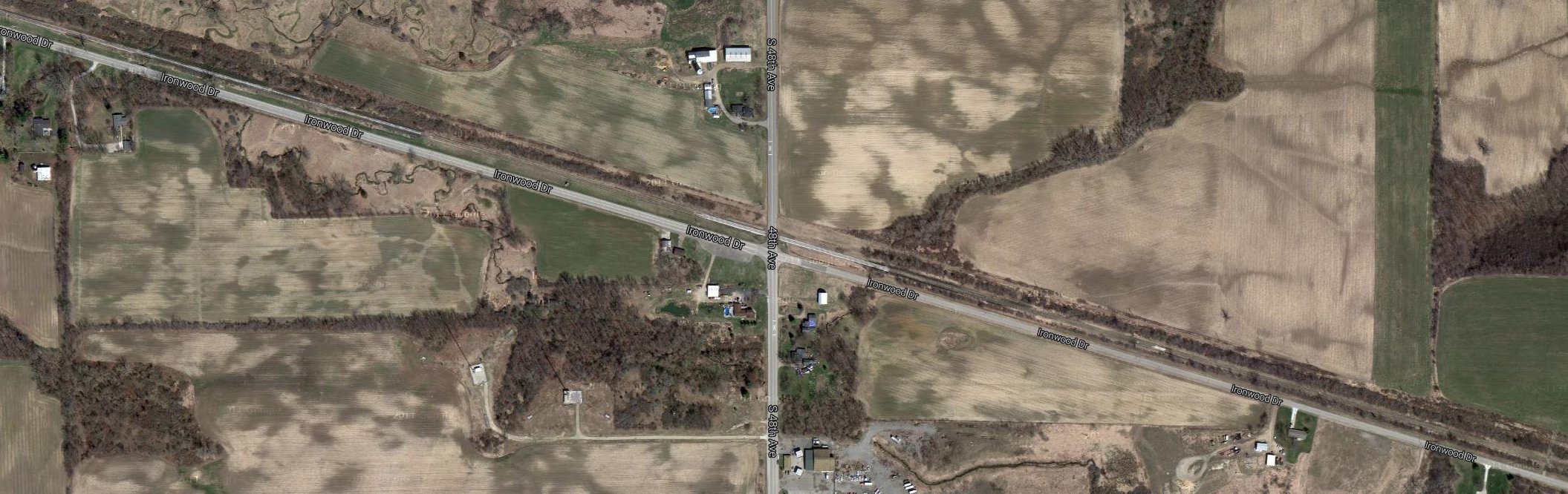
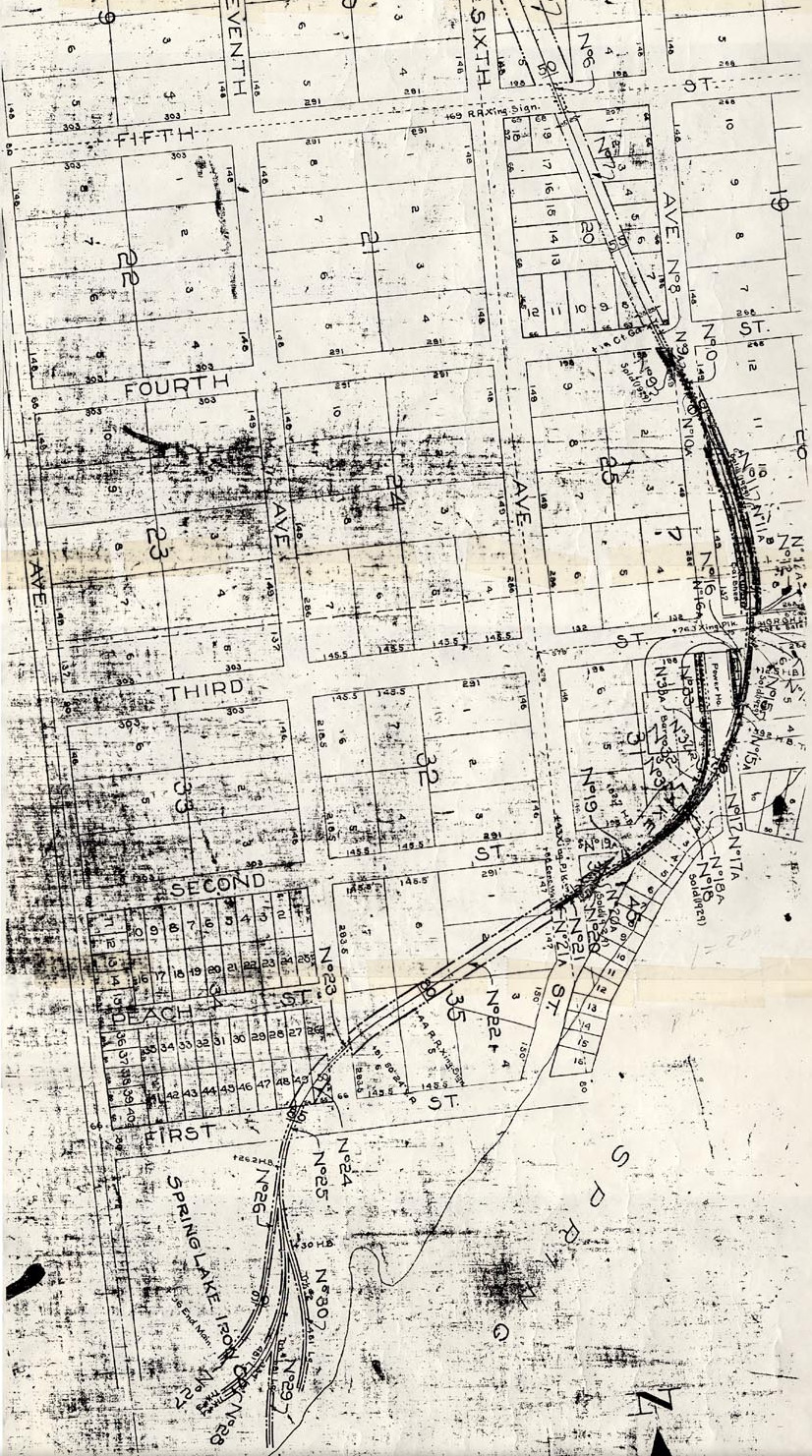
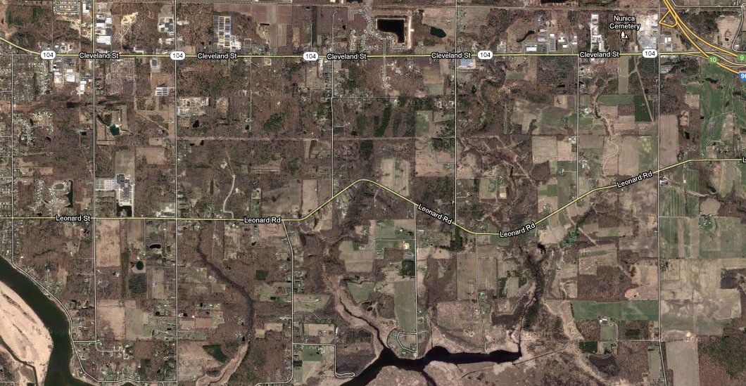
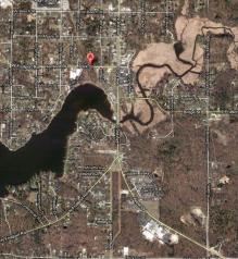
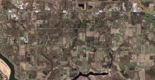
Satellite views of track beds
Although Michigan interurban systems have been gone for 84 years or so, as of
year 2012, it is still possible to locate many of the track beds from satellite
images, a technique also used by archaeologists now. The pattern of the vegetation,
buildings, and roads, that developed along the right aways can still be seen in
many areas. In some cases power companies took over the old right of ways for their
transmission lines. All of this is true, for example, for the Grand Rapids to
Kalamazoo line, along Riser Street, near Godwin. In other cases, the right of ways
were turned in to walking or bike paths. In other cases the right of ways
paralleled railroad tracks, and were covered over by interstates in the 1950s
and 1960s. In other cases, more recent housing and business developments have
completely erased the old track beds.
Below are some examples of what can still be seen of the old Grand Rapids,
Grand Haven, and Muskegon line.
Left click on the images below for larger versions.
Fruitport
|
Spring Lake
|
Coopersville
|
|
Muskegon
|
The satellite images above seem to be winter views, so the tracks show up
as brown lines, which one can discern in places where the land has not been
altered too much. The line from Grand Rapids to Kalamazoo could be still viewed
in this way essentially in year 2000. The track on the Grand Rapids end, in and
around the river, has been almost totally obliterated in year 2012. One can
follow the line somewhat today yet because of the Consumers Power transmission
lines.
Miscellaneous