
Left click on the images below for larger versions.
1836 |
1840 |
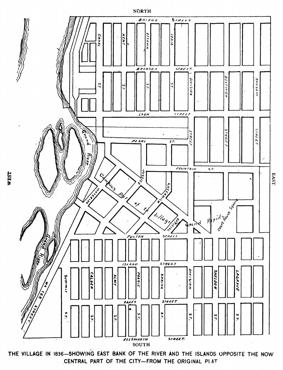
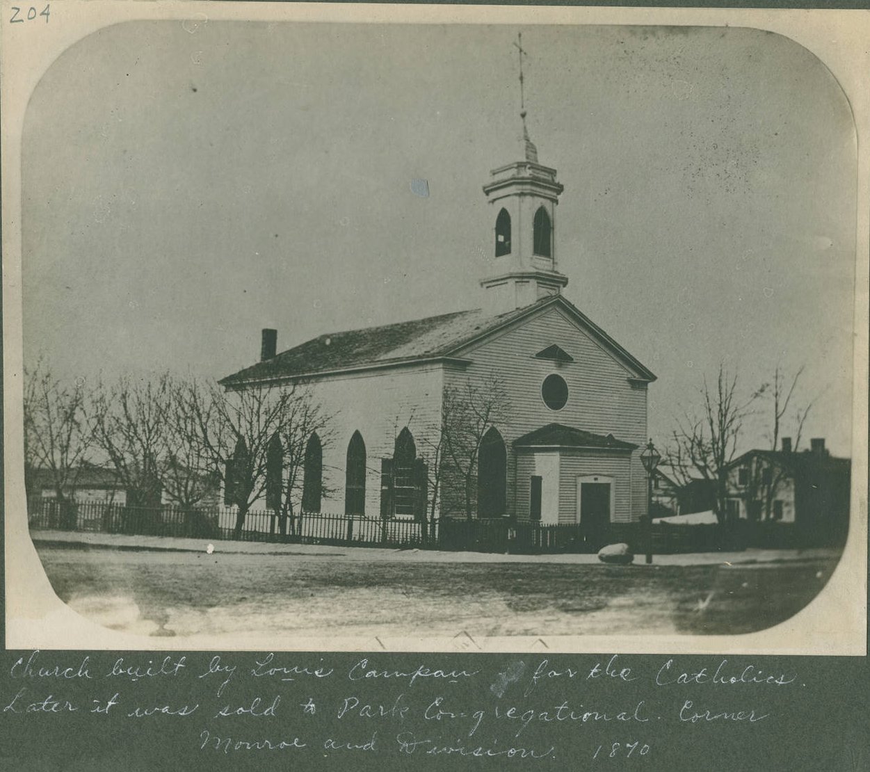
Grand Rapids was no exception, and the early settlers were not so much frontiersmen as representatives of eastern money interests. For example, John Ball was university educated, having graduated from Dartmouth College in 1820, and passed the bar in 1824. He served eastern money interests as well as local businesses, most having to do with exploiting Michigan's resources. He also held various government appointmnents, which was common in his time. Louis Campau bought the entire GR area for $90 in 1831, and proceed to plat the land.
The street names chosen are shown in the map above, and provide a cautionary tale when attempting to find the history of an area. Street names changed often. Some of the streets in the map will be familiar, and date to the original platting of GR. Many others changed, and of course more streets were added. So when looking through historical archives, one can easily be mislead by looking for a location that had a different name in the past. To complicate things further, street numbers were sometimes changed.
Below are some views of and information about Grand Rapids that anyone attending Godwin up to about 1960 would likely have known, as well as the history of the city. In one way or another most are but memories in year 2005. In some cases the material is purely of historical interest, showing some of the layers of Grand Rapids' past. They might be of interest just because they show things like what buildings were located in various places before the buildings Godwin students were likely familiar with.
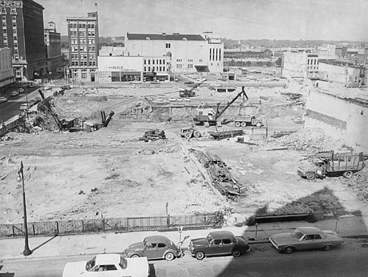
In about 1960 a monstrous federal program known as Urban Renewal was rampaging across the US, and in the name of renovation the historic areas of many US cities were introduced to the wrecking ball. When it was all over, many cities were but shadows of what they were before. Most lost some or all of their charm and character, and in many cases the cities never really recovered in terms of being centers of commerce and entertainment.
Almost everything north of Monroe Avenue and Pearl Street was demolished. Then a set of interstates took out the Union and Grand Trunk railroad depots, and much of the Michigan Street hill. Large numbers of historic homes were lost in the area north of Michigan Street, between Division Avenue and Fuller Avenue, including an octagon house built by Eliahue Smith in 1853. It was located at 7 Hastings Street. The portion of Hastings Street where the house was located no longer exists either - it is now occupied by parts of I-196.
In year 2005, there are a lot of interstates intersecting in Grand Rapids, but less and less reason for people to get off of them. Tasteless government buildings, shoddily constructed and in constant need of repair, now occupy some of the land occupied by the more colorful structures built in the 1880s. Most of the lavish RKO theaters were demolished, and along with them that feeling of grandeur audiences felt as they settled in for a movie. It's probably fair to say that the Grand Rapids that Godwin students up to year 1960 knew, and would seek for entertainment and shopping, is largely gone in year 2005.
Left click on the images below for larger versions.
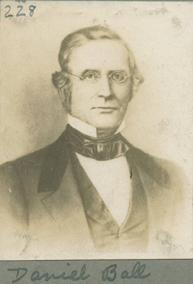
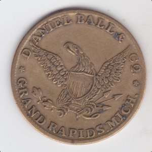
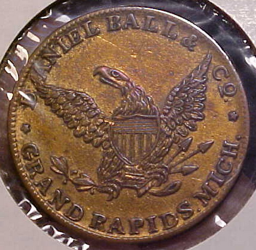
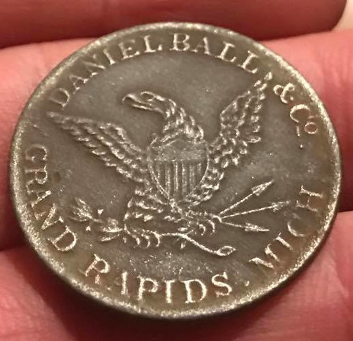
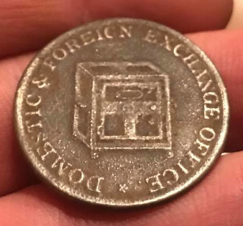
Daniel Ball - 1807-1865 Apparently no relation to John. |
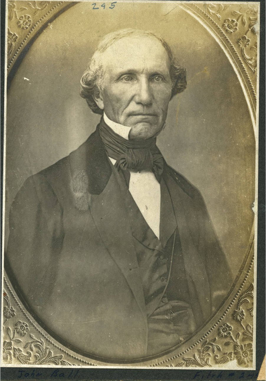
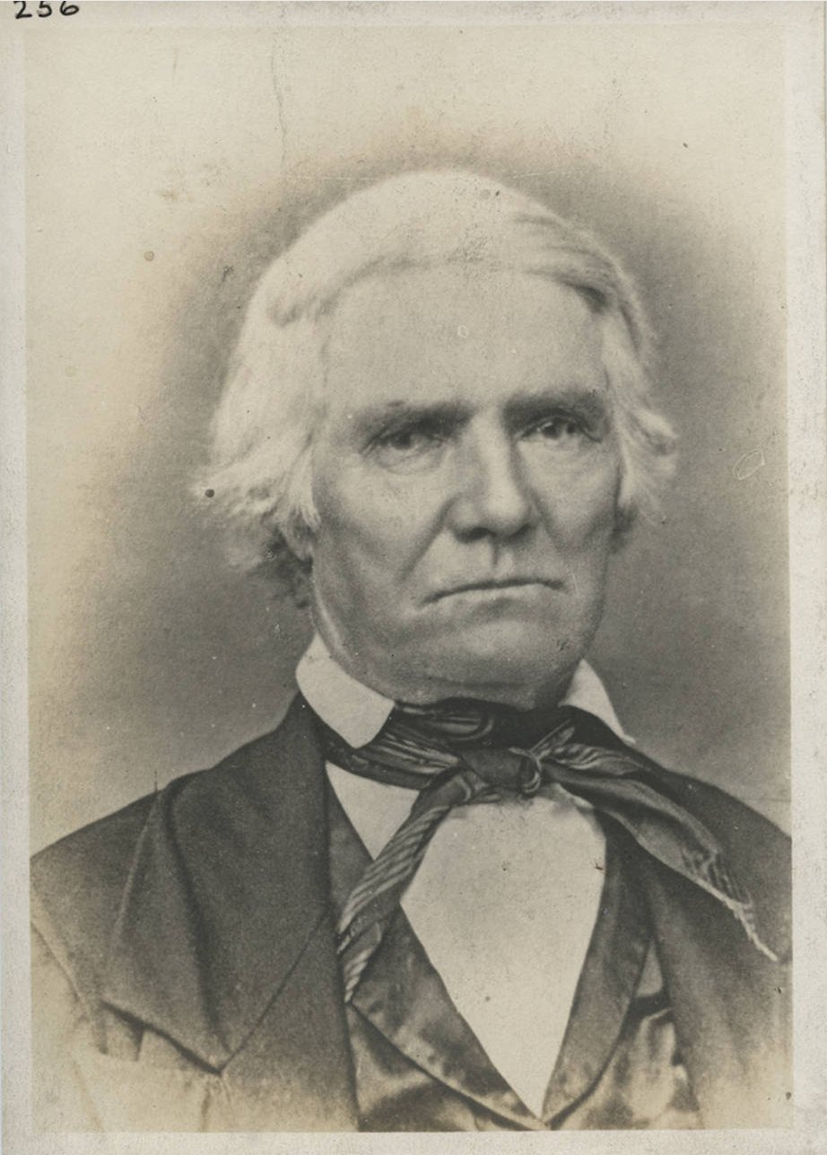
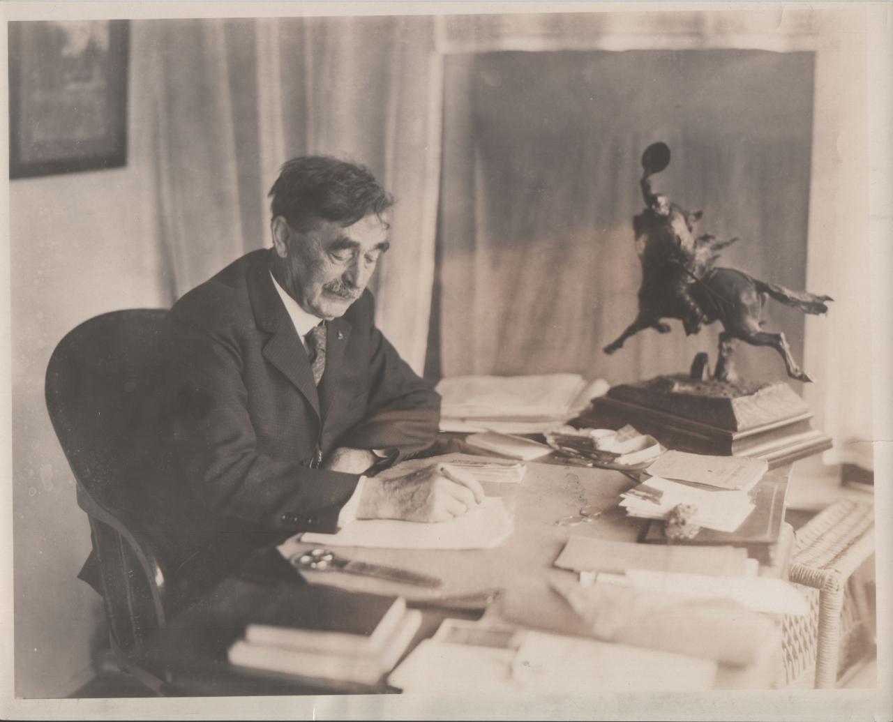
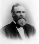
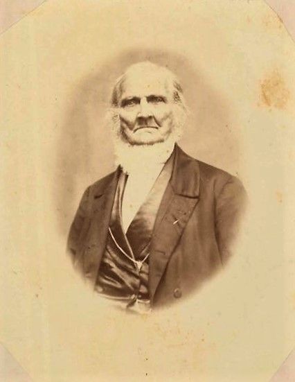
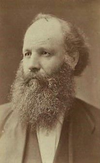
John Ball - 1794-1884 Photo c1854 |
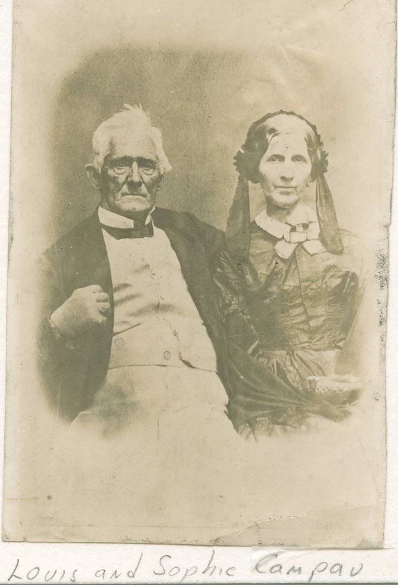
Louis & Sophie Campau - undated. |
Joel Guild - 1787-1856 |
Left click on the images below for larger versions.
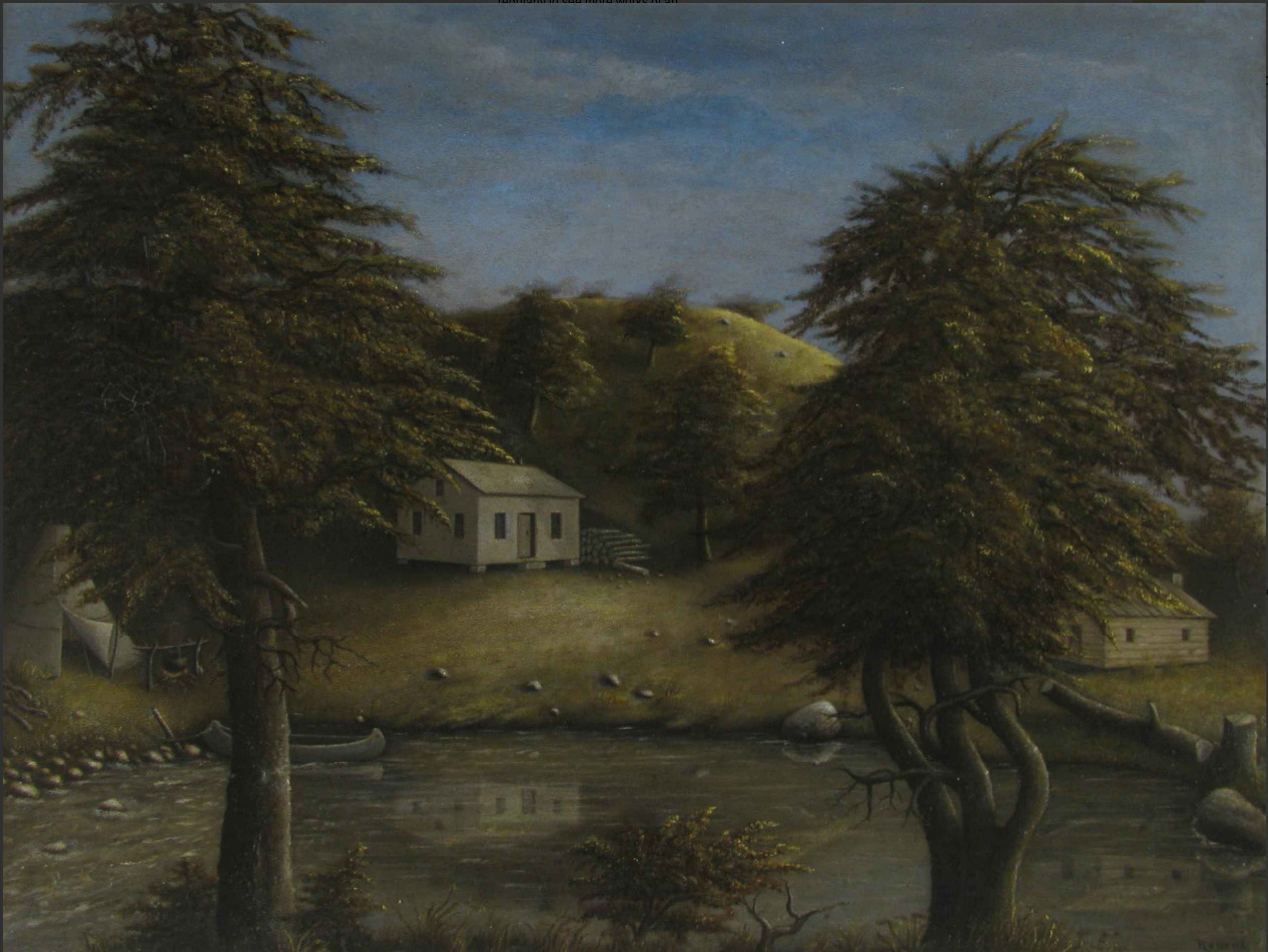
Early painting of Joel Guild house. |
Joel Guild house c1865. |
Joel Guild house c1870. |
Left click on the images below for larger versions.
|
c1854, Ball about 60. |
|
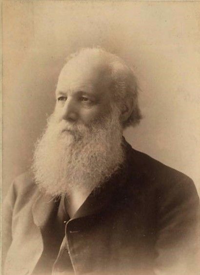
c1880, Ball about 86. |
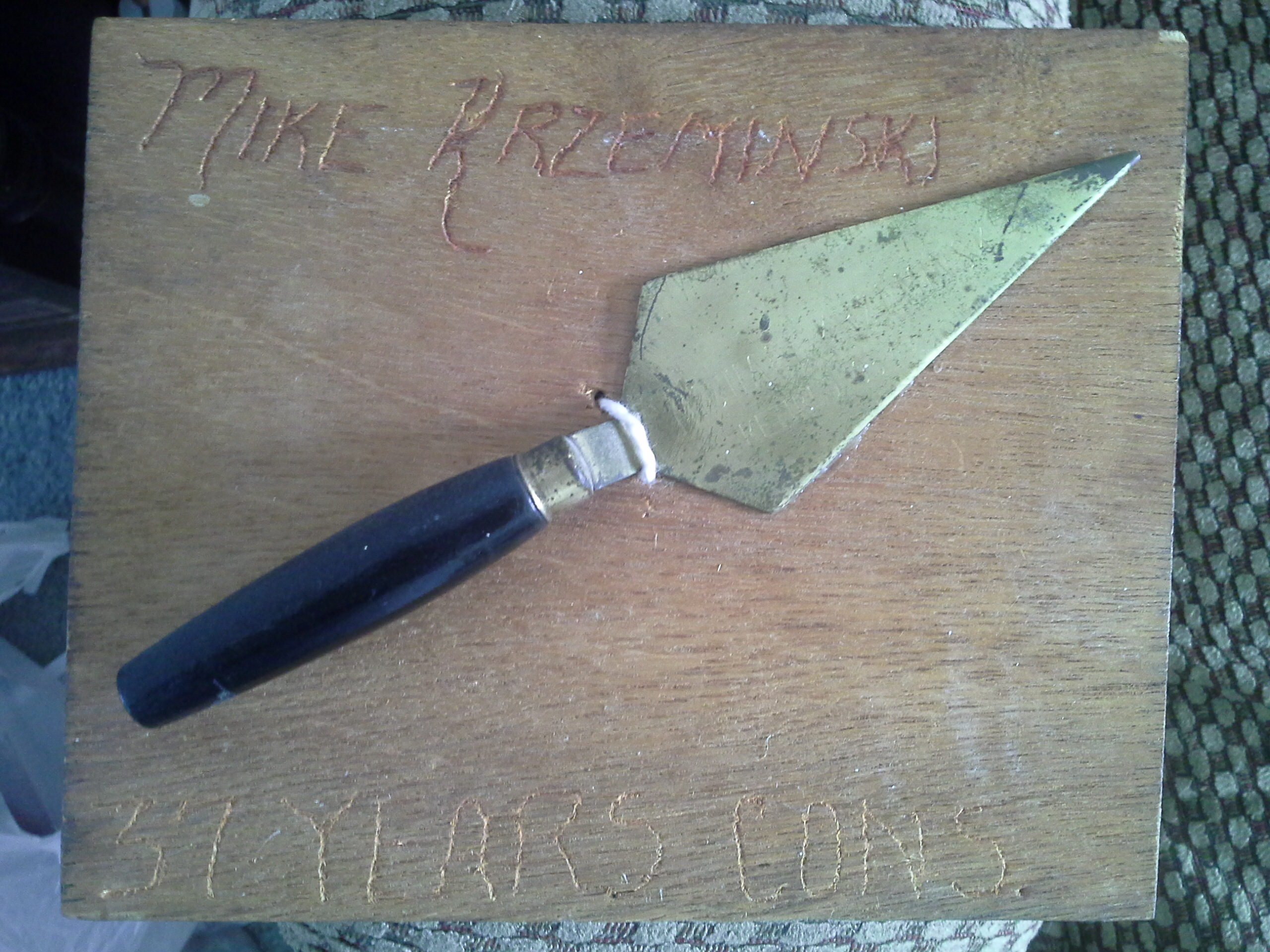
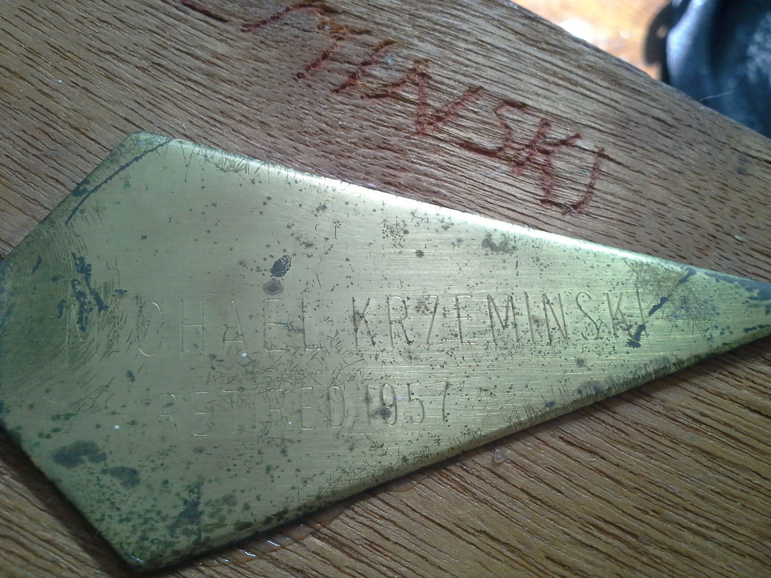
Item in the center, above, supplied for scanning by Lillian Annis, class of 1941
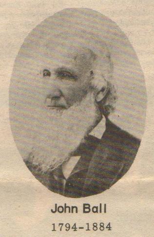
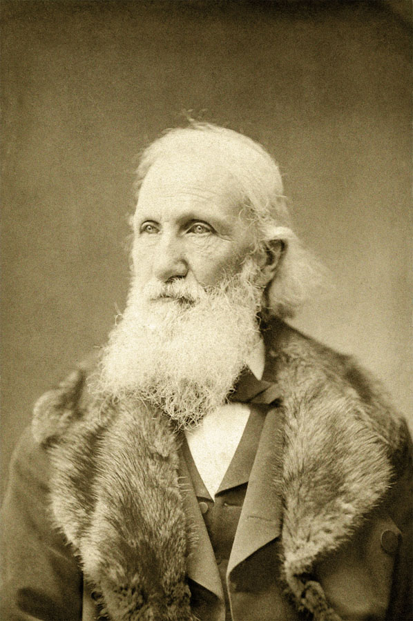
Above are photographs of John Ball, 1794 to 1884, an early Grand Rapids settler. Despite his woodsy look in later years, he was in fact a businessman and lawyer. On first arriving in GR, he represented eastern interests in exploiting resources in MI. Ball centered his activities on Grand Rapids, and was a big promoter of the city. John Ball Park is located on land donated by John Ball. Perhaps strange, people who lived in the area say that the park was derelict in around 1945, and was totally unmaintained. Apparently it was somewhat revived by the early 1950s, although conditions for the animals were pretty pathetic, to the extent the Humane Society should have closed it down.Left click on the images below for larger versions.
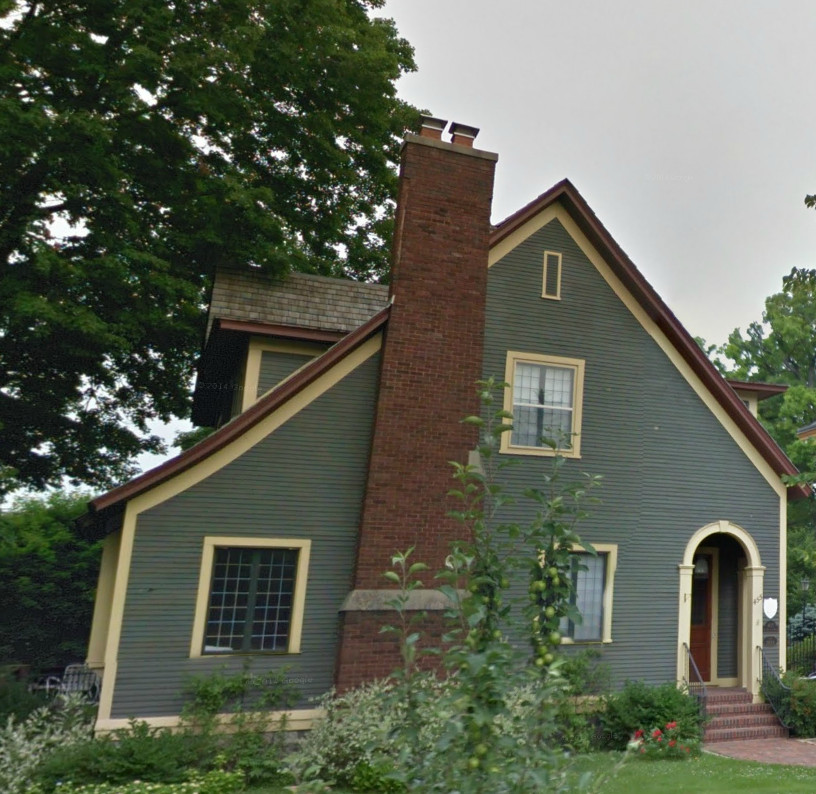
|
|
House photo supplied for scanning by Lillian Annis, class of 1941
Left click on the images below for larger versions.
|
|
|
|
|
|
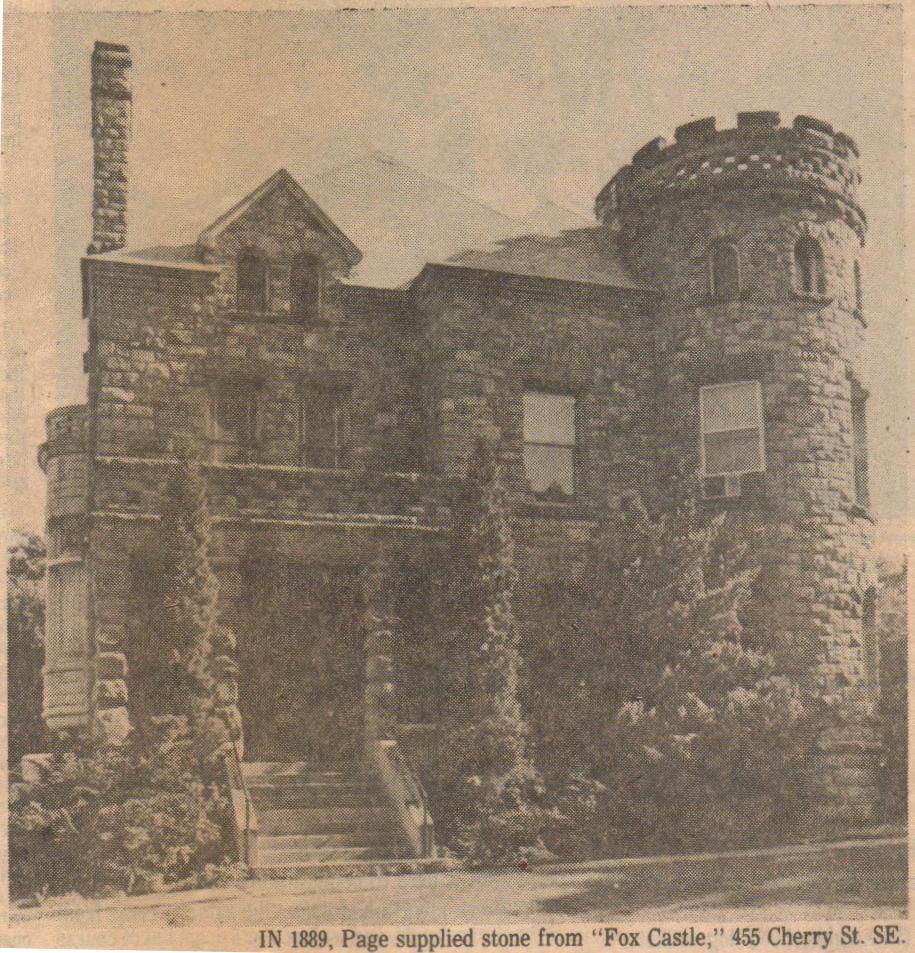
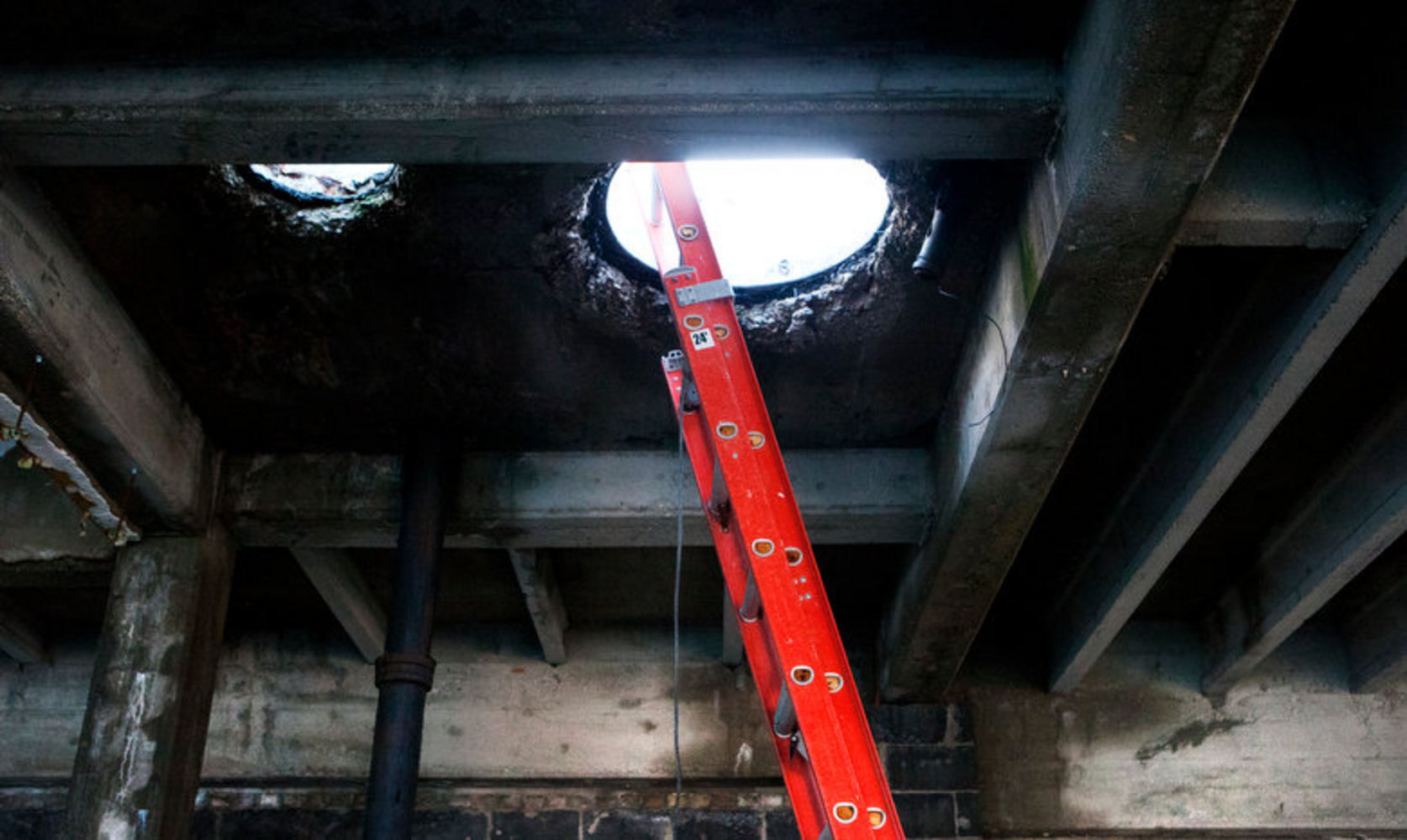
Foundation Blocks
Left click on the image below for a larger version.
|
|
|

|
Left click on the images below for larger versions.
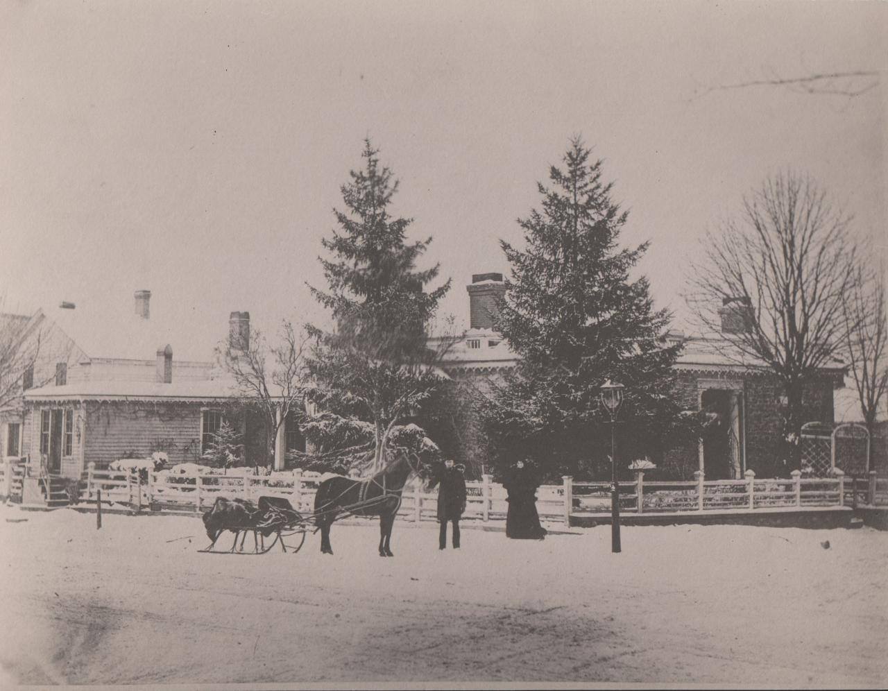
c1865. Home of Dr. Sheppard |
Material provided by Lillian Annis, class of 1941 |
Left click on the images below for larger versions.
|
c1910 |
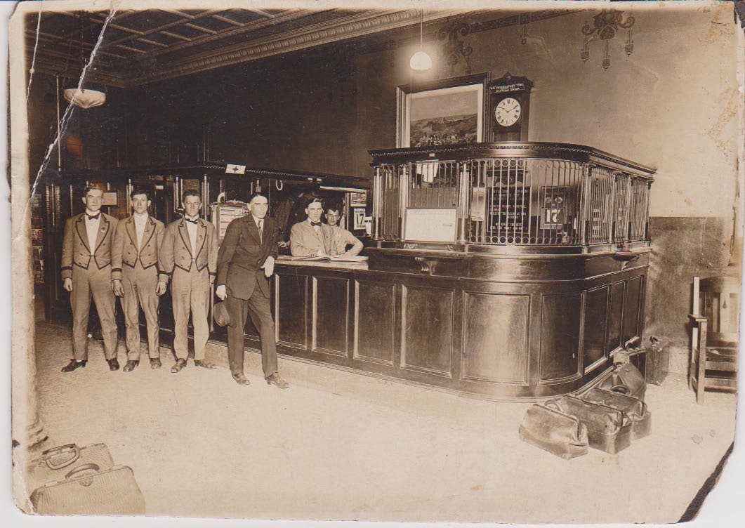
Cody Hotel lobby - 1911 |
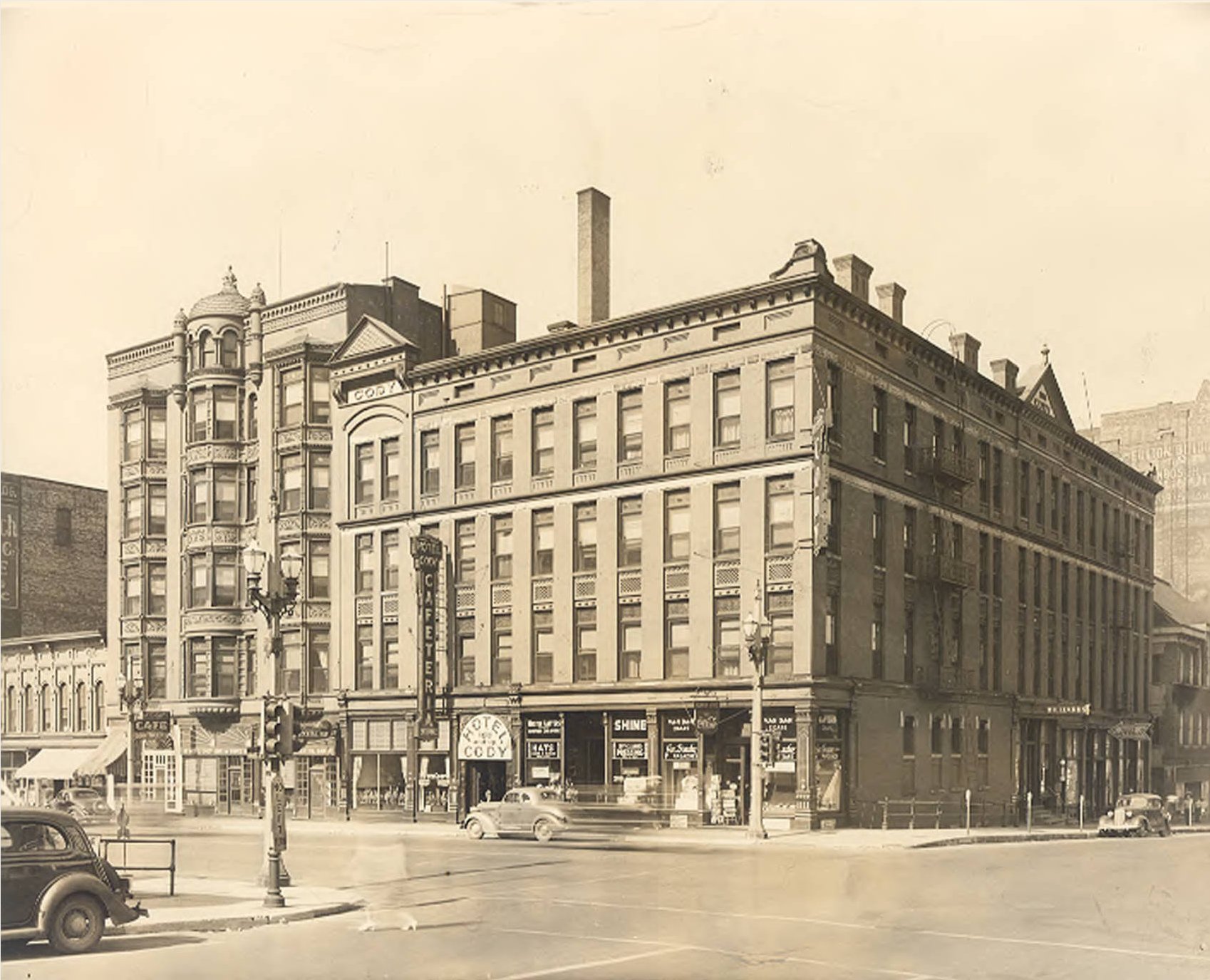
c1940 |
Like most of the bigger hotels, the Cody provided a number of food choices.
Left click on the image below for a larger version.
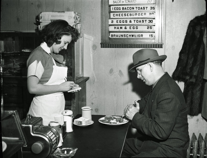
The photograph above, dated April, 1944, shows the Cody hamburger shop.
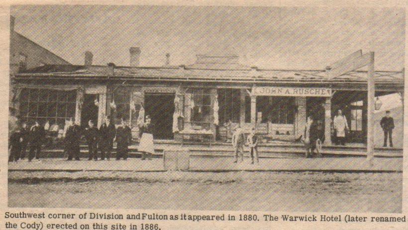
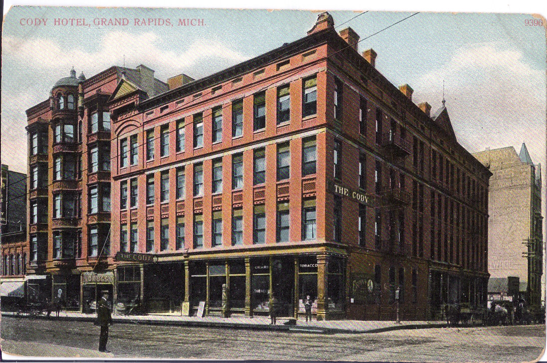
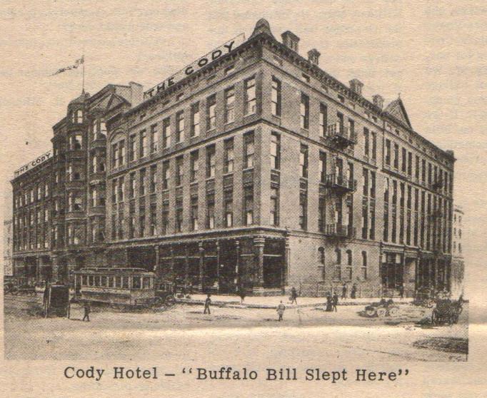
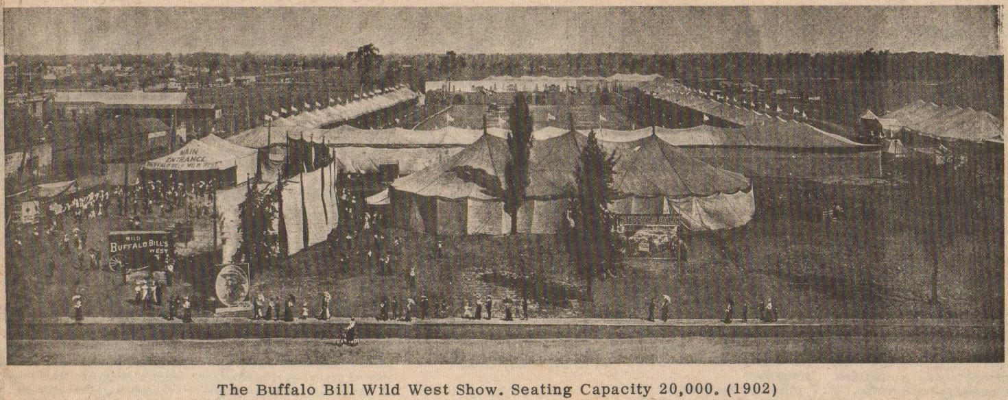
How the Warwick Hotel came to be called the Cody Hotel is not known
just now, as is whether he ever owned it. William "Buffalo Bill"
Cody used the appreciable fortune he made with his Wild West shows,
which played in Grand Rapids, as shown in the items below from 1902,
Left click on the images below for a larger version.
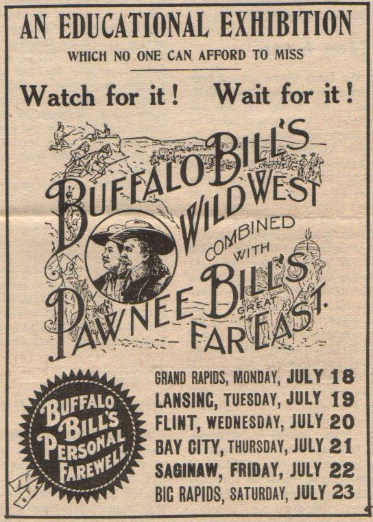
Material provided by Lillian Annis, class of 1941
to build a large number of hotels. Alas, many fine hotels were built in small cities and towns without much demand for them, and mostly lost money. The Cody Hotel was both a short term and long term hotel over the years. The Cody Hotel was renovated in 1946, but didn't seem to have much business in the 1950s. In 1960 part of the Cody Hotel, the Kortlander Building, apparently an apartment building on the southeast corner of Fulton Street and Commerce Avenue, and another building containing Moore's Hobby shop and Smalley Daniels' Cushman scooter store, were all demolished to make a city parking building. Shoddily built, it too was eventually demolished.
Left click on the images below for larger versions.
|
Left click on the images below for larger versions.
May 22, 1953 - Earle |
August, 2013 - Earle location. |
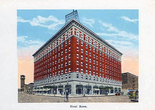
August, 2013 - Rowe |
Left click on the images below for larger versions.
c1920 |

c1974 |
Left click on the images below for larger versions.
c1918 - the first Morton House. |
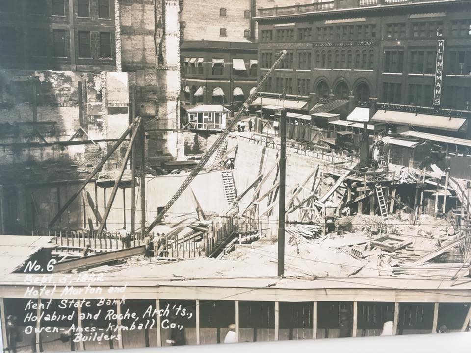
1922 - Morton House construction. |
2014 |
|
|
Wm. Holabird & Martin Roche Morton House architects. |
Left click on the images below for larger versions.
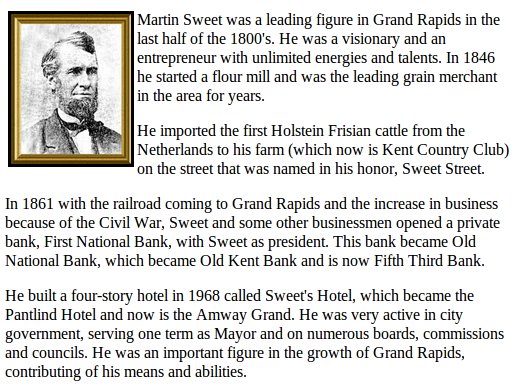
Martin L. Sweet |
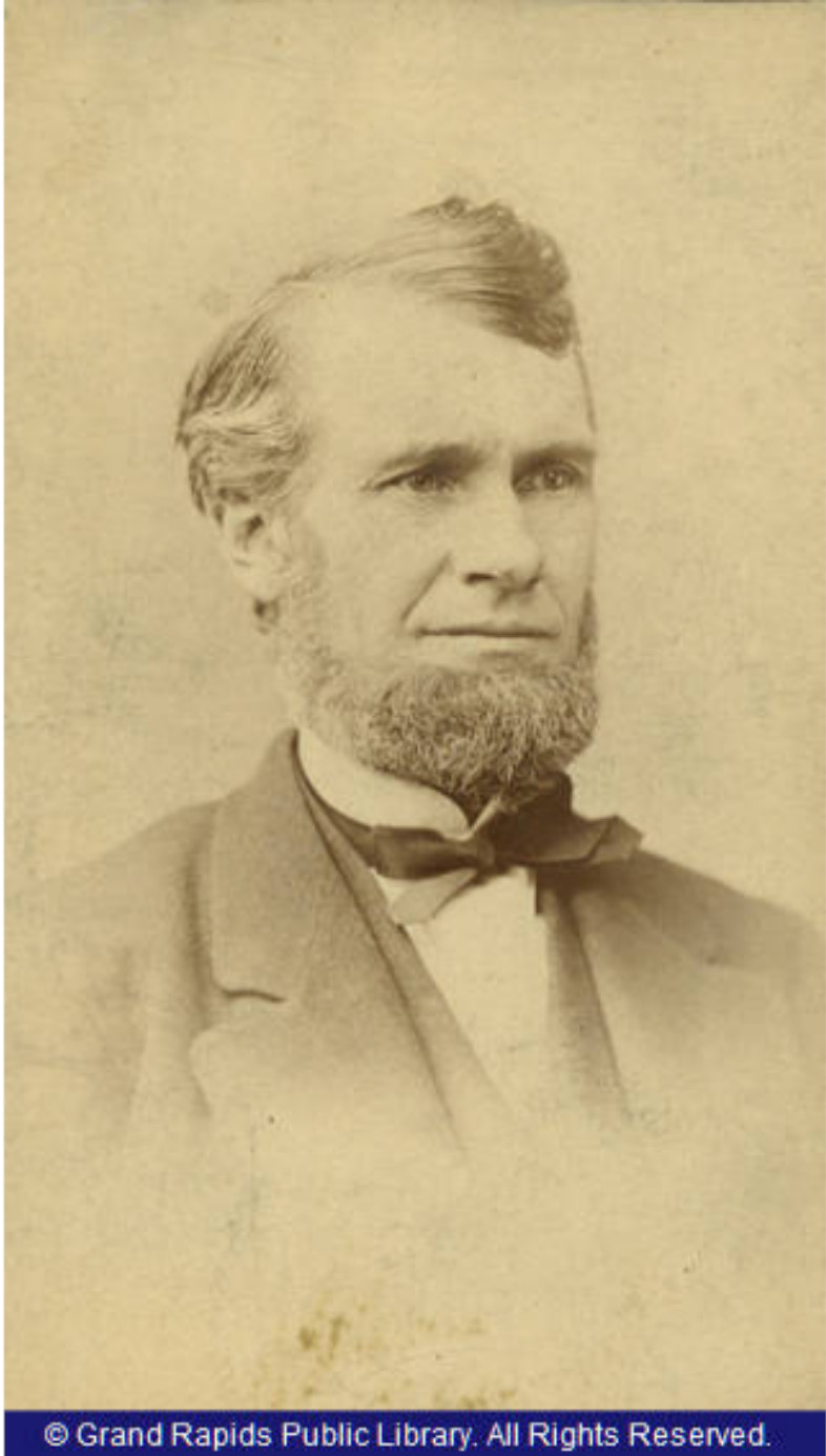
Martin L. Sweet - undated |
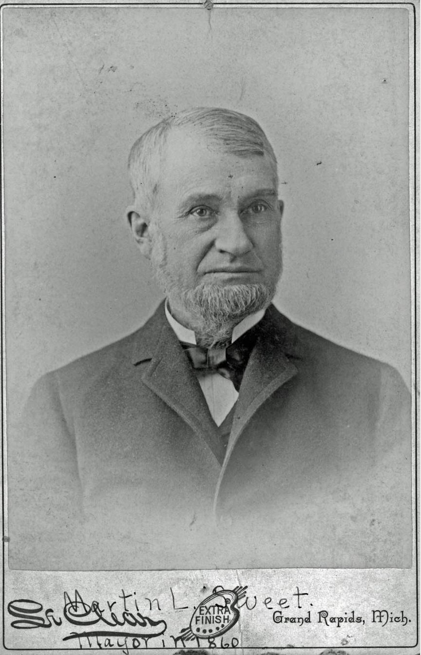
Martin Sweet - undated. |
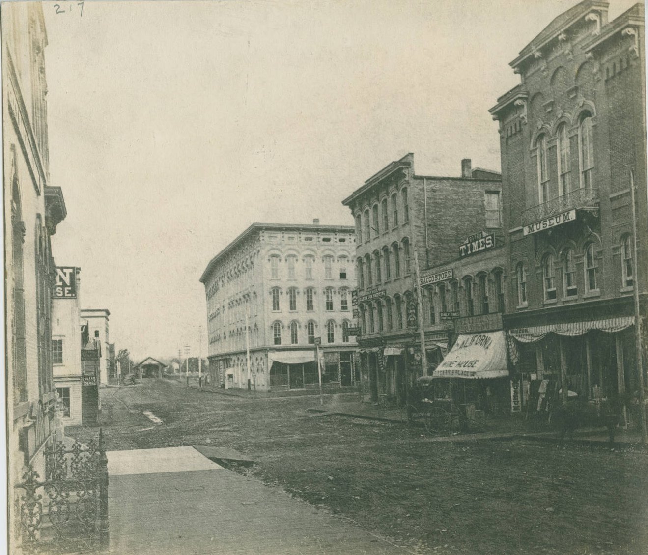
An 1870 view of Sweet's Hotel. Pearl Street covered bridge. Former site of Daniel Ball bank. |
An 1870 view of Sweet's Hotel. |
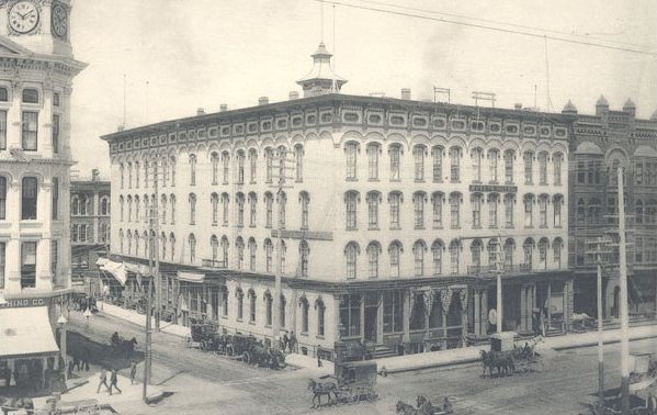
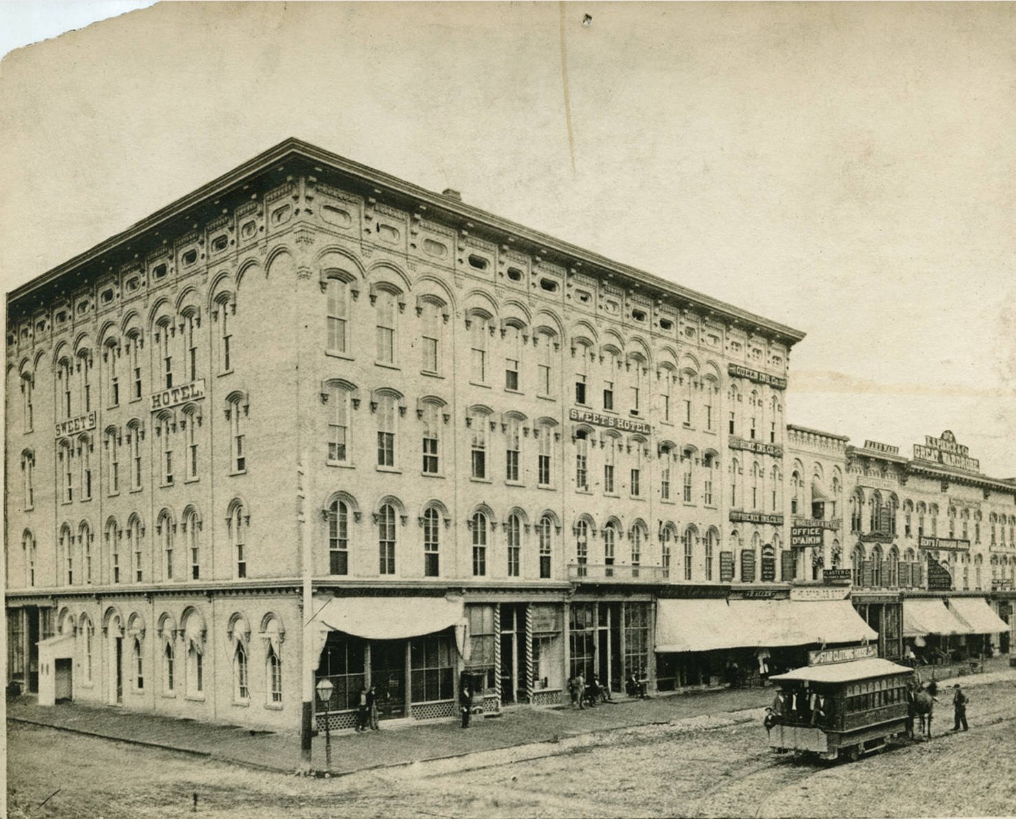
An 1888 view of Sweet's Hotel. |
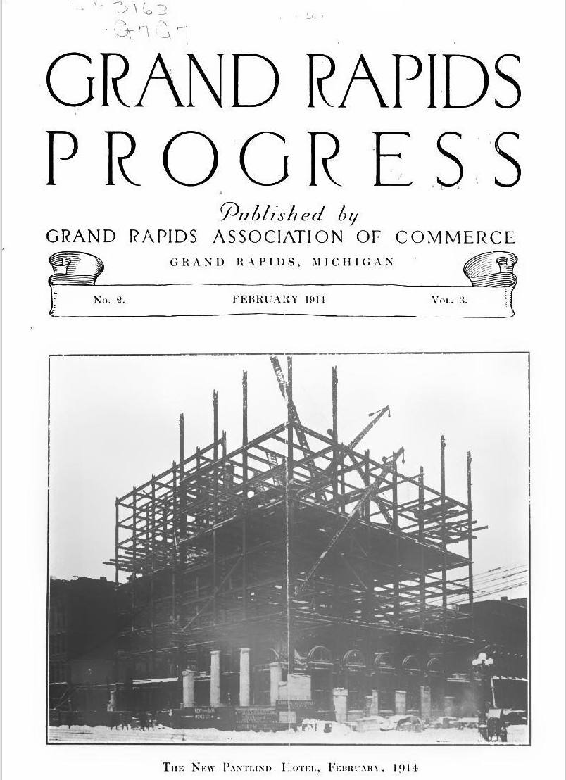
Construction of Pantlind Hotel, February, 1914. |
Left click on the images below for larger versions.
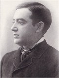
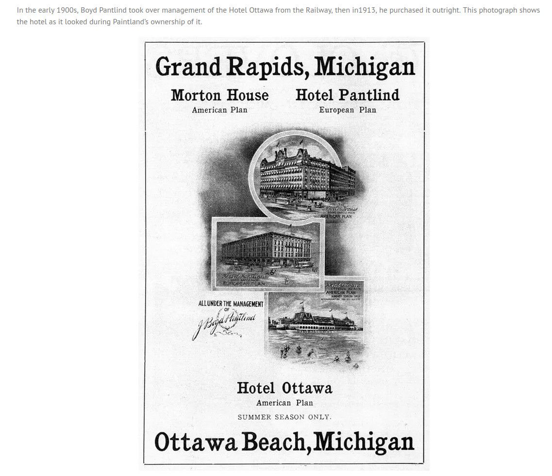
J. Boyd Pantlind |
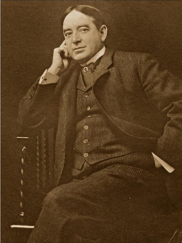
J. Boyd Pantlind |
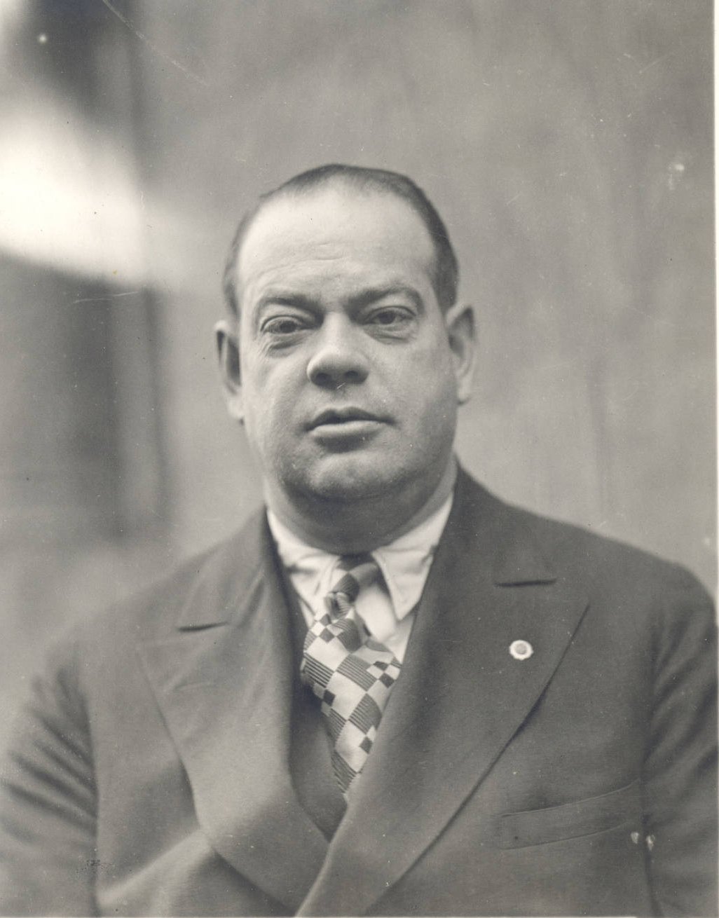
Fred Z. Pantlind - 1929 - Manager |
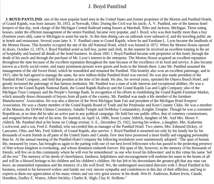
J. Boyd Pantlind - Obituary |
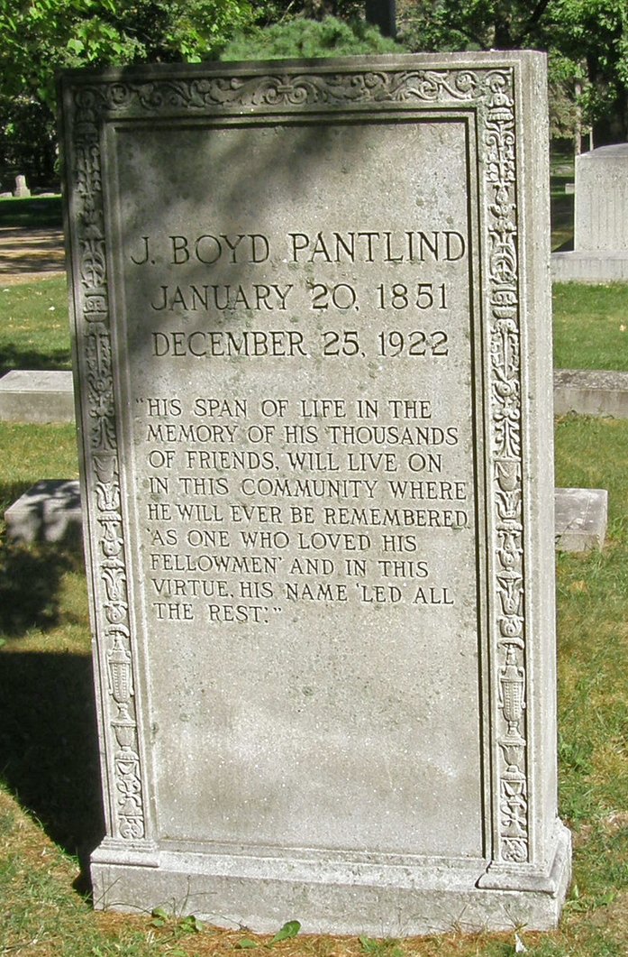
J. Boyd Pantlind - headstone Oakhill Cemetery - Block 2, lot 129, space 12 |
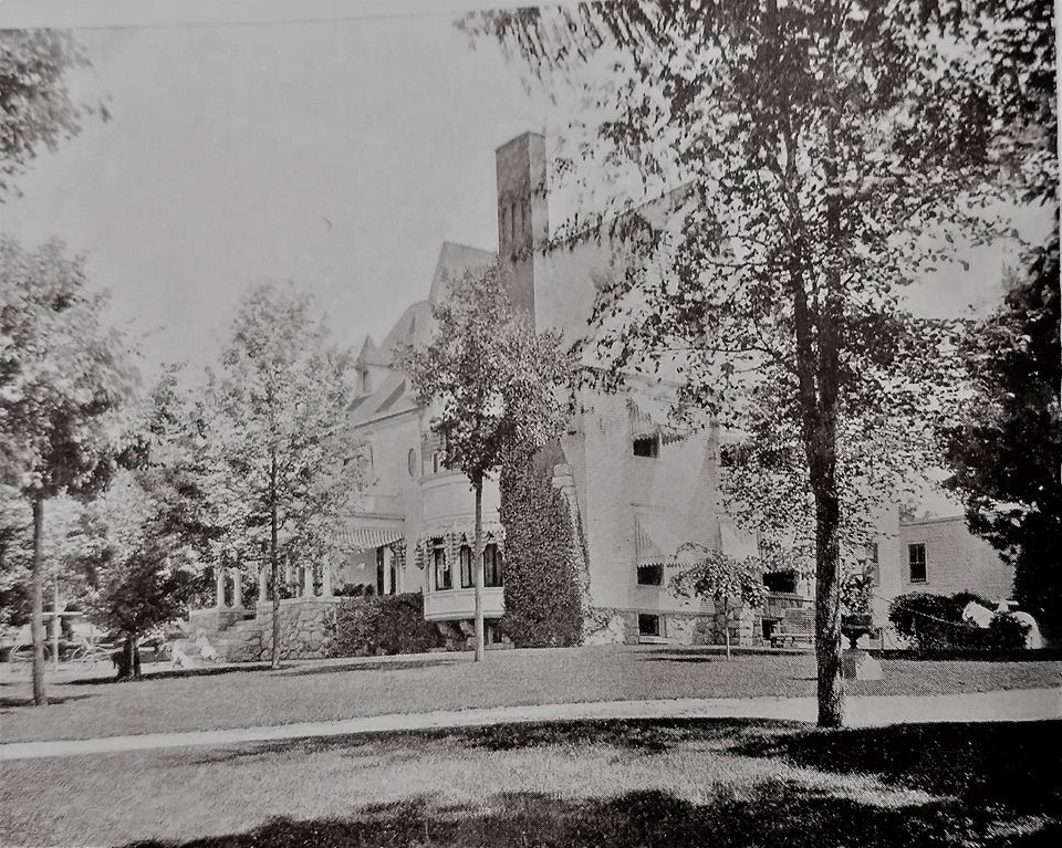
Boyd Pantlind house. c1893. 100 College - today 134 College. Site of Wood TV. |
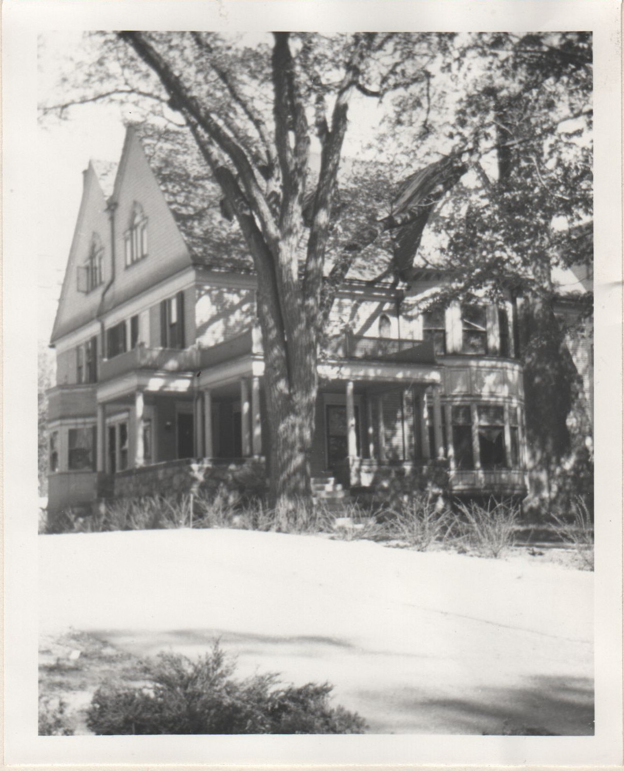
1955 - the house was empty. |
|
|
Left click on the image below for a larger version.
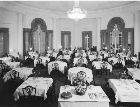
The photograph above shows the Pantlind Colonial Room in November, 1937. Most of the larger hotels served wonderful food, with an elegant atmosphere.
Left click on the images below for larger versions.

Rathbun House. |
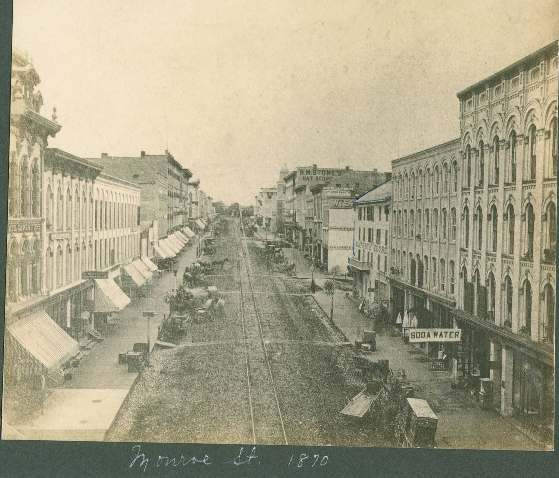
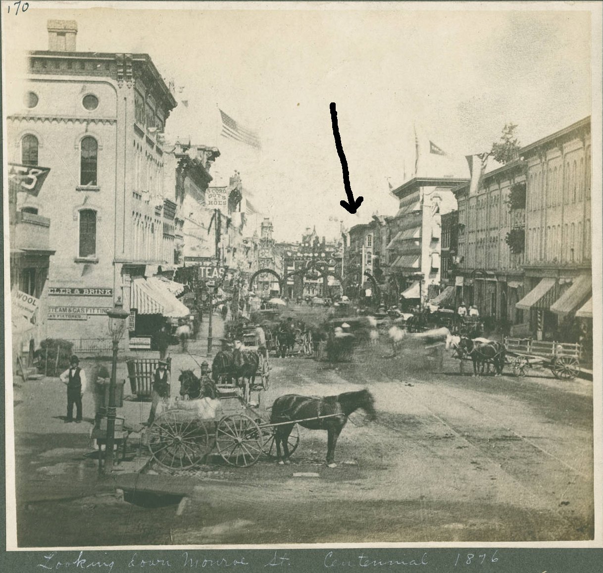
1870 - looking SE on Monroe. Rathbun house on the right side of the street. |
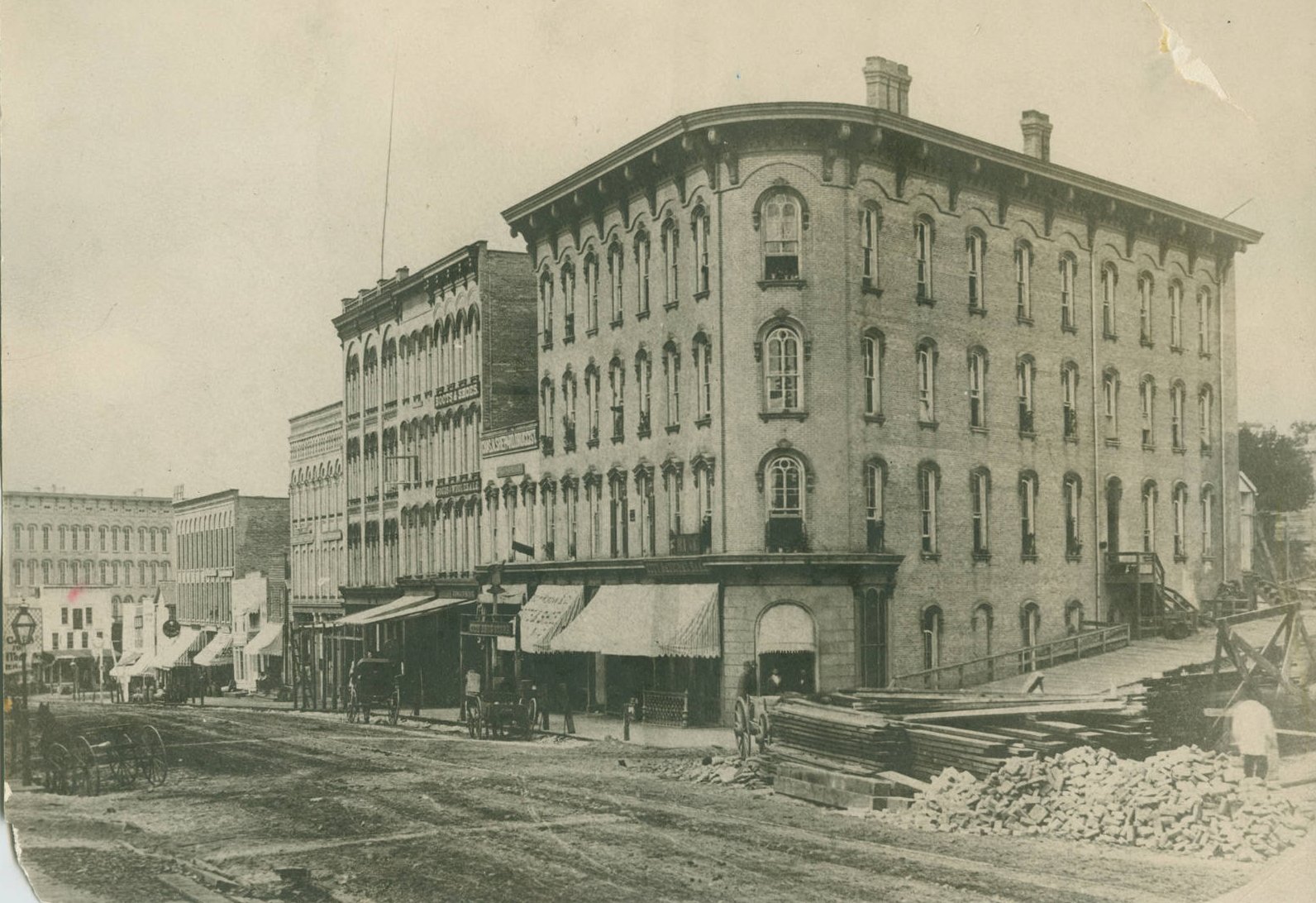
Widdicomb building |
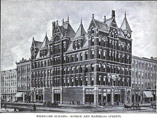
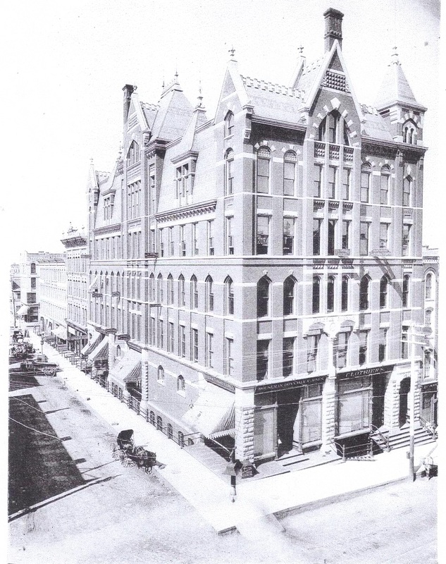
c1888 - Widdicomb building |
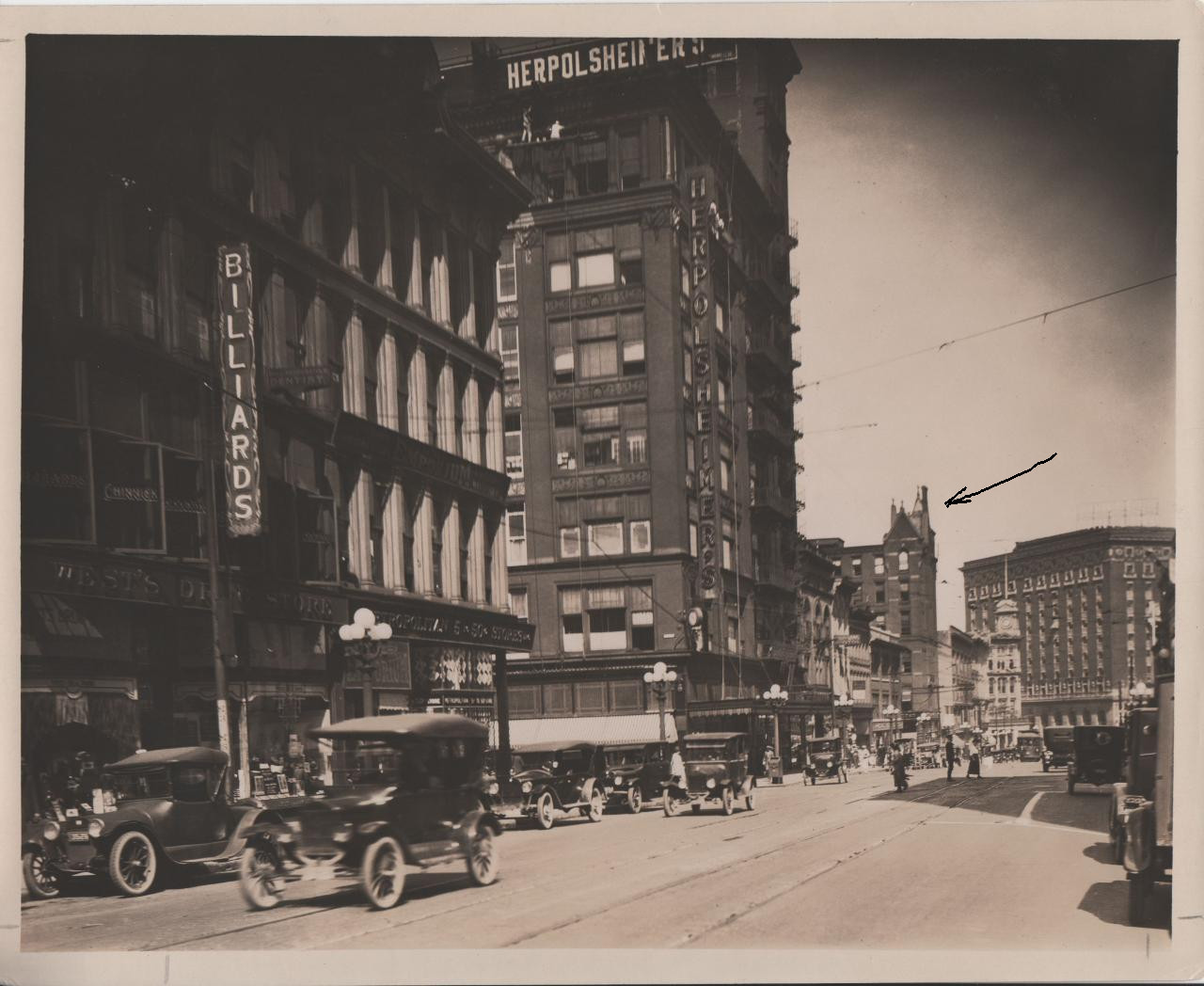
1922. Widdicomb building - arrow. |
The photos above were made available by the Grand Rapids Museum Archive.
Left click on the images below for larger versions.
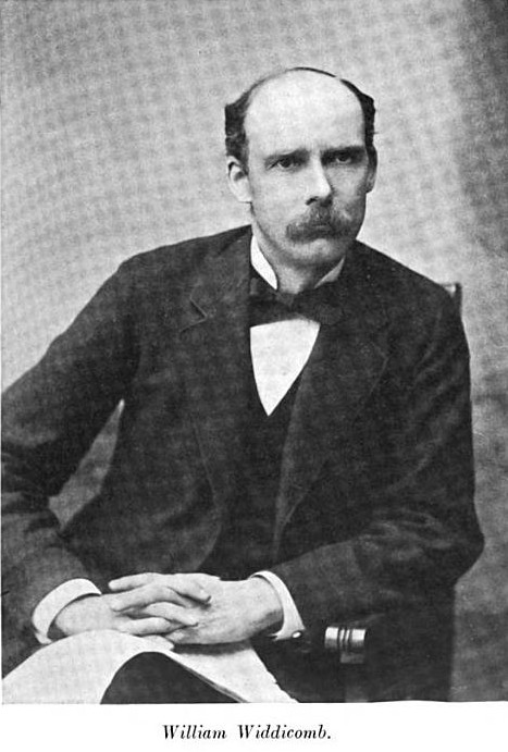
William Widdicomb c1906 |
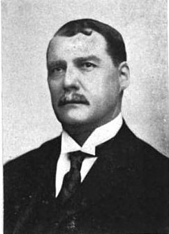
John Widdicomb c1888 |
Left click on the images below for larger versions.
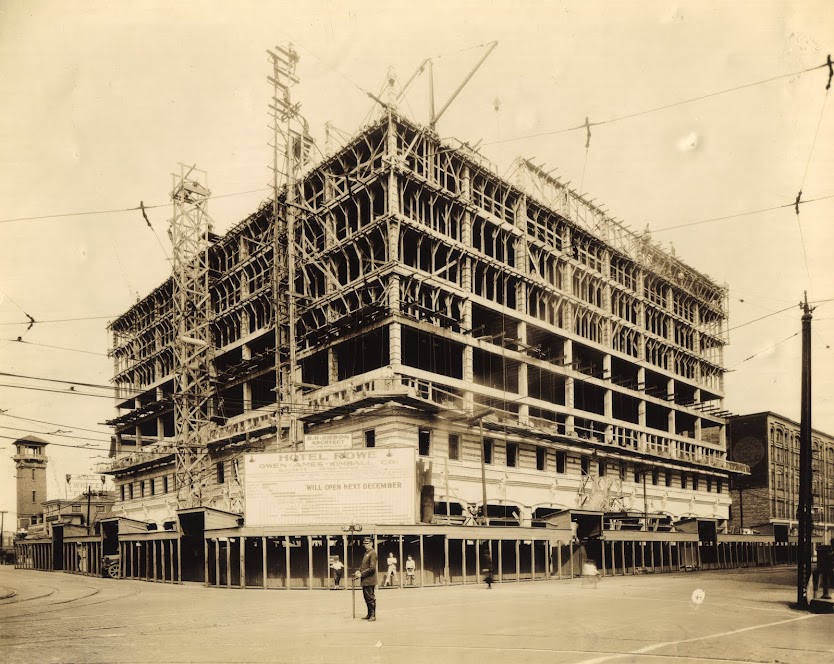
Building the Rowe Hotel. |
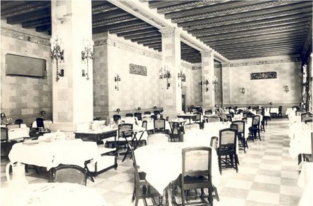
Dining room - 1930 |
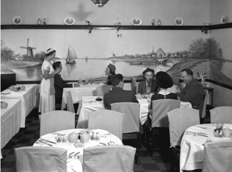
Dutch room - July 14, 1938 |
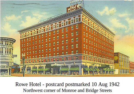
August 10, 1942 |
1947 |
1947 - postcard version |
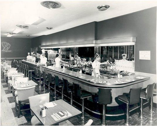
Coffee shop - January 17, 1950 |
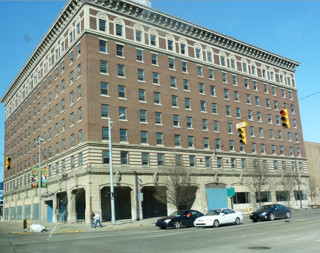
March 8, 2013 |
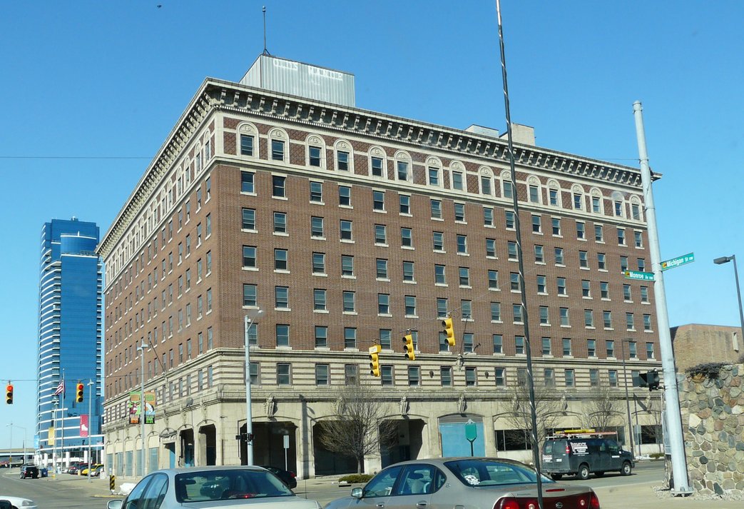
March 8, 2013 |
1929 |
1930 |
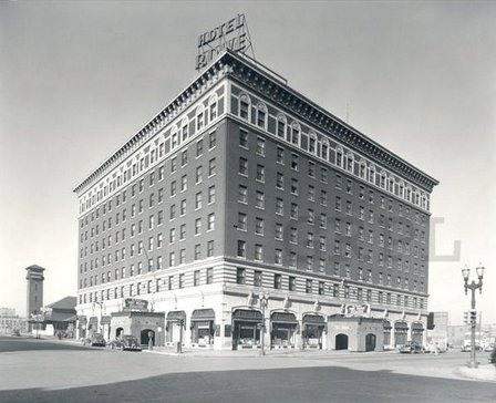
Constructing the Rowe Hotel, in an undated photograph, top row, left. In year 2012 the Rowe is an indigent hotel. The Grand Trunk railroad depot, built in 1906, and a liquor store for a while, is gone. One can identify some of the businesses on the west side of Division Avenue.
It is likely that the Grand Rapids Library has additional photos like this one of other areas of Grand Rapids. Hopefully they can be obtained some day for use here.
The two photographs in the bottom row, center and right, show the state of the Rowe hotel as of March 8, 2013. Different things have been tried to find a use for it, including turning it into an indigent hotel, but running an operation that big without the structure turning into a flea trap has to be difficult, if possible, with no real revenue coming in. Its future seems very unclear today.
Left click on the images below for larger versions.
|
|
|

Left click on the images below for larger versions.
|
Perhaps 50 to 60 ducks shot in one outing. |
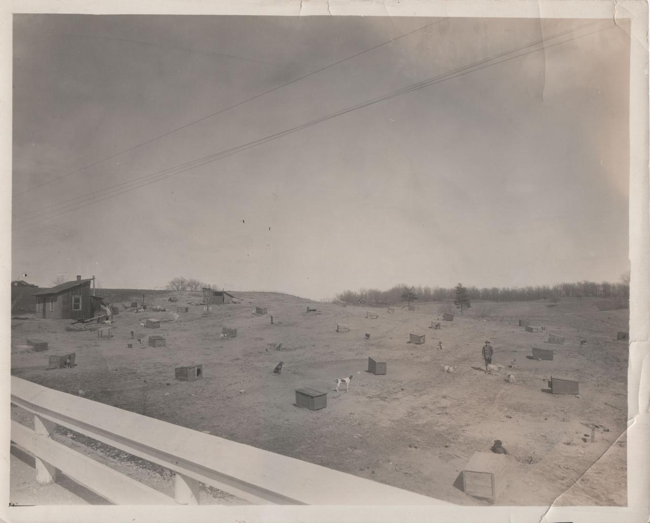
Hunting dogs - strange accommodations. |
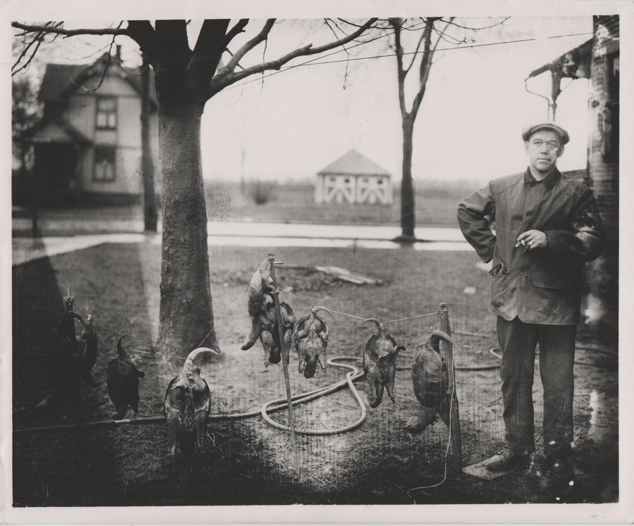
Maybe 10 large snapping turtles, for soup. |
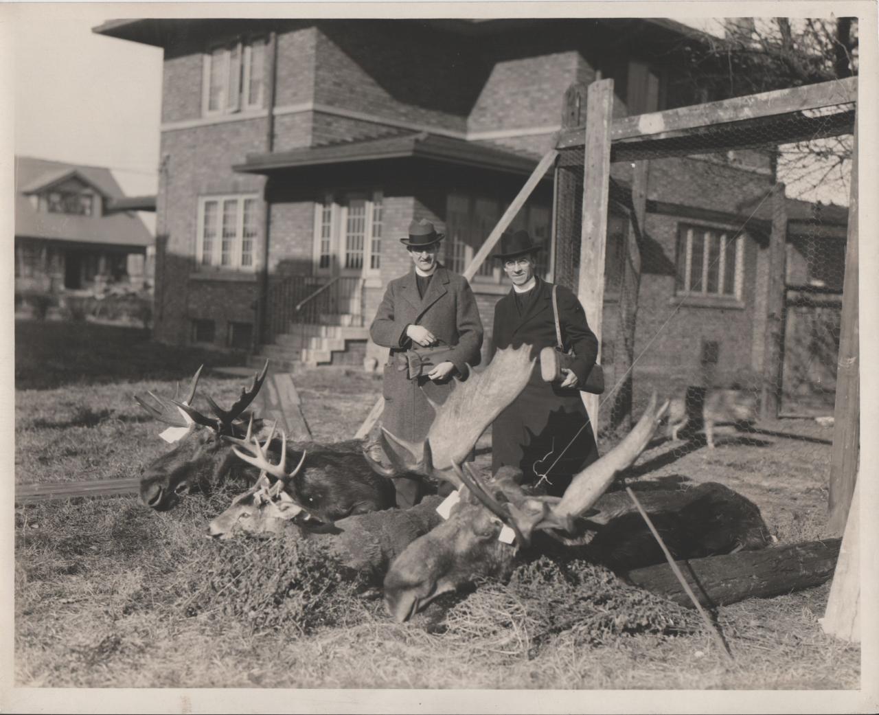
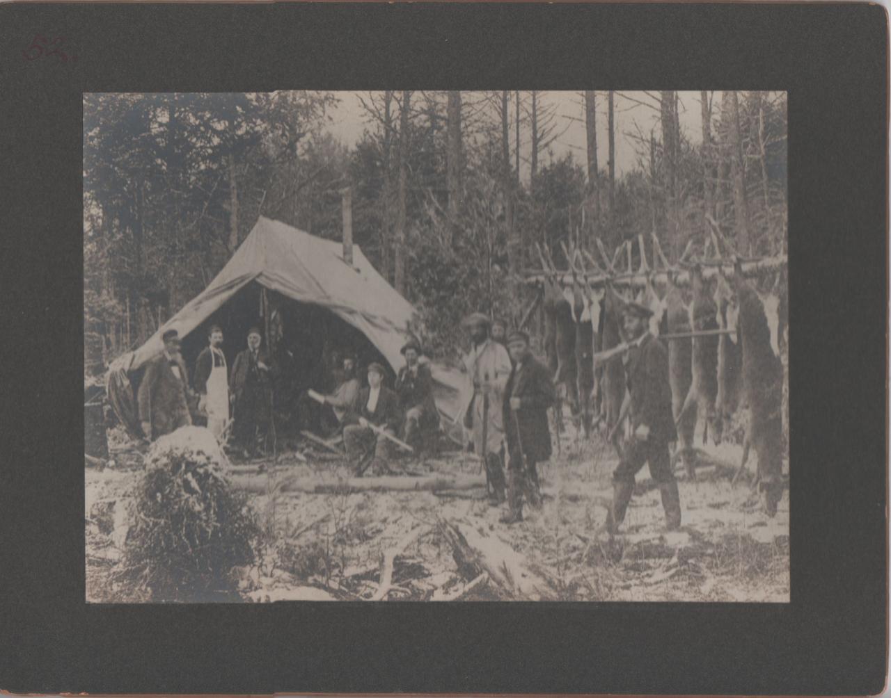
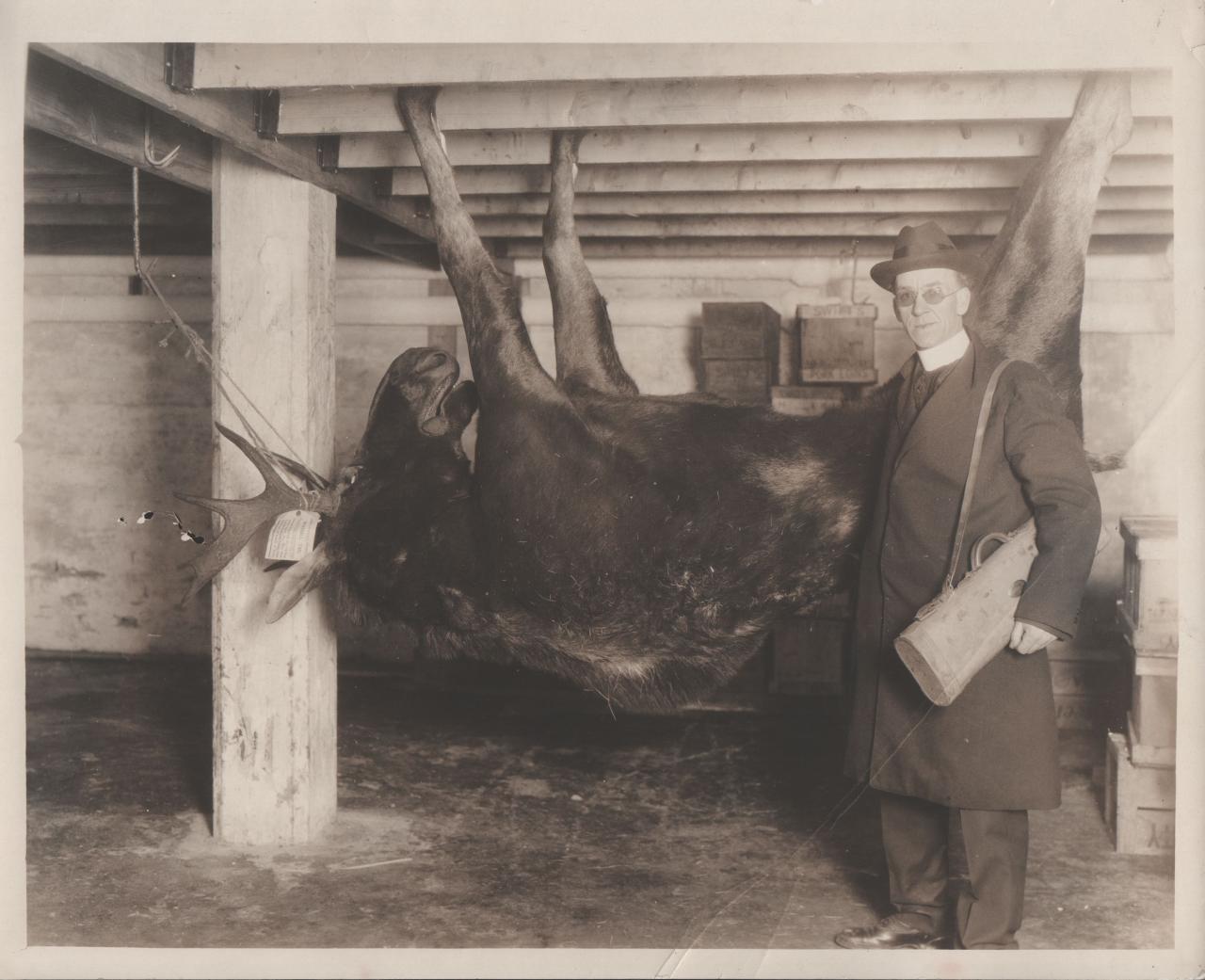
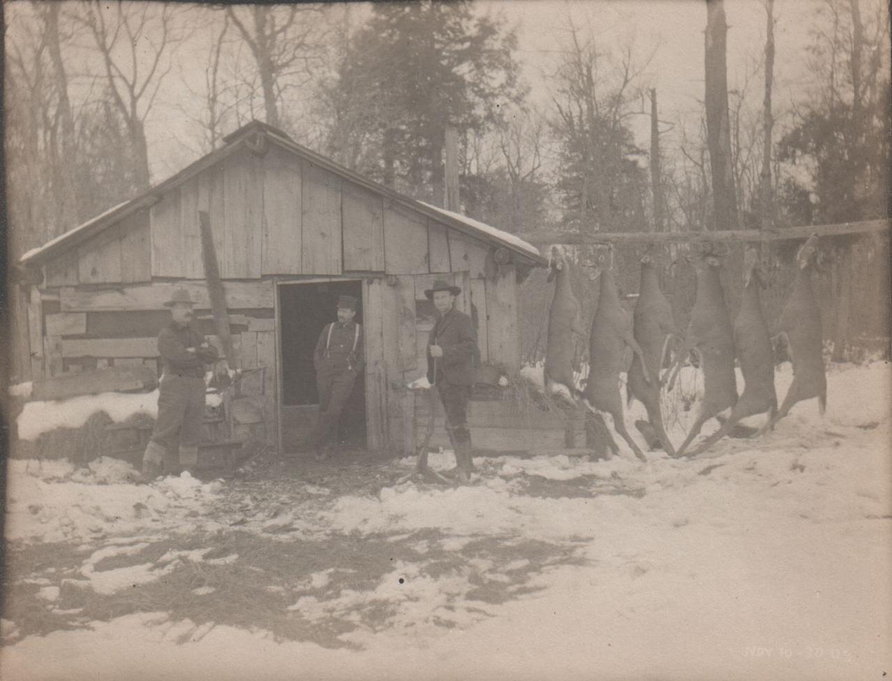
Save a soul one day, shoot a moose the next. |
|
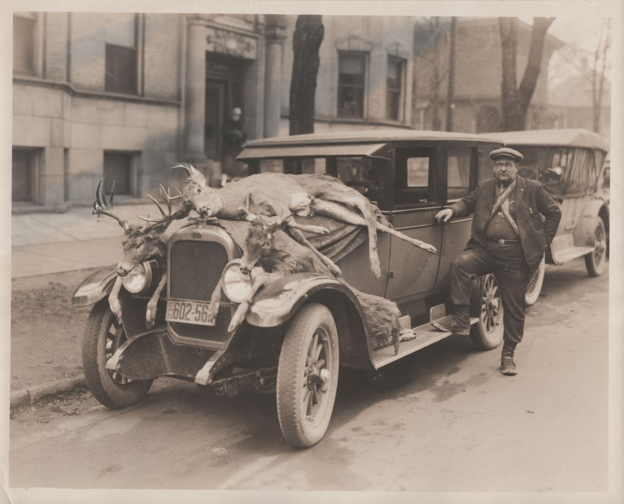
A lot of damage for one day. And some body parts to hang on a wall. Antlers, heads, etc. |
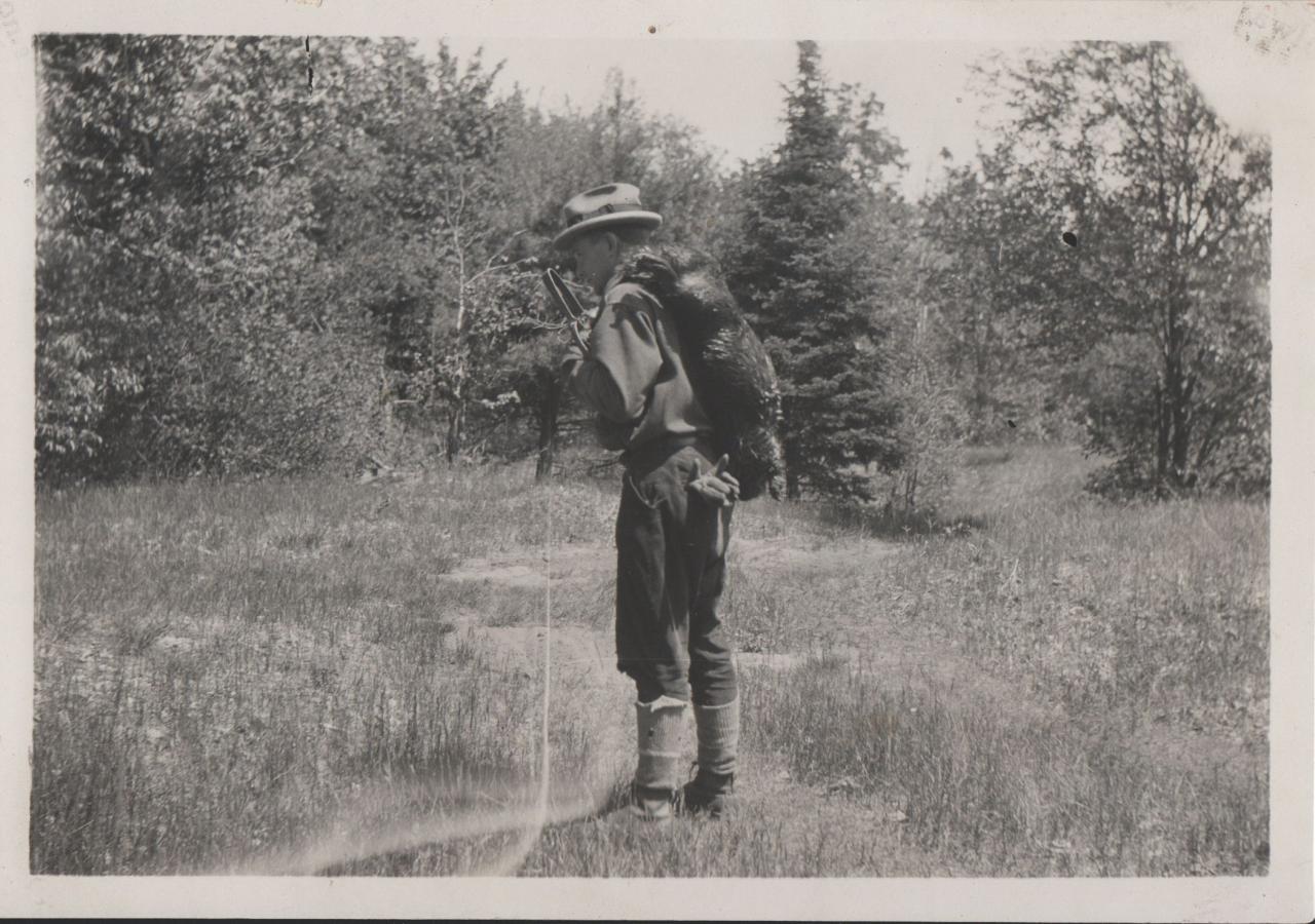
A dead beaver, and the steel trap used to kill it, no doubt to be moved to a new location. to kill again. |
|
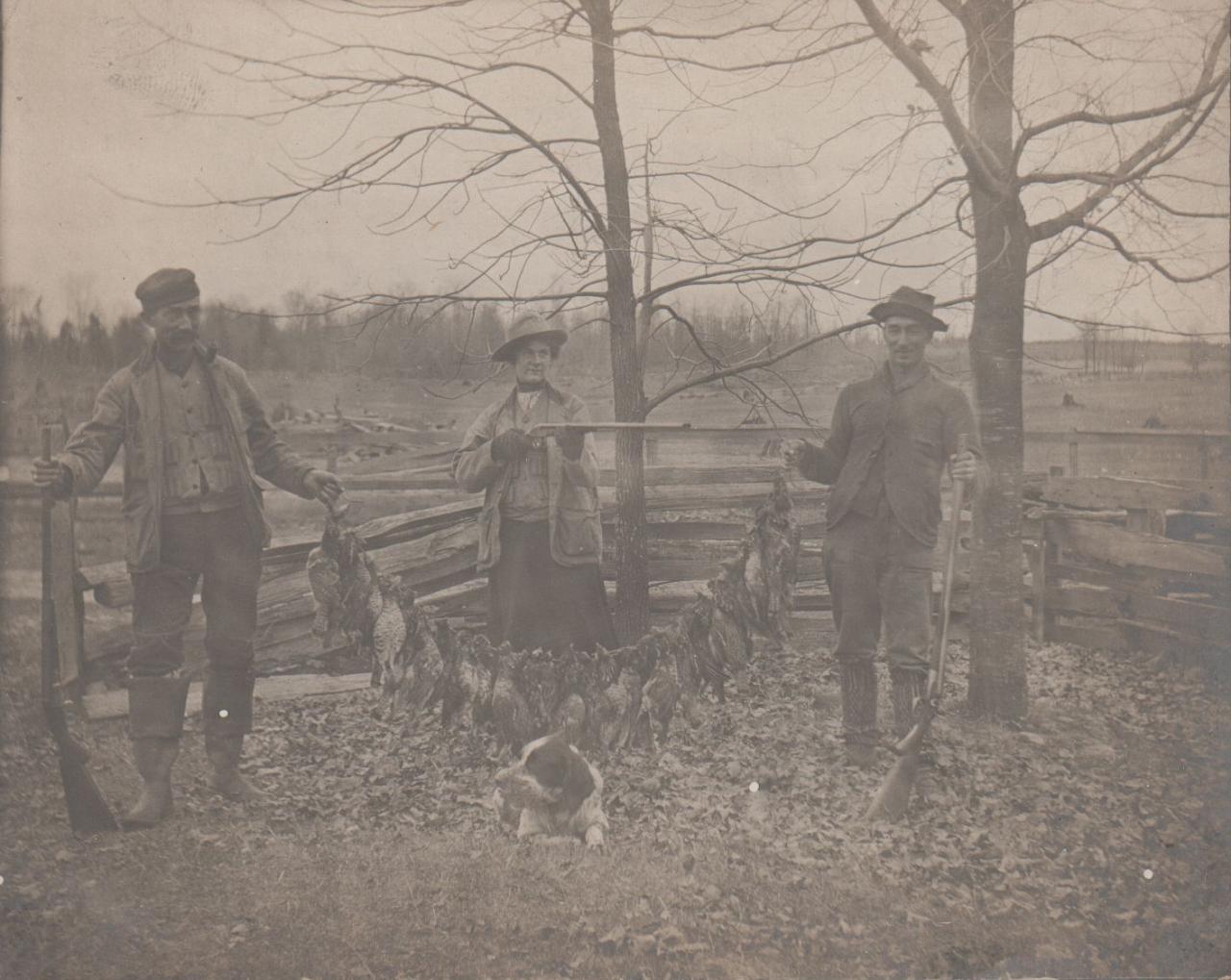
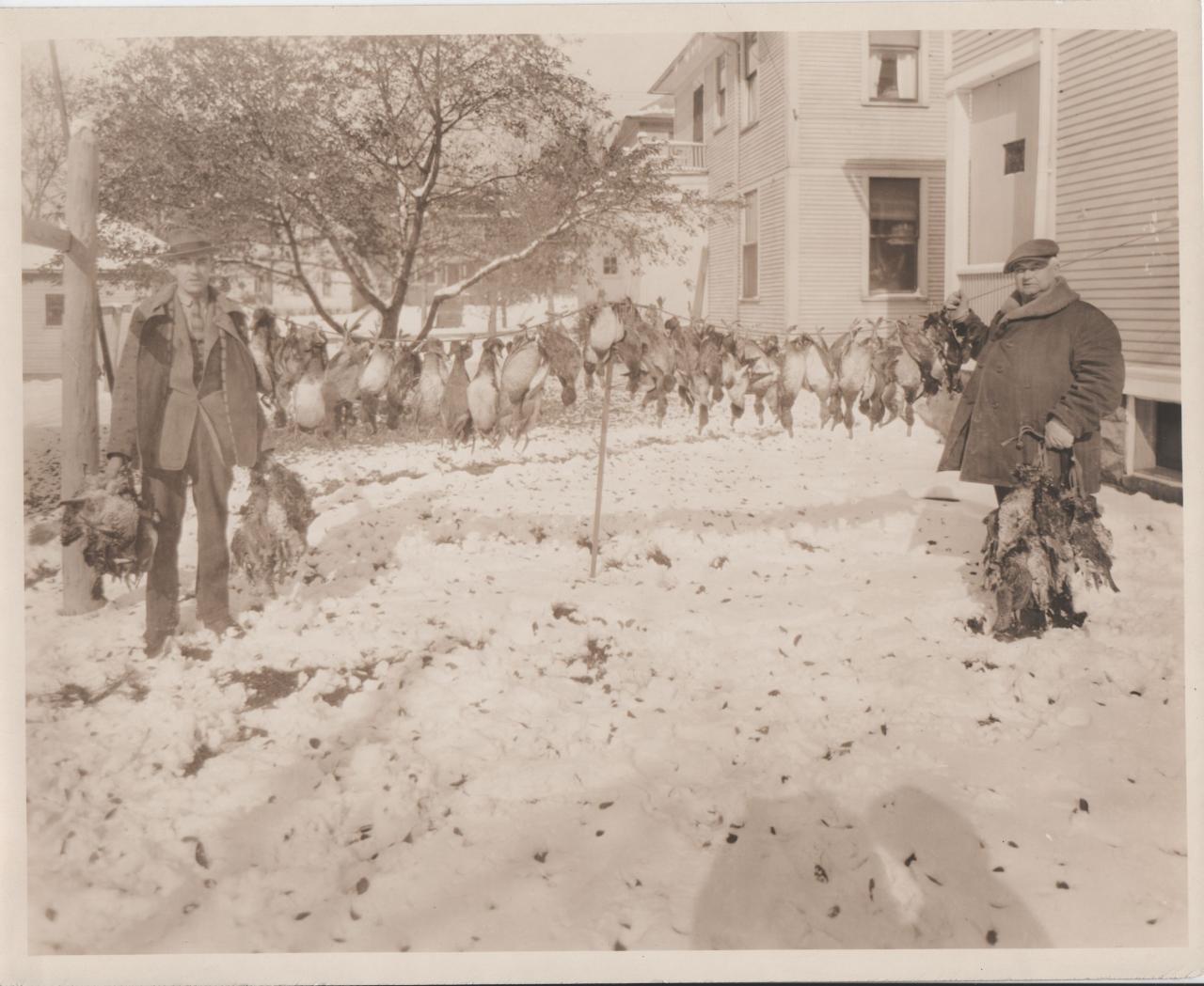
There are perhaps 50 grouse or partridge on the line, for one outing. Annie Oakley and the boys see nothing wrong with this. The endless frontier mentality. |
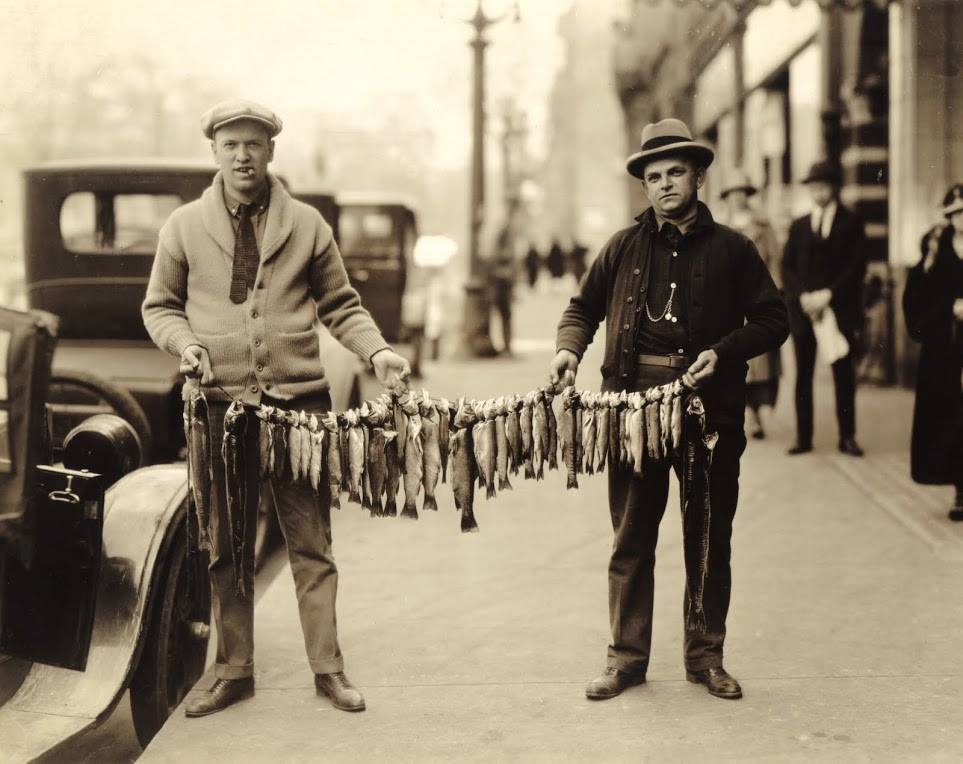
c1920. Again, there were no catch limits, and people fished until they tired of it |
Left click on the images below for larger versions.
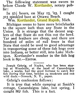
Note the last sentence. 867 fish in one visit. |
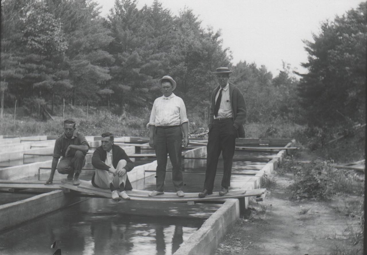
Hatchery - c1919 |
Hatchery - c1919 |
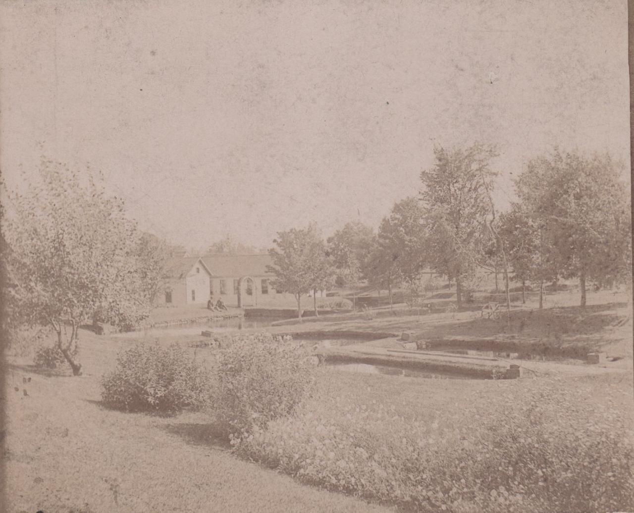
Hatchery - c1919 |
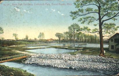
Hatchery - c1919 |
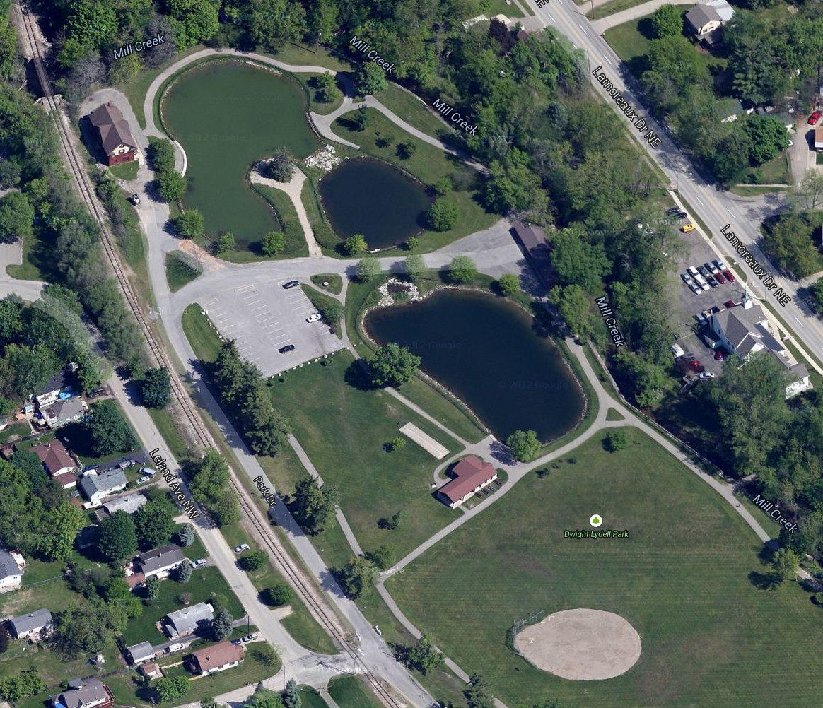
Hatchery - satellite - 2014 The building in the upper left. |
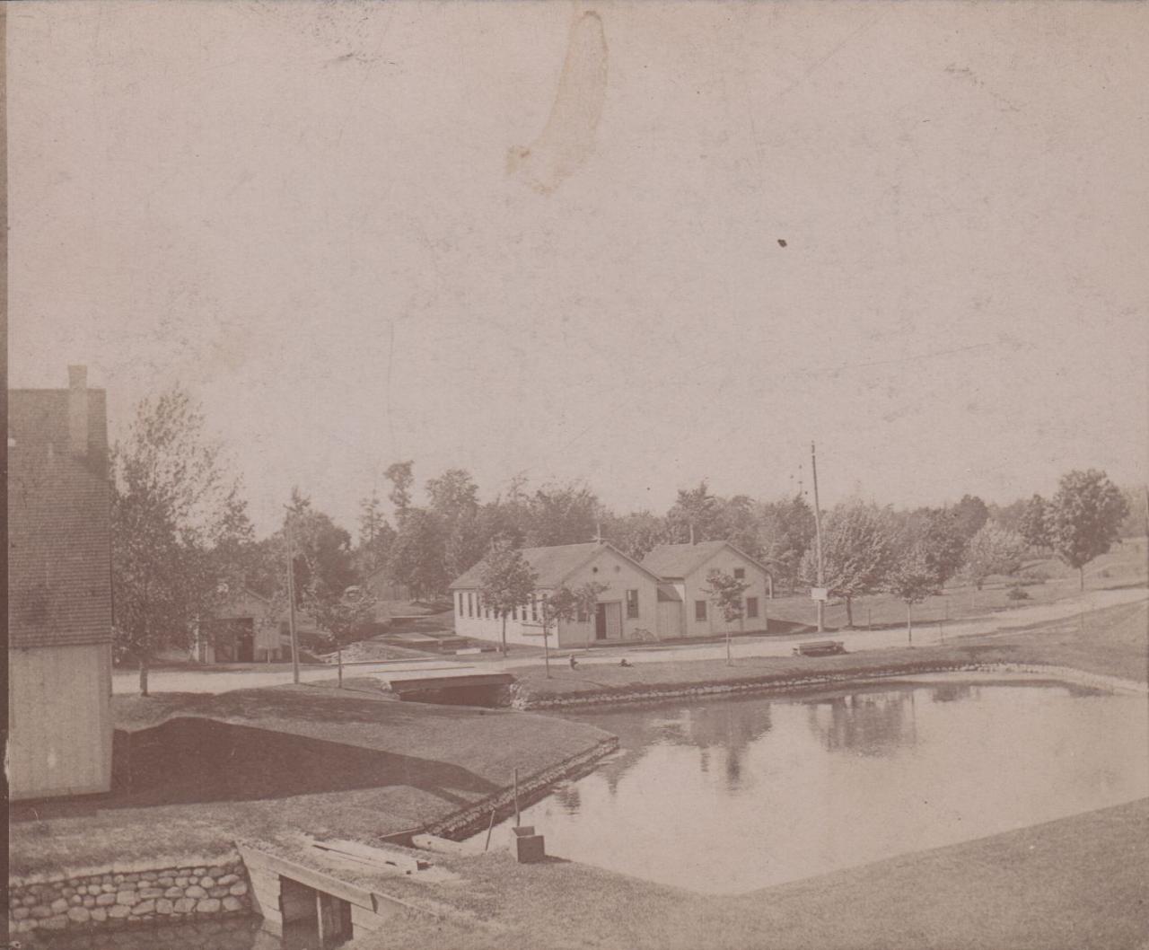
Hatchery - c1914 |
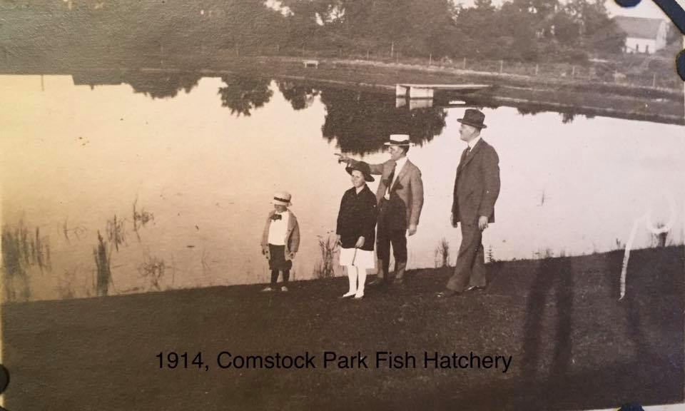
Hatchery - c1914 |
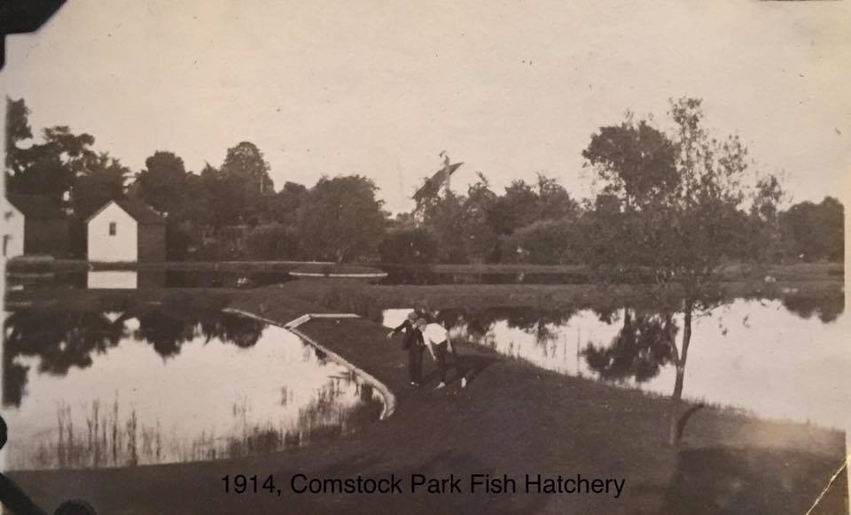
Hatchery - c1914 |
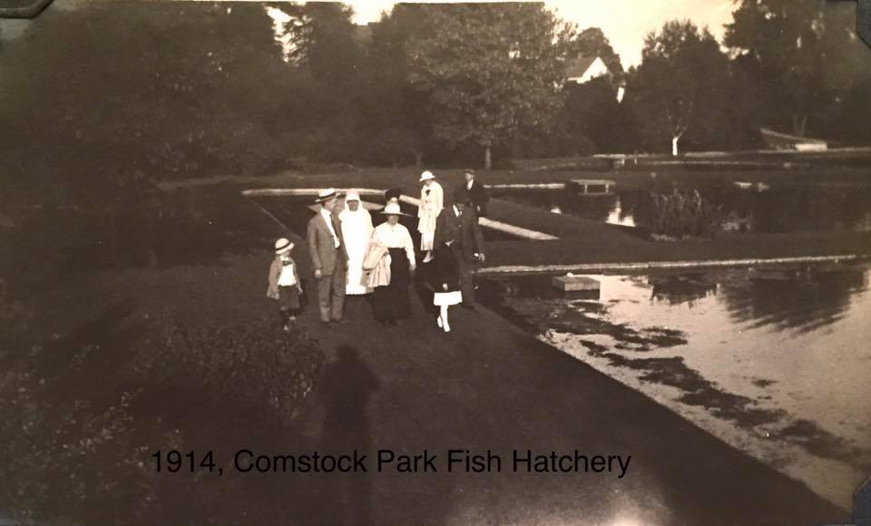
Hatchery - c1914 |
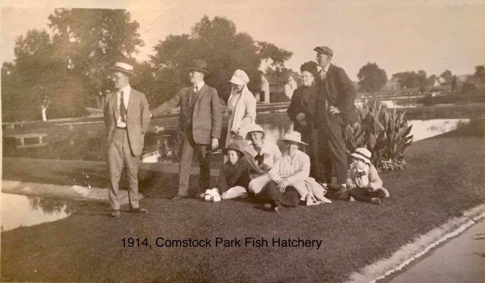
Hatchery - c1914 |
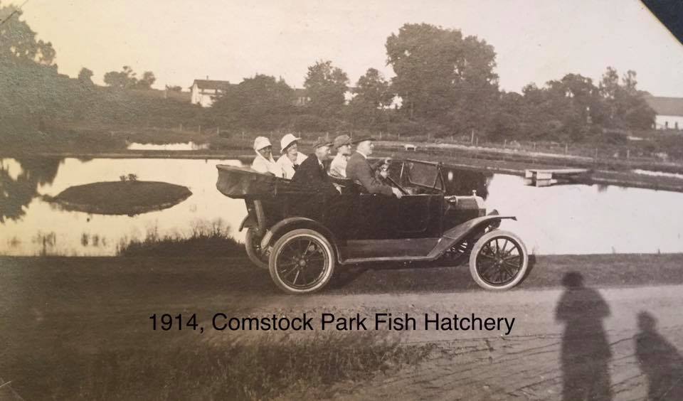
Hatchery - c1914 |
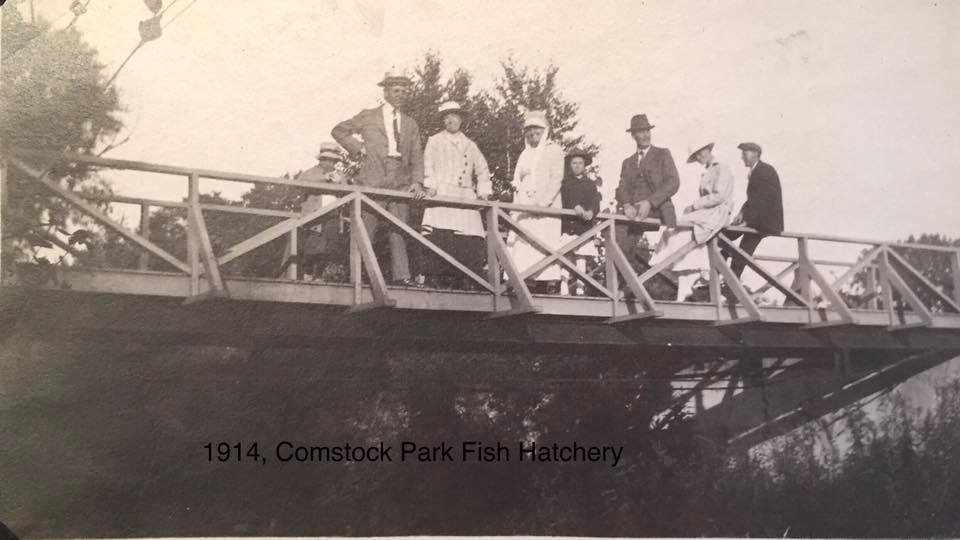
Hatchery - c1914 |
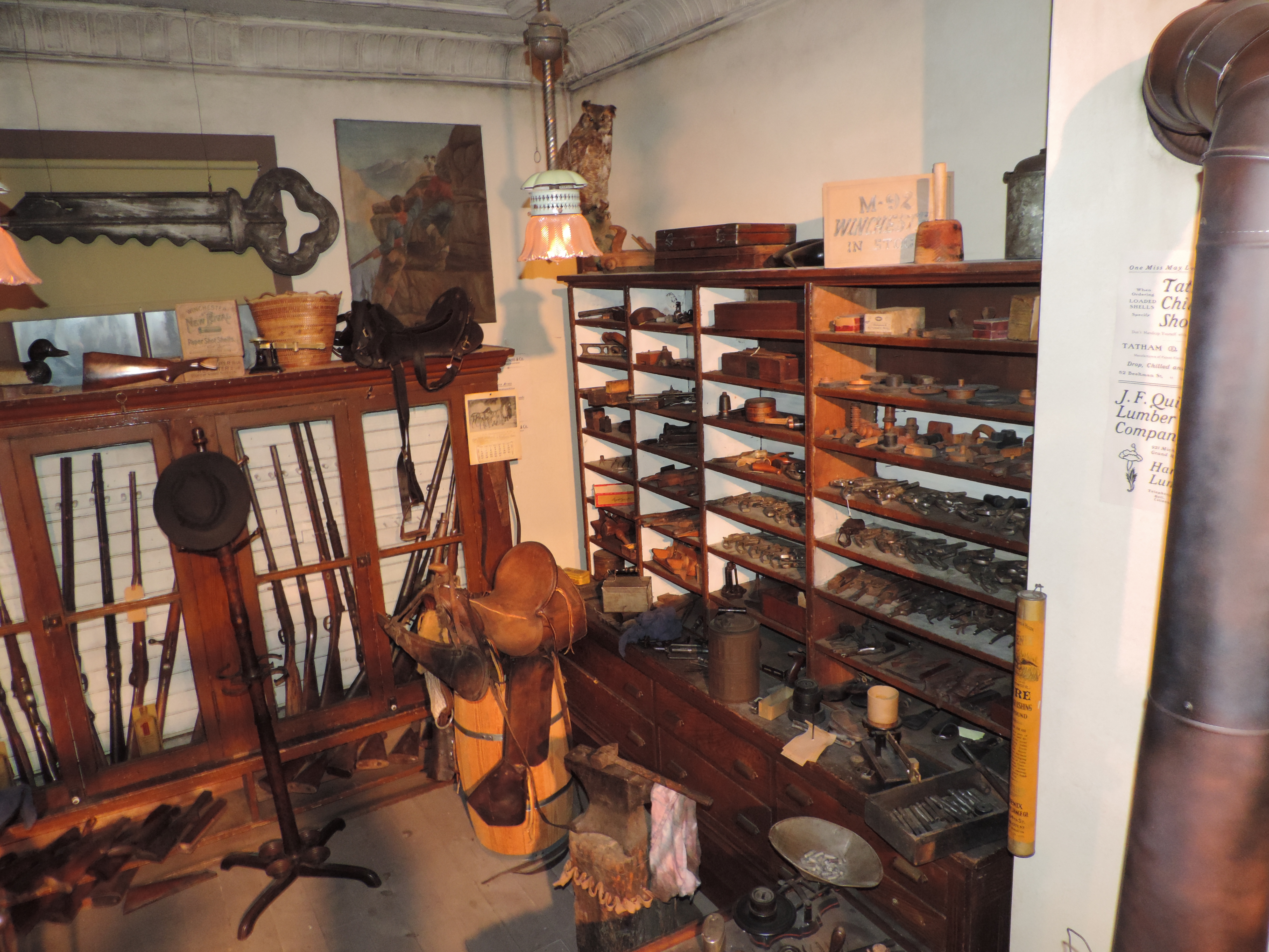
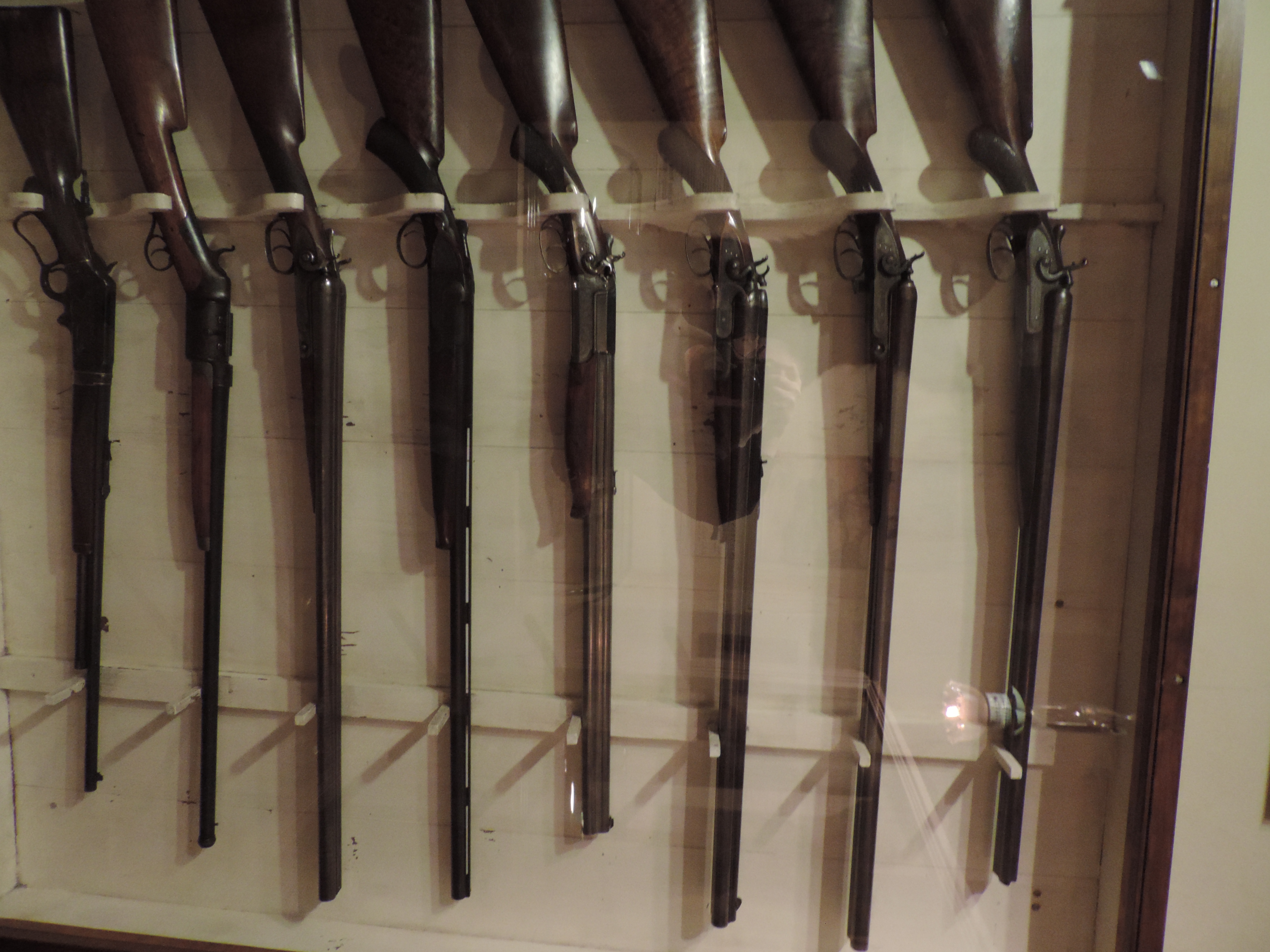
Left click on the images below for larger versions.
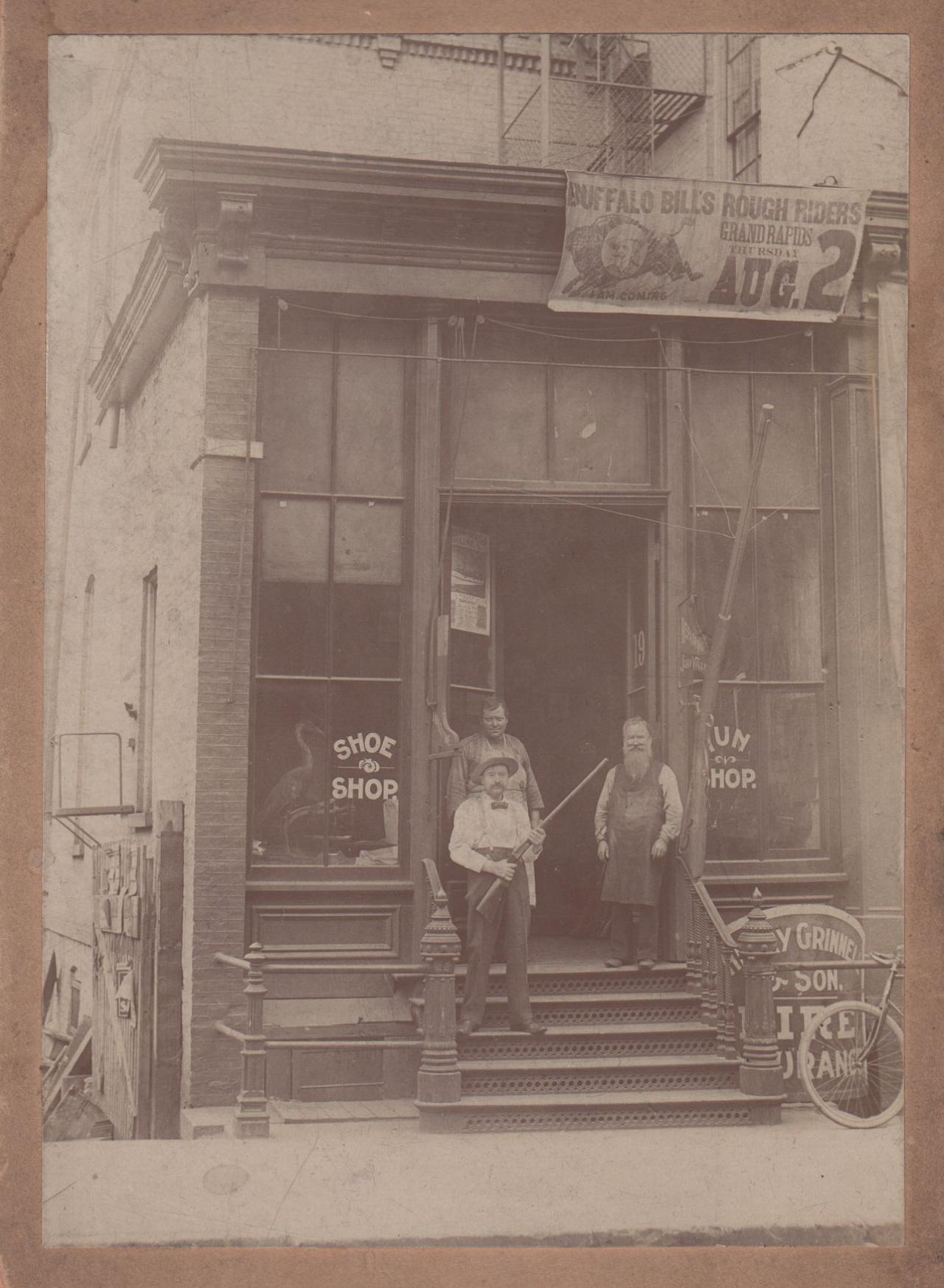
Charles - beard, Oscar, holding gun, William, c1900. |
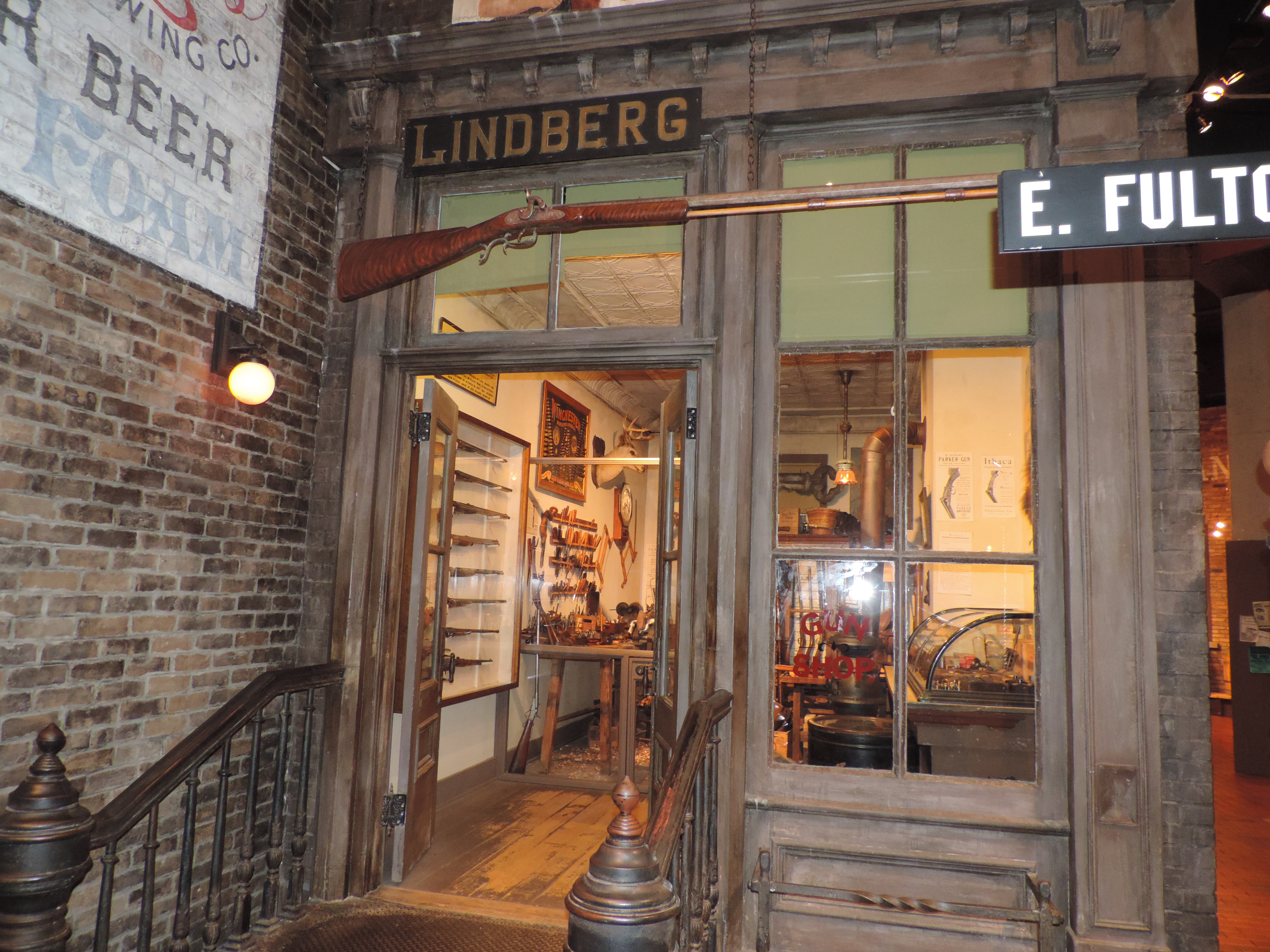
GR Museum re-creation |
GR Museum re-creation |
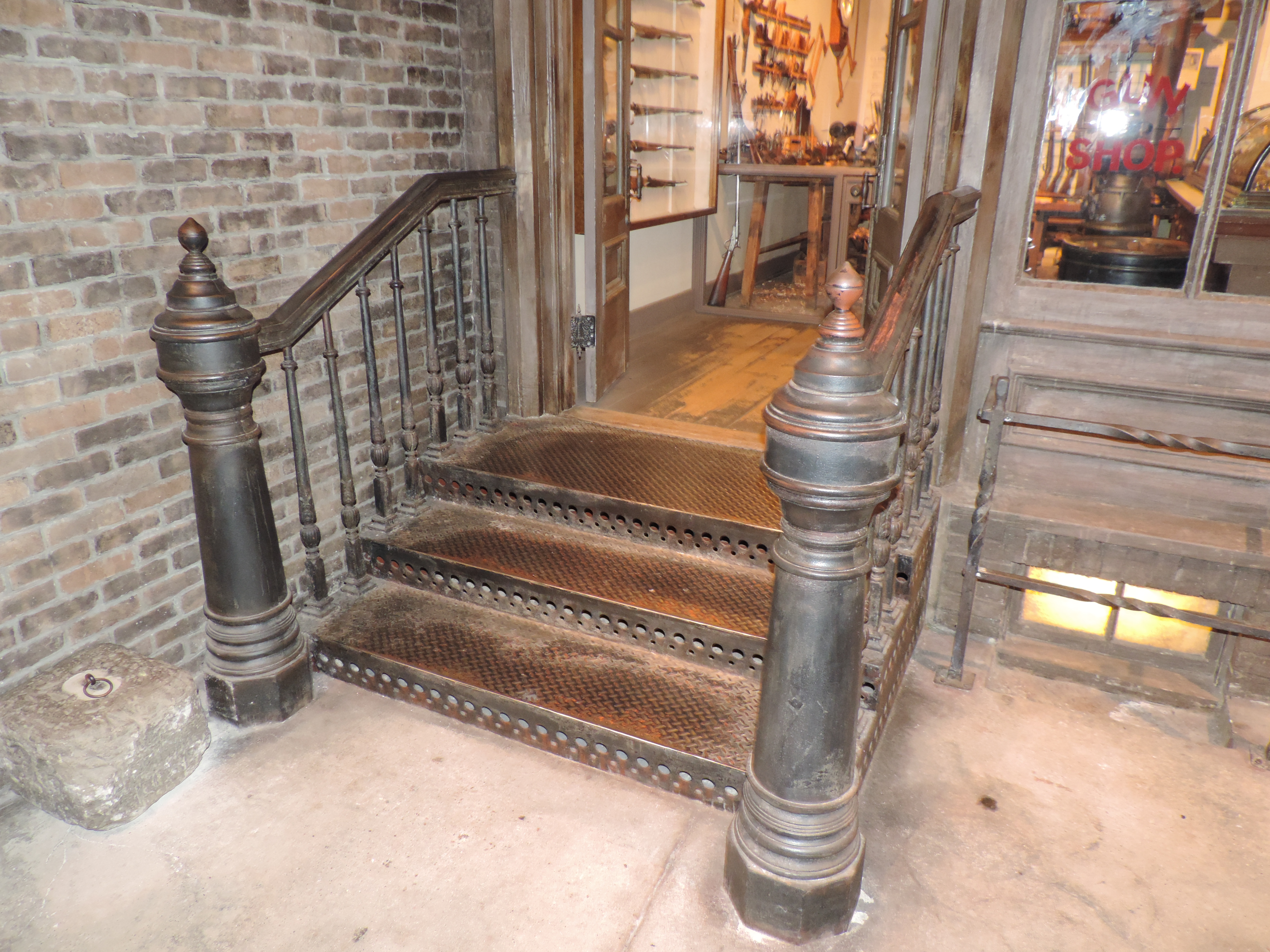
GR Museum re-creation |
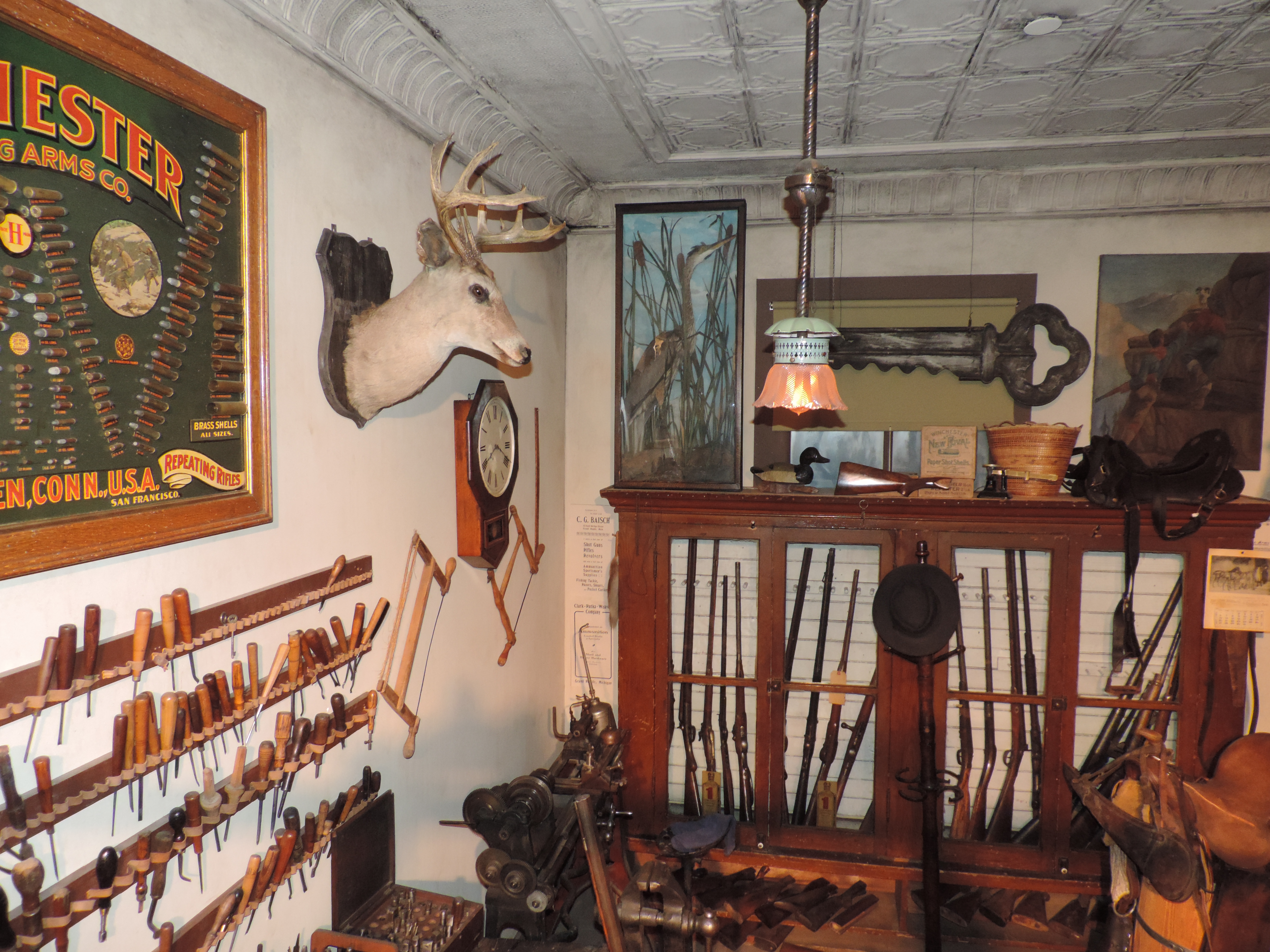
GR Museum re-creation. Notice the lathe, center, bottom. |
GR Museum re-creation |
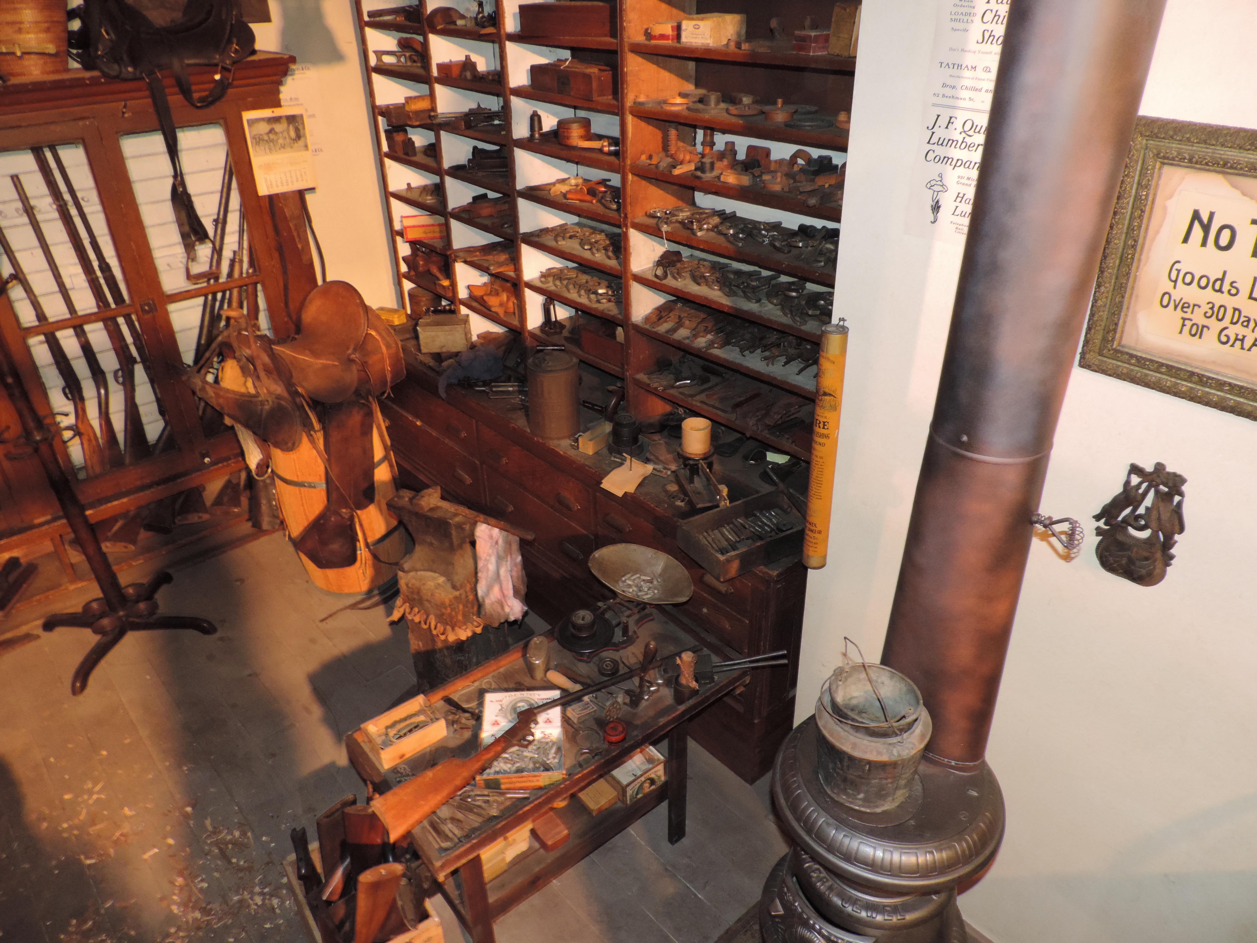
GR Museum re-creation |

GR Museum re-creation Notice the stock in the vise. |
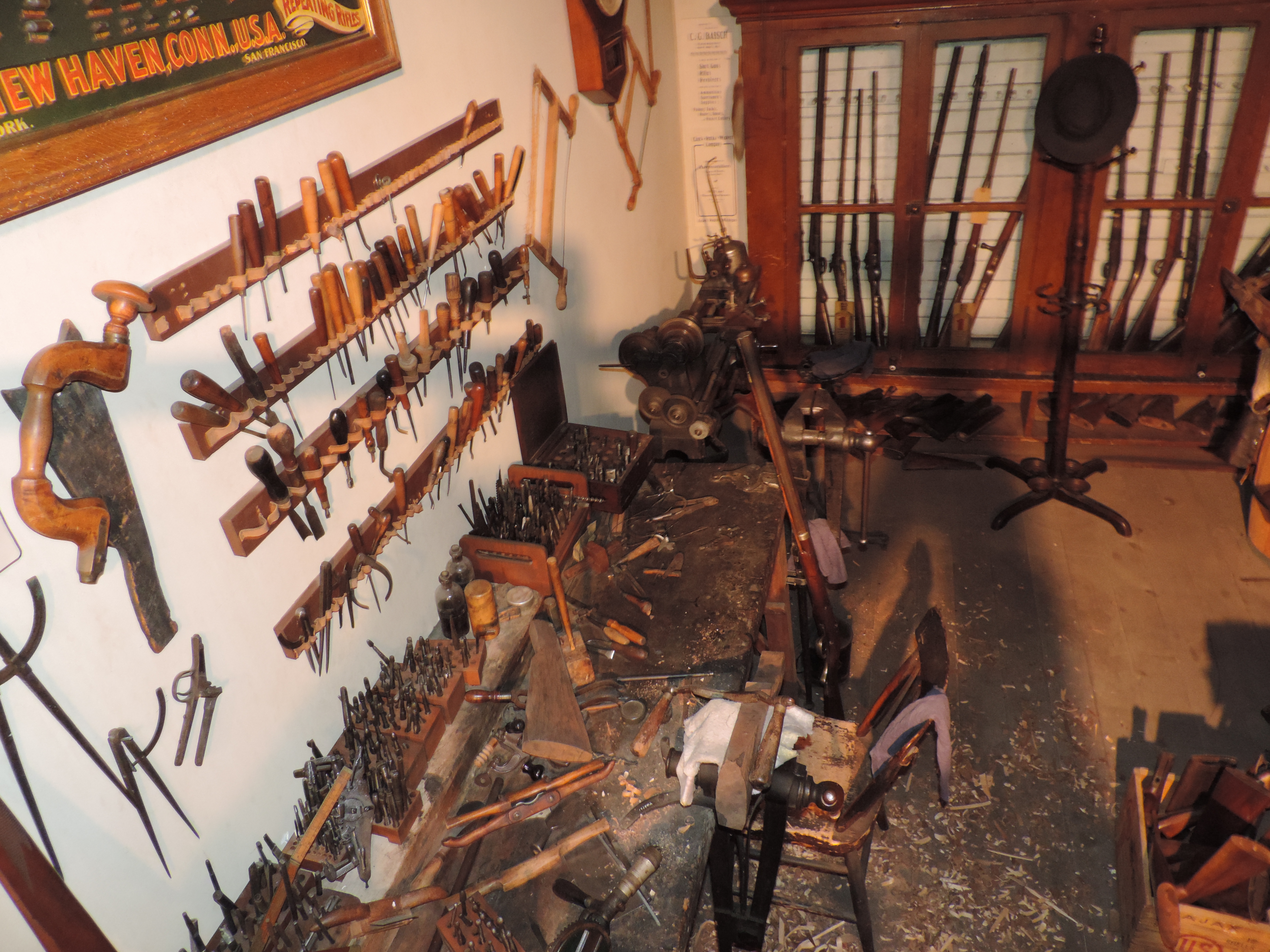
GR Museum re-creation |
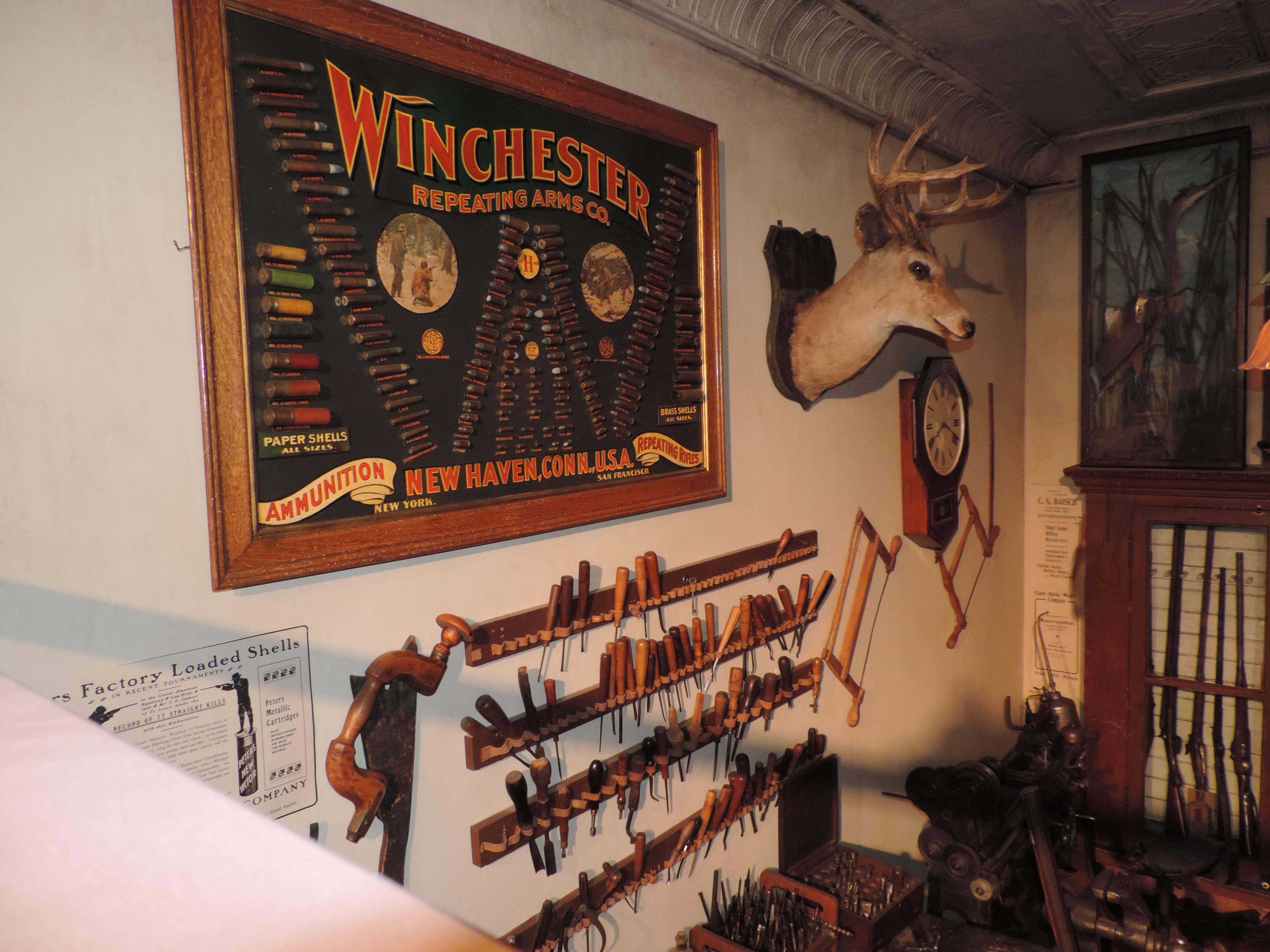
GR Museum re-creation Ammunition display - left, bottom - 8 gauge shell. |
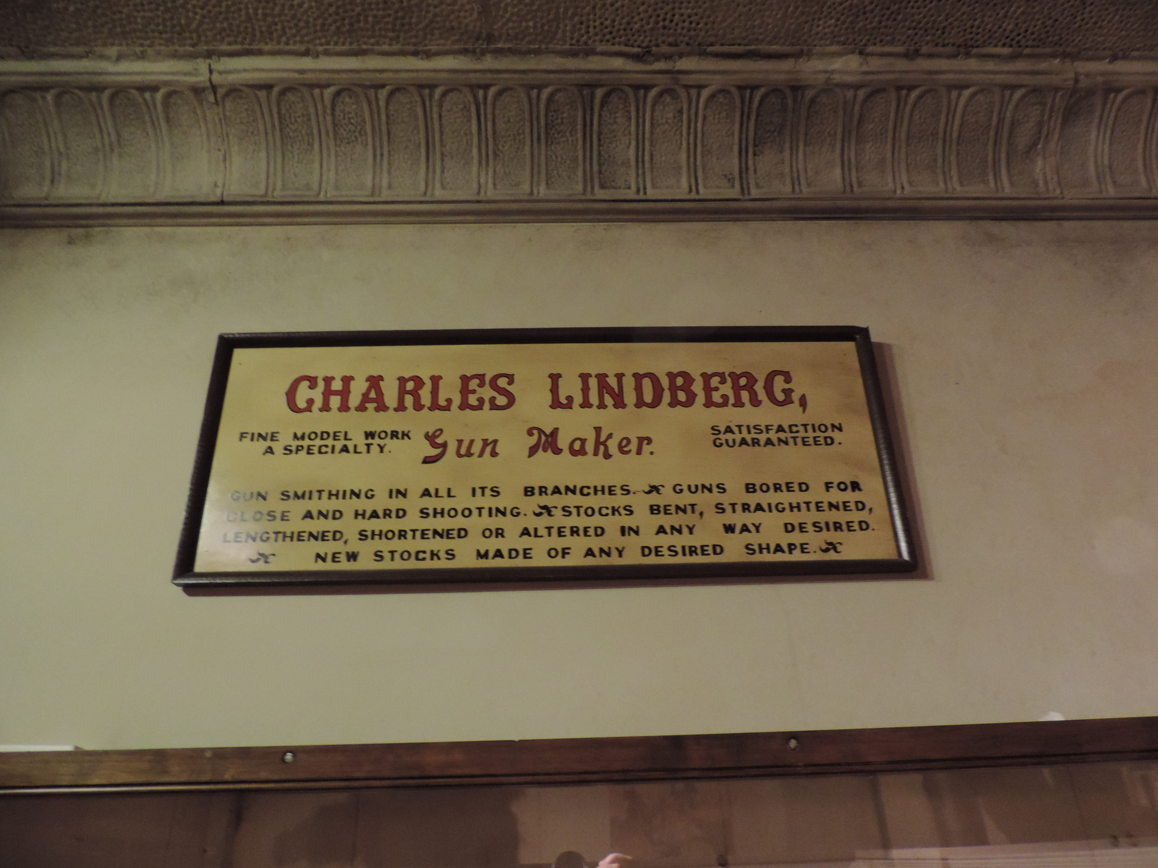
GR Museum re-creation |
GR Museum re-creation |
Left click on the image below for a larger version.
|
Left click on the images below for larger versions.
|
|
Public Museum
Left click on the images below for larger versions.
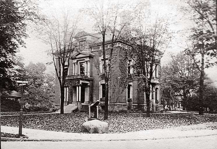
1917 - Nelson Howlett house. |
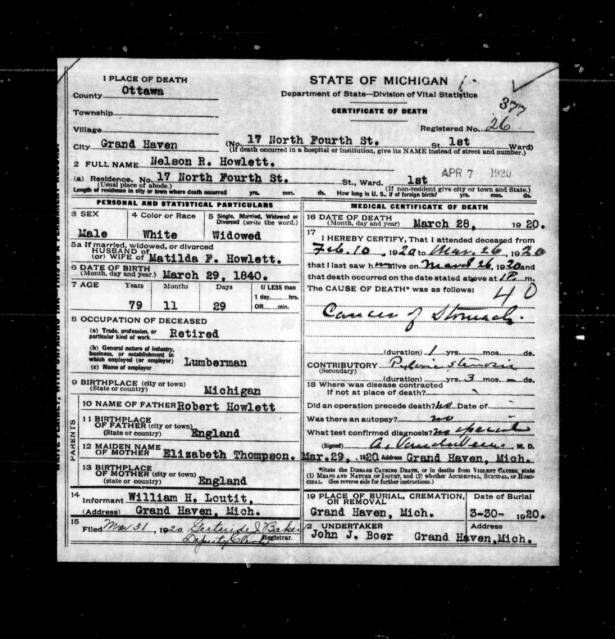
1920 - Nelson Howlett obit. |
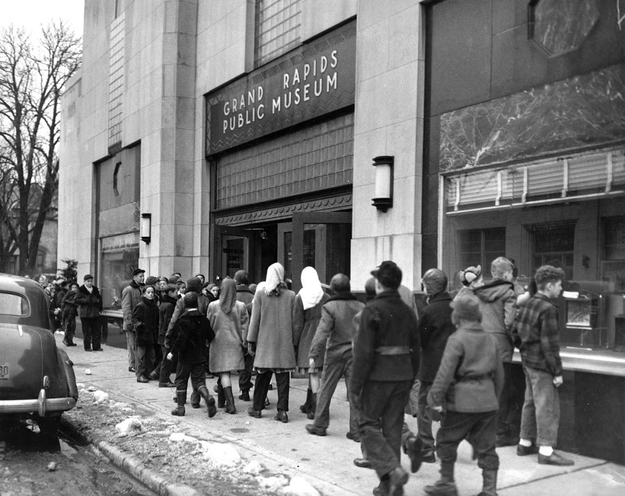
1952 |
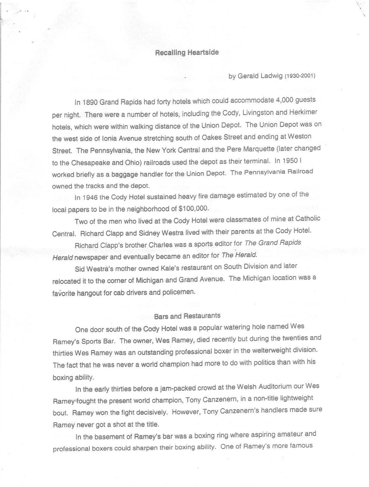
Recalling Heartside
Left click on the image below for a larger version.
|
|
|
|
|
|
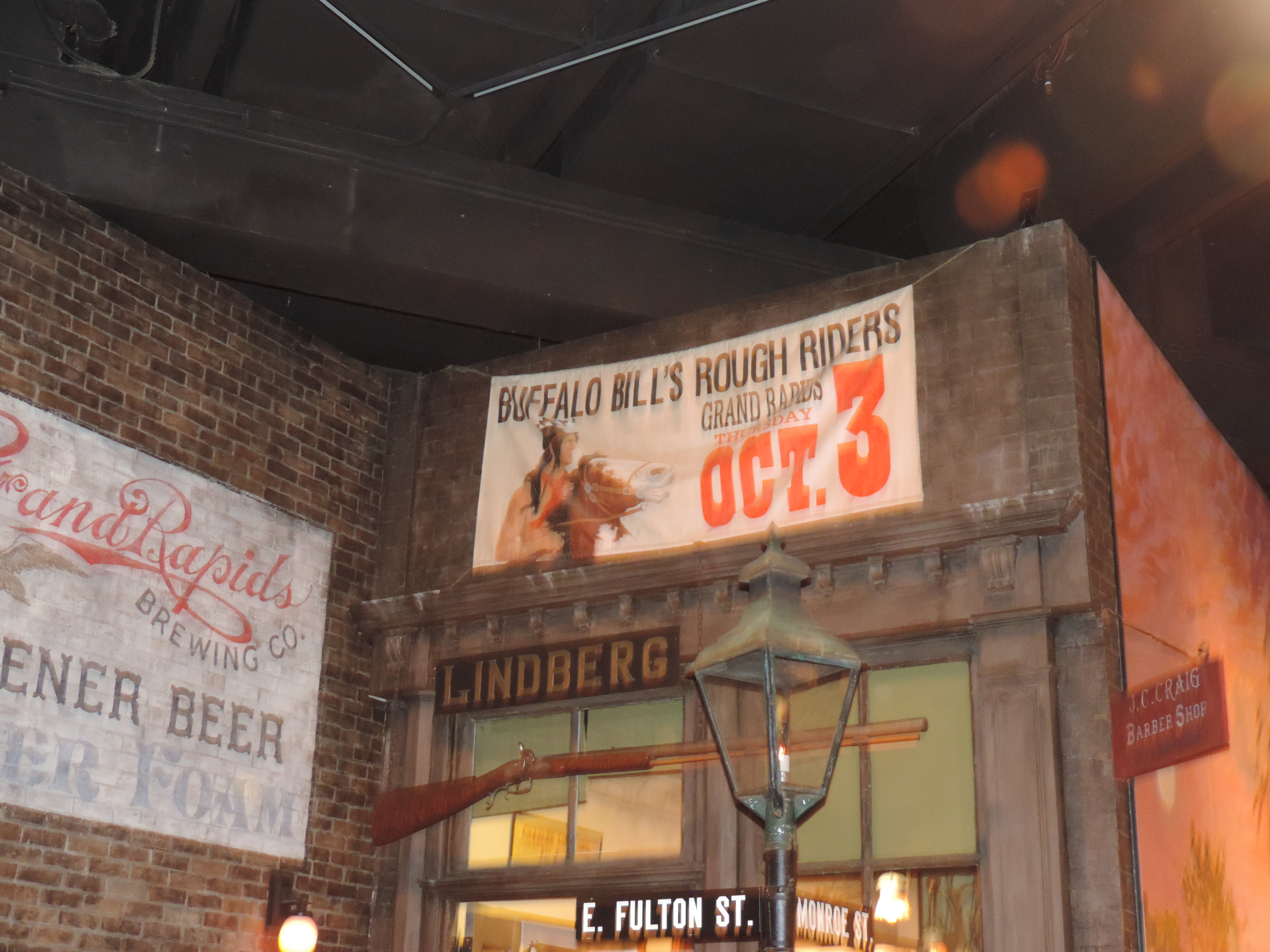
The Heartside area apparently included an area roughly bounded by Fulton and Weston, north and south, and Division Avenue and Ionia. Along Fulton, the buildings on the south side of the street included the Cody Hotel, Moore's Hobby Shop, the Charles Lindberg Sports Shop, which made keys, and sold guns and fish tackle, the Kortlander building, which contained a bar on the corner of Fulton and Commerce, Smalley Daniels', which sold Cushman scooters, and a print shop. The piece above describes a time when the area was a lively commercial district. In year 2006 the area is tacky, although recent commercial development promises to ensure that the area recovers some.
The Cody Hotel was indeed built with William "Wild Bill" Cody's money. He invested money from his wild west show in many hotels around the US, but many of them were in poorly chosen locations, and lost money. In the late 1940s yet the Cody Hotel was considered one of many Grand Rapids convention hotels. Bob Hope stayed there in about 1946, after playing a gig at Bigelow Field.
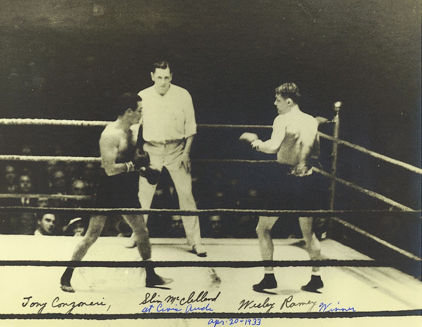
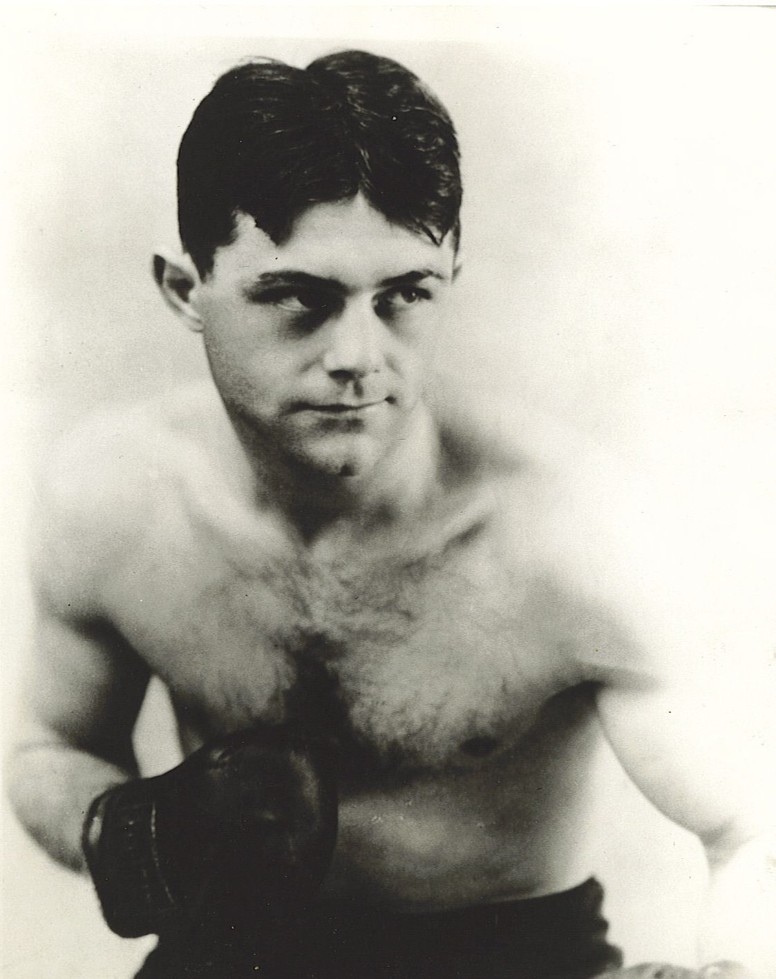
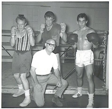
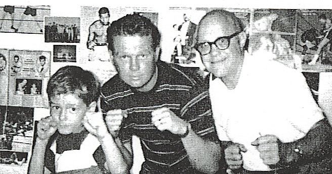
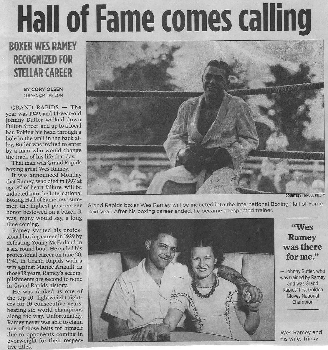
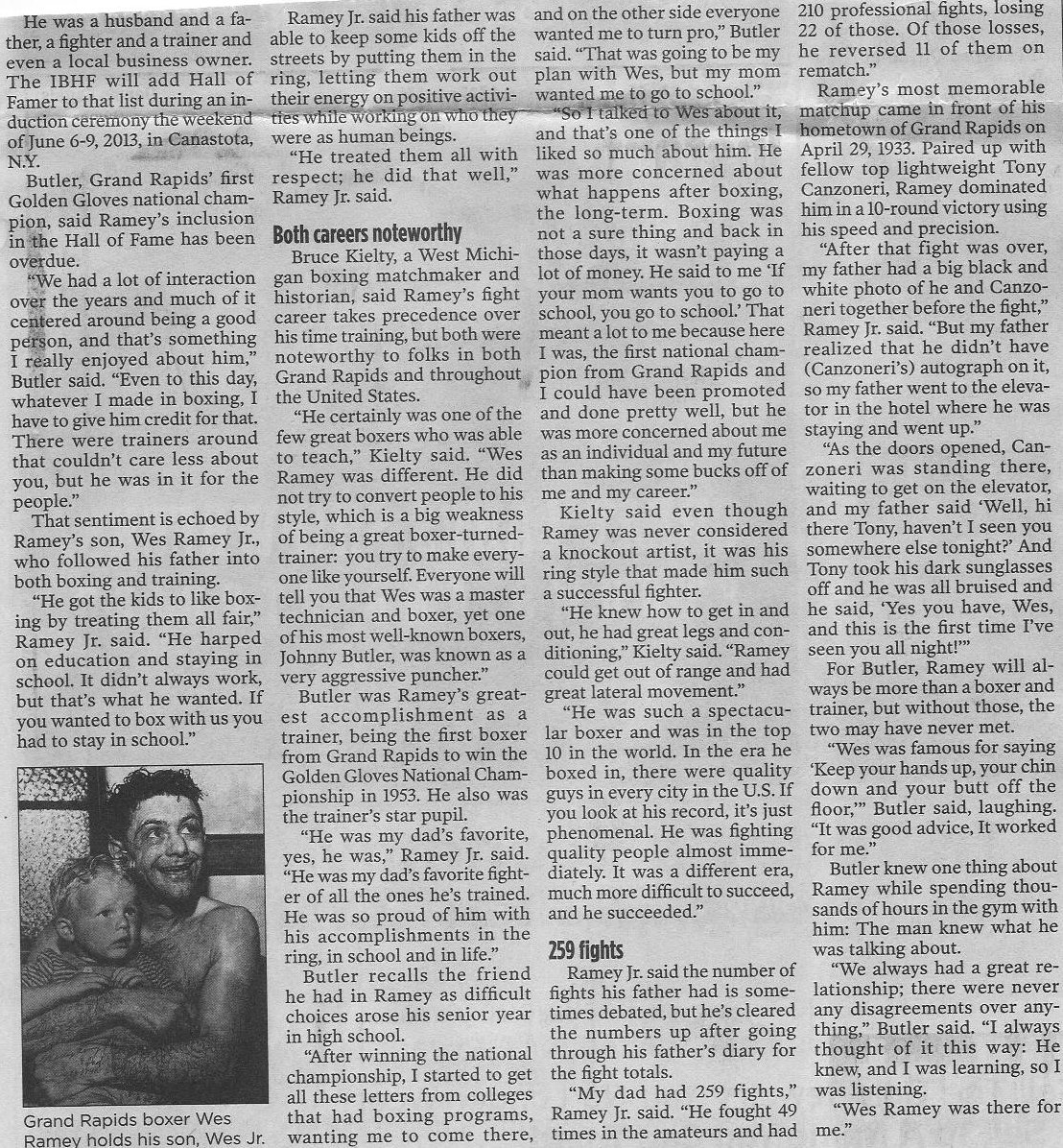
Wesley Ramey, a title quality boxer in the 1920s and 1930s, went on
to run a couple of successful sports bars just south of the Cody Hotel.
Left click on the images below for larger versions.
|
|
|
|
December 16, 2012 |
|
The bars, which he ran for some 27 years, were called "Wes Ramey's Bar" and "Wes Ramey's Lounge." After that he worked at the Godwin Heights School System, probably as a boxing instructor, and then retired. For years he also owned Wes Ramey's Gym, where he and his son, also an accomplished boxer, trained amateur and professional boxers.
The Kortlander building is described in another section, and was a general purpose commercial building, constructed around 1890 in part to house the William Kortlander wine and liquor business.
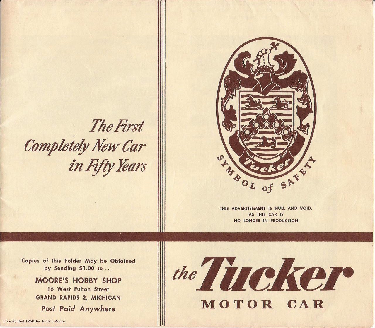
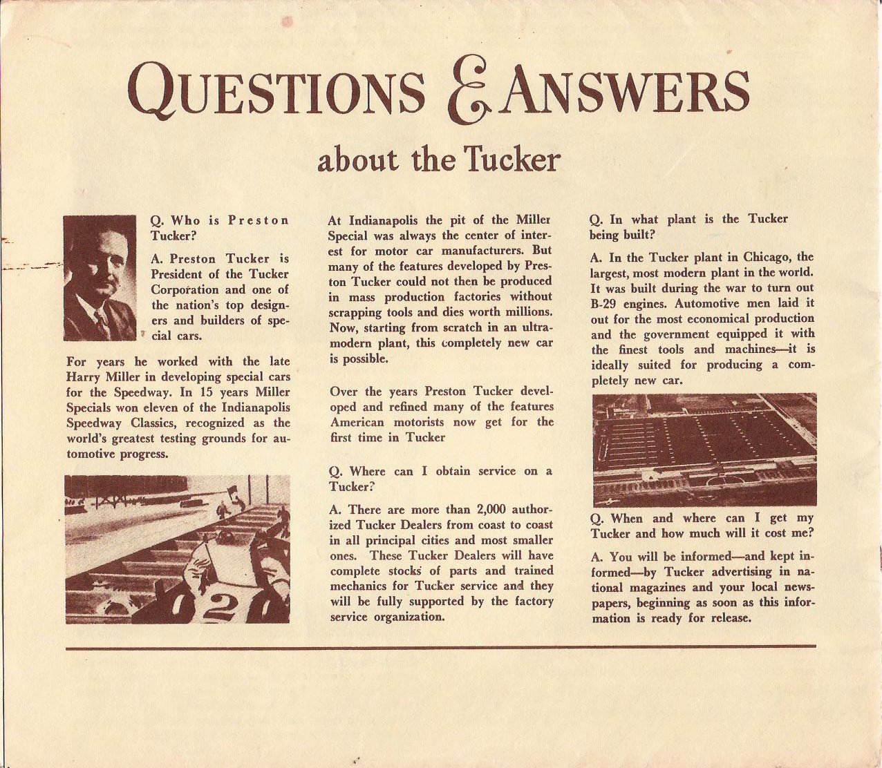
Moore's Hobby Shop, started in 1940, was an institution for many Godwin students. In the winter, a Division Avenue Bus ride downtown left only a short walk to Moore's Hobby Shop, which might well be crowded. In the lower level was a large assortment of model trains. Upstairs were things like paperback books - Floyd Clymer's books about motorcycles and cars - and airplane kits. While the merchandise was poor by 2006 standards, one could enjoy building balsa wood planes, or plastic replicas of military and civilian planes. The store was located at about 16 Fulton, in the (Maris?) building, between the Cody Hotel and the Kortlander building. The same building housed Smalley Daniels'.
One of the items produced by Moore's were reproductions of famous vehicle brochures. Below is one from 1960 about the Tucker automobile.
Left click on the images below for larger versions.
|
|
The Tucker is the poster child for what a large corporation can do if anyone or anything gets in its way. In this case, the "Big Three," which meant something in the 1940s, but is mostly comical in year 2012, used size and near monopoly status to deprive Tucker of the materials and transportation it needed to build cars. Much as in year 2012, if you have competition, either buy it, sue it, or run it out of business, through means fair and foul.
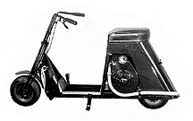
Smalley Daniels' shop sold Cushman scooters, a name now long forgotten for the most part.
From the January 15, 1946, Luddington News.
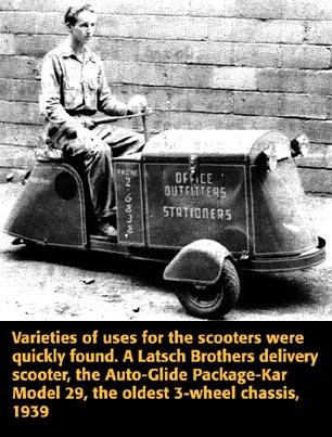
Cushman was originally the name of the Cushman Motor Works, in Lincoln, Nebraska, which made gas engines, known for their quality. Eventually this was bought out by the Ammon family, which also bought the California-based Motorglide Two-Wheel Scooter Company. The name was changed to Cushman, and in October, 1936, the first scooter, the Model R-1, was ready for sale.Very basic machines, the scooters were most suitable for local travel. Three wheel models were used for things like deliveries, and often used to sell Popsicles during the summer, with the box in the back insulated, partially filled with "dry ice," and a supply of frozen fare. By the late 1950s mopeds, and low cost Japanese and other foreign motorbikes and motorcycles were beginning to flood the US market. Cushman scooters lost appeal, and in year 2006 are mostly collector's items.
Left click on the image below for a larger version.
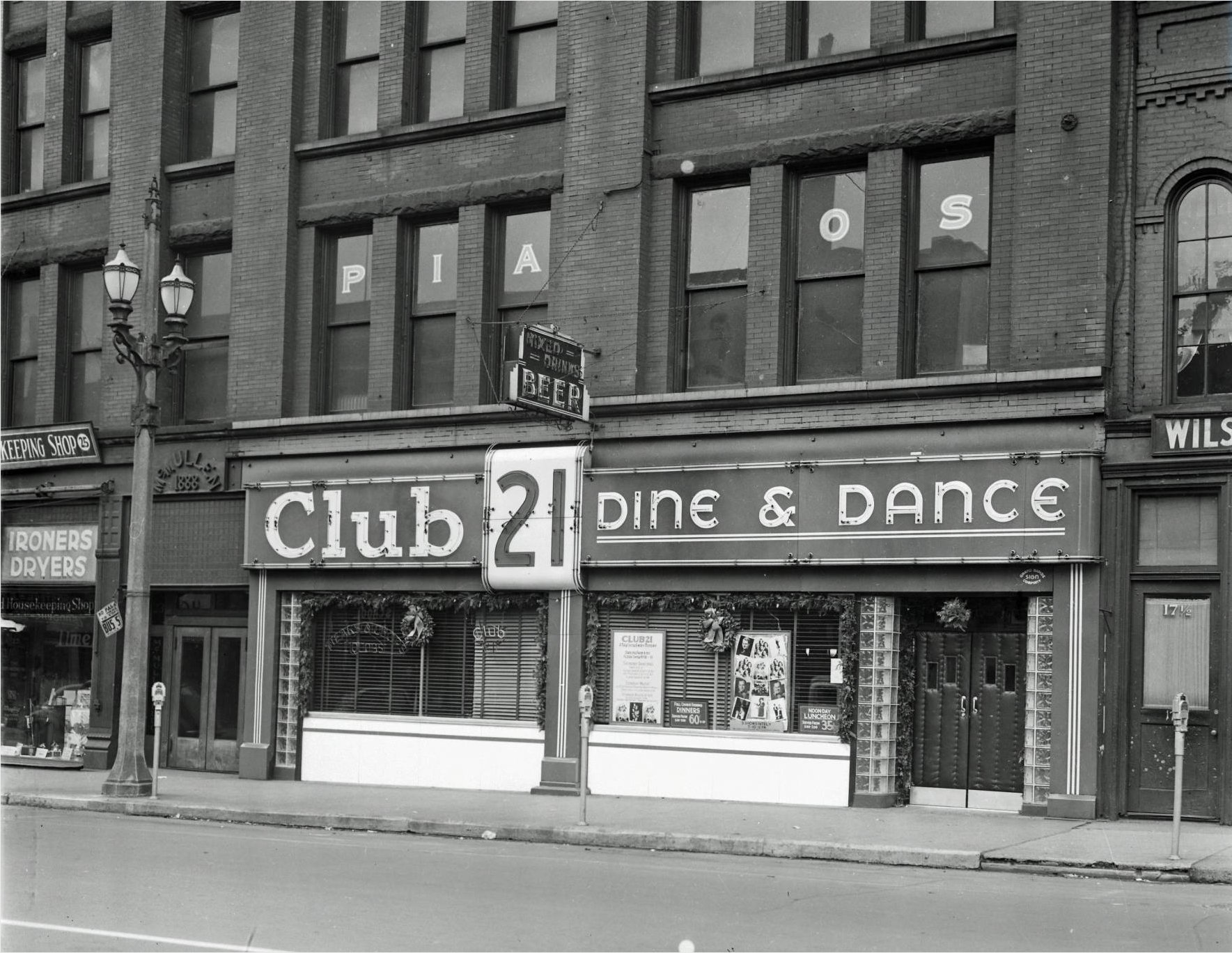
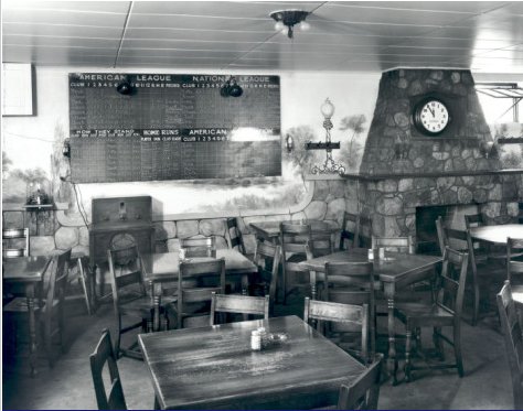
The photograph of the Club 21, located at 21 South Division Avenue, and taken on December 14, 1939, is perhaps representative of the kinds of entertainment available in the Heartside Area in the 1930s and 1940s. Downtown Grand Rapids was a safe and busy place at night in those years, and in pre television days there was a big demand for outside entertainment, which included things like dining, drinking, and bowling. Club 21, Wes Ramey's Lounge, and Wes Ramey's Bar, were places where one could get out.
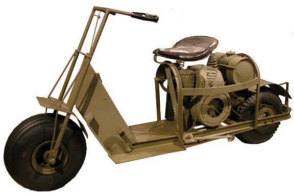
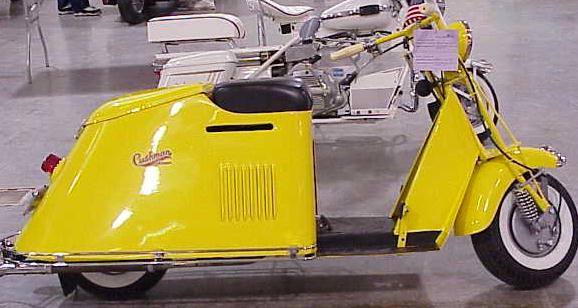
Some early Cushman motor scooters.
Left click on any image below for a larger version.
|
|
|
|
Some representative early Cushman Motor Scooters. Like most two wheel vehicles of the time, the scooters were quite basic, and never really outgrew a kind of transportation mostly suitable for local transportation on lightly traveled roads. Somewhat suited for the US suburbs of the 1930s and 1940s, they were quite dangerous on more heavily traveled roads. For many years a person could get a special license at age 14 for a two wheel vehicle with less than five horsepower. This added greatly to their popularity for many years, because they provided a measure of transportation until a person would get a driver's license for a car at age 16.
Left click on the image below for a larger version.
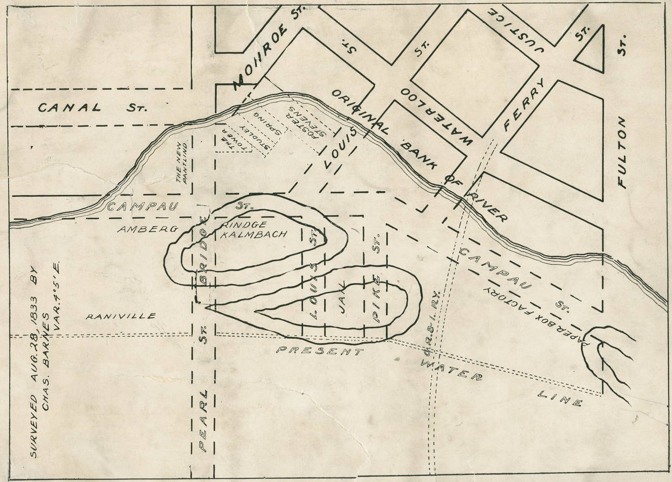
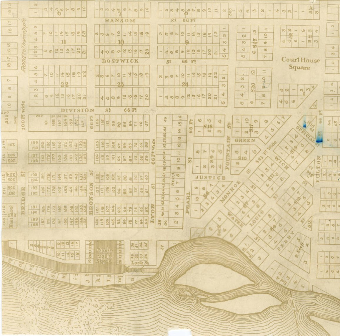
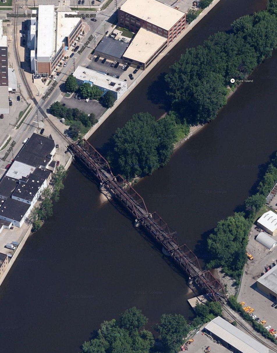
The graphic above shows part of an 1833 survey of Grand Rapids, and then the "present water line." It's not known here when the overlay was made, but a guess would be somewhat after 1875. The GR & I RR came to GR in 1875. Photos show the islands in the Grand River at about this time. Waterloo Street became Market, and Canal Street became part of Monroe. Ferry, Justice, and Campau Street also took on new names. For orientation, one sees some business names off Monroe that were familiar in the 1875 time frame.
So it's clear just how dynamic the town still was in and around 1875, when the very geography of the land was still being significantly changed. Changing land contours, and filling in water bodies, occurred all across the country, where San Francisco Bay was on the way towards being totally filled in by the time someone noticed. It's well to keep in mind that MI, and Grand Rapids in particular, were never much more than real estate dealers for financial interests in the East. Even a folksy presence like John Ball was actually a lawyer and businessman, educated at Dartmouth College, and represented Eastern business interests in the area. Like most other familiar GR names, he had his hand in various land and resource deals, and became quite prosperous by the standards of the time. He had broad interests, in education, lyceums, and geology. As settlers go, he was probably a positive force in the development of Grand Rapids.
Left click on the image below for a larger version.
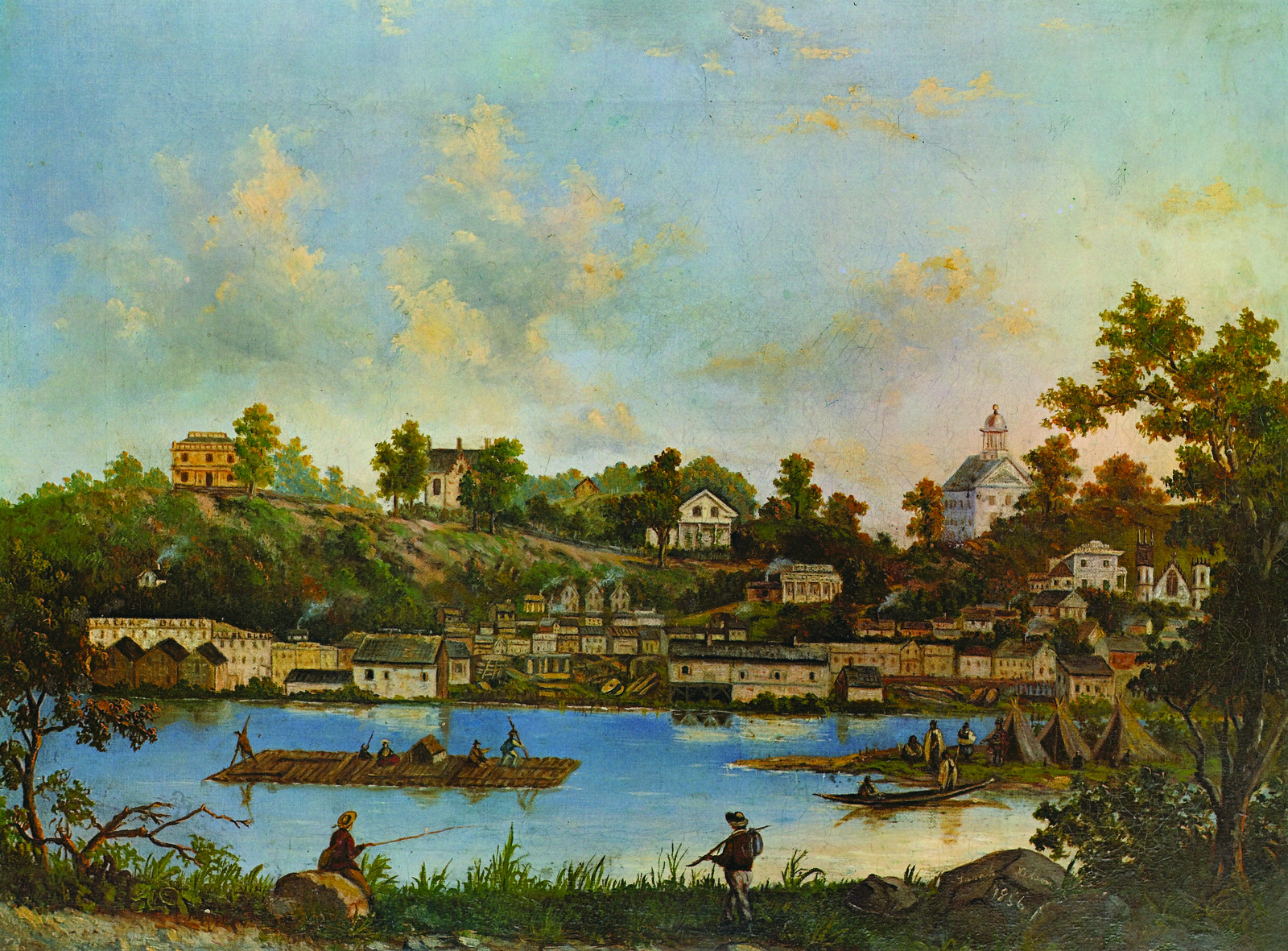
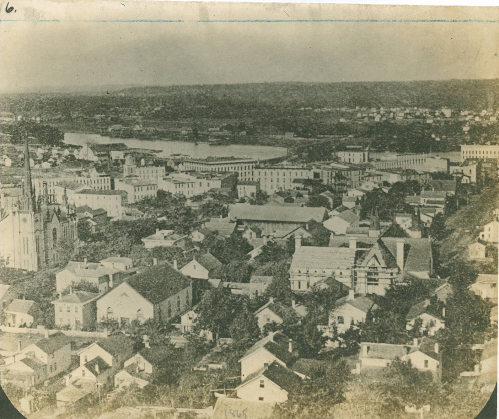
The painting above was done in 1856, by Sarah Nelson. Her name, and the date, are shown on the rock at the bottom, right. Grand Rapids was already officially a city since 1850. The part of Grand Rapids pictured here covered form what would later be Pearl Street, starting at St. Mark's Church on the right, to Michigan Street, which would later be to the right of Eliahu Smith's octagon house, shown at the left, on what would later be called Belknap Hill. The large building at the right, top, was a school, built in 1848. Whether the image represents the entire painting is not known at this point.
Left click on the images below for larger versions.
1868 bird's eye map - very large file. |
1874 bird's eye map - very large file. |
1893 bird's eye map - very large file. |
The maps above are birds eye views of Grand Rapids in 1868 and 1893. In 1868 there are canals on both sides of the river. Each had two functions. To get barges around the rapids, and to provide a water drop large enough to run the water wheels that powered the mills and other industries along the river. In time, steam engines would take over most of this function, as would the coming railroads replace the barges. The canal on the west side still existed in the 1950s, but had filled up with the endless trash people tossed into it.
In the 1868 map one can see a horse drawn trolley on the east side of the river, running parallel to Canal Street. An early attempt at public transportation, the trolleys were too heavy for the horses for the most part, and many died as a result. A later cable car system was impractical. In about the late 1880s electric trolleys began to appear, using technology invented by Frank J. Sprague, who invested ways to attach electric motors to trolley trucks in a practical, low maintenance way. Trolleys then served Grand Rapids well until 1935. In that year General Motors, by then a force in Michigan, got the city to replace its trolleys with buses, the first city to do so. Whether, and to what extent, incentives were provided to city officials to make this happen is not known, but it certainly happened across the country as GM went after one trolley system after another, in some cases buying them up simply so they could rip them out, making sure they didn't reenter service.
The covered bridge shown in the 1868 map is one of almost endless pedestrian, wagon, and railroad bridges to cross the river. Each might have been replaced two or three times.
At the top, right, of the 1868 image one sees a rutted hill. The hill, and the area above it, would later become the site of a water reservoir, a residential area, and a park. If the portrayal of the hill in the 1868 bird's eye map is essentially correct, a lot of grading must have been required, with the result being a high, and very steep hill. Shown at the right, to the right of Hastings Street, is the octagon house of Elihu Smith, built in 1853.
Left click on the image below for a larger version.
Elihu Smith octagon house, built in 1853, razed in 1961.
The area to the left of it, and east, would develop into a residential area, one of the oldest in the city. In 1961 construction of I-96 took down part of the south end of the hill, and with it the octagon house as well as other houses near it which were in the way of an on ramp.
By 1893, 25 years later, GR had grown a great deal. The vast grading programs were mostly complete, and the islands in the river were now a memory. Flood walls along the river, placed in an attempt to control the flooding now resulting from deforesting the state, rendered the river mostly an industrial trench.
The 1893 map is incredibly detailed, and was perhaps commissioned by the city.
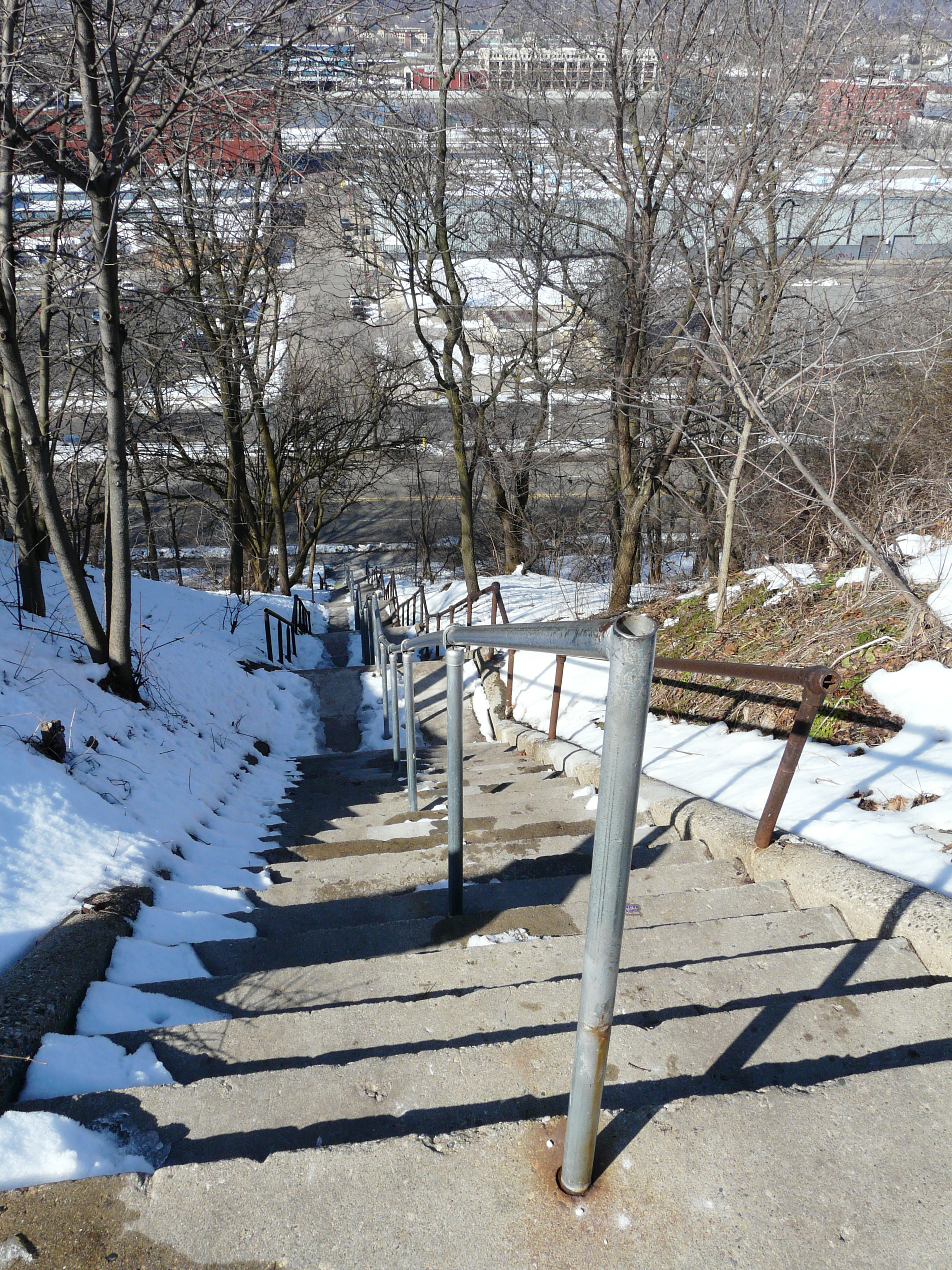
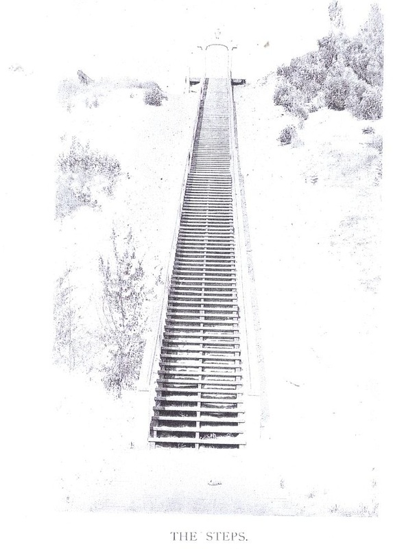
As the top of the hill developed into a residential area, called Belknap Hill, a way was needed to get to the base of the hill, where a lot of industry was located. Two concrete stairs were constructed in about 1923. These replaced a wooden one.
Left click on the images below for larger versions.
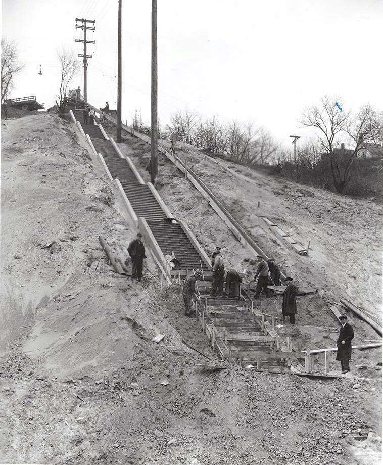
c1923 |
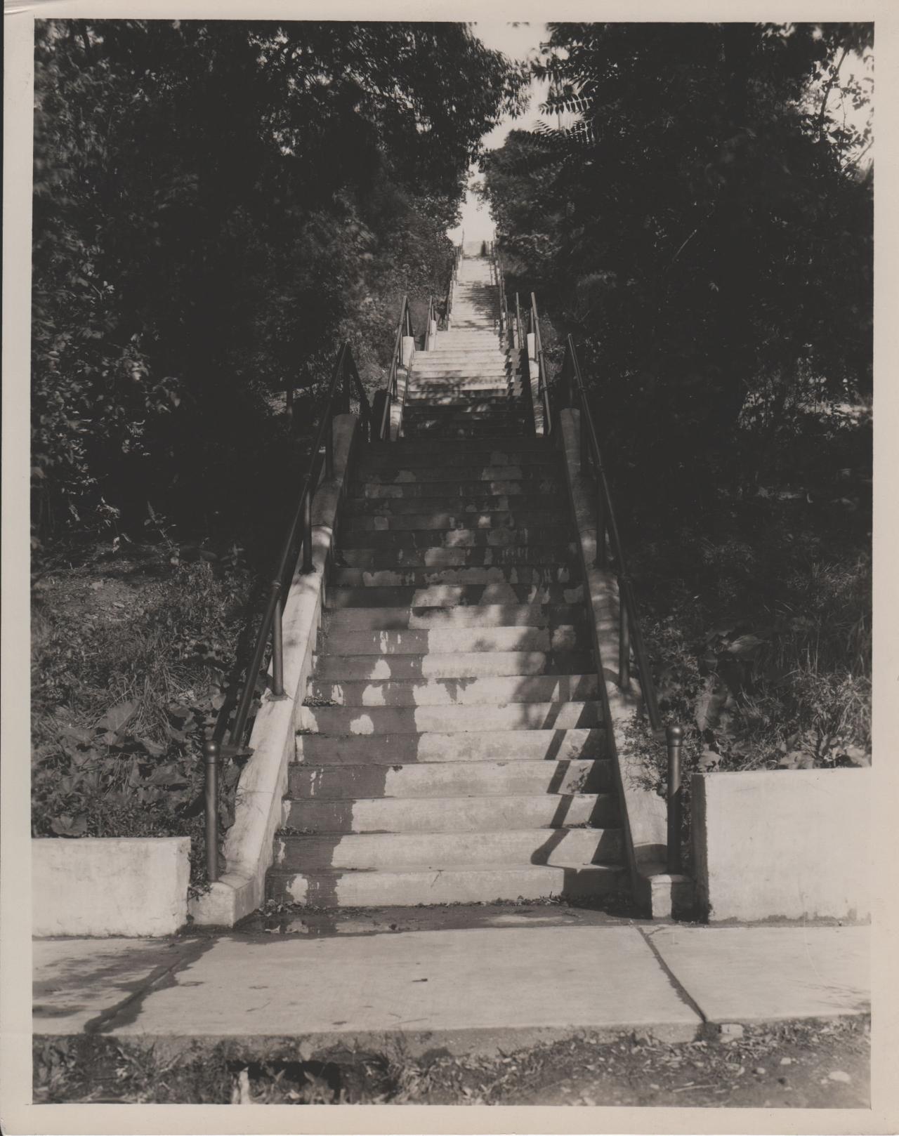
1928 |
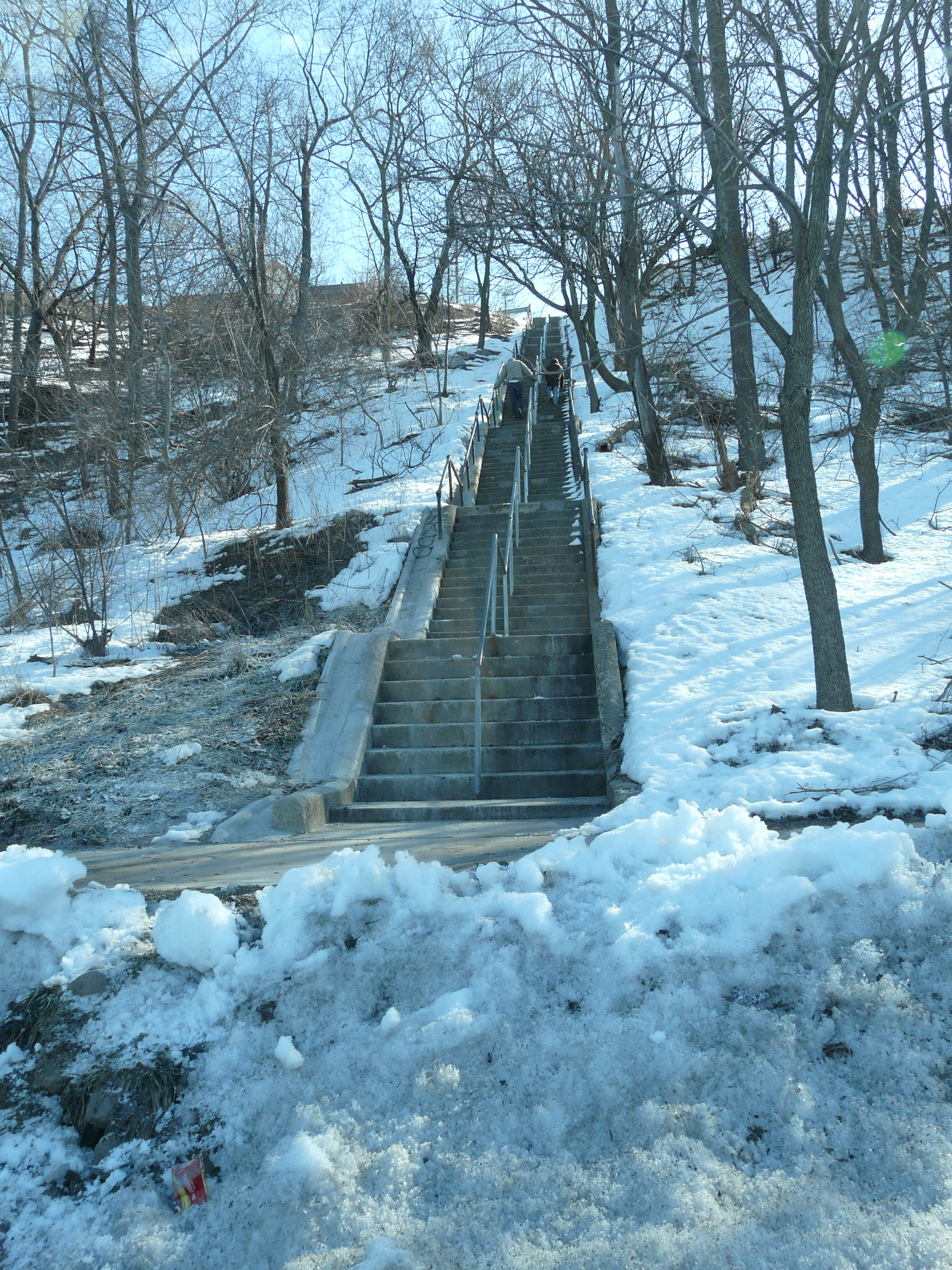
March 8, 2013 |
|
|
South stair location. |
South stair location. |
|
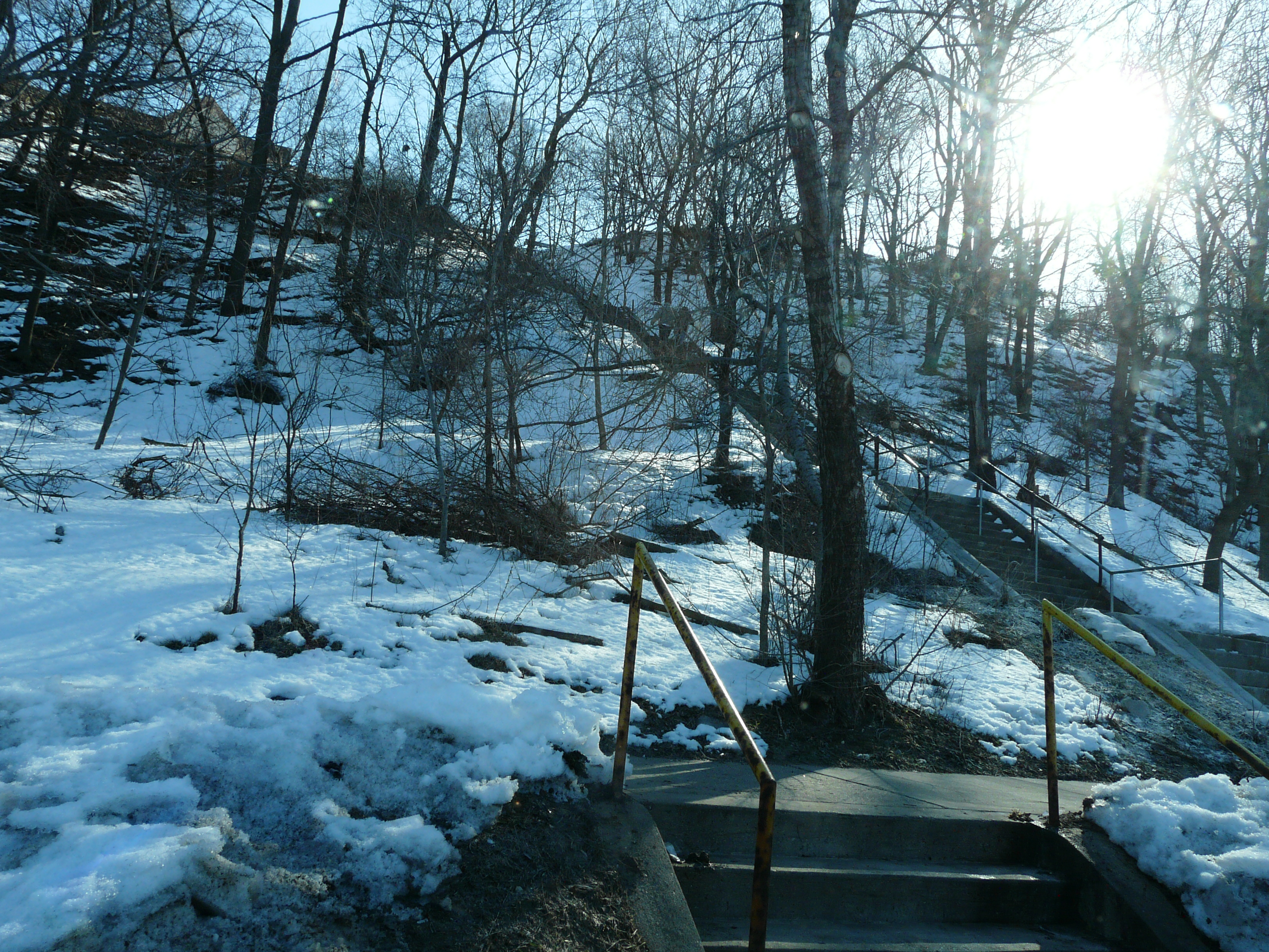
Left click on the image below for a larger version.
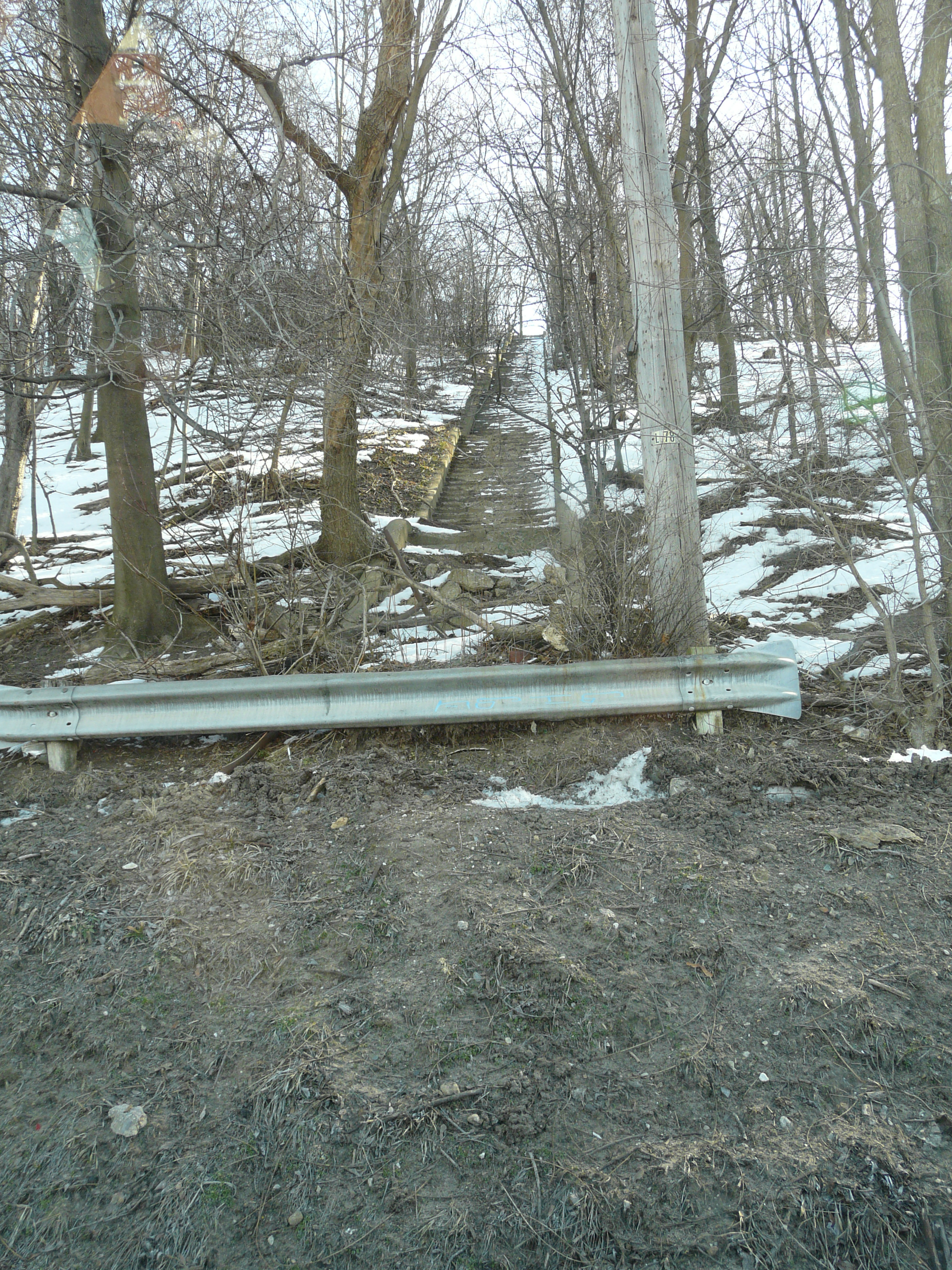
Another set of stairs further north has not been maintained. The location at the top of these stairs is not particularly residential, and it's likely anyone going to the ball fields drives to the top. In year 2013 it's probably surprising that either was saved, since the number of people that walk is much smaller, and the stairs do not particularly lead to anything useful. But for the hardy, it still can be done, as one of the photos of the southern set of stairs shows.
Left click on the images below for larger versions.
|
|
Left click on the images below for larger versions.

|
|

|
Left click on the images below for larger versions.
|
Left click on the images below for larger versions.
|
|
|
Undated. |
Belknap home, 455 Madison. Built in 1878. |
Left click on the image below for a larger version.
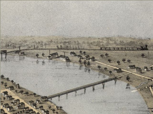
Portion of 1868 bird's eye map.
Part of an 1868 birds eye map showing the area around Leonard and Ottawa. The train in the background was part of the road going from Detroit to Muskegon, reaching Grand Rapids in 1858. It's impossible to over state the importance of the coming of the railroads at that time. The city was was instantly connected to the wider world in a very practical way. A trip to Detroit took no more time that it does in year 2012, and the flow of resources and goods were a major boost to productivity, replacing slower boats, which could have great troubles navigating Lake Michigan in the winter.
Left click on the images below for larger versions.
1860 - looking NW |
1910 - looking NW |
Circa 1910 - looking SE |
Circa 1912 |
Left click on the images below for larger versions.
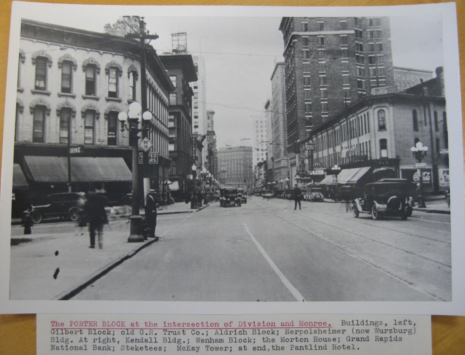
Porter block - c1920. Looking north on Division Ave. |
Porter block - c1930. |
Porter block - 1947. |
Porter block - May 27, 1947. Also shows Fulton & Division. |
Monroe - August 1, 1951 |
|
Leroy Rockwell. Photo dated June 4, 1959 |
|
Left click on the image below for a larger version.
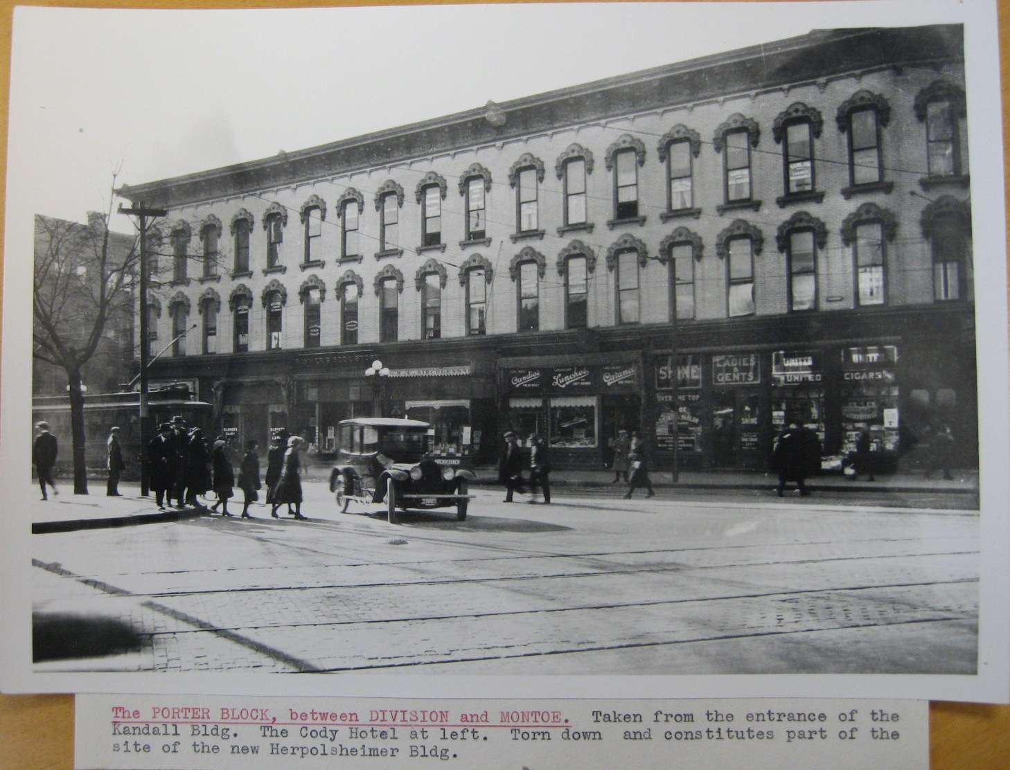
Another view of the Porter block, showing many shops at street level, and offices on the second and third floors. The Cody Hotel can be seen to the left, on the south side of Fulton Street.
Left click on the images below for larger versions.
|
|
|
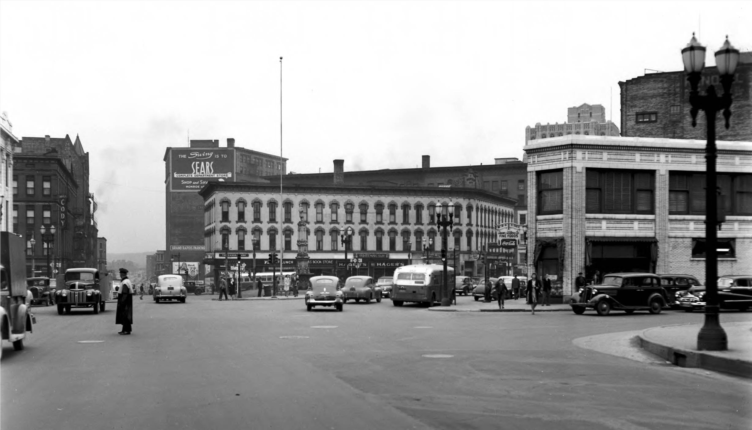
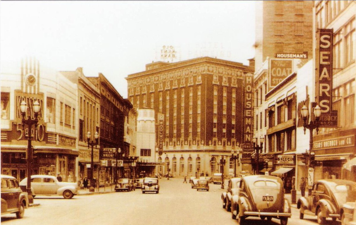
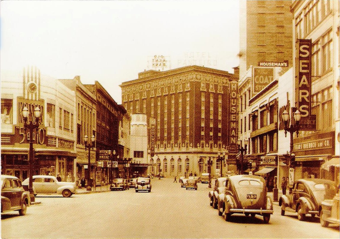
The images above were provided by Lee Smith, class of 1953, and LeRoy Rockwell, class of 1959. All are the same view, but scanned in different ways to bring out detail. Sadly, the original photo has not been made available as yet.
Both images above are different versions of the same scene, and show Grand Rapids in perhaps 1945 or before - the newest car in the image would help narrow it down. The scene shown would have been familiar to any Godwin student in 1960 yet. But not long thereafter.
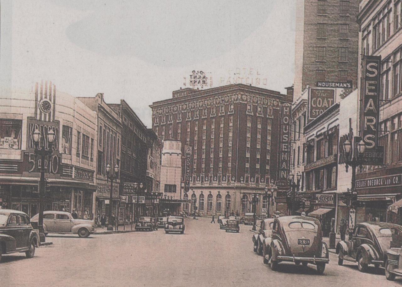
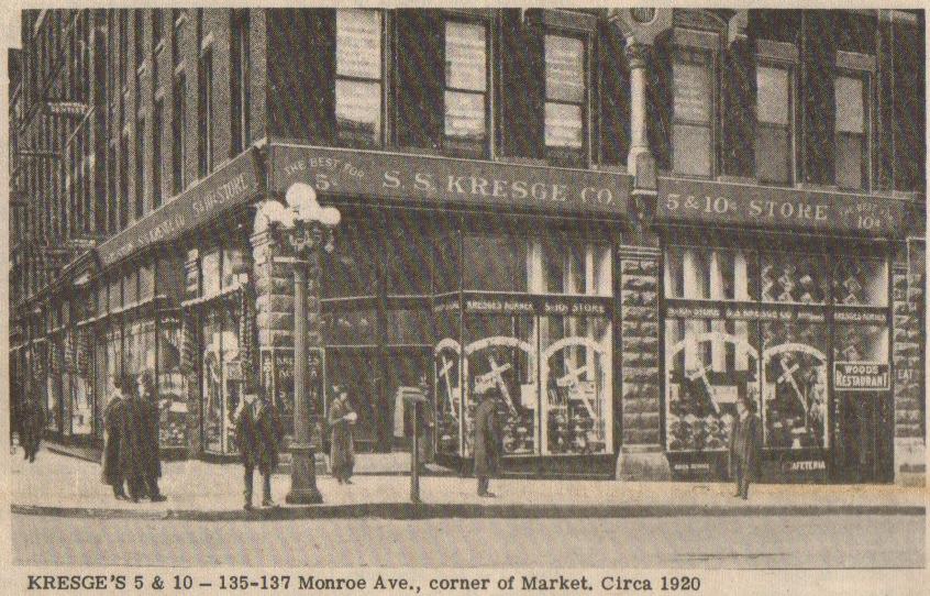
Leon Smith, class of 1953, relates that Kresge's was located on the corner
of Market ( in 2006 this seems to be Monroe ) and Monroe ( in 2006 Monroe
Center ). Across Market Street from Kresge's was the Mutual Home Bank.
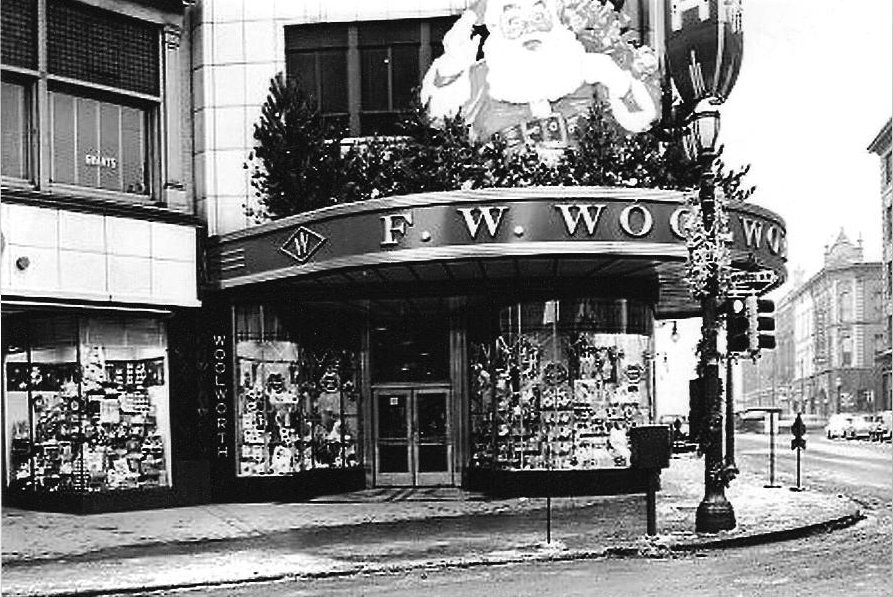
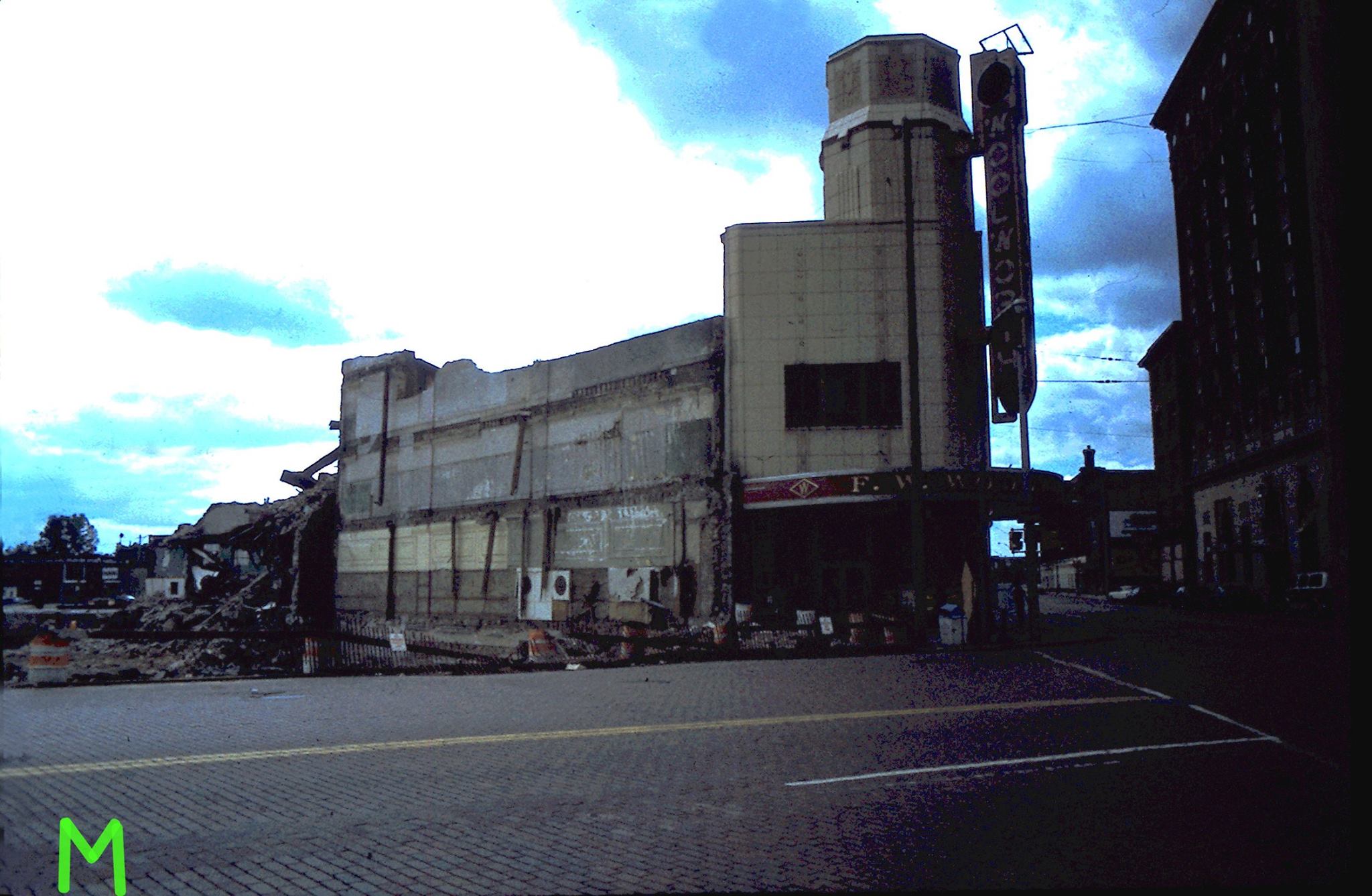
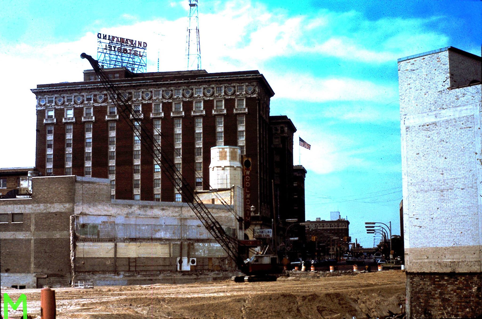
The Woolworth's store was located on Monroe and Pearl.
Left click on the images below for larger versions.

Postcard - c1905 |
July 16_1952 |
August 7, 1952 - H. L. Green |
c1950 |
Left click on the images below for larger versions.
|
|
|
The postcard image, above, right, was provided by LeRoy Rockwell, class of 1959.
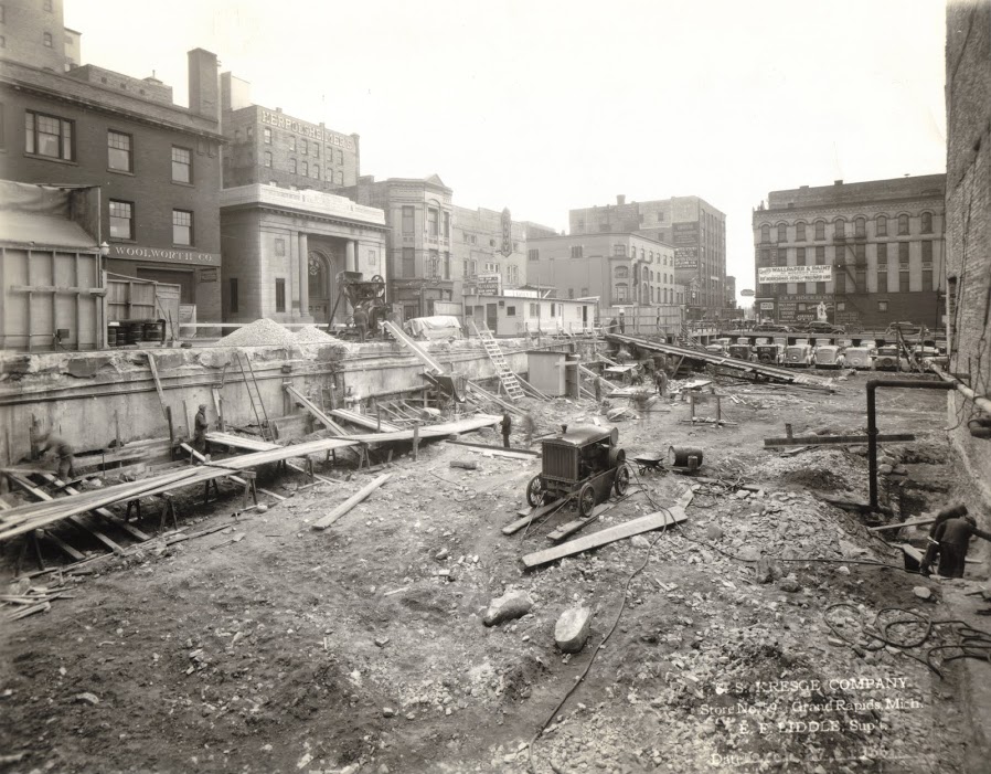
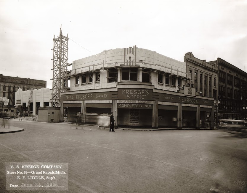
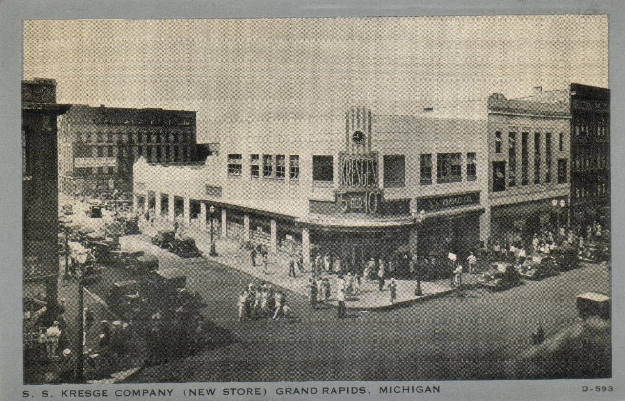
The photographs at the left, above, shows Kresge's being built, in 1936, replacing an older building. The image above, right, made from a postcard, shows Kresge's, and some of the surrounding area, in about 1940. The image is from some time in the interval from late spring to early fall; since the postcard was never sent, there is no postmark on it, and there is rarely a date when a postcard was printed, or the image on it was taken.
The image below, from 1920, shows Kresge's on the same corner before it was replaced by a new building, in 1936. It was in the Widdcomb building.
Left click on the image below for a much larger version.
The image was provided for scanning by Lillian Annis, class of 1941.
Left click on the images below for larger versions.
|
|
Left click on the image below for a larger version.
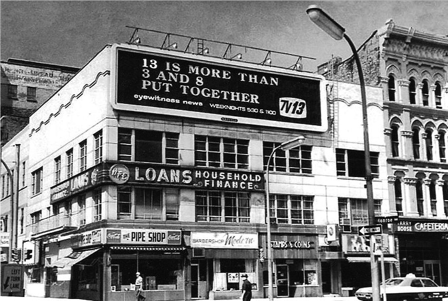
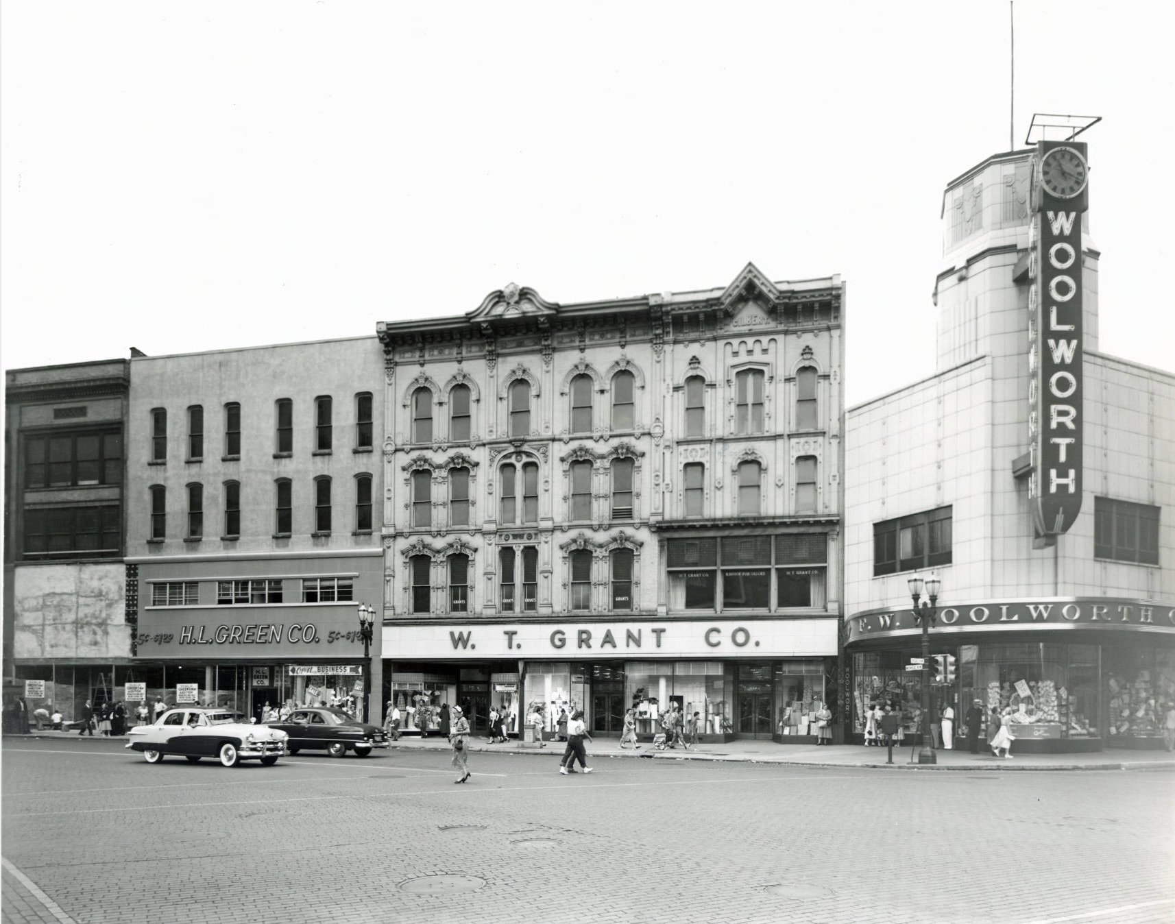
Across Division Avenue from F. W. Woolworth's was the scene above. The store called "Stamps and Coins" was previously called "The Bookery," and was located in the basement of the McKay building. In the early and mid 1950s one could go through a box of canceled stamps, and buy those selected.
Left click on the image below for a larger version.
Photograph provided for scanning by LeRoy Rockwell, class of 1959.
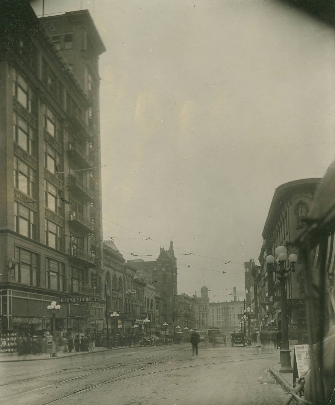
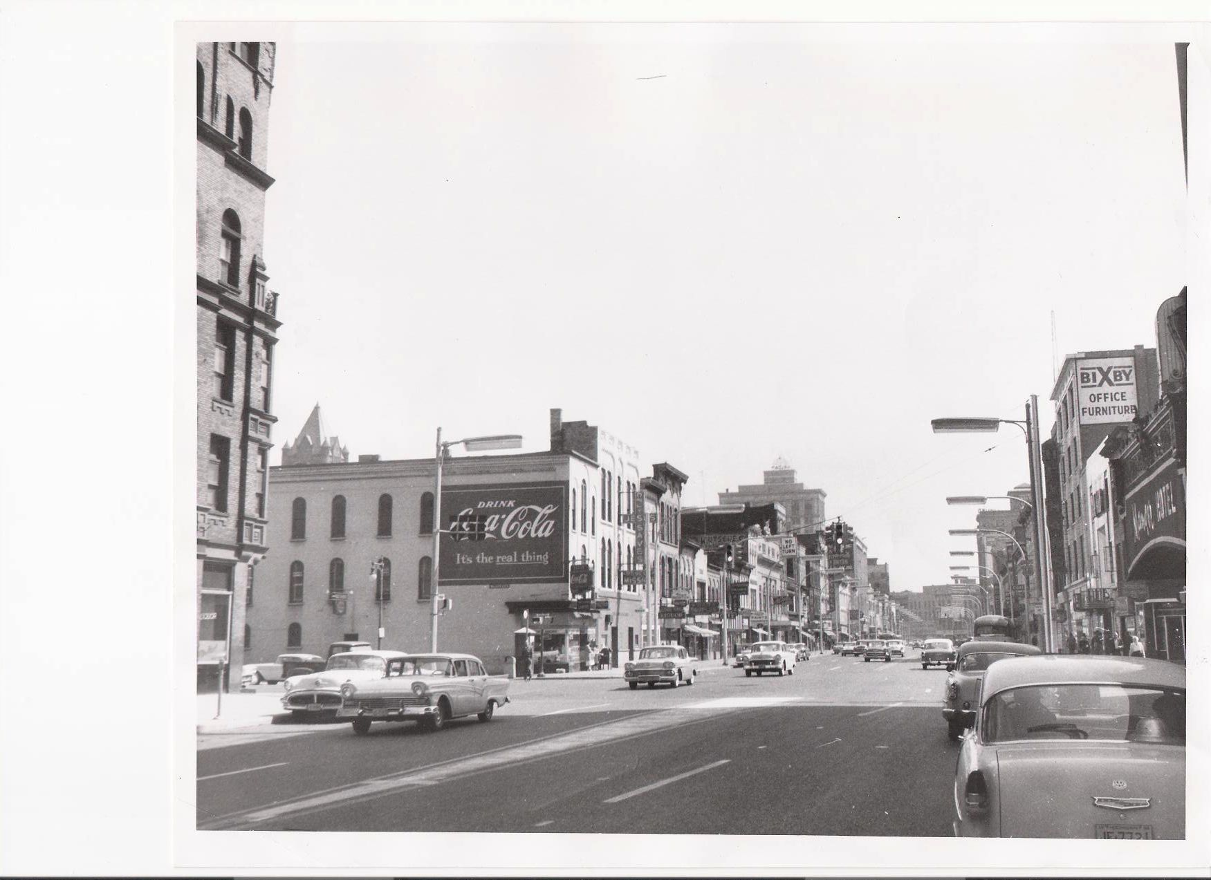
The photograph above is dated May 24, 1958. It is lower Monroe, looking north from the Michigan Street Corner.
Two things that impress someone in year 2007, many of whom probably never saw the kind of Grand Rapids that existed before the wrecking ball arrived in about 1960, compliments of a federal government program called "Urban Renewal" ( urban destruction really ) destroyed Grand Rapids, are the fact that almost everyone is dressed up, and the kind of crowds that drawn to Grand Rapids. Many people loved to take the bus in to Grand Rapids for a day of walking around, shopping, and having a meal. It is unlikely that Grand Rapids will ever have this kind of atmosphere again, for it was also a time when it was completely safe to be in town. Kids 7 and 8, including most Godwin students, took the bus to town, and their parents never had cause to worry.
Lee (Tanner) Collins, class of 1941, worked in downtown Grand Rapids for several years, as did many people in the 1940s and 1950s, and related the following:
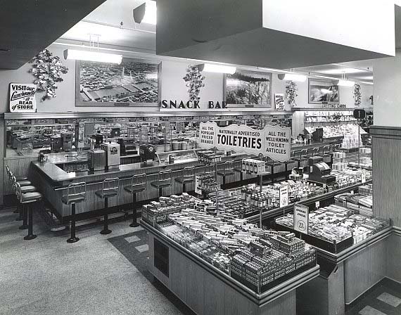
"My! What memories this one brings back! I worked for Lear Inc.from 1943 'til 1958, and started out on Buchanan Ave, then when they moved downtown, I went along there too. I spent many happy lunch hours shopping that Kresge's Dime store that you see on the left of the picture. Just inside of the door, to your right they had a small 'hot dog stand' type place, that served the best hot dogs I ever had.(The kind with cabbage, or sauerkraut) And in the back of the store they had a 'horse - shoe' shaped lunch room that served great dinners for 'cheap' too..!"
And, down in the middle of the picture was one of the other Dime Stores, Woolworth's, that we all spent many hours in too. If memory serves me correctly, in between them on the left, there was also another "Dime Store', but my memory doesn't remember the name of that one right now....
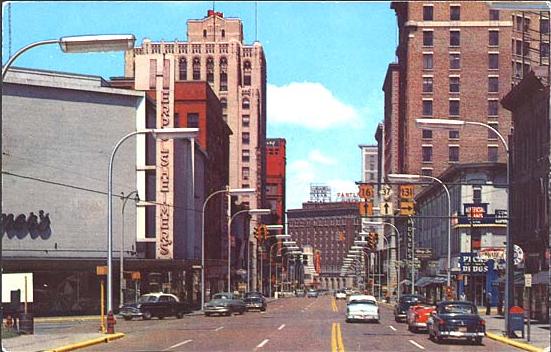
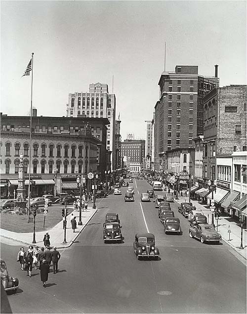
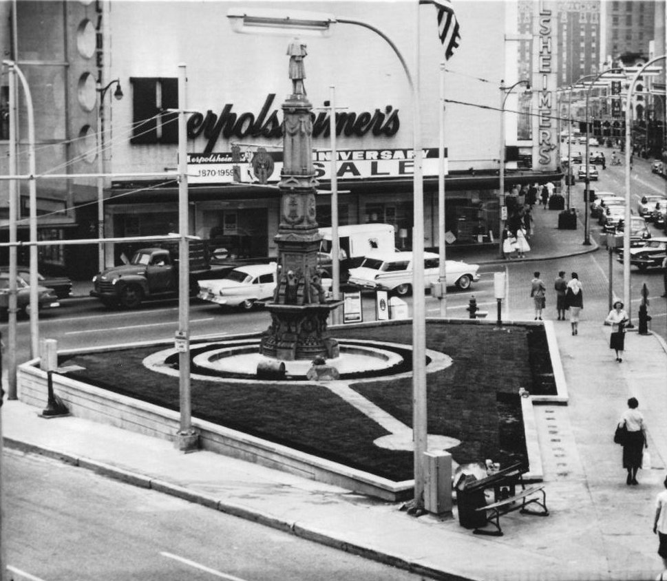
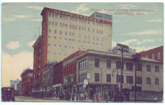
A view of Monroe Avenue, looking northwest, in about 1953. Notice that Herpolsheimer's now sits at the intersection of Division Avenue and Monroe Avenue, and is bounded on the south side by Fulton Street.
The intersection of Monroe Avenue and Market Street in about 1960. The "5 and 10" store, and a Kresge's and a Woolworth's, were all popular destinations. Each had a lunch counter, and decent food. And were mostly crowded, especially around noon.
Left click on the image below for a larger version.
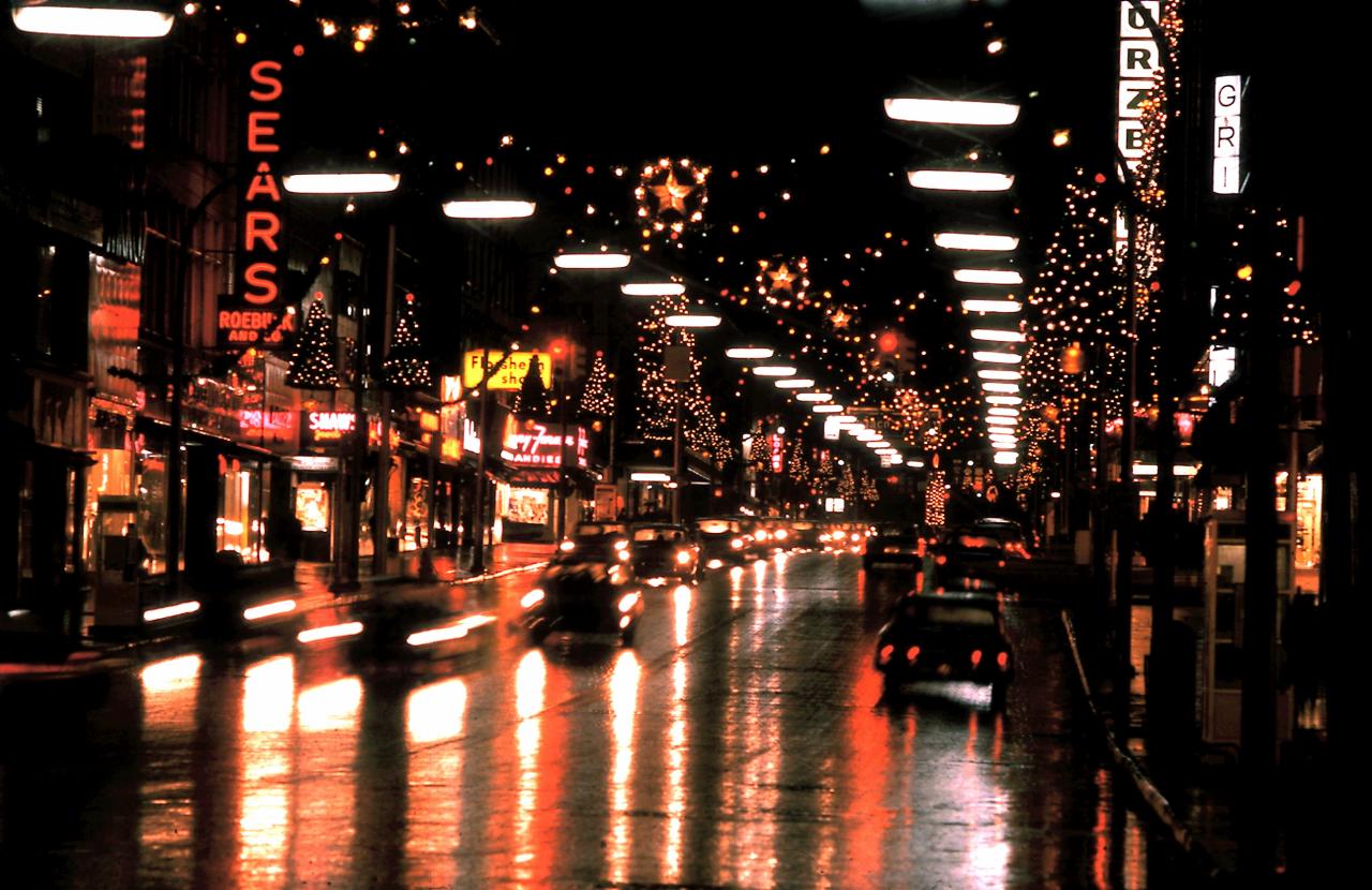
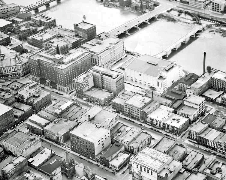
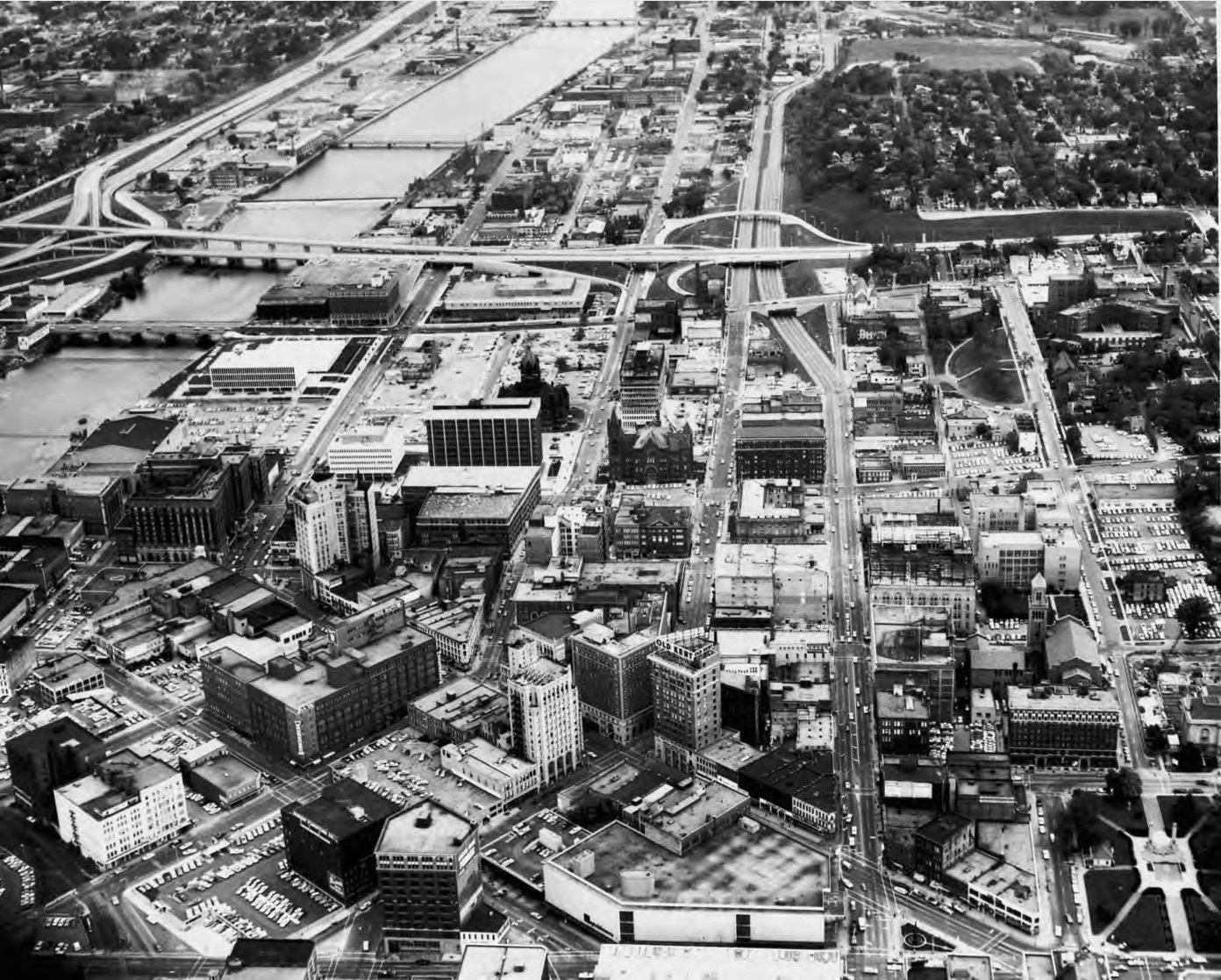
The photograph above shows a section of downtown Grand Rapids in December, 1965.
Left click on the images below for larger versions.
1870 |
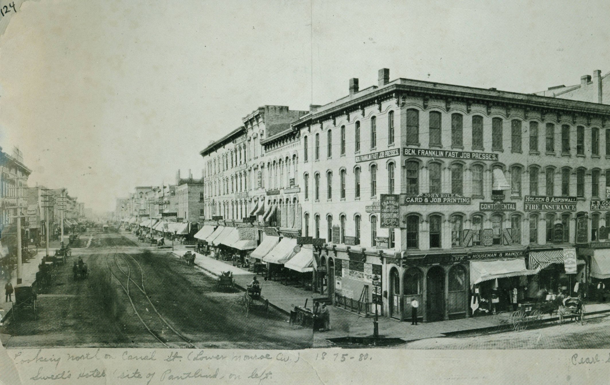
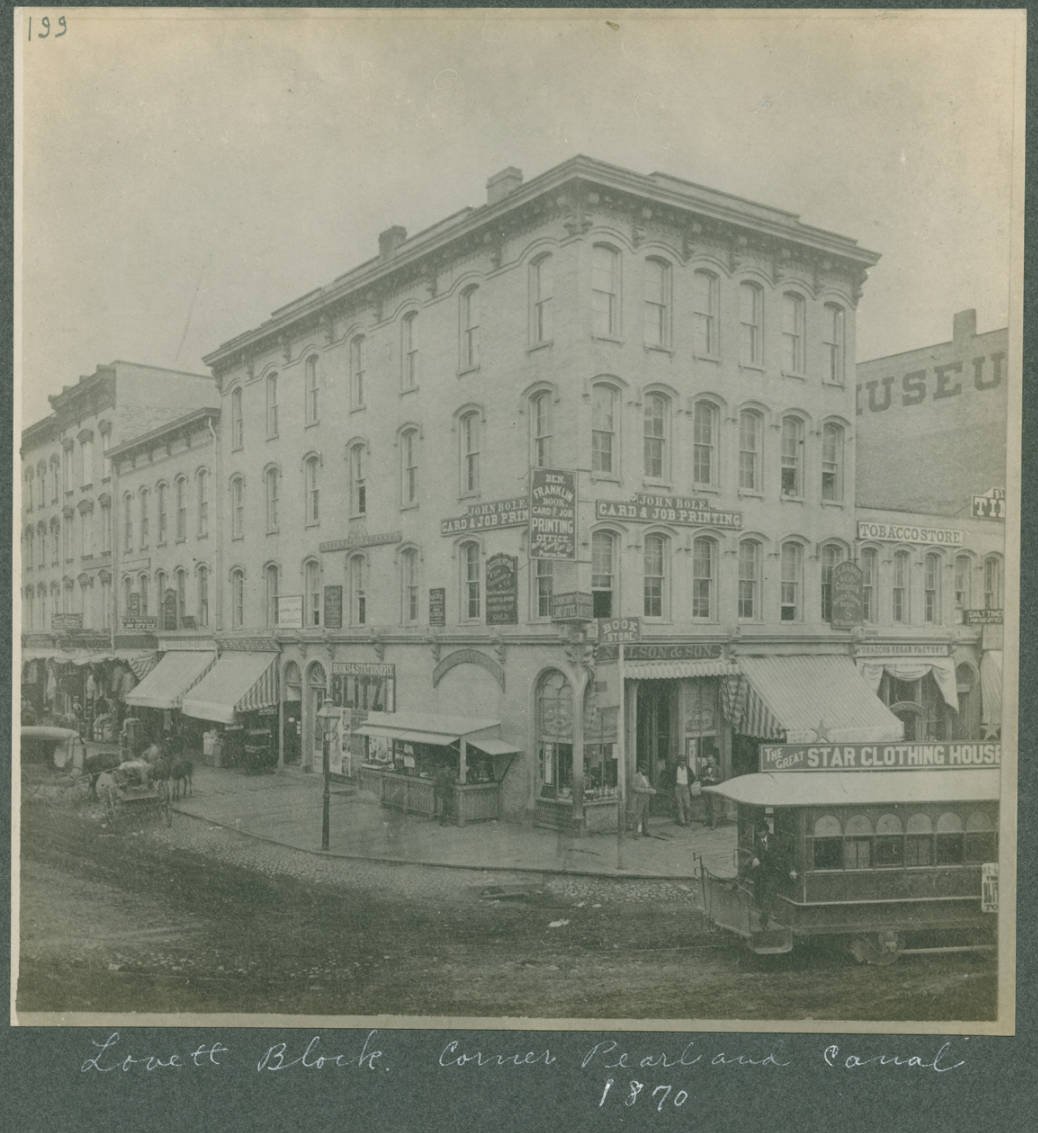
c1875 - 1880 Known as Canal Street then. |
1870 |
c1908 |
c1928 |
c1930 |
c1954 |
2013 |
2011 |
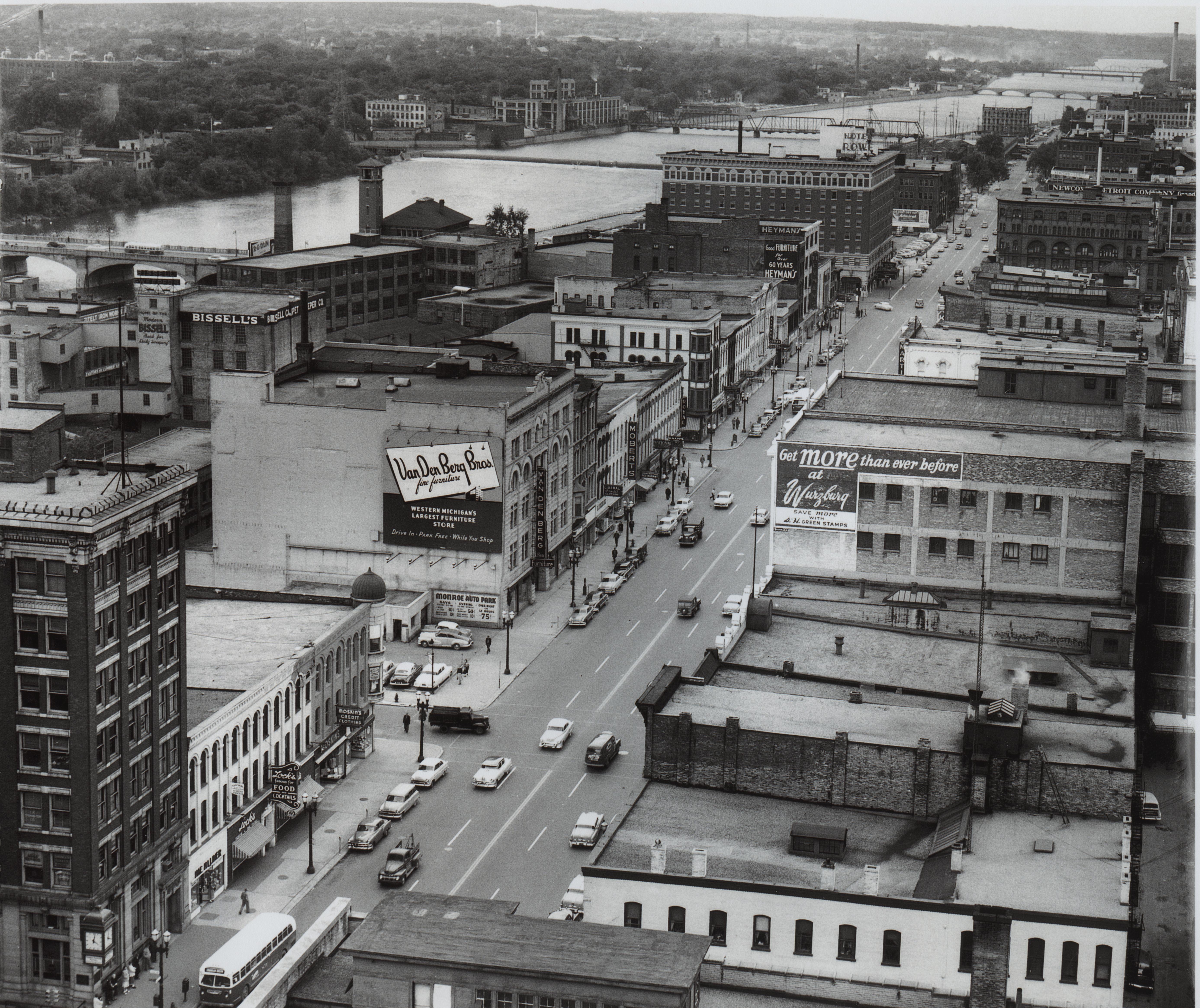
The huge photograph above is of lower Monroe c1954 - presumably summer.
Most of what is seen disappeared after the Urban Renewal wrecking ball started
to swing in the early 1960s. The Rowe hotel building still exists, although it is derelict.
The 2013 view of upper and lower Monroe show that little of what existed in 1950 exists today.
"Dime store row" is now gone. Campau Square is gone, replaced by a park named after someone who had
no obvious connection with Grand Rapids. The downtown is today mostly a commercial center, and the only
reasons people who don't work in town would go there is for the sports events and shows of various
kinds, and the bars and restaurants. The family atmosphere of the 1950s is gone.
Left click on the images below for larger versions.
1935 |
Circa 1940 |
1950 |
1957 |
1966 |
1975 |
Left click on the image below for a larger version.
The Grand Rapids Visitor - June 29, 1946
The Grand Rapids Visitor was a bi-weekly publication pointing out things of interest in the city for those visiting on business or pleasure. It apparently started publication in about 1938. How long it continued is unknown.
Pages 11-14 are missing in the example above.
Left click on the images below for larger versions.

William G. Herpolsheimer February 24, 1920 |

Henry C. Herpolsheimer - brother. Of Lincoln, NE. |

Henry B. Herpolsheimer Nov 8, 1868 - June 5, 1920 |
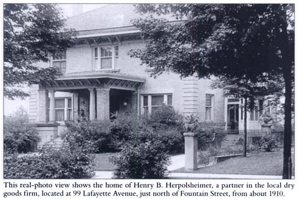
Henry B. Herpolsheimer house. 99 Lafayette Avenue - c 1910 |
|
Left click on the images below for larger versions.
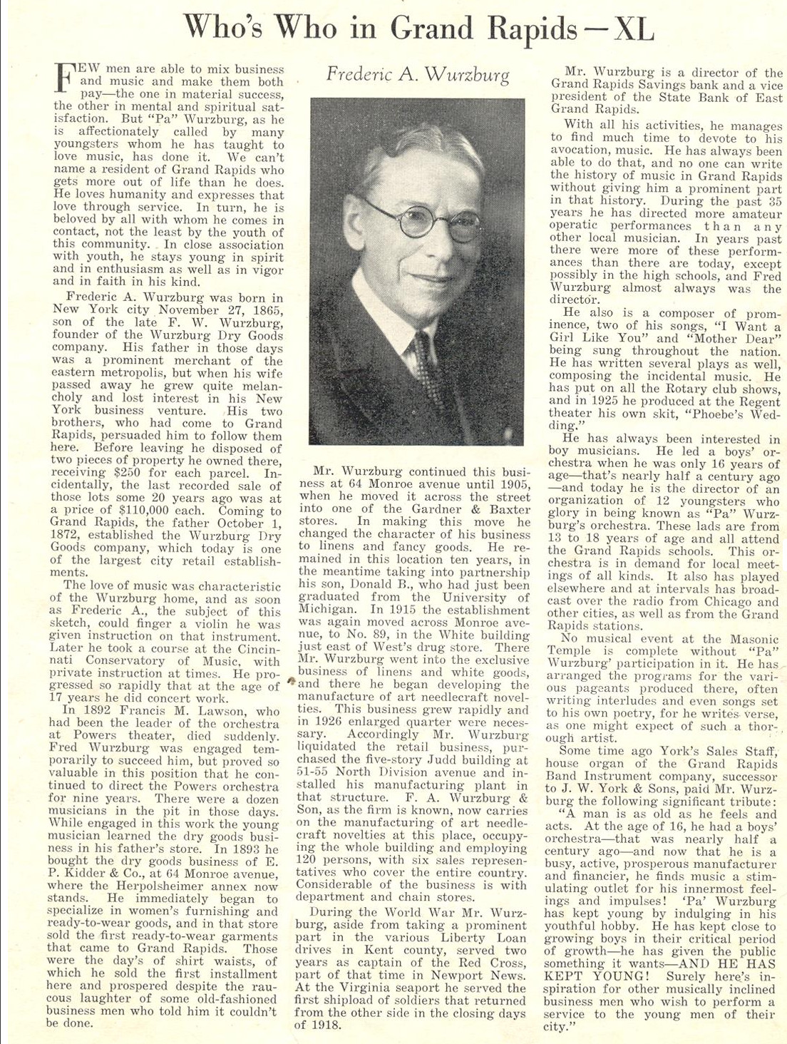
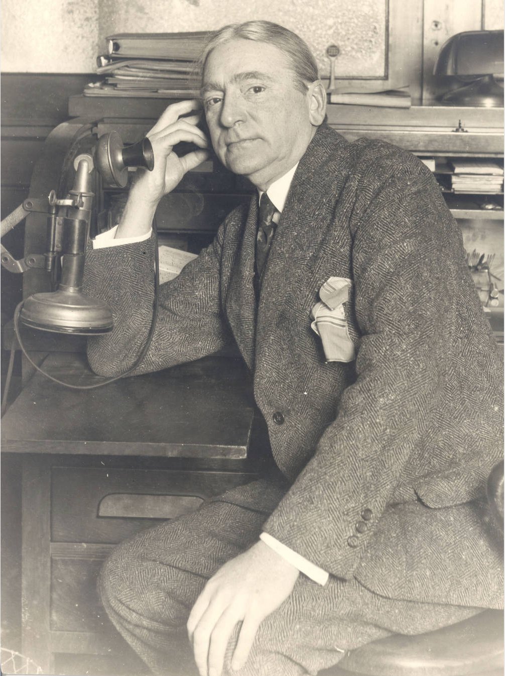
1929 - Frederic A. Wurzburg Born Nov 27, 1865 - NY City Son of founder of Wurzburg's |
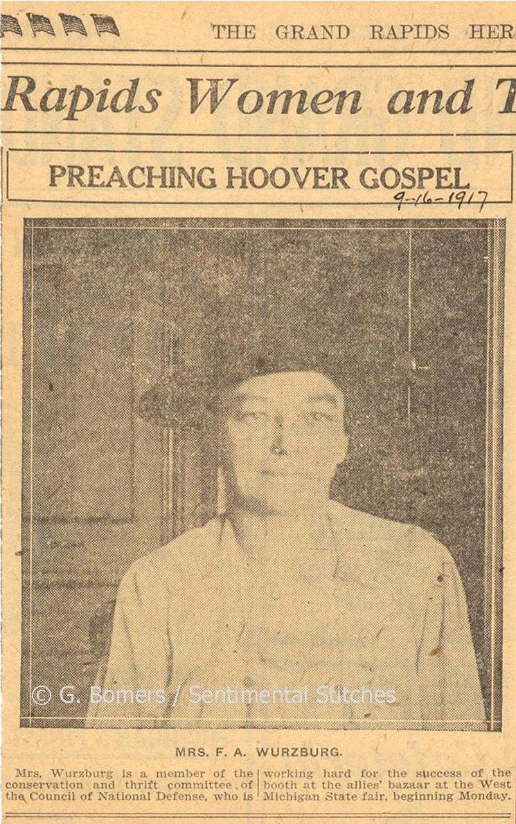
Mrs F. A. Wurzburg Former Jane Belknap September 16, 1917 |
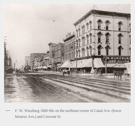
Wurzburg location 1880 - 1890 |
1928 - Edmund Wurzburg |
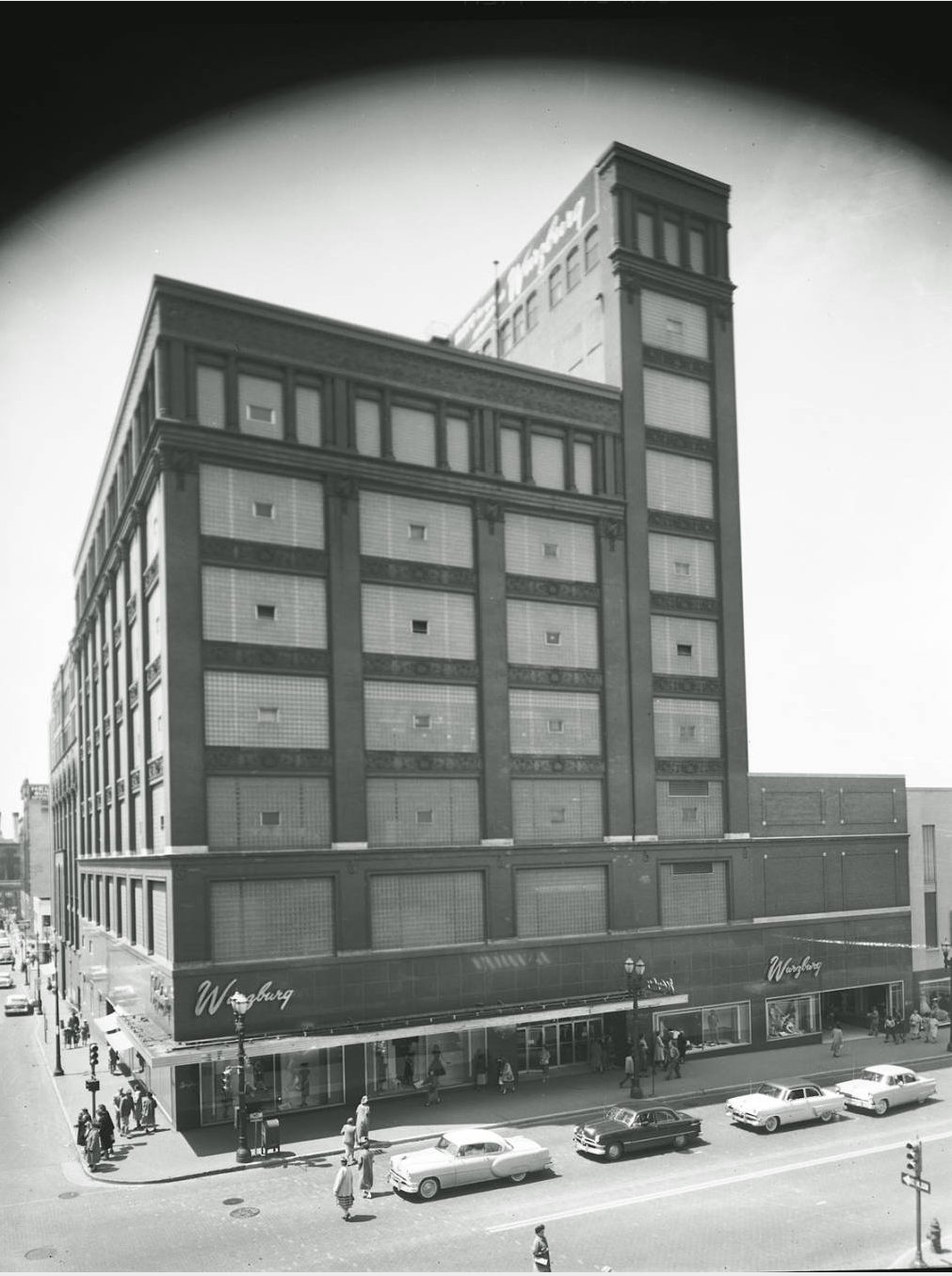
May 18, 1956 |
Donald Belknap Wurzburg |
Theresa Wurzburg - 1888 Central High graduation photo? |
Left click on the image below for a larger version.
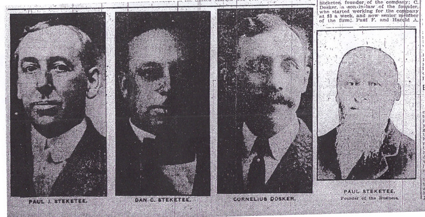
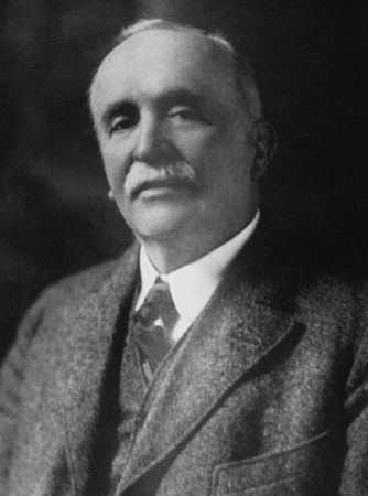
Paul G. Steketee - Founder |
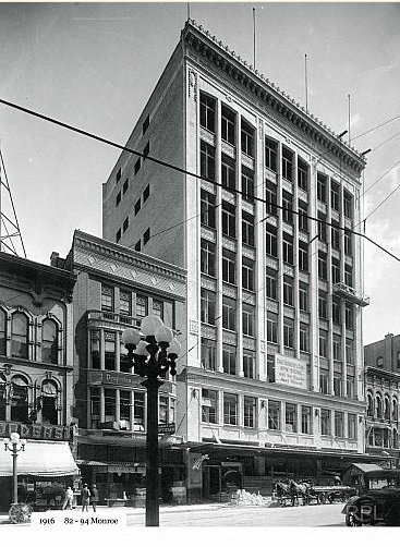
New store - 1916 |
|
|
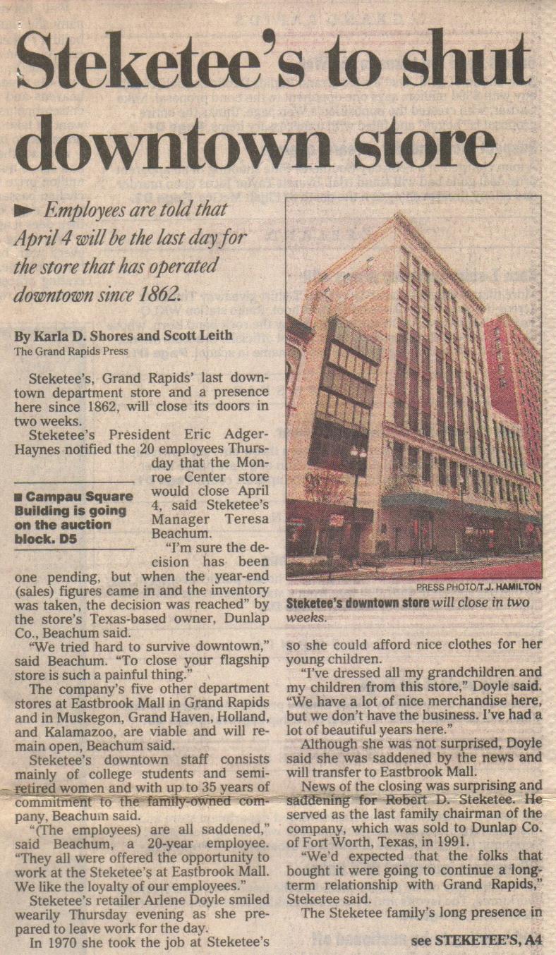
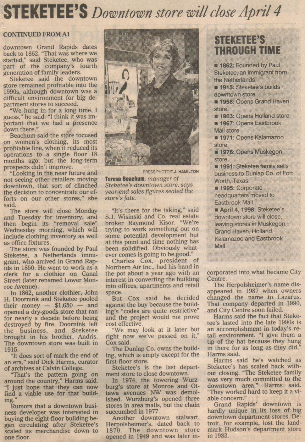
Steketee's was one of perhaps ten or so buildings in downtown Grand Rapids that that every Godwin student from about 1960 and before knew of, shopped in, and in some cases, worked in. Others include Wurzburg's, Herpolsheimer's, the Grand Rapids Library, Woolworth's, Kresge's, the Grand Rapids Pubic Museum, and the Civic auditorium. Few of these exist any longer in the downtown area, and even fewer are still in anything like their original form. The old public museum, built in about 1936, is apparently a warehouse in year 2006. Businesses like Steketee's, Wurzburg's, and Herpolsheimer's, represented families that came to Grand Rapids in the mid 1800s. Sadly, few survived very long following "Urban Renewal," a tragic federal program that led to the wrecking ball demolishing most of the city's historic areas. What the wrecking ball didn't get the interstate highway system did, again taking out wide swaths of the older city, and even changing the topography.
Steketee's was in business in Grand Rapids for about 136 years, but could not survive a change in ownership, and the demise of the traditional downtown area. Like Wurzburg's, the move to a suburban setting was not successful. Businesses like Steketee's date from a time when going in to Grand Rapids, often on the Division Avenue Bus Line for Godwin students, was a treat for most people. The format of the stores did not fit in to the more skittish atmosphere of a mall, something that Sears and Montgomery Wards also found out.
Left click on the images below for larger versions.
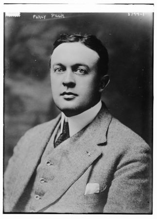
John Edward Peck |
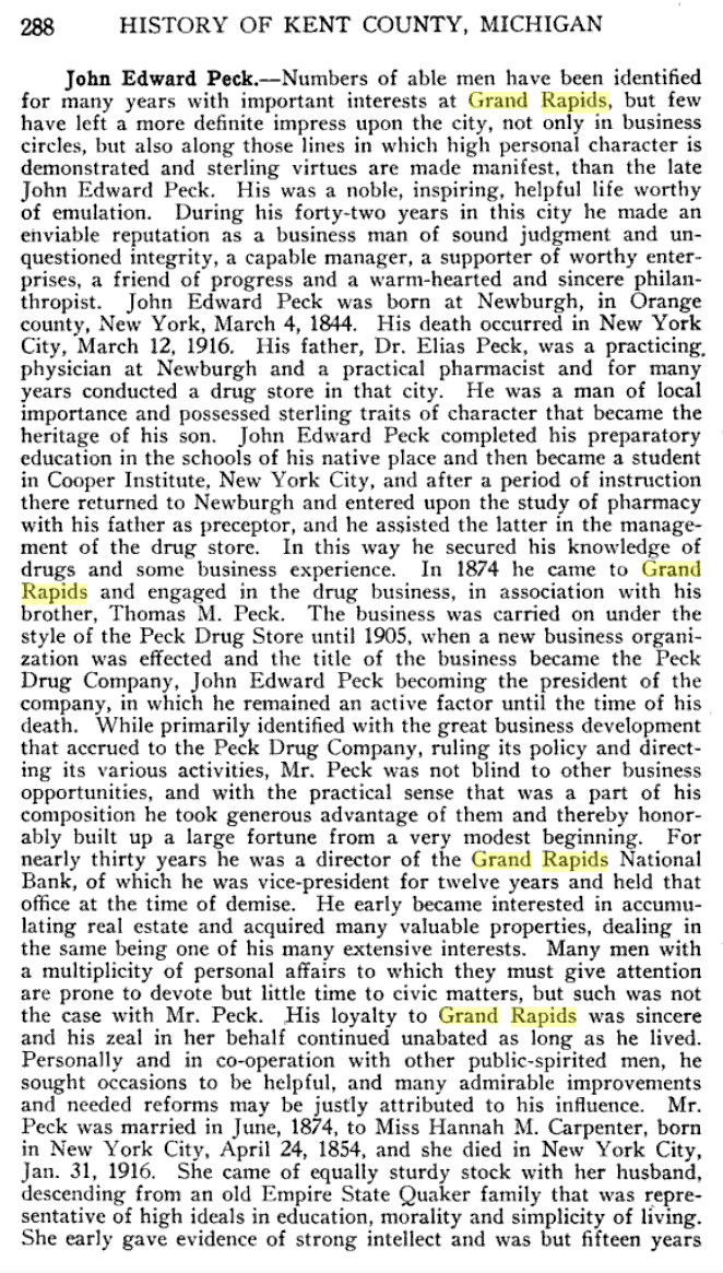
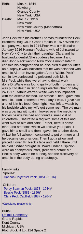
John Edward Peck - Bio 1 |
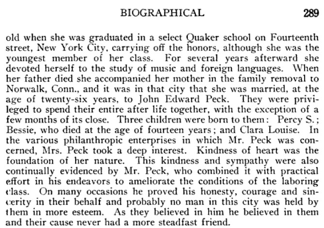
John Edward Peck - Bio 2 |
1965 |
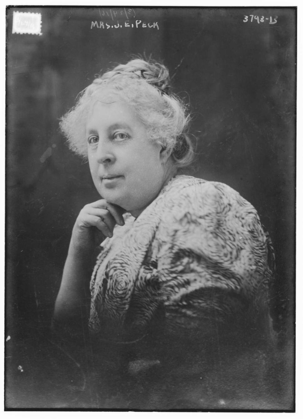
Hannah Peck |
Percy Peck |
John E. Peck obit |
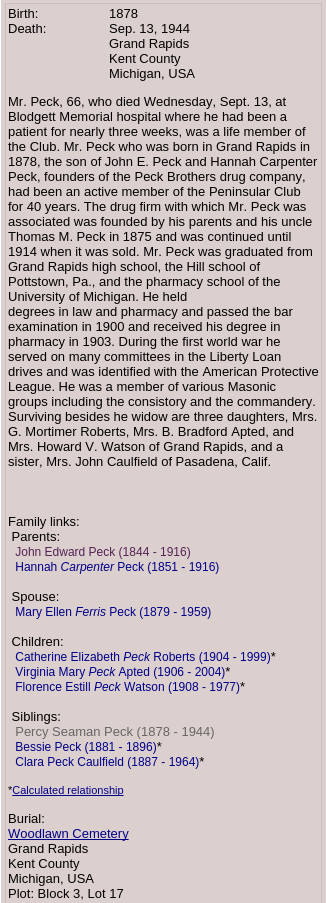
Percy Peck obit |
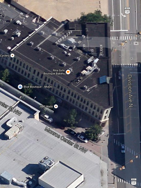
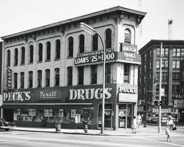
Peck drugstore building 2014 |
Manhattan building where the Peck's were murdered. |
Arthur Waite - murderer. |
Left click on the images below for larger versions.
|

|
Left click on the images below for larger versions.
|
|
|
Left click on the images below for larger versions.
|
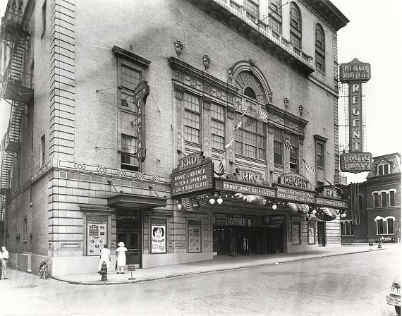

The RKO Regent theater in 1935. Part of the studio system in the 1930s yet, and much of the 1940s, the RKO theater chain was later bought by Howard Hughes after the federal government declared the joint ownership of both theaters and movie production facilities to be anti-competitive. In their day, the very size of the theaters provided a grandeur all their own. Together with ornate furnishings, the large downtown theaters provided a sense of a movie event that is hard to capture in year 2005 with a DVD player and a TV set in ones home.
Alas, television put a lot of strain on the movie industry starting in the
late 1940s. While the theaters did well in the 1950s yet in Grand Rapids,
urban renewal pretty much destroyed them after 1960. In other cases the
theaters found themselves in declining areas, and generally speaking, fewer
people went in to Grand Rapids to seek entertainment any longer. In year
2005 one has suburban theaters with six or more screens, but the surroundings
are often relatively spartan, and it simply is not the same as watching a
movie in the grand old theaters. In the 1940s something like 85 million
people a week saw a movie. The population of the US was about 140 million
then.
Left click on the image below for a larger version.
Material provided for scanning by Lillian Annis, class of 1941.
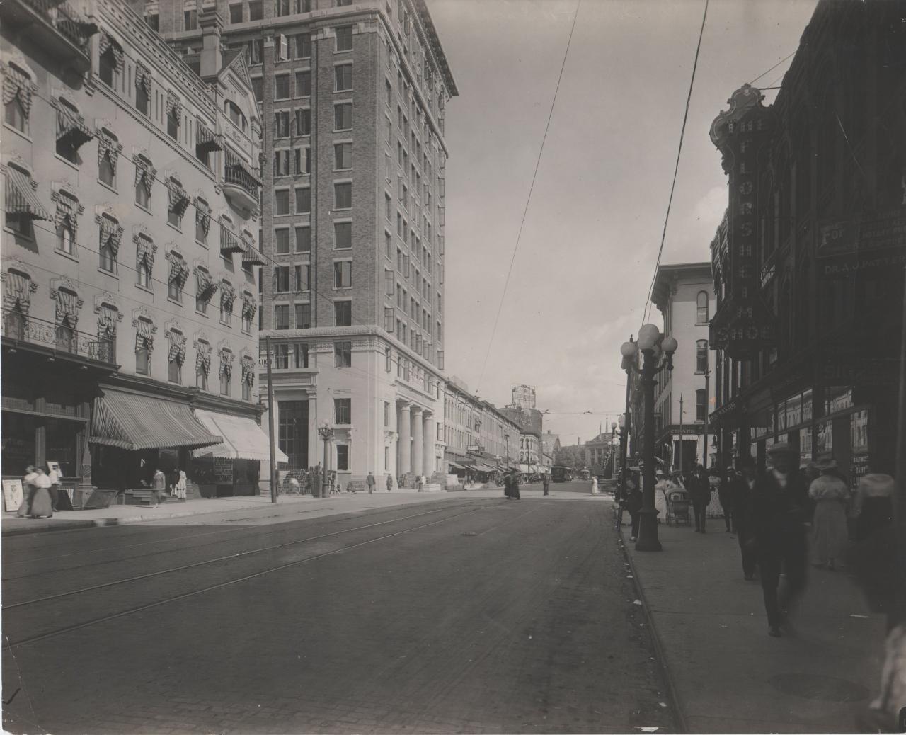
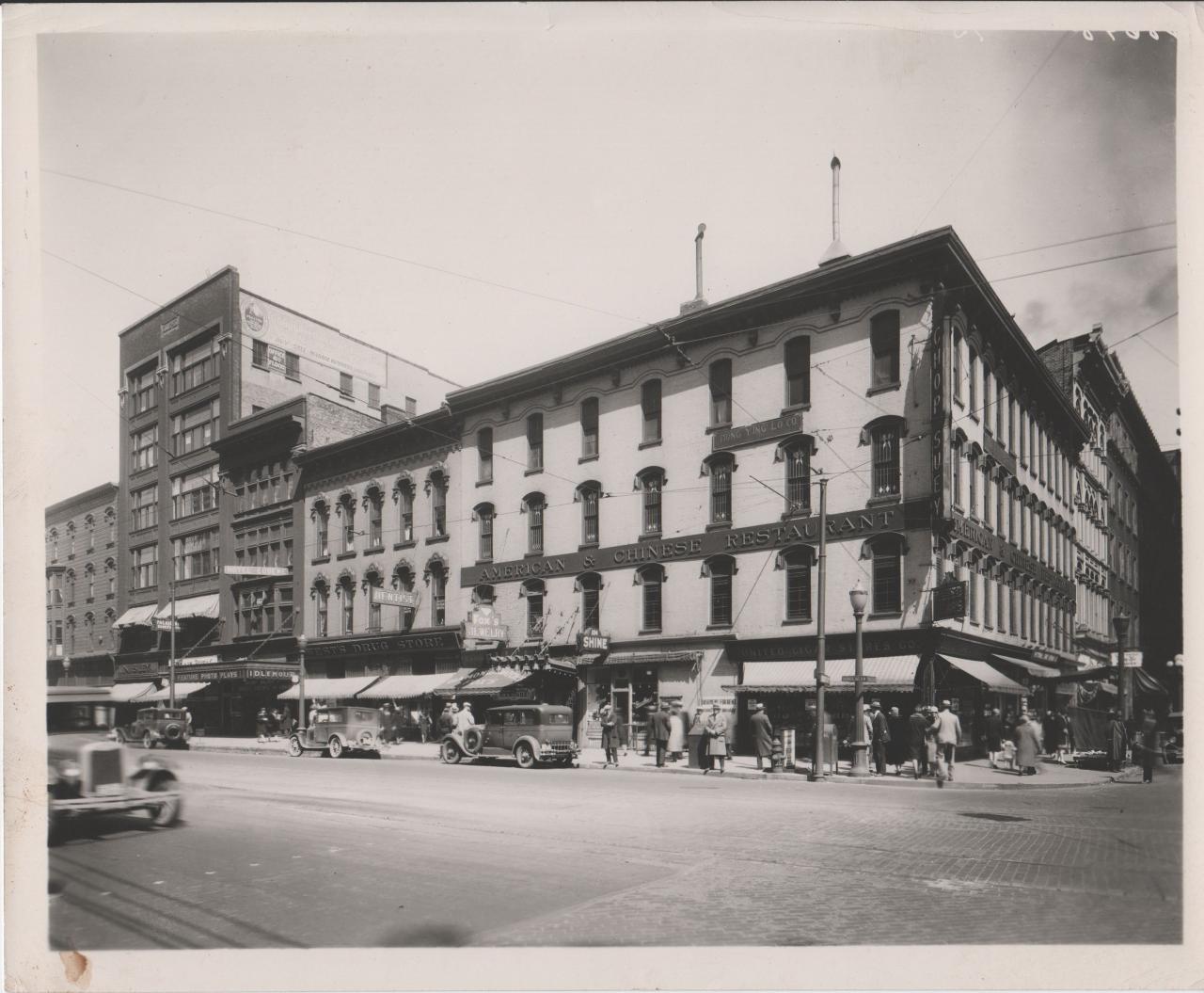
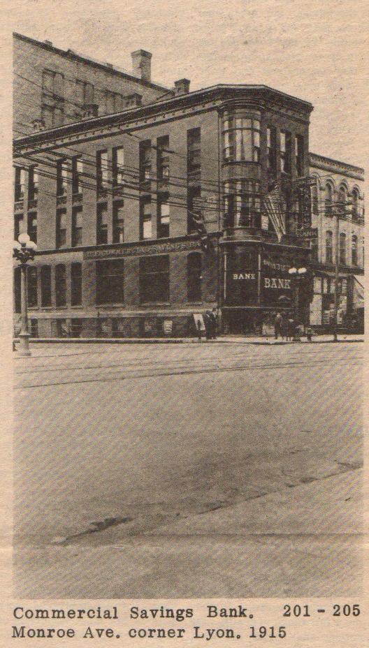
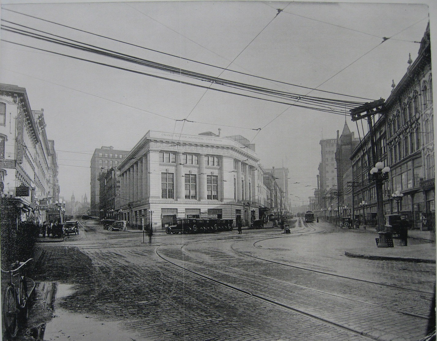
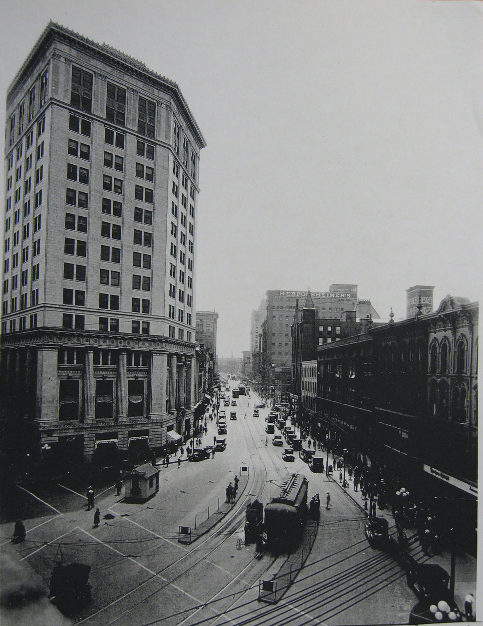
Apparently the downtown area of Grand Rapids was well documented in the 1915 time frame. Just who owns most of the photographs is unclear, but at the time it was common for a city to hire photographers to document buildings and other city features.
The photographs here are just a random sample what's probably out there somewhere, and mostly intended to show what an older Grand Rapids looked like, and what predated some of the buildings that Godwin students were familiar with.
Grand Rapids Chicks
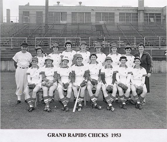
The Grand Rapids Chicks baseball team was one of many women's teams in
the 1940s and early 1950s. Perhaps started to fill the void left by male
players during WWII, women's teams like the Chicks played the game energetically
and well. Here again, perhaps the growth of television gave more people
access to televised major league games, and there was less interest in going
to see local live games. At about the same time the Grand Rapids hockey
team folded, and the hockey stadium was converted to Atlantic Mills, an
early discount store on the north edge of town.
Left click on the images below for larger versions.
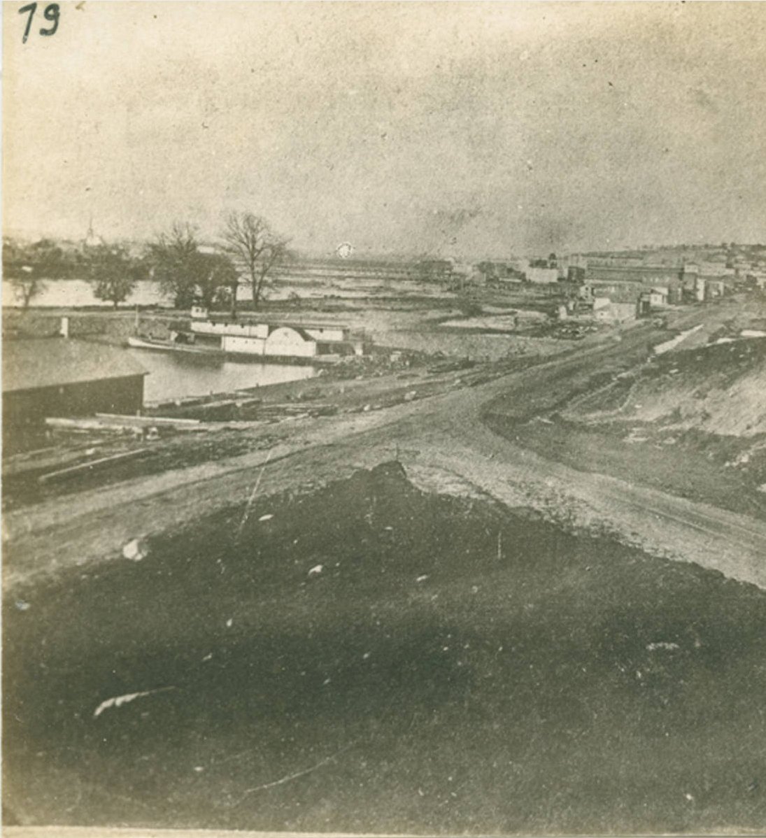
City jail, center, on one of the three large islands. Large sewer pipe shown, to dump raw sewage into the river. |
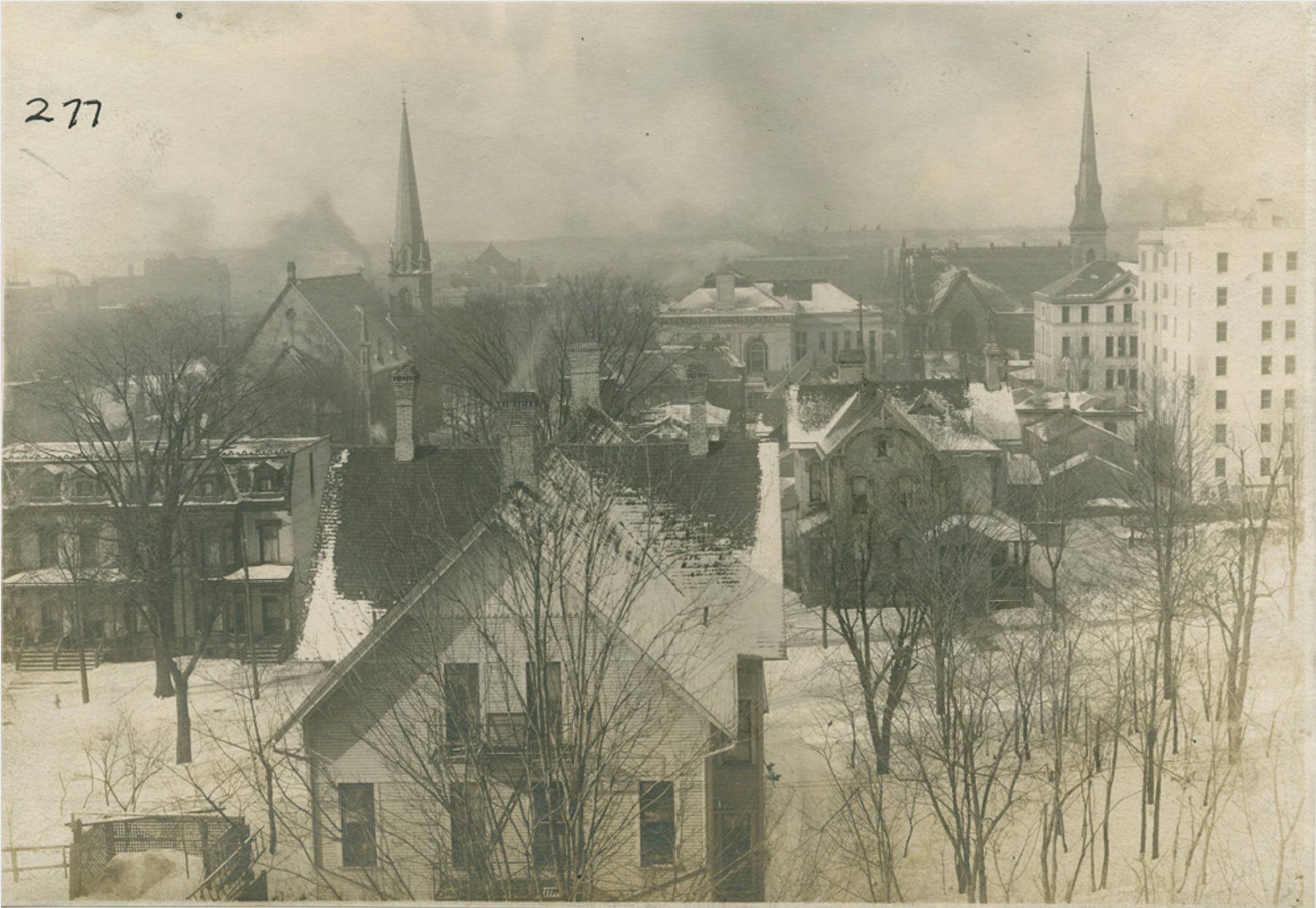
1873. To the right of Park Street Congregational's steeple one can see the islands in the Grand River. |
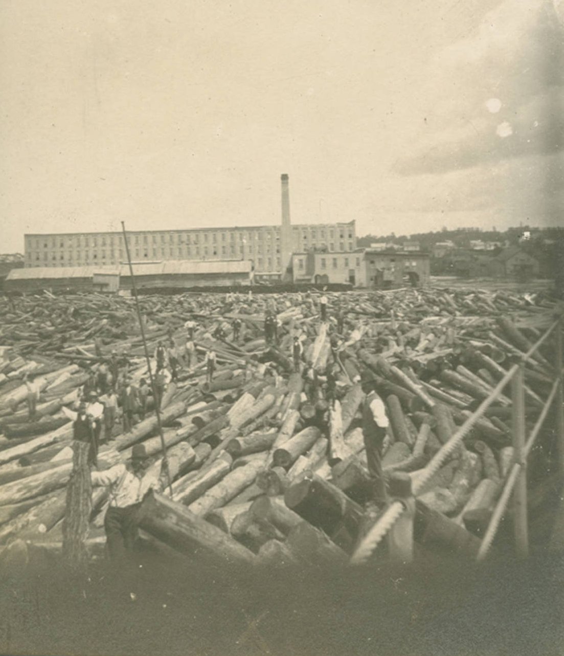
1883 - log jam. |
Left click on the images below for larger versions.
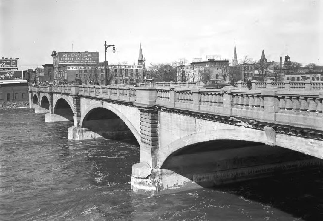
Bridge Street bridge March 15, 1950 |
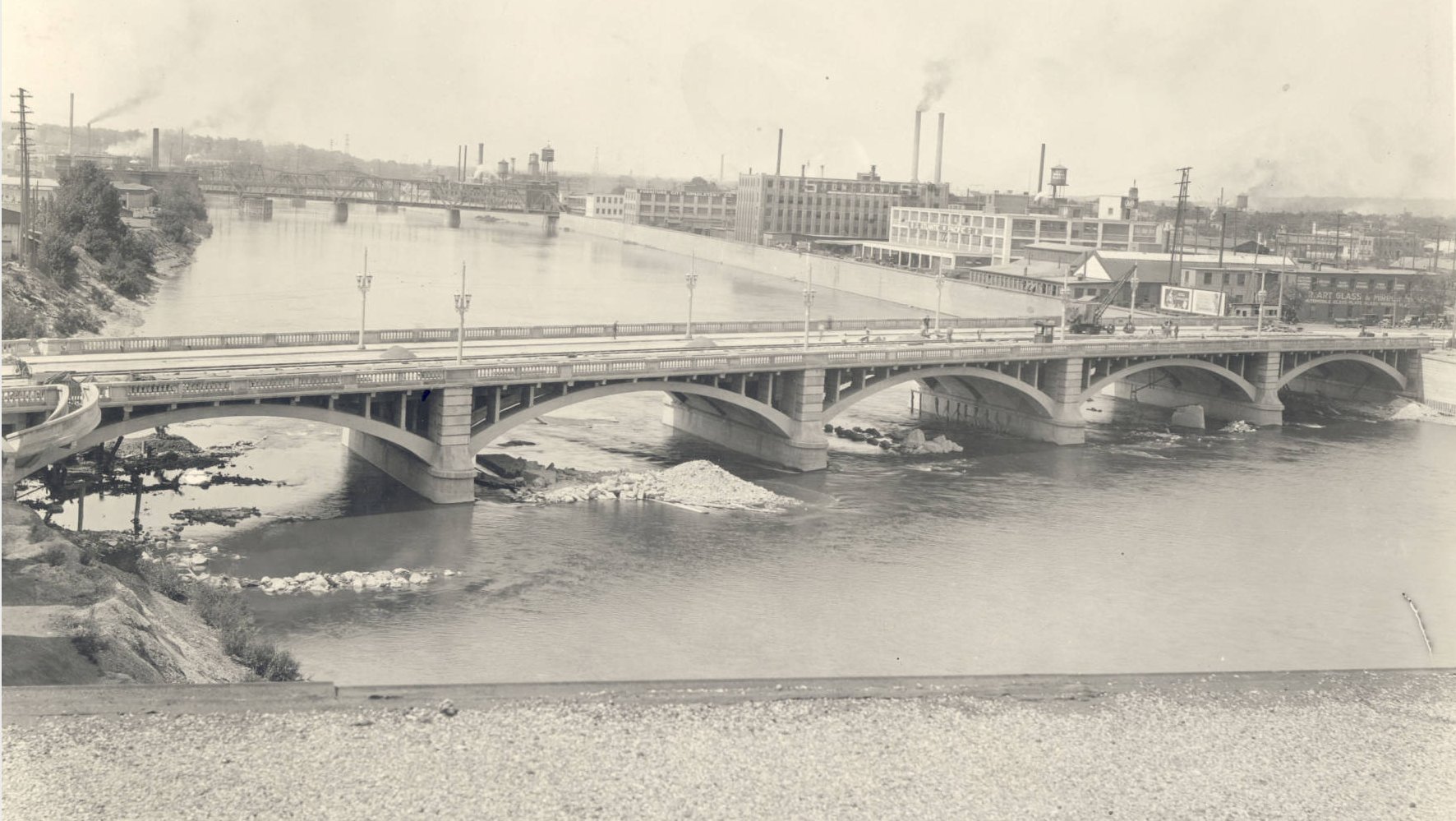
Fulton Street Bridge - 1929 Under construction. Pere Marquette Bridge to the south. |
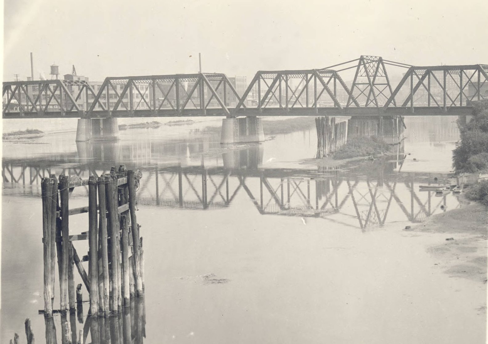
Pere Marquette Bridge - 1928 Built in 1902 |
Pere Marquette Bridge - 2013 |
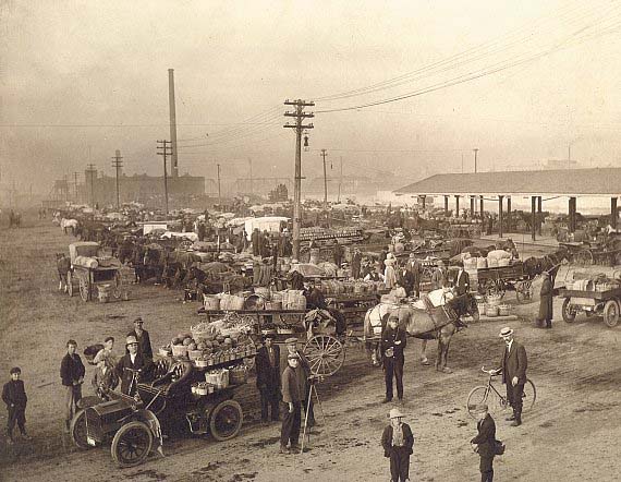
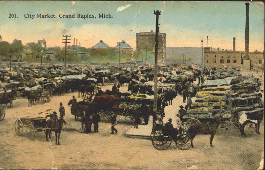
The farmer's market was popular institution in most cities in and around 1900, at time when many farms still ringed a city. The notion of suburbs had not started in earnest yet, so one had a city which ended abruptly, and then one had farmland. So as shown in the images above, with effort a farmer could bring a horse drawn wagon to a designated area and sell farm fresh produce. Cutting out a middle man or two no doubt helped the farmer make some extra money now and then.
Following the decline of the markets, farm stands catered to a population
that more and more owned its own car, and lasted while the farmland around
Grand Rapids gradually fell to the developer's blade starting in the 1930s.
As of year 2005 there is very little farmland in the immediate vicinity of
Grand Rapids. Few have any real idea where their food comes from any more.
Additional Grand Rapids postcards
Left click on the images below for larger versions.
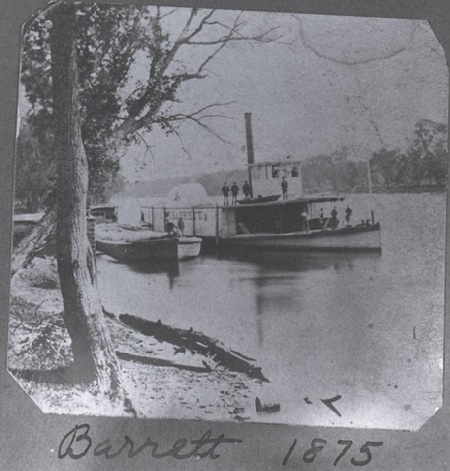
1875 - Grand River |
Daniel Ball, in canal - c1870 |
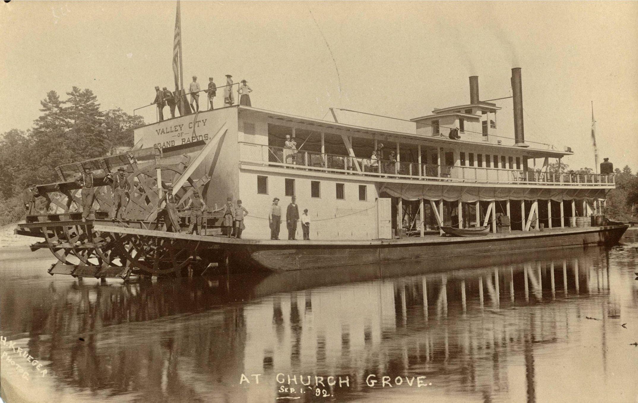
Valley City of Grand Rapids. Sept 1, 1892 |
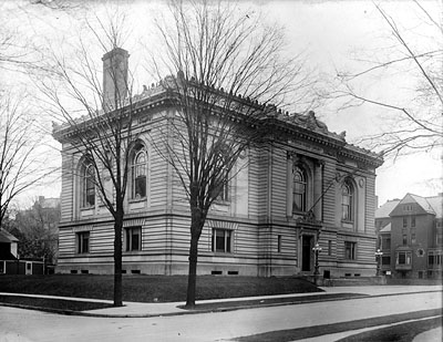
Martin A. Ryerson, 1858 to 1933, was an industrialist living in Chicago. His family, starting with his father, Martin Ryerson, and an uncle,
|
|
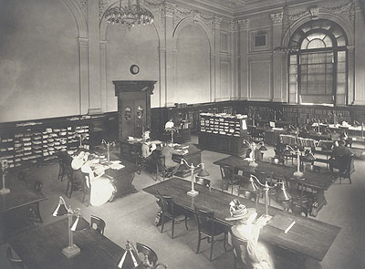
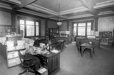
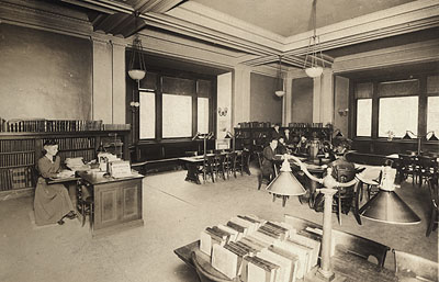
A very solid and elegant building, many Godwin students remember riding the Division Avenue bus into Grand Rapids to spend part of a day locating and using resources at the library. In year 2005 the building partly serves as just an entrance for a modern library building. Actually the second modern one, as the first one had to be torn down because of shoddy construction. Unfortunately, the tax payer funded building was in no way built to the standards of the Ryerson building, which, at 104 years old in year 2005, still probably looks largely the way it did when in opened in 1901.
Left click on either image below for a larger version.
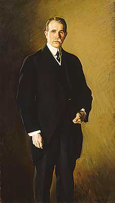
|
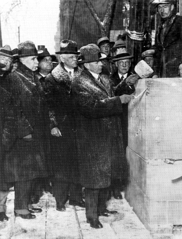
|
The image on the left, above, is a 1913 oil painting of Martin A. Ryerson. The image on the right, above, is shows Martin A. Ryerson, at the left, in 1924, participating in a cornerstone laying for a medical facility in Chicago.
Left click on the images below for larger versions.
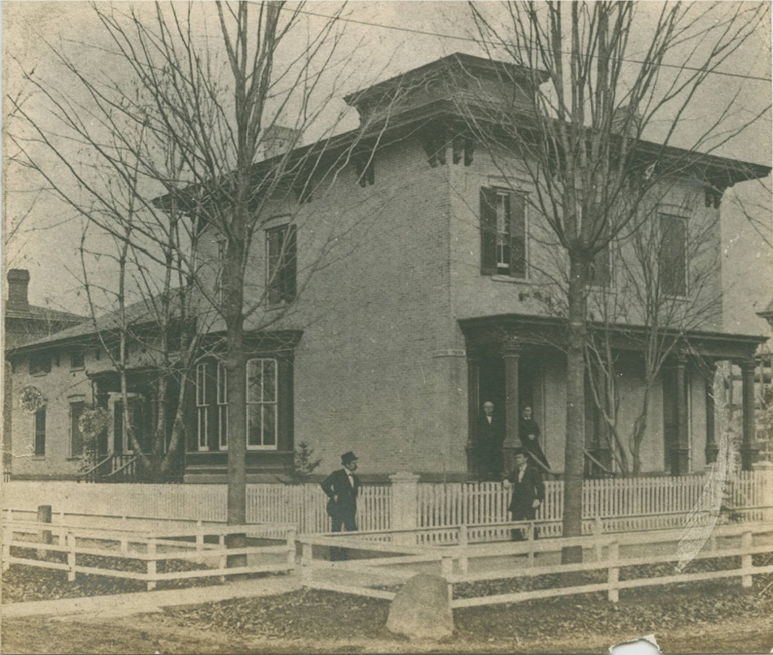
Porter house - 1865 |
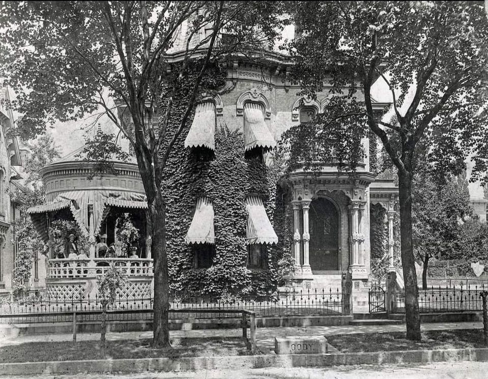
Darwin Cody residence - c1870 |
|
|
|
|
|

|
Left click on the images below for larger versions.
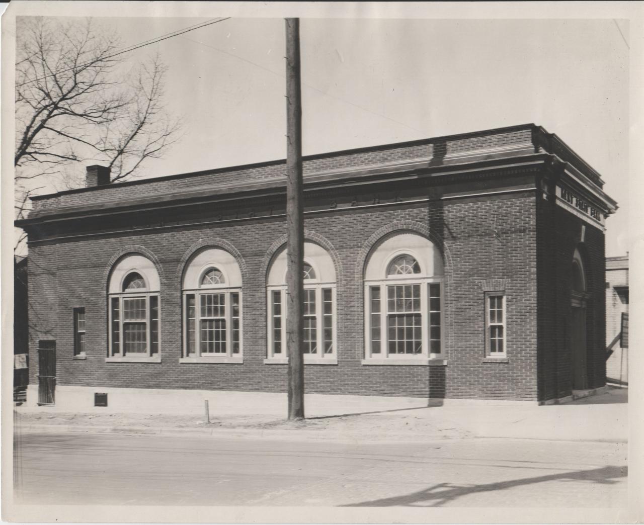
West State Bank - c1930. SW corner, Eastern & Wealthy. |
Godwin graduates in the 1930s and 1940s remember a time when most of the area roads were dirt, and at best graded dirt. Before the days of even spraying them with oil, the roads were generally dusty affairs, a situation mitigated only by the fact there wasn't much traffic on them. Every stretch of rain likely meant serious potholes, which could do real damage to a wagon or car of the time. They needed constant maintenance.
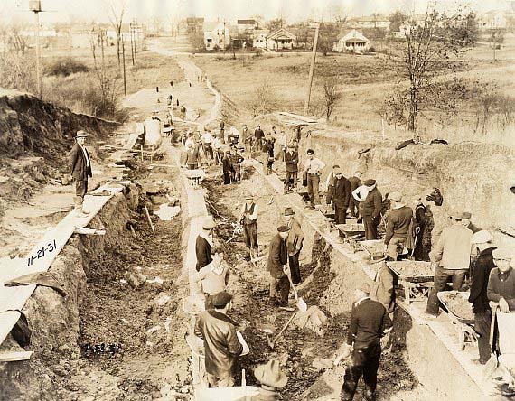
Division Avenue was paved with cement south of Burton Heights only in 1924. Allen Road, now 36th Street, was a dirt road around Godwin even in the late 1940s. The photograph above shows Eastern Avenue ( Formerly East Avenue ) at the intersection of Maybell, on November 21, 1931. Or so the photograph says. Today there is no Maybell road, so it is not clear just where the photograph was taken - many road names were changed in 1943 to provide a more consistent naming scheme. It could have even been just south of 28th Street, where Eastern was a dirt road in the 1930s yet.
In any case, Eastern was a dirt road, and a crude one, past 84th Street even as late as 1960. Only in the 1960s, when more asphalt presumably became available, were more roads paved.
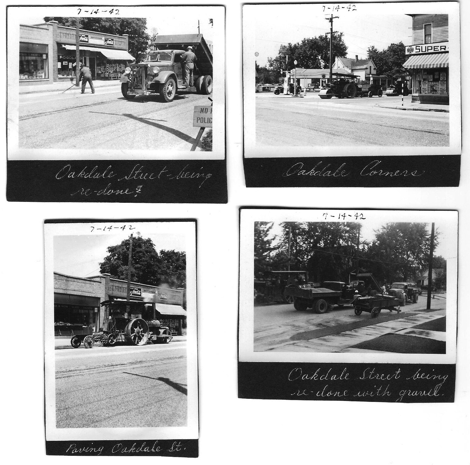
The photograph above was taken during the start of the Great Depression,
which perhaps explains why so many people are involved. Road construction
was one of many government programs meant to help keep people employed,
however minimally. The cut being made in the hill is similar to the
technique railroads used many thousands of times in many other places.
Left click on the images below for larger versions.
c1940 |
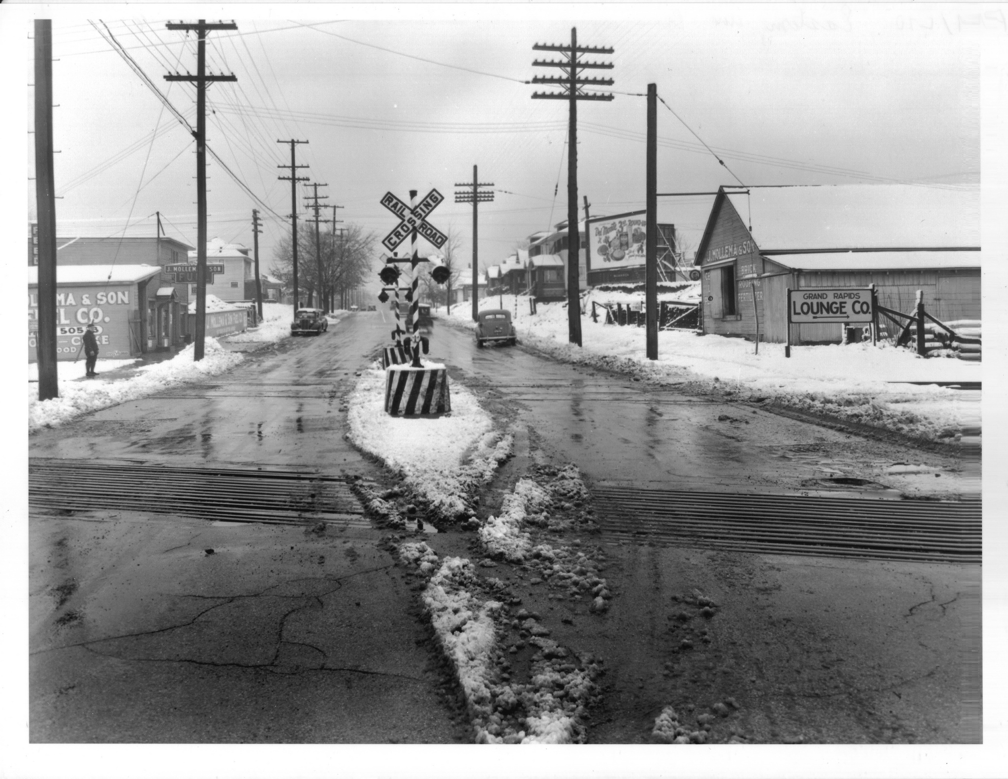
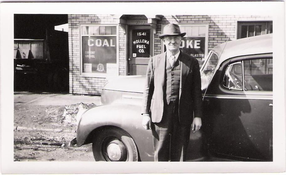
c1945 - see Mollema |
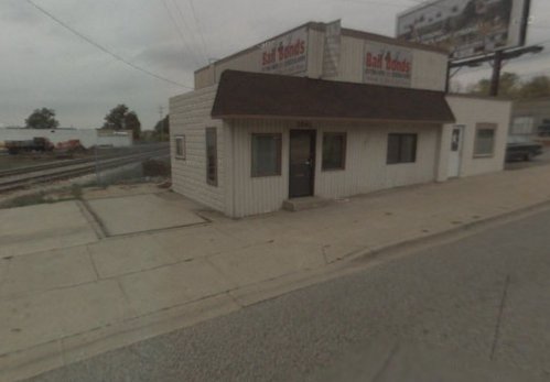
2011 - Mollema building. |
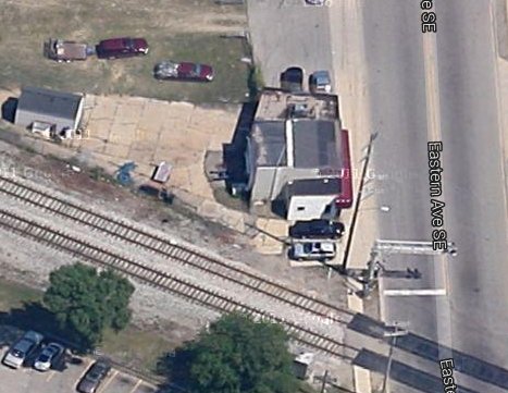
2013 - satellite view. |
Left click on the images below for larger versions.
|
|
Grand Rapids Buildings - Circa 1914
1114 Ionia NW. Weddell Manuf in the background. |
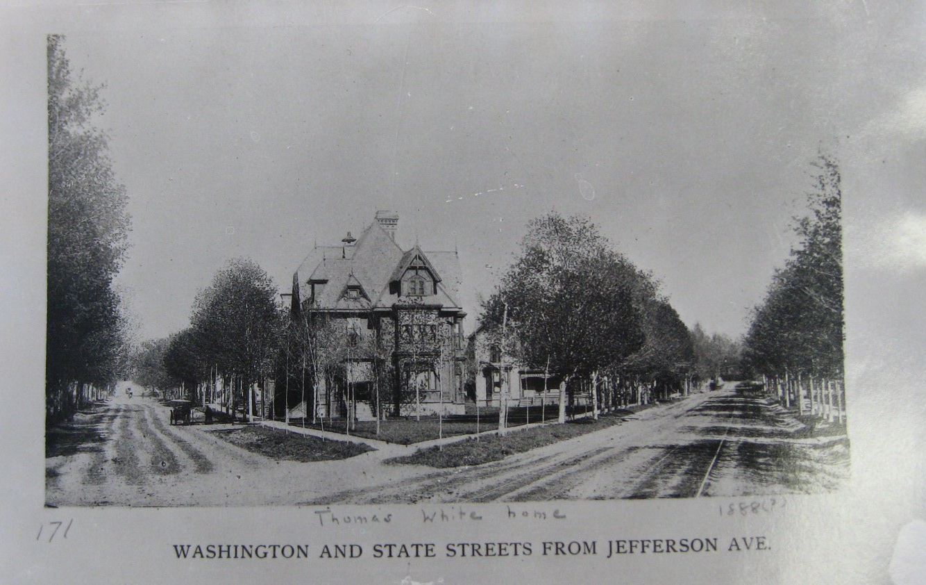
Perhaps 1888 - Thomas White was president of White & Friant Lumber Company. |
Perhaps 1909 - postcard. |
From a 1918 directory. |
June 18, 2008 |
October 11, 2013 |
June 18, 2008 |
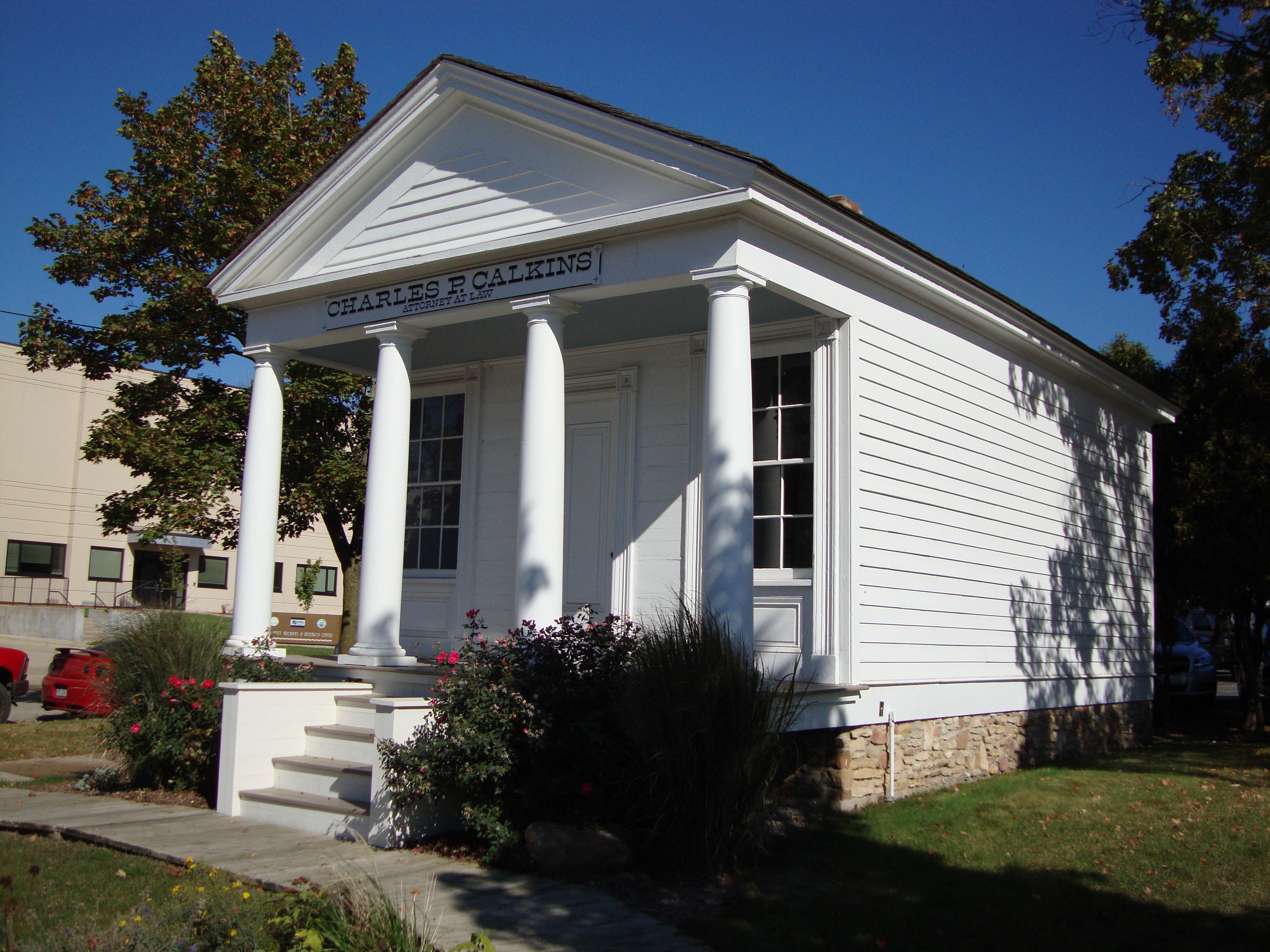
October 11, 2013 |
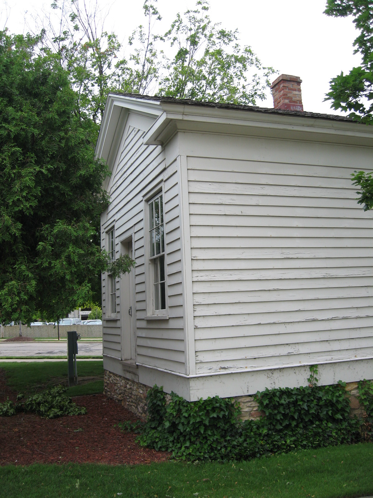
June 18, 2008 |
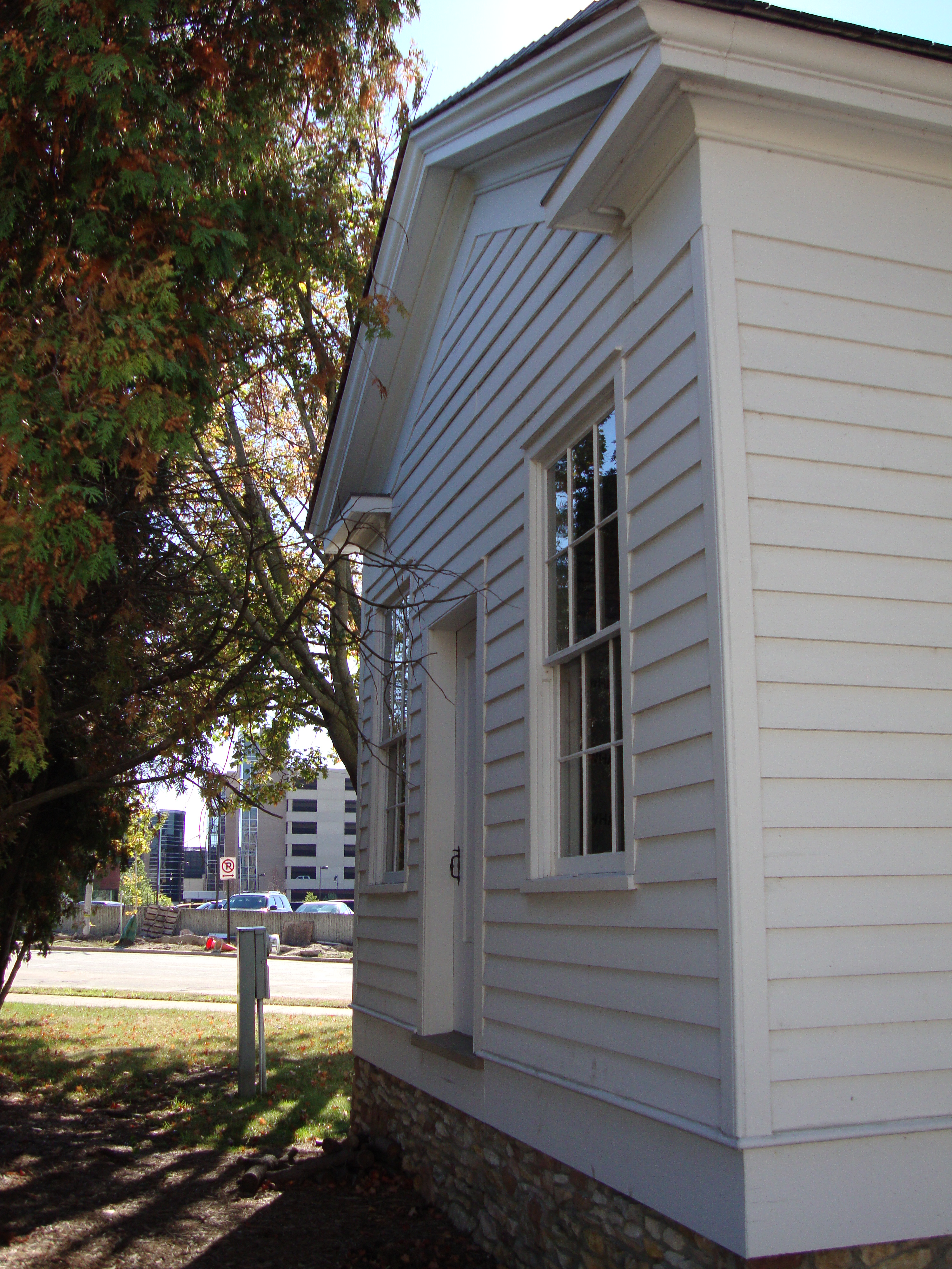
October 11, 2013 |
Left click on any image above for a larger version.
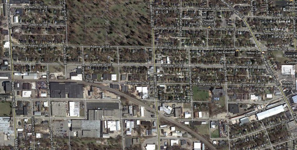
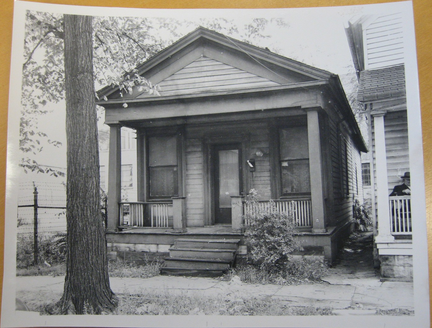
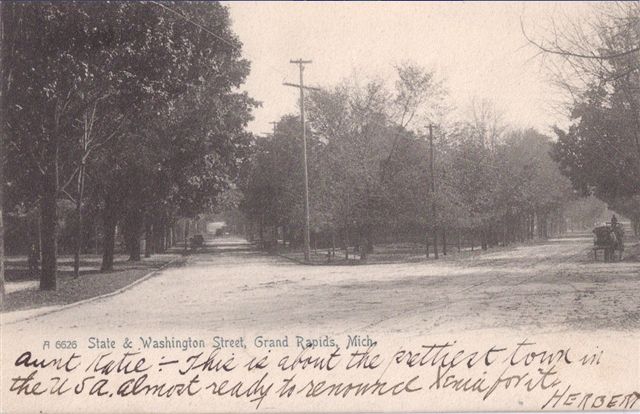
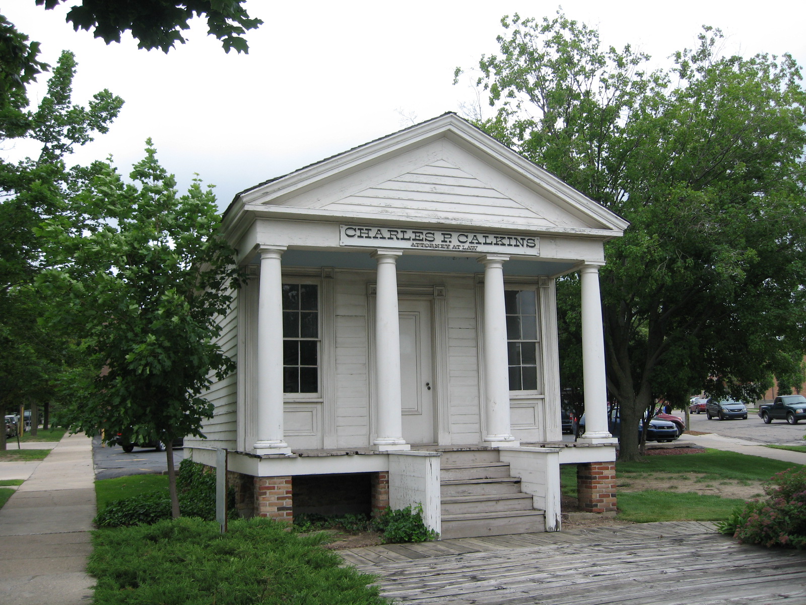
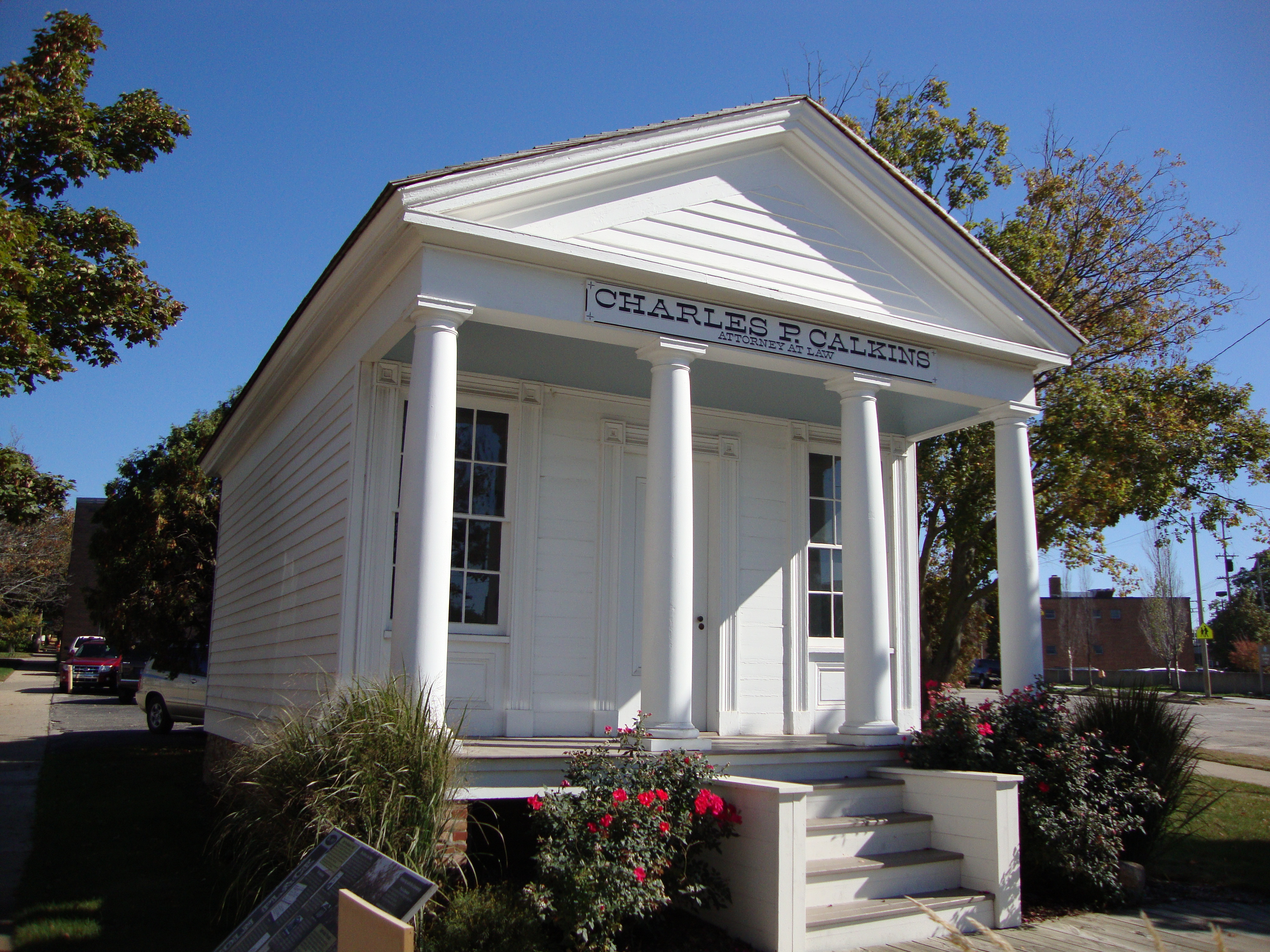
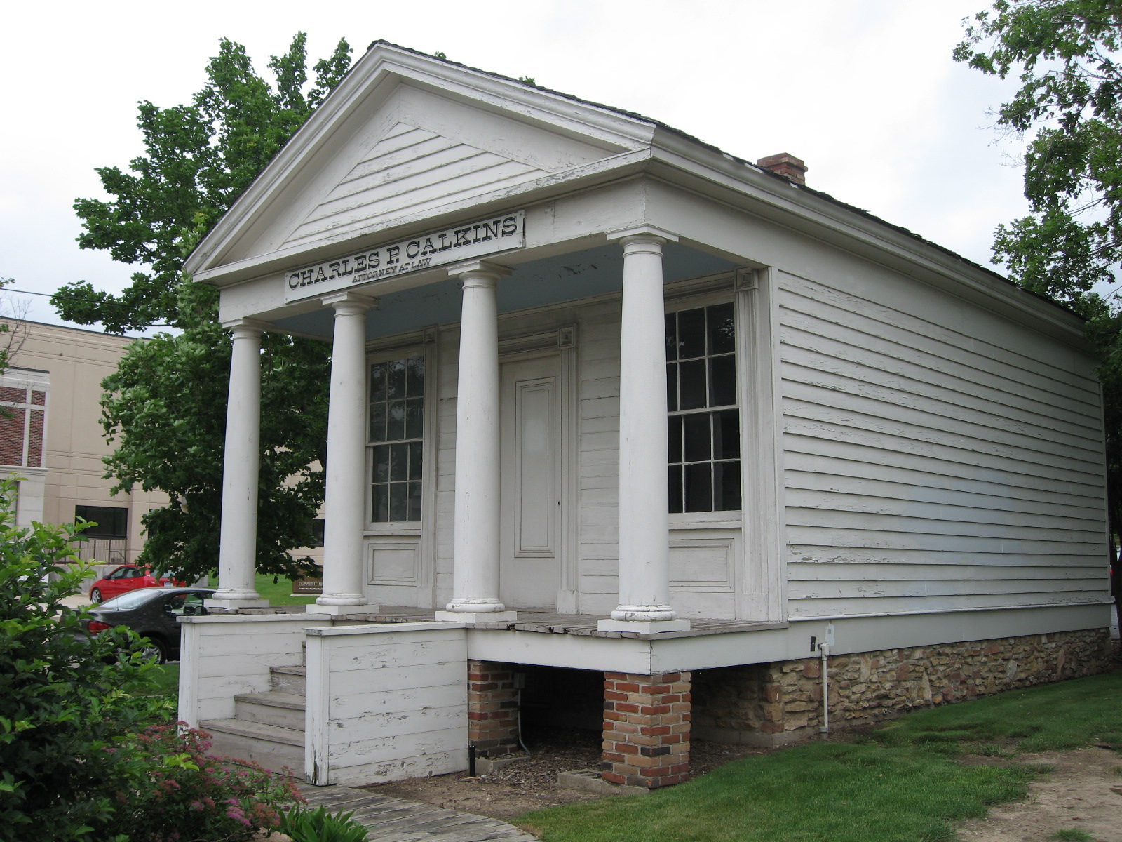
The Charles P. Calkins building is the oldest surviving structure in Grand Rapids. Built in 1836, it's said to have once been located in the the northeast corner of Monroe and Ottawa. It not clear that was the original location - the building has been moved at least twice. In year 2008 there is no such intersection. In year 2008, the building is located in Lincoln Park at the intersection of State Street southeast and Washington Street southeast. The photographs above were taken on June 18, 2008. Photos taken on October 11, 2013, show that a lot of work on the outside of the structure has been done since 2008. Much of the reconstruction has to be done using old photos and documents. The structure was significantly modified over the years, as the old photo shows. The middle photograph, top row, about shows the Thomas White house on this location in an undated photograph. Just one more stately old home to be razed in Grand Rapids.
Charles P. Calkins was a lawyer, and the building was a law office. How long the building was used is not known at this time. The photo in the top row, left, suggests the building was being used as a house at the time. Given its apparent condition, it's amazing that it survived at all. Calkins appears below in an undated photograph.
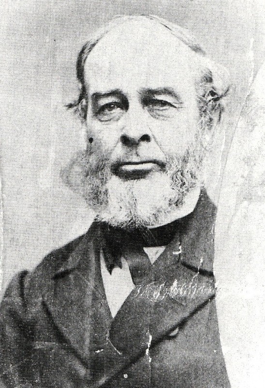
Charles P. Calkins
Charles Philo Calkins died in 1890, and is buried in the Fulton Street
Cemetery. Lot 33, block 5, grave 7.
Left click on the images below for larger versions.
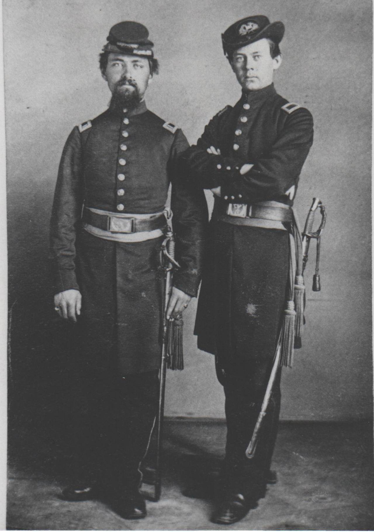
Joeseph Herner, left, Charles W Calkins, right. |
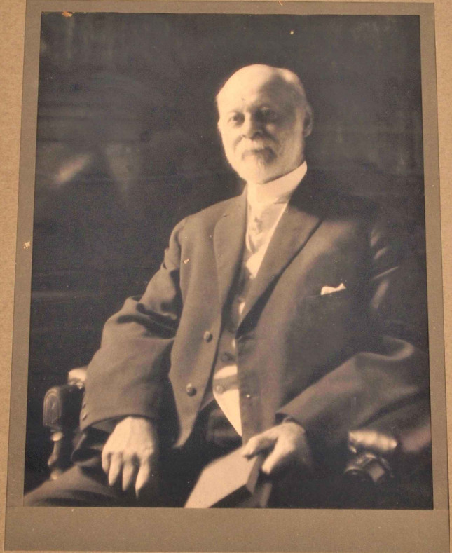
c1918 |
223 Lafayette, where Charles W. Calkins lived and died. March 28, 1918. |
Left click on the images below for larger versions.
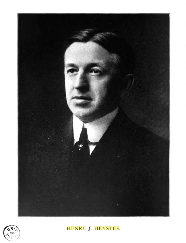
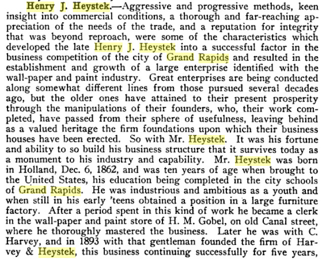
Henry J. Heystek - undated. |
|
|
|
c1910 |
c1905 |
|
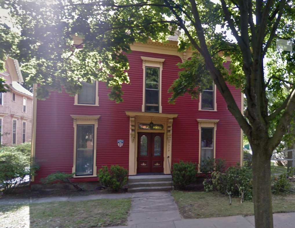
Built c1905 by Heystek |
|

March 7, 1949 |
August, 2015 |
c2015 |
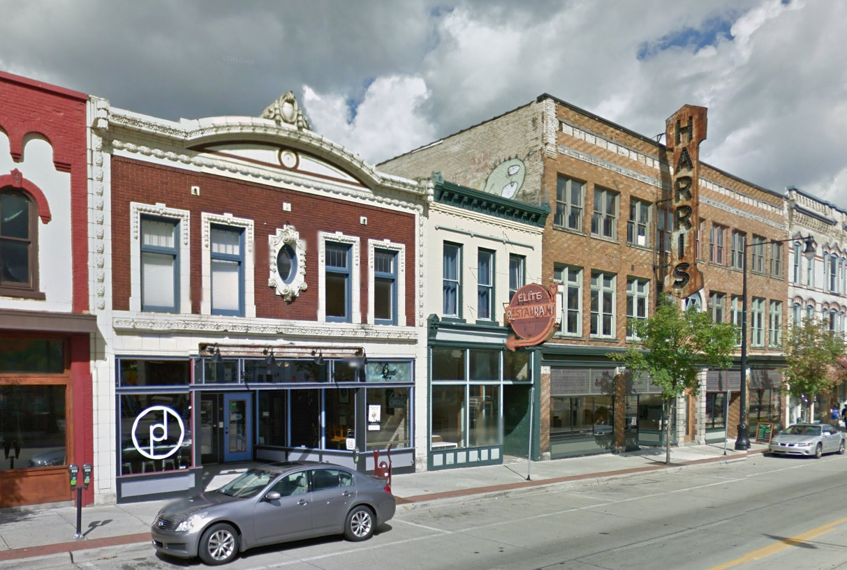
Left click on the images below for larger versions.
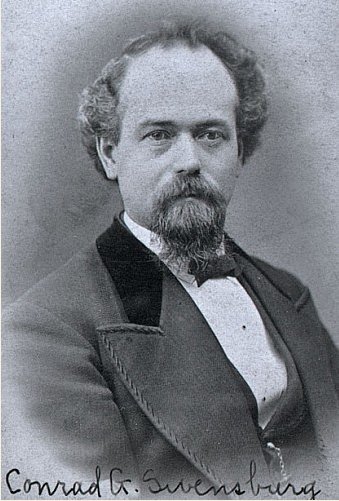
Conrad G. Svensberg |
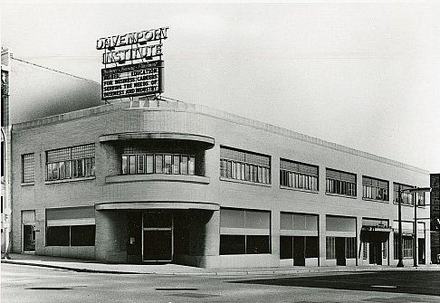
Davenport, about 1919. |
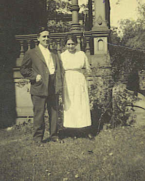
Mr. & Mrs. A. E. Davenport. |
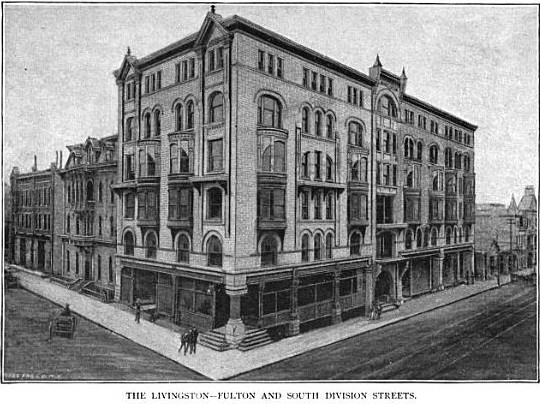
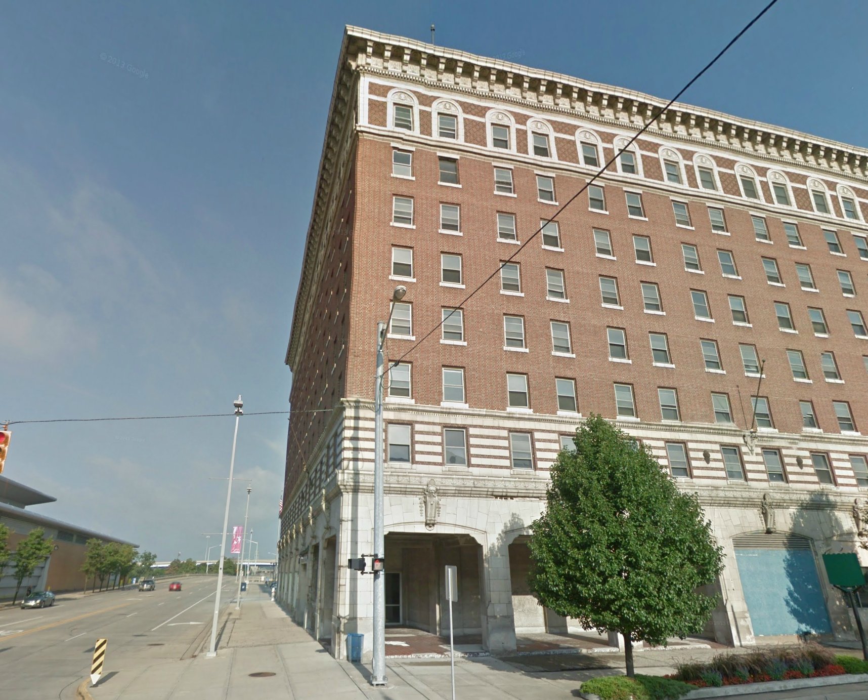
Livingston Hotel - c1888 Same corner - before Davenport |
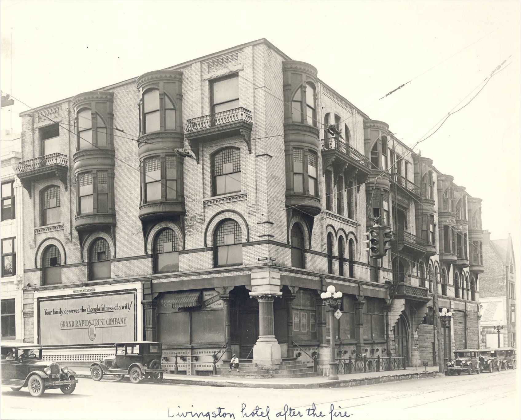
Livingston Hotel - 1924 Same corner - before Davenport After a fire, losing two top floors. |
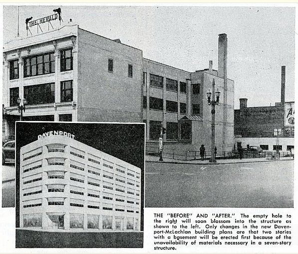
Before construction began, and the goal of six stories. |
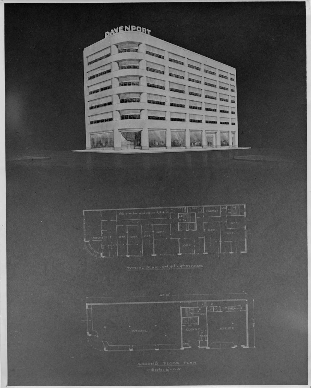
c1947 |
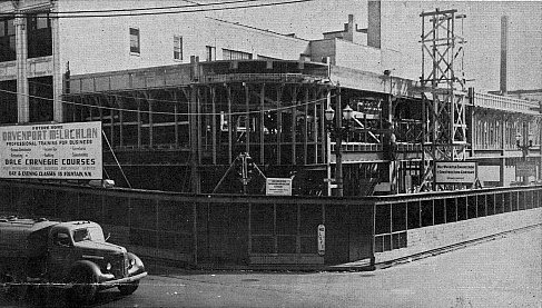
Construction of new building - 1948. |
New building - 1948. |
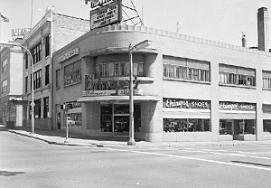
1959. |
March 8, 2013 |
Left click on one of the yearbook sections below.
| Section 1 | Section 2 |
| Section 3 | Section 4 |
1967 Yearbook
Left click on the images below for larger versions.
|
|
|
|
|
|
|
|
|
From White's history of GR:
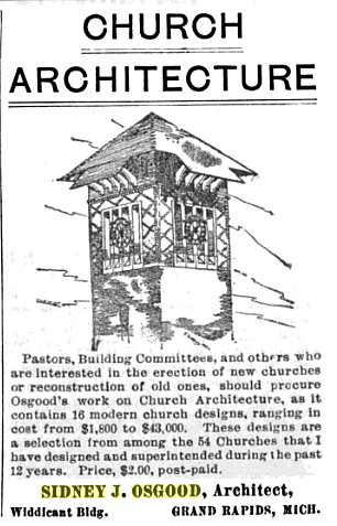
Pages 187-188 - Sidney J. and S. Eugene Osgood are the constituent members of a Grand Rapids firm that has gained high reputation in the domain of architectural art and science, and both father and son are numbered among the representative American architects, with many of the finest types of public, business and private buildings to stand as evidence of their technical skill and their exceptional facility in the expression of the highest forms of architectural artistry. Sidney J. Osgood was born in the state of Maine, and his advanced training for his chosen profession was received in the city of Boston, Massachusetts, as supplemental to a liberal education along more specific academic lines. In 1876 he established his residence in Grand Rapids, Michigan, where his first project was rebuilding the Kent County jail after it had been destroyed by fire. He has continued in the active and successful practice of his profession during the long intervening period of half a century. Though he is now venerable in years he still finds satisfaction in giving active attention to the work of the profession that he has dignified and advanced by his large and successful achievement, as well as by his sterling attributes of character. Mr. Osgood is a life member and Fellow of the American Institute of Architects, a distinction which few architects obtain.
Left click on the images below for larger versions.
Sidney J. Osgood - undated. |
His son and valued professional coadjutor, S. Eugene Osgood, is able to advert to Grand Rapids as the place of his nativity, his birth having been here occurred on the 11th of April, 1880, and his studies in the public schools of the city having been continued until his graduation in the high school. Thereafter he was employed a year in his father’s office, and he then entered Cornell University, in which he continued his studies, graduating in June, 1902, his study and his practical experience having gained to him a broad and effective knowledge of the technique and also the art and construction details of architecture. Since 1904 he has been a partner in his father's business, which is conducted under the firm name of Osgood & Osgood. The family name has long stood exponent of the best in architectural achievement, and it may be noted in this connection that the father, Sidney J. Osgood, was the architect of the beautiful and famous Congregational church at Pawtucket, Rhoade Island. The firm of Osgood & Osgood has maintained its offices in various Grand Rapids buildings, including the Porter Block, the Widdicomb building, the new building of the Grand Rapids Herald, of which the last two named the firm were the architects, and finally the Monument Square building, on Monroe avenue, which was designed by the firm and erected under its direct supervision, the large and well-equipped offices in this building having been occupied by Osgood & Osgood since 1919.
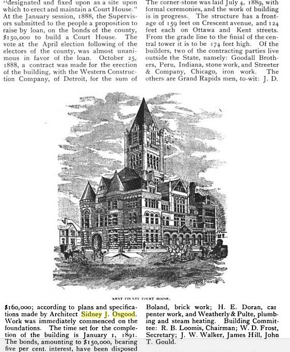
The firm has specialized in the designing of Masonic Temples of the highest grade, and its principals are at the time of this writing in the summer of 1925, serving as consulting architects of the great George Washington Masonic National Memorial Temple which is in course of erection in the city of Alexandria, Virginia. The members of the firm are also consulting architects for the magnificent new Masonic Temple in Cincinnati, Ohio. They are the designing and supervision architects of important Masonic Temple projects in the following cities: Canton, Ohio; South Bend, Indiana; Bay City, Michigan; Brockton, Massachusetts; and Providence, Rhode Island. Many fine buildings in Grand Rapids and other Michigan cities stand as monuments to the professional skill of Sidney J. Osgood and S. Eugene Osgood, among them the following: Kent County Court House, Keeler Building, Houseman & Jones Building, Kortlander Building, Grand Rapids Savings Bank Building, Commercial Bank Building, Corl & Knott Building and the Grand Rapids Masonic Temple. They have also built twenty-four churches, several schools and residences, and the firm has gained a reputation that transcends mere local limitations and has become national in its scope.
Sidney J. Osgood's office was at one time in Room 35, Widdicomb Building, on the SW corner of Monroe and Waterloo ( later, Market ).
Left click on the images below for larger versions.
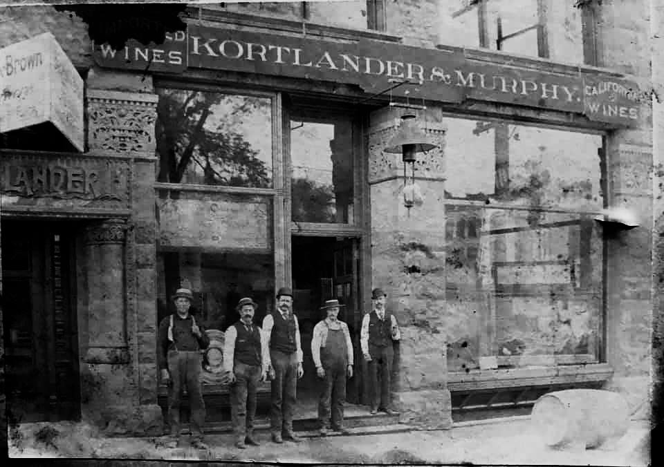
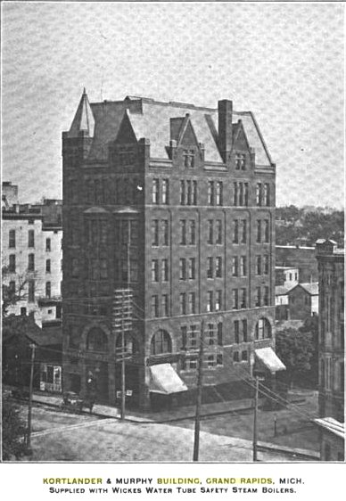
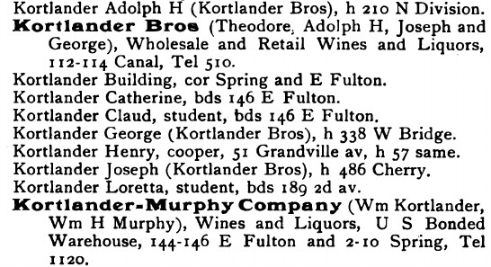
1891 - Kortlander & Murphy |
Circa 1894, when it appears in a GR board of trade publication. |
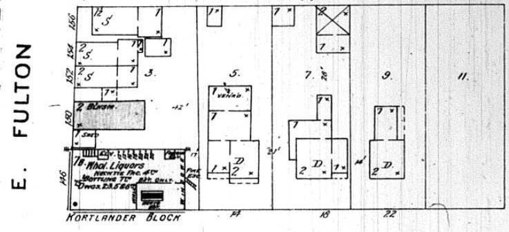
1895 Sanborn map. |
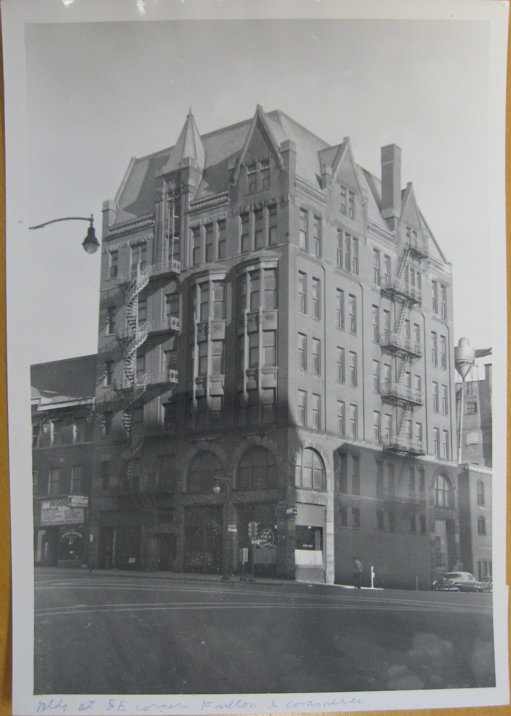
Circa 1954. |
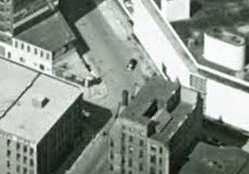
1960. |
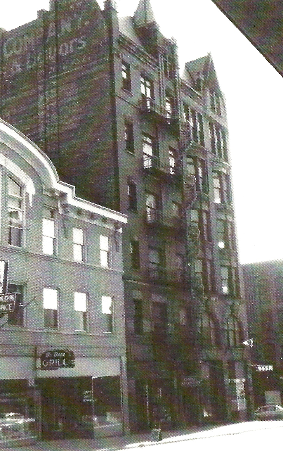
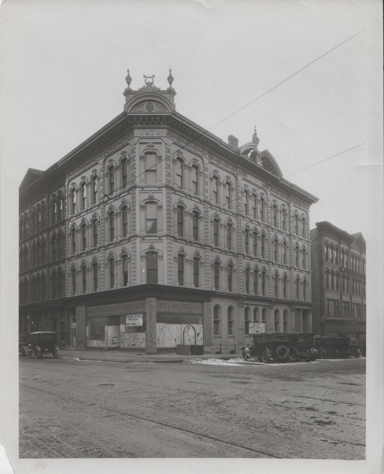
The first section of the Kortlander Building, shown at the left, first row, above, was apparently mostly a business structure, and built some time after 1885, when it does not show up on a Sanborn fire map, and 1895, when it does. See image at right, first row, above. Later - a guess being in 1916, as shown below the photo on the left, bottom row, above - an addition was made. The photo was probably taken in the early 1950s, as suggested by the car visible in the lower right hand corner. The addition seems to have consisted of apartment units, and in fact the entrance at the middle of the building, on the Fulton Street side, says something like "Central Apartments." A sign inside the entrance pointed to a rental office on the second floor. It's possible that one can see curtains on the left side of the 4th floor, in the photo at the right, above. Apparently the addition was meant to address an increase in housing demand, since it was more common to live in the city in the early part of the 20th century.
On the Fulton Street side, left, one sees an entrance behind the buggy being pulled by the horse. To the right of the entrance a bar operated in the late 1950s. To the left of the entrance was long a sports shop owned and run by Charles Lindberg - no relation to the pilot - and his two sons, Oscar and William. Gunsmithing work was done, keys made, and boats and motors worked on in the 1930s. By the 1950s there did not seem to be much business, and the store was like a living museum, possible only because of the slower pace of life at the time. And much of the material did go to the Grand Rapids museum when Charles Lindberg died in about 1958, and the store was shut down by his sons.
But the closing was prophetic in a way.
Lindberg's shop, and the bar on the other corner on the side of the
building along Fulton Street, were apparently the only parts of the
building occupied by that time.
By the mid 1950s,
after the bar closed the building would be almost completely dark. The
author remembers walking northwest on Louis Street at night and
looking back towards the Kortlander building to see a bare
light bulb lit on the third or fourth floor. Whether anyone lived in that room, or
what the light bulb signified, will never be known now.
The photograph below, provided by John Kortlander, a relative four or five
generations after William Kortlander, who built the building, shows the
Kortlander building in about 1959.
Left click on the images below for larger versions.
|
|
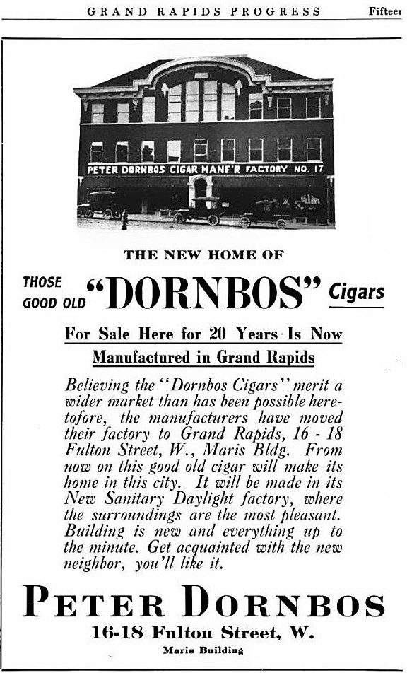
The building to the left of the Kortlander building was called the Maris building, and was completed in October, 1916 as a building to house the Dornbos Cigar Manufacturing Company, located at 16-18 Fulton Street. Just when it ceased operation is not clear. By 1940 it housed Moore's Hobby Shop, and probably Smalley Daniel's Cushman sales store. Above Moore's Hobby Shop was a dance studio. One can see part of the sign - probably "Learn to Dance" - on the left side of the photo, above and left of the "Grill" sign. Not so easy to see, there was an alley on the left side of the Kortlander building. In the mid and late 1950s there were many layers of posters on the side of the building advertising the Ringling Brothers, Barnum, and Baily Circus. The alley was otherwise a service corridor for businesses along Division Avenue. The south end of the Kortlander building had an area for the same purpose.
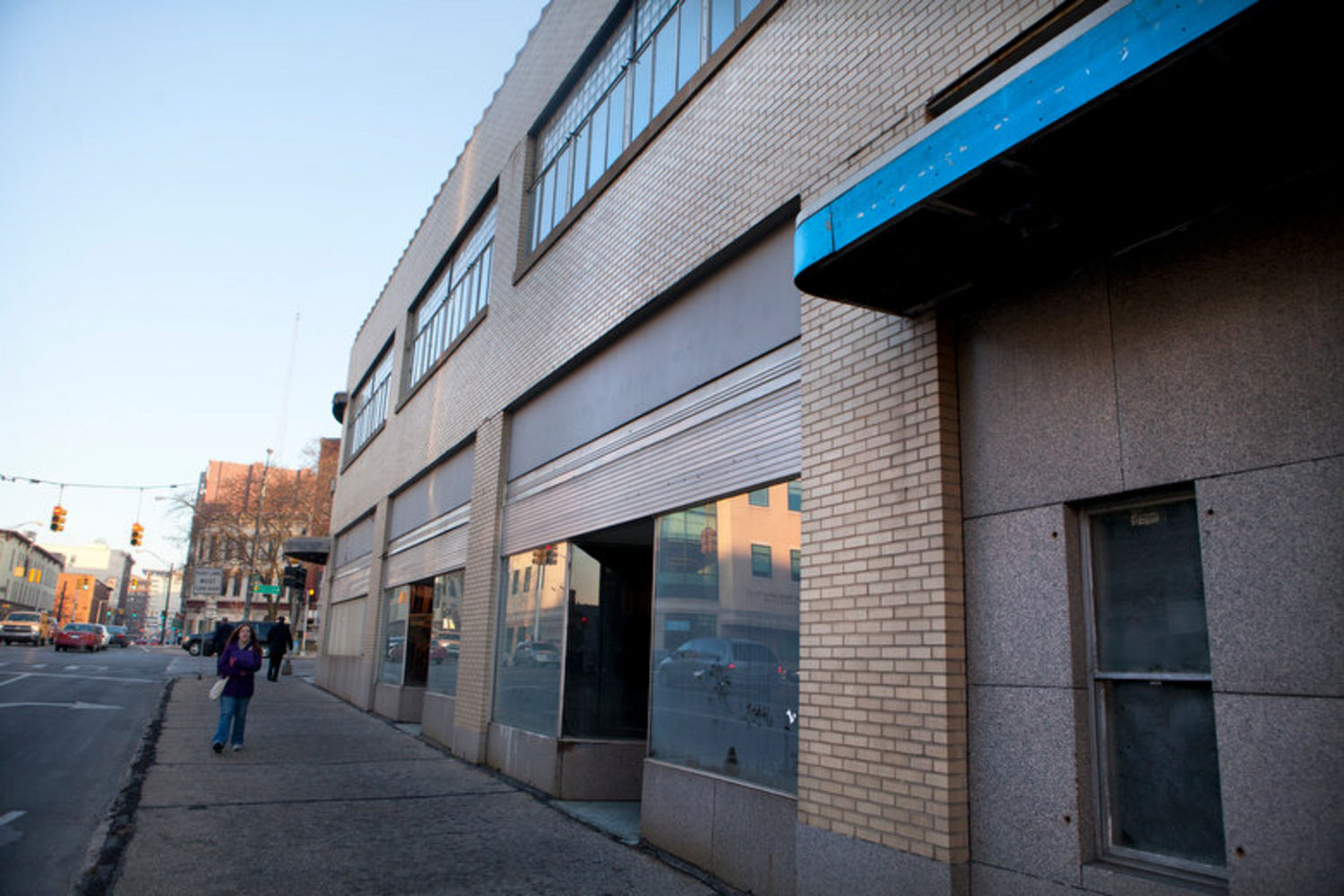
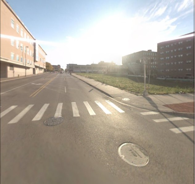
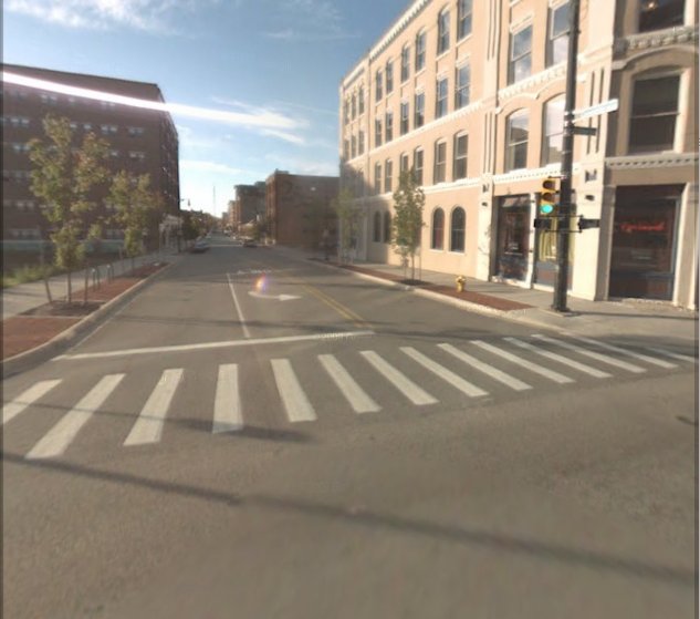
Around 1960 the Kortlander building was demolished, together with most of the Cody Hotel, and the Maris building, to make room for a municipal parking ramp. The construction of the ramp was so shoddy that it too was later demolished, in and 2008 something was once again being built on the property. Before that construction, the property along Fulton was vacant, as shown below. The image on the left looks east, along Fulton, and the one on the right looks south, along Commerce. Almost nothing from the 1950s exits in that area in year 2010.
Left click on the images below for larger versions.
|
|
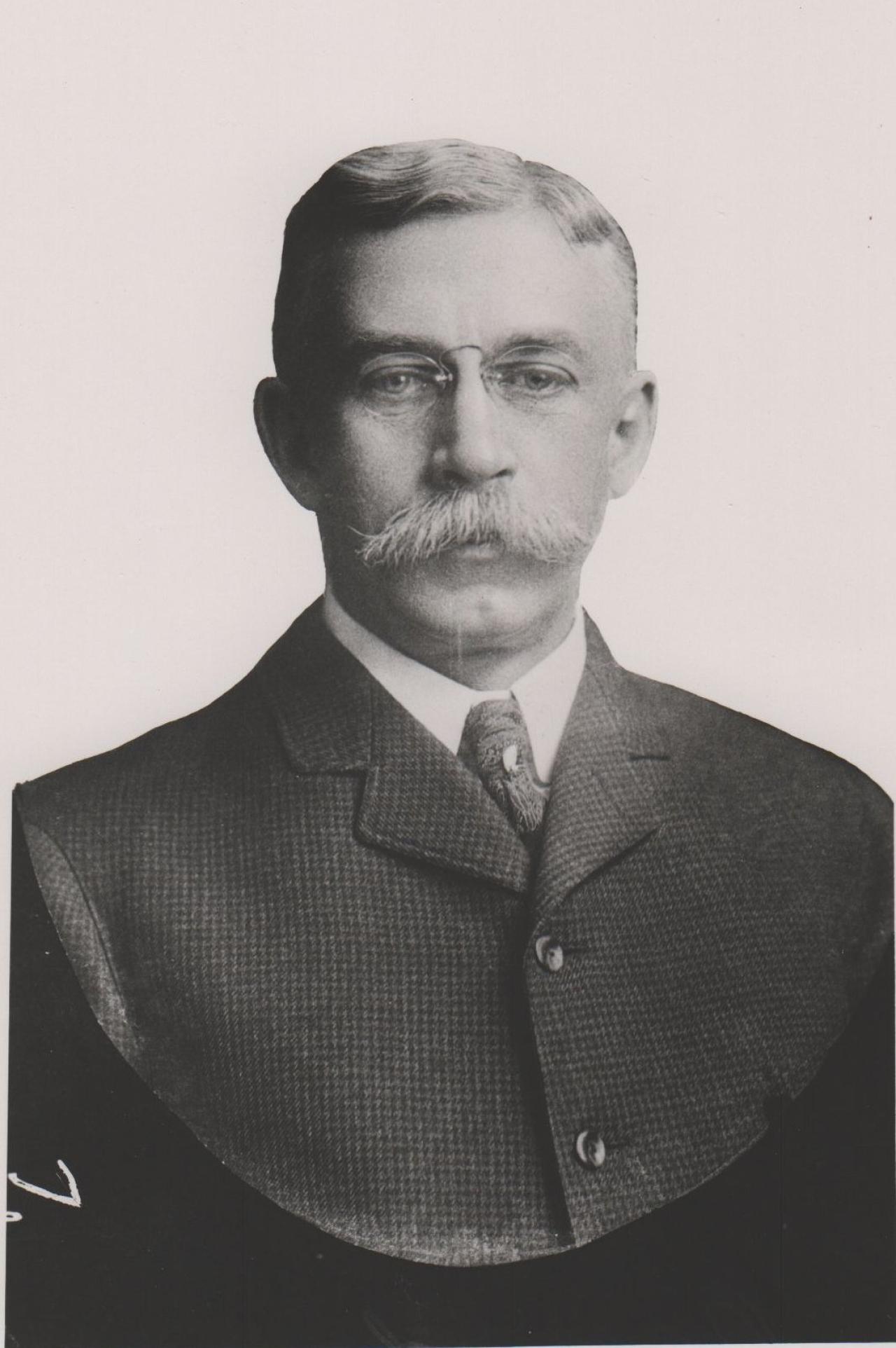
So why was the Kortlander Building even built? It starts when Henry Kortlander immigrated to the US from Germany.
Left click on the image below for a larger version.
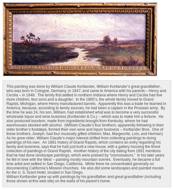
The short biography shows that Henry Kortlander learned to be a cooper
after immigrating to America. Less clear is how son William got in to the
wholesale wine and liquor business. He had contacts in Tennessee. The business was
extremely successful, and the Kortlander building was eventually built to
house the business. Four brothers formed a separate wine and liquor business,
Kortlander Brothers.
Demand in Grand Rapids must have been high.
Left click on the images below for larger versions.
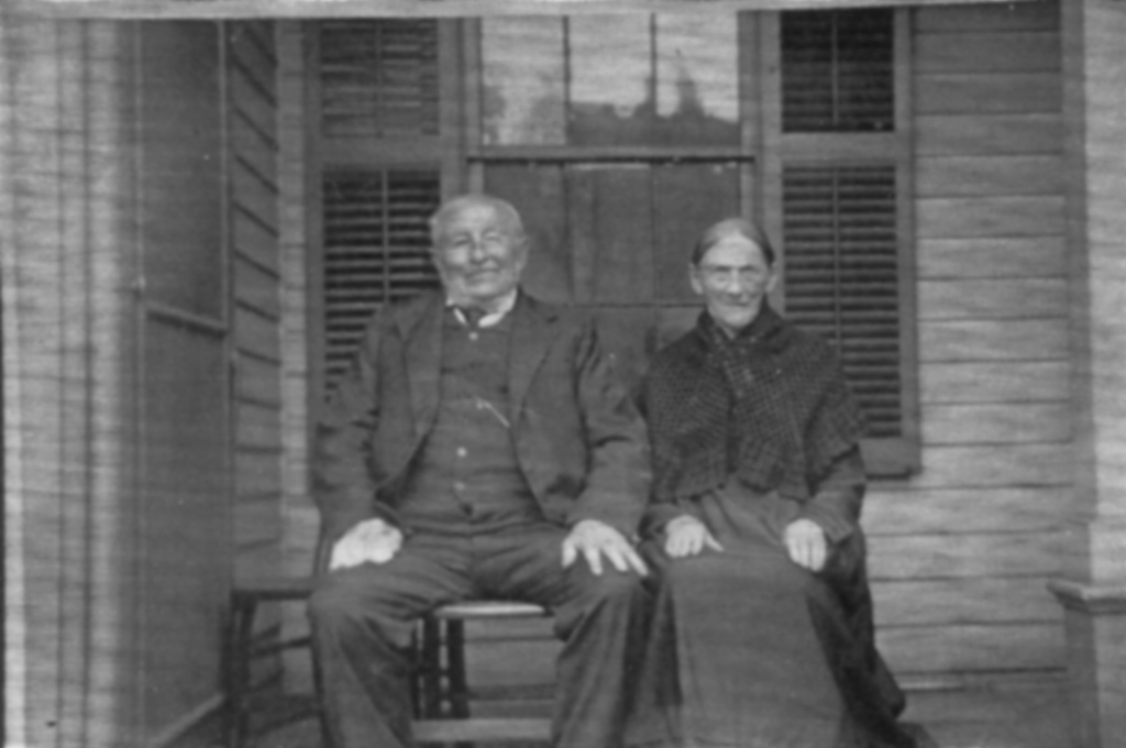
Henry & Ceceila Kortlander |
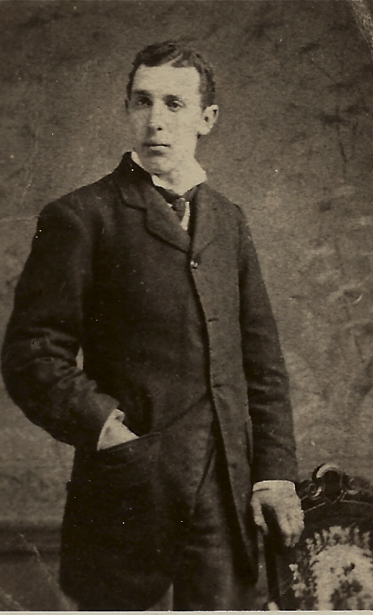
Joseph Kortlander |
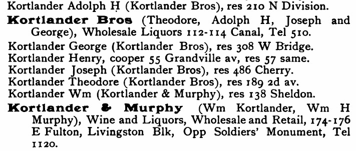
1891 |
1895 |
Above, top row, left, are Henry and Ceceila Kortlander, who immigrated from Germany with their son William. Above right, top row, is son Joseph. Neither photograph is dated.
The bottom row shows entries in the 1891 and 1895 editions of the GR city directory. The 1895 edition makes explicit reference to the building on the SE corner of Spring and Fulton. Spring was the original name for what would become Commerce Avenue.
In year 2014 the locations for many of the houses and businesses of Kortlander family businesses, mentioned in the city directories, no long exist.
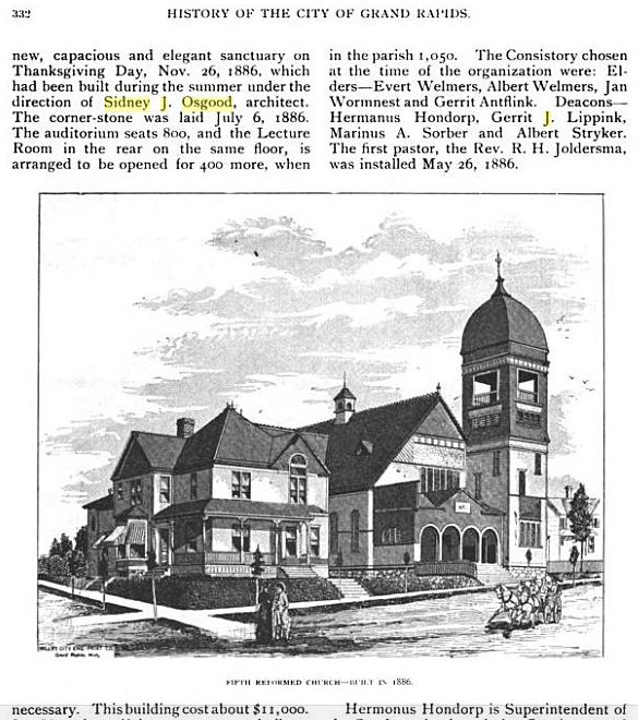
The building was designed by Sidney J. Osgood, a Grand Rapids architect, who
also designed many area churches, and the city courthouse. His brother, S. Eugene,
was also an architect.
Left click on the images below for larger versions.
|
|
|

|
The building at the right, bottom row, was never built, and it's intended purpose is not known. It's simply an example of Sidney J. Osgood's style.
The Kortlander building was in part something to house William Kortlander's wine and liquor business, and was also a general purpose commercial building. One can see the faded sign on the east side of the building, near the top, suggesting that it said "Kortlander Company, Wines & Liquors." As mentioned, at some point in time the building was expanded, likely to provide apartment units. In addition, other businesses occupied the building.
Left click on the image below for a larger version.
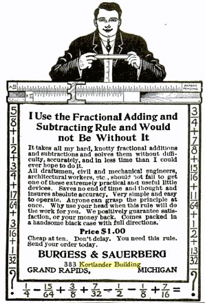
The item above is from the May, 1908, issue of Popular Mechanics. The company sold sliderules, although it never used that name.
Other businesses to occupy the Kortlander building were a shoe repair business and a radio repair shop, both owned by X Moore, who started Moore's Hobby Shop in the Maris (?) building, to the left of the Kortlander building, on Fulton Avenue. In the early 1950s Phyllis Morris, Godwin Class of 1962, remembers attending dance classes in the Kortlander building, on the second floor, which is also where the rental office was for apartments in the left side of the Kortlander building - to the left of the spiral fire escape on Fulton Avenue, shown on the photographs above. A seed company occupied the left end of the building on Fulton Avenue.
Left click on the images below for larger versions.
c1920 |
William B. Ledyard |
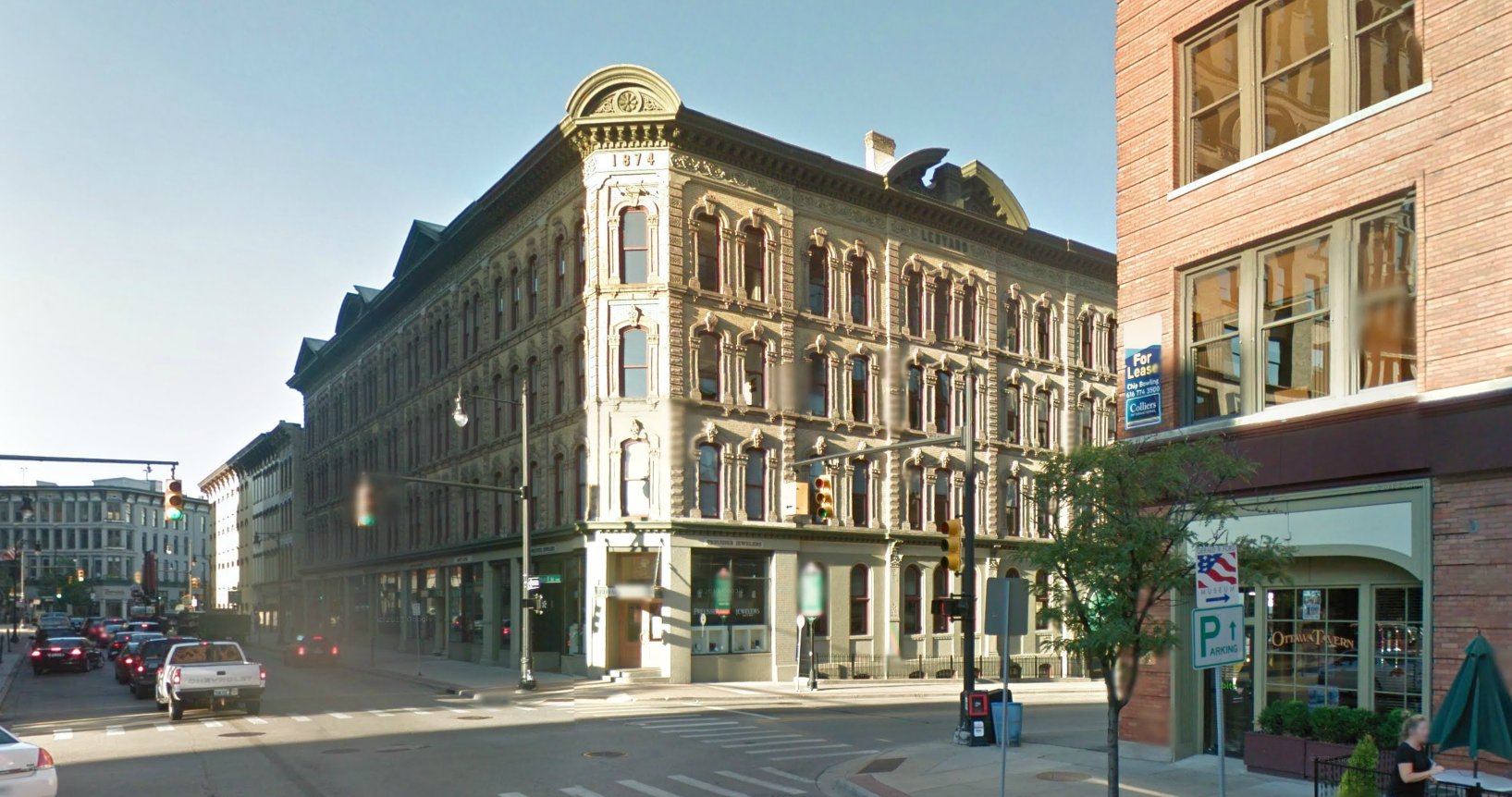
2013 |
Left click on the images below for larger versions.
1875 - Henry house. |
c1906 |
c1930 |
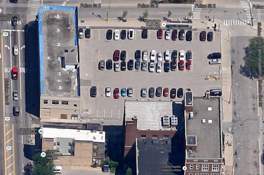
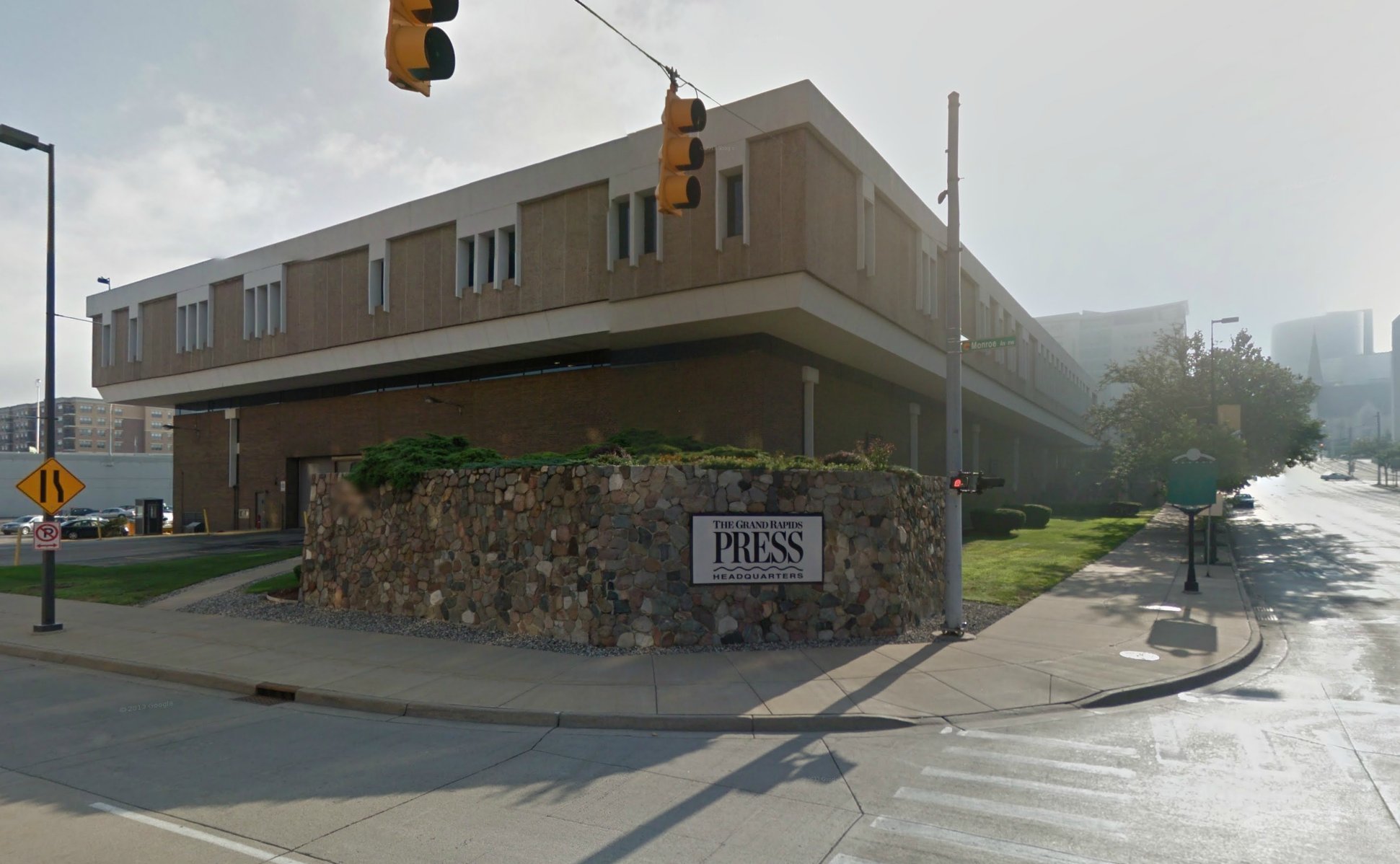
2013 - Press & Herald build location's now a parking lot. |
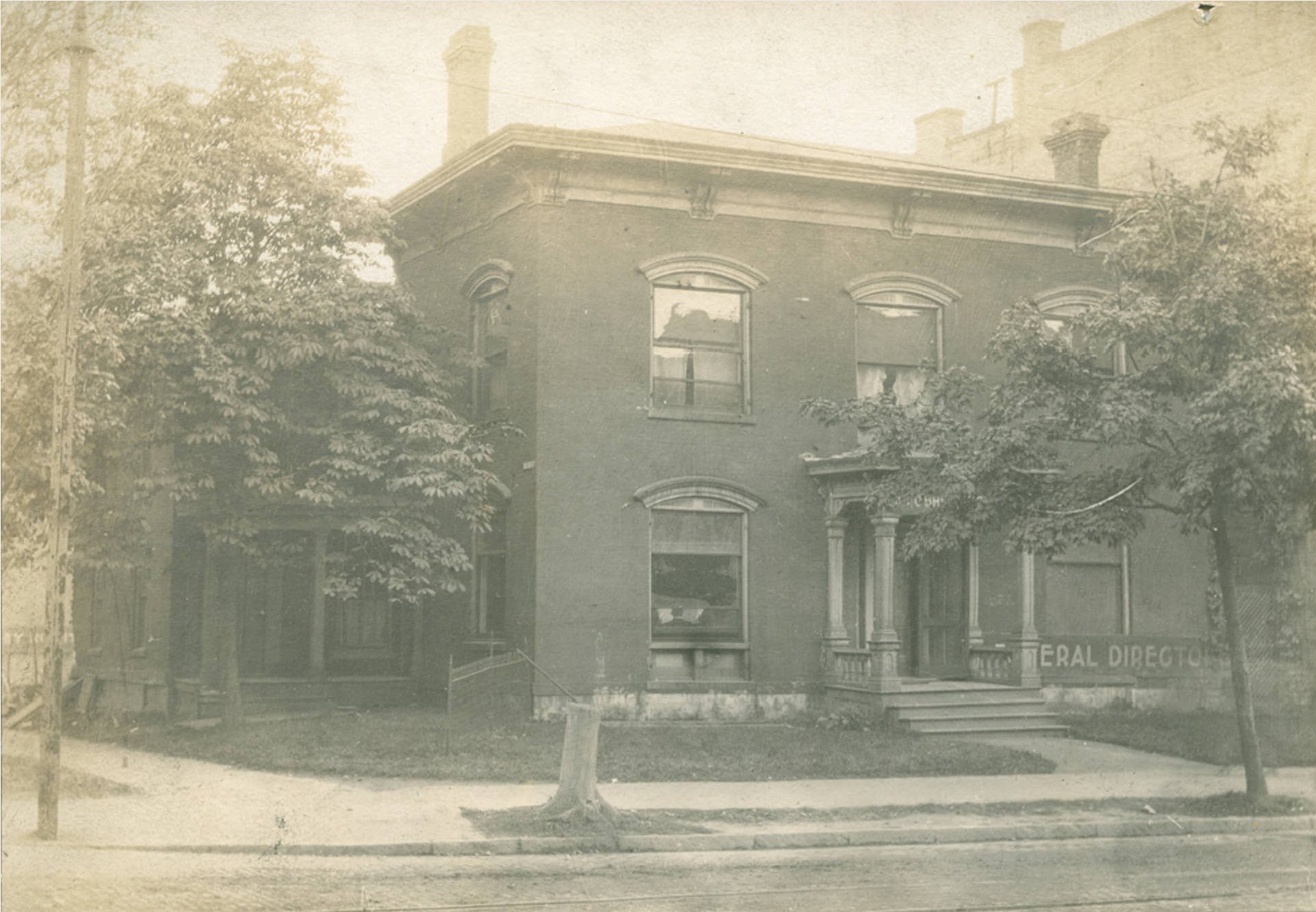
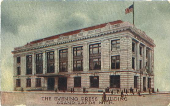
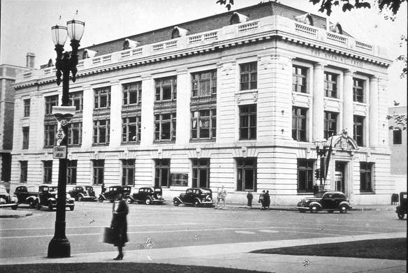
The Grand Rapids Press was a merger of the Morning Press (formed in 1890 )
and the Grand Rapids Eagle, in 1892. ( The Grand Rapids Eagle published its first issue
on December 25, 1844.) On January 1, 1893, it became an evening paper, which it
is to this day. The building above, located on the southwest corner
of Sheldon Avenue and Fulton Street, was ready for occupation in 1906.
Left click on the images below for larger versions.
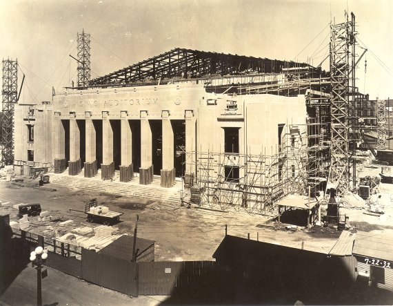
|
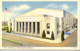
|
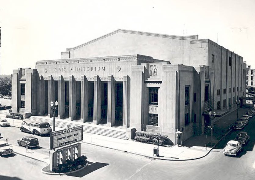
c1952 |
|
George M. Welsh, right, in 1923. Mayor Shigh on left. |
George Welsh, GR mayor, 1938 to 1950. |
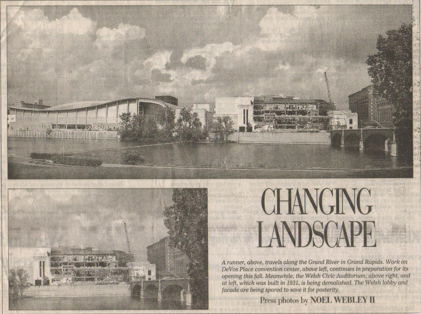
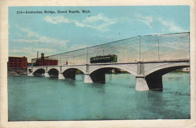
The first image shows the Grand Rapids Civic Auditorium being constructed in 1932. The second images is a postcard image showing the auditorium shortly after completion. The third image shows its demolition, in about 1980. Note in third image that the interurban bridge runs right in to the side of the auditorium. A postcard from 1928 shows the bridge with an interurban car going over it towards Grand Rapids. For whatever reason, the bridge was left standing after the interurban business failed in about 1928. The reason is quite likely that being the Depression, it was simply too expensive to remove it. Then came WWII. Eventually the bridge came to be seen as an asset. About 100 years old in 2013, it has probably reached historic status, and is safe from being razed for now. In year 2006 it is used as a foot bridge.
Almost everyone visited the Civic Auditorium at some time or another. For a circus. For one of endless stage events. For a large scouting event. For a boat or appliance show.
A very substantial building, built on the former location of the interurban depot, perhaps as one of many WPA projects. It is gone in year 2005. Exactly why it was torn down is unclear. Grand Rapids power brokers apparently decided something bigger and/or newer was needed. One wonders whether something better could have been done with the building.
The building was also known as Welsh Auditorium. George M. Welsh was owned a printing business, and was also mayor of GR from 1938 to 1950, relatively long serving in that time. 1923 photo shows him with cronies, including the standing mayor at the time, Charles R. Shigh. The mayoral position was passed around between a close knit set of business cronies, which was good for their businesses. To this day the Ellis family dominates parking in the downtown area, stemming from the actions of a 1930's mayor George Ellis. Exactly how this propagates from generation to generation is unclear, but it is a very lucrative franchise.
Left click on the images below for larger versions.
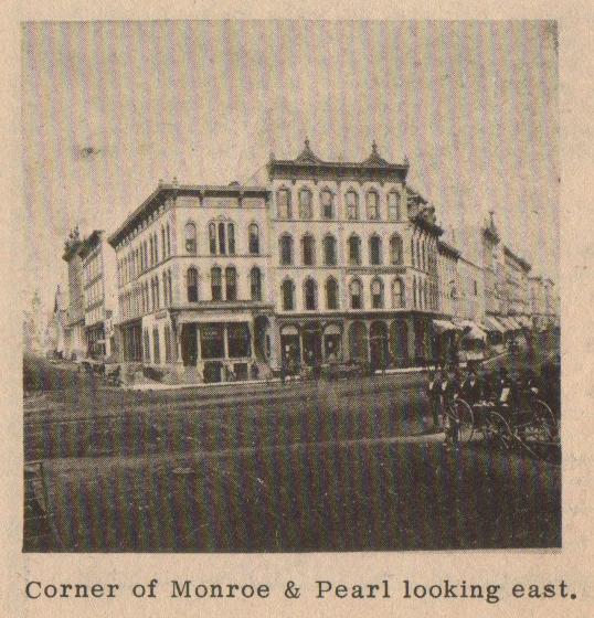
c1885 - Mercantile Agency |
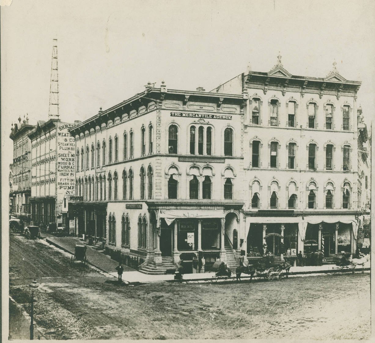
c1885 - Mercantile Agency |
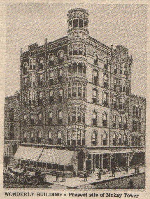
Circa 1910 - Wonderly Building |
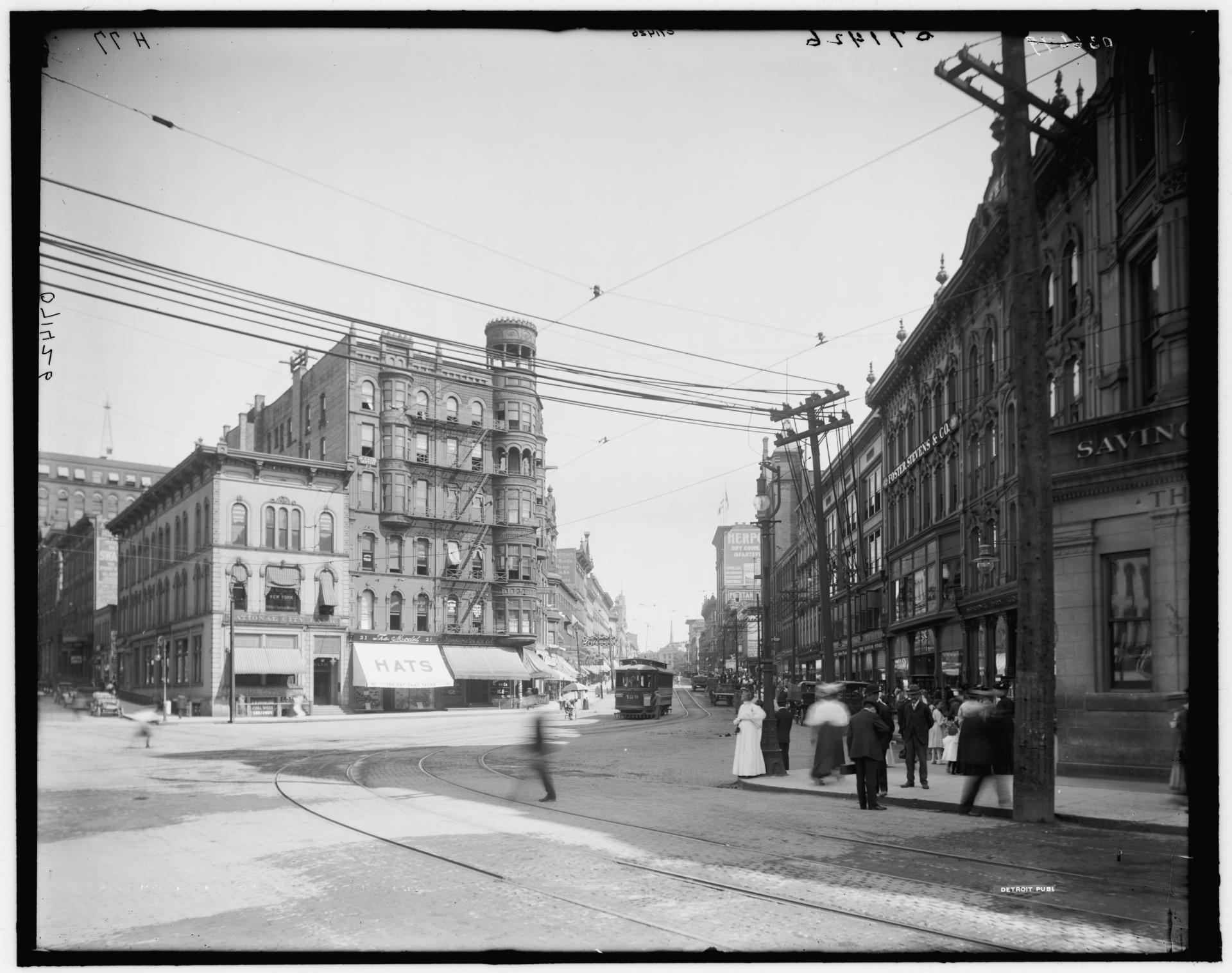
Circa 1910 - Wonderly Building |
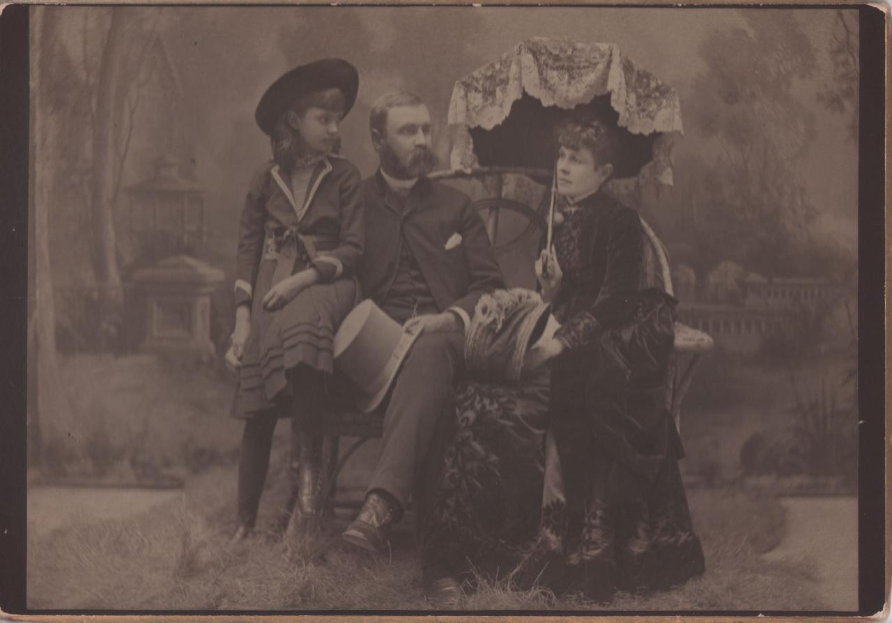
J.H.Wonderly - summer, 1884 He died August 8, 1895, at age 63. |
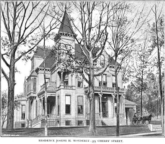
Wonderly house - 375 Cherry - c1888 |
Circa 1920 - National Bank |
Circa 1925 McKay Tower. |
Left hand and middle items, above, supplied for scanning by Lillian Annis, class of 1941
Left click on the images below for larger versions.
Frank McKay - undated photo. |
George Ellis - undated photo. |
Old city hall.
Left click on the images below for larger versions.
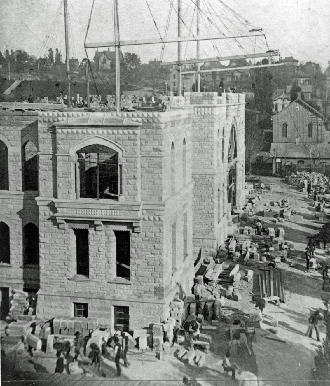
1887 - city hall construction |
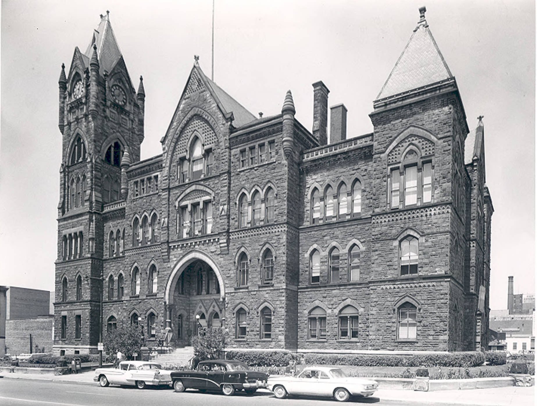
1962 |
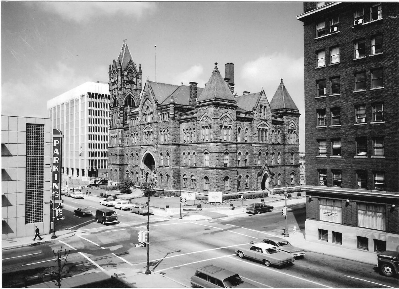
1963? |
Left click on the images below for larger versions.
1912 |
Left click on the images below for larger versions.
1862 |
1876 - Monroe during the Centennial. Building at Ottawa & Monroe indicated. |
June 28, 1953 |
2013 |
Left click on the images below for larger versions.
|
Area streetcars
Left click on the images below for larger versions.
Circa 1890 - Cherry Street |
1925 - 1982 |
Wealthy Street - 1908 |
Wealthy Street - 1908 |
Left, above, top row, streetcar barn on East Street, later Eastern, one half mile south of Cherry - c1890. Right, above, top row, streetcar barn on Scribner Street. Built in 1925, razed in 1982.
Left click on the image for a larger version.
Material provided for scanning by Lillian Annis, class of 1941.
Left click on the images below for larger versions.
|
|
Left click on the image for a larger version.
Material provided for scanning by Lillian Annis, class of 1941.
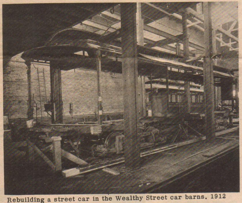
Streetcars did need to be rebuilt, repaired, or upgraded from time to time, although probably not as extensively as that shown above in a 1912 photograph. It's possible this one was involved in an accident of some kind.
Left click on the image below for a larger version.
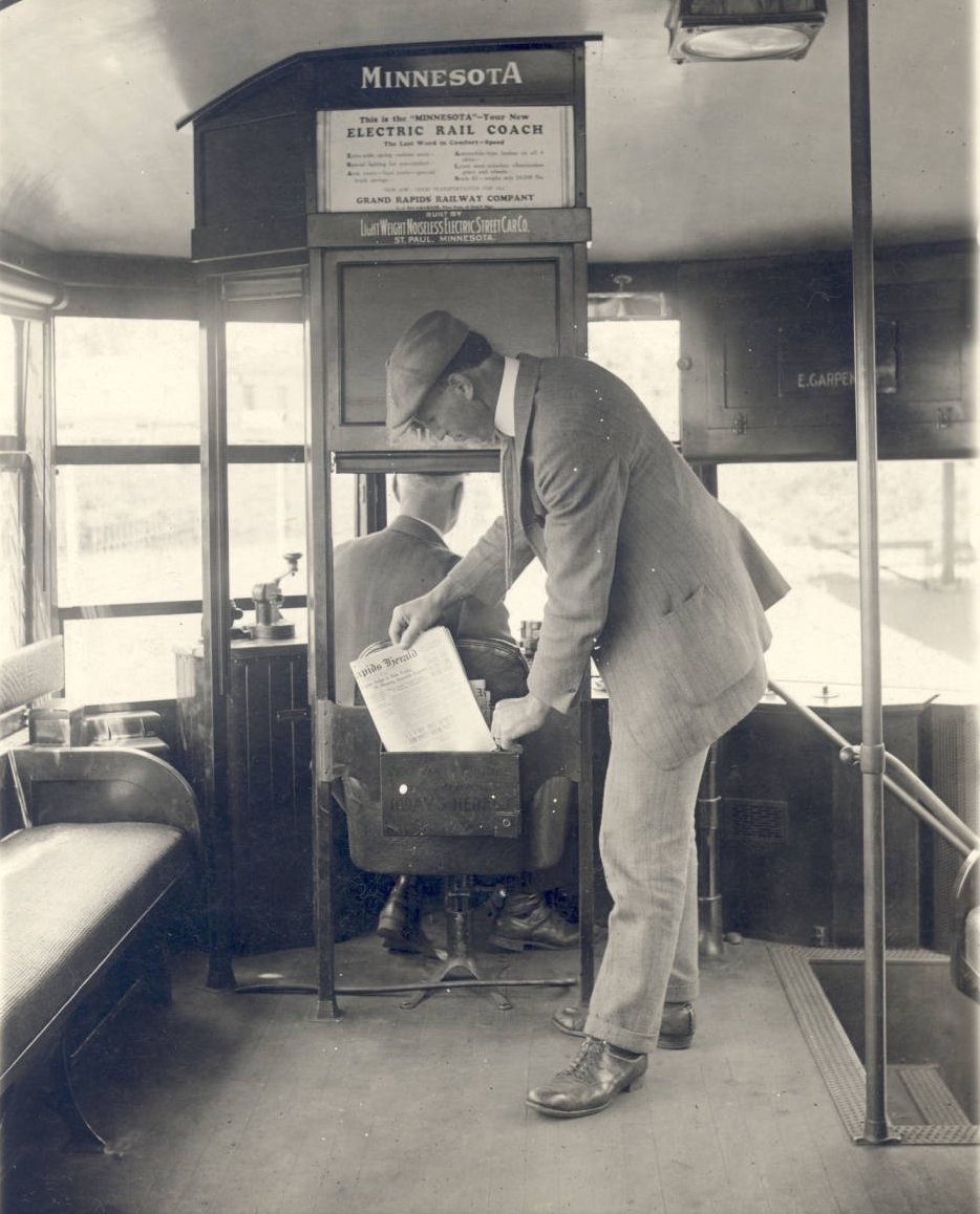
Interior of a Grand Rapids streetcar, 1927.
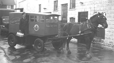
Horse drawn delivery wagons
In the Grand Rapids of the early 1950s, then a town of about 150,000, one could still hear and see horse drawn milk wagons in the wee hours of the morning.
Left click on the images below for a larger version.
|
|
|
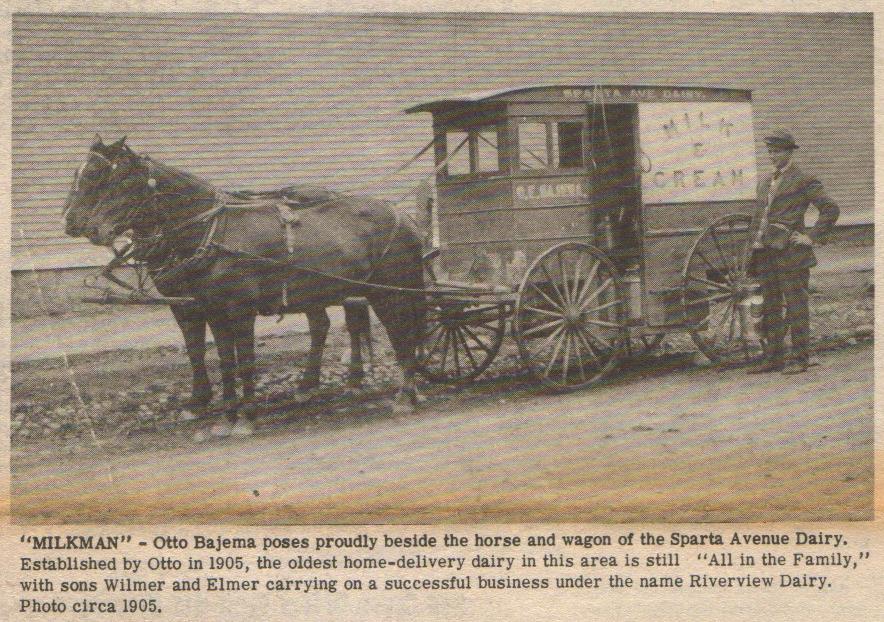
|
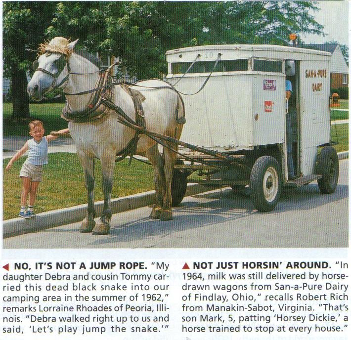
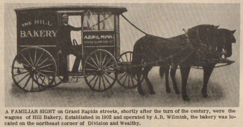
The image on top left above is of a horse drawn milk wagon in Findlay, OH, in 1964. The one on the right is a horse drawn bakery wagon in Grand Rapids, MI, 1905. Bottom left is a horse drawn mild wagon in Grand Rapids, probably from the 1940s. Bottom right is a 1905 photograph of a horse drawn milk wagon in Grand Rapids. Those in Grand Rapids were gone by the mid 1950s.
Dating from a day when most people had milk delivered, just as most homes took the Grand Rapids Herald and/or the Grand Rapids Press. In year 2006, none of these things are any longer true. The horses that knew to stop in front of every house are long gone. And anyone wanting milk must be able to drive themselves to a store. This is called progress.
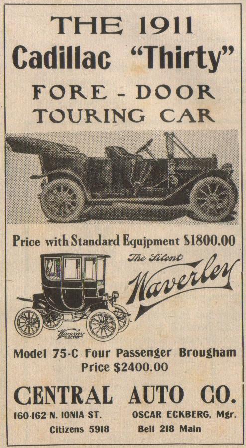
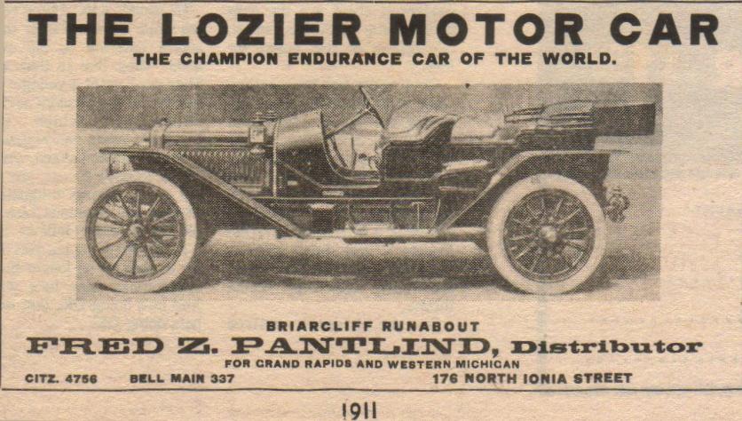
Auto dealerships
Left click on the images below for a larger version.
|
|
|
|
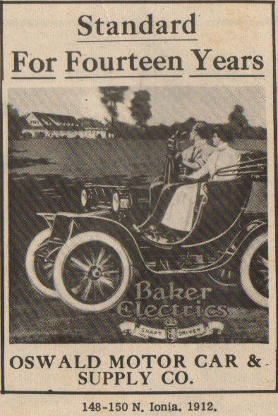
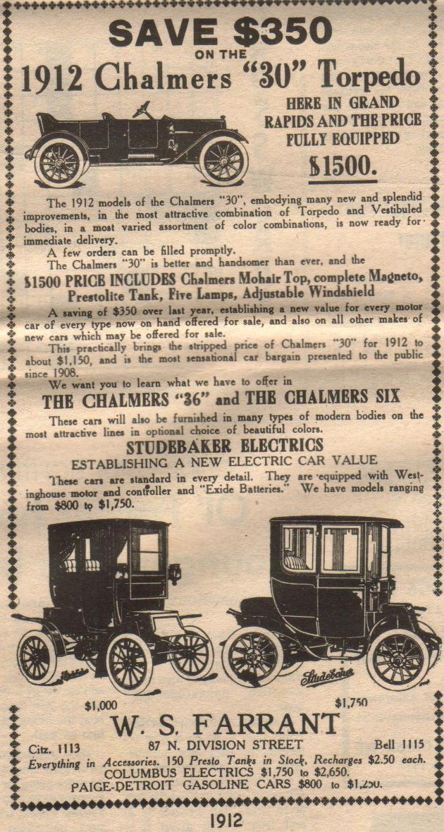
Material supplied for scanning by Lillian Annis, class of 1941
Notice that the Lozier was sold by Fred Pantlind. The old Indian Trails golf course, on the northeast corner of 28th Street and Kalamazoo Avenue, was owned by a Pantlind family member. Whether it was Fred Pantlind is not known here.
Also notice the two phone numbers, one "Citzen." and the other Bell. It appears that Grand Rapids had two phone companies in and around 1912. As happened around the country, The Bell system eventually either bought out or overpowered its rivals, leading to the nationwide system Americans enjoyed for decades. Until the US Justice system broke it up.
Left click on the images below for larger versions.
Material supplied for scanning by Lillian Annis, class of 1941 |
c1930 |
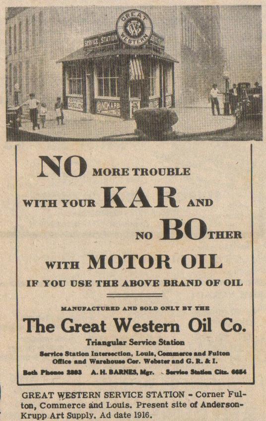
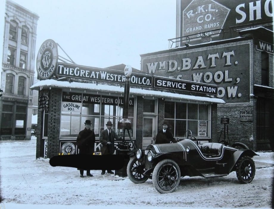
Except for electrics, cars meant gas stations, and in the 1910 to, say, 1950 era there were many gas stations in the downtown Grand Rapids, most of which are long gone in year 2007. The example above, in an undated photograph, was located where Anderson Art Supply was later located. In year 2007, it too is long gone.
Area houses
Left click on the images below for larger versions.
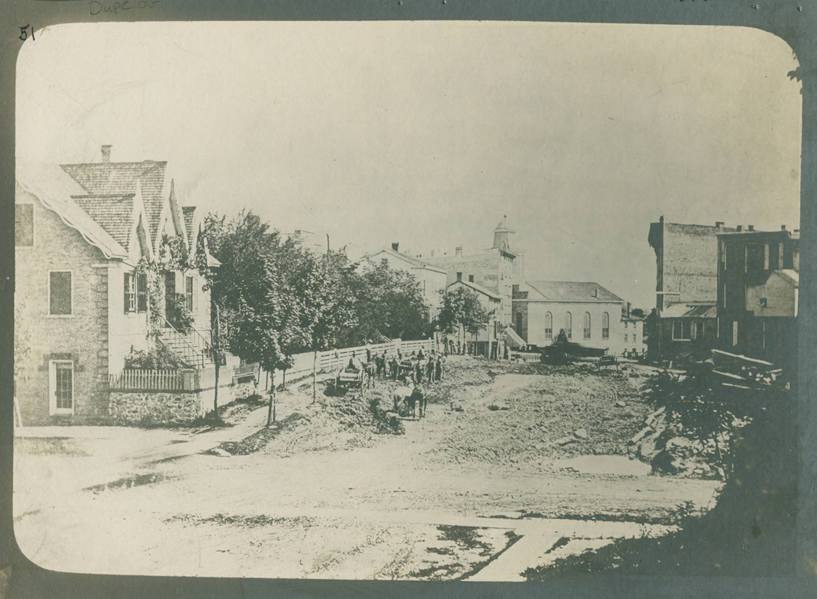
1865 - Haldane house at left - Pearl & Ottawa |
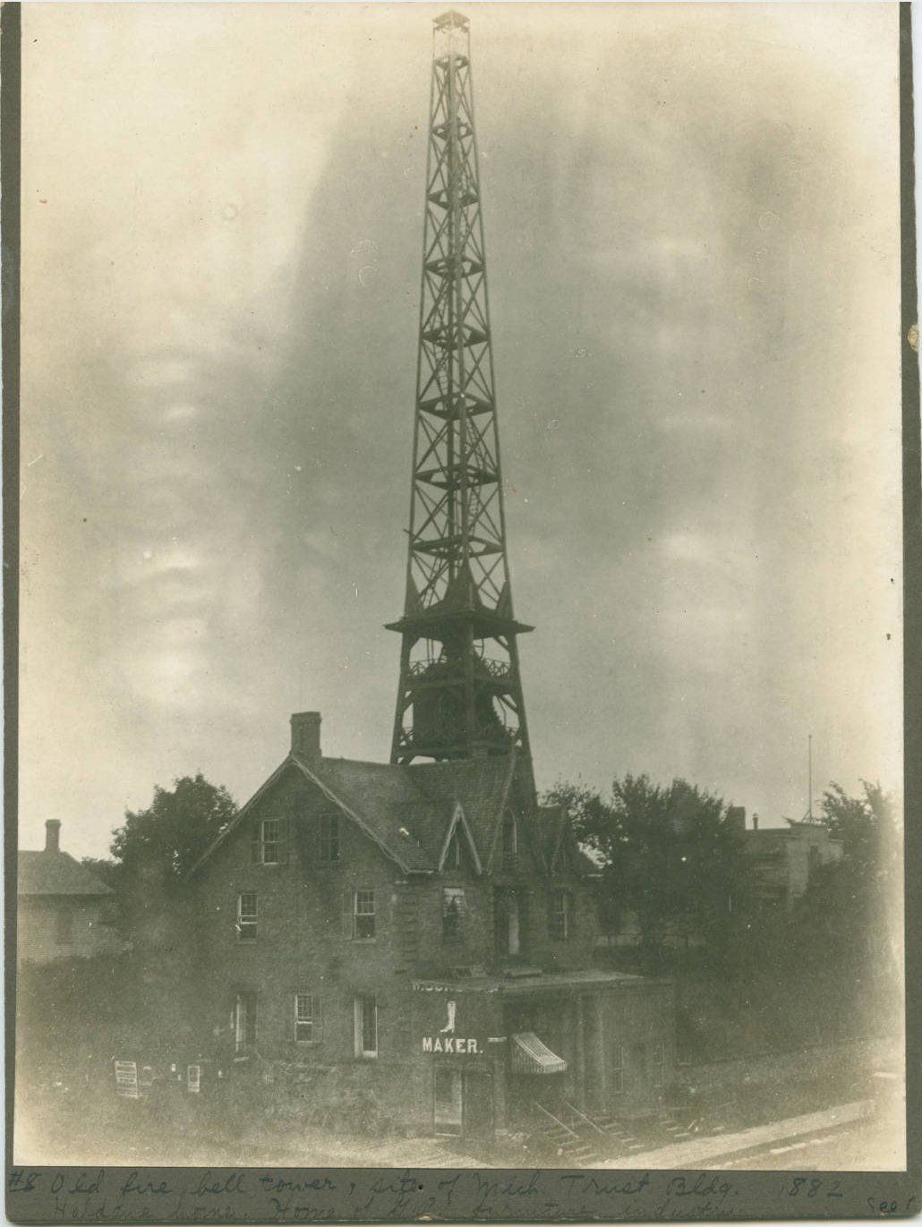
1882 - Haldane house with fire tower bell in background. |
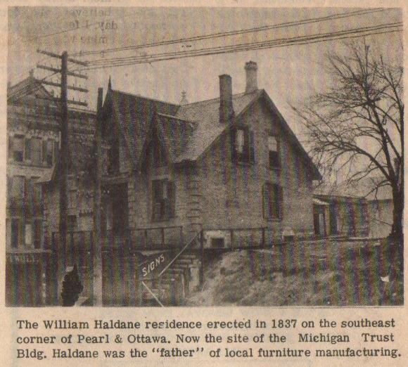
c1888 - Haldane house |
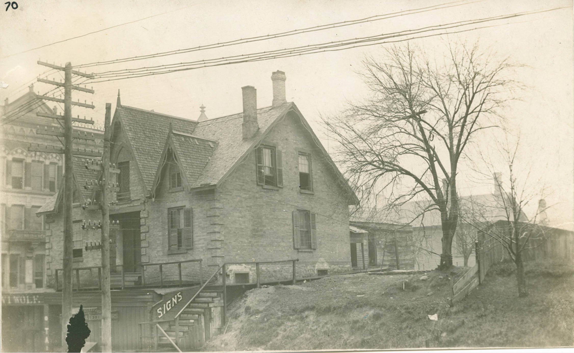
c1888 - Haldane house |
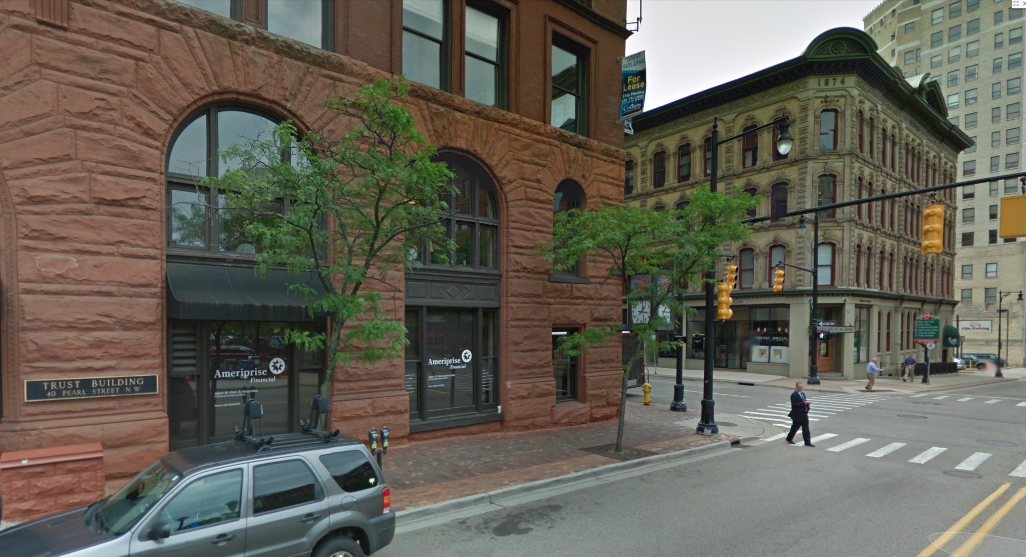
2013 - Haldane house was where the Michigan Trust building now is. |
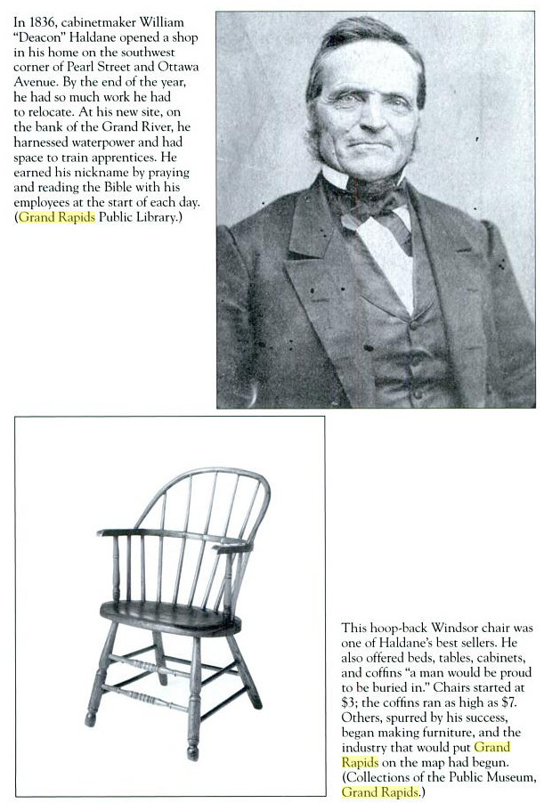
William Haldane |
Haldane came to the Grand Rapids area in 1836, and was a skilled cabinet maker. He set up shop, and for this reason is considered the father of the Grand Rapids furniture industry. The house above was built in 1837, and was located at the southeast corner of Pearl and Ottawa. At some point the street level was lowered considerably, exposing the basement level of the house. The city bought the house in 1872, and used it as offices for the departments of water and justice. The tower and fire bell was erected in 1878. The house was demolished in 1890.
Left click on the images below for larger versions.
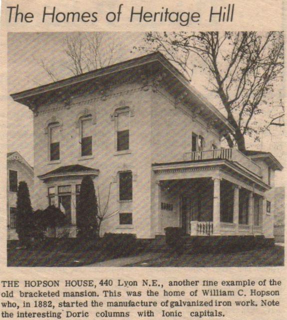
|
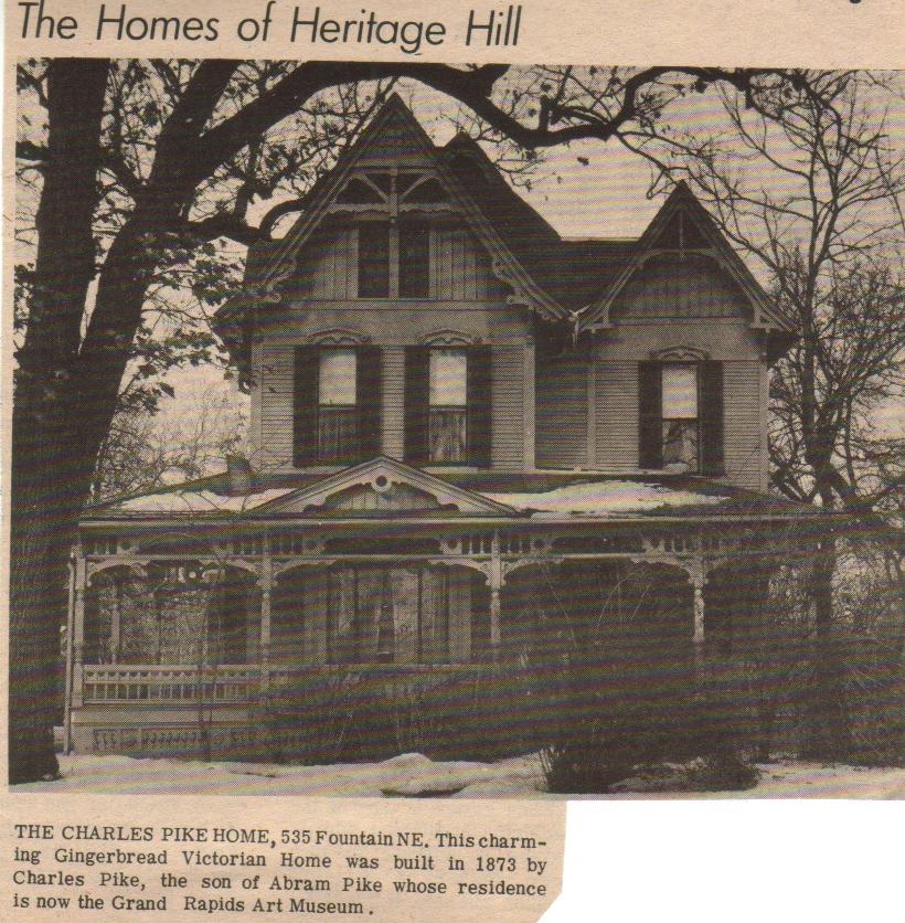
|
Material provided for scanning by Lillian Annis, class of 1941.
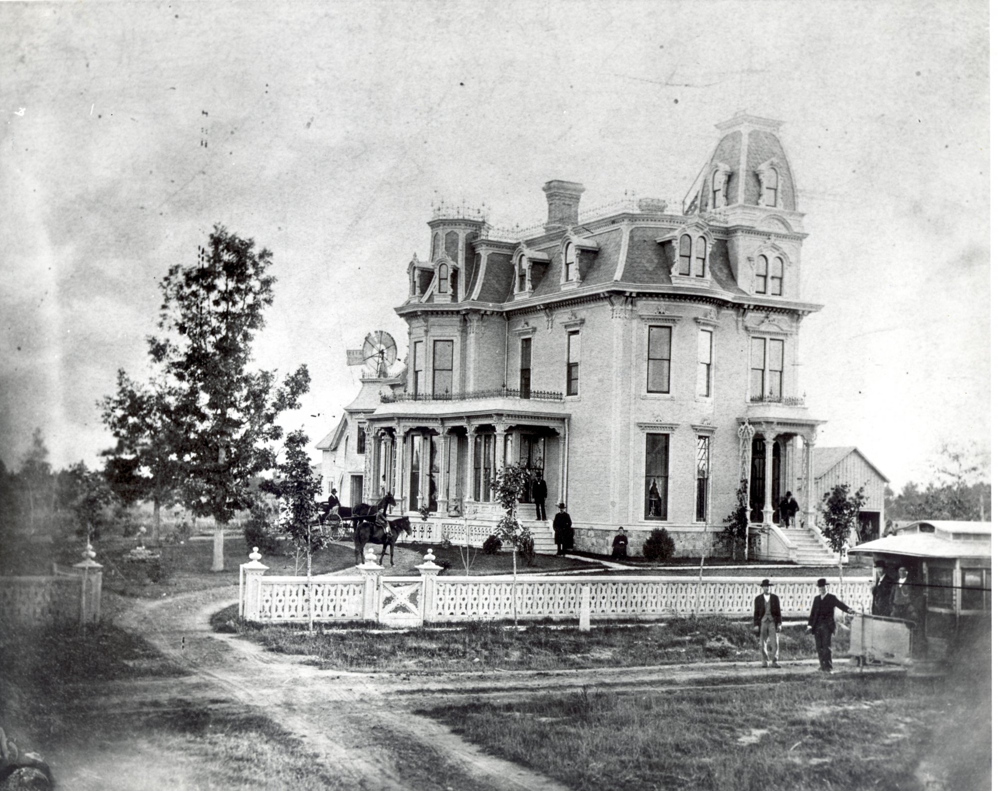
The images of the houses above date from around 1971. The Hopson house is gone in year 2013 The Pike house is unclear. The extensive gingerbread on the Pike home, which became popular in part after the band saw was invented, suggests construction dates in the 1880s for both houses. During the heyday of gingerbread one could order designs from catalogs by the foot. Over the years, the cost and labor of maintaining and repairing all of the ornate wood became apparent, and in most cases it simply rotted away over time.
Left click on the images below for larger versions.
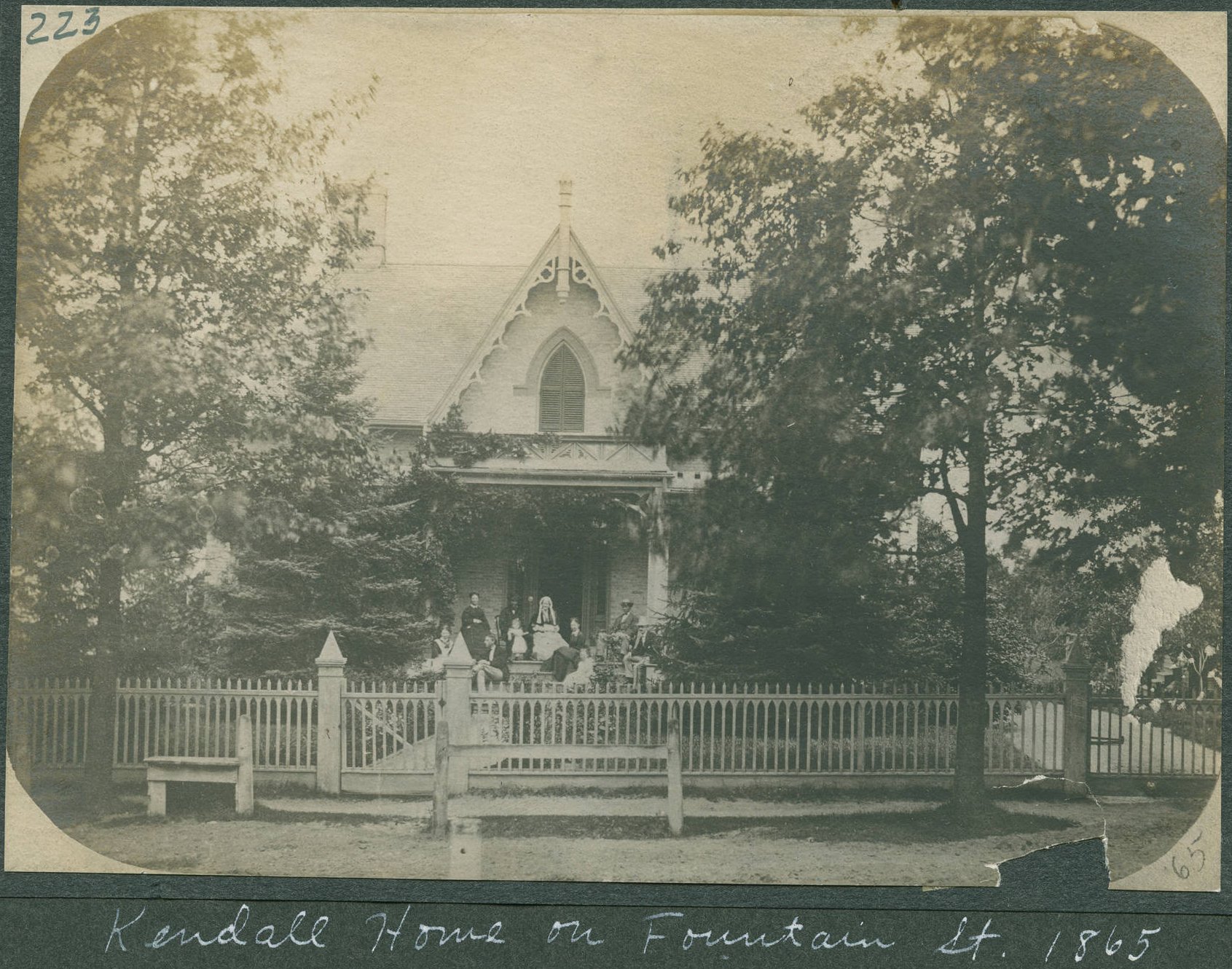
Kendall home - Fountain Street - 1865 |
Left click on the images below for larger versions.
|
1860 |
1865 |
Left click on the images below for larger versions.
Abram Pike house. |

Abram Pike house. |
|
Charles Pike house. Son of Abram. |
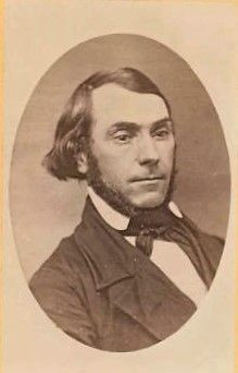
Abram Pike - perhaps 1860 |
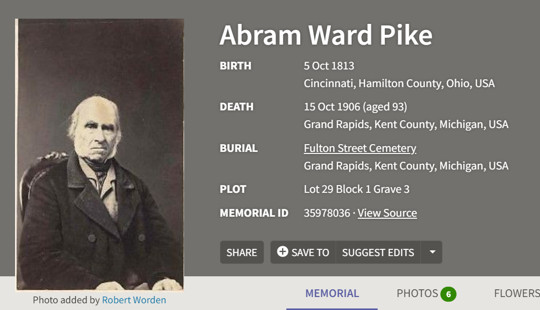
Abram Pike - perhaps 1905 |
Left click on the images below for larger versions.
c1880 |
Left click on the images below for a larger version.
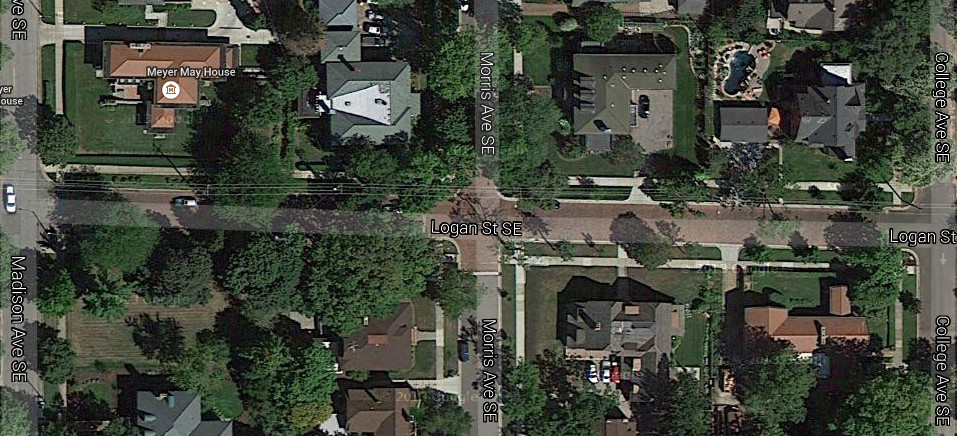
Locations - 2014 |
Left click on the images below for larger versions.
505 College - 1920 |
505 College - 2014 |
450 Madison - 1920 |
450 Madison - 1920 |
450 Madison - 1920 |
Left click on the images below for larger versions.
About 1936 |
|
|
|
E. H. Turner, 1795 - 1870 |
Left click on the images below for larger versions.
|
|
|
|
Left click on the images below for larger versions.
1875 - Division & Monroe. Pecks, left, Universalist church, above Pecks. Emmanual Lutheran in distance, on Division. Large church at the right unknown. Maybe two others. |
Left click on the images below for larger versions.
1865 |
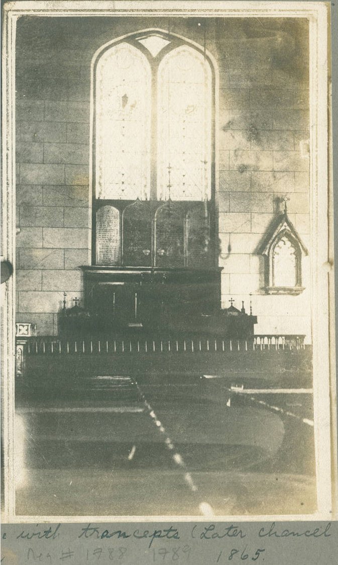
1865 |
1865 |
1865 |
1865 |
1865 |
|
1873 |
1880 |

1880 |
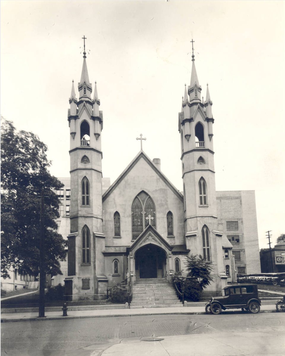
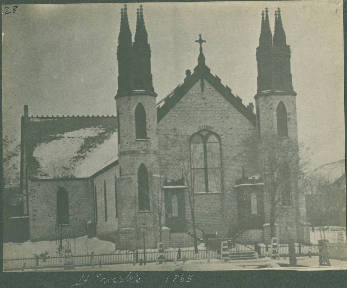
1931 |
c1865 |
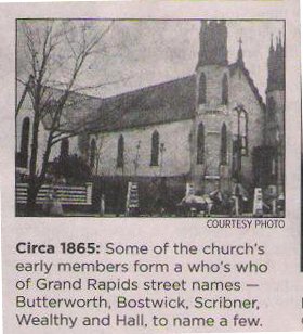
|
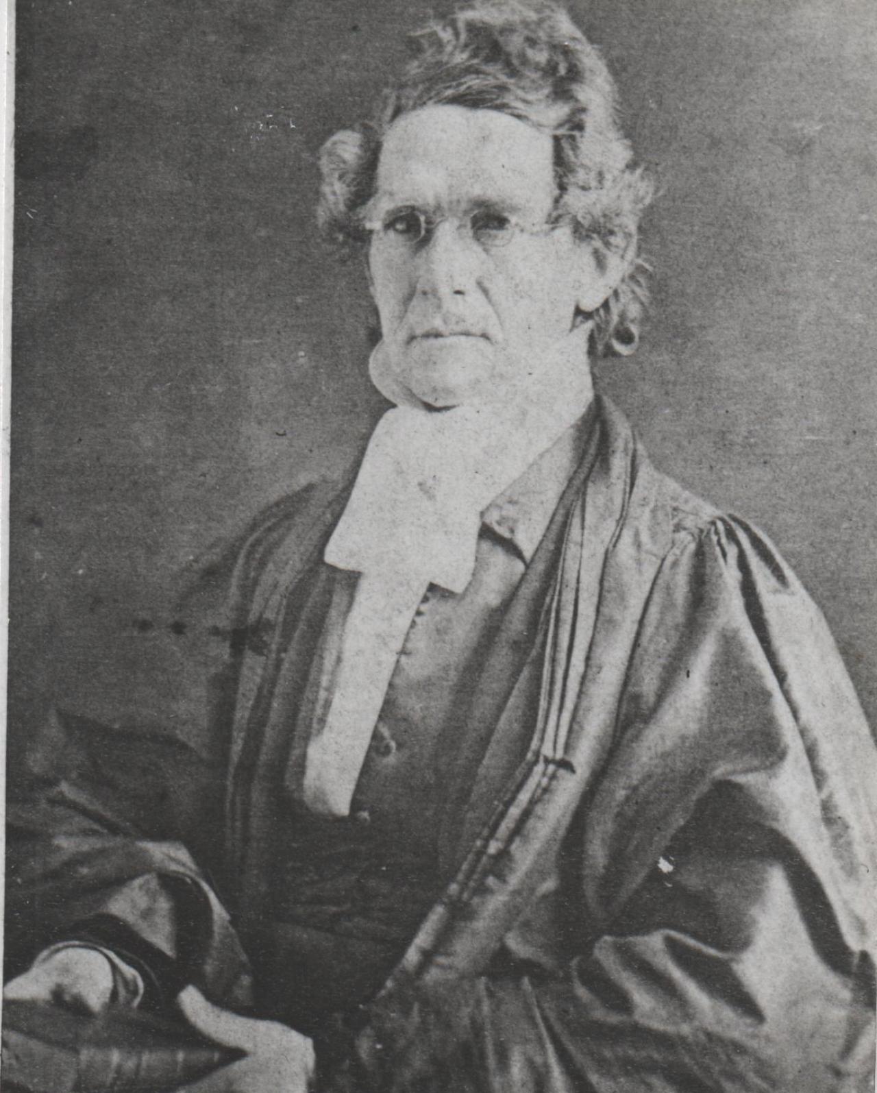
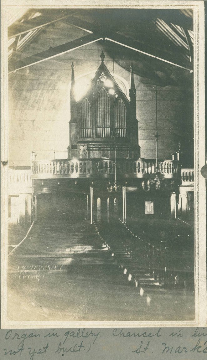
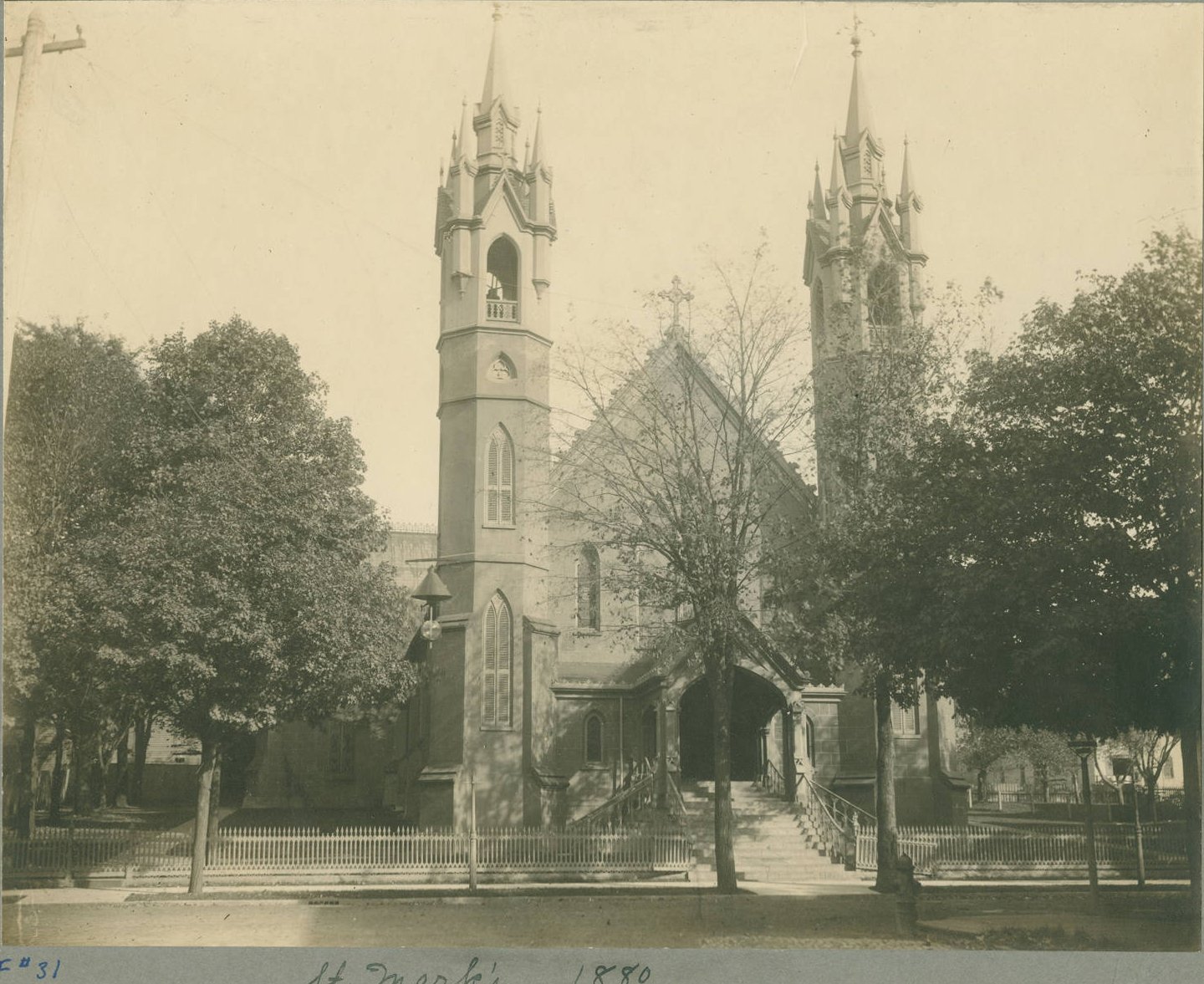
Francis Cuming - c1865 First rector of St. Marks |
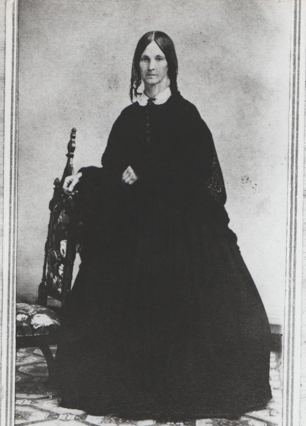
Charlotte H. Cuming - c1865 Wife of first rector. |
|
Left click on the images below for larger versions.
|
Shown in 1931. |
Left click on the images below for larger versions.
1852 |
1864 |
1865 |
Left click on the images below for larger versions.
1870 - Monroe & Division |
Left click on the images below for larger versions.
|
Left click on the images below for larger versions.
1865 _ another church is seen down the street. |
1872 - library later where house at left stands. |
|
1873 - and island in the Grand River. |
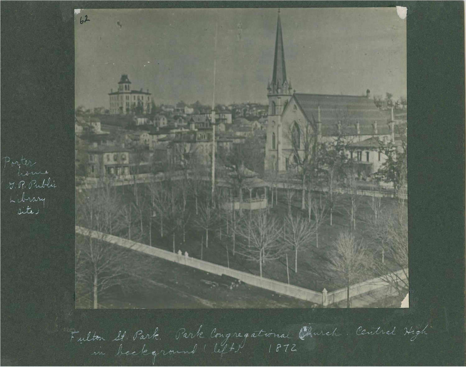
1912 - Park Street, Fountain Street, and Ryerson Library. |
Left click on the images below for larger versions.
|
|
Left click on the images below for larger versions.
Central Highschool - c1875 |
Left click on the images below for larger versions.
|
Left click on the images below for larger versions.
c1957 |
Left click on the images below for larger versions.
|
|
Material supplied for scanning by Lillian Annis, class of 1941
Left click on the images below for larger versions.
|
|
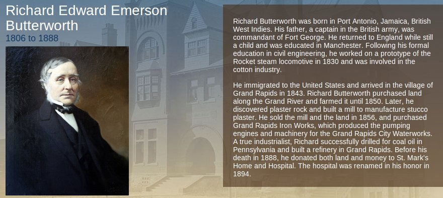
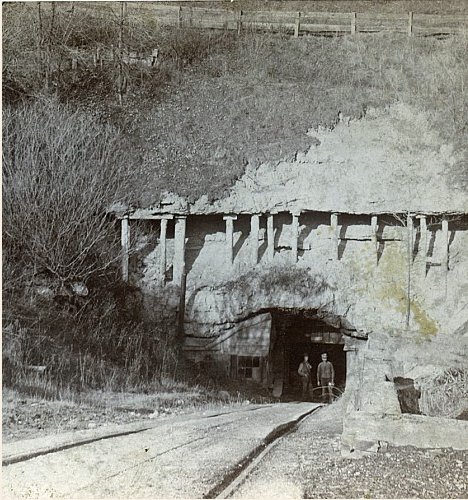
It's not exactly clear how Richard Butterworth chose to come to Grand Rapids in 1843. Perhaps because it was a fast growing area, and a great deal of money could be made exploiting resources, although he did spend 7 years farming before turning his attention to gypsum. A typical gypsum mine, located in the north part of Grand Rapids, is shown above, right. There are vast amounts of gypsum in the area centered on Grand Rapids. National Gypsum operated in the Grandville area in and around 1900.
Richard Butterworth eventually donated land and was a benefactor St. Mark's Home and Hospital, which was eventually renamed Butterworth Hospital. Butterworth Avenue is also named for him.
Left click on the images below for a larger version.
Material supplied for scanning by Lillian Annis, class of 1941
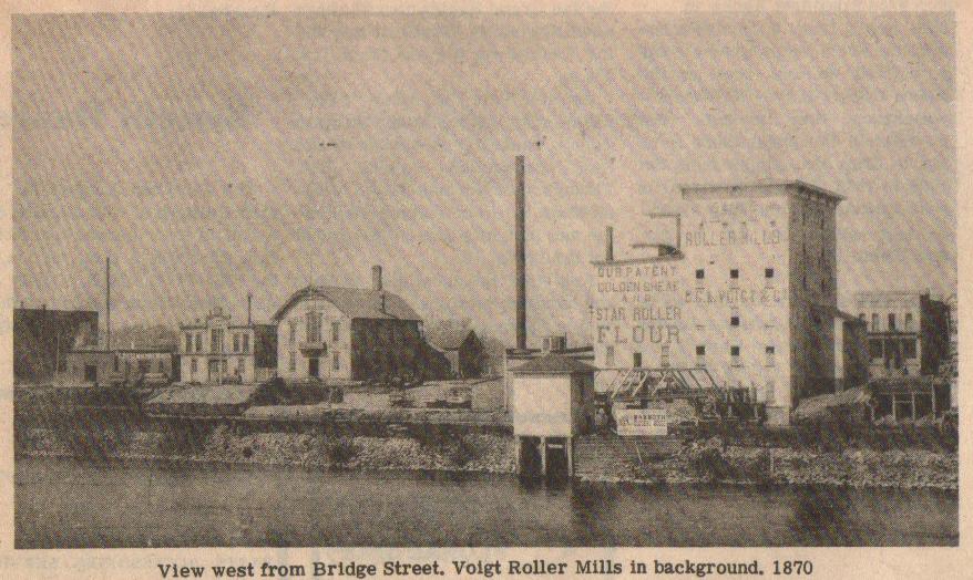
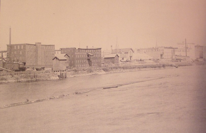
The Voigt roller mills, show in an 1870 photograph of the west side of the Grand River bank, were a familiar sight until the mid 1960s at least. Just when they were torn down is unclear. The owners home was located at 115 College Avenue SE, and is today the Voigt House Victorian Museum.Left click on the image below for a larger version.
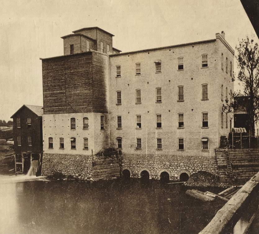
The Voigt-Crescent flour mill is shown above, in an undated photograph. One the lower left one can see water coming from the water wheel that powered the mill.
Left click on the image below for a larger version.
The Voigt mill is at the right in the undated photograph above. Here too one can see the canal on the west side of the river, which provided power for some of the businesses.
Left click on the images below for a larger version.
Material supplied for scanning by Lillian Annis, class of 1941
Left click on the images below for larger versions.
Albert Baxter - 1870 |
Albert Baxter - 1900 |
Albert Baxter's 1891 History of Grand Rapids>
Left click on the images below for larger versions.
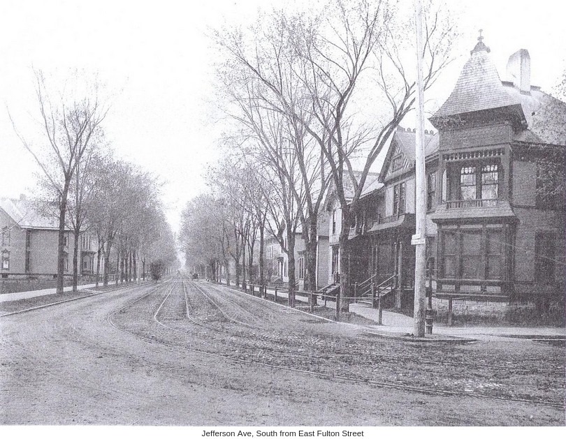
SW corner, Jefferson and Fulton, 1870 |
|
|
|
|
|